UPDATE Board of Selectmen June 20, 2017
|
|
|
- Elmer Short
- 6 years ago
- Views:
Transcription

1 MAPLE STREET I-1 AREA DRAFT ZONING BYLAW & DEVELOPMENT STANDARDS Town of Danvers, MA UPDATE Board of Selectmen June 20, 2017 The Danvers Team: Brovitz Community Planning & Design Dodson & Flinker Danvers Maple St I-1 Design Guidelines & Zoning Code Brovitz Community Planning & Design * Dodson & Flinker
 Danvers Maple Street I-1 District Action Plan (2015) Downtown Danvers Parking Study (2015) Danvers Bicycle Network & Pedestrian Priority")
2 DOWNTOWN DANVERS PLANNING INITIATIVES Danvers Community & Economic Development Plan (2004) Danvers Zoning Bylaw Review & Recommendations (2006) Danvers Mixed-Use Industrial-1 (I-1) Study (2009) Tapleyville Mixed Use Overlay District Zoning Bylaw (2014) Danvers Maple Street I-1 District Action Plan (2015) Downtown Danvers Parking Study (2015) Danvers Bicycle Network & Pedestrian Priority Plan (2015) Maple Street I-1 Area Vision Plan & Draft C40R Zoning Code (2017) Downtown Area Traffic Management Report (2017) Downtown Wayfinding Project (2017)


3 MAPLE STREET AREA VISION PLAN & C40R ZONING CODE Define Issues, Challenges & Opportunities Historic Context & Compatibility Current and Future Mix of Uses Building Scale, Density & Orientation Parking Placement, Ratios & Access Landscaping and Screening Passive & Active Recreation Streetscape and Walkability Development Review Processes


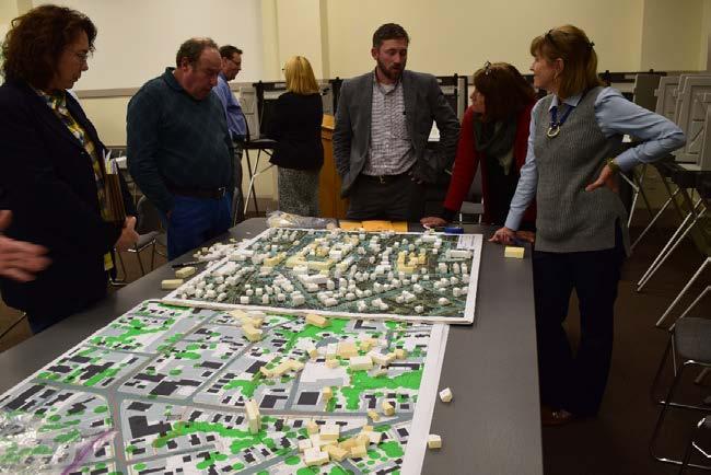
4 MAPLE STREET AREA VISION PLAN & C40R ZONING CODE Public Visioning Scenario-Building Streetscapes, Open Spaces, and Connectivity Visual Preference Survey


5 MAPLE STREET AREA VISION PLAN & C40R ZONING CODE Visual Preference Survey - Highest Rated Building Types and Design

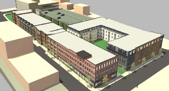
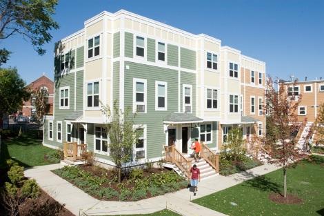
6 MAPLE STREET AREA VISION PLAN & C40R ZONING CODE Mixed Use (Comm/Res) on Maple with Townhouse residences behind. Add Second Floor and Improve Streetscape on N. Putnam St. Infill Mixed Use Building Infill Residential Building Small Single Family, Townhouses, Live/Work and Medium Sized Apartments Centralized and Shared Parking Area with LID strategies Mixed Use (Comm/Res) Infill and Redevelopment Preserve Small Historic Homes for Residential and Office Uses Streetscape Improvements on Hobart St. Common Open Space for Civic Gathering and Events Relocate Former Depot Near Rail Trail
7 MAPLE STREET AREA VISION PLAN & C40R ZONING CODE Reconfigure Intersection and Install Gateway Treatments Streetscape Improvements on Maple Street Infill Mixed Use Building at Corner of N. Putnam Mixed Use (Comm/Res) Infill or Redevelopment Redesign parking lots and streetscape improvements for shared benefits. Mixed Use (Comm/Res) Infill and Redevelopment with Structured Parking Preserve Historic Building and Allow Context Sensitive Infill for Residential and Office Uses Infill Residential Buildings Near Rail-Trail with Shared Parking Area Reconfigure Gas Stations as Gas Backwards with Convenience Store in Front


8 MAPLE STREET AREA VISION PLAN & C40R ZONING CODE N. Putnam St Maple St

9 MAPLE STREET AREA VISION PLAN & C40R ZONING CODE Character-Building Zoning & Design Standards Building Frontage Type Site Standards Parking Placement Ped/Veh. Access Landscaping Lighting/Screening Utilities Signage LID/Sustainability Stds PRIVATE REALM Building Standards Bldg. Placement Building Types Building Uses Bldg. Frontage Types Building Components Bldg. Height/Stepbacks Building Design Stds Street Standards Complete Street Hierarchy Streetscape Treatment Sidewalk Use/Activation On-Street Parking/Parklets Intermodal Facilities Utilities LID/Sustainability Stds Open Space & Rec Types Parks, Playgrounds, Commons PUBLIC REALM Outdoor Amenity Spaces Yards Dining Terrace Green Roofs Courtyards Comm. Gardens Plazas Forecourts POPS
10 ZONING & DESIGN STANDARDS ZONING BYLAW SECTION 18 MAPLE STREET TRADITIONAL NEIGHBORHOOD DEVELOPMENT OVERLAY DISTRICT (MSTND) 18.1 PURPOSE AND INTENT 18.2 AUTHORITY AND APPLICABILITY 18.3 OVERLAY DISTRICT ZONING MAP AND REGULATING PLAN 18.4 DEFINITIONS 18.5 BUILDING STANDARDS AND USES 18.6 DENSITY AND BULK STANDARDS 18.7 FAIR HOUSING REQUIREMENTS/HOUSING AND AFFORDABILITY 18.8 SITE PLANNING AND DEVELOPMENT STANDARDS 18.9 DESIGN STANDARDS ADMINISTRATION ENFORCEMENT AND APPEAL WAIVER OF REQUIREMENTS DATE OF EFFECT SEVERABILITY Purpose and Intent Incentives for property reinvestment An attractive and vibrant gateway to Downtown Danvers Lifecycle range of housing choices and types Expand downtown area living opportunities Flexibility and variety in future development Compatibility with existing uses in surrounding neighborhood Retain existing goods and services Expand opportunities for small locally-owned businesses and entrepreneurial activity Foster sustainable development and low impact design (LID) Enable the Town to receive Zoning Incentive Payments under Chapter 40R Review procedures that ensure predictable, fair and cost-effective, and expeditious permitting process
11 ZONING & DESIGN STANDARDS DESIGN STANDARDS 1. PURPOSE AND APPLICABILITY 2. DEFINITION OF TERMS 3. GUIDING PRINCIPLES 4. GENERAL DESIGN STANDARDS 5. BUILDING FRONTAGES & FAÇADE TREATMENTS 6. BUILDING COMPONENTS 7. OPEN SPACES AND OUTDOOR AMENITIES 8. SIGNAGE 9. PUBLIC REALM STANDARDS Guiding Principles 1. Traditional Neighborhood Development Patterns and Design 2. Compact Development and Human Scale Design 3. Mix of Uses and Flexible Building Space 4. Architectural Context and Adaptive Reuse of Historic Structures 5. Relationship with Downtown Core and Surrounding Neighborhoods 6. Active Open and Civic Space 7. Landscape and Streetscape Character 8. Alternative Modes of Transportation 9. Downtown and Neighborhood Gateways 10. Smart Growth and Sustainable Development
12 ZONING & DESIGN STANDARDS ZONING BYLAW MSTND Overlay District
13 ZONING & DESIGN STANDARDS ZONING BYLAW Chapter 40R Provisions Allows as-of-right residential development at minimum densities: 20 DU/Acre MU/Apartment Bldgs 12 DU/Acre 2 and 3 Unit Homes 8 DU/Acre Single Family Homes 20% of the units must be affordable Promotes mixed-use and infill development Encourages open space and protects historic districts. TABLE 1: MSTND REGULATING PLAN SUBDISTRICTS Requirement 1. Core Mixed Use Sub-District Sub-District 2. Maple Street Limited Mixed Use Sub-District 3. Hobart and Locust Street Limited Mixed Use Sub-District Underlying Base Zone I-1, R-1 I-1, R-1 C-1, C-1A, R-1 Total Sub-District Parcels Total Sub-District Acres Total No. of Existing Dwelling Units Total Existing Non-Residential Development (GFA) 1 166,890 29,298 13, Mixed Use Buildings were estimated to be equally divided between commercial and residential floor area, and the estimated residential GFA was substracted from the total.
14 MAPLE STREET AREA VISION PLAN & C40R ZONING CODE ZONING BYLAW 18.6 DENSITY AND BULK STANDARDS EXISTING DEVLOPMENT 52 DUs in MSTND Area 200,090 Non-Res SF PROJECTED NEW DEVELOPMENT 211 New Dwelling Units 171,000 Non-Res SF 30 Year Projected Build-Out C40R HOUSING INCENTIVES Estimated Incentive Payments from State = $350,000 Density Bonus Payments (as OP Issued) = $849,000 Density Provisions TABLE 5: MSTND REGULATING PLAN SUBDISTRICTS - DENSITY BY DU TYPE Dwelling Unit Types D.U.s Per Acre By Right By Special Permit 1. Single Family Detached Dwelling Units - includes Workers Cottages and Cottage Courts Single Family Attached Dwelling Units - includes horizontally-attached rowhouses, townhouses, and Live/Work Units Multi-Family/Two and Three-Family Dwelling Units Multi-Family/Four or More Dwelling Units - includes condominiums, apartment buildings, housing cooperatives Mixed Use Developments (Commercial and Multi-Family) TABLE 10: MSTND REGULATING PLAN SUBDISTRICTS - MAXIMUM DEVELOPMENT Sub-District Requirement 1. Core Mixed Use Sub-District 2. Maple Street Limited Mixed Use Sub-District 3. Hobart and Locust Street Limited Mixed Use Sub-District Underlying Base Zone I-1, R-1 I-1, R-1 C-1, C-1A, R-1 Total Sub-District Parcels Total Sub-District Acres Total No. of Existing Dwelling Units Max Number of New Dwelling Units Max. GFA of New Non-Residential Development 2,3 67,845 58,262 44, Maximum Number of New Dwelling Units is based on a Density Ratio of 20 DU/Acre except for parcels in the Res-Trans Frontage Zone which are based on 12 DU/Acre. Existing Dwelling Units were then subtrated from the gross number of units calculated under the Density Ratios. 2. Maximum GFA of New Non-Residential Development is based on an Overall Floor Area Ratio (FAR) of Maximum Number of New Dwelling Units and GFA of New Non-Residential Development excludes the Hobart Street Municipal Parking Lot in Subdistrict 3 which is not considered a developable property. Minimum Dwelling Unit Size Unit Type Useable Floor Area (Min.) Studio 400 sq. ft. 1 Bedroom 600 sq. ft. 2+ Bedrooms 900 sq. ft.

15 15
16 MAPC 40R USE REPORT HOUSING PRODUCTION ASOF Smart Growth (C40R) Districts Future Zones Units: 13,715 Built/Building Permits Issued: 3,352 (24% of total) Built/Building Permits Issued in 2009: 1,127 (175% Increase)
 MOST PROJECTS ARE MULTIFAMILY RENTALS Multi-Family Units (99%) 2/3 Family and Single Family (<1%) Rental Units (92%); Ownership Units (8%) MOST PROJECTS BUILT TO DATE HAVE USED HOUSING SUBSIDY")
17 MAPC 40R USE REPORT 40R BUILT PROJECT TRENDS MOSTLY SMALL UNITS Total Unit Built as of 2016: 3,352 1-Bedroom DUs (36%) 2-Bedroom DUs (49%) 3-Bedroom DUs (4%) 4-Bedroom DUs (0.06%) MOST PROJECTS ARE MULTIFAMILY RENTALS Multi-Family Units (99%) 2/3 Family and Single Family (<1%) Rental Units (92%); Ownership Units (8%) MOST PROJECTS BUILT TO DATE HAVE USED HOUSING SUBSIDY PROGRAMS Affordable Units (48%) of units A few projects include no affordable units (all small ownership projects); Some others are 100% affordable. Vast majority of the projects use state or federal housing subsidy programs


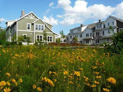
18 Completed Projects & Development COMPLETED Opportunities: 40R PROJECTS TOD/Downtown 26 acres 256 Units Zoned 50-Unit Project Mixed Use Density: 9.4DU/Acre Reading (Downtown 40R) 18


19 COMPLETED Completed 40R Projects: PROJECTS Northampton 40R Village Hill Redevelopment 16 acres 156 units Mix of Housing Density: 9.75 DU/Acre 19


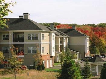
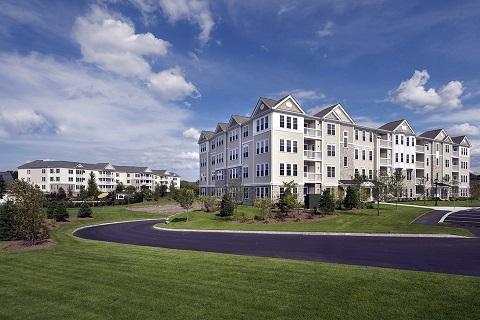
20 COMPLETED 40R PROJECTS Completed 40R Projects Lynnfield Arborpoint at MarketStreet 180 Units Adjacent office park / hotel lifestyle center & housing 20


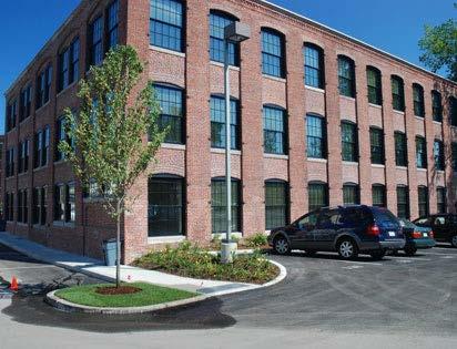
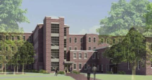
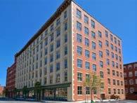
21 DEVELOPMENT CASE STUDIES/Mixed Use DANVERS, MA IDEAL BUSINESS CENTER 20 Locust Street Former Factory/Ideal Business Center Land Area: 29,214 Renovation of existing 47,850 S.F. building 24 new D.U.s (apartment) approved Approx. 20 parking spaces on site Additional Off-Site Parking Permitted Residential Density: 35 DU/Acre
 Unit Size: 1,548 Net SF and 2-Bedroom")
 Parking access off side street 3.")
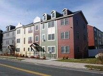
22 SCITUATE, MA DEVELOPMENT CASE STUDIES/Mixed Use HARBORSIDE VILLAGE REDEVELOPMENT Scituate Harbor Front Street Built in Residential Condos (7 Affordable) Unit Size: 1,548 Net SF and 2-Bedroom Land Area: 29,309 2,314 SF Ground Floor Comm. Space 55 Parking Spaces (all underground) Parking access off side street 3.5 Stories/40 feet height Small Plaza in front of building Residential Density: 55 DU/Acre


23 SCITUATE, MA DEVELOPMENT CASE STUDIES/Mixed Use MILL WHARF REDEVELOPMENT Scituate Harbor Front Street Built in Residential Condos 2 and 3-Bedroom Units Land Area: 48,711 SF Ground Floor Comm. Space Movie Theater 1 Parking Space/DU (all in car ports) Parking access off side street 3.5 Stories/40 feet height Small Plaza in front of building Residential Density: 25 DU/Acre


24 W.CONCORD, MA DEVELOPMENT CASE STUDIES/Mixed Use BROOKSIDE SQUARE MIXED USE TOD 2015 Mixed use project in West Concord Village Center adjacent to the commuter train station. Redevelopment of Dilapidated Industrial and Warehouse Buildings Density: 17 DU/Acre 3-story TOD project with the following components: o 36,270 SF light ind., office, indoor rec. on 1 st floor (10% leased as affordable business start-ups) o 74 apartments (84,494 SF) on 2 nd /3 rd floors 4 Studios, 32 1-BRM Units, 38 2-BRM Units (10% affordable). o Existing Post Office 3,364 SF; Future Retail 6,750 SF o Active Open Space market plaza, courtyards, and pathway along the brook

 on 2 nd /3 rd floors: o 4 Studios")
 o Total 10%")
25 W.CONCORD, MA DEVELOPMENT CASE STUDIES/Mixed Use BROOKSIDE SQUARE MIXED USE TOD 74 apartments (84,494 SF) on 2 nd /3 rd floors: o 4 Studios (518 SF) o 32 1-BRM Units (688 SF) o 38 2-BRM Units (938 SF) o Total 10% affordable


26 W.CONCORD, MA DEVELOPMENT CASE STUDIES/Mixed Use BROOKSIDE SQUARE MIXED USE TOD Underground parking Used the Shared Parking factor in zoning bylaw to reduce total required parking from 323 to 271. Overall parking ratio is 1 space/485 GFA (less than 2 spaces/1000)


27 WELLESLEY, MA DEVELOPMENT CASE STUDIES/Commercial LINDEN SQUARE INFILL DEVELOPMENT Medium sized mixed use infill development, shared access and parking, street side parking (on street but not in r-o-w), internal connection to public sidewalk, parking placed behind frontage buildings, plazas and sidewalk seating.


28 WELLESLEY, MA DEVELOPMENT CASE STUDIES/Commercial LINDEN SQUARE INFILL DEVELOPMENT Infill Development Oriented to Street and Pedestrians New Streetside Parking Added 250,000 SF Lifestyle Center on former Strip Development Site Parking ratio: 3.5 spaces/1000 for mixed use; provides 10 on-street parking spaces
 FAR =.75; Res.")

29 DARIEN, CT DEVELOPMENT CASE STUDIES/Mixed Use 16 CROSS ST REDEVELOPMENT Mixed Use (Res-Comm.) FAR =.75; Res. Density = 20 DU/Acre Redevelopment of Dilapidated Industrial Buildings Retail Ground Floor; Office and 13 Apartments on Upper Floors Reduced Setback/2.5-3 Stories Underground/Tandem/Reduced Parking Streetscape Improvements Pedestrian Orientation

30 DOWNTOWN DANVERS ENHANCEMENTS Street Activation Standards
31 MAPLE STREET I-1 AREA DRAFT ZONING BYLAW & DEVELOPMENT STANDARDS Town of Danvers, MA THANK YOU Board of Selectmen June 20, 2017 The Danvers Team: Brovitz Community Planning & Design Dodson & Flinker Danvers Maple St I-1 Design Guidelines & Zoning Code Brovitz Community Planning & Design * Dodson & Flinker
MAPLE STREET I-1 DISTRICT ZONING CODE & DESIGN STANDARDS DEVELOPMENT Town of Danvers, MA
 MAPLE STREET I-1 DISTRICT ZONING CODE & DESIGN STANDARDS DEVELOPMENT Town of Danvers, MA DRAFT OVERLAY DISTRICT & DESIGN STANDARDS Planning Board Meeting December 13, 2016 The Danvers Team: Brovitz Community
DOWNTOWN DANVERS C1-C1A DISTRICTS NEW ZONING BYLAW & DESIGN STANDARDS Town of Danvers, MA
 DOWNTOWN DANVERS C1-C1A DISTRICTS NEW ZONING BYLAW & DESIGN STANDARDS Town of Danvers, MA PUBLIC KICK-OFF MEETING & LISTENING SESSION Planning Board May 8, 2018 The Danvers Team: Brovitz Community Planning
GATEWAY DISTRICTS DRAFT ZONING & DEVELOPMENT STANDARDS City of Portsmouth, NH
 GATEWAY DISTRICTS DRAFT ZONING & DEVELOPMENT STANDARDS City of Portsmouth, NH PLANNING BOARD WORKSHOP June 22, 2017 Brovitz Community Planning & Design HOUSING INITIATIVES Portsmouth 2025 Master Plan (2017)
MERIDEN TOD A NEW TRANSIT-ORIENTED DEVELOPMENT DISTRICT ZONING REGULATION FOR MERIDEN. Greater Meriden Chamber & Connecticut Bar Association
 A NEW TRANSIT-ORIENTED DEVELOPMENT DISTRICT ZONING REGULATION FOR MERIDEN PRESENTATION TO Greater Meriden Chamber & Connecticut Bar Association 25 September 2013 Dominick J. Caruso, AICP Director of Planning
MAPLE STREET I-1 DISTRICT AREA ZONING BYLAW
 MAPLE STREET I-1 DISTRICT AREA ZONING BYLAW SECTION 18 MAPLE STREET TRADITIONAL NEIGHBORHOOD DEVELOPMENT OVERLAY DISTRICT (CHAPTER 40R SMART GROWTH OVERLAY DISTRICT) VERSION 4.0 October 31, 2017 Brovitz
Puyallup Downtown Planned Action & Code Changes. January 10, 2017
 Puyallup Downtown Planned Action & Code Changes January 10, 2017 Purpose & Location Purpose Promote economic development and downtown revitalization Tools: Municipal Code amendments Change development
MAPLE STREET I-1 DISTRICT AREA ZONING BYLAW
 MAPLE STREET I-1 DISTRICT AREA ZONING BYLAW SECTION 18 MAPLE STREET TRADITIONAL NEIGHBORHOOD DEVELOPMENT OVERLAY DISTRICT (CHAPTER 40R SMART GROWTH DISTRICT) VERSION 2.0 February 10, 2017 Brovitz Community
DRAFT FOR DISCUSSION PURPOSES ONLY. Port Credit Local Area Plan Built Form Guidelines and Standards DRAFT For Discussion Purposes
 Port Credit Local Area Plan Built Form Guidelines and Standards DRAFT For Discussion Purposes 1 Local Area Plan - Project Alignment Overview Directions Report, October 2008 (General Summary Of Selected
Town of Danvers Planning Board
 Town of Danvers Planning Board Danvers Town Hall One Sylvan Street Danvers, MA 01923 www.danvers.govoffice.com Margaret Zilinsky, Chair Kristine Cheetham William Prentiss Aaron Henry James Sears John Farmer,
From Policy to Reality
 From Policy to Reality Updated ^ Model Ordinances for Sustainable Development 2000 Environmental Quality Board 2008 Minnesota Pollution Control Agency Funded by a Minnesota Pollution Control Agency Sustainable
Route 6 Corridor Study Bristol Planning Commission Meeting #1. May 25, 2016 FITZGERALD & HALLIDAY, INC. Innovative Planning, Better Communities
 Route 6 Corridor Study Bristol Planning Commission Meeting #1 May 25, 2016 FITZGERALD & HALLIDAY, INC. Innovative Planning, Better Communities Today s Agenda 1. Introductions 2. Study overview Scope Schedule
Unified Development Ordinance. Chamblee Chamber of Commerce Meeting May 21, 2015
 Chamblee Chamber of Commerce Meeting May 21, 2015 What is the UDO? Consolidates multiple development ordinances into a coordinated format Zoning Ordinance Uses and District Standards Use Standards Subdivision
Community Advisory Committee (CAC) Meeting #7 West Anaheim Youth Center May 26, 2016
 Meeting #7 West Anaheim Youth Center May 26, 2016") Community Advisory Committee (CAC) Meeting #7 West Anaheim Youth Center May 26, 2016 1 Project Team City: David Belmer Planning and Building Director Jonathan Borrego, AICP Planning Services Manager Gustavo
Community Advisory Committee (CAC) Meeting #7 West Anaheim Youth Center May 26, 2016 1 Project Team City: David Belmer Planning and Building Director Jonathan Borrego, AICP Planning Services Manager Gustavo
Bylaw No , being "Official Community Plan Bylaw, 2016" Schedule "A" DRAFT
 Bylaw No. 2600-2016, being "Official Community Plan Bylaw, 2016" Schedule "A" Urban Structure + Growth Plan Urban Structure Land use and growth management are among the most powerful policy tools at the
UDO Advisory Committee Meeting #3 August 18, 2011
 UDO Advisory Committee Meeting #3 August 18, 2011 Today s s Agenda Welcome Recap of Meeting #2 Overview of Strategy Statement Overview of Zoning Districts What changes and what stays the same? Break Putting
DRAFT Plan Incentives. Part A: Basic Discount
 DRAFT 2030 Plan Incentives July 26, 2006 Part A: Basic Discount In order for a development to be eligible for any 2030 Land Resource Management Plan Discounts it must be located in the Urban Corridor and
City of Coral Gables Planning and Zoning Staff Report
 City of Coral Gables Planning and Zoning Staff Report Applicant: Application: Public Hearing: Date & Time: Location: City of Coral Gables Zoning Code Text Amendment Giralda Plaza Overlay District Planning
Bunker Hill Part II Urban Design. Specific Plan. Case No. CPC SP TABLE OF CONTENTS
 Bunker Hill Part II Urban Design Specific Plan Case No. CPC-2011-684-SP TABLE OF CONTENTS Section 1. Section 2. Section 3. Section 4. Section 5. Section 6. Section 7. Section 8. Section 9. Section 10.
Missing Middle Housing in Practice
 Missing Middle Housing in Practice Daniel Parolek Principal, Opticos Design, Inc. dan@opticosdesign.com New Partners for Smart Growth Kansas City, MO 2013 1 Bungalow Courts Missing MIddle Housing 2012
Article 3. SUBURBAN (S-) NEIGHBORHOOD CONTEXT
 NEIGHBORHOOD CONTEXT") Article 3. SUBURBAN (S-) NEIGHBORHOOD CONTEXT this page left intentionally blank Contents ARTICLE 3. SUBURBAN (S-) NEIGHBORHOOD CONTEXT DIVISION 3.1 NEIGHBORHOOD CONTEXT DESCRIPTION...3.1-1 Section 3.1.1
Article 3. SUBURBAN (S-) NEIGHBORHOOD CONTEXT this page left intentionally blank Contents ARTICLE 3. SUBURBAN (S-) NEIGHBORHOOD CONTEXT DIVISION 3.1 NEIGHBORHOOD CONTEXT DESCRIPTION...3.1-1 Section 3.1.1
CAN TRADITIONAL ZONING ACHIEVE OUR GOALS FOR DOWNTOWN ANN ARBOR?
 TRADITIONAL ZONING TRADITIONAL ZONING CAN TRADITIONAL ZONING ACHIEVE OUR GOALS FOR DOWNTOWN ANN ARBOR? A dense, mixed use core with flexible land uses A range of housing types and costs A walkable, pedestrian-oriented
Appendix A: Guide to Zoning Categories Prince George's County, Maryland
 Appendix A: Guide to Zoning Categories Prince George's County, Maryland RESIDENTIAL ZONES 1 Updated November 2010 R-O-S: Reserved Open Space - Provides for permanent maintenance of certain areas of land
2.35 BVT G Bow Valley Trail General Commercial District [ ]
![2.35 BVT G Bow Valley Trail General Commercial District [ ]](/thumbs/94/119006025.jpg "2.35 BVT G Bow Valley Trail General Commercial District [ ]") 2.35 BVT G Bow Valley Trail General Commercial District [2014 07] 2.35.1 Purpose This district is intended to form the core of Canmore s visitor accommodation outside the resorts and provide a variety
2.35 BVT G Bow Valley Trail General Commercial District [2014 07] 2.35.1 Purpose This district is intended to form the core of Canmore s visitor accommodation outside the resorts and provide a variety
Chapter DOWNTOWN ZONING DISTRICTS
 Chapter 20.14 Sections: 20.14.010 Purpose of the Downtown Zoning Districts 20.14.020 Land Use Regulations for Downtown Zoning Districts 20.14.030 Development Standards for Downtown Zoning Districts 20.14.010
UrbanFootprint Place Types. Urban Mixed Use. Urban Residential. Urban Commercial. Residential 1% SF Large Lot 0%
 Urban Mixed Use Residential 18% SF Large Lot 0% Employment 16% SF Small Lot 0% Mixed Use 45% Townhome 0% Open Space/Civic 21% MultiFamily 100% Intersections per mi 2 200 Office 80% Average Floors 23 Retail
APPENDIX D: DEFINITIONS
 D APPENDIX D: DEFINITIONS Terms used throughout the 2040 Comprehensive Plan should be interpreted using the definitions provided in this appendix. For interpretation of any term not defined, defer to the
COMPLETE NEIGHBORHOODS AND HOUSING. Community Summit 02 February, 2012
 Lake Oswego Comprehensive Plan COMPLETE NEIGHBORHOODS AND HOUSING Community Summit 02 February, 2012 vision statement We have a wide variety of neighborhoods with high quality, attractive and compatible
VERTICAL MIXED USE DEVELOPMENT (Urban Village)
") VERTICAL MIXED USE DEVELOPMENT (Urban Village) Overall Goal Statement Vertical Mixed Use (Urban Villages) have similar goals to Horizontal Mixed Use except densities are usually higher and projects frequently
VERTICAL MIXED USE DEVELOPMENT (Urban Village) Overall Goal Statement Vertical Mixed Use (Urban Villages) have similar goals to Horizontal Mixed Use except densities are usually higher and projects frequently
ATTACHMENT C. Development Requirements
 ATTACHMENT C Development Requirements Development Codes, also known as Municipal Codes, were reviewed for each station and compiled by jurisdiction. Only those zoning designations located within 0.5 mile
PLANNING COMMISSION. Study Session: Beach Boulevard Specific Plan Workshop
 PLANNING COMMISSION Study Session: Beach Boulevard Specific Plan Workshop Project Background Sustainable Communities Grant Funding Phase 1 Outreach: Improve the Boulevard A Specific Plan is a long-term
REGULATING PLAN for the Plaza Saltillo TOD Station Area Plan (SAP)
") REGULATING PLAN for the Plaza Saltillo TOD Station Area Plan (SAP) Adopted: December 11, 2008 Effective: March 1, 2009 REGULATING PLAN for the Plaza Saltillo TOD Station Area Plan (SAP) CONTENTS BACKGROUND...iv
REGULATING PLAN for the Plaza Saltillo TOD Station Area Plan (SAP) Adopted: December 11, 2008 Effective: March 1, 2009 REGULATING PLAN for the Plaza Saltillo TOD Station Area Plan (SAP) CONTENTS BACKGROUND...iv
Downtown Development Focus Area: I. Existing Conditions
 Downtown Development Focus Area: I. Existing Conditions The Downtown Development Focus Area is situated along Route 1, south of the train tracks, except for the existing Unilever property. It extends west
TOWNSHIP ZONING ORDINANCE PETERS TOWNSHIP PLANNING DEPARTMENT JUNE, E. McMURRAY ROAD McMURRAY, PA 1531 (724)
") EXECUTIVE PROPOSED SUMMARY PETERS Summary: Peters Township Zoning Ordinance TOWNSHIP ZONING ORDINANCE JUNE, 2017 PETERS TOWNSHIP PLANNING DEPARTMENT 610 E. McMURRAY ROAD McMURRAY, PA 1531 (724) 942-5005
EXECUTIVE PROPOSED SUMMARY PETERS Summary: Peters Township Zoning Ordinance TOWNSHIP ZONING ORDINANCE JUNE, 2017 PETERS TOWNSHIP PLANNING DEPARTMENT 610 E. McMURRAY ROAD McMURRAY, PA 1531 (724) 942-5005
BUILDING HEIGHTS. The following diagram depicts the maximum allowable building height in a +3 zone.
 BUILDING HEIGHTS The following diagram depicts the allowable building height in a +1 zone in an area with substantial topography. As the diagram demonstrates, the building has 4 floors (and would have
PLANNING AND REGULATING HOUSING OPTIONS FOR CHANGING DEMOGRAPHICS
 PLANNING AND REGULATING HOUSING OPTIONS FOR CHANGING DEMOGRAPHICS New Partners for Smart Growth Conference February 2017 HOUSING MARKETS Significant increase in rental housing Offset robust single-family
12, 14, 16 and 18 Marquette Avenue and 7 Carhartt Street Zoning By-law Amendment Application - Preliminary Report
 STAFF REPORT ACTION REQUIRED 12, 14, 16 and 18 Marquette Avenue and 7 Carhartt Street Zoning By-law Amendment Application - Preliminary Report Date: July 17, 2014 To: From: Wards: Reference Number: North
ARTICLE 5. COMMERCIAL AND OFFICE DISTRICTS 5.1 PURPOSE STATEMENTS 5.2 USES 5.3 DIMENSIONAL STANDARDS 5.4 DESIGN STANDARDS 5.5 DK DISTRICT STANDARDS 5
 ARTICLE 5. COMMERCIAL AND OFFICE DISTRICTS 5.1 PURPOSE STATEMENTS 5.2 USES 5.3 DIMENSIONAL STANDARDS 5.4 DESIGN STANDARDS 5.5 DK DISTRICT STANDARDS 5.6 CU DISTRICT STANDARDS 5.7 SW DISTRICT STANDARDS THE
MAPLE STREET I-1 DISTRICT PROJECT AREA PLACEMAKING AUDIT
 MAPLE STREET I-1 DISTRICT PROJECT AREA PLACEMAKING AUDIT EXISTING CONDITIONS I CHALLENGES I OPPORTUNITIES FINAL REPORT November 2016 Brovitz Community Planning & Design with Dodson & Flinker Associates
Draft Strategy Plan Concepts. CAC Meeting #9
 Downtown San Leandro Transit-Oriented Development Strategy Draft Strategy Plan Concepts Discussion & Conclusions CAC Meeting #9 23 January 2007 Land Use Plan & Specific Areas New mixed-use districts Context-sensitive
MONROE WARD REZONING SUMMARY. October 2018
 MONROE WARD REZONING SUMMARY October 2018 WHY IS THE CITY REZONING MONROE WARD? In July of 2017 Richmond City Council adopted The Pulse Corridor Plan, a corridor-long planning document that outlines steps
Table of Contents ARTICLE 5A CHARACTER-BASED ZONING 1
 Table of Contents ARTICLE 5A CHARACTER-BASED ZONING 1 SECTION 10.5A10 GENERAL... 1 10.5A11 Purpose and Intent... 1 10.5A12 Applicability... 1 10.5A13 Compliance with Regulating Plan... 1 10.5A14 Relationship
Truax Park Apartments
 Truax Park Apartments Master Planning and Site Development Study Prepared by The Community Development Authority of the City of Madison In association with SMITH & SMITH ASSOCIATES, Inc CONSTRUCTION COST
Public Review of the Slot Home Text Amendment
 Public Review of the Slot Home Text Amendment The proposed amendments to the Denver Zoning Code have been informed by the Slot Home Strategy Report. This document has been developed out of a robust process
Coding For Places People Love Main Street Corridor District
 Coding For Places People Love Main Street Corridor District 1) Scope a) District boundaries are assigned according to the District Boundary Map. b) The Primary Retail Corridor is assigned according to
Table of Contents ARTICLE 5A CHARACTER-BASED ZONING 1
 Table of Contents ARTICLE 5A CHARACTER-BASED ZONING 1 SECTION 10.5A10 GENERAL... 1 10.5A11 Purpose and Intent... 1 10.5A12 Applicability... 1 10.5A13 Compliance with Regulating Plan... 1 10.5A14 Relationship
Project Team. Community Workshop Draft Specific Plan Review West Anaheim Youth Center September 4, /6/2018.
 Community Workshop Draft Specific Plan Review West Anaheim Youth Center September 4, 2018 Project Team City: David Belmer Planning and Building Director Susan Kim, AICP Principal Planner Gustavo Gonzalez,
LITTLE MOUNTAIN ADJACENT AREA REZONING POLICY
 LITTLE MOUNTAIN ADJACENT AREA REZONING POLICY JANUARY 2013 CONTENTS 1.0 INTENT & PRINCIPLES...1 2.0 APPLICATION...2 3.0 HOUSING TYPES, HEIGHT & DENSITY POLICIES...3 3.1 LOW TO MID-RISE APARTMENT POLICIES...4
Town of Clinton, Connecticut Action Plan for the Historic Unilever Property and Area. Steering Committee Meeting #5 Implementation Strategies
 Town of Clinton, Connecticut Action Plan for the Historic Unilever Property and Area Steering Committee Meeting #5 Implementation Strategies Wednesday, March 19, 2014 6:30pm Steering Committee Meeting
TABLE OF CONTENTS. Chapters and Sections
 TABLE OF CONTENTS Chapters and Sections Chapter 9.02 Permits and Approvals [Addition]... 1 9.02.090 Administrative variances.... 1 Chapter [New]... 1 9.07.091 Purpose and Intent... 1 9.07.092 Applicability...
forwarddallas! Development Code Amendments Approach Quality of Life Committee Briefing June 11, 2007
 1 forwarddallas! Development Code Amendments Approach Quality of Life Committee Briefing June 11, 2007 2 Project Background The forwarddallas! Comprehensive Plan provides the foundation and launching pad
CITY OF FARMERSVILLE CITIZEN ADVISORY COMMITTEE AGENDA November 17, :30 P.M. 1, COUNCIL CHAMBERS, CITY HALL
 I. PRELIMINARY MATTERS CITY OF FARMERSVILLE CITIZEN ADVISORY COMMITTEE AGENDA November 17, 2014 6:30 P.M. 1, COUNCIL CHAMBERS, CITY HALL Call to Order, Roll Call, Prayer and Pledge of Allegiance Welcome
Outline of Land Use Bylaw, 1P2007 Changes
 Outline of Land Use Bylaw, 1P2007 Changes Changes to single and multi-family builders, renovators, land developers and trades The City s new Land Use Bylaw, 1P2007 has been approved by Council. The new
Chapter URBAN VILLAGE ZONING DISTRICTS
 Chapter 20.16 Sections: 20.16.010 Purpose of the Urban Village Zoning Districts 20.16.020 Land Use Regulations for the Urban Village Zoning Districts 20.16.030 Development Standards & Guidelines for the
City of North Richland Hills Transit Oriented Development Code
 City of North Richland Hills Transit Oriented Development Code Section 118-561. Purpose and Intent: The purpose of the Transit Oriented Development (TOD) Code is to support the development of the community
City of North Richland Hills Transit Oriented Development Code
 Section 118-561. Purpose and Intent: City of North Richland Hills Transit Oriented Development Code The purpose of the Transit Oriented Development (TOD) Code is to support the development of the community
TOWN OF DANVERS HIGH STREET INDUSTRIAL 1 (I-1) DISTRICT STUDY DRAFT FINAL REPORT DRAFT FOR DISCUSSION - 03/16/18
 DISTRICT STUDY DRAFT FINAL REPORT DRAFT FOR DISCUSSION - 03/16/18") TOWN OF DANVERS HIGH STREET INDUSTRIAL 1 (I-1) DISTRICT STUDY DRAFT FINAL REPORT DRAFT FOR DISCUSSION - 03/16/18 TOWN OF DANVERS HIGH STREET INDUSTRIAL 1 (I-1) DISTRICT STUDY Funding for this study was
TOWN OF DANVERS HIGH STREET INDUSTRIAL 1 (I-1) DISTRICT STUDY DRAFT FINAL REPORT DRAFT FOR DISCUSSION - 03/16/18 TOWN OF DANVERS HIGH STREET INDUSTRIAL 1 (I-1) DISTRICT STUDY Funding for this study was
PLANNING RATIONALE REPORT CODEAU BUILDING LTD RIDEAU STREET OTTAWA DECEMBER 2013
 PLANNING RATIONALE REPORT CODEAU BUILDING LTD 541-545 RIDEAU STREET OTTAWA DECEMBER 2013 1 This report has been prepared on behalf of Codeau Building Ltd. in support of a Zoning By-law Amendment Application
City of Tacoma Zoning Reference Guide
 City of Tacoma Zoning Reference Guide Planning and Development Services 747 Market Street, Room 345 Tacoma, WA 98402 (253) 591-5577 This document should not be used as a substitute for codes and regulations.
71 RUSSELL AVENUE. PLANNING RATIONALE FOR SITE PLAN CONTROL APPLICATION (Design Brief)
") ` 71 RUSSELL AVENUE Ottawa September 14, 2018 PLANNING RATIONALE FOR SITE PLAN CONTROL APPLICATION (Design Brief) Introduction The intent of this Planning Rationale and Design Brief is to provide planning
` 71 RUSSELL AVENUE Ottawa September 14, 2018 PLANNING RATIONALE FOR SITE PLAN CONTROL APPLICATION (Design Brief) Introduction The intent of this Planning Rationale and Design Brief is to provide planning
Poughkeepsie City Center Revitalization Plan
 Purpose and Need Purpose Increase job and educational opportunities for all residents Maximize fiscal productivity of downtown land uses Diversify retail mix Eliminate surface and building vacancies Create
City of Westminster
 http://daniels.du.edu/faculty-research/franklin-l-burns-schoolof-real-estate-and-construction-management/events/ City of Westminster DU Executive Real Estate Round Table August 2016 City of Westminster
City Avenue District Rezoning. Regional Center Area & Bala Cynwyd Retail District December 14, 2011 Public Hearing
 City Avenue District Rezoning Regional Center Area & Bala Cynwyd Retail District December 14, 2011 Public Hearing Board of Commissioners Agenda Public Hearings An Ordinance to create The City Avenue District,
Wheaton Sector Plan. Preliminary. Recommendations. Montgomery County Planning Board
 Sector Plan Preliminary Recommendations Montgomery County Planning Board 12-03-09 Scope of Work September 2008 Status Report June 2009 Preliminary Recommendations December 2009 1952 Process Today Community
NOTICE OF MEETING AND AGENDA FOR THE PLANNING COMMISSION OF SPRINGVILLE, UTAH... JANUARY 23, 2018
 NOTICE OF MEETING AND AGENDA FOR THE PLANNING COMMISSION OF SPRINGVILLE, UTAH............................ JANUARY 23, 2018 Notice is hereby given that the Planning Commission will hold a public meeting
Oak Cliff Gateway District PD 468
 Oak Cliff Gateway District PD 468 August 21, 2014 2013 Authorized Hearing Authorized Hearing September, 2013 September 12, 2013 City Plan Commission expanded boundaries to represent current Oak Cliff Gateway
Article Optional Method Requirements
 Article 59-6. Optional Method Requirements [DIV. 6.1. MPDU DEVELOPMENT IN RURAL RESIDENTIAL AND RESIDENTIAL ZONES Sec. 6.1.1. General Requirements... 6 2 Sec. 6.1.2. General Site and Building Type Mix...
Downtown 2025 Sector Development Plan
 Existing Sector / Corridor / Design Overlay Zone Summary Sheet 2025 Sector Web Address: https://www.cabq.gov/planning/documents/copy_of_2025_dec14r.pdf Joint plan with Bernalillo County No Date Adopted/Amended
Proposed Development at Ajax Plaza Windcorp Grand Harwood Place Ltd.
 Proposed Development at Ajax Plaza Windcorp Grand Harwood Place Ltd. Presentation to Ajax Council July 4, 2013 Introduction 1. Background 2. Planning Policies and Regulations 3. Downtown Community Improvement
Chapter MIXED USE ZONING DISTRICTS
 Page 1 of 12 Page 1/12 Chapter 17.18 MIXED USE ZONING DISTRICTS Sections: 17.18.010 Purposes. 17.18.020 Permitted, conditional and prohibited uses. 17.18.030 Bulk, 17.18.010 Purposes. A. Mixed Use Districts.
BYLAW NUMBER 64D2010
 . BEING A BYLAW OF THE CITY OF CALGARY TO AMEND THE LAND USE BYLAW 1P2007 (LAND USE AMENDMENT LOC2OI 0-0012) ************* **************** WHEREAS it is desirable to amend the Land Use Bylaw Number 1
Article 6. GENERAL URBAN (G-) NEIGHBORHOOD CONTEXT
 NEIGHBORHOOD CONTEXT") Article 6. GENERAL URBAN (G-) NEIGHBORHOOD CONTEXT this page left intentionally blank Contents ARTICLE 6. GENERAL URBAN (G-) NEIGHBORHOOD CONTEXT DIVISION 6.1 NEIGHBORHOOD CONTEXT DESCRIPTION...6.1-1 Section
Article 6. GENERAL URBAN (G-) NEIGHBORHOOD CONTEXT this page left intentionally blank Contents ARTICLE 6. GENERAL URBAN (G-) NEIGHBORHOOD CONTEXT DIVISION 6.1 NEIGHBORHOOD CONTEXT DESCRIPTION...6.1-1 Section
5. Housing. Other Relevant Policies & Bylaws. Several City-wide policies guide our priorities for housing diversity at the neighbourhood level: Goals
 5. Housing Other Relevant Policies & Bylaws Several City-wide policies guide our priorities for housing diversity at the neighbourhood level: Goals 1. Encourage more housing diversity while maintaining
CITY OF SARATOGA SPRINGS ZONING ORDINANCE TABLE 1: 2.0 BASE ZONING DISTRICTS
 2.0 BASE S 2.1 INTENT To fulfill the intent and purpose of this Chapter, the following tables identify zoning districts and district intents (Table 1), districts use schedule (Table 2), and districts area
Reviewing Mixed Use Proposals
 MIXED USE ZONING Citizens Guide Supplement 1 Things to Consider in Reviewing Mixed Use Proposals Using an Overlay District vs. Changing Underlying Zoning To achieve well-planned mixed use development,
DISTRICT OF CRITICAL PLANNING CONCERN (DCPC) PUBLIC HEARING. March 28, 2018
 PUBLIC HEARING. March 28, 2018") DISTRICT OF CRITICAL PLANNING CONCERN (DCPC) PUBLIC HEARING March 28, 2018 WHAT IS A DCPC? A DCPC designation allows for creation of special regulations to govern development and land use within a designated
DISTRICT OF CRITICAL PLANNING CONCERN (DCPC) PUBLIC HEARING March 28, 2018 WHAT IS A DCPC? A DCPC designation allows for creation of special regulations to govern development and land use within a designated
Attachment 5 - Ordinance 3154 Exhibit D (Revised for 9/15 Council Meeting) Page 1 of 7 Port Townsend Municipal Code. Chapter 17.18
 Page 1 of 7 Port Townsend Municipal Code. Chapter 17.18") Page 1 of 7 Page 1/7 Chapter 17.18 MIXED USE ZONING DISTRICTS Sections: 17.18.010 Purposes. 17.18.020 Permitted, conditional and prohibited uses. 17.18.030 Bulk, 17.18.010 Purposes. A. Mixed Use Districts.
Page 1 of 7 Page 1/7 Chapter 17.18 MIXED USE ZONING DISTRICTS Sections: 17.18.010 Purposes. 17.18.020 Permitted, conditional and prohibited uses. 17.18.030 Bulk, 17.18.010 Purposes. A. Mixed Use Districts.
PEDESTRIAN OVERLAY DISTRICT. November 6, 2013 Charlotte-Mecklenburg Planning Department
 Midtown Morehead Cherry PEDESTRIAN OVERLAY DISTRICT November 6, 2013 Charlotte-Mecklenburg Planning Department Meeting Purpose To provide a background on the Pedestrian Overlay District Zoning text amendment
DEVELOPMENT STANDARDS FOR RESIDENTIAL PROJECTS RESIDENTIAL BUILDING TYPES: APPROPRIATE ZONES AND DENSITIES 2-1
 2 DEVELOPMENT STANDARDS FOR RESIDENTIAL PROJECTS RESIDENTIAL BUILDING TYPES: APPROPRIATE ZONES AND DENSITIES 2-1 This Chapter presents the development standards for residential projects. Section 2.1 discusses
Downtown Plano. Creating a Transit Village
 Downtown Plano Creating a Transit Village Residential Growth Pattern Downtown Plano Plano 1891 Plano 1971 Downtown Plano Downtown Plano Avenue J Avenue J Summary of Problems Eroding economic position Physical
TASK 2 INITIAL REVIEW AND ANALYSIS U.S. 301/GALL BOULEVARD CORRIDOR FORM-BASED CODE
 TASK 2 INITIAL REVIEW AND ANALYSIS U.S. 301/GALL BOULEVARD CORRIDOR FORM-BASED CODE INTRODUCTION Using the framework established by the U.S. 301/Gall Boulevard Corridor Regulating Plan (Regulating Plan),
6040 Bathurst Street and 5 Fisherville Road Zoning Bylaw Amendment Application Preliminary Report
 STAFF REPORT ACTION REQUIRED 6040 Bathurst Street and 5 Fisherville Road Zoning Bylaw Amendment Application Preliminary Report Date: January 24, 2017 To: From: Wards: Reference Number: North York Community
Plan Dutch Village Road
 Plan Dutch Village Road Objective: The lands around Dutch Village Road are a minor commercial area that services the larger Fairview community. Maintaining the vibrancy of the area by planning for redevelopment
Bridgeland-Riverside Area Redevelopment Plan (ARP)
") Bridgeland-Riverside Area Redevelopment Plan (ARP) The current Bridgeland-Riverside Area Redevelopment Plan (ARP) was approved in 1980. Since then, a lot of changes have taken place in the city and the
Bridgeland-Riverside Area Redevelopment Plan (ARP) The current Bridgeland-Riverside Area Redevelopment Plan (ARP) was approved in 1980. Since then, a lot of changes have taken place in the city and the
Berry/University Form Based Code and Urban Residential Development
 Berry/University Form Based Code and Urban Residential Development Presented to the City Council by the Planning and Development Department October 11, 2016 Purpose Review proposed Berry/University formbased
TOWNHOUSE. TYPICAL UNIT SIZE 1,200 to 1,600 square foot average unit (two to three stories) DENSITY dwelling units/acre without cottages
 DENSITY dwelling units/acre without cottages") TOWNHOUSE Townhouses are typically two to three stories in height. Some townhouses include separate rental units, either on the top or bottom floor of a three-story townhouse unit, or in a cottage above
TOWNHOUSE Townhouses are typically two to three stories in height. Some townhouses include separate rental units, either on the top or bottom floor of a three-story townhouse unit, or in a cottage above
What is a Neighbourhood Plan?
 What is a Neighbourhood Plan? A Neighbourhood Plan determines the location and design of new transit-oriented land uses, like: Council adopts a Neighbourhood Plan following public consultation and technical
Yonge Street and 3 Gerrard Street East - Zoning Amendment Application - Preliminary Report
 STAFF REPORT ACTION REQUIRED 363-391 Yonge Street and 3 Gerrard Street East - Zoning Amendment Application - Preliminary Report Date: May 22, 2015 To: From: Wards: Reference Number: Toronto and East York
City of Chico Title 19 Land Use & Development Regulations TND Zone
 City of Chico Title 19 Land Use & Development Regulations TND Zone Adopted by the City of Chico July 3, 2002 (Ordinance #2358) TITLE 19 LAND USE AND DEVELOPMENT REGULATIONS TABLE OF CONTENTS DIVISION VI.
Charlottesville Planning Commission, Neighborhood Associations & News Media
 CITY OF CHARLOTTESVILLE A World Class City Department of Neighborhood Development Services City Hall Post Office Box 911 Charlottesville, Virginia 22902 Telephone 434-970-3182 Fax 434-970-3359 www.charlottesville.org
Town of Cary, North Carolina Rezoning Staff Report 12-REZ-27 Morris Branch Town Council Public Hearing January 24, 2013
 Town of Cary, North Carolina Rezoning Staff Report 12-REZ-27 Morris Branch Town Council Public Hearing January 24, 2013 REQUEST To amend the Town of Cary Official Zoning Map to rezone approximately 9.0
66 Isabella Street Rezoning Application - Preliminary Report
 STAFF REPORT ACTION REQUIRED 66 Isabella Street Rezoning Application - Preliminary Report Date: November 15, 2010 To: From: Wards: Reference Number: Toronto and East York Community Council Director, Community
4 DEVELOPMENT STANDARDS FOR
 4 DEVELOPMENT STANDARDS FOR RESIDENTIAL MIXED-USE PROJECTS This chapter presents standards for residential mixed-use projects in the Ashland-Cherryland Business District and the Castro Valley Central Business
RECOMMENDED ACTION: Council may vote to make specific changes to the draft. Staff will be available to help in guiding specific motions.
 CITY COUNCIL Agenda Item #16-164. Date: June 8, 2016 Consent Discussion _x_ SUBJECT: Presentation of Part 2 Unified Development Bylaws SUBMITTING DEPARTMENT: Planning RECOMMENDED ACTION: Council may vote
LAND USE AND BUILT FORM
 5 LAND USE AND BUILT FORM The existing zoning on Bank Street already allows for considerable general intensification, since the permitted Floor Space Index (FSI) would already allow several times more
CITY OF KAMLOOPS BYLAW NO A BYLAW TO AMEND THE ZONING BYLAW OF THE CITY OF KAMLOOPS
 67 68 CITY OF KAMLOOPS BYLAW NO. 5-1-2796 A BYLAW TO AMEND THE ZONING BYLAW OF THE CITY OF KAMLOOPS The Municipal Council of the City of Kamloops, in open meeting assembled, enacts as follows: 1. This
Appendix1,Page1. Urban Design Guidelines. Back to Back and Stacked Townhouses. DRAFT September 2017
 Appendix1,Page1 Urban Design Guidelines DRAFT September 2017 Back to Back and Stacked Townhouses Appendix1,Page2 Table of Contents 1 Introduction 1 1.1 Purpose 1 1.2 Urban Design Objectives 1 1.3 Building
Ann Arbor Downtown Zoning Evaluation
 Ann Arbor Downtown Zoning Evaluation Options Workbook ENP & Associates in cooperation with the City of Ann Arbor September, 2013 Photo Courtesy of Andrew Horne, February 9, 2013 Introduction Thank you
The Cannery Marketplace Narrative. Purpose: Site Design Approach: Cannery Commerce District 10/18/2017
 The Cannery Marketplace Narrative Cannery Commerce District 10/18/2017 Purpose: A number of entitlements are being requested for the Cannery Marketplace inclusive of a Master Conditional Use Permit (Master
Parking Challenges and Trade-Offs
 Parking Challenges and Trade-Offs What is the best way to balance competing interests and priorities while updating the City s off street parking regulations? Updating off street parking regulations can
City of Coral Gables Planning and Zoning Staff Report
 City of Coral Gables Planning and Zoning Staff Report Applicant: Application: Public Hearing: Date & Time: Location: City of Coral Gables Giralda Restaurant Row Overlay Zoning Code Text Amendment Planning