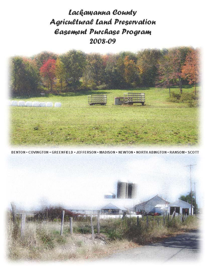
Lackawanna County Agricultural Land Preservation Easement Purchase Program
|
|
|
- Jasmine Gaines
- 5 years ago
- Views:
Transcription
1
2 Lackawanna County Agricultural Land Preservation Easement Purchase Program Recertified by the PA Department of Agriculture, April 21, 2005 County Commissioners Michael J. Washo Corey O Brien A. J. Munchak Agricultural Land Preservation Board Mary Liz Donato, Chairman James Corselius, Vice-Chairman Michael Cestone, Secretary Doug Johnson, Treasurer Larry Seymour
3 Table of Contents Introduction... 1 Purpose... 2 Public Information Program... 3 Significant Agricultural Areas... 3 Agricultural Conservation Easement Purchase Program... 4 Minimum Eligibility Criteria... 5 Planning Map To Guide Easement Purchases... 6 Procedures For Easement Evaluation and Purchase... 7 Deadline to Apply... 7 Application Form Criteria... 7 Location Map Soils Report Evaluation and Ranking of Applications Farmland Ranking System Criteria Site Assessment Factors Land Evaluation Factors Site Assessment Evaluation Land Evaluation Form Table 1 - Relative Soil Values Appraisal of Easements Easement Value Choosing an Appraiser The Appraisal Report Comparable Sales Easement Value and Purchase Price Approval of Easement Purchase Requirements of the Agricultural Easement Deed Permitted Actions Additional Program Procedures Title Insurance Statement Of Costs Summary Report Appendix A - Lackawanna County Agricultural Land Preservation Board Appendix B - Bylaws of County Board... 36
4 Appendix C - Agricultural Conservation Easement Application Form Appendix D - Farmland Ranking System Worksheet Appendix E - Appraisal Deposit Form Appendix F - State Board Review of a Purchase Recommendation Appendix G - Procedure For Inspecting And Enforcing An Easement Appendix H - Responsibility Of Owner Appendix I - Deed of Agricultural Conservation Easement Appendix J - Minimum Criteria for Applications (138e.16) Appendix K - Offer of Purchase by County Board Appendix L - Offer to Purchase Agreement Appendix M - Resolution of County Commissioners MAP... 76
5 Introduction Considering the economic importance of agriculture in Lackawanna County and the changing land use from farming to residential and commercial development, the Lackawanna County Agricultural Land Preservation Board was appointed by the County Commissioners in 1991 to implement the Agricultural Area Security Law. This provides the opportunity for owners of qualified farmland to sell or donate conservation easements that would prohibit the development of such land for uses other than commercial agriculture. Currently America is losing 1.2 million acres of farmland annually. In Lackawanna County the number of farms decreased by 10% in the years between 1997 and The expansion of vegetable production in the county has dramatically increased the need for cropland and all the acres released by fewer dairy farms have been used for these crops. However, these acres, in addition to cropland on farms no longer in production by the owner, are being rented by vegetable growers who are expanding these enterprises. Currently crop production on rented land is estimated at 75 percent of the cropland in the county. The Lackawanna County Agricultural Land Preservation Board sees an urgent need to provide commercial farmers with a method for preserving viable crop land to sustain the agricultural industry in Lackawanna County. Why Should Farmland be saved? Protection of the Environment Well-managed farmland supplies important non-market goods and services. Farmlands provide cover for wildlife, protect wetlands and watersheds, help control flooding and maintain air quality. Fresh and healthy food The farms that are closest to our cities, and in the direct path of development most of our fresh food. produce 1
6 National Economy Nearly $1 trillion is contributed to our national economy by the U.S. food and farming system. With a rapidly increasing population in the world global markets expanding, saving American farmland is a prudent investment. Strong Communities and Fiscal Stability for Local Governments Protecting the quality of life, scenic and cultural landscapes, recreational opportunities, local jobs, and farmers markets, are compelling reasons for many Americans to save farmland. Privately owned farmland requires very few services when compared to developments. Cost of Community Services studies show that nationwide, farm, forest, and open lands more than pay for the municipal services they require, while taxes on residential uses, on average, do not cover these costs. Purpose The purpose of the Lackawanna County Agricultural Land Preservation Program is to protect and promote continued crop and livestock production on viable agricultural lands in Lackawanna County by acquiring through purchase and gift, Agricultural Conservation Easements on such land. This program should prevent the development or improvement of productive agricultural land for any purpose other than agricultural production and related activities. It is also the purpose of this program to - encourage land owners to make a long term commitment to agriculture by offering them financial incentives and security of land use, protect normal farming operations in agricultural security areas from incompatible non-farmland uses that may render farming impracticable, protect normal farming operations from complaints of public nuisance against normal farming operations, assure conservation of viable agricultural lands in order to protect the agricultural economy of this County, provide compensation to landowners in exchange for their relinquishment of the right to develop their private property; and maximize Agricultural Conservation Easement purchase funds and protect the investment of taxpayers in the Agricultural Area Security Law. 2
7 The Lackawanna County Agricultural Land Preservation Program includes the policies and procedures to be used in accomplishing the objectives of the Agricultural Area Security Law, Act 43 or 1981 as amended. Public Information Program The Lackawanna County Agricultural Preservation Board will publicize the County Program through the publication and dissemination of newsletters, information brochures, annual reports, press releases, and through public meetings, workshops, extension service mailings, and direct mailings to farmers participating in agricultural security areas. All meetings of the County Board will be subject to the Act of July 3, 1986 (P.L. 388, No. 84), known as the Sunshine Act, and the Act of June 21, 1957 (P.L. 390, No. 212), referred to as the Right-To-Know Law, relating to the inspection and copying of public records. Significant Agricultural Areas In Lackawanna County Significant agricultural areas in Lackawanna County have been identified as special target areas for farmland preservation activities. These areas were chosen for their concentration of productive soils, large tracts of actively farmed land, and generally limited urban infrastructure. (See Map at end of booklet) Agricultural Conservation 3
8 Lackawanna County, through the Lackawanna County Agricultural Land Preservation Board, intends to acquire perpetual agricultural conservation easements in order to preserve viable farmland in Lackawanna County. Conservation easements may be acquired with county funds, local government unit funds, joint funds, or state funds. The county is responsible for monitoring and enforcement of all easements purchased with public funds. Conservation easements will be accepted only through voluntary sale within existing Agricultural Security Areas. Those landowners who are interested in applying for conservation easement sales on qualified land will be ranked and prioritized based on various site factors and the viability of the farming operation. An appraisal or appraisals of the conservation easement s value will be the determinant of the maximum compensable easement value. Payment to the prospective landowner may be made in a lump sum, like-kind exchange, or in installment payments over a period up to five years. The objectives of this approach to farmland preservation are to ensure the continued existence and protection of farmland in Lackawanna County by providing just compensation to landowners who voluntarily preserve their farm. The Lackawanna County Agricultural Land Preservation Board has established a deadline for submission of applications for purchase of conservation easements as outlined in this report. A conservation easement, secured through acquisition, is a legally binding document which is filed with the recorder of deeds, restricting the use of the land to agricultural and directly related uses, for which compensation is paid. Restrictions are binding upon the owner and future owners, carrying with the land. Minimum Eligibility Criteria 4
9 In order for a farmland site to be prioritized for easement purchase, a landowner must submit a completed application form for the purchase of a conservation easement. The Lackawanna County Agricultural Land Preservation Board will accept all applications for further processing for the purchase of conservation easements if the application meets the minimum criteria listed below. Failure of the applicant to meet the minimum criteria will result in a rejection of that application. Therefore, the applicant will not receive the benefit of being prioritized. All applicants that have been rejected by the board for the reason of not meeting the minimum criteria will be given written notice of the rejection along with an explanation of the reason(s) why the application was rejected, within sixty (60) days of the application deadline. The following state minimum criteria are prerequisites for a conservation easement sale. The farmland tract must: 1a. Be located in an approved and duly recorded Agricultural Security Area consisting of 500 acres or more; OR 1b. Be bisected by the dividing line between two local government units, having the majority of its viable agricultural land within an agricultural security area of 500 acres or more and the remainder in another local government unit outside of an agricultural security area. OR 1c. Be bisected by the dividing line between the purchasing county and an adjoining county, having the land located in the purchasing county within an agricultural security area of 500 acres or more and the remainder in another county outside of an agricultural security area, and with respect to which one of the following applies: A mansion house is on the tract and located within the purchasing county. When the mansion house on the tract is bisected by the dividing line between two counties, the landowner has chosen the purchasing county as the situs of assessment for tax purposes. When there is no mansion house on the farmland tract, the majority of the tract s viable agricultural land is located within the purchasing county. AND 5
10 2. Contain 50 percent of soils which are available for agricultural production and are of capability classes I through IV, as defined by the soil surveys published by the United States Department of Agriculture - NRCS; AND 3. Contain the greater of 50 percent or 10 acres of harvested cropland, pasture or grazing lands; AND 4. Be contiguous acreage of at least 50 acres in size unless the tract is at least 10 acres in size and is either utilized for a crop unique to the area or is contiguous to a property which has a perpetual conservation easement in place which is held by a qualified conservation organization, as that term is defined at Section 171 (h) (3) of the Internal Revenue Code. Contiguous acreage is defined as all portions of one operational unit as described in the deed, or deeds, whether or not the portions are divided by streams, public roads, bridges, and whether or not described as multiple tax parcels, tracts, purports, or other property identifiers. It includes supportive lands such as unpaved field access roads, drainage areas, border strips, hedgerows, submerged lands, marshes, ponds, and streams. A tract may be 49 to 35 acres in size, with the provision that state funds account for no more than 50% of the purchase price. In addition, the County minimum criteria include: Only perpetual conservation easements will be purchased. The maximum easement price that the County Board will pay is $2,500 per acre. Any offer to sell a perpetual easement at a price less than the appraised value may qualify as a conservation contribution. Planning Map To Guide Easement Purchases The Lackawanna County Agricultural Land Preservation Board has adopted a planning map to guide easement purchases (See Map at end of booklet). The map identifies Significant Agricultural Areas within the county. Parcels located within existing Significant Agricultural Areas will be afforded higher priority than parcels located outside of these areas. 6
11 Procedures for Easement Evaluation and Purchase This section details the procedures for conservation easement evaluation and purchase. The majority of this text is derived directly from the guidelines promulgated by the Pennsylvania Department of Agriculture. All conservation easement applications and other documentation shall be done in accordance with the model formats included in the state guidebook and any future revisions thereto. ( 14.1 (a) (3) (xv) and (b) (2) (xiv)). Deadline to Apply Owners of qualified land may offer to sell a conservation easement by applying to the Board by March 1 of each year. This program becomes effective on January 1, A separate application shall be required for each farmland tract offered for easement purchase. The farmland tract may be composed of non-contiguous parcels, parcels with different property tax numbers, or separately deeded properties. The farmland tract must meet the minimum criteria for acreage. The application must consist of a completed application form, location maps, a soils report and a crop report. The County Board will have two (2) years to complete the purchase of an easement with available funds. Application Form The County Board has developed an application form, as shown in Appendix C, requesting the following information to determine if the property meets the minimum eligibility criteria: Name, address, telephone number and signature of the owner of the property. County, municipality and agricultural security area in which the farmland tract is located. 7
12 One of the following, as applicable: If the farmland is eligible to be considered for easement purchase under 138e.16(a)(1)(i), the county, local government unit and agricultural security area in which the farmland tract is located. If the farmland is bisected by a dividing line between two units of local government and is eligible to be considered for easement purchase under 138e.16(a)(1)(ii), the county and local government units in which the farmland tract is located, the agricultural security area in which a portion of that farmland tract is located, a breakdown of the acreage proposed for easement purchase in each local government unit and a breakdown of the number acres of viable agricultural land in the acreage proposed for easement purchase in each local government unit. If the farmland tract is bisected by the dividing line between two or more counties and is eligible to be considered for easement purchase under 138e.16(a)(1)(iii), the counties and local government units in which the farmland tract is located, the agricultural security area in which a portion of that farmland tract is located, and one of the following: o If there is a mansion house on the farmland tract, an acknowledgement of this fact and a designation of the county in which the mansion house in located. o If there is a mansion house on the farmland tract, and the mansion house is bisected by the dividing line between two or more counties, an acknowledgement of this fact and a designation of the county the landowner has chosen as the situs of assessment for tax purposes. o If there is no mansion house on the farmland tract, an acknowledgement of this fact and a breakdown of the acreage proposed for easement purchase in each county and a breakdown of the number of acres of viable agricultural land in the acreage proposed for easement purchase in each county. Total acreage of farm. Number of acres proposed for easement purchase. Crops grown on the land proposed for purchase. Numbers and kinds of livestock on the farm. 8
13 Street location of farm, and directions from the nearest state route. Deed reference - book, volume and page. County tax map records, including tax parcel number, or account number of each parcel. The date of the USDA-NRCS conservation plan, if any. Name, address and telephone number of person to be contacted to view the farmland tract. The date of any nutrient management plan. The applicant must provide crop production information for the farmland tract for the most recent crop year that comparable statistics are available from the Pennsylvania Agricultural Statistics Service (PASS) as follows: Commodity Acres Grown Yield Per Acre The applicant shall provide a livestock report for the farmland tract for the most recent calendar year that comparable statistics are available from the Pennsylvania Agricultural Statistics Service as follows: Average Product Amount Livestock Numbers Sold Sold If the applicant grows crops or produces livestock that are of a type not reported by PASS, the county board shall obtain two years of production data 9
14 from the applicant in order to determine if the application meets the minimum criteria as set forth in Section 138e.16(a) (5) (i) - (Appendix K). Location Map The following information must be provided indicating the location of the farm proposed for easement purchase: A USGS topographical map showing the location of the farmland tract; A tax map of the farmland proposed for protection with map reference and tax parcel number clearly indicated; Soils Report The applicant must provide a soils report, including a narrative description of each of the soil types found on the farm, and soils map for the farmland tract proposed for easement purchase, and a table showing the capability class and use of the land, as follows: Class I Class II Class III Class IV Other TOTAL Acres of Cropland/ Other Total Acres Pastureland The soils map shall color code soil types as follows: Class I Class II Class III Class IV Class V-VIII Wetlands = Green = Yellow = Red = Blue = Uncolored = Cross-Hatch, or shown on a separate map 10
15 Evaluation and Ranking of Applications The Lackawanna County Agricultural Land Preservation Board will review each application to determine if it is complete and meets the minimum eligibility criteria. The Lackawanna County Agricultural Land Preservation Board will evaluate all timely applications that meet the minimum criteria and then rank the applications according to the Farmland Ranking System. A representative of the County Board will visit the farm, gather information and discuss the County Program with the applicant. A Farmland Ranking System has been devised to rank applications for conservation easement purchase. The criteria addressed within the ranking system are in addition to the minimum criteria required by the state. All qualified farms will be prioritized and ranked according to this system. Following the Land Evaluation Site Assessment (LESA) ranking system and priority ranking on each applicant, the County Board will determine an appraisal order for applicants. The application with the highest LESA ranking score will be appraised first, followed by the next highest LESA score and so on. The County Board reserves the right to limit the number of applicants it chooses to appraise. Farmland Ranking System Criteria All properties considered for easement purchase would be evaluated in compliance with 14.1 (d) (1) (i-iv) regarding soil quality, likelihood of conversion, proximity to other eased lands, land stewardship, and fair and equitable procedures. Site Assessment Factors This component of the numerical ranking system consists of thirteen factors, grouped into three categories, which assess the farming operations based on: Development Potential, 11
16 Farmland Potential, and Clustering Potential. Each factor is assigned a maximum point value that indicates its importance relative to all other factors. Each factor is then stratified into a range of possible point values. The total score for these factors accounts for fifty percent (50%) of the total Farmland Ranking score, with each potential weighted as follows: Development Potential (15%); Farmland Potential (20%); Clustering Potential (15%). Land Evaluation Factors Each soil mapping unit found in Lackawanna County has been assigned a score based on its land capability classification, important farmland classification and productivity for corn. Based on these factors, each soil has been assigned a relative value with 100 being assigned to the best soils for agricultural production in the county. All the other soils in the county have been assigned relative values less than 100. The total score for these factors accounts for fifty percent (50%) of the total Farmland Ranking score. To determine the Total Point Value of a given farm, the point values for Site Assessment and Land Evaluation are added together to produce a Total Score, as shown in Appendix D. 12
17 Site Assessment Evaluation Development Potential Factors These factors are intended to identify the extent to which development pressures from urban areas cause conversion of agricultural land to non-agricultural uses. The greater a farm's likelihood of conversion to a non-farm use, the higher its score will be in this category. 1. Availability of Sanitary Sewer and Public Water Explanation: A farm is more likely to be surrounded by incompatible land uses or be converted to non-agricultural uses if it is in an area that has access to public sewer and water service. Public sewer and/or water adjacent to farm Public sewer and/or water existing within 1/2 mile of farm Public sewer and/or water existing within 1-2 miles of farm Public sewer and/or water non-existing within 2 miles of farm 30 points 20 points 10 points 0 points Score 1a. For Municipalities Without a Public Sewer System (Alternative Factor) Percent of soils that would have slight to moderate limitations for on-lot sewage disposal. A tract of land that has a higher percentage of soils that are suitable for on-lot sewage disposal (Class I and II Soils) shall receive a higher score. 61% to 100% 30 points 41% to 60% 20 points 21% to 40% 10 points 0% to 20% 0 points Score 13
18 2. Amount of Road Frontage This factor measures the capability of the farm to be developed or improved for nonfarm use. Access to public roads increases the suitability of a parcel for subdivision and development. Over 1000 feet of public road frontage 40 points feet of public road frontage 20 points feet of public road frontage 0 points Score 3. Extent of Non-Agricultural Use in Area Extent of Non-Agricultural Use in area (1 mile radius). A tract with extensive nonagricultural uses in the area shall receive a higher score than a tract that is more distant from such non-agricultural uses. Intensive development adjacent or in immediate vicinity (10 lots or more - commercial, industrial, residential uses) 30 points Intensive or extensive scattered development within 1/2 mile radius (20 lots or more - commercial, industrial, residential uses) 15 points Scattered non-agricultural development within 1 mile radius (20 lots or more) 7 points No significant non-agricultural development in area 0 points Score Total Development Potential Score 14
19 Farmland Potential Factors These factors measure the potential agricultural productivity or farming practices on the site. 4. Percentage of Farm Used for Harvested Cropland, Pasture, and Grazing Land The purpose of this program is to protect viable farmland. If a large percentage of a tract is devoted to other land uses, the tract will receive a lower score % 20 points 80-89% 16 points 70-79% 12 points 60-69% 8 points 50-59% 4 points 49% or less 0 points Score 5. Stewardship of the Land and Use of Conservation Practices and Best Management Practices This factor rewards those farms with active conservation and land management practices in effect. This is based on visual site inspection by the board or its designates. 75% to 100% 15 points 50% to 74% 10 points Less than 50% or no conservation practices and/or poor management 0 points Score 15
20 6. Acreage of Tract Proposed for Easement Purchase The acreage of farmland parcel offered for conservation easement purchase: Over 100 acres 20 points 75 to 100 acres 15 points 50 to 74 acres 10 points less than 50 acres but 10 acres or more contiguous to another perpetually eased tract or farm 5 points Score 7. Historic, Scenic, and Environmentally Sensitive Qualities Environmentally sensitive and historical areas can buffer farmland from noncompatible land-uses. The farm is adjacent to a tract declared or listed by local, state, or federal agencies as historic, scenic, open space, or cultural; AND/OR farm adjoins designated protected areas such as flood plains, wildlife habitats, parks, forests, and educational sites. Yes No 15 points 0 points Score 8. Capability of farm to generate annual gross receipts greater than $25,000 Gross annual receipts of $50,000 or more 15 points Gross annual receipts of $25,000 to $49, points Gross annual receipts less than $25,000 0 points Score 16
21 9. Farm Owner/Operator or leased/rented farmland Explanation: This factor acknowledges an applicant's contribution to preserving the agricultural potential of the county as the owner-operator or leased/sharecropped land to support another farming operation. Owner-Operator Farmland leased/rented 3 of previous 5 years Farmland leased/rented less than 3 years points 7 points 0 points Score Total Farmland Potential Score Clustering Potential Factors These factors measure the importance of preserving blocks of farmland that support commercial agriculture and help to shield the agricultural community against conflicts with incompatible land-uses. 10. Located within a Significant Agricultural Area as desirable for agricultural use Explanation: This factor addresses the question of whether the subject parcel is located within a Significant Agricultural Area as designated by the Lackawanna County Agricultural Land Preservation Easement Purchase Program. These areas were chosen because they contain agricultural soils (capability classes I, II, III, and IV), large parcels actively being farmed and have little or no infrastructure (public water and sewer). Yes No 25 points 0 points Score 17
22 11. Tract is adjacent to farms with existing conservation easements Grouping agricultural conservation easement purchases in an area will help to develop a nucleus of farms which can support each other and reduce conflicts with incompatible land-uses. Tracts closer to restricted land shall receive a higher score than those that are not. Adjacent to farm(s) with existing conservation easement Within 1/4 mile of farm(s) with existing conservation easement Within 1/2 miles of farm(s) with existing conservation easement Within 1 mile of farm(s) with existing conservation easement Further than 1 mile from farm(s) with existing conservation easement 25 points 20 points 15 points 10 points 0 points Score 12. Percent of adjoining land in an Agricultural Security Area Clustering of security area parcels are desirable since they allow for the convenience of farming and they also represent a farming community. 100% 25 points 75% to 99% 18 points 50% to 74% 12 points 25% to 49% 6 points 0% to 24% 0 points Score 18
23 13. Percent of Land within one-half (1/2) mile of the applicant's parcel (outside boundary) in agricultural or woodland uses This factor is a major indication of the agricultural character of the area. The definition of "agricultural or woodland uses" should be interpreted to mean all agricultural and related uses that can be considered part of a farm operation. This would include farmlands, pastureland, woodlands, and drainage areas. >75% 25 points 50% - 74% 18 points 25% - 49% 8 points <25% 0 points Score Total Clustering Potential Score 19
24 Land Evaluation Form Each soil mapping unit found in Lackawanna County has been assigned a score based on its land capability classification, important farmland classification and productivity for corn. Based on these factors, each soil has been assigned a relative value with 100 being assigned to the best soils for agricultural production in the county. All the other soils in the county have been assigned relative values less than 100. See Table 1 for a listing of the relative values for all the soils in the county. Soil values are to be taken from the Table 1 and assigned to the appropriate acreage on a farm as follows: A B C D Mapping Unit Acreage Relative Value X = X = X = X = X = X = X = X = Totals Average Soil Value for Farm = (Total of D / Total of B) Total Land Evaluation Score 20
25 Table 1 Relative Soil Values for Lackawanna County Soils Map Symbol Value ArC 0 AsB 0 AsD 0 ASE 0 At 0 BaB 100 BaC 67 BaD 50 BbB 0 BbD 0 BcB 100 Da 0 Db 0 DYD 0 DYE 0 FA 0 Hm 67 HO 0 LaB 100 LaC 67 LaD 50 LbB 0 LbD 0 LCE 0 LeB 74 LeC 67 LeD 50 LfB 74 LfC 67 LxB 0 LxD 0 Map Symbol Value McB 74 McC 67 McD 50 MfB 74 MfC 67 MhB 0 MhD 0 MK 0 MrA 53 MrB 53 MrC 53 MsB 53 MsC 53 MxB 0 MxD 0 NcA 27 NcB 27 NxB 0 OcB 67 OcC 67 OcD 50 OfB 67 OfC 67 OxB 0 OxD 0 OYE 0 Ph 100 PK 0 Po 100 Pp 100 Qu 0 Map Symbol Value ReA 53 SwB 100 SwC 67 SwD 50 SxB 0 SxD 0 UA 0 Ur 0 Us 0 VcA 53 VcB 53 VcC 53 VfB 53 VfC 53 VxB 0 VxD 0 WcB 74 WcC 67 WcD 50 WfB 74 WfC 53 WgB 0 WgD 0 WkB 74 WkC 67 WxB 0 WxD 0 WyA 67 WyB 67 WyC 50 WyD 0 WyE 0 21
26 Appraisal of Easements Successfully ranked applications will be forwarded an Appraisal Deposit Form, as shown in Appendix E. Applicants who wish to proceed with selling a farmland conservation easement will complete and submit the Appraisal Deposit Form to the Lackawanna County Agricultural Land Preservation Board. Submitted with the appraisal request form will be a deposit in the amount of $500. This deposit is refundable if the applicant does not break an agreement of sale and the applicant accepts an offer equal to the appraised value of the easement. The applicant will also receive a refund of his deposit if the applicant agrees to sell an easement at less than the appraised value or if the county does not make an offer to purchase the easements. Finally, the applicant will receive a refund if the county offers to purchase an easement for less than the appraised value and the applicant is not willing to accept less than the appraised value. The deposit will be held in escrow. Determining the easement value may involve a second appraisal paid for by the applicant. Easement Value Offers to purchase easements will be based upon one or more appraisal reports. The appraisal report will estimate both the market value and farmland value of the farmland tract. The difference is the easement value. The market value and farmland value will be based primarily on an analysis of comparable sales. If comparable sales are not available for the agricultural value, the County Board, subject to approval by the State Board, may assign an agricultural value based on crop production. The value of a building or other improvement on the farmland tract may not be considered in determining the easement value. The value of the building or other improvement shall appear separately in the appraisal report. 22
27 Choosing an Appraiser The appraiser will be an independent licensed real estate appraiser who is qualified to appraise properties for easement purchase. Appraisers shall be selected on the basis of experience, expertise, and professional designation. The appraiser shall be a Pennsylvania State Certified Real Estate Appraiser in accordance with the standards set forth in Act 43. The Appraisal Report The appraiser will supply a narrative report that contains the following information and is in the following format: Introduction Letter of Transmittal Table of Contents Certificate of Value Summary of Salient Facts and Conclusions Purpose of the Appraisal Definitions, including those definitions of market value, farmland value and easement value. Description of Property Area or Neighborhood Description Description of Appraised Property * Legal Description * Property Data and Zoning * Description of Improvements * Color Photos of Subject Property * Tax Map of Subject Property * Sketch of Subject Property or Aerial Photograph * Location Map showing the location of subject farmland tract in a county or municipality. * Soils Map showing property boundaries. 23
28 Analyses and Conclusions Analysis of Highest and Best Use Valuation Methodology: Market Value * Comparable Sales Data * Adjustment Grid * Location Map of Comparable Sales Market Value Estimate Valuation Methodology: Farmland Value * Comparable Sales Data * Location Map of Comparable Sales * Farmland Value * Value of Improvements * Easement Value * Professional Qualifications of the Appraiser * An adjustment grid Comparable Sales Appraisers will supply information concerning comparable sales as follows: At least three comparable sales will be used for appraisals. If the appraiser cannot obtain sufficient comparable sales data within the same county as the subject, he may use comparable sales from other counties, after consultation with the County Board. The use of comparable sales that require adjustment of 50% or more is permitted only with the approval of the County Board. All comparable sales must be completely described and include pertinent data, i.e., date of sale, purchase price, zoning, road frontage in feet, topographical information, soil conditions, soil series and an estimate of the range of slope in accordance with Section 138e.63(f)(2) of the Commonwealth Agricultural Conservation Easement Purchase Program and any other relevant information. The appraisal must include an analysis comparing the pertinent date for each comparable sale to the subject property. 24
29 The location of each comparable sale used in the appraisal report must be shown accurately on the comparable sales map and sufficiently identified and described so as to be located easily. For comparable sales used to estimate the farmland value, the appraiser will use sales of land that are confined to agricultural use because of legal restrictions or physical impairments that make the land valuable only for agricultural use. Data may also be gathered from farm real estate markets where farms have no apparent developmental value. If comparable sales data is not available for farmland value, the County Board, subject to the approval of the State Board, will assign a farmland value based on crop production or a capitalization of rental income. The appraiser will report whether the subject property has any land use restrictions, public or private, which limit the developmental capability of the land. The appraiser will report whether the subject property is within a flood plain or has any other physical attributes that limit the developmental capability of the land. Number of Copies - The appraiser will provide at least one original and two copies of each report to the County Board. Each report and all copies will be bound with rigid covers. Easement Value and Purchase Price Easements shall only be purchased in perpetuity. The appraisal report provides the County Board with an estimate of the value of the easement purchased in perpetuity, which is the difference between the market value and the farmland value. The maximum easement purchase price for an easement that the County Board will pay is $2,500 per acre. 25
30 The applicant may, at applicant's expense, retain another state-certified general real-estate appraiser to determine the easement value. This appraisal must be compl.eted in accordance with these guidelines. If the applicant secures an independent appraisal, the easement value will be the difference between the non-agricultural value and the agricultural value, determined as follows: The agricultural value will equal the sum of: * The farmland value determined by the applicant's appraiser; and * one-half of the difference between the farmland value determined by the County Board's appraiser and the farmland value determined by the applicant's appraiser if the farmland value determined by the County Board's appraiser exceeds the farmland value determined by the applicant's appraiser. The non-agricultural value will equal the sum of: * the market value determined by the County Board's appraiser; and * one-half of the difference between the market value determined by the seller's appraiser and the market value determined by the County Board's appraiser, if the market value determined by the seller's appraiser exceeds the market value determined by the County Board's appraiser. The price paid for purchase of an easement in perpetuity will be equal to or less than the easement value, as determined above. Approval of Easement Purchase The Lackawanna County Agricultural Land Preservation Board, when determining whether to purchase an easement, will consider the following: Evaluation according to the farmland ranking system; Consistency with county map of priority agricultural areas; 26
31 Cost relative to total allocations and appropriations; and Proximity to other lands subject to easements. If a farmland tract is approved for easement purchase, the County Board, or a representative of the County Board, shall meet with the applicant to review the appraisal reports. Any offer to purchase an easement shall be submitted to the applicant in writing and accompanied by the appraisal report. The offer may be less than or equal to the appraised value of the easement. Within 30 days of receipt of the written offer from the County Board an applicant may either: accept the offer; reject the offer, or secure an independent appraisal as set forth in Section 138e.66 (Appendix L). Failure by the applicant to act within 30 days will constitute rejection of the offer. If the offer of purchase is accepted, the County Board will prepare an agreement of sale. The agreement will be conditioned upon the approval of the State Board, see Appendix F, and be subject to the ability of the applicant to provide good title to the premises, free of any encumbrances such as liens, mortgages, options, rights of others in surface mineable coal, land use restrictions, adverse ownership interests, and other encumbrances which would adversely impact the county and state's interest in the property. Settlement will be scheduled at a time and place convenient to both buyer and seller. The owner is required to obtain a conservation plan before the County Board recommends approval of the easement purchase to the State Board in accordance with Appendix H, Section 200. Requirements of the Agricultural Easement Deed All owners of the subject real estate shall execute a deed, (refer to sample Deed in Appendix I) conveying the easement containing the following requirements: 27
32 The deed shall be in recordable form and contain an accurate legal description setting forth the metes and bounds of the farmland tract subject to the easement. For purchases made entirely with state funds, the Commonwealth of Pennsylvania will be the sole grantee. For purchases made entirely with local municipal funds, the municipality will be the sole grantee. For purchases made using a combination of state and county funds, the grantees will be the Commonwealth of Pennsylvania and the county providing the funds under joint ownership as defined in the Act. For purchases made using a combination of state, municipal, and county funds, the grantees will be the Commonwealth of Pennsylvania, the local municipality providing the funds, and the county under joint ownership as defined in the Act. * Neither the Commonwealth nor the county may sell, convey, extinguish, lease, encumber, restrict or otherwise dispose of their interest in the easement without the consent of the other. * Upon the sale, conveyance, extinguishment, lease, encumbrance or other disposition of the easement, the Commonwealth and the county will receive a pro rata share of the proceeds based upon their respective contributions to the purchase price. A copy of the deed shall be submitted to the State Board for approval. All instruments and documents for the purchase of easements must be approved by the State Board prior to execution and delivery. Requirements of the agricultural easement deed. The owners of the subject farmland tract have certain responsibilities as easement which deed shall include the provisions of Section 100. (relating to deed clauses). (Appendix I) The deed shall be in recordable form (Appendix I) and contain: A legal description setting forth the metes and bounds of the farmland tract subject to the easement. 28
33 At least one course and distance referencing a fixed marker or monument of a type commonly placed in the field by a surveyor. The legal description shall not contain a closure error greater than one foot per 200 linear feet in the survey. The farmland tract on which an easement is to be purchased must be surveyed unless the legal description contained in the deed recorded in the land records of the county in which the farmland tract is located satisfies the requirements as stated above. A survey required by the provisions of this paragraph shall meet the requirements of Chapter 138e.73 (relating to survey requirements). Permitted Actions An agricultural easement shall not prevent the following: The granting of leases, assignments or other conveyances or the issuing of permits, licenses or other authorization for the exploration, development, storage, or removal of coal by underground mining methods, oil and gas by the owner of the subject land or the owner of the underlying coal by underground mining methods, oil and gas or the owner of the rights to develop the underlying coal by underground mining methods, oil and gas, or the development of appurtenant facilities related to the removal of coal by underground mining methods, oil or gas development or activities incident to the removal or development of such minerals; The granting of rights-of-way by the owner of the restricted land in and through the land for the installation of, transportation of, or use of water, sewage, electric, telephone, coal by underground mining methods, gas, oil or oil products lines; Construction and use of structures on the restricted land necessary for agricultural production; Construction and use of structures on the restricted land for the purpose of providing necessary housing for seasonal or full-time employees for the landowner s principal residence, provided that only one such structure may be constructed on no more than two acres of the restricted land during the term of the easement; and 29
34 Permitted Customary Part-time or Off-season Minor or Rural Enterprises. Directly associated uses are defined as customary, supportive and agriculturally compatible uses of farm properties in Lackawanna County, Pennsylvania, and are limited to the following: i. The direct sale to the public or agricultural products produced principally on the farm, provided that at least 50% of such products are produced by the farm operator; ii. Any and all structures contributing to the production, primary processing, direct marketing and storage of agricultural products produced principally on the farm; iii. Structures associated with the production of energy for use principally on the farm including wind, solar, hydroelectric, methane, wood, alcohol fuel and fossil fuel systems and structures and facilities for the storage and treatment of animal waste; iv. The provision of services or production and sale, principally by persons in residence, of agricultural goods, services, supplies and repairs and/or the conduct of traditional trades and the production and sale of home occupational goods, arts and crafts, so long as these uses remain incidental to the agricultural and open space character of the farm and are limited to occupying or adjoining residential and/or principally agricultural structures of the property; limited in site coverage to one-half of one percent of the area of the property; v. Structures and facilities associated with irrigation, farm pond improvement, wildlife habitat improvement, and soil and water conservation practices including but not limited to wetland development or restoration, wildlife wetland habitat management, wildlife upland habitat management and riparian forest buffer resource management systems used for erosion and sediment control and water quality improvement. The State Agricultural Land Preservation Board approved and authorized on July 13, 2000 the use of any conservation practice under CRP/CREP as not violating the deed of agricultural conservation easement with respect to the restricted land provided the conservation plan as revised allows for the implementation of any such conservation practices. 30
35 vi. The accommodation of tourists and visitors within principally family residential and/or agricultural structures otherwise permitted under the law so long as the accommodation of tourists and visitors is undertaken as a part-time or off-season minor or rural enterprise and is incidental to the agricultural and open space character of the property; vii. Agriculture related services or activities associated with customary part-time or offseason minor or rural enterprises or activities incidental to agricultural production are permissible provided they remain incidental to the agricultural and open space character of the farm. No excavating, paving, gravelling, construction of permanent structures or other activities that would diminish the productive capacity of the soils is permitted in connection to such activities. The Lackawanna County Agricultural Land Preservation Board reserves the right to review and approve these activities on a case by case basis. Such activities include, but are not limited to the following: a. Hayrides and wagon tours b. Corn mazes c. Farm tours d. Pick your own crops e. Pumpkin celebrations f. School farm tours g. Home occupations, limited to the existing residential structure, such as beauty parlors, hair salons, arts and crafts, antique sales, direct marketing, appliance repair, electronics repair, small equipment and tool repair, tax return preparation, financial planning, plumbing, electrical and enterprises similar in scope and nature to those listed. h. Bed and breakfast i. Butchering and processing of game animals j. Taxidermy k. Seed sales l. Tax collection viii. The following guidelines apply to all activities allowable under section vii. a. Signs, seasonal or permanent, shall not have any adverse impact on the eased property s viability for agricultural production, as determined by the County Board. Permanent signs shall be limited to two signs, each with a 31
36 maximum width of 48 inches and a maximum height of 36 inches. The height of the sign above the ground shall not exceed 8 feet. b. No permanent parking facilities may be constructed for allowable activities or for vehicles related to allowable activities without County Board approval. Such facilities, if approved, will be limited to size, location and construction as specified by the County Board. c. In order to preserve the inherent agricultural value of the land, coverage (the aggregate of all buildings, driveways, access roads and parking areas) shall not exceed 5% of the contiguous eased farm area, nor non-contiguous tracts submitted and eased under one application, coverage shall not exceed 5% on any single tract. d. Buildings may not be constructed for the sole purpose of conducting allowable customary part-time or off-season minor or rural enterprises. Existing agricultural buildings, or buildings that are constructed with the primary intended use being for agricultural production, may be used to conduct such activities provided that the activity is limited to less that 50% of the floor space of such buildings. This restriction is not intended to supersede section vii.g above. The above provisions are not intended to supersede local zoning ordinances. In areas of conflict, the more restrictive covenant applies. 32
37 Additional Program Procedures Title Insurance The County Board will provide a title insurance commitment to the State Board upon submission of its recommendation for a purchase of an easement. At settlement, the County Board will provide a title insurance policy issued by a title insurance company authorized to conduct business in the Commonwealth of Pennsylvania by the Pennsylvania Insurance Department. The cost of such title insurance will be a cost incident to the easement purchase payable or reimbursable from a county's allocation under the Act. Statement of Costs The County Board will submit a statement of the costs incident to the purchase of the easement to the State Board that shall include: Easement purchase price; County appraisal costs; Necessary legal fees for title search, preparation of documents, and attendance at closing; Recording fees; Survey costs; Reimbursements to a nonprofit land conservation organization that has acquired an easement at the request of the County Board, for the purpose of transferring the easement to the county or the state or both. These costs include the easement purchase price, reasonable costs of financing the purchase, appraisal costs, necessary legal costs, recording fees, and survey costs. The costs of providing adjoining landowners with required notices and of providing necessary advertisements. The statement of costs must specify the amount of state funding requested for the purchase, and the amount of county funds allocated for the purchase. 33
AGRICULTURAL LAND PRESERVATION EASEMENT PURCHASE PROGRAM
 AGRICULTURAL LAND PRESERVATION EASEMENT PURCHASE PROGRAM Montgomery County, Pennsylvania April 2014 MONTGOMERY COUNTY BOARD OF COMMISSIONERS Josh D. Shapiro, Chair Leslie S. Richards, Vice Chair Bruce
Application for Sale of Agricultural Conservation Easement to the Commonwealth of Pennsylvania
 Application for Sale of Agricultural Conservation Easement to the Commonwealth of Pennsylvania 1. General Information Farm Owner(s): Address: Telephone #: (H) (C) E- Mail Address: Primary Contact Person:
Crawford County Agricultural Easement Purchase Program. Prepared for the Crawford County Agricultural Land Preservation Board
 Crawford County Agricultural Easement Purchase Program Prepared for the Crawford County Agricultural Land Preservation Board 2011 (printed 11/15/2011) PART Crawford County Agricultural Land Preservation
Ch. 138e EASEMENT PURCHASE PROGRAM 7. CHAPTER 138e. AGRICULTURAL CONSERVATION EASEMENT PURCHASE PROGRAM GENERAL
 Ch. 138e EASEMENT PURCHASE PROGRAM 7 CHAPTER 138e. AGRICULTURAL CONSERVATION EASEMENT PURCHASE PROGRAM GENERAL Sec. 138e.1. 138e.2. 138e.3. Purpose. Eligibility. Definitions. REQUIREMENTS FOR CERTIFICATION
PERMITTED ACTS and RURAL ENTERPRISES
 PERMITTED ACTS and RURAL ENTERPRISES Pennsylvania s Agricultural Area Security Law, known as Act 43, 3 P.S. 901. et seq., and the Regulations promulgated thereunder by the Pennsylvania Department of Agriculture
APPENDIX D BUTLER COUNTY AGRICULTURAL LAND PRESERVATION BOARD AGRICULTURAL CONSERVATION EASEMENT PROGRAM APPLICATION FORM
 APPENDIX D BUTLER COUNTY AGRICULTURAL LAND PRESERVATION BOARD AGRICULTURAL CONSERVATION EASEMENT PROGRAM APPLICATION FORM A. General Information: Owner(s) of Property Social Security Number(s) Address
Ch. 138e EASEMENT PURCHASE PROGRAM 7. CHAPTER 138e. AGRICULTURAL CONSERVATION EASEMENT PURCHASE PROGRAM GENERAL
 Ch. 138e EASEMENT PURCHASE PROGRAM 7 CHAPTER 138e. AGRICULTURAL CONSERVATION EASEMENT PURCHASE PROGRAM GENERAL Sec. 138e.1. 138e.2. 138e.3. Purpose. Eligibility. Definitions. REQUIREMENTS FOR CERTIFICATION
Torch Lake Township Antrim County, Michigan
 Torch Lake Township Antrim County, Michigan Farmland and Open Space Development Rights Ordinance Ordinance No. 04-01 Effective September 3, 2004 AN ORDINANCE creating a farmland and open space protection
CLINTON COUNTY AGRICULTURAL LAND PRESERVATION BOARD Agricultural Conservation Easement Application Form
 CLINTON COUNTY AGRICULTURAL LAND PRESERVATION BOARD Agricultural Conservation Easement Application Form A separate application shall be required for each farmland tract offered for easement purchase. The
SUBDIVISION GUIDELINES (As Approved by the State Agricultural Land Preservation Board on July 10, 1996)
") SUBDIVISION GUIDELINES (As Approved by the State Agricultural Land Preservation Board on July 10, 1996) Section XI: CONSTRUCTION OF AN ADDITIONAL STRUCTURE AND SUBDIVISION A. Authority Authority for the
SUBDIVISION GUIDELINES (As Approved by the State Agricultural Land Preservation Board on July 10, 1996) Section XI: CONSTRUCTION OF AN ADDITIONAL STRUCTURE AND SUBDIVISION A. Authority Authority for the
Cumberland County Agricultural Land Preservation Program. Program Guidelines
 Cumberland County Agricultural Land Preservation Program Program Guidelines Cumberland County Agricultural Land Preservation Program Program Guidelines December 16, 2004 State Board Approval for Recertification
Guidelines for Construction of Recreational Buildings and Improvements Greater than 1000 Square Feet Outside Acceptable Development Areas
 Guidelines for Construction of Recreational Buildings and Improvements Greater than 1000 Square Feet Outside Acceptable Development Areas The following guidelines are established by the Easement Committee
UNOFFICIAL COPY OF HOUSE BILL 1272 A BILL ENTITLED
 UNOFFICIAL COPY OF HOUSE BILL 1272 M4 6lr0525 By: Delegates Smigiel, Kelley, Rosenberg, and Sossi Introduced and read first time: February 10, 2006 Assigned to: Environmental Matters 1 AN ACT concerning
Subtitle H Agricultural Conservation Easement Program
 1 1 1 1 1 1 0 1 0 1 0 Subtitle H Agricultural Conservation Easement Program SEC.. [1 U.S.C. ] ESTABLISHMENT AND PURPOSES. (a) Establishment. The Secretary shall establish an agricultural conservation easement
Chapter 52 FARMLAND AND OPEN SPACE PRESERVATION
 Chapter 52 FARMLAND AND OPEN SPACE PRESERVATION [HISTORY: Adopted by the Town Board of the Town of Troy 10-11-1999 by Ord. No. 99-2. Amendments noted where applicable.] GENERAL REFERENCES Building construction
Easement Program Guidelines for Water Resources and Stream Work
 Easement Program Guidelines for Water Resources and Stream Work The following guidelines are established by the Easement Committee to create standards for reviewing requests by landowners to conduct stream
CHAPTER 352 COUNTY LAND PRESERVATION AND USE COMMISSIONS
 CHAPTER 352 COUNTY LAND PRESERVATION AND USE COMMISSIONS Referred to in 6B.3, 15E.111, 159.6, 173.3, 455B.275 Chapter does not invalidate ordinances existing on July 1, 1982, or require adoption of zoning
PURCHASE OF DEVELOPMENT RIGHTS (PDR) APPLICATION
 APPLICATION") OTTAWA COUNTY PURCHASE OF DEVELOPMENT RIGHTS (PDR) PROGRAM (Contact Information) FOR OFFICIAL USE ONLY Application Number PURCHASE OF DEVELOPMENT RIGHTS (PDR) APPLICATION This information is required by
OTTAWA COUNTY PURCHASE OF DEVELOPMENT RIGHTS (PDR) PROGRAM (Contact Information) FOR OFFICIAL USE ONLY Application Number PURCHASE OF DEVELOPMENT RIGHTS (PDR) APPLICATION This information is required by
Open Space Taxation Act
 Open Space Taxation Act WASHINGTON STATE DEPARTMENT OF REVENUE JUNE 2007 The information and instructions in this brochure are to be used when applying for assessment on the basis of current use under
APPLICATION FOR SUBDIVISION APPROVAL OF A SKETCH PLAN with checklist
 Prior to filing any application for SUBDIVISION approval, the applicant shall request in writing that the zoning administrator schedule a pre-submission conference. APPLICATION TO THE PLANNING BOARD TOWN
BROCHURE # 37 OPEN SPACE
 BROCHURE # 37 OPEN SPACE The information and instructions in this publication are to be used when applying for assessment on the basis of current use under the open space laws, chapter 84.34 RCW and chapter
General Development Plan Background Report on Agricultural Land Preservation
 General Development Plan 2008 Background Report on Agricultural Land Preservation February 2008 I. Introduction Anne Arundel County has been an agricultural community for over 350 years, beginning with
Farmland Preservation Program Application
 Farmland Preservation Program Application Purchase of Development Rights Program Application Deadline: Wednesday June 1, 2016 at 11:00a.m. Ingham County Purchasing Department c/o Farmland and Open Space
LEGISLATIVE PURPOSES. 2. Provide sources of agricultural products within the state for the citizens of the state
 LEGISLATIVE PURPOSES 1. Assist in sustaining the farming community 2. Provide sources of agricultural products within the state for the citizens of the state 3. Control the urban expansion which is consuming
Chapter 100 Planned Unit Development in Corvallis Urban Fringe
 100.100 Scope and Purpose. Chapter 100 Planned Unit Development in Corvallis Urban Fringe (1) All applications for land divisions in the Urban Residential (UR) and Flood Plain Agriculture (FPA) zones within
Chapter XX Purchase of Development Rights Program
 Chapter XX Purchase of Development Rights Program Short Title. This ordinance is to be known and may be cited as the Purchase of Development Rights ( PDR ) Program. Purpose Pursuant to the authority granted
Easement Program Guidelines for Locating Towers and Communication Devices
 Easement Program Guidelines for Locating Towers and Communication Devices The following guidelines are established by the Easement Committee to create standards for reviewing requests by landowners to
Understanding. Clean and Green. Lycoming County Assessment Office 48 West Third Street Williamsport PA (570)
") Understanding Clean and Green Lycoming County Assessment Office 48 West Third Street Williamsport PA 17701 (570) 327-2301 DISCLAIMER: The material contained in this booklet is intended to provide only
Understanding Clean and Green Lycoming County Assessment Office 48 West Third Street Williamsport PA 17701 (570) 327-2301 DISCLAIMER: The material contained in this booklet is intended to provide only
***** Subchapter A. GENERAL PROVISIONS ***** PERMIT APPLICATIONS
 105.11. Permit requirements. 105.12. Waiver of permit requirements. Title 25 Environmental Protection Part I. Department of Environmental Protection Subpart C. Protection of Natural Resources Article I.
ARTICLE VII TDR. 701 Purpose.
 ARTICLE VII TDR 701 Purpose. The primary purpose of establishing a TDR program is to permanently preserve prime farmland, sensitive natural areas, and rural community character that would be lost if the
CT Department of Agriculture
 CT Department of Agriculture FARMING PROTECTED LAND Workshop DoAg Agriculture Viability Grant, American Farmland Trust, CT Farmland Trust & CT Land Conservation Council Senexet Grange, Woodstock, CT October
MUSKEGON COUNTY BOARD OF COMMISSIONERS ORDINANCE NO MUSKEGON COUNTY FARMLAND DEVELOPMENT RIGHTS ORDINANCE APPROVAL DATE: MAY 10, 2005
 MUSKEGON COUNTY BOARD OF COMMISSIONERS ORDINANCE NO. 2005-217 MUSKEGON COUNTY FARMLAND DEVELOPMENT RIGHTS ORDINANCE APPROVAL DATE: MAY 10, 2005 PUBLISH DATE: JUNE 25, 2007 An ordinance creating the Muskegon
DEED OF EASEMENT STATE OF NEW JERSEY AGRICULTURE RETENTION AND DEVELOPMENT PROGRAM. This Deed is made, 20. BETWEEN, and is referred to as the Grantor;
 DEED OF EASEMENT E3E Page 1 of 7 STATE OF NEW JERSEY AGRICULTURE RETENTION AND DEVELOPMENT PROGRAM This Deed is made, 20 BETWEEN whose address is, and is referred to as the Grantor; AND the State Agriculture
Understanding the Clean and Green Program
 Understanding the Clean and Green Program Perry County, Pennsylvania DISCLAIMER: The material contained in this document is intended to provide only general information concerning the Pennsylvania Farmland
DEED OF AGRICULTURAL CONSERVATION EASEMENT TO THE COMMONWEALTH OF PENNSYLVANIA IN PERPETUITY
 Prepared By: Return To: UPI# DPERSF (6-2006) EXHIBIT C DEED OF AGRICULTURAL CONSERVATION EASEMENT TO THE COMMONWEALTH OF PENNSYLVANIA IN PERPETUITY THIS DEED OF AGRICULTURAL CONSERVATION EASEMENT, made
TRANSFER OF DEVELOPMENT RIGHTS (TDR) ORDINANCE Revised November 2013
 ORDINANCE Revised November 2013") ARTICLE III Transfer of Development Rights (TDR) Program Part 301 Establishment and Purpose. 165-301.01. Purpose. Pursuant to the authority granted by 15.2-2316.1 and 2316.2 of the Code of Virginia, there
ARTICLE III Transfer of Development Rights (TDR) Program Part 301 Establishment and Purpose. 165-301.01. Purpose. Pursuant to the authority granted by 15.2-2316.1 and 2316.2 of the Code of Virginia, there
Open Space Taxation Act JULY 2017
 Open Space Taxation Act JULY 2017 The information and instructions in this publication are to be used when applying for assessment on the basis of current use under the open space laws, chapter 84.34 RCW
Clean and Green LEBANON COUNTY UNDERSTANDING THE PROGRAM
 LEBANON COUNTY UNDERSTANDING THE Clean and Green PROGRAM When a county implements a Clean and Green program, it places two values on each parcel of land that qualifies. These values are known as the Fair
DEED OF EASEMENT STATE OF NEW JERSEY AGRICULTURE RETENTION AND DEVELOPMENT PROGRAM. BETWEEN, whose address is and is referred to as the Grantor;
 Page 1 of 8 E3-E DEED OF EASEMENT STATE OF NEW JERSEY AGRICULTURE RETENTION AND DEVELOPMENT PROGRAM This Deed is made, 20. BETWEEN, whose address is and is referred to as the Grantor; AND, whose address
ARTICLE XI - CONSERVATION SUBDIVISIONS
 ARTICLE XI - CONSERVATION SUBDIVISIONS Section 1101: Purpose and Intent. This Article is intended to provide for residential subdivisions that are designed based first and foremost on the preservation
Conservation Design Subdivisions
 Conservation Design Subdivisions An excerpt from the Rules and Regulations Governing Division of Land in Sheridan County, Wyoming, November 5, 2010 Sheridan County Public Works Department 224 S. Main Street
Farmland and Open Space Preservation Purchase of Development Rights Program Frequently Asked Questions
 Farmland and Open Space Preservation Purchase of Development Rights Program Frequently Asked Questions Why should a community consider farmland preservation programs? Farmland preservation is important
Transitioning from the Farmland Preservation Program to the Working Lands Initiative
 Transitioning from the to the The table below describes differences between the Department of Agriculture, Trade and Consumer Protection s (DATCP) previous and the new. Contact: DATCPWorkingLands@wisconsin.gov
Notice of Continuance Land Classified as Current Use or Forest Land RCW Chapter and 84.33
 When Recorded Return to: Notice of Continuance Land Classified as Current Use or Forest Land RCW Chapter 84.34 and 84.33 Grantor(s)/Sellers: Grantee(s)/Buyers: Mailing Address: City, State, Zip: Assessor
Conservation Easement Stewardship
 Conservation Easements are effective tools to preserve significant natural, historical or cultural resources. Conservation Easement Stewardship Level of Service Standards March 2013 The mission of the
BLAIR COUNTY. UNDERSTANDING THE Clean and Green PROGRAM. COUNTY OF BLAIR Blair County Courthouse 423 Allegheny Street Hollidaysburg, PA
 BLAIR COUNTY UNDERSTANDING THE Clean and Green PROGRAM When a county implements a Clean and Green program, it places two values on each parcel of land that qualifies. These values are known as the Fair
SUBCHAPTER 59F CONSERVATION RESERVE ENHANCEMENY ENHANCEMENT PROGRAM (CREP) STATE PORTION OF THE PROGRAM
 STATE PORTION OF THE PROGRAM") SUBCHAPTER 59F CONSERVATION RESERVE ENHANCEMENY ENHANCEMENT PROGRAM (CREP) STATE PORTION OF THE PROGRAM SECTION.0100 - CONSERVATION RESERVE ENHANCEMENT PROGRAM (CREP) -- STATE PORTION OF THE PROGRAM 02
SUBCHAPTER 59F CONSERVATION RESERVE ENHANCEMENY ENHANCEMENT PROGRAM (CREP) STATE PORTION OF THE PROGRAM SECTION.0100 - CONSERVATION RESERVE ENHANCEMENT PROGRAM (CREP) -- STATE PORTION OF THE PROGRAM 02
Understanding. Clean and Green
 Understanding Clean and Green Lycoming County Assessment Office 48 West Third Street Williamsport PA 17701 (570) 327-2301 DISCLAIMER: The material contained in this booklet is intended to provide only
Understanding the Clean and Green Program
 Understanding the Clean and Green Program Venango County, Pennsylvania DISCLAIMER: The material contained in this booklet is intended to provide only general information concerning the Pennsylvania Farmland
Marin County Agricultural Land Conservation Program March 1, 2014
 Marin County Agricultural Land Conservation Program March 1, 2014 I. Purpose of this Document This document describes the Marin County Agricultural Land Conservation Program (County Program). The Marin
Rule 80. Preservation of Primary Agricultural Soils Revised and approved by the Land Use Panel during its public meeting on January 31, 2006.
 Rule 80. Preservation of Primary Agricultural Soils Revised and approved by the Land Use Panel during its public meeting on January 31, 2006. (A) Purpose. In accordance with 10 V.S.A. Sections 6025(b)
(a) Administrator: "Administrator" means the county employee assigned to administer the provisions of this subtitle.
 Administrator: Administrator means the county employee assigned to administer the provisions of this subtitle.") Howard County, Maryland Subtitle 5. Agricultural Land Preservation Sec. 15.500. Short Title; Findings; Purpose. (a) Short Title: This subtitle may be known as the Howard County Agricultural Land Preservation
Howard County, Maryland Subtitle 5. Agricultural Land Preservation Sec. 15.500. Short Title; Findings; Purpose. (a) Short Title: This subtitle may be known as the Howard County Agricultural Land Preservation
About Conservation Easements
 Section Three: Farm Transfer Tools About Conservation Easements Editor s note: One question that our education collaborative has fielded consistently throughout the years is about conservation easements.
4. If any perennial surface water passes through or along the property lines of the acreage, a minimum of 200 feet or frontage should be required.
 b. Provide adequate acreage for appropriate productive use of rural residential land, such as small numbers of livestock, large gardens, etc. 3. Minimum of 200 feet of frontage on an improved county or
THE COUNTY BOARD OF SUPERVISORS OF THE COUNTY OF DOUGLAS DOES ORDAIN AS FOLLOWS:
 8.1 SUBDIVISION CONTROL ORDINANCE THE COUNTY BOARD OF SUPERVISORS OF THE COUNTY OF DOUGLAS DOES ORDAIN AS FOLLOWS: SECTION I. GENERAL INTERPRETATION This ordinance shall not repeal, impair or modify private
Open Space Preservation Program
 Open Space Preservation Program Open Space Purchase of Development Right Program Deadline: June 1, 2016 at 11:00 a.m. Ingham County Purchasing Department c/o Farmland and Open Space Preservation Board
DRAFT FOR PUBLIC HEARING (rev. March, 2016)
") Chapter 200. ZONING Article VI. Conservation/Cluster Subdivisions 200-45. Intent and Purpose These provisions are intended to: A. Guide the future growth and development of the community consistent with
Chapter 200. ZONING Article VI. Conservation/Cluster Subdivisions 200-45. Intent and Purpose These provisions are intended to: A. Guide the future growth and development of the community consistent with
Sketch Plan 2018 Bargersville Plan Commission Application Kit
 Sketch Plan 2018 Bargersville Plan Commission Application Kit For Commercial, Industrial, and Residential Developments At least 31 days prior to the intended filing of the Primary Plat or Development Plan
New York State Department of Agriculture and Markets Model Agricultural Conservation Easement
 New York State Department of Agriculture and Markets Model Agricultural Conservation Easement Deed of Conservation Easement {Italics text in brackets is informational to the drafter; please delete when
Kent/MSU Extension Attn: Stacy Byers 775 Ball Ave NE Grand Rapids, MI Tel: (616)
") 2017 KENT COUNTY PURCHASE OF DEVELOPMENT RIGHTS (PDR) PROGRAM Kent/MSU Extension Attn: Stacy Byers 775 Ball Ave NE Grand Rapids, MI 49503 Email: stacy@sheridanland.com Tel: (616) 632-7878 FOR OFFICIAL
2017 KENT COUNTY PURCHASE OF DEVELOPMENT RIGHTS (PDR) PROGRAM Kent/MSU Extension Attn: Stacy Byers 775 Ball Ave NE Grand Rapids, MI 49503 Email: stacy@sheridanland.com Tel: (616) 632-7878 FOR OFFICIAL
Town of Falmouth s Four Step Design Process for Subdivisions in the Resource Conservation Zoning Overlay District
 Town of Falmouth s Four Step Design Process for Subdivisions in the Resource Conservation Zoning Overlay District All subdivisions shall be designed in accordance with the following four-step process.
WILLIAMSON ACT CONTRACTS GUIDELINES
 NEVADA COUNTY COMMUNITY DEVELOPMENT AGENCY PLANNING DEPARTMENT ERIC ROOD ADMINISTRATION BUILDING 950 Maidu Avenue Nevada City, California 95959-8617 Phone: (530) 265-1222 FAX : (530) 265-9851 WILLIAMSON
OPEN SPACE TIMBER PROGRAM OKANOGAN COUNTY CODE, CHAPTER 14.09
 OPEN SPACE TIMBER PROGRAM OKANOGAN COUNTY CODE, CHAPTER 14.09 14.09.010 - Short Title 14.09.020 - Purpose 14.09.030 - Administration 14.09.040 - Compliance with Regulations 14.09.050 - Scope 14.09.060
FINAL DRAFT 12/1/16, Rev. to 7/18/17
 FINAL DRAFT 12/1/16, Rev. to 7/18/17 (As Adopted 8/8/17 Effective 9/1/17) SHELTON PLANNING AND ZONING COMMISSION Proposed Amendments to Zoning Regulations I. Amend Section 23 PERMITTED USES by inserting
CONSERVATION EASEMENTS FREQUENTLY ASKED QUESTIONS
 CONSERVATION EASEMENTS FREQUENTLY ASKED QUESTIONS CCALT Founder and Steamboat rancher, Jay Fetcher notes, You shouldn t even be considering a conservation easement unless two things have happened: (1)
*SB0046* S.B. 46 S.B AGRICULTURE SUSTAINABILITY ACT. LEGISLATIVE GENERAL COUNSEL 6 Approved for Filing: V. Ashby :38 AM 6
 LEGISLATIVE GENERAL COUNSEL 6 Approved for Filing: V. Ashby 6 6 01-27-12 10:38 AM 6 S.B. 46 1 AGRICULTURE SUSTAINABILITY ACT 2 2012 GENERAL SESSION 3 STATE OF UTAH 4 Chief Sponsor: Scott K. Jenkins 5 House
Notice of Continuance Land Classified as Current Use or Forest Land Chapter and Revised Code of Washington
 When Recorded Return to: Cowlitz County Assessor s Office Attn: Forest Land / Current Use Dept 207 N 4 th Avenue Kelso WA 98626 Notice of Continuance Land Classified as Current Use or Forest Land Chapter
I. Requirements for All Applications. C D W
 108-16.1. Application checklists. Checklist for Required Submissions to the Planning Board or Zoning Board of Adjustment of Monroe Township All required submissions are to be made to the Administrative
2015 Reinvest in Minnesota (RIM) Reserve Wetlands Program
 Reserve Wetlands Program") 2015 Reinvest in Minnesota (RIM) Reserve Wetlands Program Eligibility Guidance Document 1/16/15 The purpose of the RIM Wetlands Program is to identify and enroll under permanent easement lands that contain
2015 Reinvest in Minnesota (RIM) Reserve Wetlands Program Eligibility Guidance Document 1/16/15 The purpose of the RIM Wetlands Program is to identify and enroll under permanent easement lands that contain
p URCHASE of development rights
 A well-designed Land Evaluation and Site Assessment (LESA) system can help public officials, with limited funds, acquire development rights to a "critical mass" of preserved farmland Using LESA in a purchase
AGRICULTURAL CONSERVATION EASEMENT PROGRAM AGRICULTURAL LAND EASEMENTS
 AGRICULTURAL CONSERVATION EASEMENT PROGRAM AGRICULTURAL LAND EASEMENTS OVERVIEW The Agricultural Conservation Easement Program (ACEP) is a voluntary federal conservation program implemented by the USDA
Lane Code CHAPTER 10 CONTENTS
 Lane Code CHAPTER 10 CONTENTS AGRICULTURAL LAND DISTRICT (A-2) 10.107-05 Purpose. 10.107-10 Uses. 10.107-12 Review Process. 10.107-20 Land Division Requirements. 10.107-30 Land s. 10.107-40 Setback Requirements.
PROJECT SCORING GUIDANCE. Introduction: National Proiect Selection:
 FOREST LEGACY PROGRAM PROJECT SCORING GUIDANCE Introduction: This document provides guidance to the National Review Panel on how to score individual Forest Legacy Program (FLP) projects, including additional
4. facilitate the construction of streets, utilities and public services in a more economical and efficient manner;
 PVPC MODEL BYLAW BY-RIGHT CLUSTER ZONING BYLAW Prepared by Pioneer Valley Planning Commission Revised: October 2001 1.00 Development 1.01 Development Allowed By Right Development in accordance with this
Umatilla County Department of Land Use Planning
 Umatilla County Department of Land Use Planning 216 SE 4 th ST, Pendleton, OR 97801, (541) 278-6252 PROCESSING TYPE I & III APPLICATIONS Land Division, Type I - IV Supplemental Application & Information
STATEMENTS OF POLICY Title 7 AGRICULTURE
 3072 STATEMENTS OF POLICY Title 7 AGRICULTURE DEPARTMENT OF AGRICULTURE [7 PA. CODE CH. 137a] Clean and Green The Department of Agriculture (Department) gives notice of the interim regulations for implementing
Multiple Use Forest District (MUF)
") This district is defined as Multiple Use Forest District with a minimum lot size of 20 acres. 11.15.2162 Purposes The purposes of the Multiple Use Forest District are to conserve and encourage the use
This district is defined as Multiple Use Forest District with a minimum lot size of 20 acres. 11.15.2162 Purposes The purposes of the Multiple Use Forest District are to conserve and encourage the use
Article 7: Residential Land Use and Development Requirements
 Article 7: Residential Land Use and Section 701: Statement of Intent (A) (B) (C) The intent of Article 7 is to develop certain land use and development requirements for the residential uses within Cumru
CHAPTER 7 VOLUNTARY FARMLAND PRESERVATION ORDINANCE
 CHAPTER 7 VOLUNTARY FARMLAND PRESERVATION ORDINANCE (Adopted 6/7/2004) ARTICLE I TITLE An ordinance of the Board of County Commissioners of Rockingham County, North Carolina, entitled, "VOLUNTARY FARMLAND
APPLICATION. Telephone Fax Address. Telephone Fax Address FOR MARTIN COUNTY USE ONLY
 APPLICATION PRESERVE AREA MANAGEMENT PLAN/ ABBREVIATED PRESERVE AREA MANAGEMENT PLAN Growth Management Department Environmental Division PART 1: Applicant Information A. Land Owner(s) Name Title and Company
GOVERNMENT CODE - GOV
 GOVERNMENT CODE - GOV TITLE 7. PLANNING AND LAND USE [65000 66499.58] ( Heading of Title 7 amended by Stats. 1974, Ch. 1536. ) DIVISION 2. SUBDIVISIONS [66410 66499.38] ( Division 2 added by Stats. 1974,
TOWNSHIP OF BORDENTOWN LAND DEVELOPMENT APPLICATION CHECKLIST. General Requirements for all Applications
 TOWNSHIP OF BORDENTOWN LAND DEVELOPMENT APPLICATION CHECKLIST This CHECKLIST has been adopted in accordance with Section 25:807 of the Land Development Ordinance of the Township of Bordentown and will
ADAMS COUNTY AGRICULTURAL LAND PRESERVATION PROGRAM
 ADAMS COUNTY AGRICULTURAL LAND PRESERVATION PROGRAM Adams County Agricultural Land Preservation Board 19 Baltimore Street, Suite 101 Gettysburg, PA 17325 717-337-5859 www.adamscounty.us Adams County Agricultural
Group Sewer Only** 80 Ft Frontage* 20,000 Sq. Ft. (.46 acre) Minimum** 120 Ft Frontage* 20,000 Sq. Ft. (.46acre) Minimum** 150 Ft Frontage*
 Minimum** 120 Ft Frontage* 20,000 Sq. Ft. (.46acre) Minimum** 150 Ft Frontage*") Residential Lots Minimum Chart The minimum lot size of any minor subdivision where there is no public sewers shall be as shown below or as required by township zoning and/or the Tuscarawas General Health
Residential Lots Minimum Chart The minimum lot size of any minor subdivision where there is no public sewers shall be as shown below or as required by township zoning and/or the Tuscarawas General Health
ARTICLE 4 MAJOR SUBDIVISION/LAND DEVELOPMENT PLAN REQUIREMENTS
 ARTICLE 4 MAJOR SUBDIVISION/LAND DEVELOPMENT PLAN REQUIREMENTS SECTION 401 LAND SKETCH PLANS FOR MAJOR SUBDIVISIONS AND DEVELOPMENTS 401.1 Sketch Plan Information The following process and procedures shall
Special Use Permit - Planned Unit Development Checklist. Property Address:
 Special Use Permit - Planned Unit Development Checklist Special Use Permit Number. Parcel Code/s #28-11- - - Property Address: Applicant: ARTICLE VIII Ordinance Reference - Section 8.1.2 Permit Procedures:
Forsyth County. Farmland Preservation Program Guidelines. July 1997
 Forsyth County Farmland Preservation Program Guidelines July 1997 Forsyth County, North Carolina Farmland Preservation Program Guidelines Table of Contents I. Introduction Page A. General 1 B. Duties and
Implementation of Permanent Easements and Associated Nutrient Load Reductions
 1 Minnesota Nutrient Reduction Strategy Agricultural Sector/BWSR RIM Program Measure Implementation of Permanent and Associated Nutrient Load Reductions Measure Background Visual Depiction The map in Figure
Planning Incentive Grant (PIG) Easement Purchase Application
 Easement Purchase Application") Planning Incentive Grant (PIG) Easement Purchase Application Section I: To be completed by Landowner or Applicant Section II: To be completed by County or Municipality PROPERTY INFORMATION Section I County
Planning Incentive Grant (PIG) Easement Purchase Application Section I: To be completed by Landowner or Applicant Section II: To be completed by County or Municipality PROPERTY INFORMATION Section I County
Creating an Agricultural Security Area Advisory Committee (ASAAC)
") TABLE OF CONTENTS CHAPTER 1 Section 1.1 Section 1.2 Section 1.3 Section 1.4 Section 1.5 CHAPTER 2 Section 2.1 Section 2.2 Section 2.3 Section 2.4 Section 2.5 Section 2.6 Section 2.7 Section 2.8 Section
TABLE OF CONTENTS CHAPTER 1 Section 1.1 Section 1.2 Section 1.3 Section 1.4 Section 1.5 CHAPTER 2 Section 2.1 Section 2.2 Section 2.3 Section 2.4 Section 2.5 Section 2.6 Section 2.7 Section 2.8 Section
NOW THEREFORE, BE IT ORDAINED BY THE BOARD OF COUNTY COMMISSIONERS. Adoption of Transferable Development Rights Land Development
 NOW THEREFORE, BE IT ORDAINED BY THE BOARD OF COUNTY COMMISSIONERS OF ST. LUCIE COUNTY, FLORIDA, AS FOLLOWS: Section 1. Recitals Adopted. Each of the above stated recitals is hereby adopted and confirmed.
CHAPTER Committee Substitute for Committee Substitute for Senate Bill No. 2188
 CHAPTER 2004-372 Committee Substitute for Committee Substitute for Senate Bill No. 2188 An act relating to land development; amending s. 197.502, F.S.; providing for the issuance of an escheatment tax
ANSWERS TO COMMONLY ASKED QUESTIONS ABOUT AGRICULTURAL LAND VALUE IN KANSAS
 ANSWERS TO COMMONLY ASKED QUESTIONS ABOUT AGRICULTURAL LAND VALUE IN KANSAS By The Ag Use Section Property Valuation Division (PVD) February 28, 2017 General Questions: Who establishes the appraised value
1. The Deed of Conservation Easement General Definitions, Conditions, Prohibitions and Easement Committee Definitions for Bluestone Mining.
 Guidelines for Commercial Bluestone Mining on Watershed Agricultural Council (WAC) Conservation Easements The following guidelines are established by WAC to create standards for the development of Commercial
Georgia Conservation Tax Credit Program Frequently Asked Questions
 Georgia Conservation Tax Credit Program Frequently Asked Questions What are the minimum requirements for eligibility under the Georgia Conservation Tax Credit Program (GCTCP)? Individual and corporate
FARMLAND AMENITY PROTECTION. A Brief Guide To Conservation Easements
 FARMLAND AMENITY PROTECTION A Brief Guide To Conservation Easements The purpose of this guide is to help landowners access their land amenity value and to provide direction to be compensated for this value.
CONSERVATION EASEMENTS FREQUENTLY ASKED QUESTIONS
 CONSERVATION EASEMENTS FREQUENTLY ASKED QUESTIONS CCALT Founder and Steamboat rancher, Jay Fetcher notes, You shouldn t even be considering a conservation easement unless two things have happened: (1)
PRE-PROPOSAL for the NYS Farmland Protection Implementation Grant Program
 DEBORAH MATURO Clerk ONDAGA COUNTY AGRICULTURE AND FARMLAND PROTECTION BOARD 407 Court House Syracuse, NY 13202 Phone: 315/435-2070 BRIAN REEVES Chairman Onondaga County Agriculture & Farmland Protection
CHAPTER 3 PRELIMINARY PLAT
 10-3-1 10-3-3 SECTION: CHAPTER 3 PRELIMINARY PLAT 10-3-1: Consultation 10-3-2: Filing 10-3-3: Requirements 10-3-4: Approval 10-3-5: Time Limitation 10-3-6: Grading Limitation 10-3-1: CONSULTATION: Each
A. Preserve natural resources as identified in the Comprehensive Plan.
 1370.08 Conservation Residential Overlay District. Subd. 1 Findings. The City finds that the lands and resources within the Conservation Residential Overlay District are a unique and valuable resource