THE PINERY PLANNED DEVELOPMENT GUIDE SUMMARY
|
|
|
- Rosamond Wilcox
- 5 years ago
- Views:
Transcription
1 THE PINERY PLANNED DEVELOPMENT GUIDE SUMMARY Combined Version of Amendments 1-22 As of October 2015 i
2 Table of Contents Article I: Preamble and Statement of Commitments... 4 A. Preamble... 4 B. Mitigation/Statement of Commitments... 6 C. Ownership Certificate...22 D. County Certification...22 E. Clerk and Recorder Certification Article II: General Provisions...22 A. Application Article III: Control Provisions...23 A. Transfer of Density...23 B. Density Reserve...24 C. Planning Area Boundaries...24 D. Road Alignments...24 E. Borrow Sites Article IV: Definitions A. Word Usage B. Definitions Article V: Land Use Regulations...35 A. Residential Planning Areas- General...35 B. Equestrian Estate Residential Planning Area...37 B. Estate Residential Planning Area C. Single Family Planning Area- Detached and Attached Single Family Dwelling Units...39 D. Multi-Family Planning Area E. Additional Restrictions for Residential Development F. Convenience Commercial Planning Area...46 G. Recreation Facilities Planning Area G. Commercial Planning Area H. Community Service Planning Area I. Parks, Open Space and Recreation Facilities Planning Areas...54 J. Entryway Open Space Planning Zone...58 J. Business Park Planning Area ii
3 N. Town Center Area...64 O. Uplands Commercial Zone P. Design Guidelines... 1 Article VI Ancillary Use Standards...65 A. Lighting B. Signs...67 C. Fences and Retaining Walls D. Screening E. Accessory or Primary Exterior Storage...72 F. Common Open Space/Landscaping...72 iii
4 Blue= 3rd amendment Green=5th amendment Red= 11th amendment If it is an entire paragraph that only appears in two, then a note is at the end and in purple If it is a short statement, then it is repeated in the respective colors If it appears in all three, it is in black Green highlight indicates change to amendment Yellow highlight indicates a reference to article or exhibit that will need to be checked Article I Motion Article I: Preamble and Statement of Commitments A. Preamble The Pinery PD Master Plan and Development Guide provides a comprehensive controlling document for the regulation of land within The Pinery PD Master Plan area, a planned community in the unincorporated area of Douglas County, State of Colorado. Douglas County approved the zoning for Pinery PD Master Plan on July 26, At the time the zoning for The Pinery Planned Development was approved, there were no legal requirements for the developer to submit a Development Guide to Douglas County. On May 11, 1984, Senior Corp. ("Senior") requested a minor adjustment to the eastern portion of The Pinery PD Master Plan; this adjustment was approved as a minor adjustment by the Douglas County Planning Director. At the request of the Douglas County Planning staff, a Development Guide for The Pinery PD Master Plan, Adjustment (May 31, 1984) area was completed and recorded in 1985 (hereinafter 1985 Development Guide). Senior requested a Major Plan Amendment on December 19, 1986, for the entire Pinery PD Master Plan and a rezoning to include an additional four hundred and eighty (480) acres and forty and 2/10 (40.2) acres (Filing 10) in The Pinery PD Master Plan. The Development Guide has been extended to all property within The Pinery PD Master Plan area, as amended by the Major Plan Amendment/Rezoning (April 7, 1987) (hereinafter "Pinery PD Plan"), and modifications to the Development Guide were suggested. On February 15, 1989, Senior submitted a Major Plan Amendment for the selected portions of The Pinery east of State Highway 83 and south of the old Pinery, approximately one thousand six hundred ninety five (1,695) acres. The 1989 plan amendment decreased the density on the east side from two thousand seven hundred thirty-six 4
5 (2,736) units to nine hundred forty-one (941) units. For approximately one thousand one hundred (1,100) acres of the southeast portion of The Pinery, the density was reduced from two thousand two hundred forty-nine (2,249) units to four hundred fourteen (414) units, resulting in primarily two and one-half (2.5) acre lots. This low density area is known as High Prairie Farms. Senior had one hundred and ninety-four (194) one hundred thirty (130) units one hundred thirty (130) units in a density reserve pool for this southeast area. These reserve units could be allocated to any Planning Area(s) on the east side by a Minor Plan Amendment. Concomitant with the reduced densities in the 1989 Plan Amendment, modifications were made in the infrastructure, such as parks, open space, roads and schools. This Development Guide, approved August 8, 1989, is controlling for all property in the Pinery PD Plan and, as the comprehensive Development Guide, supersedes the 1985 and 1987 Development Guides. The Development Guide, approved August 8, 1989, was controlling for all property as delineated on The Third Amendment to the Pinery PD Plan and, as the comprehensive Development Guide, superseded the 1985 and 1987 Development Guides. The Development Guide, approved August 8, 1989, was controlling for all property as delineated on The Third Amendment to the Pinery PD Plan and, as the comprehensive Development Guide, superseded the 1985 and 1987 Development Guides. In September of 1993, the Pinery Joint Venture (PJV) purchased approximately 2,993 acres from Senior Corp. - 1,742 acres west of State Highway 83, and 1,251 acres east of State Highway 83: This purchase did not include the approximate 470 acres west of Highway #83 known as the Pinery Northwest. This 470 acres remains under the control of the Pinery Third Amendment Development Guide. In October of 1993, PJV sold 137 acres in the Filing 1-A plat on the east side which also remains controlled by the Third Amendment Development Guide. The Fourth Amendment to the Pinery PD Plan was a minor amendment approved by the Planning Director on August 25, 1994, to transfer 22 units from west of Highway 83 to east, leaving a total of 3,483 units on the west. The Fifth Amendment, originally submitted in 1994 with 1,114 acres, was subsequently revised in 1995 to 960 acres allowing 771 units. Concomitant with the increased density in this 1995 Plan Amendment, modifications are made in the infrastructure such as open space, roads, sanitary sewer, and possibly schools. This Development Guide, approved October 11, 1995, is controlling for all property as affected by the Pinery Fifth Amendment and the approximate 1742 acres west of Highway #83 known as the Pinery Southwest, and supersedes the 1989 Development Guide for these areas. (only in 5th and 11th) This Development Guide sets forth land uses and development standards for the continued development of The Pinery Fifth Amended PD Plan area. The Development Guide also establishes variations in standards and requirements for development which are divergent from the standards and services outlined in the Douglas County Zoning Resolutions and substantive resolutions. (only in 3rd and 5th) This Eleventh Amendment to the Pinery Development Guide shall control that portion of the property located west of Cherry Creek and supersedes portions of The Pinery Development Guide Fifth Amendment for areas governed by this amendment. 5
6 While preparing the 1984 Master Plan Adjustment, the 1987 Major Plan Amendment/Rezoning to this 1995 Fifth Plan Amendment to The Pinery PD Master Plan and revisions to the Development Guide, Senior PJV had numerous meetings and consultations with adjacent property owners, representatives of adjacent Homeowners Associations, the Douglas County School District, the Douglas County Parks and Open Space Department, the Douglas County Engineering Staff, the Douglas County Planning Staff and Douglas County officials. The PD Master Plan and this Guide have been modified several times to incorporate and address specific issues and concerns raised at those meetings. In order to facilitate this planned development, Senior PJV has provided certain agreements and commitments which shall be, after the approval of this Development Guide and PD Plan, binding upon Senior PJV, its successors and assigns, with respect to the land within The Pinery PD Plan which it owns, as set forth in the Development Guide. Such assurances and commitments are as follows: Such commitments are contained in the following Section B. (only in 3rd and 5th) B. Mitigation/Statement of Commitments (Mitigation in 3rd, Statement of Commitments in 5th and 11th) Douglas County approved zoning for The Pinery Planned Development, pursuant to a request to Terracor, on July 26, Terracor filed for bankruptcy and pursuant to the bankruptcy plan (Order of November 29, 1982 Confirming the Second Amended Consolidated Chapter 11 Plan of the Debtor (Terracor) of November 4, 1982), and the Douglas County Agreement (October 4, 1982), funds aggregating $657, were provided to Douglas County to complete roadway and drainage improvements. During the review of the 1984 Pinery PD Master Plan Adjustment, concerns were raised about impacts of The Pinery development on regional and local infrastructure and facilities. Senior committed to requested mitigations in the 1985 Development Guide. In December of 1986, Senior requested a Major Plan Amendment to transfer density from portions of The Pinery east of State Highway 83 to portions of The Pinery west of State Highway 83. This reduced the overall density on the Pinery east of State Highway 83 from three and 14/100 (3.14) to one and 65/100 (1.65) dwelling units per acre. Senior requested that an additional four hundred eighty (480) acres west of State Highway 83 and forty and 2/10 (40.2) acres east of State Highway 83 (later dedicated to Douglas County for Open Space purposes) (later dedicated to Douglas County for Open Space purposes) be included in the planned development, but with no additional units added to the total units approved in With the transfer of density and rezoning, the overall density of the Pinery west of State highway 83 is one and 58/100 (1.58) dwelling units per acre. Local residents, the Douglas County School District, the Douglas County Parks and Open Space Department, the Douglas County Engineer, the Douglas County Planning Staff and Douglas County Commissioners raised concerns about the impacts of The Pinery development on the regional and local infrastructure, services and facilities. In response to their concerns about major roadways, such as Jordan Road Extended, North Pinery Parkway Extended, Parker Frontage Road, State Highway 83, North and South Pinery Parkway and Villages of Castle Rock Road; schools; local and regional parks; and mass transportation, etc., Senior, its successors and assigns, committed to provide mitigations, which were recognized to mitigate impacts associated with The Pinery PD Plan area. 6
7 Subsequent to the 1993 purchase by Pinery Joint Venture, and as a part of the 1995 Major Plan Amendment and Development Guide revision, those mitigations were reviewed to determine which had been accomplished by Senior as of the 1993 purchase date, and which remain to be accomplished by PJV. (5th and 11th) PJV, its successors and/or assigns, hereby commits to provide the following mitigations, which are recognized to mitigate impacts remaining from the previous Development Guide, and include also mitigations as required in the BOCC approval of the Fifth Amendment and Development Guide: PJV sold its interest in the area in 1997 to Community Development Group of the Pinery, LLC and Community Development Group 450, LLC (collectively known as CDG). Subsequently CDG sold its interest in the area east of Cherry Creek and west of State Highway 83 to Continental Homes. CDG hereby commits to provide the following mitigations for the remaining area west of Cherry Creek, which are recognized to mitigate impacts remaining from the previous Development Guide, and include also mitigations as required in the BOCC approval of the Fifth Amendment and Development Guide and subsequent amendments: Commitments Organized by Topic (Numbers do not match up with what they are in individual amendments) 1. Cash Contribution- Completed 11/85 Immediately following approval and recordation of The Pinery Development Guide in 1985, Senior contributed and Douglas County accepted a cash payment of $500, S. Pinery Parkway (East Side)- Completed 11/85 Immediately following approval and recordation of the 1985 Pinery Development Guide, Senior resurfaced the South Pinery Parkway from State Highway 83 east to the intersection of South Pinery Parkway and Hyperion Way (The Pinery Filing 8A), approximately two-thirds (2/3) of a mile. 3. N. Pinery Parkway (East Side)- Completed 11/85 Concurrent with improvements to South Pinery Parkway, Senior improved North Pinery Parkway from east of the intersection of State Highway 83 and North Pinery Parkway to the intersection of North Pinery Parkway and Lakeview Drive in State Highway 83 Right-of-Way- Following approval and recordation of the 1987 Pinery PD Plan and Development Guide, Senior shall, upon request of the Douglas County Commissioners, convey by Special Warranty Deed with a title commitment warranting title to Douglas County, an additional right-of-way not to exceed one hundred fifty (150) feet total width, for State Highway 83 which is owned by Senior. For State Highway 83 which is owned by Senior. If not requested by Douglas County prior to the platting of affected parcels, Senior will dedicate, as appropriate, portions of the right-of-way for State Highway 83 with final plats. Donations by Senior directly to the Colorado Department of Highways will satisfy Senior's obligations pursuant to this section, (See: County Commissioners letter of August 17, 1988 recorded on August 25, 1988 at Book 810, Page 187 attached hereto as Exhibit A.) 5. State Highway 83 Intersections - That State Highway 83 intersection improvements for North and South Pinery Parkways, Bayou Gulch Road (west side of State Highway 83 ), 7
8 should they be required by the State Highway Department, will be paid for by Senior, as may be required by the Board of County Commissioners at the time of platting. Douglas County recognizes that Senior in 1988/1989 completed the following: improvements, including signalization, to the intersections of State Highway 83 and North Pinery Parkway, High Prairie Drive (South Pinery Parkway), and Bayou Gulch at Ponderosa High School and dedication of land adjacent to State Highway 83 for highway slope easements. Additional intersection improvements may be necessary, especially to accommodate development of The Pinery properties west of State Highway 83. (3rd and 5th) State Highway 83 intersection improvements for South Pinery Parkway, Bayou Gulch Road (west side of State Highway 83), will be paid for by CDG, as approved in the First Amendment To That Certain Agreement Dated July 28, 1997 Between Pinery West, LLC And The Board of County Commissioners Of The County Of Douglas, dated December 28, (#1 in 11th) 6. State Highway 83 Commercial Intersections- That intersection improvements on State Highway 83 necessary for access to The Pinery commercial parcels adjacent to State Highway 83 will be determined by the State Highway Department, and funding of these highway intersection improvements shall be a condition at final plat approval for The Pinery commercial parcels adjacent to State Highway 83. (3rd and 5th) Intentionally deleted from 11th (#2) 7. Jordan Road Right-of-Way- Following approval and recordation of the 1987 Pinery PD Plan and Development Guide, PJV shall, upon request of the Douglas County Commissioners, convey by Special Warranty Deed with a title commitment warranting title to Douglas County, that property owned by PJV which is necessary for a right-of-way, not to exceed one hundred fifty (150) feet total, for the proposed Jordan Road extension, as extended from Bayou Gulch Road through PJV property and as illustrated on The Pinery PD Plan. If not requested by Douglas County prior to the platting of affected parcels, PJV will dedicate, as appropriate, portions of the right-of-way for Jordan Road with final plats. (3rd and 5th) Jordan Road - Construction/Design - Prior to and/or concurrently with the development of the southern portions of the Pinery PD Plan west of State Highway 83, PJV commits to participate in the design, funding and construction of that portion of Jordan Road within the PD Plan. If between 101 and 600 dwelling units are approved on a Final Plan or Final Plats of the Pinery PD property located west of Cherry Creek, and at that time, there are not two existing points of public roadway access to this area which comply with all Douglas County Standards, then a bridge spanning Cherry Creek (the "Cherry Creek Bridge") shall be constructed with (2) 12-foot drive lanes, a 3-foot paved shoulder on each side of the road and a 4-foot sidewalk on one side. If between 601 and 775 dwelling units are approved on a Final Plat or Final Plats for the Pinery PD property located west of Cherry Creek, the Cherry Creek Bridge shall be constructed in accordance with specifications set forth in the preceding sentence. If more than 775 dwelling units are approved on a Final Plat or Final Plats for the Pinery PO property located west of Cherry Creek, the Cherry Creek Bridge shall be constructed in accordance with all then current Douglas County Standards and the Pinery Planned Development Master Plan and Development Guide. (8th amendment to 5th Amendment) 8
9 9. North Pinery Parkway (West Side) Following approval and recordation of the 1987 Pinery PD Plan and Development Guide, Senior shall, upon request of the Douglas County Commissioners, convey to Douglas County a right-of-way, not to exceed one hundred fifty (150) feet total width, by Special Warranty Deed with a title commitment warranting title to Douglas County, across the lands owned by Senior for the extension of the North Pinery Parkway beginning from State Highway 8 3 to Senior's westernmost boundary, as illustrated on The Pinery PD Plan. If not requested by Douglas County prior to platting of affected parcels, Senior will dedicate, as appropriate, portions of the right-of way for the North Pinery Parkway extension with the final plats. Senior will be responsible for the construction of local road improvements in the northern Commercial/Business Park Planning Areas, at the levels of improvements required to serve these Planning Areas. However, construction of North Pinery Parkway as a major arterial and a bridge over Cherry Creek shall not be the responsibility of Senior. 10. Chambers Road Right-of-Way- Prior to recordation of the first final plat for the property within the Eleventh Amended PD Plan and Development Guide, CDG shall, upon request of the Douglas County Commissioners, convey by Special Warranty Deed with a title policy warranting title to Douglas County, that property owned by CDG which is necessary for a right-of-way, not to exceed one hundred twenty (120) feet total as stated in the First Amendment To That Certain Agreement Dated July 28, 1997 Between Pinery West, LLC And The Board Of County Commissioners Of The County Of Douglas, for the proposed Chambers Road extension, as extended from State Highway 83 through CDG property and as illustrated on the Eleventh Amended Pinery West PDPlan. CDG will dedicate, as appropriate, portions of the right-of-way for Chambers Road with final plats or deeds. 11. Chambers Road - Construction/Design- Prior to and/or concurrent with the development of the Eleventh Amended Pinery West PD Plan west of Cherry Creek, CDG commits to design, fund and construct-that portion of Chambers Road (two (2) lanes of an ultimate four ( 4) lane arterial roadway section within a 120' right-of-way) within the PD Plan from its current terminus in the Pinery SW Filing No. 1A to the intersection with the proposed Rural Collector adjacent to the southeast corner of Planning Area 12. CDG commits to design, fund and construct the Rural Collector road from its intersection with the proposed Chambers Road to its connection with the existing Crowfoot Valley Road. Additionally, CDG commits to dedication of the proposed 120' right-of-way for the future Chambers Road extension from its proposed terminus at the Chambers Road/Rural Collector intersection to the northern limits of the site. CDG further commits to construct the Chambers Road/Cherry Creek bridge of two (2) 12-foot drive lanes with a 3-foot paved shoulder on each side of the road plus a minimum 4-foot sidewalk on one side as defined in the Eighth Amendment to the Pinery Development Guide and further detailed in the First Amendment To That Certain Agreement Dated July 28, 1997 Between Pinery West, LLC And The Board Of County Commissioners Of The County Of Douglas. 12. Villages of Castle Rock Road (Crowfoot Valley Road)- Following approval and recordation of the Pinery PD Plan and Development Guide, Senior PJV shall, upon request of the Douglas County Commissioners, convey to Douglas County by Special Warranty Deed with a title commitment warranting title to Douglas County, a right-of way not to exceed one hundred fifty (150) feet total width, across the lands owned by Senior PJV for the extension 9
10 of the Villages of Castle Rock Road into The Pinery, as illustrated on The Pinery PD Plan. If not requested by Douglas County prior to platting of affected parcels, Senior PJV will dedicate, as appropriate, portions of the right-of-way for Villages of Castle Rock Road with final plats. (3rd and 5th) CDG has conveyed to Douglas County by Special Warranty Deed, sufficient right-of-way, across the lands owned by CDG for the widening of Crowfoot Valley Road. 13. Access Points - All access points, road locations and Planning Are boundaries on the PD Plan are conceptual in nature and may be altered, with County approval, as Minor Plan Amendments at the time of platting, site plan approval, Development Guide amendment, and/or roadway design approval. 14. Access to the Szvmanski Subdivision - Lot 1 of the Szymanski Subdivision does have adequate access. However, if Lot 1 of the Szymanski Subdivision is developed for compatible, low density residences (two and one-half (2.5) acres or larger lots), Senior PJV will allow access through High Prairie Farms. If such access is provided, road maintenance costs will be shared. (3rd and 5th) Intentionally Deleted 15. Phasing - West Side - Senior PJV CDG agrees to submit to Douglas County a phasing plan for the unplatted PD Plan area west of Cherry Creek, with the first residential plat submitted for the property west of Cherry Creek. Such phasing plan shall be supported by a traffic study which addresses the impact of the continued development of the PD Plan area west of Cherry Creek on the area roads. The acceptance of the phasing plan by the Douglas County Commissioners will be based on adequate regional roadway infrastructure. 16. Plat Fees -That each subdivision developer, upon approval and recordation of their respective final subdivision plats within The Pinery PD Plan Area, shall pay $ per platted dwelling unit to Douglas County, an estimated total payment of $809, $950, $165, (ie $ x 825), to be used at the discretion of Douglas County to mitigate for local and regional impacts of The Pinery PD Plan. 17. Timing of Dedication - Rights-of-way for arterial streets, as generally noted on the Eleventh Amended PD Plan, shall be reserved for dedication to Douglas County. Final location and dedication of these properties to Douglas County shall occur upon request of the county or at final plat of these properties, whichever occurs first, and at no acquisition cost to the County, provided however that such conveyance shall not trigger or relieve, in and of itself, any construction of improvements by the developer. Senior PJV CDG shall provide Douglas County with easements in parks and open space areas, not dedicated to the County, necessary for maintenance of drainage facilities and appropriate utilities. Senior PJV CDG shall provide Douglas County with easements for public use of the regional trails, and Douglas County agrees to use monies including, but not limited to, impact fees from The Pinery PD Plan Development, to finance, construct and maintain regional trails as shown on the Eleventh Amended PD Plan. 18. Park-n-Ride -Senior PJV will provide, at the request of the County and the Regional Transportation District, a four (4) acre site at a mutually agreeable location, for a mass transit Park-n-Ride. Does not apply. 10
11 A lot of size and location suitable to the Regional Transportation District (RTD) shall be dedicated to RTD for use as a Park-n-Ride facility. Such lot size and location shall be determined to the satisfaction of RTD at the time of preliminary plan review for Planning Area. (Replaces existing Commitment #16, Pinery PD Development Guide Sixteenth Amendment by 19th amendment). 19. Regional Trails Plan - Senior PJV CDG has included Master Regional Trails on the Pinery Eleventh Amended PD Plan. Each final plat will indicate locations of private local trails if present, within the final plat and their connections with the regional trails. 20. School Sites - Transfer/Grading - The final configuration, as shown on the Eleventh Amended PD Plan, and transfer of school sites to the Douglas County School District will occur with the platting of adjacent residential developments. The Douglas County School District may request transfer of the school site east of State Highway 83 prior to platting of the adjacent residential area, only after Senior has final platted at least one hundred twenty-five (125) equestrian estate lots east of State Highway 83. The Douglas County School District may request transfer of the school site east of State Highway 83 prior to platting of the adjacent residential area, only after PJV has final platted at least one hundred twenty-five (125) lots east of State Highway 83. If the Douglas County School District requests transfer of the school site prior to platting of the adjacent residential area, the School District shall be responsible for platting the school site or obtaining a subdivision exemption prior to Senior s PJV's CDG s transfer of the land to the School District. Areas of dedicated school sites with slopes in excess of six (6) percent will be overlot graded by Senior PJV CDG, its successors or assigns, at a time agreed upon with the Douglas County School District. 21. School Sites - Floodplain - Senior will provide a twenty-five (25) acre junior high school site in I PA7, which site will be- located completely outside the designated one hundred (100) year floodplain. PJV will provide a twenty-five (25) acre junior high school site in PA7, which site will be located completely outside the designated one hundred (100) year floodplain. As agreed upon with the School District, CDG will provide a ten (10) acre elementary school site in PA 19, which site will be located completely outside the designated one hundred (100) year floodplain. 22. School Financing Regulations - Upon adoption by the Douglas County Board of County Commissioners of a uniform and equitable regulation for financing the construction of County-wide schools, Senior PJV CDG, its successors or assigns, will agree to comply with such regulation. 23. Sidewalks - Senior will provide, as a minimum, sidewalks on one (1) side of the street in all plats west of State Highway 83 that have a net density in excess of two (2) dwelling units per acre. Sidewalks will be provided, as a minimum, on one (1) side of the street in all plats east of State Highway 83, except for equestrian estate residential plats and estate residential plats where no sidewalks will be provided. Location of sidewalks will be submitted to the Douglas County School District for review and approval at final platting. PJV CDG will provide sidewalks as required by the Douglas County Roadway Standards in effect at the time of 11
12 final platting, or as approved with variances at the time of each final plat. Additionally, CDG will construct pedestrian/bike trails as shown on the Eleventh Amended PD Plan and the Preliminary Plan. An internal pedestrian system consisting of attached and detached walks within rights-ofway or easements shall be delineated at preliminary plan review. Easements will be established at final plat, if determined necessary. The system will link all areas of the residential and commercial development to the Cherry Creek trail via connections to the Fonder Draw trail and the future Douglas County Cherry Creek trailhead. (Supplements existing Commitment #21, Pinery PD Development Guide Sixteenth Amendment by 19 th amendment). 24. Geologic Hazard Areas - The County and the School District relied upon information on the Colorado Geologic Survey Map of 1978, prepared by James M. Soule, to determine that portions of PA 2 and PA 9 may have a high risk of possible slope failure. If the current Colorado Geologic Survey Map, at the time of platting of PA 2 and PA 9, indicates that PA 2 and PA 9 are areas with high risk of slope failure, then PJV Senior will have a geologic study of the areas identified with high risk of slope failure in PA 2 and PA 9 prepared by a qualified geotechnical engineer prior to final plat. The study should will indicate that there is no severe risk of slope failure or that engineering may be done to mitigate potential impacts of slope failure. If engineering to mitigate slope failures in PA 9 would result in extra expenses to the school district, then the school site will be relocated, if requested by the Douglas County School District, to a portion of PA 2 that does not have a high risk of slope failure and PA 9 may be changed to single family residential by a Minor Plan Amendment. Colorado Geological Survey will be a referral agency for all platting with the Pinery PD west of Highway 83. Intentionally deleted. (3rd and 5th pretty much same with exception of slight changes noted in respective colors) 25. Drainage/Creek Crossing Design Senior PJV CDG commits that the designs for major road or arterial crossings commits that the designs for major road or arterial crossings two lanes of the arterial crossing of Cherry Creek and major drainages will be submitted as part of the street plans concurrent with, or prior to, the first plat in the planned development to Douglas County for review and approval. Additionally, CDG commits to the right-of-way dedications for Chambers Road and the Rural Collector in accordance with item 4 above. 26. Master Drainage Plan - A Master Drainage Plan shall be provided at the time of submittal of a sketch/preliminary plan or site plan sketch plan Preliminary Plan, for the entire basin affected by the plan under application. Such plans shall be consistent with the standards of Douglas County Storm Drainage Design and Technical Criteria. 27. Overlot Grading - Senior will not overlot grade areas, prior to approval of a grading plan, as required by Douglas County at final plat or site plan. Over lot grading will be carefully controlled to minimize impact to existing trees and significant vegetation. PJV will not over lot grade areas, prior to obtaining a grading permit, as required by Douglas County. Overlot grading will be carefully controlled to minimize impact to existing trees and significant vegetation. CDG will not overlot grade areas, prior to obtaining a grading permit, as required by Douglas County. Roads or bridges being constructed in accordance with approved county 12
13 plans, construction of county approved accepted drainage improvements and grading of school sites, at the request of the school district, shall not be considered as overlot grading; however, Senior PJV CDG shall concurrently submit copies of such improvement plans to the Douglas County engineer for review and approval. 28. Water Conservation - Design of landscaped areas adjacent to and part of the roadways will include water conservation practices, such as plantings with low water demand, native vegetation and efficient irrigation practices. Water conservation will also be encouraged in other common landscaped areas. A master landscape and pedestrian framework plan for arterial and collector level roadways, following the guidelines set forth in the Pinery Village Design Guidelines (Section Vl, Article I herein) shall be submitted to Douglas County for review and approval prior to the submittal of the first preliminary plan north of North Pinery Parkway. The plan shall provide for water conserving landscape materials and irrigation systems and shall address phasing and installation of plant material, grading, amounts, types and location of landscape material, street furniture, sidewalks and trails. The plan may be amended if approved by Douglas County through the final plat and site improvement plan review process. (Supplements existing Commitment #26, Pinery PD Development Guide 16th Amendment by 19th amendment). The following commitments #22 through #44 apply only to portions of the Pinery PD property located east of Highway 83. (9th amendment) (numbered differently here, still included in 5th, commitments deleted in 11th) 29. Democrat Road Curve Senior PJV will dedicate to Douglas County an eighty (80) foot rightof-way to relocate the Democrat Road curve along the outer boundaries of Planning Area in order to provide a curve radius of six hundred and fifty (650) feet. Senior PJV will dedicate said right-of-way and improve the curve, including paving, concurrent with the final platting of Planning Area or at the issuance of a residential building permit for the two hundred fiftieth (250th) lot within Planning Areas 60, 61, 63, 64, 65, 66, 67, 68, 69, 70 and 71 whichever occurs first. 30. Temporary Access - Senior PJV agrees to provide Douglas County with a temporary easement for access from The Pinery Filing No. 7A through Planning Areas and/or The location of the access must be mutually agreed upon by Senior and Douglas County. The access shall be constructed and maintained by, and be the sole responsibility of Douglas County. Douglas County agrees to terminate the access upon the platting of Planning Areas and 67 71, or any portions thereof, at Senior s PJV s request, if the access is not maintained or use of the access harms Senior s PJV s adjacent properties. Senior PJV will not be responsible for providing any substitute, alternate or relocated access and Douglas County will not delay or deny any requests to develop Planning Areas 66 or or 71 because of the temporary access. 31. High Prairie Drive - High Prairie Drive is to be constructed approximately in the existing Democrat Road location adjacent the southern boundary of the Misty Pines Subdivision. The design of High Prairie Drive shall, to the extent practical, minimize earthwork cuts and fills by following natural existing contours of the land. The design shall also attempt to mitigate 13
14 impacts due to disturbance of existing vegetation and trees and impacts to Misty Pines properties. The Misty Pines Homeowners Association shall be allowed to participate in the development and evaluation of alternative proposed High Prairie Drive designs prior to submittal of such plans to the County for approval. Final design of High Prairie Drive adjacent to Misty Pines shall include a landscape plan, prepared by a Colorado landscape architect, to mitigate the visual impacts of High Prairie Drive. Existing eight (8) foot to twenty-five (25) foot high trees, that need to be removed for the construction of High Prairie Drive may, when practical, be transplanted and maintained for one (1) growing season along the north side of the proposed High Prairie Drive adjacent to Misty Pines. Existing Ponderosa Drive and existing Selly Road shall be reconstructed at their points of intersection with High Prairie Drive, if necessary, to improve the design of High Prairie Drive. Prior to the preliminary platting of any High Prairie Farms filing which would extend High Prairie Drive beyond its intersection with Irish Pat Murphy Drive, Senior PJV agrees to coordinate with the Misty Pines Homeowners Association to address the potential Ponderosa Drive traffic short-cutting problem. Senior PJV acknowledges that Misty Pines residents have suggested two possible solutions, in the following order of priority: a. Extend High Prairie Drive (if not to its full cross-section, at least with twenty-four (24) feet minimum pavement width), to complete the loop to existing North Pinery Parkway. b. Reconstruct the Ponderosa Drive cross intersection at North Pinery Parkway to replace it with two offset tee intersections. 32. In Lieu of Democrat Road Curve - improvements will be made to the Democrat Road Curve, as specified above (Mitigation, No. 22) (Mitigation, NO. 27), or in lieu thereof, the equivalent of $185, will be donated to Douglas County upon request of the County Commissioners, to be used for road improvements as directed by the County Commissioners. 33. County Regulations Senior PJV and Douglas County agree that any off-site mitigation/impact fee and service cost recovery regulations, guidelines or other authority of general applicability adopted or promulgated by the County shall apply to The Pinery if such regulations, guidelines or other authority are of general applicability to the development of all other land in the County. Nothing herein shall restrict the police power of the County to enact regulations concerning the use and development of land within Douglas County. 34. Gondolier Farms Parcel - Prior to recordation of the Fifth Amendment PD Plan and Development Guide, PJV agrees to convey to Douglas County all of PJV's interest in and to an approximate 198 acre site (Exhibit D, attached) in the Gondolier Farms property. The County and PJV acknowledge that, by conveying this property, PJV is foregoing the right to develop approximately 620 residential units currently zoned on their portion of the Gondolier Property, and that the County's approval of this Pinery Fifth Amended PD Plan and Development Guide will authorize a portion of these forfeited units to be developed on the Pinery Property. The County agrees to limit uses on the Gondolier Property to public open space, public recreation facilities, a school site, and/or equestrian facilities. Douglas County further agrees that in dedicating an approximate 12 acre site in the easterly portion of the Pinery, and conveying the approximate 198 acre site in Gondolier Farm, PJV is 14
15 deemed to have completed all school site dedication and cash-in-lieu requirements contained in the County Subdivision Resolution as applied to the approximate 960 acre Pinery Fifth Amendment plan area. 35. Connector Road - PJV agrees to construct a roadway connecting High Prairie Drive with the northeasterly corner of the Gondolier Farms property. 36. "Exhibit C" showing the conceptual lotting plan shall be included in The Pinery 5th Amendment rezoning project file (ZR ) and will provide the general basis for the Sketch Plan. The Sketch Plans for this area shall be in substantial compliance with the conceptual lotting plan "Exhibit C" as determined by Douglas County Planning. The total number of 'h acre lots shall not exceed 159. This plan shall be revised to reduce from 8 to a maximum of 5 the number of lots adjacent to Pinery Filing #5, but the total number of lots which may be developed on the subject property shall remain 771. The developer will delay the build-out of this parcel for a period of four years and, during those four years, shall seek an alternative site for the lot that lies closest to the Thunderhill Road. 37. A detailed tree inventory and tree preservation plan shall be provided to Douglas County Planning as part of the submittal for each Sketch Plan within The Pinery 5 th Amendment. This inventory shall identify trees greater than 6" dbh (diameter breast height), and significant massings of scrub oak, that may be impacted by roadway or house construction. The tree preservation program shall be conducted in accordance with the items described in Paragraph 5 of The Pinery 5th Amendment Letter of Understanding dated September 28, 1995 from Pinery Joint. Venture to the Pinery Homeowners Association. Trees designated to be relocated would be relocated first to buffer areas with an available, adequate water source. And, in the event a buffer zone is lacking adequate screening, additional trees may be planted. 38. If, in the opinion of the County Engineering Department based on level of service or other objective standards, traffic conditions warrant improvements to the intersections of Pinery Parkway and High Prairie Drive (South Pinery Parkway) to State Highway 83 as a result of build out of this proposed rezoning, PJV (their successors and/or assigns) shall be responsible for their pro-rata share of such improvements prior to the hearing of any Sketch Plans by the Douglas County Board of Commissioners. 39. Three pocket parks, as shown on the conceptual lotting plan Exhibit A, shall be constructed by PJV (their successors or assigns), at their expense. A minimum of one park must be constructed concurrently with each 250 units constructed. Each park shall be 2 to 3 acres in size and shall contain at a minimum a tot lot, a covered shelter and an open play area (turf area, volleyball court, basketball court etc.). The location of these parks shall be identified prior to approval of the first sketch plan within every 250 unit planned. In addition, PJV will donate to Douglas County the amount of $150, to be used to construct park facilities on the 198 acre Gondolier parcel. This sum is to be payable by PJV concurrent with recordation of the first final plat in the Fifth Amendment plan area. Douglas County agrees.that in constructing the three pocket parks, conveying the 198 acre Gondolier parcel, and donating the $150,000.00, PJV is deemed to have completed all local 15
16 and regional park dedication and cash-in-lieu requirements contained in the County Subdivision Resolution as applied to the approximate 960 acre Pinery Fifth Amendment plan area. 40. PJV and the community would work together to come up with a street lighting program. This program would have to meet with County and appropriate agency approvals. The purpose of the program is to provide for lighted intersections, but on the balance of the streets to have front yard lighting. Subject to the appropriate authorities' approval, street lighting shall have hoods or shades so that lighting is focused downward. 41. A phasing plan shall be submitted with the first sketch plan showing the location of the development by phases. No more than 150 lots shall be final platted in any 12-month period. Phasing will proceed in a contiguous manner from west to east with the exception of the loop connection for Elizabeth and Powell Streets. A commitment shall be included to block the ends of Powell, Elizabeth, and Ponderosa during construction until houses are occupied. 42. Building envelopes shall be established for each lot at the time of Sketch Plan. Such building envelopes shall observe no-build/indigenous landscape areas as follows: - 100' along the south and east boundaries shown on "Exhibit C" - 50' along common property boundaries with Pinery Filings 5, 6, and All fencing abutting open space areas shall be unpainted and of the open rail type, and any privacy fencing shall be set back from lot lines. 44. The main trail to be constructed in the diagonal gulch corridor shall be concrete, at least 5" thick and 8' in width (except in sections where tree preservation makes a narrower trail more desirable), and shall be constructed in a manner subject to Douglas County review and approval. The developer shall consult with a professional in trail construction in constructing such trail. There shall be an adequate equestrian trail system permitting access for abutting horse properties to go through The Pinery 5th Amendment and connect with the County trail system. 45. Douglas County Engineering shall review the updated Traffic Study for the proposed development regarding impact to the intersection of Sunridge Hollow Road and Ponderosa Drive. Based on Douglas County Engineering's review of the Traffic Study, should the impact warrant improvements to such intersection, the developer shall contribute a pro-rata share of such improvements. In addition, the developer shall have a traffic consultant review the existing conditions on Ponderosa Road and make recommendations to the County if improvements are required. 46. Final plats for this development shall depict utility easements which minimize environmental disturbance. To the extent feasible and subject to approval by the appropriate authorities, utility easements shall be located along front property lines and other areas containing infrastructure. 47. PJV shall cause its builders to participate in the Douglas County School Facilities Trust Fund Foundation on the same terms as those approved by the foundation from time to time for other builders. 16
17 48. PJV will limit the irrigated/finished landscape areas for all lots within the plan as follows: Lot Size Less than ½ acre ½ acre to 1 acre Greater than 1 acre Maximum Irrigated Area 8,000 S.F. 9,000 S.F. 10,000 S.F Maximum Turf Area 6,000 S.F. 6,000 S.F. 7,500 S.F. These limits will also be subject to the Architectural Control Guidelines and Covenants and Declarations pertaining to the property Landscape and Irrigated Areas - CDG will limit the irrigated/finished landscape areas for all lots within the plan, as agreed upon with the Pinery Water and Sanitation District, as follows: Lot Size Less than ½ acre ½ acre to 1 acre Greater than 1 acre Maximum Irrigated Area 8,000 sf 9,000 sf 10,000 sf Maximum Turf Area 6,000 sf 6,800 sf 7,500 sf These limits will also be subject to the Design Guidelines and Covenants, Conditions and Restrictions pertaining to the property 49. PJV will work with the appropriate agencies and the County's Public Works Department to insure there is an appropriate grading plan and road cross sections to attempt to minimize construction impacts. Such guidelines may include: (i) increasing range of road grades; (ii) a master grading plan for each phase to be submitted as part of the Sketch Plan process; (iii) a requirement for builders to submit, for each lot, individual grading plans that must conform to the master grading plan; (iv) that the master grading plan be available for public review as part of the Sketch Plan process; (v) that there will be no clear cutting on any of the lots; (vi) that PJV identify areas where overlot grading my by required. Alternative road standards will be subject to review and approval by Douglas County at the time of Sketch Plan review. 50. Where residential lots in the Fifth Amendment plan area directly abut residential lots existing as of 1995, building heights along this perimeter will be consistent with height restrictions of those existing adjacent lots. 51. PJV will create a mandatory Master Homeowners Association for the Fifth Amendment plan area, and may create individual mandatory Homeowner Associations as plat filings are completed. Declarations of Covenants, Conditions, and Restrictions will be prepared, along with separate architectural guidelines, and will be provided for review by the Pinery Homeowners Association and Douglas County prior to approval of the first final plat. The finalized covenants will be recorded concurrent with recordation of the first final plat. Commitments here on out specific to 19th amendment, some modified by 20th 17
18 52. Prior to approval of the first preliminary plan within the boundaries of the 19th Amendment, the Developer, its successors and assigns shall provide a comprehensive weed management plan covering all open space and undeveloped areas within the preliminary plan, for review and approval by Douglas County. Implementation of the weed management plan shall be the responsibility of the Pinery Commercial Metropolitan District 1 or 2 or a business owners association. 53. A preliminary landscape plan for buffering that portion of Pinery Commercial area located north of North Pinery Parkway from Highway 83 shall be provided to Douglas County at the time of the first preliminary plan for the area north of North Pinery Parkway. This preliminary landscape plan shall address landscape treatment and buffering along the entire length of Highway 83 frontage (Highway 83 Buffer Area). Landforms and plant material shall be utilized to provide screening and buffering of portions of the development, while maintaining appropriate visibility to the Pinery Commercial Area uses. The landscape buffer shall be a minimum of twenty (20) feet in width, except that for twenty percent (20%) of the frontage of each planning area, it shall be a minimum of forty (40) feet in width. The landscape buffer area shall be established in tracts to be owned and maintained by the Developer, its successors and assigns or the Pinery Commercial Metropolitan Districts Nos. 1or 2. The preliminary landscape plan shall address phasing and timing of installation of the buffer area improvements, to the satisfaction of Douglas County. 54. A preliminary landscape plan for buffering Planning Areas 39 and 40-B located south of North Pinery Parkway from Highway 83 shall be provided with the first preliminary plan for the area south of North Pinery Parkway. Landforms and plant material shall be utilized to provide screening and buffering of the residential portion of the development, while maintaining appropriate visibility to the Pinery Commercial Area uses (Planning Area 40-B). The landscape buffer shall be a minimum of twenty (20) feet in width across the entire length of Highway 83 frontage for Planning Area 40-B, and shall be a minimum of seventyfive (75) feet in width along the entire length of Highway 83 frontage for Planning Area 39. The landscape buffer area shall be established in tracts to be owned and maintained by the Developer, its successors and assigns or the Pinery Commercial Metropolitan Districts Nos. 1 or 2. The preliminary landscape plan shall address phasing and timing of installation of the buffer area improvements, to the satisfaction of Douglas County. 55. The Town Center within Planning Area 40-A and 40-B shall integrate high-quality architecture, strong pedestrian linkage, design features, improvements and amenities as described within the Pinery Village Design Guidelines (PVDG) for the purpose of creating an attractive and vibrant community gathering space and center. The principal pedestrian and community gathering feature shall be based upon the design options as described within the PVDG and shall include a plaza or pedestrianized street design scheme as further described within the PVDG. Buildings on lots within Planning Area 41 which front upon the east-west road separating Planning Area 41 from Planning Area 40 (aka Collector Road A) shall be subject to Town Center Architectural and Site Design Standards. Buildings on lots within Planning Area 41 which do not front upon Collector Road A shall be subject to Business Park architectural and site design standards as included in the PVDG. 18
19 56. The Cherry Creek trailhead will be relocated to the west of its existing location at no cost to Douglas County by the Developer, its successors and assigns. The relocation of the trailhead shall be assured through a subdivision improvement agreement for the first final plat within Planning Area 38. The trailhead area shall be dedicated, upon request, to Douglas County. 57. Developer, its successors, and assigns will provide the right-of-way for all public roadways within the Pinery Commercial area at no cost to Douglas County. 58. Developer, its successors, and assigns or the Pinery Commercial Metropolitan District 1 or 2, at their expense, will construct North Pinery Parkway (full width per Douglas County Criteria, may be phased) from the intersection of Highway 83 to the western edge of the proposed trailhead access road intersection at their expense and at no cost to Douglas County. 59. Douglas County shall cause the construction of North Pinery Parkway from the west side of the intersection of the Pinery trailhead access road to and across Cherry Creek including the required Cherry Creek bridge structure. The Developer, its successors, and assigns shall only be required to dedicate the right-of-way for this portion of the roadway 60. Any slope, construction, and/or drainage easements required for the County's portion of construction of North Pinery Parkway shall be granted to the County at no cost to Douglas County within ninety (90) days of written request by Douglas County. 61. The Developer, its successors, and assigns or the Pinery Commercial Metropolitan District 1 or 2, at their expense, will construct all proposed public roadways (full width per Douglas County criteria, may be phased) with the exception of any portion of North Pinery Parkway west of the western edge of the trailhead access road intersection and unconstructed portions of Collector Road B south of the proposed temporary cui de sac adjacent to Planning Area 39 and unconstructed portions of Collector Road B north of the proposed temporary cul de sac north of Piney Creek Drainage within the Pinery West Development at no cost to Douglas County. (modified by 20th amendment) 62. At such time as right-of-way for Collector B is dedicated within or adjacent to Planning Area 39, the right-of-way shall be established in its entirety from North Pinery Parkway (NPP) to the southerly boundary of the Planned Development. Sufficient right-of-way necessary to provide access to uses within Planning Area 39 ("Initial Road Segment") shall be platted and constructed as part of the first final plat. Additional right-of-way, extending from the Initial Road Segment to the southerly Planned Development boundary ("Planning Area 39 ROW Extension") shall be dedicated to the Pinery Commercial Metropolitan District 1 or 2 ("District") for use as future public right-of-way, at no cost to the District or Douglas County. The District shall own and maintain the Planning Area 39 ROW Extension. At any time following approval of the final plat containing the Planning Area 39 ROW Extension and 14-B within ninety (90) days of written request by Douglas County, the District shall convey the Planning Area 39 ROW Extension to Douglas County, at no cost to Douglas County. (modified by 20th amendment) 63. At such time as right-of-way for Collector B is dedicated within or adjacent to Planning Areas 42 and/or 43, the right-of-way shall be established in its entirety from the southerly 19
20 boundary of Planning Areas 42 and/or 43 to the northerly boundary of the Planned Development. Sufficient right-of-way necessary to provide access to uses within Planning Areas 42 and/or 43 ("Initial Road Segment") shall be platted and constructed as part of the first final plat. Additional right-of-way, extending from the Initial Road Segment to the northerly Planned Development boundary ("Planning Area 42 and/or 43 ROW Extension") shall be dedicated to the Pinery Commercial Metropolitan District I or 2 ("District") for use as future public right-of-way, at no cost to the District or Douglas County. The District shall own and maintain the Planning Area 42 and/or 43 ROW Extension. At any time following approval of the final plat containing the Planning Area 42 and/or 43 ROW Extension and within ninety (90) days of written request by Douglas County, the District shall convey the Planning Area 42 and/or 43 ROW Extension to Douglas County, at no cost to Douglas County. 64. Developer, its successors, and assigns shall dedicate to the Colorado Department of Transportation (CDOT) any necessary right-of-way, at no cost to CDOT, for any required improvements to Highway 83 as a result of any new access points to Highway 83. This dedication shall be identified at the preliminary plan and conveyed by separate document at final plat for each affected area. Such improvements shall be at the Developer's cost and shall be guaranteed through a subdivision improvement agreement. (modified by 20th amendment, pulled out the from very beginning of statement) 65. Developer, its successors, and assigns or the Pinery Commercial Metropolitan District 1 or 2, at their expense, shall construct any required acceleration/deceleration turn lanes per Douglas County and/or CDOT criteria at the intersection of North Pinery Parkway and Highway 83 as directed by Douglas County and/or CDOT. This construction shall occur at such time as warranted by the traffic study for Pinery Commercial as approved by Douglas County. 66. Developer, its successors, and assigns or the Pinery Commercial Metropolitan District 1 or 2, at their expense, shall make the required traffic signal improvements/modifications to the intersection of Highway 83 and North Pinery Parkway, as directed by CDOT, at no cost to Douglas County or CDOT. Signal improvements shall occur at such time as warranted by the traffic study for Pinery Commercial as approved by Douglas County. 67. Developer, its successors, and assigns or the Pinery Commercial Metropolitan District l or 2, at their expense, shall make necessary improvements to the east side of the intersection at Highway 83 and North Pinery Parkway for the purpose of aligning to the intersection on the west side of Highway 83, as depicted on the proposed construction drawings associated with the appropriate final plat, and at the direction of Douglas County. 68. Developer, its successors, and assigns or the Pinery Commercial Metropolitan District l or 2, at their expense, shall provide all traffic signal designs and installations adjacent or internal to the site for any intersections meeting signal warrants at no cost to Douglas County. 69. Developer, its successors, and assigns shall cause the updating of the existing traffic study for each land use application, upon request of Douglas County. The update shall be submitted concurrently with the preliminary plan, final plat, or site improvement plan 20
21 submittal, or as otherwise requested by Douglas County, for each development area. (20th amendment) 70. A site improvement plan for the commercial plaza as described in Article VI, Section P of the Pinery Planned Development Development Guide shall be submitted concurrent with the site improvement plan for the first building adjacent to or fronting such plaza. Construction of the plaza may occur in no more than two (2) total phases. 71. Developer, its successor and assigns shall provide and maintain wildlife habitat mitigation within both the north and south side of the Fonder Draw corridor, and in the westernmost portion of Planning Area 39, west of the proposed alignment of Collector Road. B. Fifteen (15) trees and thirty (30) shrubs, chosen from species approved by the Division of Wildlife, shall be planted for wildlife habitat along Fonder Draw; and an additional fifteen(15) trees and thirty (30) shrubs shall be planted for wildlife habitat in and around the detention area in Planning Area 39, west of Collector Road B alignment. Plans for such plantings shall be submitted to Douglas County at the time of preliminary plan review for Planning Area 39. The installation of the trees and shrubs shall be guaranteed through the inclusion of the landscape plan within the subdivision improvement agreement for the first final plat in Planning Area Developer, its successors, and assigns, or the Pinery Commercial Metropolitan District 1 or 2, at their expense, shall provide Douglas County School District with a two (2) acre site for a School District administration building. The location of the building site shall be within Planning Area 38 or an alternate Business Park location, as determined at the discretion of the Developer, its successors and assigns. Such school site location shall be established and conveyed through the subdivision review and approval process for any land area within Planning Areas 38, or 41, 42 and Developer, its successors and assigns shall undertake a burrowing owl study in accordance with established practices prior to construction activities which commence between March 15 and October 31 in any area containing a prairie dog colony. 74. The Developer, its successors and assigns shall perform an initial survey of the property for active raptor nesting sites prior to commencement of initial, major grading activity, if such grading activity is to occur between February 15 and August 31, and shall provide a copy of such study to the Colorado Division of Wildlife (DOW), with adequate time for their review and comment, prior to undertaking the grading activities. A copy of such study shall also be provided to Douglas County. 75. The Developer, its successors and assigns shall provide, construct, own and maintain park improvements for public use, at no cost to Douglas County, including a two (2) acre off-leash dog park within Planning Area H, in the general vicinity of Planning Area 38, inclusive of improvements, a 0.21 acre tot-lot within Planning Area 38, inclusive of improvements, 1.5 miles of paved trail, and 1/2 mile of crusher fine trail. Expenditures by the Developer for these improvements shall at a minimum meet the cost estimate of $774,000 shown in the table below. The location of these improvements shall be established through the 21
22 preliminary plan and final plat review processes. Construction plans for the improvements shall be submitted to Douglas County for review and approval. The timing of installation of the facilities shall be determined to the satisfaction of Douglas County during the subdivision review processes for land areas which include the identified improvement and shall be guaranteed by a subdivision improvement agreement. (20th amendment) C. Ownership Certificate (5th and 11th) D. County Certification E. Clerk and Recorder Certification (5th and 11th) Article II: General Provisions (How 5 and 11 formatted) A. Application Provisions of this Development Guide (Guide) shall apply to the undeveloped portions of The Pinery, east and west of State Highway 83, along with several tracts of land within platted subdivisions presently owned by Senior as illustrated on the undeveloped portions of the Pinery, east and west of State Highway 83, as delineated on the Pinery Fifth Amended portions of The Pinery west of Cherry Creek, as delineated on The Pinery Eleventh Amendment PD Plan attached hereto as Exhibit A and referred to hereinafter as the "PD Plan". The legal descriptions for all areas covered by this Guide are attached as Exhibit B. Please see these for any exceptions which may not be contained within the PD Plan. This Development Guide shall not control the use of property or affect the rights of property owners within any portion of the Pinery platted prior to the year , or any portion of the Pinery outside of the boundary illustrated on the attached PD Plan. The Development Guide for Pinery Filing 8B was approved by the Douglas County Commissioners on December 3, 1984 and is the controlling document for Filing 8B (See Book 559, Page 758 to 780, recorded January 30, 1985). Provided, however, that this provision shall not limit, affect, or preclude in any way the ability of CDG to extend the provisions of this Development Guide to other land as provided for in the Douglas County Zoning Resolution. GENERAL PROVISIONS 1. Authority -_This Development Guide is authorized by Part II, Section 14 Section 15 - Planned Development District of the Douglas County Zoning Resolution adopted pursuant to the Colorado Planned Unit Development Act of
23 2. Applicability - The provisions of this Development Guide shall run with the land. The landowners, their successors, heirs, or assigns shall be bound by this Development Guide. (only in 5th and 11th) 3. Adoption - The adoption of this Development Guide shall evidence the findings and decision of the Douglas County Board of Commissioners that this Development Guide for the Pinery West Eleventh Amendment to the PD Plan is in general conformity with the Douglas County Master Plan; is authorized by the provision of Part II, Section 14 Section 15 of the Douglas County Zoning Resolution; and that such Part II, Section 14 Section 15 and this Development Plan comply with the Colorado Planned Unit Development Act of 1972, as amended. 4. Relationship to County Regulations - The provisions of this Development Guide shall prevail and govern the development of The Pinery Fifth Amended PD Eleventh Amended PD, provided, however, that where the provisions of this Development Plan and Guide do not specifically address a particular subject, the relevant provisions of the Douglas County Zoning Resolution, as amended, or any other applicable resolutions or regulations of Douglas County, shall be applicable. 5. Enforcement- To further the mutual interest of the residents, occupants, and owners of the Planned Development and of the public in the preservation of the integrity of the Plan Guide Guide, the provisions of this Guide relating to the use of the land and the location of common open space shall run in favor of Douglas County and shall be enforceable at law or in equity by the County without limitation on any power or regulation otherwise granted by law. 6. Conflict - Where there is more than one provision within the Development Guide that covers the same subject matter, the provision which is most restrictive or imposes higher standards or requirements shall govern unless determined otherwise by the Director of Planning and Community Development. (only in 5th and 11th) 7. Maximum Level of Development - The total number of dwellings approved for development within the Planning Areas is the maximum development requested for platting or construction (plus approved density transfers, if any). The actual number of dwellings or level of development for commercial, business, or industrial properties may be less due to subdivision or site improvement plan requirements or other requirements of the Board of County Commissioners. (only in 5th and 11th) 8. Project Tracking - At the time of subdivision final plat, the applicant shall provide a summary of the development, to date, along with the final plat submittal to the Planning Division, in order to assure maximum development limits are not exceeded. (only in 5th and 11th) Article III: Control Provisions A. Transfer of Density The maximum number of residential dwelling units shall be the number as established within all residential land use categories as set forth in Four thousand two hundred and sixty-nine (4,269) 23
24 residential dwelling units shall be the maximum number of dwelling units within all residential land use categories as set forth in Eight hundred twenty-five (825) residential dwelling units shall be the maximum number of dwelling units within all residential land use categories as set forth in the 11th Amendment to the PD Plan for The Pinery, except as provided below. PD Plan for The Pinery, except as provided below. The total number of dwellings units within one or more Planning Areas may be increased through a transfer of dwelling units from one or more other Residential Planning Areas, up to a maximum of twenty (20) percent for any one particular Planning Area. In the Planning Areas affected by this 5th Amendment (61, 64, 65, 66, 67, 68, 69, 70, 71), density transfer among Planning Areas shall be limited to five (5) percent. The transfer of dwelling units shall be considered a Minor Amendment of the PD Plan as provided for in this Development guide. The resulting PD Plan Amendment shall be monitored at the Planning Department as provided for herein. At the time the total number of dwelling units approved by Douglas County Commissions for all of The Pinery as set forth in the PD Plan is attained, any remaining undeveloped land in any residential Planning Area shall be held under residential zoning and shall be subject to a Major Amendment to the PD. (Revised by the 19th amendment, which is in blue) B. Density Reserve An additional one hundred thirty (130) units are available in a density reserve pool to be transferred to only the following Planning Areas: 59, 60, 63, 64, 65, 66, and 67. A density transfer from this reserve pool, as provided, shall be allowed at preliminary or final plat. If the transfer: of density of density increases the total Planning Area density by more than twenty (20) percent then a minor adjustment will be required. C. Planning Area Boundaries (lettered differently in 5th and 11th) The Planning Area boundary is the boundary as shown in the PD Plan. Modifications in Planning Area boundaries and arterial and collector street modifications may be accomplished by the developer at the time of Preliminary Plan review, without any amendment to this Guide or to the Plan itself. D. Road Alignments (3rd and 11th) The PD Plan is intended to depict general locations of roads and Planning Areas. In granting Preliminary Plan approval, the Planning Department or Board of County Commissioners shall allow modifications for the purpose of establishing: Final road alignments. Final configuration of lot and tract sizes and shapes. Final building envelopes. Final access and parking location. Landscaping adjustments and drainage improvements/layout. E. Borrow Sites Any area within The Pinery West, except public school, park and open space land may be used by Senior PJV CDG and its assigns as a borrow or stockpile site for construction materials after 24
25 obtaining Douglas County approval of the proposed Grading, Erosion, and Sedimentation Control Plan, and after a grading permit has been issued. However, dedicated dedicated land may be used for borrow or stockpile sites with prior authorization from Douglas County. If lands proposed for dedication (as shown on the PD Plan) are to be used for borrow or stockpile sites, prior authorization from Douglas County shall be obtained. No material from a borrow or stockpile site shall be used for commercial purposes outside The Pinery. Uses permitted for borrow or stockpile material within The Pinery shall include, but not be limited to, overlot fill, street subbase and base course, utility bedding, foundation backfill, floor subbase and landscaping. Use of borrow or stockpile sites shall comply with the erosion control standards of The Pinery East Metropolitan District The Pinery East Metropolitan District Douglas County. However, if The Pinery East Metropolitan District has not adopted erosion control standards, use of the borrow sites shall comply with Douglas County's erosion control criteria. If both criteria are in effect, the most restrictive shall apply. However, if The Pinery East Metropolitan District has not adopted erosion control standards, use of the borrow sites shall comply with Douglas County's erosion control criteria. If both criteria are in effect, the most restrictive shall apply. Once a borrow or stockpile site becomes permanently inactive, it shall be reclaimed in accordance with all applicable Douglas County regulations, as amended, by the extractor or the landowner, including regarding and reseeding with appropriate native vegetation. Article IV: Definitions (5th and 11th identical) A. Word Usage In the interpretation of this Guide, the provisions and rules of this section shall be observed and applied, in conjunction with the provisions of the Douglas County Zoning Resolution, as may be amended, except when the context requires otherwise: 1. Words used or defined in one tense or form shall include other tenses and derivative forms. 2. The masculine gender shall include the feminine and thee feminine shall include the masculine. B. Definitions 1. Abutting- Having a common border with, or being separated from such common border by an alley or easement. 2. Adjacent- when used to indicate land in the immediate vicinity of a parcel or lot, means land which shares a boundary line with the parcel or lot in question. 3. Apartment House- A residential structure containing three (3) or more dwelling units for non-transient residency on a rental or lease basis. 4. Arterials, Major- Arterials which are defined as major in The Pinery include Jordan Road, North Pinery Parkway (west of SH83) and Crowfoot Valley Road. 25
26 5. Arterials, Minor- Arterials which are defined as minor in The Pinery include Village Road extended and the North Pinery Parkway (east of SH83). 6. Buffer- A unit of land which may be required between land uses to eliminate or minimize negative effects of conflicts between them. Buffers may include a combination of natural and/or man-made berming, natural and/or improved landscaping, entryway features, fences, wall and passive open space uses such as trails. Buffer areas shall be kept free of buildings, parking and storage areas. Such open space buffer shall be provided by the developer whose project establishes the land use situation requiring the open space buffer. If a buffer was previously provided by an adjacent property, whether or not part of the parcel or project, such buffer shall not be required. If the projects establishing open space buffer requirements are separate by a public street right-of-way or private street easement, only the standard street setback shall be required. 7. Building Line- A line on a lot, generally parallel to a lot line or road right-of-way line, located a sufficient distance therefrom to provide the minimum setbacks required by this Guide, The building line delineates the area in which building are permitted subject to all applicable provisions of this Guide. 8. Building- Principal or Main- A building or buildings which may contain more than one (1) dwelling unit, in which is conducted one or more of the principal permitted uses of the lot or project in which it is situated and including areas such as garages, carports and storage sheds, which are attached to or architecturally integrated with the principal building. 9. Building Setback- The distance between the building line and the adjacent street right-ofway property line, private street easement line or external parcel boundary. In the case of attached dwellings, building setbacks shall apply only to the outermost extremities of the total building. (See definition of Setback) 10. Caretaker Residence - A dwelling unit accessory to any building arranged, designed and intended for occupancy by a person or persons owning, employed in or dealing with, and responsible for security and maintenance of such building or the uses permitted therein. 11. Child Care Center/Nursery School/Day Care Centers A facility by whatever name known, which is maintained for the whole or part of a day on a regular basis for the care of cumulatively six (6) or more children under the age of sixteen (16) years and not related to the owner, operator or manager thereof on a full-time basis plus two (2) children on a parttime basis. Full-time shall be seven (7) hours or more whether such facility is operated with or without stated educational purposes. The term shall include facilities commonly known as "day care centers", "day nurseries", "nursery schools", "kindergartens", "preschools", "play groups", "play schools", "day camps", "summer camps" and "day centers" for children. 12. Club - The association of individuals joining together for social interaction or some other common objective. It is an association with limited membership controlled by its members 26
27 into which admission cannot be obtained by any person at his pleasure, or in which property is actually owned or secured in common or held for the benefit of the members. 13. Commercial Retail -A commercial use characterized by the selling of tangible goods, wares and merchandise directly to the consumer and not typically for resale including, but not limited to, such uses as drug stores, department stores, discount stores, banks and financial institutions, groceries and automobile service stations, including gas pumps. 14. Commercial Service -A commercial use characterized by the selling of services and intangibles directly to the consumer including, but not limited to, motels, hotels, restaurants and similar uses. 15. Community Use - A use or facility which provides for recreational, educational, cultural or entertainment needs of the development within which the land area is located, for the benefit of the user of that development, or in the case of a public use or facility, for the benefit of the larger community. 16. Conventional Residential Development- A form of development consisting of lots and buildings wherein each lot fronts on a street; buildings conform to traditional front, side and rear yard requirements; and commonly owned and special use areas, if ally, are secondary and supplementary to the development design. 17. Corral, Private- An accessory structure to a residence for the keeping of riding animals residing on the premises or in the development for use by the residents and their guests and not for the purpose of profit. 18. Density, Gross -A ratio of number of dwelling units per acre calculated by dividing the number of dwelling units within the boundary of one or more Residential Planning Areas or portion thereof by the number of acres contained within the Planning Area(s) or portion thereof, including all land within said Planning Area(s) or portion thereof reserved or dedicated for open space, recreation, educational, community and public use, including public street rights-of-way and private street easements. 19. Development- Any man made change to improved or unimproved real estate including, but not limited to, buildings, structures, mining, dredging, filling, grading, paving, excavation or drilling operations. 20. Douglas County Sign Regulations - The Sign Regulations adopted by Douglas County as part of the Douglas County Zoning Resolution on November 15, 1982 and the amendments thereto adopted February 2, 1987, codified as Part II, Section 19 of the Douglas County Zoning Resolutions. 21. Dwelling - A building used primarily for residential occupancy, but excluding therefrom mobile homes, hotels, motels, tents, seasonal vacation cabins and other buildings designed or used primarily for temporary occupancy. 27
28 22. Dwelling Unit, Atrium - An alternative type of single family detached or attached dwelling unit in which tile private individual open space associated with each dwelling unit is consolidated into a private yard surrounded by building or walls forming an atrium. This atrium replaces the conventional front, side and rear yards associated with traditional single family detached dwelling units. 23. Dwelling Unit, Clustered Single Family- A type of single family detached or attached dwelling unit development which combines reduced lot size with compensation amounts of open space within the proposed development. 24. Dwelling Unit, Multi-family -A type of dwelling unit designated for and occupied by more than four (4) families each in spate areas within one (1) structure. 25. Dwelling Unit, Patio - An alternative type of single family detached or attached dwelling unit in which the private individual open space associated with each dwelling unit is consolidated into a garden or patio area commonly located toward the side or rear of the lot. This patio area replaces the conventional front side and rear yards associated with traditional single family detached dwelling units. 26. Dwelling Unit. Single Family - A dwelling unit type which includes both single family detached or attached dwelling units. 27. Dwelling Unit, Single Family Attached- A type of dwelling unit designated for and occupied by not more than four (4) families each in separate areas within one (1) structure. 28. Dwelling Unit, Single Family Detached- A type of dwelling unit designated for and occupied by not more than one (1) family and having no roof, wall or floor in common with any other dwelling unit. 29. Dwelling Unit, Townhome- A type of single-family attached or multi-family dwelling unit in which each single unit goes from ground to roof and is separated from other townhome dwelling units by a common wall. Each townhome dwelling unit has individual outside access. Although townhome dwelling units have no side yards, front and rear yards can exist. 30. Equestrian Training Facilities, Private - An accessory use to a residence consisting of an outdoor area used by horses for training or exercise purposes including, but not limited to, riding rings, jumps and paddocks. 31. Dwelling Unit. Zero (0) Lot Line- An alternative type of single family detached dwelling unit which is situated on a lot so that one or more sides rest directly on the boundary line of the lot. 32. Exterior Storage- Outdoor storage of fuel, raw materials, products and equipment. In the case of lumber yards, exterior storage includes all impervious materials stored outdoors. 28
29 33. Family - A group of persons living together as a single housekeeping unit who are related by blood, marriage or adoption or an unrelated group of not more than three (3) persons living together as a single housekeeping unit and who share the use of common facilities. 34. Fence - An enclosing structure other than part of a building of sufficient strength and dimension to prevent straying from within or intrusion from without. 35. Gasoline Service Stations - A building or premise in or on which principal use is the retail sale of gasoline, oil or other fuel for motor vehicles and which may include, as an incidental use only, facilities used for polishings, greasing, washing or otherwise cleaning or light servicing of motor vehicles but may not include liquefied petroleum gas distribution facilities, facilities for major repairs, wrecker services or rental operations. 36. Group Care Facilities - A facility where three (3) or more persons are provided supervision and a planned treatment of counseling, therapy or other rehabilitative social services in a family environment. Such residence must be licensed by or operated by a federal, state, county or local/judicial/health/welfare agency or serve only referrals from such agencies as group care facilities, group foster care, children's homes, halfway houses, rehabilitative centers, maternity or senior citizen homes. 37. Household Pets- Any species of animal completely kept as a pet, as a custom in the community, within households, not of a type commonly raised as livestock on a farm, and the keeping of which is not prohibited by county ordinance. 38. Loading or Unloading Space -An off-street space or berth on the same site with a building or contiguous to a group of buildings for the temporary parking of a commercial vehicle while loading or unloading merchandise or materials. 39. Lot - A lot is a portion of a subdivision intended as a unit for transfer of property ownership or for development and designated as a lot on a recorded plat or, in the absence thereof, on a plat on file in the office of the Douglas County Assessor. 40. Lot Area, Minimum - The total area within the property lines of the lot, excluding adjacent rights-of-ways. 41. Lot Boundary- Any line separating a lot from a street, alley, another lot or any other land not part of the lot. 42. Lot, Corner Lot -A lot situated at the junction of two (2) or more intersecting streets. 43. Lot Line, Front - The property line dividing a lot from a street or highway and there shall be only one (1) front lot line. 44. Lot Line, Rear- The line opposite the front lot line. 45. Lot Line, Side- Any lot lines other than front lot lines or rear lot lines. 29
30 46. Open Space - Public or private land and aquatic areas which are required, regulated or managed to protect the natural environment and significant cultural resources, provide recreation opportunities, shape the pattern of development or any combination thereof, including but not limited to natural and landscaped common areas, drainage ways and elements with a limited number of buildings and accessory uses compatible with the intended use. 47. Open Space Common- The total area and structures which are designed, designated and maintained for common use and enjoyment by the owners of the project(s) and their tenants, employees, etc., such as recreation areas and facilities, private yards, landscaped areas, open space areas, drainage areas and natural areas. 48. Parcel- The area within the boundary lines of a development. 49. Park-n-Ride Facilities - A type of public transmit facility which allows for the parking of vehicles and bus shelters, storage and repair facilities excluded. 50. Planning Area (PA) - Land use parcels identified by a circled number on the recorded PD Plan. 51. Planning Zone - Land Use classification, identified by a circled letter on the recorded PD Plan, to which the developer commits a minimum acreage; the specific location of which will be determined during final plat of adjacent parcels. 52. Principal Use - The specific primary purpose or activity for which land or any building thereon is designed, arranged or intended, or for which it is occupied or maintained. 53. Project - One (1) or more lots planned, designed and developed as a unified entity, such as a condominium development, single family development, patio home or cluster development, commercial or office development. A project can include a Planning Area or portion thereof. 54. Property Owner s Association- An association of property owners within a project(s) created to govern the area with powers including, but not limited to: the setting and collection of expenses assessments from the members of the association, the control and maintenance of common areas and the enforcement of protective covenants. 55. Public Use/Building- Uses which are owned by and operated for the public by a school district, special district, city, county, state or federal government. 56. Public Utility - Every firm, partnership, association, cooperative, company, cooperation and governmental agency which is engaged in providing bus, electric, rural electric, telephone, telegraph, communications, gas, water, sewerage, television or street transportation services. 30
31 57. Quasi-Public Use- Uses operated by recognized religious, philanthropic or educational institutions on a non-profit basis on which goods, merchandise and services are not provided for sale on the premises. 58. Recreational Facilities - The following classes of recreational facilities have these meanings: a. Public recreational facilities means public parks, swimming pools, golf courses and other such facilities owned or operated by or under the direction of a government agency, special or metropolitan district, or a nonprofit corporation which is considered public. b. Private recreational facilities includes golf courses, tennis courts, swimming pools, country clubs or recreational facilities for fraternal organizations, all of which are owned and operated by either nonprofit organizations with a limited membership or by private persons who own the facilities and are the users of them. c. Commercial recreational facilities include bowling alleys, health spas( swimming pools, tennis courts, miniature golf facilities, and the like, operated on a commercial basis for use by the paying public, excluding amusement parks. 59. Residential Land Use Category - Major residential land use designations as indicated on the Third Major Plan Amendment/Rezoning (1989) Fourth Major Plan Amendment (1994) and any amendments thereto. Residential land use categories include estate, single family, multifamily "A", multi-family "B" and multi-family "C". 60. Restaurant/Fast Food - An establishment whose principal business is the sale of goods and/or beverages which are readily available: (1) within the restaurant building, (2) within a motor vehicle parked on the premises, or (3) off the premises as carry out orders and whose principal method of operation includes the following characteristics: food and/or beverages are usually served in inedible containers or in paper, plastic or other disposable containers. 61. Riding, Hiking and Biking Trails -A trail or passageway arranged, designed and intended for use by equestrians, pedestrians or cyclists using nonmotorized bicycles. 62. Right-of-Way or Passageway - An area or strip of land, either publicly or privately owned, over which a right-of-passage has been recorded for use by vehicles, equestrians or pedestrians. 63. School - Elementary, junior and senior high schools as well as any public, parochial or private school for any grades between kindergarten and twelfth that is either accredited by the Colorado Department of Education or recognized by the Department of Education or compulsory education. This includes buildings used specifically for teaching or teaching related activities, such as administration, but not including ancillary school facilities such as maintenance areas, bus parking, storage yards or similar structures or areas. 31
32 64. Service Industries -A use characterized by the selling of services, as opposed to the manufacture of products, such as repairing services, printing facilities, and recording studios and recreational vehicle storage and warehousing. (Amended by the 20th amendment, pulls out the statement in green from 5th) 65. Setback- The distance extending across the full width or depth of the lot between the designated lot line and the nearest line or point of the building and parking lots where specified herein. 66. Shopping Center- A group of retail and service establishments located in a complex which is planned, developed, owned or managed as a unit, with off-street parking provided on the property. 67. SH83- State Highway Sign- A sign is any object or device situated outdoors which is used to advertise, identify, display, direct or attract attention to an object, person, institution, organization, business; product, service, event or location by any means including, words, letters, figures, designs, symbols, fixtures, colors, motion, illumination or projected images. Signs do not include the following: a. Flags of nations or an organization of nations, states and cities, fraternal, religious and civic organizations. b. Merchandise, pictures or models of products or services incorporated in a window display. c. Time and temperature devices not related to a product. d. National, state, religious, fraternal, professional and civic symbols or crests. e. Works of art which in no way identify a product. f. Scoreboards located on athletic fields. 69. Sign, Area Measurement - The area of a sign shall be measured in conformance with the regulations as herein set forth provided that the structure containing the sign, including stone monuments, wood structures, the backing or bracing of a sign shall be omitted from measurement. Decorative landscape elements including fences, walls and monuments which are integrated with the sign design shall not be included to determine sign area. Where there are not more than two (2) faces and where the faces are back-to-back, parallel or at less than a ninety (90) degree angle, the total area of all sign faces shall determine the area of the sign. 70. Sign, Consolidated - A sign which serves as common or collective identification for two (2) or more uses on the same sign. 32
33 71. Sign, Development -A temporary sign used by a builder or developer to announce or advertise property for sale, rent or lease. 72. Sign, Development Center Identification - A sign which identifies a group of businesses and/or offices which form a development, business/office park or shopping center. 73. Sign, Directional -A sign for the purpose of directing the public to a real estate development (existing or under construction), a community service use (such as, schools, parks, golf courses, equestrian centers or open spaces), a building or a facility within the PD Plan area. 74. Sign, Entryway- A sign and/or monument which identifies the development through use of a sign which contains a name and/or logo. 75. Sign Face - The surface of a sign upon, against or through which the message is displayed or illustrated. Sign face shall exclude elements considered to be structural or landscaping, such as fences, walls, stone monuments and the like. 76. Sign, Identification - means and includes the following: a. A name plate which establishes the identity of an occupant by listing his name and business or professional title. b. A sign which establishes the identity of a building or building complex by name or symbol only. c. A sign which indicates street address or combines name plate and street address. d. A sign which identifies a use or facility such as a park, golf course, school or community center. e. A commemorative sign, such as a cornerstone, memorial or plaque, when such is cut into a masonry surface or constructed of bronze or other incombustible material and is made an integral part of the structure. As used herein the term "identification sign" shall not be construed to include a sign advertising a commodity service offered on the premises, other than to indicate only the business name. 77. Sign, Political- A sign, banner, picture or other device either temporary or permanent in nature, which is intended to urge the voting public for support of a candidate, political party or political philosophy in any national, state, city or local governmental subdivision election or any combination thereof. 78. Sign Structure- Any supports, uprights, braces or framework of a sign. Supports are further defined to be that portion of the supporting member or members extending from the ground level to the lowest point of the sign. 33
34 79. Sign, Temporary - A sign, banner or other advertising device or display constructed of cloth, canvas, cardboard, wallboard, plywood or other light temporary material, with or without structural frame, intended for temporary display including, but not limited to, the following purposes, decorative displays for holidays, announcing a special event or promoting a political campaign or special election. Time limitations for the use of a temporary sign are contained in Article VI, Section B. 80. Sign, Time/Temperature/Date - A sign which displays the current time, outdoor temperature and/or date of the month. 81. Solar Collector- Any of a variety of devices (e.g., flat plate concentrating, vacuum tube, greenhouse) used to collect solar energy and convert it to any other form of energy. Solar collectors are installed on roofs, walls or detached from a principal structure. 82. Special Use (Uses Permitted by Special Review) -A use allowed in the indicated district only by permit issued by the Board of County Commissioners. Permission may be granted, granted with conditions or denied in accordance with the provisions of this Guide and the applicable provisions of the Douglas County Zoning Resolution, and as hereafter amended. 83. Stable, Private - A building or portion thereof and accessory structures used to shelter and feed horses, which are used exclusively by the owners or occupants of the property upon which the stable is situated and their guests. No fee shall be charged for any service connected therewith. 84. Story- The part of a building between the surface of a floor and the ceiling immediately above. 85. Street Frontage - A lineal frontage or frontages of a lot or parcel abutting on a private or public street which provides principal access to or visibility of the premises. 86. Street. Private - A privately owned access way generally not constructed to County specifications and not maintained by the County. 87. Street, Public- A dedicated right-of-way constructed to County specifications for a stated design classification. It includes engineered drainage, based on the one hundred (100) year storm frequency, and all traffic control devices necessary for the safe movement of traffic. It is maintained by the County Department of Highways. 88. Width of Lot - The distance parallel to the front lot line, measured between side lot lines through the part of the building or structure where the lot is narrowest. 34
35 Article V: Land Use Regulations (3rd lettering is completely different) A. Residential Planning Areas- General 1. Intent - To provide for residential development and associated uses. 2. Uses Permitted by Right- Unless specifically stated elsewhere in this Article, the following uses are permitted by right in all Residential Planning Areas: a. Single family detached dwelling units. No more than one unit will be allowed per platted lot. No more than one unit will be allowed per platted lot. b. Attached or detached private garage, provided they conform to the architectural character and colors of the primary residence. c. Commonly associated accessory uses incidental to the principal use or building and located on the same site as the principal use or building including, but not limited to, "Ancillary Units", storage sheds, which conform to the architectural character and colors of the primary residence, private greenhouses, private greenhouses home occupations, private tennis courts and private swimming pools. d. Household pets. (Number limited per Douglas County requirements.) e. Private and/or common open space. Open space development standards shall apply, Article V, Section I. f. Private recreational uses, country clubs, golf courses, common horse stables and/or corral facilities (for use by occupants or owners within the development only) common horse stables and/or corral facilities (for use by occupants or owners within the development only) and associated buildings (i.e. maintenance building, cart storage building, restrooms, etc.), common recreational facilities including, but not limited to: tennis courts, swimming pools, and jogging, riding, hiking and biking trails. The Planning Department may require some level of site plan review for uses in this paragraph. Parks development standards shall apply, Article V, Section I. g. Parks, playgrounds and other recreational areas. Parks standards shall apply, Article V, Section I. h. Any other uses consistent with the purposes of this section and compatible with the uses set forth herein may be allowed at the discretion of the Planning Director. Other uses not itemized or not reasonably similar to those listed shall not be allowed unless and until the use is approved by the County according to the procedures for "Uses Not Itemized" contained within the Douglas County zoning Resolution, and as hereafter amended. (3rd and 5th same, l. for 11th) 35
36 h. Building and roof colors will have low light reflectivity values and earthtone colors that blend in with the natural landscape. i. Trees and shrubs that extend the natural character of the Pinery to the west of Cherry Creek will be utilized to compliment the surrounding landscape. j. Buildings and homes will be designed in a manner that minimizes the visual impact and preserves the integrity of the bluffs. Buildings and homes will be designed with a horizontal form and a low roof pitch, not to exceed 8:12. (Amended by the 15th Amendment) k. Gate-guarded parcels within privately maintained right-of-way areas. l. Any other uses consistent with the purposes of this section and compatible with the uses set forth herein may be allowed at the discretion of the Planning Director. Other uses not itemized or not reasonably similar to those listed shall not be allowed unless and until the use is approved by the County according to the procedures for "Uses Not Itemized" contained within the Douglas County Zoning Resolution, and as hereafter amended. 3. Uses Permitted by Special Review- Unless specifically stated otherwise elsewhere in this Article the following uses are permitted by special review, in accordance with the Douglas County Zoning Resolution, as amended, in all Residential Planning areas: a. Churches, church schools and synagogues. b. Nursery schools and day/child care centers, as defined by the Douglas County Zoning Resolution, as amended. c. Group or assisted living care facilities. d. Public and quasi-public buildings and structures, such as police stations, fire stations, libraries and emergency care facilities. e. Caretaker s residences. Caretaker s residences. 4. Additional Restrictions- For additional conditions which apply to specific locations within The Pinery, refer to Article V, Section E. 5. Development Standards - Unless specifically stated in this Article, the following standards apply to all Residential Planning Areas: a. Building Setback From Major Roads. Building setback from major county arterials or from State Highway 83 (Parker Road) shall be a minimum of forty (40) feet. b. Conventional and Alternative Development Standards. In the following sections of this Article, a distinction is made between "Conventional" (See Article VI, Section VI, Section 36
37 B) and "Alternative" Development Standards. Either of these forms of development, as defined for each Land Use Category, is permissible within a given Planning Area or portion thereof. B. Equestrian Estate Residential Planning Area (Only in the 3rd) 1. Intent - To provide for residential development of single family detached dwelling units and associated uses which may include the keeping of horses. 2. Uses Permitted by Right - To those uses permitted in Article VI, Section A.2., add the following: a. Private horse stable and/or corral including related equestrian training facilities. Provisions regulating the keeping of animals and livestock shall be contained in the covenants and Douglas County Zoning Resolution as hereafter amended. b. Clustered single family detached dwelling units (See Alternative Development Standards, Article VI, Section B.5.) 3. Uses Permitted by Special Review- Those uses permitted in Article VI, Section A.3 4. Conventional Development Standards a. Building Setbacks. The minimum principal building or accessory building setback from any public street right-of-way (excluding major county arterials), private street easement line or from any other property line shall be: Dwelling Unit Accessory Building Building Front 50 feet 50 feet Building Sides 25 feet 20 feet Building Rear 40 feet 20 feet b. Lot Area. The minimum lot area (net) shall be one hundred thousand (100,000) square feet. However, the manicured, intensely irrigated lawn area shall be limited to six thousand (6,000) square feet per lot. c. Building Height. No buildings or structures within Equestrian Estate Planning Areas shall exceed thirty-five (35) feet in height. 5. Alternative Development Standards 37
38 a. Alternative Standards. Alternative standards shall apply where clustered single family detached dwelling units are built. No minimum lot size shall be required, but the maximum density shall be one (1) dwelling unit per two and one-half (2.5) acres over the entire project area. For example, for a Planning Area containing one hundred (100) acres, if the maximum of forty (40) dwelling units were clustered in an area of eight (8) acres, then the remaining ninety-two (92) acres would be devoted to open space. b. Building Setback. The minimum principal building or accessory building setback from any public street right-of-way (excluding major county arterials), private street easement line or from any other property line shall be: Dwelling Unit Accessory Building Building Front 30 feet 30 feet Building Sides 15 feet 15 feet Building Rear 15 feet 15 feet c. Building Height. No buildings or structures within Equestrian Estate Planning Areas shall exceed thirty-five (35) feet in height. B. Estate Residential Planning Area (Planning Areas 1, 12, 66, & 69) (Planning Areas 2, 3, 8, 10, 11, 18) (from here on out, lettered differently in the 3rd) 1. Intent - To provide for residential development for single family detached dwelling units and associated uses. 2. Uses Permitted by Right- See Article VI, Section A.2, See Article V, Section A.2. See Article V, Section A.2. A temporary facility for the sales/marketing operations of the Estate Residential Planning Area lots will be allowed, should CDG or its assigns request. Additionally, an "Ancillary Unit" shall be allowed, within the setbacks for an "Accessory Building" as described in Article V.B.4.a. and shall not be greater than 1,000 square feet in size, must be located on the same lot as the principal dwelling unit and conform to the architectural character and colors of the primary dwelling unit. 3. Uses Permitted by Special Review- See Article V, Section A.3 4. Conventional Development Standards (Applicable to all Estate Residential Planning Areas, especially Areas 66 & 69 Applicable to all Estate Residential Planning Areas) a. Building Setbacks. The minimum principal building or accessory building setback from any public street right-of-way (excluding major county arterials), private street easement line or from any other property line shall be: Dwelling Unit 38 Accessory Building
39 Building Front Building Sides Building Rear Building Rear (if abutting the golf course) 40 feet 25 feet 25 feet 30 feet (100, NBA) 30 feet 35 feet 40 feet 30 feet 50 feet 10 feet 15 feet 20 feet 10 feet 15 feet 25 feet 35 feet b. Lot Area. The minimum lot area (net) shall be thirty thousand (30,000) square feet. c. Building Height. No buildings or structures within the Estate Residential Planning Areas shall exceed thirty-five (35) feet in height as building heights are determined by Douglas County pursuant to the Uniform Building Code, as amended and adopted by Douglas County. 5. Alternative Development Standards- Does not apply (Do not apply to Planning Areas 66 & 69) a. Alternative Standards. Alternative standards shall apply where clustered single family detached or attached dwelling units are built. No minimum lot size shall be required but the maximum density shall be one (1) dwelling unit per acre over the entire project area. For example, for a Planning Area containing one hundred (100) acres, if the maximum number of units of one hundred (100) dwelling units were clustered in an area of eight (8) acres, then the remaining ninety-two (92) acres would be reserved as private open space. (only in 3rd and 5th) b. Building Setbacks. The minimum principal building or accessory building setback from any public street right-of-way or private street easement line, or any other property line shall be: (only in 3rd and 5th) Building Front Building Sides Building Rear Dwelling Unit 30 feet 15 feet 15 feet Accessory Building 30 feet 15 feet 15 feet c. Building Height. No buildings or structures within the Estate Residential Planning Areas shall exceed thirty-five (35) thirty-nine (39) feet in height. (only in 3rd and 5th) C. Single Family Planning Area- Detached and Attached Single Family Dwelling Units (Planning Areas 2,4,10,14,15,16,17,20,24,27,29,61,64,65,67,68, 70 and 71) (Planning Areas I, 4, 5, 6, 7, 9, 12, 13, 14, 15, 16 & 17) 1. Intent - To provide for residential development for single family dwellings and associated uses. 39
40 2. Uses Permitted by Right- To those uses permitted by right in Article VI, Section A.2., add the following: See Article V, Section A.2. See Article V, Section A.2. a. Patio or atrium dwelling units. b. Clustered single family dwelling units. c. Zero lot line dwelling units. d. Single family attached dwelling units. e. Any other uses consistent with the purposes of this section and compatible with the uses set forth herein may be allowed at the discretion of the Planning Director. Other uses not itemized or not reasonably similar to those listed shall not be allowed unless and until the use is approved by the County according to the procedures for "Uses Not Itemized" contained within the Douglas County Zoning Resolution, as hereafter amended. 3. Additional Uses Permitted by Right- To those uses permitted by right in Article V, Section C.2, add all of the uses listed in Article V Section C.3. except for item (d). (amended by 9th amendment) a. Patio or atrium dwelling units. b. Clustered single-family dwelling units. c. Zero lot line dwelling units. d. Single family attached dwelling units. e. Any other uses consistent with the purposes of this section and compatible with the uses set forth herein may be allowed at eh discretion of the Planning Director. Other uses not itemized or not reasonably similar to those listed shall not be allowed unless and until the use is approved by the County according to the procedures for "Uses Not Itemized" contained within the Douglas County Zoning Resolution, as hereafter amended. 3. Uses Permitted by Special Review- See Article VI, Section A.3 To those uses permitted by special review in Article V, Section A.3, add the following: a. Any other uses consistent with the purposes of this section and compatible with the uses set forth herein may be allowed at the discretion of the Planning Director. Other uses not itemized or not reasonably similar to those listed shall not be allowed unless and until the use is approved by the County according to the procedures for "Uses Not Itemized" contained within the Douglas County Zoning Resolution, as hereafter amended. 4. Conventional Development Standards 40
41 a. Building Setbacks: (Lots one (1) acre or larger) The minimum principal building or accessory building setback from any public street right-of-way, (excluding state highways and major county arterials), private street easement, or from any other property line shall be: Building Front Building Sides Building Rear Building Rear (if abutting the golf course) Hwy. 83 and arterials Dwelling Unit 30 feet (du) 40 feet (du) 40 feet (du) 25 feet (garage) 25 feet 10 feet 25 feet 20 feet 25 feet (50/100 NBA) 30 feet 35 feet Accessory Building 30 feet 30 feet 50 feet 10 feet 15 feet 20 feet 10 feet 10 feet (50/100, NBA) 20 feet 35 feet 40 feet Something in here was revised by the 19th and 20th amendments (through 5.d) b. Building Setback. (Lots smaller than one (1) acre) The minimum principal setback for each single family detached dwelling unit or accessory building from any public street right-of-way (excluding state highways and major county arterials), private street easement, or from any other property line shall be: Building Front Building Sides Building Rear Building Rear (if abutting the golf course) Hwy. 83 and arterials Dwelling Unit 20 feet 30 feet 30 feet 7.5 feet 10 feet 10 feet 20 feet 25 feet (50/100 NBA) 25 feet 35 feet Accessory Building 70 feet 20 feet 40 feet 10 feet 10 feet 10 feet 10 feet 10 feet (50/100, NBA) 20 feet 35 feet 40 feet 40 feet c. Lot Area. The minimum lot area (net) shall be fifteen thousand (15,000) twelve thousand (12,000) square feet. (5th and 11th only) c. Building Setbacks (SH 83 and Major County Arterials) Building Setbacks from the proposed right-of-way for SH83 and major county arterials shall be forty (40) feet. d. Building Height. No buildings or structures within the Single Family Planning Areas shall exceed thirty-five (35) thirty-nine (39) thirty-five (35) feet in height, as building heights are determined by Douglas County pursuant to the Uniform Building Code, as amended and adopted by Douglas County. 41
42 e. Development within Planning Area 39 shall be in accordance with Article VI-P (19th amendment) 5. Alternative Development Standards- Does not apply (3rd and 5th same text, formatted differently) Alternative Standards. Alternative development standards for zero (0) lot line dwelling units, patio or atrium dwelling units, clustered single family detached dwelling units and single family attached dwelling units, are provided below. a. Building Setbacks. The minimum principal building or accessory building setback from any public street right-of-way, private street easement, or from any other property line shall be: Building front Garage setback (front loaded) Building sides 15 feet Minimum distance between Bldgs. Building rear 10 feet (Bldg. Dept. may require plot plans) 10 feet 10 feet (one (1) side only for zero lot line or attached dwelling unit) Planning Area 39 only 20th and 21st Amendments 12 feet 22.5 feet 5 feet 12.5 feet for streetside side setback on corner lot 6.5 feet 5.2 feet when adjacent to open space or landscape easement Highway 83 & arterials 100 feet 40 feet 100 feet Table revised by 20th and 21st amendments and possibly the 19th b. Building Height. No building or structures within the Single Family Planning Areas shall exceed thirty-five (35) thirty-nine (39) feet in height. c. Development within Planning Area 39 shall be in accordance with Article VI-P (amended by 19th and 20th amendments) D. Multi-Family Planning Area 1. Intent- To provide for residential development allowing for a variety of dwelling units including, but not limited to: townhomes, multi-family, single family detached or attached, zero (0) lot line, patio, atrium and clustered single family dwelling units. 2. Uses Permitted by Right 42
43 a. All uses permitted by right and special review as specified in the 11th Amendment to the PD Guide within the Single Family Planning Area(s) including single family detached dwelling units, clustered single family dwelling units, zero (0) lot line dwelling units, patio and atrium dwelling units and single family attached dwelling units. Single Family Planning Area Conventional Development Standards shall apply where appropriate, Article V, Section C.4. b. Townhome dwelling units. c. Multi-family dwelling units. d. Patio or atrium dwelling units. e. Clustered single family dwelling units. f. Zero lot line dwelling units. g. Single family detached or attached dwelling units. 3. Uses Permitted by Special Review. All the uses stated in Article V, Section A.3 are permitted. With the following exception: a. Group Care facilities 4. Development Standards a. Density. The maximum gross density for any particular Multi-Family Planning Area shall not exceed the following dwelling units per acre or as indicated on the PD Plan: The maximum number of units for the Multi-Family Planning Area shall be 44, based on an approval of 825 dwelling units for all the residential Planning Areas. MF- A MF- B Maximum Gross Density 8 10 Table same for 3 and 5 except for last column MF- C 20 b. Building Setbacks. The minimum principal or accessory building setback from any public street right-of-way, private street easement line, or from any other property line shall be: Building Front Building Sides Building Rear Building, from Hwy. 83 and arterials Building, from Hwy. 83 and arterials feet 20 feet 20 feet 10 feet 10 feet 7.5 feet (unless zero-lot line product is proposed, where a minimum of 10 foot side setback is required opposite the zero-lot line side) 10 feet 15 feet 20 feet 40 feet 40 feet
44 c. Building Height. No buildings or structures within the Multi-Family Planning Area shall exceed forty-five (45) feet. Within Planning Areas 4, 5, 7 and 8, the maximum building height shall not exceed thirty-five (35) feet. No buildings or structures within the Multi-Family Planning Area shall exceed forty-five (45) feet for multi-unit buildings, or thirty-nine (39) feet for single family dwellings (attached or detached). No buildings or structures within the Multi-Family Planning Area shall exceed thirty-five (35) feet in height, as building heights are determined by Douglas County pursuant to the Uniform Building Code, as amended and adopted by Douglas County. d. Building Separation. Where multi-family dwelling units (excluding townhomes) are directly adjacent to (not separated by a street) single family dwelling units, commercial or business park uses; the minimum building separation shall be fifty (50) feet. However, landscape and parking areas may be located within this fifty (50) feet but no closer than thirty (30) feet to single family residential. e. Common Open Space. A minimum of twenty (20) percent of each Multi-Family Planning Area shall be provided as common open space to be owned and maintained by a Homeowners Association or a metropolitan district. Of this twenty (20) percent, fifteen (15) percent shall be landscaped in accordance with the Douglas County Site Plan Review Criteria; the remaining five (5) percent may be unlandscaped. This twenty (20) percent shall be landscaped in accordance with the Douglas County Site Improvement Plan Review Criteria. This twenty (20) percent shall be landscaped in accordance with the Douglas County Site Improvement Plan Review Criteria, set forth in the Douglas County Zoning Resolution, as amended. f. Buffer Requirements. i. Unless previously provided, where multi-family dwelling units are located directly adjacent (not separated by a street) to single family dwelling units, commercial or business park uses, a twenty (20) foot wide landscaped buffer shall be provided. Such landscape design shall be controlled by the Douglas County Site Improvement Plan Review Criteria, set forth in the Douglas County Zoning Resolution, as amended. Such buffer shall be considered a part of the fifteen (15) percent required landscaped open space. ii. Where multi-family uses are located adjacent to SH83, a twenty (20) foot wide buffer shall be provided within the forty (40) foot building setback. The purpose of such buffer shall be to provide a visual relief to building lines which may be seen from the highway so as to break up a continuous view into these areas. However, "windows" into such areas may occur at intermittent points as appropriate along the frontage. Such buffer shall be designed in an undulating fashion to provide a varied setback for parking areas, rather than a straight, unbroken line. The buffer may contain a combination of natural and/or improved landscaping and berming and entryway features including entryway signs. (in 3rd and 5th) 44
45 E. Additional Restrictions for Residential Development 1. Intent- To define conditions and restrictions, established by the previous Development Guide, which apply to specific geographic locations within the Pinery. 2. Planning Areas West of State Highway 83 Planning Areas West of State Highway 83 Planning Areas West of Cherry Creek - For all portions of planning Areas 1 and 12 1 and and 18 exceeding twenty-five (25) percent slope, the following additional restrictions apply: a. Site planning shall respect the relationship of the site to site topography, maintaining natural grade, drainage patterns, natural vegetation and ridgelines, wherever possible. b. The clustering of buildings may be utilized to provide the maximum amount of open space and natural vegetation and help to preserve scenic views, wherever possible. The clustering of buildings may be utilized to provide the maximum amount of open space and natural vegetation and help to preserve scenic views, wherever possible. Building will not be allowed on slopes greater than twenty-five (25) percent. Building will not be allowed on slopes greater than twenty-five (25) percent. c. Cut and fill shall be minimized, wherever possible. d. Sketch and preliminary plans Sketch and preliminary plans Final Plats shall not be phased for individual Estate Residential planning Areas on the west side but shall include the entire acreage of the Planning Area (PA 1 or 12) (PA 1 or 12), at the time of submittal, so that each planning Area may be reviewed as a whole. e. No homes shall be sited on the crest of the bluffs. f. When clustering is not utilized, building envelopes will be delineated at the time of platting, so that the building envelope will be located in areas of slope of less than twenty-five (25) percent. The residences and accessory buildings must then be located within the building envelopes. 3. Planning Areas East of State Highway 83- Within five hundred (500) feet of previously platted Pinery Filings 6, 6A, 7 and 7A, the following additional restrictions shall apply: Does not apply a. Residential land uses shall be limited to single family detached dwelling units only. b. Minimum lot size shall not be less than ten thousand five hundred (10,500) feet. c. Building setbacks for each single family detached dwelling unit shall be: Building front Building Sides Building Rear 25 feet 10 feet 25 feet 45
46 a. Within five hundred (500) feet of previously platted Pinery Filings 6, 6A, 7 and 7A, the following additional restrictions shall apply: i. Residential land uses shall be limited to single family detached dwelling units only. ii. See conceptual lotting plan, exhibit C, for transition areas. iii. Building setbacks for each single family detached dwelling unit shall be: Building Front Building Sides Building Rear 25 feet 10 feet 25 feet b. Development Standards for Single Family Residential Areas (not affected by Article V. E. 3a) i. Buffer areas between this development and adjacent properties will be established at dimensions indicated on the PD Plan and will prohibit fencing and tree cutting. ii. See conceptual lotting plan, exhibit C, for transition areas iii. During the sketch plan and platting processes, "additional open space", as a percent of the total planning area as indicated on the PD Plan, exclusive of designated open space planning zones, will be established and utilized to preserve trees, slopes, significant areas. F. Convenience Commercial Planning Area Does Not Apply (Included in 3rd and 5th) 1. Intent - To provide for a limited range of retail goods and services, business and professional services which support residential uses, complimentary public community services and facilities. 2. Uses Permitted by Right a. Commercial retail including, but not limited to: convenience food marts with gas pumps*, gasoline service stations*, car washes and other car care facilities, dry cleaners and Laundromats, beauty salons, drug stores, liquor stores (with drive-up facilities), hardware stores, restaurants and fast-food restaurants with drive-up windows. * see special application, Article V, Section F.3(d) b. Commercial service including, but not limited to: printing and publishing offices, office supply stores, banks with drive-up windows and satellite bank facilities, postal satellite facilities, veterinary clinics (without outdoor kennels) and emergency care clinics. c. Commercial recreational d. Professional offices 46
47 e. Attached or detached parking structures or garages. f. Commonly associated accessory uses incidental to principal use or building and located on the same site as the principal use or building including, but not limited to: storage building, heating and ventilating, air conditioning structure and similar uses. g. Private and/or common open space. Common open space development standards shall apply, Article V, Section I. h. Private clubs, private parks and recreational uses including, but not limited to: country clubs, golf courses, tennis courts, swimming pools and jogging, biking and hiking trails. Parks development standards shall apply, Article V, Section I. i. Bus stops and/or park & ride facilities. j. Parks, playgrounds and other recreational facilities. Parks standards Article V, Section I. k. Buildings, garages and utility stations related to emergency services such as ambulance, fire, police and rescue. l. Nursery schools and day/child care centers. m. Churches, church schools and synagogues. n. Neighborhood public service, health and education facilities, such as community centers, libraries and museums. Park-n-ride facilities. o. Any other use consistent with the purposes of this section and compatible with the uses set forth herein may be allowed at the discretion of the Planning Director. Other uses not itemized or not reasonably similar to those listed shall not be allowed unless and until the use is approved by the County according to the procedures for "Uses Not Itemized" contained within the Douglas County Zoning Resolution, as hereafter amended. 3. Development Standards a. Building Setback: Street. The minimum principal and accessory building setback from any public street right-of-way line shall be thirty (30) feet, excluding state highways and major county arterials. Building setbacks from the proposed right-of-way of SH83 and major county arterials shall be forty (40) feet. b. Building Height. No buildings or structures within the Convenience Commercial Planning Area shall exceed thirty-five (35) feet in height. 47
48 c. Common Open Space. A minimum of fifteen (15) percent of the Convenience Commercial Planning Area shall be provided as landscaped open space to be maintained by a property owner's association, property owner or metropolitan district. d. Special Application-Site Design Criteria. Gas Pumps and Gasoline Stations. i. Minimum setback of twenty (20) feet for gasoline pumps from the adjacent right-of-way. ii. Minimum landscape strip adjacent to street - ten (10) feet. e. Buffer Requirements. Unless previously provided, where convenience commercial uses are located directly adjacent to (not separated by a street) to single family or multi -family dwelling units, a twenty (20) foot wide landscaped buffer shall be provided. Such landscape design shall be controlled by the Douglas County Site Improvement Plan Review Criteria. Such buffer shall be considered a part of the fifteen (15) percent required landscaped open space. G. Recreation Facilities Planning Area Included only in the third amendment 1. Intent - To provide for public, quasi-public and/or private central recreational facilities. 2. Uses Permitted by Right - The recreation facilities allowed include public recreational facilities, private recreational facilities and commercial recreational facilities. To those uses permitted in Article VI, Section A.2., add the following: a. Equestrian Facilities including, but not limited to: i. Indoor Area ii. Commercial stables which may be leased or sold in condominium form to owners within the community or to the general public. iii. Equestrian training facilities, including outdoor show rings, outdoor areas, jumps, paddocks, meeting rooms and education center. iv. Accessory commercial operations including, but not limited restaurants, snack shops, concessions, club facilities, veterinarians, horse and equestrian equipment sales and rentals, and tack shops. v. Accessory structures related to equestrian facility storage and maintenance. vi. Parking areas necessary to accommodate equestrian events. 48
49 vii. Auxiliary uses of the facilities for non-equestrian activities shall also be permitted. b. Swim and/or tennis facilities including, but not limited to, the following: i. Indoor and/or outdoor swimming pools. ii. Indoor and/or outdoor tennis courts. iii. Accessory structures related to the swim and/or tennis facilities. iv. Accessory commercial operations including, but not limited to, restaurants, snack shops, club facilities, pro shops and equipment rental. c. Health club facilities. d. Caretakers or operators residence. 3. Uses Permitted by Special Review- To those uses permitted in Article VI, Section A.3., add the following: a. Helicopter landing pad. 4. Development Standards a. General i. Building Setback From Street. The minimum principal building or accessory building setback from any public street right-of-way shall be forty (40) feet. ii. Building Height. No buildings or structures within the Equestrian Facilities Planning Area shall exceed forty-five (45) feet in height. b. Special Equestrian Facility Standards i. The main equestrian center building shall be set back three hundred (300) feet from the property lines. All accessory buildings and parking lots shall be set back one hundred (100) feet from the property lines. Fences, paddocks, roads, ponds, landscaping and other non-structural uses shall be permitted within the setbacks. ii. A landscaped buffer, an average of seventy-five (75) feet wide, with variable width but not less than thirty (30) feet wide, shall be provided along the west property line of Planning Area 62. Storm drainage facilities may be included within the buffer. 49
50 iii. The outdoor arenas shall only be used for public shows or public events between the hours of 5:00 a.m. and 11:00 p.m., local time. iv. Lights for the outdoor arenas must not illuminate residential areas beyond the property boundaries. Lights for the outdoor arenas, except security lights, shall be extinguished between the hours of 11:00 p.m. and 5:00 a.m., local time. v. Manure collection and storage areas shall be set back at least one hundred (100) feet from the property line. vi. Manure shall be removed from the site at least two (2) times per month. vii. Horses will not be kept permanently in pens or paddocks outside. viii. Fly control measures will be used. ix. Prior to construction, a site plan must be approved for all site improvements and structures. G. Commercial Planning Area Does not apply (Included in 3rd and 5th) 1. Intent - To provide for a broad range of business, professional and commercial uses. 2. Uses Permitted by Right a. Commercial retail. b. Commercial service. c. Commercial recreational. d. All those uses permitted by right within the Multi-Family Planning Area. Multi-Family Planning Area Development Standards shall apply, Article V, Section D. e. All those uses permitted by right within the Convenience Commercial Planning Areas. Convenience Commercial Planning Area Development Standards shall apply, Article V, Section F. f. Professional offices, including a sales information center. g. Service industries. h. Private clubs, private parks and recreational uses including, but not limited to: country clubs, golf courses, tennis courts, swimming pool, and jogging, biking and hiking trails. Parks Development Standards shall apply, Article V, Section I. 50
51 i. Parks, playgrounds and other recreational uses. Parks Development Standards shall apply, Article V, Section I. j. Bus Stops. k. Private and/or common open space. Common Open Space Development Standards shall apply, Article V, Section I. l. Commonly associated accessory uses incidental to principal use or building and locate on the same site as the principal use or building including, but not limited to: storage buildings, heating and ventilating, air conditioning and similar uses. m. Attached or detached parking structures or garages. n. Land application of wastewater effluent. o. Mini- warehouses, no outside storage of materials or storage of toxic or flammable items shall be permitted. p. Buildings, garages and utility stations related to emergency services such as ambulance, fire, police and rescue. q. Neighborhood public service, health and education facilities such as community centers, libraries and museums. r. Any other use consistent with the purposes of this section and compatible with the uses set forth herein may be allowed at the discretion of the Planning Director. Other uses not itemized or not reasonably similar to those listed shall not be allowed unless and until the use is approved by the County according to the procedures for "Uses Not Itemized" contained within the Douglas County Zoning Resolution, as hereafter amended. s. RTD Park-n-Ride facilities. (added by 16th amendment) 3. Uses Permitted By Special Review a. Churches, church schools and synagogues. b. Nursery Schools and day/child care centers. c. Office and repair facilities for public utilities. All repair facilities shall be enclosed and storage yards shall be adequately screened. d. Park-n-ride facilities. 51
52 e. Land application of wastewater effluent 4. Development Standards a. Building Setback: Street. The minimum principal and accessory building setback from any public street right-of-way line shall be thirty (30) feet. The minimum principal and accessory building setback from the proposed right-of-way for State Highway 83 and major county arterials shall be forty (40) feet. b. Building Height. No buildings or structures within the Commercial Planning Area shall exceed forty-five (45) feet in height. c. Building Separation. Where commercial uses are directly adjacent (not separated by a street) to single or multi-family dwelling units, the minimum building separation shall be fifty (50) feet. However, landscaped and parking areas may be located within this fifty (50) feet. d. Common Open Space. A minimum of fifteen (15) percent of each Commercial Planning Area shall be provided as landscaped open space to be maintained by a property owner's association, property owner or metropolitan district. e. Multi-family Uses. Multi-family uses as permitted by right within the Commercial Planning Area shall be developed under the control and standards provided in the Multi-Family Planning Area. When developed for multi-family uses, the maximum gross density shall not exceed twenty (20) dwelling units per acre. The maximum number of multi-family dwelling units permitted within all of the Commercial Planning Areas combined shall be six hundred (600). These dwelling units shall be obtained through a transfer of units from any Residential Planning Area (s). However, the total number of dwelling units for The Pinery, four thousand three hundred and eighty three (4,383), shall not be exceeded by this transfer. f. Buffer Requirements. i. Unless previously provided, where commercial uses are located directly adjacent (not separated by a street) to single family or multi-family dwelling units, a twenty (20) foot wide landscaped buffer shall be provided. Such landscape design shall be controlled by the Douglas County Site Plan Review Criteria. Such buffer shall be considered a part of the fifteen (15) percent required landscaped open space. ii. Where commercial uses are located adjacent to SH83, a twenty (20) foot wide buffer shall be provided within the forty (40) foot building setback. The purpose of such buffer shall be to provide a visual relief to building lines which may be seen from the highway so as to break up a continuous view into these areas. However, "windows" into such areas may occur at 52
53 intermittent points as appropriate along the frontage. Such buffer shall be designed in an undulating fashion to provide a varied setback for parking areas, rather than a straight, unbroken line. The buffer may contain a combination of natural and/or improved landscaping and berming and entryway features including entryway signs. g. Commercial Uses Adjacent to Cherry Creek. Potential businesses locating in proximity to Cherry Creek shall incorporate this natural amenity into the site design. Such businesses as restaurants, other services, office and/or commercial uses are encouraged to provide open space and landscaped areas which relate to the riverfront and are encouraged to orient parking, storage and mechanical equipment away from the Creek. The County shall consider such site design elements when reviewing site plans for this area. H. Community Service Planning Area (Planning Areas 7, 9, 19, G) (2.0 acre site) 1. Intent- To provide for a full range of community support facilities. 2. Uses Permitted by Right a. Private recreational and parks uses, clubs, common recreational facilities including, but not limited to: tennis courts, swimming pools, and jogging, hiking and riding trails, and club support facilities such as restaurants and tennis shops. Parks Development Standards shall apply, Article V, Section I. b. Parks, playgrounds and recreation areas and facilities. Parks Development Standards shall apply, Article V, Section I. c. Private and/or common open space. Common Open Space Development Standards shall apply, Article V, Section I. d. Land application of wastewater effluent, approved through all appropriate governmental agencies, except for active recreation areas in designated parks. e. Common associated accessory uses incidental to principal use or building and located on the same site as the principal use or building including, but not limited to storage sheds which conform to the architectural character and colors of the primary structure and similar uses. f. Neighborhood public service, health and education facilities such as community centers, libraries and museums. Schools and administrative facilities for elementary and secondary and secondary education. g. Nursery schools and day/child care centers. 53
54 h. Public and quasi-public buildings and structures including but not limited to, police stations, police stations, fire stations and emergency care facilities. i. Any other uses consistent with the purposes of this section and compatible with the uses set forth herein may be allowed at the discretion of the Planning Director. Other uses not itemized or not reasonably similar to those listed shall not be allowed unless and until the use is approved by the County according to the procedures for "Uses Not Itemized" contained within the Douglas County Zoning Resolution, as hereafter amended. 3. Uses Permitted by Special Review a. Land application of wastewater effluent, approved through all appropriate governmental agencies, within active recreation areas in designated parks. 4. Development Standards a. Building Setback: Street. The minimum building setback from any public street rightof-way line shall be: Building Front Building Sides Building Rear Building, from Hwy 83 & arterials Building, from Hwy 83 & arterials 30 feet 30 feet 30 feet 40 feet 40 feet b. Building Height. No buildings or structures within the Community Center Planning Area shall exceed thirty-five (35) feet in height, as building heights are determined by Douglas County pursuant to the Uniform Building Code, as amended and adopted by Douglas County. c. Land Application. Land application of wastewater effluent shall be conducted according to the applicable requirements, standards and regulations adopted by the Sanitation District serving The Pinery, Douglas County and the State of Colorado. d. Common Open Space. A minimum of fifteen (15) percent of the Community Center Planning Area shall be provided as landscaped open space, to be maintained by the property owners or a metropolitan district. I. Parks, Open Space and Recreation Facilities Planning Areas (Planning Areas A,B,C, D, E, F, 59, S, T, U, V, W) (Parks and Open Space and Recreation separate in 3rd amendment) 1. Intent- To provide for public and private park and open space uses which complement residential development. 54
55 2. Delineation of Parks and Open Space a. Configuration. Sites for park and open space use shall be located within The Pinery West in the general amounts and locations delineated on the Third Major Amendment to the PD Plan (1989). Fifth Amendment to the PD Plan (1995). Eleventh Amendment to the PD Plan (200I). Precise configuration of individual park sites shall be shown on final plats of adjacent residential developments. Such parks may occur within Planning Areas or Planning Zones. b. Qualifications. All parks and open space shall conform to the following provisions: i. Be intended for passive and/or active recreation uses. ii. Be left in its natural unaltered state, re-established to its natural state, or landscaped and maintained, creating an environment appropriate for recreation. iii. Be accessible and usable to the residents when not inconsistent with public safety objectives. iv. Areas which qualify as open space include, but are not limited to: (formatted slightly differently in 11 than 5, this is how 5 is) a) Walkways, pedestrian paths, equestrian trails, bicycle paths, open plazas and malls, concourses, separate yards, terraces, natural drainage ways, open space buffers, playgrounds, improved rooftops and similar structures designed specifically for active and passive recreational uses and which are not designated to be used by motor vehicles, except for emergency and service purposes. b) Areas used for design purposes, such as planted or landscaped areas, flowerbeds and planters including landscape areas within parking lots and landscaped medians. c) Aquatic areas, ponds and lakes. d) Stormwater detention or retention areas. e) Areas specifically designated as parks, tot-lots or playgrounds. f) Buffer areas 55
56 d. Exclusions. Open space areas do not include: i. Unused or left over portions of property which are specifically used for storage or outdoor areas which have been developed for use as a storage area. ii. Motor vehicle uses such as parking lots, open-air showrooms, roads or service areas at, above or below ground level. However, landscaping over underground parking and landscaped areas within parking lots will be included. 3. Uses Permitted by Right a. Parks, playgrounds and other recreational uses b. Passive Recreational uses c. Active recreational uses including, but not limited to, the following facilities: baseball diamonds, softball diamonds, golf courses (including land application of wastewater effluent on the golf course), soccer fields, tennis courts, volleyball courts, basketball courts, swimming pools, play apparatus, picnic areas. Recreation centers, and jogging, hiking, bicycling or equestrian trails. d. Land application of wastewater effluent is permitted within parks and open space areas not designated for active recreation. e. Common associated accessory uses incidental to principal use or building and located on the same site as the principal use or building, including storage shed and similar uses. f. Timbers at the Pinery Sales Information Center. Within Planning Area U, a Timbers at the Pinery Sales Information Center shall be a permitted use by right until such time as the last new lot is sold, or eleven years from the date of whichever comes first. The Director of the Douglas County Department of Community Development may grant an extension if there is still an inventory of new lots that have not sold at the time of expiration of this use. Extensions will be based on projected time necessary to sell the remaining inventory of new lots. The Sales Information Center may be used only for sales and information for lots/homes within the Timbers at the Pinery in the Pinery Planned Development. The owners, successors or assigns shall remove the improvements and revegetate the disturbed areas, as specified in the site improvement plan for the Sales Information Center, within six months of the required 56
57 closure of the Timbers Sales Information Center. (17th amendment) Temporary facility for the sales/marketing operations of the Estate Residential Planning Area lots. f. Water wells (19th amendment) g. Water storage ponds. (19th amendment) h. Any other uses consistent with the purposes of this section and reasonably similar to the uses set forth herein may be allowed at the discretion of the Planning Director. Other uses not itemized or not reasonably similar to those listed shall not be allowed unless and until the use is approved by the County according to the procedures for "Uses Not Itemized" contained within the Douglas County Zoning Resolution as hereafter amended. 4. Uses Permitted by Special Review a. Stadiums for athletic events. b. Neighborhood public service, health and education facilities, including but not limited to, libraries, museums, community centers and performance centers. c. Public and quasi-public buildings and structures including, but not limited to, police stations, fire stations and emergency care facilities. d. Land application of wastewater effluent within active recreation areas in designated parks. e. Country clubs. 5. Trails a. Regional Trails. The Pinery shall permit Douglas County to construct and maintain regional trails along Bayou Gulch, McMurdo Gulch and Cherry Creek, in accordance with the current (1989) County Regional Trail Master Plan, and as shown on the PD Plan. These trails shall be available for public use. b. Local Trails. All other trails, including those devoted to jogging, riding, hiking and/or bicycle use shall be local and shall be owned, operated and controlled by the Pinery Commercial Metropolitan District 1 or 2 metropolitan district or a Homeowners Association metropolitan district or a Homeowners Association. (19th amendment) 6. Title and Title and Access to Park and Open Space Areas (19th amendment) 57
58 a. Title. A local park totaling at least sixty (60) twelve and one-half (12.5) acres will be conveyed to the homeowners association at the time of a final plat. of the adjacent properties to Douglas County. for all or a portion of Planning Area 14. The metropolitan district with jurisdiction for the area shall have right of refusal for a ninety-nine (99) year no cost lease for each of the park and open space lands deeded to Douglas County. The regional park depicted on the map for the Pinery Eleventh Amendment shall total at least one hundred fifty (150) acres. The land for this park shall be conveyed to Douglas County in parcels as final plats are recorded for adjacent Planning Areas 13, 14, 16 and 17. The parcels conveyed to Douglas County shall have marketable title. (only in 5th and 11th, not included in 19th amendment of 3rd) b. Access. Douglas County will be provided with easements within parks and open space areas in order to construct and construct and maintain drainage improvements and regional trails. All local and regional park sites shall be available for public use. 7. Development Standards a. Building Setback: Street. The minimum principal building or accessory building setback from any public street right-of-way, private street easement line, or from any other property line shall be: Building Front Building Sides Building Rear 25 feet 15 feet 25 feet b. Building setbacks from State Highway 83 shall be forty (40) feet. (only in 3rd and 5th) c. The preceding setback requirements shall not be applicable to signs, walls and other landscape features within the landscape entryways. Sign setback requirements and corner vision requirements shall control, Article VI, Section B. d. Building Height. No buildings or structures shall exceed forty-five (45) feet in height, except for indoor tennis complexes and gymnasiums. e. Land Application. Land application of wastewater effluent shall be conducted according to the applicable requirements, standards and regulations adopted by the Sanitation District serving The Pinery, Douglas County and the State of Colorado. (19th amendment) J. Entryway Open Space Planning Zone (Planning Area Q). Does Not Apply. 58
59 1. Intent-To provide open space uses. 2. Uses Permitted by Right a. Passive or active recreational uses. b. Jogging, riding, hiking and/or bicycle trails including equestrian trails. c. Commonly associated entryway features including, but not limited to, ornamental monuments, fountains, walls, fences, signs and landscape materials. d. Active recreation uses including, but not limited to: baseball diamonds, softball diamonds, soccer fields, tennis courts, volleyball courts, basketball courts, swimming pools, play apparatus, equestrian pastures and facilities picnic areas. Parks development standards shall apply, Article V, Section I. e. Land application of wastewater effluent, except for active recreation uses in designated parks. f. Any other uses consistent with the purposes of this section and compatible with the uses set forth herein may be allowed at the discretion of the Planning Director. Other uses not itemized or not reasonably similar to those listed shall not be allowed unless and until the use is approved by the County according to the procedures for "Uses Not Itemized" contained within the Douglas County Zoning Resolution, as hereafter amended. 3. Uses Permitted by Special Review a. Land application of wastewater effluent within active recreation areas in designated parks. 4. Development Standards a. Building Setback: Street. The minimum building setback from any public street rightof-way line (excluding SH83 and major county arterials) shall be: Building Front Building Sides Building Rear 25 feet 15 feet 25 feet This setback requirement shall not be applicable to signs, walls and other landscape features within the landscape entryway parcels. Sign setback requirements and corner vision requirement shall control. b. Building setbacks from SH83 shall be forty (40) feet. 59
60 c. Building setbacks from major county arterials shall be thirty (30) feet. d. Building Height. No buildings or structures shall exceed thirty-five (35) in height. e. Land Application. Land application of wastewater effluent shall be conducted according to the applicable requirements, standards and regulations adopted by the Sanitation District serving The Pinery, Douglas County and the State of Colorado. f. Sales Information Center. Within Planning Area 34, a sales information center shall be a use permitted by right. J. Business Park Planning Area Included only in the 3rd amendment 1. Intent - To provide for a broad range of uses to accommodate businesses and industries primarily engaged in research, development and testing, compatible light general manufacturing, service industries, warehousing and construction, and activities relating thereto. 2. Uses Permitted by Right a. Light industrial facilities including light manufacturing, processing or assembling of products in laboratories, except those involved in any hazardous process or that emit noxious noise, vapor, refuse, smoke, lights, vibrations, dust, fumes or odors. This would include sale at retail or wholesale and, storage of such products, manufactured, processed or assembled on the premises. b. Professional offices. c. Commercial service. d. Service industries. e. Warehousing and Distribution Facilities. These are to be defined as buildings, the primary function of which is the storage and distribution of goods and wares. Warehouse/distribution facilities are to be complimentary to the research and development and light industrial uses. These facilities may also have a sales and/or office component. Heavy commercial/general industrial type warehouse and distribution facilities shall be prohibited. Free-standing warehouses or transfer stations for freight shall also be prohibited. 60
61 f. Research and Development Facilities. These uses are to be defined as a land use or activity which is intended to serve the high technology and telecommunications industry. This is not intended to support heavy manufacturing. g. Laboratories. A land use or structure devoted to the experimental study or science of testing and analysis of chemicals, drugs, minerals or medical, dental or optical related analytical or diagnostic services for the fields of medicine, dentistry or optometry. Laboratories for electronics and other high technology testing and analysis are also included. h. Office/Showrooms. These uses are to be defined as a land use or structure which combines at least two (2) of the following: off ice display, inventory and showroom, wholesale or retail sales and services generally oriented to the needs of the business community, and storage functions where the storage function is accessory to the primary operation. Showrooms and sales functions shall be permitted only in conjunction with other office, research and development, and light industrial uses permitted herein. The sales function must be ancillary use to such other primary use. Office/showroom facilities are typically designed for multiple tenant occupancy where each tenant has only light trucking and loading requirements. These structures typically have an office/sales/showroom area in the front and a storage of inventory and loading docks in the rear. i. Commercial Recreation j. Attached or detached parking structures or garages. k. Private clubs, private parks and recreational uses including, but not limited to, country clubs, athletic clubs, golf courses, tennis courts, swimming pools, and jogging, biking and hiking trails. l. Parks, playgrounds and other recreational uses. Parks Standards shall apply, Article VI, Section L. m. Bus stops. n. Private and/or common open space. Common Open Space Development Standards shall apply Article VI, Section L. o. Common associated accessory uses incidental to principal use or building and located on the same site as the principal use or building including, but not limited to: storage buildings, heating and ventilating, air conditioning and similar uses. p. Within Planning Area 39 only, all uses by right within the multi-family planning areas except multi-family dwelling units as described by Article VI-E(2)(c). Multi-Family Development Standards shall apply, Article VI, Section E. (19th and 20th amendments) 61
62 q. All uses permitted in the Town Center Planning Area, Town Center Planning Area standards shall apply for all lots located in PA 41 fronting Collector Road A. (19th amendment) r. Recreational vehicle/ storage (outdoors) within Planning Area 42 and 43 and the northernmost 260 feet of Planning Area 28 only. (20th amendment) s. Motor vehicle/automotive repair and services. (16th amendment) t. Buildings, garages, utility stations related to emergency services such as ambulance, fire, police and rescue. (19th and 20th amendment) u. Neighborhood public service, health and education facilities such as community centers, libraries and museums. v. Churches, church schools and synagogues. w. Temporary concrete, asphalt or mortar batching plants permitted only during the time period of road construction at The Pinery and only for use within The Pinery. Roads serving the facilities must be adequate to accommodate the projected loads from the concrete, asphalt or mortar batching plant. Emission control regulations shall be met. Such facilities shall only be located within the Planning Areas 42 and 43 of the adopted PD Plan. x. Park and Ride facilities for Regional Transportation District. (16th, 19th and 20th) y. Child care centers, day care centers and preschools permitted in PA 38 only. (19th amendment) z. Water treatment facilities (within PA 38 only) (19th and 20th amendments) aa. Assisted living facilities for elderly car in an institutional, non-residential setting (Planning Area 38 only, must meet 1,000-foot setback to wastewater treatment plant). (19th amendment) bb. Mini warehouse (mini storage/self storage) within PA 42 and 43 only. (20th amendment) cc. Any other uses consistent with the purposes of this section and reasonably similar to the uses set forth herein may be allowed at the discretion of the Planning Director. Other uses not itemized or not reasonably similar to those listed shall be allowed unless and until the use is approved by the County according to the procedures for Uses Not Itemized contained within the Douglas County Zoning Resolution, as hereafter amended. 62
63 3. Uses Permitted by Special Review a. Office and repair facilities for public utilities. All repair facilities shall be enclosed and storage yards shall be screened. b. Sale at wholesale and storage of the commodity, expect live animals, commercial explosives or above-ground bulk storage of flammable liquids or gases, unless and only to the extent that storage of such liquids or gases are not necessary for energy or heating devices to serve the uses in the project or lot. c. Construction industries and those relating thereto including, but not limited to general contractors, engineering contractors, specialty contractors, and temporary contractors storage yards. Construction industries shall not exceed thirty percent (30%) of the land area ( platted lots ) within the Business Park Area uses and appropriate roads shall be designed to accommodate those loads. This provision shall not apply to temporary construction during site development. d. Removed by 20th amendment 16th amendment removed a 19th amendment removed b, e and f from 16th amendment 4. Development Standards a. Building Setback: The minimum principal and accessory building setback form any public street right-of-way. The minimum principal and accessory building setback from the proposed right-of-way for State Highway 83 and major county arterials shall be forty (40) feet. The minimum principal and accessory building setback from dedicated open space shall be twenty (20) feet. (20th amendment) b. Building setback to lot line other than street right-of-way, within the same planning are, shall be zero (0) feet. (19th amendment) c. Building Height. No building or structures within the Commercial Planning Area shall exceed forty-five (45) feet in height. d. Common Open Space. A minimum of fifteen (15) percent of each lot shall be provided as landscaped open space. (19th amendment) e. Multi-Family Uses. Multi-family uses are permitted by right within the Business Park Planning Area shall be developed under the control and standards provided in the Multi-Family Planning Area. When developed for multi-family uses, the maximum gross density shall not exceed twenty (20) dwelling units per acre. The maximum number of multi-family dwelling units permitted within all of the Business Park Planning Areas combined shall be six hundred (600). These dwelling units shall be obtained through a transfer of units from any Residential Planning Area(s). 63
64 f. Buffer Requirements. Unless previously y provided, where commercial uses are located directly adjacent (not separated by a street) to single family or multi-family dwelling units, a twenty (20) foot wide landscaped buffer shall be provided. Such landscape design shall be controlled by the Douglas County Site Review Criteria. Such buffer shall be considered a part of the fifteen (15) percent required landscaped open space. (19th amendment) g. Commercial Uses Adjacent to Cherry Creek. Potential businesses locating in proximity to Cherry Creek shall incorporate this natural amenity into the site design. Such businesses as restaurants, encouraged to provide open space and landscaped areas which relate to the riverfront and are encouraged to orient parking, storage and mechanical equipment design elements when reviewing site plans for this area. (13th amendment) h. Outdoor Storage. Outdoor storage shall be controlled by enclosure and concealment with a solid fence (one completely preventing view of at least six (6) feet in height). Such fences shall be wood or masonry construction expect that within Planning area 38, upon provision of adequate landscaping, as determined by the Douglas County Planning Director, vinyl clad woven wire (chain link) with windscreen fabric may be used to screen area from public view. Additionally within Planning Area 28, in outdoor storage areas which are not visible from public areas, or upon provision of adequate landscaping, as determined by the Douglas County Planning Director, the use of woven wire (chain link) fences is permitted. The screen fences must be coordinated with landscaping; storage shall not be allowed in a required front setback of required landscaped area. (13th amendment) (19th amendment) (20th amendment) Outside storage is permitted as an accessory use for used permitted by right and is also controlled by Article VII, Section E. N. Town Center Area Added by the 19th amendment 1. Intent- To provide a unique and vibrant pedestrian friendly shopping and cultural experience for a broad range of retail, professional and commercial uses. Building architecture, landscaping, plaza areas, pedestrian pathways and boundaries shall collectively establish a sense of retail community and human scale. The Town Center shall include PA Uses Permitted by Right a. Commercial Retail (excluding automobile repair). b. Commercial Services. 64
65 c. Commercial Dining. d. Commercial Theater and Entertainment uses including but not limited to movie theatres, and dining movie theatres. e. Residential development above or adjacent to retail development. f. Professional Offices. g. Parks, playgrounds and other recreational uses. Parks Development Standards shall apply, Article VI, Section L. h. Bus stops. i. Private and/or common open space. Common Open Space Development Standards shall apply, Article VI, Section L. j. Commonly associated accessory uses incidental to principal use of building and located on the same site as the principal use of building including, but not limited to: storage buildings, heating and ventilating, air conditioning and similar uses. k. Attached or detached parking structures or garages. l. Neighborhood public service, health and education facilities including, but not limited to community centers, libraries and museums. m. A Douglas County Sheriff s substation. n. Any other use consistent with the purposes and intent of this section and compatible with the uses set forth herein may be allowed at the discretion of the Planning Director. Other uses not itemized or not reasonably similar to those listed shall not be allowed unless and until this use is approved by the County according to the procedures for Uses Not Itemized contained within the Douglas County Zoning Resolution, as hereafter amended. 3. Uses Permitted by Special Review a. Churches, church schools and synagogues. b. Buildings, garages and utility stations related to emergency services such as ambulance, fire, police and rescue. 65
66 4. Development Standards a. Building Setbacks from Roads. The minimum principal and accessory building setback from any public road right-of-way line shall be twenty (20) feet. The minimum principal and accessory building setback from the State Highway 83 and major County arterials shall be forty (40) feet. b. Building Setbacks from Open Space. The minimum principal and accessory building setback from dedicated open space shall be twenty (20) feet. c. Building Setbacks to Lot Lines. The minimum principal and accessory building setback from lot lines other than street right-of-way, within the Town Center shall be zero feet (0') except for pad sites. The minimum principal and accessory building setback from lot lines other than street right-of-way, for pad sites within the Town Center area (PA 40) shall be five feet (5'). d. Building Height. No buildings or structures with the Town Center Area shall exceed forty-five (45) feet in height. e. Open Space. A minimum of fifteen (15) percent of each Town Center Planning Area shall be provided as landscaped open space. f. Buffer Requirements Unless previously provided, where commercial uses are directly adjacent (not separated by a street) to single family or multi-family dwelling units (measured horizontally), a twenty (20) foot wide landscaped buffer shall be provided. Such buffer shall be considered part of the fifteen (15) percent required landscaped open space. O. Uplands Commercial Zone Added by 19th amendment 1. Intent- To provide area for cohesively designed retail, commercial and office buildings designed to function with the topography of the particular area and to create a gateway to the Pinery West commercial development. 2. Uses Permitted by Right a. Professional Offices b. Commercial services 66
67 c. Service industries (i.e.-insurance offices, consulting services, hair salons, spas, health facilities) d. Nursery schools and day/child care facilities e. Any other uses consistent with the purposes of this section and reasonably similar to the uses set forth herein may be allowed at the discretion of the Planning Director. Other uses not itemized or not reasonably similar to those listed shall not be allowed unless and until the use is approved by the County according to the procedures for "Uses Not Itemized" contained within the Douglas County Zoning resolution as hereafter amended. 3. Development Standards a. Building Setback: Street. The minimum principal and accessory building setback from any public street right-of-way shall be thirty (30) feet. The minimum principal and accessory building setback from the proposed right of way for State Highway 83 and major county arterials shall be forty (40) feet. b. Building Setbacks from Open Space. The minimum principal and accessory building setback from dedicated open space shall be twenty (20) feet. c. Building Height. Buildings or structures within the Uplands Commercial Planning Area shall not exceed thirty-five (35) feet in height. For lots fronting upon State Highway 83, or separated from such by a tract, building heights shall be limited to one story for that portion of the structure viewed most directly from State Highway 83. For that portion of the structure oriented away from Highway 83, a two story walk-out condition is allowed, with walk-out lower levels stepping down the slope to the west. For lots not fronting on State Highway 83, building heights shall be limited to a two-story elevation on the uphill portion of the structure, with a three story walk-out condition permitted on the lower portion of the site. d. Common Open Space. A minimum of fifteen (15) percent of each lot shall be provided as landscaped open space to be maintained by a property owner association, property owner, or metropolitan district. 67
68 P. Design Guidelines Added by the 19th amendment 1
69 2
70 3
71 4
72 5
73 6
74 7
75 8
76 9
77 10
78 11
79 12
80 13
81 14
82 15
83 16
84 17
85 18
86 19
87 20
88 21
89 22
90 23
91 24
92 25

93 26
94 27
95 28
96 29
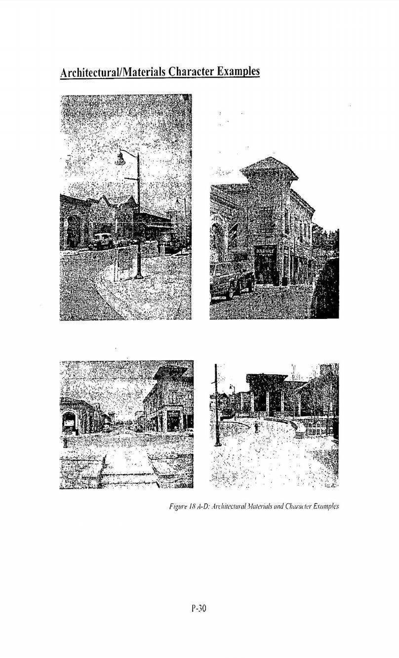
97 30
SUBDIVISION REGULATIONS
 CHAPTER 14 SUBDIVISION REGULATIONS 14-100 Provisions 14-200 Preliminary Plat 14-300 Final Plat 14-400 Replat 14-500 Minor Subdivision 14-600 Administrative Replat 14-700 Vacation of Roadways, Public Easements,
Draft Zoning Changes for the 2nd Planning Board Public Hearing, January 22, 2018.
 Draft Zoning Changes for the 2nd Planning Board Public Hearing, January 22, 2018. No changes were made at the 1st Public Hearing. Proposed wording for the 1 st Public Hearing in red, eliminated text in
REPLACEMENT EXHIBIT 2 SECOND AMENDMENT TO THE COMPREHENSIVE DEVELOPMENT PLAN
 REPLACEMENT EXHIBIT 2 SECOND AMENDMENT TO THE COMPREHENSIVE DEVELOPMENT PLAN User s Guide for the Douglas County Town of Parker Intergovernmental Agreement (IGA) Please be advised that approved amendments
ARTICLE 23 CONDOMINIUM STANDARDS
 ARTICLE 23 CONDOMINIUM STANDARDS Section 23.01 Intent. The intent of this Article is to provide regulatory standards for condominiums and site condominiums similar to those required for projects developed
SUBDIVISION DESIGN PRINCIPLES AND STANDARDS
 SECTION 15-200 SUBDIVISION DESIGN PRINCIPLES AND STANDARDS 15-201 STREET DESIGN PRINCIPLES 15-201.01 Streets shall generally conform to the collector and major street plan adopted by the Planning Commission
Guide to Preliminary Plans
 Guide to Preliminary Plans Introduction The Douglas County is committed to providing open, transparent application processes to the public. This Guide is provided to assist anyone interested in the procedures
Guide to Combined Preliminary and Final Plats
 Guide to Combined Preliminary and Final Plats Introduction The Douglas County is committed to providing open, transparent application processes to the public. This Guide is provided to assist anyone interested
Pima Country, Arizona Code of Ordinances : Residential recreation areas.
 Pima Country, Code of Ordinances 18.69.090: Residential recreation areas. A. Purpose. 1. The purpose of this section is to ensure that recreation areas are available for the use and enjoyment of subdivision
GWINNETT COUNTY CSO CONSERVATION SUBDIVISION OVERLAY DISTRICT REQUIREMENTS
 GWINNETT COUNTY CSO CONSERVATION SUBDIVISION OVERLAY DISTRICT REQUIREMENTS Section 1316. CSO Conservation Subdivision Overlay District. 1. Purposes. The purposes of this overlay district are as follows:
Exhibit "A" have applied for a re-zoning and re-classification of that property from OPEN RURAL (OR) to that of a PLANNED UNIT DEVELOPMENT (PUD); and
 to that of a PLANNED UNIT DEVELOPMENT (PUD); and") I NSTR # 200632845 OR BK 61439 PGS 0728-0750 RECORDED 06/24/2066 12:25:50 PR JOHN Q. CRAWFOKD CLERK OF CIRCUIT COURT NASSAU COUNTY, FLORIDA RECORDING FEES 1.37.80 ORDINANCE NO. 2006-65 AN ORDINANCE AMENDING
I NSTR # 200632845 OR BK 61439 PGS 0728-0750 RECORDED 06/24/2066 12:25:50 PR JOHN Q. CRAWFOKD CLERK OF CIRCUIT COURT NASSAU COUNTY, FLORIDA RECORDING FEES 1.37.80 ORDINANCE NO. 2006-65 AN ORDINANCE AMENDING
Guide to Minor Developments
 Guide to Minor Developments Introduction The Douglas County (DCD) is committed to providing open, transparent application processes to the public. This Guide is provided to assist anyone interested in
Article 7: Residential Land Use and Development Requirements
 Article 7: Residential Land Use and Section 701: Statement of Intent (A) (B) (C) The intent of Article 7 is to develop certain land use and development requirements for the residential uses within Cumru
SECTION 900 PARKS AND SCHOOLS
 SECTION 900 PARKS AND SCHOOLS Page 901.00 GENERAL POLICY 901.01 Reservations of Land for Public Use...................... 900-1 902.00 PARKS AND RECREATION 902.01 Parks in General.......................................
Canyons South. Annexation Impact Report. September 1, 2015
 Canyons South Annexation Impact Report September 1, 2015 1 Introduction This Annexation Impact Report has been prepared to meet the statutory requirements set forth in Colorado Revised Statutes 31 12 108.5
TOTTENHAM SECONDARY PLAN
 TOTTENHAM SECONDARY PLAN AMENDMENT NO. 11 TO THE OFFICIAL PLAN OF THE TOWN OF NEW TECUMSETH The following text and schedules to the Official Plan of the Town of New Tecumseth constitute Amendment No. 11
Letter of Intent May 2017 (Revised November 2017)
") THE BEACH AT WOODMOOR LETTER OF INTENT MAY 2017 (REVISED NOVEMBER 2017) OWNER/APPLICANT: CONSULTANT: Lake Woodmoor Holdings LLC N.E.S. Inc. 1755 Telstar Drive, Suite 211 619 North Cascade Avenue Colorado
THE BEACH AT WOODMOOR LETTER OF INTENT MAY 2017 (REVISED NOVEMBER 2017) OWNER/APPLICANT: CONSULTANT: Lake Woodmoor Holdings LLC N.E.S. Inc. 1755 Telstar Drive, Suite 211 619 North Cascade Avenue Colorado
CITY OF SARATOGA SPRINGS ZONING ORDINANCE
 Appendix C: 8. The Village At Saratoga Planned Unit Development (formerly 241.8) Chapter 241.8 AN ORDINANCE PROVIDING FOR THE ESTABLISHMENT OF A PLANNED UNIT DEVELOPMENT DISTRICT TO BE KNOWN AS "THE VILLAGE
WRITTEN DECISION OF THE HAYDEN CITY COUNCIL REGARDING MAPLE GROVE PRELIMINARY SUBDIVISION APPLICATION (SUB-0013) HAYDEN SIGNATURE, LLC
 HAYDEN SIGNATURE, LLC") WRITTEN DECISION OF THE HAYDEN CITY COUNCIL REGARDING MAPLE GROVE PRELIMINARY SUBDIVISION APPLICATION (SUB-0013) HAYDEN SIGNATURE, LLC Application of Hayden Signature, LLC, an Idaho limited liability company,
WRITTEN DECISION OF THE HAYDEN CITY COUNCIL REGARDING MAPLE GROVE PRELIMINARY SUBDIVISION APPLICATION (SUB-0013) HAYDEN SIGNATURE, LLC Application of Hayden Signature, LLC, an Idaho limited liability company,
ARTICLE 15 - PLANNED UNIT DEVELOPMENT
 Section 15.1 - Intent. ARTICLE 15 - PLANNED UNIT DEVELOPMENT A PUD, or Planned Unit Development, is not a District per se, but rather a set of standards that may be applied to a development type. The Planned
Guide to Replats. Step 1. Step 2. Step 3. Step 4. Step 5. Step 6. Step 7. Step 8. Step 9. Step 10
 Guide to Replats Introduction Douglas County is committed to providing open, transparent application processes to the public. This Guide is provided to assist anyone interested in the procedures and expectations
PINE CANYON PD ZONING REGULATIONS
 Review Notes: Green highlight = blanks to be completed before recording. 1. DEFINITIONS For purposes of the PD Plan and these Zoning Regulations: (1) capitalized terms used but not defined in the PD Plan
ARTICLE 5 GENERAL REQUIREMENTS
 5.1 SUITABILITY OF THE LAND ARTICLE 5 GENERAL REQUIREMENTS 5.1.1 Land subject to flooding, improper drainage or erosion, and land deemed to be unsuitable for development due to steep slope, unsuitable
PINE RIDGE COMMONS PUD AMEND ORDINANCE NUMBER 99-94
 PINE RIDGE COMMONS PUD AMEND ORDINANCE NUMBER 99-94 Title page of the Planned Unit Development Document, previously attached as Exhibit A to the PUD document of Ordinance Number 99-94, the Pine Ridge commons
PROFFER FORM. Date of Proffer Signatures: ZMA # Berkmar Business Park Tax Map and Parcel Number(s): , E and a portion of G
: , E and a portion of G") PROFFER FORM Original Proffer X Amendment Date of Proffer Signatures: 5.68Acres to be rezoned from C-1 and R-6 to NMD Pursuant to Section 33.3 of the Albemarle County Zoning Ordinance, the Owner hereby
PROFFER FORM Original Proffer X Amendment Date of Proffer Signatures: 5.68Acres to be rezoned from C-1 and R-6 to NMD Pursuant to Section 33.3 of the Albemarle County Zoning Ordinance, the Owner hereby
RESOLUTION NO. RESOLUTION APPROVING ZONING PETITION 84-71, Special Exception. WHEREAS, the Board of County Commissioners, as the governing
 /. ;C- C, i RESOLUTION NO. R-@+-l2?8 RESOLUTION APPROVING ZONING PETITION 84-71, Special Exception WHEREAS, the Board of County Commissioners, as the governing body, pursuant to the authority vested in
610 LAND DIVISIONS AND PROPERTY LINE ADJUSTMENTS OUTSIDE A UGB
 ARTICLE VI: LAND DIVISIONS AND PROPERTY LINE ADJUSTMENTS VI-21 610 LAND DIVISIONS AND PROPERTY LINE ADJUSTMENTS OUTSIDE A UGB 610-1 Property Line Adjustments (Property Line Relocation) A property line
Approved 58 Unit Residential Condo Development for Sale. For Sale: Price Upon Request
 Approved 58 Unit Residential Condo Development for Sale 185 Thorpe Street Fairfield, 06824 For Sale: Price Upon Request u u u u Approved 58 Unit Residential Condo Development For Sale on 6.7 Acres in Fairfield
RE: 6. GILL/GREEN COMPREHENSIVE PLAN AMENDMENT, REZONING AND PRELIMINARY PLAT
 commission memo DATE: Thursday - August 9, 2018 TO: Marion Planning & Zoning Commission FROM: David N. Hockett, AICP Principal Planner RE: 6. GILL/GREEN COMPREHENSIVE PLAN AMENDMENT, REZONING AND PRELIMINARY
DRAFT FOR PUBLIC HEARING (rev. March, 2016)
") Chapter 200. ZONING Article VI. Conservation/Cluster Subdivisions 200-45. Intent and Purpose These provisions are intended to: A. Guide the future growth and development of the community consistent with
Chapter 200. ZONING Article VI. Conservation/Cluster Subdivisions 200-45. Intent and Purpose These provisions are intended to: A. Guide the future growth and development of the community consistent with
2 November 9, 2011 Public Hearing APPLICANT: ASHVILLE PARK, L.L.C.
 2 November 9, 2011 Public Hearing APPLICANT: ASHVILLE PARK, L.L.C. PROPERTY OWNER: ATC REALTY SIXTEEN, INC. STAFF PLANNER: Faith Christie REQUEST: Modification of Conditional Change of Zoning approved
CHAPTER34 PRUD - PLANNED RESIDENTIAL UNIT DEVELOPMENT
 CHAPTER34 PRUD - PLANNED RESIDENTIAL UNIT DEVELOPMENT 17-34-1 17-34-2 17-34-3 17-34-4 17-34-5 17-34-6 17-34-7 17-34-8 17-34-9 Purpose Planned Residential Unit Development Defined Planned Residential Unit
City of Edwardsville, Kansas Special Benefit District Policy
 City of Edwardsville, Kansas Special Benefit District Policy Date Adopted: September 12, 2011 Section 1. Objective The objective is to establish a policy to finance public streets, sanitary sewers, water
SITE PLAN REVIEW PROCEDURES SECTION DEVELOPMENTS REQUIRING SITE PLAN APPROVAL
 SECTION 22.01 PURPOSE ARTICLE XXII PROCEDURES The purpose of this Article is to establish uniform requirements of procedure for all developments in the Township. Certain specific types of minor development
SECTION 23 PLANNED RESIDENTIAL DEVELOPMENT FOR ELDERLY PERSONS
 SECTION 23 PLANNED RESIDENTIAL DEVELOPMENT FOR ELDERLY PERSONS 23.1 General: In order to provide for the special needs of elderly and handicapped persons who may require multifamily type living accommodations,
Chapter 100 Planned Unit Development in Corvallis Urban Fringe
 100.100 Scope and Purpose. Chapter 100 Planned Unit Development in Corvallis Urban Fringe (1) All applications for land divisions in the Urban Residential (UR) and Flood Plain Agriculture (FPA) zones within
EXHIBIT D. Planned Unit Development Written Description April 13, 2016 Rouen Cove Phase II PUD
 1 EXHIBIT D Planned Unit Development Written Description April 13, 2016 Rouen Cove Phase II PUD Development # 8986.001 Developer: Curtis L. Hart Hart Resources LLC 8051 Tara Lane Jacksonville, Florida
b) Tangerine Corridor Overlay District 1) Tangerine Corridor District Regulations
 Tangerine Corridor Overlay District 1) Tangerine Corridor District Regulations") Attachment 1 Tangerine Road Corridor Overlay District Section 27.10.D.3.f.vi.b Initiation of Code Amendment September 2, 2014, Planning and Zoning Commission b) Tangerine Corridor Overlay District 1) Tangerine
Attachment 1 Tangerine Road Corridor Overlay District Section 27.10.D.3.f.vi.b Initiation of Code Amendment September 2, 2014, Planning and Zoning Commission b) Tangerine Corridor Overlay District 1) Tangerine
CONDOMINIUM REGULATIONS
 ARTICLE 37 CONDOMINIUM REGULATIONS SECTION 37.01. Purpose The purpose of this Article is to regulate projects that divide real property under a contractual arrangement known as a condominium. New and conversion
The following regulations shall apply in the R-E District:
 "R-E" RESIDENTIAL ESTATE DISTRICT (8/06) The following regulations shall apply in the R-E District: 1. Uses Permitted: The following uses are permitted. A Zoning Certificate may be required as provided
EXHIBIT A LEGAL DESCRIPTION
 EXHIBIT A LEGAL DESCRIPTION DESCRIPTION LOTS 59 AND 60, BLOCK 24, THE PALM BEACH FARMS CO. PLAT NO. 3, ACCORDING TO THE MAP OR PLAT THEREOF, AS RECORDED IN PLAT BOOK 2, PAGE(S) 45 THROUGH 54, INCLUSIVE,
Chapter Plat Design (LMC)
") Chapter 18.14 Plat Design (LMC) Sections: 18.14.010 Lot width 18.14.020 Right-of-way requirements 18.14.030 Pipe stem lots 18.14.040 Division resulting in minimum lot sizes 18.14.050 Flood prone and bad
Chapter 18.14 Plat Design (LMC) Sections: 18.14.010 Lot width 18.14.020 Right-of-way requirements 18.14.030 Pipe stem lots 18.14.040 Division resulting in minimum lot sizes 18.14.050 Flood prone and bad
Town of Bristol Rhode Island
 Town of Bristol Rhode Island Subdivision & Development Review Regulations Adopted by the Planning Board September 27, 1995 (March 2017) Formatted: Highlight Formatted: Font: 12 pt Table of Contents TABLE
-MENDOCINO COUNTY PLANNING AND BUILDING SERVICES- DIVISION OF LAND REGULATIONS TITLE 17
 ARTICLE VI -- GENERAL REGULATIONS AND PROVISIONS Sec. 17-50. Sec. 17-51 General Plan. Sec. 17-52 Lot and Block Design and Configuration. Sec. 17-53 Lot Access. Sec. 17-54 Private Roads. Sec. 17-55 Water
ASPEN GLEN PUD. Eighth Amended PUD Guidelines
 ASPEN GLEN PUD Eighth Amended PUD Guidelines A. Applicability Statement To carry out the purposes and provisions of the Garfield County Zoning Regulations, as amended, The Aspen Glen Club Planned Unit
Condominium Unit Requirements.
 ARTICLE 19 CONDOMINIUM REGULATIONS Section 19.01 Purpose. The purpose of this Article is to regulate projects that divide real property under a contractual arrangement known as a condominium. New and conversion
PLANNED DEVELOPMENT DISTRICT STANDARDS. Cadence Site
 PLANNED DEVELOPMENT DISTRICT STANDARDS Cadence Site A Planned Development District 1. Statement of General Facts, Conditions and Objectives Property Size: Approximately 57.51 Acres York County Tax Map
a. provide for the continuation of collector streets and thoroughfare streets between adjacent subdivisions;
 Section 7.07. Intent The requirements of this Section are intended to provide for the orderly growth of the Town of Holly Springs and its extra-territorial jurisdiction by establishing guidelines for:
ARTICLE 14 PLANNED UNIT DEVELOPMENT (PUD) DISTRICT
 DISTRICT") ARTICLE 14 PLANNED UNIT DEVELOPMENT (PUD) DISTRICT Section 14.01 Intent. It is the intent of this Article to allow the use of the planned unit development (PUD) process, as authorized by the Michigan Zoning
ARTICLE 14 PLANNED UNIT DEVELOPMENT (PUD) DISTRICT Section 14.01 Intent. It is the intent of this Article to allow the use of the planned unit development (PUD) process, as authorized by the Michigan Zoning
PLANNED UNIT DEVELOPMENTS (Ordinance No.: 3036, 12/3/07; Repealed & Replaced by Ordinance No.: 4166, 10/15/12)
") 159.62 PLANNED UNIT DEVELOPMENTS (Ordinance No.: 3036, 12/3/07; Repealed & Replaced by Ordinance No.: 4166, 10/15/12) A. PURPOSE 1. General. The Planned Unit Development (PUD) approach provides the flexibility
159.62 PLANNED UNIT DEVELOPMENTS (Ordinance No.: 3036, 12/3/07; Repealed & Replaced by Ordinance No.: 4166, 10/15/12) A. PURPOSE 1. General. The Planned Unit Development (PUD) approach provides the flexibility
PALM BEACH COUNTY ENGINEERING DEPARTMENT. ZONING COMMISSION SUBDIVISION VARIANCE STAFF REPORT October 1, 2015
 PALM BEACH COUNTY ENGINEERING DEPARTMENT ZONING COMMISSION SUBDIVISION VARIANCE STAFF REPORT October 1, 2015 APPLICATION NO. CODE REQUIRED PROPOSED VARIANCE SECTION SD-147 11.E.9.B.2 When lots are platted
City and County of Broomfield, Colorado
 City and County of Broomfield, Colorado CITY COUNCIL AGENDA MEMORANDUM To: From: Mayor and City Council George Di Ciero, City and County Manager Teri Malies, Principal Planner Terrance Ware, Planning Director
WIREGRASS RANCH DRI/MPUD MASTER ROADWAY PLAN CONDITIONS OF APPROVAL PDD DRC
 WIREGRASS RANCH DRI/MPUD MASTER ROADWAY PLAN CONDITIONS OF APPROVAL DRC 1. This Master Roadway Plan (the MRP) replaces and supersedes the Roadway Alignment and Construction Phasing Plan (File No. GM06-737)
DOUGLAS COUNTY SUBDIVISION RESOLUTION Article 4 Preliminary Plan 10/13/2015
 ARTICLE 4 PRELIMINARY PLAN 401 Intent An in-depth analysis of the proposed subdivision, including a review of the design considering the ability to obtain water and sanitation, identified geologic hazards,
THE COUNTY BOARD OF SUPERVISORS OF THE COUNTY OF DOUGLAS DOES ORDAIN AS FOLLOWS:
 8.1 SUBDIVISION CONTROL ORDINANCE THE COUNTY BOARD OF SUPERVISORS OF THE COUNTY OF DOUGLAS DOES ORDAIN AS FOLLOWS: SECTION I. GENERAL INTERPRETATION This ordinance shall not repeal, impair or modify private
ARTICLE FIVE FINAL DRAFT
 ARTICLE FIVE 021218 FINAL DRAFT Sec. 503.6 Open Space Preservation Option Open Space Preservation Option Open Space Preservation developments may be approved in the AR, R-1, R-2 and R-3 zoning districts,
ARTICLE IV: DEVELOPMENT STANDARDS
 ARTICLE IV: DEVELOPMENT STANDARDS IV-53 409 PRIVATE STREETS A private street means any way that provides ingress to, or egress from, property by means of vehicles or other means, or that provides travel
Community Development
 Land Use Petition RZ-16-002 Date of Staff Recommendation Preparation: April 15, 2016 (CEL) Date of Planning Commission Recommendation: May 3, 2016 PROJECT LOCATION: DISTRICT/SECTION/LANDLOT(S): ACREAGE
CHAPTER IV IMPLEMENTATION
 CHAPTER IV IMPLEMENTATION Chapter Outline IV. Implementation Page A. Public Works Projects/Public Infrastructure IV-1 1. Facilities Master Plan Overview IV-1 2. Facilities Master Plan Service Standards
AN ORDINANCE AMENDING THE CITY ZONING ORDINANCE AND THE OFFICIAL CODE OF THE CITY OF CLARKSVILLE RELATIVE TO CLUSTER OPTION DEVELOPMENTS
 ORDINANCE 74-2012-13 AN ORDINANCE AMENDING THE CITY ZONING ORDINANCE AND THE OFFICIAL CODE OF THE CITY OF CLARKSVILLE RELATIVE TO CLUSTER OPTION DEVELOPMENTS BE IT ORDAINED BY THE CITY COUNCIL OF THE CITY
ARTICLE 24 PRIVATE ROAD, SHARED PRIVATE DRIVEWAY AND ACCESS EASEMENT STANDARDS
 ARTICLE 24 PRIVATE ROAD, SHARED PRIVATE DRIVEWAY AND ACCESS EASEMENT STANDARDS SECTION 24.00 INTENT AND PURPOSE The standards of this Article provide for the design, construction and maintenance of private
ORDINANCE NO AN ORDINANCE AMENDING THE CODE OF ORDINANCES OF THE CITY OF PORT ARANSAS, TEXAS, BY ADOPTING A NEW CHAPTER
 ORDINANCE NO. 2008-09 AN ORDINANCE AMENDING THE CODE OF ORDINANCES OF THE CITY OF PORT ARANSAS, TEXAS, BY ADOPTING A NEW CHAPTER TWENTY-SIX CONCERNING IMPACT FEES FOR ROADWAY FACILITIES; INCORPORATING
EXCERPTS FROM HALIFAX REGIONAL MUNICIPALITY CHARTER
 EXCERPTS FROM HALIFAX REGIONAL MUNICIPALITY CHARTER Municipal planning strategy 227 The Council may adopt a municipal planning strategy for all, or part, of the Municipality and there may be separate strategies
STAFF REPORT FOR MAJOR SUBDIVISION
 STAFF REPORT FOR MAJOR SUBDIVISION FINAL PLAT CASE NO. FA-12-002 HEARING DATE: September 5, 2012 CASE NAME: Solterra Subdivision Filing No. 12 PROCEDURE: Planning Commission ADDRESS OF MAJOR SUBDIVISION
ARTICLE 143. PD 143.
 ARTICLE 143. PD 143. SEC. 51P-143.101. LEGISLATIVE HISTORY. PD 143 was established by Ordinance No. 17685, passed by the Dallas City Council on February 2, 1983. Ordinance No. 17685 amended Ordinance No.
Article XII. R-1 Agricultural-Low Density Residential District
 Article XII R-1 Agricultural-Low Density Residential District Section 1200. Declaration of Legislative Intent In expansion of the Declaration of Legislative Intent and Statement of Community Development
AAAA. Planning and Zoning Staff Report Zoning Text Amendment, ZOA-PH Request
 AAAA Hearing Date: September 3, 2015 Planning and Zoning Staff Report Zoning Text Amendment, ZOA-PH2015-23 Development Services Department Applicant: Request Staff: Christian Samples, 455-5958 csamples@canyonco.org
SECTION 10.7 R-PUD (RESIDENTIAL PLANNED UNIT DEVELOPMENT) ZONE
 ZONE") Article X Zones 10-20 SECTION 10.7 R-PUD (RESIDENTIAL PLANNED UNIT DEVELOPMENT) ZONE A. PURPOSE AND INTENT: The R-PUD Residential PUD Zone is intended to provide alternative, voluntary zoning procedures
Article X Zones 10-20 SECTION 10.7 R-PUD (RESIDENTIAL PLANNED UNIT DEVELOPMENT) ZONE A. PURPOSE AND INTENT: The R-PUD Residential PUD Zone is intended to provide alternative, voluntary zoning procedures
SECTION 7000 LAND DEVELOPMENT REQUIREMENTS
 SECTION 7000 LAND DEVELOPMENT REQUIREMENTS 7000 LAND DEVELOPMENT REQUIREMENTS... 1 7001 LEGISLATIVE AUTHORITY... 1 7001.1 LAND DEVELOPMENT... 1 7001.1.1 Title 40, Idaho Code... 1 7001.1.2 Idaho Code 40-1415
TOOELE COUNTY LAND USE ORDINANCE CHAPTER 31 Page 1
 CHAPTER 31 PLANNED COMMUNITY ZONE (P-C) Section 31-1 Definitions. 31-2 Purpose. 31-3 Land use districts. 31-4 P-C zone area minimum requirements. 31-5 Permitted uses. 31-6 Conditional uses. 31-7 Planning
FINAL DRAFT 12/1/16, Rev. to 7/18/17
 FINAL DRAFT 12/1/16, Rev. to 7/18/17 (As Adopted 8/8/17 Effective 9/1/17) SHELTON PLANNING AND ZONING COMMISSION Proposed Amendments to Zoning Regulations I. Amend Section 23 PERMITTED USES by inserting
PLANNING COMMISSION REPORT Regular Agenda -Public Hearing Item
 PDP-13-00518 Item No. 3B- 1 PLANNING COMMISSION REPORT Regular Agenda -Public Hearing Item PC Staff Report 2/24/14 ITEM NO. 3B PRELIMINARY DEVELOPMENT PLAN FOR HERE @ KANSAS; 1101 INDIANA ST (SLD) PDP-13-00518:
CONDITIONAL USE PERMIT APPLICATION FOR AN EXCAVATION/BORROW PIT INSTRUCTIONS
 City of Chesapeake Department of Planning Post Office Box 15225 Chesapeake, Virginia 23328-5225 (757) 382-6176 FAX (757) 382-6406 CONDITIONAL USE PERMIT APPLICATION FOR AN EXCAVATION/BORROW PIT INSTRUCTIONS
AMENDED ZONING BY-LAW ARTICLE SENIOR LIVING COMMUNITY
 AMENDED ZONING BY-LAW ARTICLE 13.5 - SENIOR LIVING COMMUNITY ARTICLE : To see if the Town will vote to amend the Zoning Bylaw as follows: 2. By deleting existing Section 13.5, Senior Living Community,
Public Facilities and Finance Element
 This Element of the General Plan addresses the following public facilities issues: Water Service, including both potable (drinkable) and non-potable water delivery. Sewer Service, and Financing and construction
Subchapter 16 Subdivisions.
 Subchapter 16 Subdivisions. Sections: 35.16.1 Authority. 35.16.2 Purpose. 35.16.3 Jurisdiction. 35.16.4 Application. 35.16.5 Compliance and Enforcement. 35.16.6 Approval of Plat Required. 35.16.7 Lots,
9. REZONING NO Vicinity of the northwest corner of 143 rd Street and Metcalf Avenue
 9. REZONING NO. 2002-15 Vicinity of the northwest corner of 143 rd Street and Metcalf Avenue 1. APPLICANT: Andrew Schlagel is the applicant for this request. 2. REQUESTED ACTION: The applicant is requesting
ML-4 MULTIFAMILY RESIDENTIAL ZONE. [Added by Ord. No ]
![ML-4 MULTIFAMILY RESIDENTIAL ZONE. [Added by Ord. No ]](/thumbs/90/103301433.jpg "ML-4 MULTIFAMILY RESIDENTIAL ZONE. [Added by Ord. No ]") 55-26. ML-4 MULTIFAMILY RESIDENTIAL ZONE. [Added 2-2-98 by Ord. No. 1998-1 2] The following regulations apply in the ML-4 Zone. A. Permitted Uses. (1) Garden apartments, together with accessory structures
55-26. ML-4 MULTIFAMILY RESIDENTIAL ZONE. [Added 2-2-98 by Ord. No. 1998-1 2] The following regulations apply in the ML-4 Zone. A. Permitted Uses. (1) Garden apartments, together with accessory structures
STATE OF MICHIGAN COUNTY OF MARQUETTE, TOWNSHIP OF NEGAUNEE LAND DIVISION, SUBDIVISION AND CONDOMINIUM ORDINANCE
 STATE OF MICHIGAN COUNTY OF MARQUETTE, TOWNSHIP OF NEGAUNEE LAND DIVISION, SUBDIVISION AND CONDOMINIUM ORDINANCE Adopted: August 8 th, 2008 Effective: August 28 th, 2008 Sec.100. Title ARTICLE I GENERAL
UPPER MOUNT BETHEL TOWNSHIP NORTHAMPTON COUNTY, PENNSYLVANIA
 UPPER MOUNT BETHEL TOWNSHIP NORTHAMPTON COUNTY, PENNSYLVANIA JOINDER DEED / LOT CONSOLIDATION TOWNSHIP REVIEW PROCESS When accepting proposed Joinder Deeds / Lot Consolidations, review the Joinder Deed
Washington County, Minnesota Ordinances
 Washington County, Minnesota Ordinances Ordinance No. 153 Text Amendment to the Washington County Development Code - Chapter One, Section 2 and Chapter Two, Part 1, Part 2, Part 3, of the Development Code
Planned Unit Development (PUD). Sections:
. Sections:") Chapter 19.07. Planned Unit Development (PUD). Sections: 19.07.01. Purpose. 19.07.02. PUD Definition and Design Compatibility. 19.07.03. General PUD Standards. 19.07.04. Underlying Zones. 19.07.05. Permitted
Chapter 19.07. Planned Unit Development (PUD). Sections: 19.07.01. Purpose. 19.07.02. PUD Definition and Design Compatibility. 19.07.03. General PUD Standards. 19.07.04. Underlying Zones. 19.07.05. Permitted
CHAPTER 3 PRELIMINARY PLAT
 10-3-1 10-3-3 SECTION: CHAPTER 3 PRELIMINARY PLAT 10-3-1: Consultation 10-3-2: Filing 10-3-3: Requirements 10-3-4: Approval 10-3-5: Time Limitation 10-3-6: Grading Limitation 10-3-1: CONSULTATION: Each
CITY OF EAU CLAIRE, WISCONSIN. SPECIAL ASSESSMENT POLICY (Dated: November 8, 2016)
") CITY OF EAU CLAIRE, WISCONSIN SPECIAL ASSESSMENT POLICY (Dated: November 8, 2016) (Adopted by reference by Ordinance No. 7207 adopted November 8, 2016) PURPOSE The purpose of this Policy is to assure fair
CITY OF EAU CLAIRE, WISCONSIN SPECIAL ASSESSMENT POLICY (Dated: November 8, 2016) (Adopted by reference by Ordinance No. 7207 adopted November 8, 2016) PURPOSE The purpose of this Policy is to assure fair
Cluster Development Princeton Township, Mercer County
 Cluster Development Princeton Township, Mercer County Division 9 Residential Clusters Section 10B-189 Statement of purposes. The township committee to implement the goals and objectives of the Princeton
ARTICLE IX. DEVELOPMENT FEES
 ARTICLE IX. DEVELOPMENT FEES ARTICLE IX. DEVELOPMENT FEES DIVISION 1: GENERAL PROVISIONS Sec. 21-9100. Purpose Sec. 21-9110. Methods of Satisfaction Sec. 21-9120. Development Fee Accounts Sec. 21-9130.
BY BOARD OF COUNTY COMMISSIONERS AN ACT TO BE ENTITLED
 BY BOARD OF COUNTY COMMISSIONERS ORDINANCE NO. AN ACT TO BE ENTITLED AN ORDINANCE AMENDING THE PASCO COUNTY LAND DEVELOPMENT CODE, ARTICLE 700, BY REPEALING EXISTING SECTION 702, ENVIRONMENTALLY SENSITIVE
CITY PLANNING COMMISSION COMPREHENSIVE PLAN AND REVIEW CRITERIA
 Page 3 CITY PLANNING COMMISSION COMPREHENSIVE PLAN AND REVIEW CRITERIA COMPREHENSIVE PLAN: The City Planning Commission uses the Comprehensive Plan as a guide in all land use matters. The Plan is available
A. Preserve natural resources as identified in the Comprehensive Plan.
 1370.08 Conservation Residential Overlay District. Subd. 1 Findings. The City finds that the lands and resources within the Conservation Residential Overlay District are a unique and valuable resource
Draft Model Access Management Overlay Ordinance
 Draft Model Access Management Overlay Ordinance This model was developed using the City of Hutchinson and the Trunk Highway 7 corridor. The basic provisions of this model may be adopted by any jurisdiction
Project File #: SF Project Name: Jackson Ranch Filing No. 4 Parcel Nos.: , and
 COMMISSIONERS: DARRYL GLENN (PRESIDENT) MARK WALLER (PRESIDENT PRO TEMPORE) STAN VANDERWERF LONGINOS GONZALEZ PEGGY LITTLETON PLANNING AND COMMUNITY DEVELOPMENT DEPARTMENT CRAIG DOSSEY, EXECUTIVE DIRECTOR
MAJOR BOUNDARY LINE ADJUSTMENT PROCESS GUIDE
 MAJOR BOUNDARY LINE ADJUSTMENT PROCESS GUIDE Clear Creek County Planning Department P.O. Box 2000 Georgetown, Colorado 80444 (303) 679-2436 - phone (303) 569-1103 - fax PURPOSE To establish criteria and
WASCO COUNTY PRELIMINARY SUBDIVISION APPLICATION
 WASCO COUNTY PRELIMINARY SUBDIVISION APPLICATION DETAILED SPECIFIC WRITTEN REQUEST File Number: SDV- Number of Proposed Lots & their Dimensions: PRELIMINARY SUBDIVISION PLAN REQUIREMENTS The approval of
CITY OF FERNDALE HEARING EXAMINER
 CITY OF FERNDALE HEARING EXAMINER RE: Planned Unit Development ) 16001-PUD Preliminary Plat ) 16018-SE Plat Variance ) 16002-VAR Application by ) ) MD General, L.L.C. ) FINDINGS OF FACT, Malloy Heights
PIN , Part 1, Plan SR-713 in Lot 2, Concession 5, Township of McKim (1096 Dublin Street, Sudbury)
") STAFF REPORT Applicant: Dalron Construction Limited Location: PIN 02124-0103, Part 1, Plan SR-713 in Lot 2, Concession 5, Township of McKim (1096 Dublin Street, Sudbury) Official Plan and Zoning By-law:
STAFF REPORT Applicant: Dalron Construction Limited Location: PIN 02124-0103, Part 1, Plan SR-713 in Lot 2, Concession 5, Township of McKim (1096 Dublin Street, Sudbury) Official Plan and Zoning By-law:
ARTICLE III GENERAL PROCEDURES, MINOR PLANS AND FEE SCHEDULES
 ARTICLE III GENERAL PROCEDURES, MINOR PLANS AND FEE SCHEDULES 301. Prior to Submission a. Copies of this Ordinance shall be available on request, at cost, for the use of any person who desires information
FINAL SPUD APPLICATION
 The Planning & Development Services Department is here to assist you with your development application pursuant to the Community Development Code (CDC). This publication outlines the Final SPUD Development
ARTICLE 13 CONDOMINIUM REGULATIONS
 ARTICLE 13 CONDOMINIUM REGULATIONS Section 13.01 Purpose. The purpose of this Article is to regulate projects that divide real property under a contractual arrangement known as a condominium. New and conversion
11 November 13, 2013 Public Hearing
 11 November 13, 2013 Public Hearing APPLICANT:. D/B/A RYAN HOMES PROPERTY OWNER: MUNDEN LAND, LLC STAFF PLANNER: Carolyn A.K. Smith REQUEST: Modification of Conditional Change of Zoning approved by the
ARTICLE V AGRICULTURAL PRESERVATION AND RURAL RESIDENTIAL DISTRICT
 ARTICLE V AP AGRICULTURAL PRESERVATION AND RURAL RESIDENTIAL DISTRICT Section 500. PURPOSE It is the purpose of the AP, Agricultural Preservation and Rural Residential District, to foster the preservation
I. Requirements for All Applications. C D W
 108-16.1. Application checklists. Checklist for Required Submissions to the Planning Board or Zoning Board of Adjustment of Monroe Township All required submissions are to be made to the Administrative