A Landowner s Guide to. BWSR Conservation Easements
|
|
|
- Olivia Gallagher
- 5 years ago
- Views:
Transcription


1 A Landowner s Guide to BWSR Conservation Easements
2 2 1/4/2014


3 A Landowner s Guide to BWSR Conservation Easements This guide summarizes responsibilities that landowners have in the care of conservation easements and provides guidance for conducting effective site inspections and making informed decisions about long-term management needs of easement lands. An electronic version of this guide with links to resources is available at: vegetation/landowner_guide_to_conservation_easements.pdf Table of Contents What is a Conservation Easement? The Importance of Conservation Easements The Landowners Essential Role Common Easement Questions What Can and Can t I Do on My Easement? How is the Boundary for My Easement Defined? Can the Public Access my Easement? Who Should I Contact with Questions? How Do I Care for My Easement? A Landowner s Responsibilities The Role of Others Site Inspections Spotting and Resolving Problems Strategies to Manage and Care for My Easements Other Strategies to Improve Wildlife Habitat 3


4 What is a Conservation Easement? Conservation easements involve the acquisition of certain property rights for conservation purposes. Landowners who offer the state a conservation easement receive a payment or marketable wetland mitigation credits to permanently restore or preserve the land. In turn, the landowners establish conservation practices where necessary, such as native grass and forbs, trees, or wetland restorations. The easement is recorded on the land title with the county recorder and transfers with the land when the parcel is sold. The Landowner s Essential Role While BWSR secures a number of different types of easements through various easement programs, the expectations of landowners are generally the same. Know and maintain the easement boundary Understand and comply with easement terms and conditions or limited use conditions Maintain and manage the easement property Maintain the essential components of the Conservation or Wetland Banking Restoration Plan that was implemented on the easement. The Importance of Conservation Easements t en n do wn er m la 4 A Conservation easements play an important role in our landscapes by providing important ecological functions, recreational uses, and a natural heritage to be passed on to future generations. Easements secured by the Minnesota Board of Water and Soil Resources (BWSR) protect the state s water and soil resources by permanently restoring and protecting wetlands, adjacent native grassland, wildlife habitat complexes, riparian buffers, and other important resource areas on economically marginal, flood-prone, environmentally sensitive, or highly erodible lands. e as e on h n is conservatio


5 Common Easement Questions 1) What Can and Can t I Do on My Easement? General Outdoor recreational uses are allowed, including hunting, fishing, trapping, and bird watching. Conservation grazing, haying, and biofuel harvest may be allowed as part of an approved site management plan. Please work with Soil and Water Conservation Districts (SWCD) staff in seeking approval and planning for such easement activities. Cropping Limited recreational vehicle use on easement acres is allowed as long as it does not damage native vegetation or cause erosion. Native or perennial vegetative cover must be maintained on conservation easements, so cropping, permanent structures, roads, etc. are prohibited. Hunting Blinds and Deer Stands on Easements Temporary ground blinds are acceptable as long as they are not in place long enough to damage vegetative growth. H a yi n g Hunting blinds and deer stands that are elevated, or attached to a tree, and have no impact on the vegetation are allowed. Supporting posts may be dug into the ground, but no concrete, rock or concrete pads are allowed. They must be maintained in an upright position so as not to impact the vegetation. Trails Any trail that is developed or maintained through mowing or brush control is not authorized. Acceptable trials include unmaintained single-track, wildlife, or unmaintained walking trails. 2) How is the Boundary for My Easement Defined? Grazing The easement boundary was defined at the time of acquisition and is depicted on the recorded easement. The easement boundary should be clearly staked or monumented. Contact the SWCD for assistance in establishing boundary markers or posts, or if you have any boundary questions. 3) Can the Public Access my Easement? No, unless allowed by the Landowner. Landowners can choose to apply to enroll their land in Walk-In Access (WIA), a program to provide new hunting opportunities on private land. Deer Stand 4) Who Should I Contact With Questions? The SWCD should be contacted about easement questions or when management issues arise. The following website provides contact information for local Soil and Water Conservation Districts (SWCD): 5
6 6 How Do I Care for My Easement? Four main components to easement care: Comply with easement conditions Respect and maintain easement boundaries Inspect and maintain all major components of any associated restoration plan Actively participate in managing the easement to maintain and enhance ecological functions A Landowner s Responsibilities Landowners are the front lines in the care of conservation easements. They are responsible for ensuring that vegetation and any conservation practices that are established as part of the project continue to function at a high level and meet program goals. A key to ensuring proper operation of the site involves periodic site inspections to identify problems, and working to find appropriate solutions. The management of easement land is important for maintaining quality habitat and several things can be done to enhance site habitat and function over time. The Role of Others BWSR has a responsibility to enforce and insure the long-term quality of its easements. BWSR often relies on Soil and Water Conservation Districts (SWCD) or other partners to conduct periodic site inspections. Easement concerns identified by these resource professionals will be shared with the landowner in order to resolve any concerns. Site Inspections As part of a conservation stewardship program, conservation professionals will also inspect the easement site. However, these inspections do not occur every year, making landowner self-inspections critical in identifying and treating potential problems. Problems commonly associated with conservation easements include: presence of noxious weeds erosion excess seepage of water obstructed outlets and water control structure woody vegetation on constructed areas easement encroachment. Landscapes are constantly changing due to weather, climate, and both human and natural disturbances. As a result, landowners should regularly inspect their easement to check for problems before they become serious. You may have to look at your land differently than before. Although easements differ, having one implies a commitment to specific goals. Understanding how those are measured, and what can set you back, will make your role as steward easier and more enjoyable. It is helpful to have a well defined process for conducting site inspections to ensure that they are thorough, safe, and targeted to collect the right information. The following are recommended steps for conducting a site inspection, and initiating the process of making informed decisions about necessary project maintenance. 1) Revisit the Conservation/Restoration Plan The Conservation/ Restoration Plan was developed to guide the construction, planting, and long term preservation of the project. These plans define project goals, plant communities to be restored, restoration methods, and planned maintenance needs and schedules. 2) Determine Inspection Timing and Frequency Landowners should periodically inspect their easement during the first three years after initial establishment (usually when noxious weeds will be blooming in June), and at least annually thereafter (adjusting timing based on past experience). If a wetland was restored on the easement site, inspect wetland structures each spring and after major precipitation events. 3) Plan the Site Inspection Included in this document is an inspection checklist (pg.7). Review the checklist before conducting an inspection to see what types of items should be investigated. 4) Conduct the Inspection The inspection should be conducted when the weather is favorable as ensuring safety is the first priority. Equipment and materials that may be useful during the inspection include: cell phone, sun protection, boots, ATV, water, mosquito/tick repellent, and outdoor clothing. Bring a copy of the conservation plan map, a camera, and the provided site inspection form. 5) Determine What Solutions are Needed After the site inspection, review the results to determine if any maintenance is required. The next section of the guide provides guidance about maintenance problem solving.


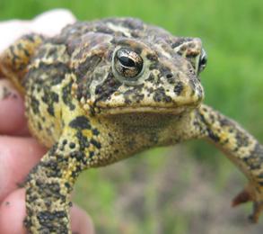
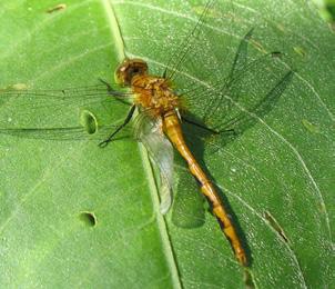
7 Site Inspection Checklist Property: Date: Inspectors: Site Vegetation Presence of any problem weeds Canada Thistle Purple Loosestrife Common Tansy Wild Parsnip Spotted Knapweed Leafy Spurge More information at: Minnesota_Invasive_Plant_Species_Resources.pdf Other: Woody plants establishing and growing rapidly in areas where prairie/grassland was planned. Sparse Cover of Vegetation Problems with Constructed Areas Notes Erosion from flowing water, wave action, or burrowing rodents Excess seeping underneath berms or along outlet structures Obstructed culverts or water control structures Woody vegetation growth on constructed areas Problems with Boundary Integrity Encroachment issues (crop overspray, haying, annual crops etc.) Signs/ posts missing or damaged Beneficial Features Frogs Song birds Water fowl Flower diversity Pollinators Dragonflies 7


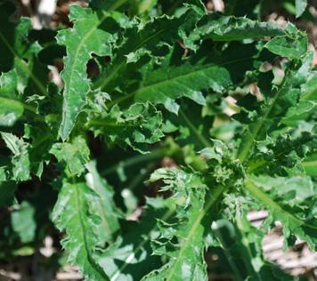
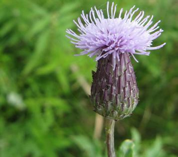
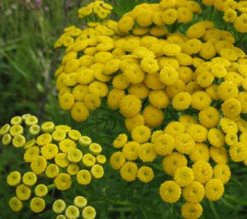
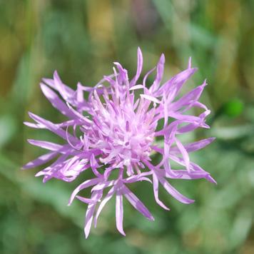
8 Spotting and Resolving Problems The following information summarizes specific problems that are commonly encountered within conservation easement lands and provides suggested actions for correcting them. Further assessment and guidance by SWCD or other conservation professionals may be needed for some situations. Site Vegetation Healthy stands of native vegetation are important to provide wildlife habitat, filter stormwater, and other landscape benefits. It is important to ensure that vegetation is sufficiently established, maintains diversity levels, and is outcompeting invasive species. Problem: Sparse cover of vegetation Action: Consult with SWCD staff to assess the planting and to determine if additional seeding is needed. They will aid in choosing potential seed mixes and sources as well as interseeding methods. In some cases seed can be hand collected from areas where vegetation is established as planned. Problem: Presence of weeds on the Minnesota Noxious Weeds List for an updated list of noxious weeds) out-competing desirable native plantings (see: Action: Control species that are listed on the Noxious Weeds List. Work with the SWCD staff to find options for control, such as mowing or burning. See also potential management strategies on page 10. Problem: Woody plants establishing in areas where prairie or grassland was planned. Action: Conduct removal of woody trees through methods such as cutting, girdling, prescribed fire, and herbicide application. See potential management strategies on page 10. Other Site Features Various water control structures and other constructed features may be included in your easement plan. Landowners should understand what these features do and threats to their functionality. Monitoring for damages caused by rodents, woody vegetation and/or storms is key. Structures can be clogged by cattails, branches or beaver activity, and removal of such obstructions can be dangerous. Consult the SWCD with any questions about these features and proper procedures for maintaining them. Problem: Damage to any embankment (water holding berm) from rilling, wave action, or burrowing rodents. Action: Promptly replace eroded material and seed, and/or sod as necessary. Contact the the SWCD if rodent damage continues over time or if activity appears to be threatening embankment stabilitiy. Spotted knapweed MN invasive Woody establishment in prairie 8 Loosestrife patch
. Action: If any seepage along the outlet structure is visible, contact the SWCD immediately. itc hp D Problem: Seepage along the outlet structure.")

.")

9 Problem: Embankment seepage at abutments and foundations on the downstream side of any embankments may warrant immediate action (a small amount of seepage is to be expected and is probably acceptable). Action: If any seepage along the outlet structure is visible, contact the SWCD immediately. itc hp D Problem: Seepage along the outlet structure. on Action: If seepage is excessive or if water is visibly moving through the embankment, contact the SWCD immediately. lug i n go o d ti di n co Problem: Shrub, tree, or woody vegetation growth on or at base of embankments. Action: Annually remove all trees and shrubs from embankment top and side slopes. lwa y/ ou tle co Spil Action: Remove obstructions. Check outlets each spring and after major storms, at least 2 times each summer. If any damage exists, contact the SWCD immediately. nd itio n Problem: Obstructed or damaged outlets, including deterioration of the outlet structure (corrosion, rusting, cracks, holes). t stru cture in g oo d Boundary Integrity The boundary of your conservation easement should be clearly marked and respected. Understanding your easement boundary will aid in maintaining site integrity and complying with the easement terms and conditions. Problem: Boundary posts missing or damaged. nt km e am ag an td en Problem: Encroachment from adjacent activities (crop overspray, haying, annual crop planting). Ro d Action: Contact the SWCD. Signs are recommended on all corners and every 500 feet in areas where the boundary may be unclear. Be sure signs are at least 4 feet high and mounted on durable posts. b e to earthen em Action: Re-establish perennial native vegetation in disturbed areas, add additional boundary marking if needed. Native habitat meets crop field border 9


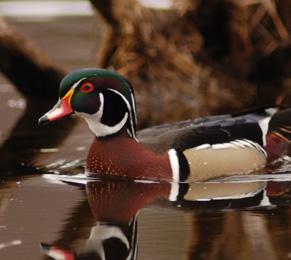
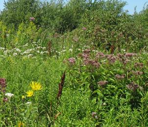
10 Strategies to Manage and Care for an Easement Active management helps ensure that the land continues to provide high quality habitat and meets project goals. Management activities that will be best suited for an easement will depend on location and site conditions. Local resource staff (such as the DNR, Fish & Wildlife Services or the SWCD) are familiar with the area can provide guidance about what management activities will be most beneficial and may be able to assist with more complex activities such as prescribed burning. Check with the SWCD for potential funding opportunities for easement management. The following is a summary of common management activities and their potential benefits. Prescribed Burning: Fire historically played a role in maintaining the health and diversity of prairies. Conducting prescribed burns every three to four years in prairies can help control woody plant establishment, promote diversity and plant health, and help control weedy grasses. Spring burns are often conducted to set back non-native cool-season grasses while fall burns can set back woody plants and promote wildflowers. Firebreaks, burn plans and appropriate local approval are all important components of prescribed burning. Weed Management: In addition to prescribed burning, other methods may be needed to control problem weeds such as Canada thistle, purple loosestrife, leafy spurge, spotted knapweed, common tansy, buckthorn, and other species that may displace native plants. Timely mowing may help stop seed production and set-back weeds though it should be conducted outside of the bird nesting season (April 15- Aug. 1st.) Be sure to only mow the weed patch, avoiding surrounding native vegetation. Haying and conservation grazing are also management strategies that can be used with program approval. Spot herbicide treatment is a common method of controlling problematic invasive species. Malla rd Nest Woody Tree Control: Tree establishment on constructed areas can cause problems for the proper functioning of wetland structures. Trees and shrubs in prairies can degrade habitat for ground nesting birds such as ducks, pheasants, and many songbirds. As a result, tree removal through prescribed burning, cutting, and herbicide treatment may be beneficial. Water Level Management: Some conservation easement projects have water control structures that allow for the management of water levels. With the oversight of qualified conservation professionals, wetlands can be managed to control weedy species and rough fish, and to provide improved habitat for migratory waterfowl. More information about management can be found at: 10 Prescribed Burning


11 Seasonal Management Timeline Spring Summer Fall Winter Service nest structures Conduct prescribed burns Monitor early season weeds and problems with water control structures Spot herbicide treatment of perennial weeds or unwanted herbaceous vegetation before natives green up Replant annual food plots if needed Replant perennial vegetation as needed Limit human use & activity during the Spring & Summer bird nesting season (April 15- Aug. 1st) Mow undesirable species after August 1st unless invasive species are concentrated Mow firebreaks for Fall prescribed burning Release insects for biological control Implement conservation grazing plans Mid-summer drought may bring dry conditions and draw down of water levels, providing better access and more maintaince opportunties Monitor late season weeds and problems with water control structures In coordination with agencies and local staff, manage water levels to control invasive animals and vegetation and promote habitat for migratory birds Spot treat herbicide to reed canary grass and reoccurring broadleaf plants such as thistle Treat stumps of larger unwanted woody vegetation with herbicide. Conduct fall prescribed burns Mow firebreaks for spring prescribed burn In coordination with agencies and local staff, mow non-native cattails to the ice level for springtime control Wigeon 11

 Habitat Plantings: Planting additional wildflowers not only adds color to the easement landscape but creates habitat for pollinators and small mammals.")
.")


 Basking Log: If your easement includes a wetland, don t readily remove snags or other dead brush, as they create habitat for amphibians and beneficial")

.")
 Wood Duck House: If your easement includes or is near a wetland, these stunning birds will readily move into a constructed nest.")
 Ducklings can jump from heights of up to 24 feet safely. A cone guard to protect against squirrels and raccoons helps secure the nest.")
 Upland Planting Buffer: Improvements to the upland buffer can be made by planting native grasses and wildflowers.")
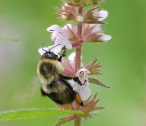
12 Other Strategies to Improve Wildlife Habitat Easement care also may involve making habitat improvements. Certain activities will enhance wildlife use or provide other benefits. The following are some simple things a landowner can do to improve habitat on their conservation easement. 1) Habitat Plantings: Planting additional wildflowers not only adds color to the easement landscape but creates habitat for pollinators and small mammals. Seed mixes ideal for pollinators and habitat diversity should have at least fifteen species, a high percentage of forbs (30-60% by seed count), and at least three flowering species in each bloom period (Spring, Summer and Fall). 2) Mallard Nesting: If your easement includes an open water wetland, constructed nests are a great way to boost mallard populations within your wetland and help keep eggs safe from predators. Nests are elevated 3 long tubes made from welded wire mesh with straw, hay, or grass sandwiched between an inner and outer mesh layer. Placement of the nest depends on site conditions, but generally one should place nests near the edge of a marsh or in pockets of water ranging from 1 1/2 to 3 deep, with adequate vegetative cover nearby. 3) Basking Log: If your easement includes a wetland, don t readily remove snags or other dead brush, as they create habitat for amphibians and beneficial insects such as carpenter bees. Many birds will supplement their diet with insects found in dead or dying logs. A log placed partially submerged into the north side of a wetland pool creates a prime place for turtles to bask in the sun. 4) Song Bird House: Many bird species will utilize constructed bird houses, including the Tree Swallow, Eastern Bluebird, Common Flicker, and American Kestrel. Sizing of the house depends on the desired species, but the most important factor is the entry hole size (see diagram). Up to four houses per acre are recommended. See Wood Working for Wildlife for more detailed house plans. 1 1/2 5) Wood Duck House: If your easement includes or is near a wetland, these stunning birds will readily move into a constructed nest. Place nests 3-20 feet high and away from objects predators could use to access the nest (branches, fence posts etc.) Ducklings can jump from heights of up to 24 feet safely. A cone guard to protect against squirrels and raccoons helps secure the nest. Reference Wood Working for Wildlife for more specific design notes. 6) Upland Planting Buffer: Improvements to the upland buffer can be made by planting native grasses and wildflowers. Such improvements provide habitat for birds and mammals that frequent wetlands and helps protect the wetland from nutrient loading and erosion. Pheasants, ducks, prairie chickens, mice, voles, and many more benefit from such plantings. Be sure to wait until after nesting season (April 15-August 1) for any mowing and invasive species control. 2 1/2 3 American Kestrel off ground 8 Common flicker 6-30 off ground Eastern Bluebird 5-10 off ground 5 4 Tree Swallow 5-15 off ground ) Bat House: Bats are a great addition to any easement, as they eat many pests such as rootworms, stink bugs, leafhoppers, mosquitoes, and cutworms. Houses should be a dark color (using water based paints) with rough inside walls to mimic tree bark. Place the house off the ground in a sunny location. Reference Wood Working for Wildlife for more specific design notes.

13 Native Wildflowers 4 Song Bird House 2 Mallard Nesting 5 Wood Duck House 3 Basking Log 6 Native Grass and Prairie Habitat 7 Bat House 13

14 ADDITIONAL REFERENCES Minnesota Wetland Restoration Guide NRCS 643 practice Standard Minnesota Noxious Weeds Woodworking for Wildlife ID=68733&stocknum=275 BWSR Inter-Seeding Guidelines 14
RECITALS. B. WHEREAS, Ranch, its successors and assigns, are referred to in the Easement as the Grantor ; and
 Basic Components of Management Plans Associated with Conservation Easement Acquisitions Where A Land Trust Or other third party Is the Grantee April 17, 2012 Key: Text in normal font, without highlight,
Conservation Partners Legacy Grant Application
 CPL Applications (Total to date: 129) Spreadsheet Conservation Partners Legacy Grant Application CPL1000084 Name and Contact Project Identifier: CPL1000084 Project Name: CREP Easement Invasive Species
Environment and Natural Resources Trust Fund Request for Proposals (RFP)
") Environment and Natural Resources Trust Fund 2012-2013 Request for Proposals (RFP) Project Title: Southeast Minnesota Sensitive Habitat Protection Program (SHPP) ENRTF ID: 067-D Topic Area: D. Land Acquisition
Environment and Natural Resources Trust Fund 2012-2013 Request for Proposals (RFP) Project Title: Southeast Minnesota Sensitive Habitat Protection Program (SHPP) ENRTF ID: 067-D Topic Area: D. Land Acquisition
WRP COMPATIBLE USE PERMITS
 WRP COMPATIBLE USE PERMITS By statute, WRP easements are acquired to protect, restore, and enhance the functions of wetland ecosystems for migratory birds and wetland dependent wildlife Reservations in
ILLINOIS DEPARTMENT OF NATURAL RESOURCES. Policy and Procedure Manual
 ILLINOIS DEPARTMENT OF NATURAL RESOURCES Policy and Procedure Manual Chapter 5 Chapter 5 Subchapter E Resources Land Agricultural/Wildlife & Habitat Land Lease Management POLICY: Many Department owned
RIM Reserve Easements 101
 RIM Reserve Easements 101 2015 BWSR Academy BWSR Academy 2011 History RIM Reserve was established in 1986 Concept was initially proposed in 1984 by the Citizen Commission to Promote Hunting and Fishing
Agricultural Lease Bid Process and Policy Updated September 21, 2017
 Agricultural Lease Bid Process and Policy Updated September 21, 2017 Introduction: Pitkin County Open Space & Trails (OST) was established by the voters of Pitkin County in 1990 with the following mission;
Easement Grant of Easement for Habitat Protection
 Date: Grantor(s): XXXXXXXXXX Grantee: Tri-Basin Natural Resources District, (hereinafter referred to as Tri-Basin NRD)1308 2 nd St., Holdrege NE 68949 Protected Property: See Exhibit A attached for legal
Clarksville, TN APPENDIX C STORM WATER AND BMP MAINTENANCE AGREEMENTS AND INSPECTIONS FORMS
 Clarksville, TN APPENDIX C STORM WATER AND BMP MAINTENANCE AGREEMENTS AND INSPECTIONS FORMS STORM WATER MAINTENANCE AGREEMENT Grading Permit No.: Tax Map and Parcel No.: Project Name: THIS AGREEMENT, made
RIM 201. BWSR Academy 2013
 RIM 201 BWSR Academy 2013 presented by. The Easement Witches History Citizen Commission to Promote Hunting and Fishing in MN, (established by Gov. Perpich) proposes the concept of RIM in 1984 Reinvest
Implementation of Permanent Easements and Associated Nutrient Load Reductions
 1 Minnesota Nutrient Reduction Strategy Agricultural Sector/BWSR RIM Program Measure Implementation of Permanent and Associated Nutrient Load Reductions Measure Background Visual Depiction The map in Figure
Antelope Ridge Wind Farm Habitat Mitigation Plan November 2011
 Antelope Ridge Wind Farm Habitat Mitigation Plan November 2011 I. Introduction The Antelope Ridge Wind Farm will be constructed in two phases, in the locations as shown on the attached map, Exhibit A.
PROJECT SCORING GUIDANCE. Introduction: National Proiect Selection:
 FOREST LEGACY PROGRAM PROJECT SCORING GUIDANCE Introduction: This document provides guidance to the National Review Panel on how to score individual Forest Legacy Program (FLP) projects, including additional
Introduction. Management Strategies for Central Maritime Chaparral. Reasons for Protection
 Management Strategies for Central Maritime Chaparral by Tami Nakahara Introduction The central maritime chaparral community (CMC) in the Elkhorn Slough Watershed, North Monterey County, California is classified
Terry E. Poole Principal Agent Emeritus University of Maryland Extension
 Terry E. Poole Principal Agent Emeritus University of Maryland Extension What is a lease? Simply put, it s a contract by which one party (the landowner/landlord) gives another party (the tenant) the use
LLC & MLLC Property Bismark Meadows Bonner County, Idaho
 Vital Ground Property Management Plan LLC & MLLC Property Bismark Meadows Bonner County, Idaho December 10, 2009 (updated 2/12/13) Ryan Lutey The Vital Ground Foundation Building T-2, Fort Missoula Road
Administrative Penalty Order (APO) Plan for Buffer Law Implementation
 Plan for Buffer Law Implementation") Administrative Penalty Order (APO) Plan for Buffer Law Implementation June 28, 2017 This document was adopted by the Board of Water and Soil Resources (BWSR) pursuant to Minn. Stat. 103B.101, subd. 12(a)
Administrative Penalty Order (APO) Plan for Buffer Law Implementation June 28, 2017 This document was adopted by the Board of Water and Soil Resources (BWSR) pursuant to Minn. Stat. 103B.101, subd. 12(a)
Post Construction and Operations & Maintenance Guidance
 CHAPTER 6 Post Construction and Operations & Maintenance Guidance 6.0 Introduction As with any building system, stormwater management practices (SMPs) require maintenance to ensure longterm function. Post-construction,
Annotated Baseline Documentation Report (BDR) Template for Natural Heritage Lands Owned by a Land Trust
 Template for Natural Heritage Lands Owned by a Land Trust") Annotated Baseline Documentation Report (BDR) Template for Natural Heritage Lands Owned by a Land Trust This Annotated Baseline Documentation Report (BDR) Template was prepared by the request of the Ontario
Annotated Baseline Documentation Report (BDR) Template for Natural Heritage Lands Owned by a Land Trust This Annotated Baseline Documentation Report (BDR) Template was prepared by the request of the Ontario
Lessard Sams Outdoor Heritage Council
 Lessard Sams Outdoor Heritage Council MEMO: Agenda Item # 10 DATE: December 11, 2014 SUBJECT: PRESENTER: 2015 Legislative Appropriation Recommendation Bill Heather Koop, LSOHC staff Background: On October
IRS FORM 8283 SUPPLEMENTAL STATEMENT DONATION OF CONSERVATION EASEMENT
 Name(s) shown on income tax return Identifying Number Robert T. Landowner 021-34-1234 Susan B. Landowner 083-23-5555 IRS FORM 8283 SUPPLEMENTAL STATEMENT DONATION OF CONSERVATION EASEMENT On November 12,
Conservation Easement Stewardship
 Conservation Easements are effective tools to preserve significant natural, historical or cultural resources. Conservation Easement Stewardship Level of Service Standards March 2013 The mission of the
SUBCHAPTER 59F CONSERVATION RESERVE ENHANCEMENY ENHANCEMENT PROGRAM (CREP) STATE PORTION OF THE PROGRAM
 STATE PORTION OF THE PROGRAM") SUBCHAPTER 59F CONSERVATION RESERVE ENHANCEMENY ENHANCEMENT PROGRAM (CREP) STATE PORTION OF THE PROGRAM SECTION.0100 - CONSERVATION RESERVE ENHANCEMENT PROGRAM (CREP) -- STATE PORTION OF THE PROGRAM 02
SUBCHAPTER 59F CONSERVATION RESERVE ENHANCEMENY ENHANCEMENT PROGRAM (CREP) STATE PORTION OF THE PROGRAM SECTION.0100 - CONSERVATION RESERVE ENHANCEMENT PROGRAM (CREP) -- STATE PORTION OF THE PROGRAM 02
Conservation Plans, Vouchers, & PIRFs
 Conservation Plans, Vouchers, & PIRFs Outline Conservation Plan Preparation Voucher Preparation PIRFs vs. Revision Requests Violations & Veg Guidelines Outline Conservation Plan Preparation Benefits of
LAKE OF THE WOODS COUNTY WETLAND CONSERVATION ORDINANCE OF 2002
 Ordinance # LAKE OF THE WOODS COUNTY WETLAND CONSERVATION ORDINANCE OF 2002 ARTICLE 1 TITLE AND PURPOSE Section 1.1. Title This Ordinance shall be known, cited and referred to as the Lake of the Woods
MODEL DEED RESTRICTION FOR THE PENNSYLVANIA STATE PROGRAMMATIC GENERAL PERMIT-3 (PASPGP-3) DECLARATION OF RESTRICTIVE COVENANTS FOR CONSERVATION
 DECLARATION OF RESTRICTIVE COVENANTS FOR CONSERVATION") MODEL DEED RESTRICTION FOR THE PENNSYLVANIA STATE PROGRAMMATIC GENERAL PERMIT-3 (PASPGP-3) DECLARATION OF RESTRICTIVE COVENANTS FOR CONSERVATION THIS DECLARATION OF RESTRICTIVE COVENANTS FOR CONSERVATION
MODEL DEED RESTRICTION FOR THE PENNSYLVANIA STATE PROGRAMMATIC GENERAL PERMIT-3 (PASPGP-3) DECLARATION OF RESTRICTIVE COVENANTS FOR CONSERVATION THIS DECLARATION OF RESTRICTIVE COVENANTS FOR CONSERVATION
5. That the Owner shall agree that all development Blocks shown within the Draft Plan will be connected to full municipal services.
 Conditions Relating to Draft Plan of Subdivision Approval East Fonthill 26T 01014 (Draft Plan dated December 1, 2013, and revised August 28, 2014), the Town of Pelham 1. This approval applies to the Draft
Buffer and Soil Loss Statutes, as amended in 2017 by Laws of Minnesota 2017, Chapter 93 (S.F. 844)
") Buffer and Soil Loss Statutes, as amended in 2017 by Laws of Minnesota 2017, Chapter 93 (S.F. 844) May 30, 2017 103B.101 BOARD OF WATER AND SOIL RESOURCES Subd. 12. Authority to issue penalty orders. (a)
Buffer and Soil Loss Statutes, as amended in 2017 by Laws of Minnesota 2017, Chapter 93 (S.F. 844) May 30, 2017 103B.101 BOARD OF WATER AND SOIL RESOURCES Subd. 12. Authority to issue penalty orders. (a)
THE COUCHICHING CONSERVANCY LAND STEWARDSHIP POLICY. As approved by the Board, April 30, 2007
 THE COUCHICHING CONSERVANCY LAND STEWARDSHIP POLICY As approved by the Board, April 30, 2007 When one tugs at a single thing in nature, he finds it attached to the rest of the world. John Muir This policy
Chestnut Street and Eliot Street
 BASELINE DOCUMENTATION REPORT and LAND MANAGEMENT PLAN Massachusetts Executive Office of Energy and Environmental Affairs Local Acquisitions for Natural Diversity (LAND) Grant Program Property name: Warren
Using Easements to Conserve Biodiversity. Jeff Lerner Defenders of Wildlife
 Using Easements to Conserve Biodiversity Jeff Lerner Defenders of Wildlife jlerner@defenders.org Northeast LTA June 10, 2006 Defenders of Wildlife Mission: to protect native wild animals and plants in
Georgia Conservation Tax Credit Program Frequently Asked Questions
 Georgia Conservation Tax Credit Program Frequently Asked Questions What are the minimum requirements for eligibility under the Georgia Conservation Tax Credit Program (GCTCP)? Individual and corporate
113,923,000. Article 1 Sec moves to amend H.F. No as follows: 1.2 Delete everything after the enacting clause and insert:
 1.1... moves to amend H.F. No. 4167 as follows: 1.2 Delete everything after the enacting clause and insert: 1.3 "ARTICLE 1 1.4 OUTDOOR HERITAGE FUND 1.5 Section 1. OUTDOOR HERITAGE APPROPRIATION. 1.6 The
Minnesota Water Quality and Habitat Conservation Reserve Enhancement Program (MN CREP) Overview February 14, 2017
 Overview February 14, 2017") Minnesota Water Quality and Habitat Conservation Reserve Enhancement Program (MN CREP) Overview February 14, 2017 1 MN Conservation Reserve Enhancement Program (MN CREP) General Overview Practices, Outcomes,
Minnesota Water Quality and Habitat Conservation Reserve Enhancement Program (MN CREP) Overview February 14, 2017 1 MN Conservation Reserve Enhancement Program (MN CREP) General Overview Practices, Outcomes,
Oxbow Park and Preserve Management Plan
 Oxbow Park and Preserve Management Plan INTRODUCTION This Plan establishes a framework for the sound stewardship of Oxbow Park and Preserve. Policies, management objectives and envisioned future improvements
Introduction to INRMP Implementation Options
 El Dorado County Integrated Natural Resources Management Plan Introduction to INRMP Implementation Options 1 Our approach to the options evaluation is based on the INRMP components as they are currently
Putting the Farm Bill to Work for Wildlife
 Putting the Farm Bill to Work for Wildlife Aimee Weldon, Defenders of Wildlife Nate Fuller, Southwest Michigan Land Conservancy Chris Pupke, Chesapeake Wildlife Heritage The Farm Bill it s not just about
METROPOLITAN COUNCIL 390 North Robert Street, St. Paul, MN Phone (651) TDD (651)
 TDD (651)") METROPOLITAN COUNCIL 390 North Robert Street, St. Paul, MN 55101 Phone (651) 602-1000 TDD (651) 291-0904 DATE: December 26, 2012 TO: Metropolitan Parks and Open Space Commission FROM: Jan Youngquist, AICP;
METROPOLITAN COUNCIL 390 North Robert Street, St. Paul, MN 55101 Phone (651) 602-1000 TDD (651) 291-0904 DATE: December 26, 2012 TO: Metropolitan Parks and Open Space Commission FROM: Jan Youngquist, AICP;
Sample Baseline Documentation Report (BDR) Annotated Template for Environmentally Important Land
 Annotated Template for Environmentally Important Land") Sample Baseline Documentation Report (BDR) Annotated Template for Environmentally Important Land The baseline documentation report (BDR) provides a snap shot of the biophysical condition of a property
Sample Baseline Documentation Report (BDR) Annotated Template for Environmentally Important Land The baseline documentation report (BDR) provides a snap shot of the biophysical condition of a property
Saskatchewan Farmland Ownership
 Saskatchewan Farmland Ownership Joint presentation to the Ministry of Agriculture by: Ducks Unlimited Canada Nature Conservancy of Canada Saskatchewan Wildlife Federation June 11, 2015 DUC Saskatchewan
CHARTER TOWNSHIP OF OSHTEMO KALAMAZOO COUNTY, MICHIGAN NOTICE OF ORDINANCE ADOPTION
 CHARTER TOWNSHIP OF OSHTEMO KALAMAZOO COUNTY, MICHIGAN NOTICE OF ORDINANCE ADOPTION TO: THE RESIDENTS AND PROPERTY OWNERS OF THE CHARTER TOWNSHIP OF OSHTEMO, KALAMAZOO COUNTY, MICHIGAN, AND ANY OTHER INTERESTED
MANAGEMENT PLAN FOR THE TOWN-OWNED LAND ("PROTECTED PROPERTY ), Norwich, Vermont (Updated April 2008) I. INTRODUCTION
, Norwich, Vermont (Updated April 2008) I. INTRODUCTION") MANAGEMENT PLAN FOR THE TOWN-OWNED LAND ("PROTECTED PROPERTY ), Norwich, Vermont (Updated April 2008) I. INTRODUCTION This document is the Management Plan for the "Protected Property" defined herein, as
MANAGEMENT PLAN FOR THE TOWN-OWNED LAND ("PROTECTED PROPERTY ), Norwich, Vermont (Updated April 2008) I. INTRODUCTION This document is the Management Plan for the "Protected Property" defined herein, as
Central Pennsylvania Conservancy Project Selection Criteria Form
 Central Pennsylvania Conservancy Project Selection Criteria Form The following criteria guide the actions of the Central Pennsylvania Conservancy s Land Protection Committee and Board of Directors in selecting
CHAPTER 6 CHESAPEAKE BAY PRESERVATION AREAS AND STREAM PROTECTION AREAS
 CHAPTER 6 CHESAPEAKE BAY PRESERVATION AREAS AND STREAM PROTECTION AREAS 6.1 INTRODUCTION Virginia s Chesapeake Bay Preservation Area (CBPA) Designation and Management Regulations (9VAC10-20 et seq.) require
Wildlife Habitat Conservation and Management Program
 EXHIBIT 1 PC-2015-4106 ODFW Guide Wildlife Habitat Conservation and Management Program Manual for Counties and Cities Oregon Department of Fish and Wildlife March 2006 Table of Contents 1. Introduction
Oxbow Park and Preserve Management Plan Draft: December 2013
 Draft: December 2013 INTRODUCTION This Plan establishes a framework for the sound stewardship of Oxbow Park and Preserve. Policies, management objectives and envisioned future improvements outlined within
Changes to the SFIA Program:
 Changes to the SFIA Program: What it means for landowners and service providers SFEC U of MN Extension Webinar January 16, 2018 John Carlson MN DNR Forestry Private Forest Management/SFIA Program Coordinator
AVAILABLE FUNDING OPPORTUNITIES
 APPENDIX F AVAILABLE FUNDING OPPORTUNITIES FOR GrSG HABITAT CONSERVATION F-1 F-2 Table F-1. Specific funding opportunities identified for GrSG habitat conservation. Colorado Species Partnership (CSCP)
MODEL DEED RESTRICTION
 MODEL DEED RESTRICTION This type of Protective Covenant is the most commonly used. It is a legal agreement between the grantor, typically the property owner or applicant, and the Corps. Please view instructions
APRIL 30, ILL. ADM. CODE 2580 CH. I, SEC. 2580
 TITLE 17: CONSERVATION CHAPTER I: DEPARTMENT OF NATURAL RESOURCES SUBCHAPTER f: ADMINISTRATIVE SERVICES PART 2580 CONSERVATION STEWARDSHIP PROGRAM Section 2580.10 Definitions 2580.20 Eligibility 2580.30
Conservation Stewardship Collaborative. Inventorying, Monitoring, and Managing Natural Resources on Conservation Lands
 Conservation Stewardship Collaborative Inventorying, Monitoring, and Managing Natural Resources on Conservation Lands December 2009 Scott Ruhren, Ph.D. Senior Director of Conservation Audubon Society of
Conservation Partners Legacy Grants - Online Applications
 Conservation Partners Legacy Grants - Online Applications Jamie Gangaware Admin List Applications Summary Spreadsheet Log Out Project Summary Project Info Site Info Budget Info Review & Approval Additional
Resource Protection Area Map Update - Frequently Asked Questions
 DEPARTMENT OF ENVIRONMENTAL SERVICES Office of Sustainability and Environmental Management 2100 Clarendon Boulevard, Suite 705, Arlington, VA 22201 TEL 703-228-4488 FAX 703-228-7134 TTY 703-228-4611 www.arlingtonva.us
Biodiversity Planning Policy and Guidelines for (LEP) Rezoning Proposals
 Rezoning Proposals") Council Policy Biodiversity Planning Policy and Guidelines for (LEP) Rezoning Proposals Table of Contents Table of Contents... 1 Policy... 2 Policy Objectives... 2 Policy Statement... 2 Guidelines... 2
Council Policy Biodiversity Planning Policy and Guidelines for (LEP) Rezoning Proposals Table of Contents Table of Contents... 1 Policy... 2 Policy Objectives... 2 Policy Statement... 2 Guidelines... 2
ALREADY SUBMITTED FOR HIGHLANDS COUNCIL PRE
 Highlands Preservation Area Approval Application Checklist Items Block 15901 Lot 1, West Milford See Highlands Council Review at: http://www.highlands.state.nj.us/njhighlands/projectreview/ **For advisory
Part 9: Paying for It. by James L. Cummins
 So You Now Have the Old Home Place Part 9: Paying for It by James L. Cummins Cropland can be leased and/or used to establish dove fields. This is the ninth and final segment in a series titled So You Now
Community Development Committee
 Community Development Committee For the Metropolitan Council meeting of February 13, 2013 Committee Report Business Item 2013-29 ADVISORY INFORMATION Date Prepared: January 25, 2013 Subject: Rice Creek
Chesapeake Bay Preservation Area (CBPA) Map Update. Presentation to the County Board July 15, 2017
 Map Update. Presentation to the County Board July 15, 2017") Chesapeake Bay Preservation Area (CBPA) Map Update Presentation to the County Board July 15, 2017 Chesapeake Bay Program Comprehensive Plan Chesapeake Bay Preservation Ordinance (1992) (Chapter 61, Arlington
Chesapeake Bay Preservation Area (CBPA) Map Update Presentation to the County Board July 15, 2017 Chesapeake Bay Program Comprehensive Plan Chesapeake Bay Preservation Ordinance (1992) (Chapter 61, Arlington
Monitoring. 1. Select the monitoring team for each project site and coordinate schedules by telephone or electronic mail.
 LTA S&P Reference: 11 C Procedure No. 11.1.B Monitoring PROCEDURE: This procedure provides details about conservation easement monitoring as required in Policy 11.1 Conservation Easement Stewardship. Purpose
Submittal of the Minutes from the March 9, 2011, April 5, 2011, and April 19, 2011 Cabinet Meetings.
 AGENDA BOARD OF TRUSTEES OF THE INTERNAL IMPROVEMENT TRUST FUND JUNE 16, 2011 Attachments to the items below can be viewed at the following link: http://www.dep.state.fl.us/secretary/cab/public_notices.htm
MARK TWAIN LAKE MASTER PLAN CLARENCE CANNON DAM AND MARK TWAIN LAKE MONROE CITY, MISSOURI
 MARK TWAIN LAKE MASTER PLAN CLARENCE CANNON DAM AND MARK TWAIN LAKE MONROE CITY, MISSOURI CHAPTER 4 LAND ALLOCATION, LAND CLASSIFICATION, WATER SURFACE, AND EASEMENT LANDS This Master Plan is a land use
SALE OF PUBLIC LAND IN ALBERTA RECOMMENDATIONS FOR IMPROVING REGULATION, POLICY AND PROCEDURES
 SALE OF PUBLIC LAND IN ALBERTA RECOMMENDATIONS FOR IMPROVING REGULATION, POLICY AND PROCEDURES 1. Introduction The recent application to government for sale of 25 sections of public land that would see
Corte Madera Marsh Restoration Project Update
 Corte Madera Marsh Restoration Project Update Building and Operating Committee Agenda Item No. 5 August 25, 2016 Photo credit: WRA Background of Site 1. 72 acre parcel carved out of larger property acquired
APPLICATION. Telephone Fax Address. Telephone Fax Address FOR MARTIN COUNTY USE ONLY
 APPLICATION PRESERVE AREA MANAGEMENT PLAN/ ABBREVIATED PRESERVE AREA MANAGEMENT PLAN Growth Management Department Environmental Division PART 1: Applicant Information A. Land Owner(s) Name Title and Company
Validation Checklist. Date submitted: How to use this check-list. Ecosystem Credit Accounting System. Version 1.1&2. Project Information
 Ecosystem Credit Accounting System Version 1.1&2 Last updated April 21, 2017 Validation Checklist Date submitted: Project Information Project Name Trading Area Name Trading Area Type (e.g., TMDL, TNC Ecoregion)
Conservation Easements
 INFORMATION BRIEF Minnesota House of Representatives Research Department 600 State Office Building St. Paul, MN 55155 John Helland, Legislative Analyst 651-296-5039 January 2005 Conservation Easements
Innovative Local Government Land Conservation Techniques
 Innovative Local Government Land Conservation Techniques Three new successful land conservation programs used in Maryland by Baltimore and Carroll Counties are worthy of further examination. Baltimore
2015 WETLAND CONSERVATION ACT STATUTE CHANGES
 2015 WETLAND CONSERVATION ACT STATUTE CHANGES Summary of Key Statute Changes and Related Legislation with Explanations This summary includes excerpts from Laws of MN 2015, Chapter 4, Article 4. It includes
Landowner s Guide to Conservation Incentives In Georgia
 Landowner s Guide to Conservation Incentives In Georgia Fifth Edition May 2015 Using the Guide Landowners should be aware that this guide is not inclusive of all programs available to conserve land. This
COASTAL CONSERVANCY. Staff Recommendation August 2, 2012 HARE CREEK BEACH COASTAL ACCESS TRAIL. Project No Project Manager: Lisa Ames
 COASTAL CONSERVANCY Staff Recommendation August 2, 2012 HARE CREEK BEACH COASTAL ACCESS TRAIL Project No. 08-001-02 Project Manager: Lisa Ames RECOMMENDED ACTION: Authorization to disburse up to $60,000
Instructions for Completion of the Temporary Field Authorization (TFA) or Dispositional Operational Approval (DOA) Application Form under the Public
 or Dispositional Operational Approval (DOA) Application Form under the Public") Instructions for Completion of the Temporary Field Authorization (TFA) or Dispositional Operational Approval (DOA) Application Form under the Public Lands Administration Regulation Table of Contents List
Instructions for Completion of the Temporary Field Authorization (TFA) or Dispositional Operational Approval (DOA) Application Form under the Public Lands Administration Regulation Table of Contents List
Staying Connected in the Northern Appalachians
 Staying Connected in the Northern Appalachians Potential Conservation Easement Provisions Designed to Explicitly Address Connectivity in the Northern Appalachians Updated and Revised May 2012 In this document,
Additionality in Conservation Easements Programs: Grassland Easements in the Prairie Pothole Region
 Additionality in Conservation Easements Programs: Grassland Easements in the Prairie Pothole Region Jeffrey Savage, USDA-ERS, jsavage@ers.usda.gov Roger Claassen, USDA-ERS Vince Breneman, USDA-ERS Chuck
Neds Corner Station. What is a Conservation Covenant?
 Neds Corner Station What is a Conservation Covenant? www.trustfornature.org.au What is a conservation covenant? A conservation covenant (deed of covenant) is a voluntary, legal agreement made between a
( ) Ordinance. Environmental Resources Management
 Ordinance. Environmental Resources Management") PALM BEACH COUNTY BOARD OF COUNTY COMMISSIONERS AGENDA ITEM SUMMARY Agenda Item #:5 I/" 3 Meeting Date: April 1,2008 ( ) Consent Department Submitted By: Submitted For: ( ) Ordinance Environmental Resources
PALM BEACH COUNTY BOARD OF COUNTY COMMISSIONERS AGENDA ITEM SUMMARY Agenda Item #:5 I/" 3 Meeting Date: April 1,2008 ( ) Consent Department Submitted By: Submitted For: ( ) Ordinance Environmental Resources
Fannie Mae Fails to Maintain Foreclosures in African American and Latino Neighborhoods in Gary, Indiana
 Fannie Mae Fails to Maintain Foreclosures in African American and Latino Neighborhoods in Gary, Indiana South Suburban Housing Center 18220 Harwood Ave # 1, Homewood, IL 60430 John Petruszak, Executive
Maryland Conservation Corps
 Maryland Conservation Corps Program Overview and Easement Project 1 Maryland Conservation Corps Began in 1984 as a Summer Conservation Corps for Youth In 1992 the program expanded to a 10 month program
CONSERVATION EASEMENT GRANT AND AGREEMENT. ( the "Grantor") - and - Strathcona County ( the "Grantee")
 - and - Strathcona County ( the Grantee)") CONSERVATION EASEMENT GRANT AND AGREEMENT BETWEEN: ( the "Grantor" - and - Strathcona County ( the "Grantee" (the Grantor and the County sometimes referred to jointly as the "Parties" IN CONSIDERATION
CONSERVATION EASEMENT GRANT AND AGREEMENT BETWEEN: ( the "Grantor" - and - Strathcona County ( the "Grantee" (the Grantor and the County sometimes referred to jointly as the "Parties" IN CONSIDERATION
FIRE DEPARTMENT INFORMATION BULLETIN #007
 SUBJECT: WEED ABATEMENT FIRE DEPARTMENT INFORMATION BULLETIN #007 Fire Department 955 Sonoma Ave Santa Rosa, CA 95404 (707) 543-3500 FAX (707) 543-3520 www.santarosafd.com Code References: Santa Rosa City
Application for 1-d-1 (Open-Space) Agricultural Use Appraisal
 Agricultural Use Appraisal") Application for 1-d-1 (Open-Space) Agricultural Use Appraisal Texas Comptroller of Public Accounts Travis Central Appraisal District (512) 834-9138 Appraisal District s Name Phone (area code and number)
Application for 1-d-1 (Open-Space) Agricultural Use Appraisal Texas Comptroller of Public Accounts Travis Central Appraisal District (512) 834-9138 Appraisal District s Name Phone (area code and number)
People, Property and Power Lines. Frequently asked questions about power lines on or near your property
 People, Property and Power Lines Frequently asked questions about power lines on or near your property Great River Energy is a not-for-profit wholesale electric power cooperative which provides electricity
Wildlife Management as Agricultural Use For Property Tax Valuation in Texas
 ESP-377 10/2017 Wildlife Management as Agricultural Use For Property Tax Valuation in Texas Larry A. Redmon, Associate Department Head Soil and Crop Sciences, College Station, TX James C. Cathey, Associate
Horse Gulch Management Plan Final Draft: April 18, 2013
 I. INTRODUCTION This Plan provides a framework for the sound stewardship of the City of Durango Horse Gulch open space area. The Plan includes baseline information regarding the area, management objectives
Alberta Conservation Association 2010/11 Project Summary Report
 Project Name: Conservation Site Management Alberta Conservation Association 2010/11 Project Summary Report Land Management Program Manager: Darren Dorge Project Leader: Brad Taylor Primary ACA staff on
Application Procedures for Easements or Rights of Way on City of Fort Collins Natural Areas and Conserved Lands March 2012
 Application Procedures for Easements or Rights of Way on City of Fort Collins Natural Areas and Conserved Lands March 2012 IMPORTANT NOTE: This document was created to accompany the City of Fort Collins
Implementation Tools for Local Government
 Information Note #5: Implementation Tools for Local Government This Information Note is a guide only. It is not a substitute for the federal Fisheries Act, the provincial Riparian Areas Regulation, or
GWINNETT COUNTY CSO CONSERVATION SUBDIVISION OVERLAY DISTRICT REQUIREMENTS
 GWINNETT COUNTY CSO CONSERVATION SUBDIVISION OVERLAY DISTRICT REQUIREMENTS Section 1316. CSO Conservation Subdivision Overlay District. 1. Purposes. The purposes of this overlay district are as follows:
CHAPTER 3 PRELIMINARY PLAT
 10-3-1 10-3-3 SECTION: CHAPTER 3 PRELIMINARY PLAT 10-3-1: Consultation 10-3-2: Filing 10-3-3: Requirements 10-3-4: Approval 10-3-5: Time Limitation 10-3-6: Grading Limitation 10-3-1: CONSULTATION: Each
ARTICLE 5 GENERAL REQUIREMENTS
 5.1 SUITABILITY OF THE LAND ARTICLE 5 GENERAL REQUIREMENTS 5.1.1 Land subject to flooding, improper drainage or erosion, and land deemed to be unsuitable for development due to steep slope, unsuitable
2009 Project Abstract For the Period Ending June 30, 2011
 2009 Project Abstract For the Period Ending June 30, 2011 PROJECT TITLE: Habitat Acquisition for Minnesota Valley Wetland Management District of USFWS 4(h), Minnesota s Habitat Conservation Partnership
Mid-Michigan Land Conservancy
 Mid-Michigan Land Conservancy Conserving mid-michigan s natural, scenic, recreational and agricultural lands midmilandcons.org 2017 Vol. 5 From the President Paul Kindel Mid-Michigan Land Conservancy (MMLC)
LIVING LANDS BIODIVERSITY GRANTS: INFORMATION AND APPLICATION. Due: January 16, 2009
 LIVING LANDS BIODIVERSITY GRANTS: INFORMATION AND APPLICATION Due: January 16, 2009 PURPOSE OF LIVING LANDS PROJECT Defenders of Wildlife s Living Lands project provides financial, technical and educational
MILLE LACS COUNTY DRAINAGE AUTHORITY DRAINAGE POLICY
 CONTENTS MILLE LACS COUNTY DRAINAGE AUTHORITY DRAINAGE POLICY 1. DEFINITIONS... 2 2. GENERAL INFORMATION... 2 3. INSPECTIONS... 3 4. MEETINGS... 3 5. RECORDS RETENTION... 3 6. ADDITIONAL DRAINAGE... 3
APPLICATION FOR REGULAR ZONING PERMIT
 Receipt No. Fee Date Date Permit Issued: Certificate of Compliance: Date Floodplain Zoning Permit: Date DOOR COUNTY LAND USE SERVICES 421 Nebraska Street Door County Government Center Sturgeon Bay, Wisconsin
RULE F: WETLAND ALTERATION
 RULE F: WETLAND ALTERATION 1. POLICY. It is the policy of the Board of Managers to: (a) (b) (c) (d) (e) Maintain no net loss in the quantity, quality, and biological diversity of Minnesota's existing wetlands.
CONSERVATION EASEMENT INCLUDING MITIGATION
 After recording return to: GRANTOR: GRANTEE: GRANTEE (Trustee): LEGAL DESCRIPTION: TAX PARCEL I.D. #: REFERENCE # s: WHATCOM COUNTY N/A CONSERVATION EASEMENT INCLUDING MITIGATION This grant of a conservation
CITY OF FORT COLLINS NATURAL AREAS AND CONSERVED LANDS EASEMENT POLICY
 CITY OF FORT COLLINS NATURAL AREAS AND CONSERVED LANDS EASEMENT POLICY Adopted January 3, 2012 PURPOSE: The purpose of the policy statement is to clarify the policies and procedures of the City of Fort
Conceptual Scheme SE W4
 Conceptual Scheme September 2014 Conceptual Scheme 1. PURPOSE 1.1. The purpose of a Conceptual Scheme (CS) is as follows: a) To provide a framework for the subsequent subdivision and/or development of
APPLICATION FOR PERMIT: (Pursuant to Ord & Reso ) 4d Habitat Loss Permit Vegetation Removal Tree Removal. Address:
 4d Habitat Loss Permit Vegetation Removal Tree Removal. Address:") CITY OF ESCONDIDO Planning Division 201 North Broadway Escondido, CA 92025-2798 (760) 839-4671 Fax: (760) 839-4313 APPLICATION FOR PERMIT: (Pursuant to Ord. 91-54 & Reso. 94-436) Case No: FOR INTERNAL
CITY OF ESCONDIDO Planning Division 201 North Broadway Escondido, CA 92025-2798 (760) 839-4671 Fax: (760) 839-4313 APPLICATION FOR PERMIT: (Pursuant to Ord. 91-54 & Reso. 94-436) Case No: FOR INTERNAL
LOCAL WEED INSPECTOR'S GUIDE FOR ENFORCEMENT OF THE MINNESOTA NOXIOUS WEED LAW PRODUCED BY THE
 LOCAL WEED INSPECTOR'S GUIDE FOR ENFORCEMENT OF THE MINNESOTA NOXIOUS WEED LAW PRODUCED BY THE SEED AND NOXIOUS WEED UNIT PLANT PROTECTION DIVISION MINNESOTA DEPARTMENT OF AGRICULTURE 625 ROBERT STREET