The Integration of Natural and Built Environment Data
|
|
|
- Mae McCarthy
- 5 years ago
- Views:
Transcription
1 The Integration of Natural and Built Environment Data The Experience of Europe with a Focus on Denmark Prof. Stig Enemark Aalborg University, Denmark Vice-President of THE SEVENTEENT UNITED NATIONS REGIONAL CARTOGRAPHIC CONFERENCE FOR ASIA AND PACIFIC, BANGKOK, SEPTEMBER 2006


2 The European Perspective 25 countries in the European Union Size like Australia Population about half a billion
3 The INSPIRE Concept The INSPIRE Concept INSPIRE is ambitious. The initiative intends to trigger the creation of a European spatial information infrastructure that delivers to the users integrated spatial information services. These services should allow the users to identify and access spatial or geographical information from a wide range of sources, from the local level to the global level, in an inter-operable way for a variety of uses. The target users of INSPIRE include policy-makers, planners and managers at European, national and local level and the citizens and their organizations. Possible services are the visualization of information layers, overlay of information from different sources, spatial and temporal analysis, etc. EU-Commission, 2004.
4 The INSPIRE Framework Different Policies and standards 5 cm/year ITRF93 NNR-NUVEL1A Europe is moving 3cm/ year GI Institutional GI technical framework standards Spatial Data Infrastructure Different sea levels in Europe Meteo data Fundamental and thematic GI data sets Spatial Information Services Catchments Need to create pan- European spatial data sets Land Cover eeurope : egovernement on line GIS to manage Natura2000 sites
5 The INSPIRE Time Schedule Time schedule for implementation: End of 2008: Implementing rules for metadata, network services, monitoring, and reporting End of 2011: Implementing rules for the use of spatial data and data sharing between public bodies End of 2013: datasets as described in the Annexes will be available End of 2014: INSPIRE will be fully operational. INSPIRE works on two parallel lines: A top-down European approach A bottom-up GI sector approach
6 Key European Trends and Characteristics Environmental concerns seems to be the key political driver for INSPIRE and also for National Spatial Information Infrastructures. Most European cadastres are complete and highly accurate allowing their utilization in a range of management and planning activities Most European countries have developed authoritative, government administered registers to manage people, location and land-use activities. Institutional issues seems to be the major barrier for achieving comprehensive and integrated solutions


7 Focus on Denmark 43,000 sq km 5 mill inhabitants One third lives in the capital area Flat country 70 % agriculture 10 % urban 7000 km coastline
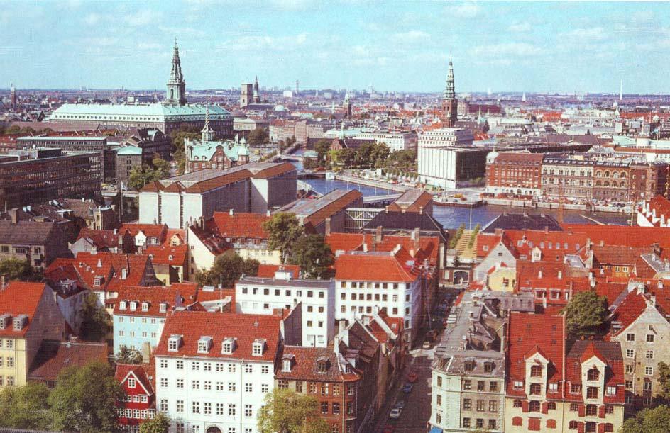
8 Wonderful Copenhagen
9 Aalborg at the fjord
10 An Assessment of the Danish LAS based on the Land Management Paradigm


11 The Spatial Information Infrastructure NSC produce the cadastral map and digital topo maps 1:10,000 (TOP10DK). Available through the map service Local authorities and utilities produce large scale topo maps on demand. Available on the municipal web services Digital registers available through the public information server. Cross reference register ensures Accessibility. Geocoded addresses in combination with the central population register ensures the link between people and land.

12 The Public Information Server

13 The Public Information Server

14 The Map Service

15 The Map Service

16 Buildings are not in the Cadastre They are registered in the Building and Housing Register The Web-Cadastre

17 The Planning Information Service

18 County Administration Web Service Showing the various land-use restrictions

19 The Municipal Web Service Different kind of maps, plans, and GIS analysis
20 The Service Oriented IT Architecture Users: All kind User services: Self services collect and organise data from different sources for specific purposes Case systems design and support the processes in government administration Common services: Information services support the distribution of data Administrative services secure the process of access to and updating of the data Data services: Provide functionality For distribution and administration Data: Official (authentic) governmental Registers and map databases Quality, authenticity, and actuality Flexibility and accessibility Standardisation
21 8ei 8d ø 8dt 8dk 1.50m 8eg 7.5 0m 8ed 8do 8dd 8ac 3.0 0m 8cu 8cæ 9æ 1hi 1g ø 1ha 1hb 1hc 1hd 1he 1hf 1hg bx 1bx 1bx 7.00m 8ei 8d ø 8dt 8dk 1.50m 8eg 7.5 0m 8ed 8do 1.5 0m 8dd 8ac 3.0 0m 8cu 8cæ 9æ 1hi 1g ø 1ha 1hb 1hc 1hd 1he 1hf 1hg bx 1bx 1bx 7.00m Land Valuation and Taxation 1ac 1dc 1c n 6c aø 6bc 1af 1c o 11ch 1bl 1c u 1ad 1dz 1cv 1bæ 1h 6be 1aæ Land Value 1c d 1æ 1dxper 6bd sq.m. 1ae 1ck 11ca 11bø 1du 1az 1m 6bf "g" ci 1av 1cy e -345 l 1r 14bs 1g 1cæ 1cø 1da 1db 1dh 1v 1au Land Value in cv 1eh 1at 3ed 3ee 3ef 3eg 1c q 1fo ay 1eø 1as DKK per sq.m. 1v 14bi 14di 11ce 14dh 1ey 3ec 1ap 4 b 1cz 14be ar 1ax 3dø 3ea 3eb 1aq 14gp 1ao 1an 3dæ 11cf > m 3b 11cz da "f" 1bh 1be 1bd 3dy 3dz "ag" 1bk 1ay 1bf dg 3du 11cn 11cr 1fs 1bg "m" 3ds 3el 3dt 11br 11bs 11bp 11bq 1bi 14ct 3dx 11cs 11bl 11bo 14dc 11bm 11bn 11co 3dv 11cm 1p 1q 1r 1s 1t 1u a 1o 1n f 14df 11bk 11bt 11c p 11ct 3dl 3dm 3dn 3do 3dp 3dr 11bæ 11bz11by 11bx 11bv 11bu Silkeborgvej ek cz 11cø 11bi cq "c " h 40 ad 40f c 40d 40aa 40y 11bf 40ab 11az 3gf 8be 11ar 40 af 40ag 40ai 1g p 3dh 8ae 1bs 3fa 8r 40x 3gæ 40h 40ah 11dø 11dæ q 18u 40z 3di 1bn 40g 40v 40a 3dg 3gø 10ba 21ah 40æ 1a 21 ag 40an 1hm 21ai 12a 1fa 8x 52f 21af 40 aæ 40q 18t 40at 52 b 1i 40b 52a 1hk 6a 52d Gellerup By, Brabrand 21ak 40au 8q 9au 9at 1gy 40av 3df a 21ag 40 1hh 1by 40p 18i 16bo 1gæ 1gz 3dk 40ar 4h 1l 40m 40as dn 1bø 40ae "g" 5bd 18q 21g 12bp 1el 12bz12h 10gm eq 1ev 3ø 21af 40ap 40al 40aq 9s 9u 5cy 1ac 10f 9e 40 a 1dc 5cf 1c n 6c aø 9y 1cf 6bc 40n 9ac 5i 5ig 1af 1c o 11ch 40ao 9ah c n 1c a 1c q 1bl 40am 40ak 5ih 1c u 1ad 1dz 1bæ 1h 6be 1aæ 1cv 1c d 1æ 1dx cx 1ae ad 9z 5ik Property Value6bd c e 9ae 9ag 1cl 1ck 11ca 11bø 5c q 5ii 5k 1dk 1du 1az 1m 6bf "g" 9t 5c o 4ci 1av 16aø 5f 1cy af 14e -345 "g" 5c p 1de 40t cl 1r 40az 40k 5ci 14bs 1g 1cæ 1cø 1da 1db 1dh 1v 1au s 16fe ev 1cø 16fg 5ck 1cv 11cv 3ey -163 y 1eh 1at 3gd 16eæ 3ed 3ee 3ef 3eg 1c q 1fo ay 3ay 7dx 7g 1eø 1v 1as 3ge 1by 14bi 14di 11ce 3gc 7c g 14dh 3gb 9x 1dp "c " 3ec 7c h 1cz 1ey 1ap 3ga 3gx bb 14be a 14 1ar 1ax 3dø 3ea 3eb 1aq 14gp 1ao 1an 40u 1dp 29m 11du 3fø 9ab 9ø 6h 3dæ 11cf 6d 6e 1m 9aa 7eb 6f 11cz i 6c 3b 11da "f" 29q 1bh 1be 1bd 3dy 3dz "ag" 1bk 1ay 1bf 7ec 14dg 3du 11cn 11cr 1fs 1bg "m" 3ds 3el 11bs 6i 3dt 11br 11bp 11bq 1bi 14ct 3dx 11cs 11bl 11bo 14dc 11bm 11bn 11co 3dv 11cm 1o 1p 1q 1r 1s 1t 1u 5a 1f 1n 14df 11bk 11bt 11c p 11ct 3dl 3dm 3dn 3do 3dp 3dr 11bæ 11bz11by 11bx 11bv 11bu Silkeborgvej 8ek cz 11cø 11bi cq "c " h 40 ad 40f c 40d 40aa 40y 11bf 11az 3gf 8be 11ar 40 af 40ag 40ab 40ai 1g c p 3dh 8ae 40x 3fa 8r 1bs 3gæ 40h 40ah 11dø 11dæ cq 18u 40z 3di 1bn 40g 40v 40a 3dg 3gø 10ba 21ah 40æ 21 ag 40an 1hm 21ai 1a 12a 1fa 8x 52f 21af 40 aæ 40q 18t 40at 52 b 1i 40b 52d 52a 1hk 6a Gellerup By, Brabrand 21ak 40au 8q 9au 9at 1gy 40av 3df a 21ag 40 1hh 1by 40p 18i 16bo 1gæ 1gz 3dk 40ar 4h 1l 40m 40as dn 1bø 40ae "g" 5bd 18q 21g 12bp 1el 12bz12h 10gm eq 1ev 3ø 21af 40ap 40al 40aq 9s 9u 5cy 10f 9e 40 a 5cf 9y 1cf 40n 9ac 5i 5ig 40ao 9ah c n 1c a 40am 1c q 40ak 5ih 5cx ad 9z 5ik c e 9ae 9ag 1cl 5c q 5ii 5k 1dk 9t 5c o 16aø 5f 9af "g" 5c p 1de 40t 40az 40k 5ci 40s 16fe ev 1cø 3ey 16fg 5ck 1cv gd 16eæ 3ay 7dx 7g 3ge 1by 3gc 7c g 3gb 9x 1dp "c " 7c h 3ga 3gx 40a 40u 1dp 29m 11du 3fø 9ab 9ø 6h 6d 6e 9aa 7eb 6f 40i 6c 29q 7ec 5.00m Tyttebæ rvej m 8eh 8dæ 8ds 8di 8dz 8d r 8dh 8ef 8dy 8dq 8ee 8dx 8dp 8dg Gellerup Sogn Fuglsangsvej 1.50m 8dv 8df Brabrand Sogn 8du 8de 8ec 8dn 1.5 0m Brabrand Sogn 8eb 8dm 8dc Gellerup Sogn 8ea 8dl 8db 10.00m 1.50m 8cn 8cs 8cy 8ci 8co 8c t 8cz 8ck 8cp 8c l 8cq 8cv 8cø 8cm 8cr 8c x 8da 3gv 3gp 3gl 3gu 3go 3gk 3gt 3gn 3gs 3gi 3gm 3gr 3gq 3gh Silkeborgvej 3gg øgelvej 40a 3.50m Fre dskov "ah" 8,00m 13.00m Brabrand Skovvej The Values are generated automatically on the basis of recorded sales prices - plus a human factor. 8.00m Edithsvej Edithsvej m Sigridsvej m m 5.00m m Tytt ebæ rvej 5.00m 5.00m Brabrand Skov vej m -372 Gudru 5.0 0m 5. 00m eh 8dæ 8ds 8di 8dz 8dr 8dh 8ef 8dy 8dq 8ee 8dx 8dp 8dg Gellerup Sogn Fuglsangsvej 1.50m 8dv 8df Brabrand Sogn 8du 8de 8ec 8dn Brabrand Sogn 8eb 8dm 8dc Gellerup Sogn 8ea 8dl 8db 10.00m 1.50m 8cn 8cs 8cy 8ci 8co 8c t 8cz 8ck 8cp 8c l 8cq 8cv 8cø 8cm 8cr 8c x 8da 3gp 3gl 3go 3gk 3gi 3gn 3gv 3gu 3gt 3gs 3g m 3gr 3gq 3gh Land and property valuation is carried out by the municipal authorities. Silkeborgvej 3gg øgelvej 40 a 3.50m Fre dskov "ah" 8,00m 13.00m Brabrand Skovvej 8.00m Edithsvej Edithsvej m Sigridsvej m m m 5. 00m 5.00m Brabrand Skov vej Gudru Property Value in million DDK m m -176 < ½ ½
22 Land-Use Planning Decentralised Responsibility National planning The Minister establishes the overall framework through guidelines and directives Regional plans The 12 regions revise their regional plans every 4th. year Local plans More than plans have been prepared since 1977 Municipal plans The 275 municipalities revise their plans every 4th. year Framework control: Planning at lower levels must not contradict planning decision at higher levels.
23 Integrated Land-Use Management The system ensures that undesirable development does not occur; and that desirable development is in line with the land-use regulations for sustainable development. However, the system can not ensure that desirable development actually happens at the right place and the right time.
24 .
25 Challenges and New Initiatives Challenges and Barriers No overall Land Policy? No national policy for the Spatial Data Infrastructure? Implementation of e-government? Merging of the Cadastre and The Land Book? 3-D and Marine Cadastre? New initiatives The ICT architecture The Land Book The Property Concept The Cadastral map The Multipurpose Cadastre Implementation of the new administrative reform The Property Concept?


26 The Service Oriented IT Architecture This is the big issue that will drive the development of the LAS with regard to both policies, institutions and administrative processes


27 The Land Book The Land Book was digitised by The new project: Digitisation of the of archives Adjustment of procedures to better reflect the ICT opportunities. On-line registration based on standard forms. The organisation will change: Closing down the local land registries Establishing one national land registry authority New Model? Titles registered in the cadastre Easements registered at the cadastral map Mortgage registered through the financial sector
28 The Property Concept The property concept is a legal term defined slightly different in the various land acts (cadastre, land book, and valuation). There is a need to find a common term that should also accommodate other types of properties and complex commodities


")


29 The Accuracy of the Cadastral Map A call for the educated use of the map There is a need to improve the accuracy of the cadastral maps (by upgrading) to obtain better consistency with the large scale topographic maps.

30 The Multipurpose Cadastre Should the cadastre host the land-use regulations? Today: Yes In the future: No! Currently, the cadastre is hosting a few land-use regulations such as the coastal protection zone, the dunes protection zone, and soil contaminated areas. From a legal as well as an administrative point view this is very problematic. In the future, using the service oriented IT- architecture, the cadastre will still be the basic (authentic) layer of registration. But the registration will be the responsibility of the various governmental authorities. This, again, calls for an educated use of the map to ensure consistency between the cadastral information and land-use restrictions.


31 Land Information and Land-Use Planning - new administrative structure The new administrative reform by 1 January municipalities 100 > 30, counties 5 Land-use responsibilities moves from The 15 counties to the new 100 municipalities Where and how does the knowledge and information bases move? It is all politically decided, but nobody really knows how to deal with it

32 Final Remarks The objective of this presentation is to present the European perspective in terms of the INSPIRE initiative - and to analyse the Danish LAS in terms of being an ICT enabled system for sustainable development. It can be concluded that the systems works well in support of sustainable development through en efficient land market and effective land-use management. The property layer is well integrated for asset management and the planning control system is well tailored for an decentralised and integrated approach to land-use management. The Land Information Infrastructure and the institutional arrangements need continuous attention to be adapted to ITC developments. The general awareness of the land management area as a coherent whole could still be improved.

33 The Danish Way - bridging the gaps Thanks for your attention
ICT Enabled Land Administration Systems for Sustainable Development. - the Danish Way. Looking at Darwin or Denmark?
 ICT Enabled Land Administration Systems for Sustainable Development Looking at Darwin or Denmark? - the Danish Way Prof. Stig Enemark Aalborg University, Denmark Vice-President of EXPERT GROUP MEETING
The Integration of Natural and Built Environment Data
 5 cm/year ITRF93 NNR-NUVEL1A The Integration of Natural and Built Environment Data The Experience of Europe with a Focus on Denmark Prof. Stig Enemark Aalborg University, Denmark Vice-President of The
PUBLICATION No.: 8 APRIL 2002 PROPERTY VALUATION AND TAXATION IN DENMARK. By Jens Wolters. Jens Wolters National Survey and Cadastre, Denmark
 DdL The Danish Way March 2002 PUBLICATION No.: 8 APRIL 2002 THE DANISH WAY Property Valuation and Taxation in Denmark PROPERTY VALUATION AND TAXATION IN DENMARK By Jens Wolters Revised and updated by Stig
Yarmouth County Registry of Deeds
 Record Type Volume Dates Indexes Reel Index 1A 1774-1792 18776 not at Archives Index 2 1785-1817 18776 not at Archives Index 3 1817-1832 18776 not at Archives Index 4 1832-1846 18776 not at Archives Index
THE INTEGRATION OF NATURAL AND BUILT ENVIRONMENT DATA THE EXPERIENCE OF EUROPE WITH A FOCUS ON DENMARK
 UNITED NATIONS E/CONF.97/6/IP. 40 ECONOMIC AND SOCIAL COUNCIL Seventeenth United Nations Regional Cartographic Conference for Asia and the Pacific Bangkok, 18-22 September 2006 Item 7 of the provisional
Greetings from Denmark. Property Rights, Restrictions and Responsibilities - A Global Land Management Perspective. Wonderful Copenhagen
 Property Rights, Restrictions and Responsibilities - A Global Land Management Perspective Greetings from Denmark 43,000 sq km Prof. Stig Enemark President Aalborg University, Denmark Aalborg Copenhagen
A beautiful setting. The Evolving Role of Cadastral Systems in Support of Good Land Governance. Setting the scene
 The Evolving Role of Cadastral Systems in Support of Good Land Governance Prof. Stig Enemark President Aalborg University, Denmark THE DIGITAL CADASTRAL MAP FIG COMMISSION 7 OPEN SYMPOSIUM KARLOVY VARY,
From Measurement to Management
 From Measurement to Management The changing role of the land surveyors Prof. Stig Enemark Aalborg University, Denmark LAND MANAGEMENT AND HUMAN RIGHTS INTERNATIONAL SEMINAR, HØGSKOLEN I BERGEN, 8 9 SEPTEMBER
The Digital Cadastral Database and the Role of the Private Licensed Surveyors in Denmark
 IRISH INSTITUTE OF SURVEYORS, DUBLIN INSTITUTE OF TECHNOLOGY, 23 NOVEMBER 2005 PUBLISHED IN IIS NEWS, WINTHER 2006. The Digital Cadastral Database and the Role of the Private Licensed Surveyors in Denmark
Legal Supplement Part B Vol. 54, No th Decemeber, THE FINANCIAL INSTITUTIONS ACT, CHAP. 79:09 ORDER
 Legal Supplement Part B Vol. 54, No. 128 16th Decemeber, 2015 1657 LEGAL NOTICE NO. 215 REPUBLIC OF TRINIDAD AND TOBAGO THE FINANCIAL INSTITUTIONS ACT, CHAP. 79:09 ORDER MADE BY THE MINISTER OF FINANCE
Supporting Capacity Development for Sustainable Land Administration Infrastructures
 THE EIGHTH UNITED NATIONS REGIONAL CARTOGRAPHIC CONFERENCE FOR THE AMARICAS (UNRCCA) 27 June 1 July 2005, United Nations Headquarters, New York Supporting Capacity Development for Sustainable Land Administration
Land Markets and Land Rights in support of the Millennium Development Goals
 Land Markets and Land Rights in support of the Millennium Development Goals A Global Perspective Prof. Stig Enemark President Aalborg University, Denmark 3rd LAND ADMINISTRATION FORUM FOR THE ASIA AND
The Danish Digital Cadastral Map A Tool for Land Management
 The Danish Digital Cadastral Map A Tool for Land Management Søren CHRISTENSEN, Denmark Key words: Digital cadastre, restrictions pertaining to public law, land management. ABSTRACT The establishments of
Danish Multipurpose Cadastre Experiences so Far
 Danish Multipurpose Cadastre Experiences so Far Jørgen SKRUBBELTRANG, Denmark Key words: Multipurpose cadastre, restrictions pertaining to public law, new users, top down implementation, quality of the
Land Administration Infrastructures for Sustainable Development
 The Global Challenges Land Administration Infrastructures for Sustainable Development Prof. Stig Enemark Department of Development and Planning Aalborg, University, Denmark INTERNATIONAL CONFERENCE ON
Digitalisation of the Real Property Rights Towards Spatially enabled E-Government
 Digitalisation of the Real Property Rights Towards Spatially enabled E-Government Lise Schroeder, Bent Hulegaard Jensen, Esben Munk Soerensen & Line Hvingel Istanbul, Turkey 25 june 201 Overview Introduction
Cadastre: definitions
 Introduction New vision towards a multipurpose cadastral system to support land management in Morocco Moha EL-AYACHI, El Hassane SEMLALI, Mohamed ETTARID, Driss TAHIRI, Institut Agronomique et Vétérinaire
INSPIRE Thematic Working. Cadastral parcels. September 2008
 INSPIRE Thematic Working Cadastral parcels September 2008 The INSPIRE context The INSPIRE Directive Its aim is to build the INfrastructure for Spatial InfoRmation in Europe The INSPIRE Directive has been
Land surveying is probably the (second) oldest profession in the world
 oldest profession in the world") Land Surveying and Land Management in an International Perspective Prof Stig Enemark Honorary President Aalborg University, Denmark CADASTRE IN A DIGITAL WORLD NORDIC AND GLOBAL PRESPECTIVES INTERNATIONAL
Land Surveying and Land Management in an International Perspective Prof Stig Enemark Honorary President Aalborg University, Denmark CADASTRE IN A DIGITAL WORLD NORDIC AND GLOBAL PRESPECTIVES INTERNATIONAL
Scenic Nepal. Land Administration Systems. Outline of Presentation. Interests in land. Rights: Registration and security of tenure positions
 Scenic Nepal Land Administration Systems Managing Rights, Restrictions, and Responsibilities in Land Prof. Stig Enemark President Aalborg University, Denmark SURVEY DEPARTMENT KATHMANDU, NEPAL. 16 FEBRUARY
Land Management and Development
 CLGE INTERNATIONAL CONFERENC 2005 EUROPEAN PROFESSIONAL QUALIFICATIONS IN GEODETIC SURVEYING BRUSSELS, 1-2 DECEMBER 2005 Land Management and Development Professor Stig Enemark Department of Development
Understanding the Land Management Paradigm
 FIG COM 7 SYMPOSIUM ON INNOVATIVE TECHNOLOGIES FOR LANDADMINISTRATION 19 25 June 2005, Madison, Wisconsin, USA. Understanding the Land Management Paradigm Prof. Stig Enemark Vice-President of FIG Department
Land Administration In Public Private Partnerships
 Land Administration In Public Private Partnerships Workshop Customers - Co-operation - Services Vienna, 12-13 September 2002 Peter Creuzer Content Land Administration - Tasks History Spatial Data Infrastructure
Spatial Enablement and the Response to Climate Change and the Millennium Development Goals
 Spatial Enablement and the Response to Climate Change and the Millennium Development Goals Prof. Stig Enemark President Aalborg University, Denmark 18th UNITED NATIONS REGIONAL CARTOGRAPHIS CONFERENCE
ARMSTRONG COUNTY, PENNSYLVANIA
 ARMSTRONG COUNTY, PENNSYLVANIA (ALL JURISDICTIONS) Armstrong County COMMUNITY NAME COMMUNITY NUMBER APOLLO, BOROUGH OF 420092 APPLEWOLD, BOROUGH OF 420093 ATWOOD, BOROUGH OF 422297 BETHEL, TOWNSHIP OF
Building a European Spatial Data Infrastructure: The Role of EuroGeographics
 Building a European Spatial Data Infrastructure: The Role of EuroGeographics Richard Kirwan President of EuroGeographics 1st Congress on Cadastre in the EU 1 Presentation overview EuroGeographics - the
International funding projects in Republic Geodetic Authority
 International funding projects in Republic Geodetic Authority Serbia: Republic Geodetic Authority Workshop Exploring Funding Instruments for NMCA 7-8 November 2012 Republic Geodetic Authority Republic
New Danish e-cadastre and its role in the Danish e-government
 New Danish e-cadastre and its role in the Danish e-government PCC Budapest 2011 Pia Dahl Højgaard, pdh@kms.dk Cadastre and Legal Authority, National Survey and Mapping, Denmark The danish context Neighbours
Use of data in Ukraine for sustainable economic growth. Oleksandr Maliuk State Service of Ukraine for Geodesy, Cartography and Cadastre
 Use of data in Ukraine for sustainable economic growth Oleksandr Maliuk State Service of Ukraine for Geodesy, Cartography and Cadastre Kehl, 2017 Content of the presentation Ukraine & StateGeoCadastre:
Cadastral Parcels in the context of INSPIRE
 Cadastral Parcels in the context of INSPIRE Gyula IVÁN Institute of Geodesy, Cartography & Remote Sensing, HUNGARY Open Symposium on Environment and Land Administration Big Works for the Defence of Territory
Lessons for federated countries that have state land registries the Australian experience
 Lessons for federated countries that have state land registries the Australian experience Ian Williamson Centre for SDI and Land Administration Department Infrastructure Engineering University of Melbourne
National Spatial Data Infrastructure development in Republic of Macedonia
 National Spatial Data Infrastructure development in Republic of Macedonia Sonja Dimova, state advisor for geomatics AGENCY FOR REAL ESTATE CADASTRE September 6-th, 2017, Strasbourg AREC competence for
PROJECT INFORMATION DOCUMENT (PID) APPRAISAL STAGE Report No.: PIDA Project Name. Region Country Sector(s) Theme(s)
 APPRAISAL STAGE Report No.: PIDA Project Name. Region Country Sector(s) Theme(s)") Public Disclosure Authorized Public Disclosure Authorized Public Disclosure Authorized Public Disclosure Authorized Project Name Region Country Sector(s) Theme(s) Lending Instrument Project ID Borrower(s)
Public Disclosure Authorized Public Disclosure Authorized Public Disclosure Authorized Public Disclosure Authorized Project Name Region Country Sector(s) Theme(s) Lending Instrument Project ID Borrower(s)
ESCROW DEPOSIT AND TRUST AGREEMENT
 11030-23 JH:SRF:KD:brf AGENDA DRAFT 8/29/2016 ESCROW DEPOSIT AND TRUST AGREEMENT This ESCROW DEPOSIT AND TRUST AGREEMENT, dated as of October 1, 2016 (the Agreement ), is by and between the CITY OF ALBANY,
Croatian SDI: a Tool for Accelerated Development of the Geo-Conscious Society
 STATE GEODETIC ADMINISTRATION Croatian SDI: a Tool for Accelerated Development of the Geo-Conscious Society Prof.Dr.Sc. Željko Bačić, Mr.Sc. Ljerka Rašić FIG Working Week 2009 - Surveyors Key Role in Accelerated
Spatial Data Infrastructure in Sweden
 Spatial Data Infrastructure in Sweden Hans-Erik WIBERG, Sweden Key words: ABSTRACT Sweden was one of the first countries to address Data Infrastructure matters and have during several decades developed
Land Administration And Spatial Data Infrastructures
 Land Administration And Spatial Data Infrastructures Ian WILLIAMSON, Donald GRANT and Abbas RAJABIFARD Centre for SDIs and Land Administration Department of Geomatics University of Melbourne, Australia
Key Registers in Finland and some views of Cadastre 2035
 Presented at the FIG Working Week 2016, May 2-6, 2016 in Christchurch, New Zealand Key Registers in Finland and some views of Cadastre 2035 FIG Working Week, Christchurch New Zealand May, the 3rd, 2016
Designing for transparency and participation in the Hellenic Cadastral Project
 Designing for transparency and participation in the Hellenic Cadastral Project Dr. Dimitris Rokos Director of Planning and Investments, Hellenic National Cadastre and Mapping Agency S.A. Table of Contents
NEW ROLES OF LAND ADMINISTRATION SYSTEMS
 NEW ROLES OF LAND ADMINISTRATION SYSTEMS Centre for SDIs and Land Administration Department of Geomatics The University of Melbourne Email: ianpw@unimelb.edu.au SUMMARY This paper sketches the key issues
Land and Geographic Information, an Important Part of the Infrastructure in Sweden
 Land and Geographical Information Land and Geographic Information, an Important Part of the Infrastructure in Sweden Land and Geographic Information, an Important Part of the Infrastructure In Sweden Bo
The Fit- for-purpose Concept
 The Fit- for-purpose Concept Building Spatial Frameworks for Sustainable Land Governance in Sub-Sahara Africa Prof. Stig Enemark Honorary President Aalborg University, Denmark LAND POLICIES AND LAND GOVERNANCE,
PLANNING BOARD APPLICATION FORM TOWNSHIP OF BETHLEHEM 405 MINE ROAD ASBURY, NEW JERSEY Date of Application: Township Application Number:
 Township of Bethlehem Page 1 of 8 PLANNING BOARD APPLICATION FORM TOWNSHIP OF BETHLEHEM 405 MINE ROAD ASBURY, NEW JERSEY 08802 Date of Application: Township Application Number: Jurisdiction: Planning Board
STATUS REPORT
 Working Group 3 Land Administration STATUS REPORT 2006-2009 2009 Prof Ian Williamson (Chair) Mr Ahmad Fauzi Nordin (Vice Chair) Assoc. Prof Abbas Rajabifard (Vice Chair) 18th UNRCC-AP Conference Bangkok
Mass Valuation: Processes & Decisions
 C+LR KEN Cadastre + Land Registry Knowledge Exchange Network Mass Valuation: Processes & Decisions Gerhard.Muggenhuber@bev.gv.at BEV - www.bev.gv.at - Federal Office of Metrology and Surveying Dept. International
The Challenge to Implement International Cadastral Models Case Finland 1
 The Challenge to Implement International Cadastral Models Case Finland 1 Tarja MYLLYMÄKI and Tarja PYKÄLÄ, Finland Key words: cadastre, modelling, LADM, INSPIRE SUMMARY Efforts are currently made to develop
Property Transactions in the Digital Age. The Property Cadastre in the Context of Spatial. Dr. Jens Riecken, NRW Ministry of the Interior
 Property Transactions in the Digital Age The Property Cadastre in the Context of Spatial Data Infrastructure (SDI) Dr. Jens Riecken, NRW Ministry of the Interior Property Transactions in the Digital Age
Challenges for the multi purpose cadastre
 Jens RIECKEN, Markus SEIFERT, Germany Key words: Multi purpose cadastre, 3d-cadastre, land use, SDI, solar cadastre SUMMARY Over the past 30 years, with the progress of information technologies the development
Cadastres, Land Information Systems and Planning - is decentralisation a significant key to sustainable development?
 Cadastres, Land Information Systems and Planning - is decentralisation a significant key to sustainable development? Prof. Stig Enemark Department of Development and Planning Aalborg University, Fibigerstrede
KCA ORGANIZATION GOVERNMENT OF KOSOVA MINSTRY OF PUBLIC SERVICES GOVERNMENT OF KOSOVA MINSTRY OF PUBLIC SERVICES
 Development of Cadastre and Land Management in Kosovo Prof. Dr. sc. Murat Meha, chief executive Hyzri Llabjani-Cadastral Expert * Hajzer Bublaku-Lawyer FIG Working Week 2004 in Athens, Greece, May 22-27,
Incorporating Sustainable Development Objectives into ICT Enabled Land Administration Systems - Case Study Switzerland
 EXPERT GROUP MEETING ON INCORPORATING SUSTAINABLE DEVELOPMENT OBJECTIVES INTO ICT ENABLED LAND ADMINISTRATION SYSTEMS 9-11 November 2005, Centre for Spatial Data Infrastructures and Land Administration
Click to edit Master title style
 Click to edit Master title style Modern Cadastre and Land Administration Session 5a. The toolbox approach Jude Wallace 2007 Click to edit Overview Master title style Objectives To understand the circumstances
Integrated Land-Use Management for Sustainable Development
 Integrated Land-Use Management for Sustainable Development Stig ENEMARK, Denmark Key words: Planning control, land-use, land management, informal urban development SUMMARY The paper addresses the issue
The Use of Cadastral Information in Projects Financed by the EU: The Hellenic Cadastre
 The Use of Cadastral Information in Projects Financed by the EU: The Hellenic Cadastre Prof. D. Balodimos Vice-President of Ktimatologio S.A. (Hellenic Cadastre) Acknowledgements Dr. Panos Lolonis, Coordinator
Cadastre a role model for Private-Public-People-Partnership
 Cadastre 4.0 - a role model for Private-Public-People-Partnership Gerda Schennach, Austria Chair of FIG Commission 7 1 Who owns... buildings? the mountains? land? forests? the sea? infrastructure? 2 From
Content and message. 3D registration of real property in Denmark. Content and message. Introduction. Cadastral register
 Content and message 3D of real property in Denmark Jantien Stoter Section GIS technology, Delft University of Technology (NL) Esben Munk Sørensen and Lars Bodum GeoInformation and MediaTechnologi, Aalborg
New Technology for Cadastral Systems. Brent Jones, PE, PLS
 New Technology for Cadastral Systems Brent Jones, PE, PLS Benefits of Good Land Administration Key to addressing global challenges.. Secure Tenure Equitable Land and Property Taxation Support for Government
Cadastre and Land Registration in Europe
 Annex A: Questionnaire 2007 for Information Resource Cadastre and Land Registration in Europe Introduction This questionnaire is based on the EuroGeographics vision document 'Cadastre and Land Registration
Re-engineering engineering the cadastre to support e-governmente
 Centre for SDIs and Land Administration Department of Geomatics Re-engineering engineering the cadastre to support e-governmente Ian Williamson UN sponsored Third Land Administration Forum, Tehran, 2009
Expert Group Meeting 9-11 November 2005 Geomatics The University of Melbourne Centre for Spatial Data Infrastructures and Land Administration
 Incorporating Sustainable Development Objectives into ICT Enabled Land Administration Systems Australia s International Science Linkages Program Expert Group Meeting 9-11 November 2005 Geomatics The University
Topographic Signs Important Context of 3D Cadastre
 STATE GEODETIC ADMINISTRATION Gruška 20,10 000 Zagreb, Croatia Delft University of Technology Faculty of Architecture and the Built Environment Department OTB GIS Technology Section Topographic Signs Important
Status and Perspectives of the Geodesy, Cartography and Cadastre Authority Availability of Geographic Information in Slovakia.
 Status and Perspectives of the Geodesy, Cartography and Cadastre Authority Availability of Geographic Information in Slovakia Hedviga Májovská Geodesy, Cartography and Cadastre Authority of the Slovak
LAUNCH OF CADASTRAL TEMPLATE 2.0
 LAUNCH OF CADASTRAL TEMPLATE 2.0 Dr. Daniel Steudler Scientific Associate, swisstopo Prof. Abbas Rajabifard Director Centre for SDIs and Land Administration, Melbourne University FIG-Commission 7, Annual
LIS a motivation for SDI initiative
 Eric Mwaikambo Ardhi University Dar es Salaam Tanzania Overview Status of LIS in Tanzania Relationship between SDI and LIS Spatial Standards LIS a motivation for SDI initiative Conclusion & Recommendations
The Development Strategy for Cadastre and Land Register in Finland
 1 2 The Development Strategy for and Land in Finland Arvo Kokkonen Ministry of Agriculture and Forestry Facts and figures of Finland - land area 304 530 km² - water area 33 615 km² - total area 338 195
Content. Development and Potential for Improvements of the Austrian Land Administration System. Introduction. Dynamic Framework of Land Administration
 Development and Potential for Improvements of the Austrian Land Administration System Reinfried MANSBERGER, BOKU Vienna Gerhard MUGGENHUBER, BEV Vienna Gerhard NAVRATIL, TU Vienna Christoph TWAROCH, TU
The Multipurpose Hungarian Unified Land Registry System
 The Multipurpose Hungarian Unified Land Registry System András Osskó FIG Working Week Integrating Generation Stockholm, Sweden 14-19 June 2008 Republic of Hungary is located in Central Europe Neighbouring
Unified Land Administration for a Better Spatial Infrastructure
 Unified Land Administration for a Better Spatial Infrastructure Gyula IVÁN Institute of Geodesy, Cartography & Remote Sensing FÖMI (HUNGARY) Open Symposium 30th Korean Cadastral Seminar & FIG Commission
Report and update from Working Group A on Core Data
 JOINT UN-GGIM: EUROPE ESS MEETING ON THE INTEGRATION OF STATISTICAL AND GEOSPATIAL INFORMATION LUXEMBOURG 31 MARCH 2017 Report and update from Working Group A on Core Data François Chirié, Dominique Laurent,
The Development of the Austrian Cadastre from Documentation to an Integrated Planning and Decision Support System
 The Development of the Austrian Cadastre from Documentation to an Integrated Planning and Decision Support System WPLA - Working Party on Land Administration 15-17 October 2014, Vienna, Austria Wernher
Advances in Modern Land Administration Cadastre 2014 in the Year 2006
 Advances in Modern Land Administration Cadastre 2014 in the Year 2006 Winfried HAWERK, Germany Key words: E-Land Administration, IT renewal strategies SUMMARY FIG Commission 7 Working Group 7.3 deals with
Public private collaboration model in the cadastral workflow in Denmark
 Public private collaboration model in the cadastral workflow in Denmark Jakob HØJGAARD-GERAAE, Denmark Key words: Cadastre, digital cadastre, e-governance, history, land management SUMMARY The structure
Annual Meeting 2006 SLOVENIA, BLED RASAS GOFMANAS JAUNIUS GRIGAS RIMANTAS RAMANAUSKAS KESTUTIS TRECIOKAS
 Annual Meeting 2006 SLOVENIA, BLED LAND ADMINISTRATION IN LITHUANIA RASAS GOFMANAS JAUNIUS GRIGAS RIMANTAS RAMANAUSKAS KESTUTIS TRECIOKAS ADMINISTRATIVE STRUCTURE OF LITHUANIA HISTORY OF LAND ADMINISTRATION
Building Integrated Land Information Systems and Development of NSDI
 Stig JÖNSSON, Sweden Key words: Land administration, land information systems, property formation, spatial data infrastructure, Inspire, institutional cooperation SUMMARY Lantmäteriet the Swedish agency
BULGARIAN CADASTRE A GUARANTEE FOR THE OWNERSHIP RIGHTS IN IMMOVABLE PROPERTIES
 4 TH INTERNATIONAL CONFERENCE RECENT PROBLEMS IN GEODESY AND RELATED FIELDS WITH INTERNATIONAL IMPORTANCE February 28 - March 2, 2007, Inter Expo Centre, Sofia, Bulgaria BULGARIAN CADASTRE A GUARANTEE
The Cadastre of Public-law Restrictions on Landownership in Switzerland
 The Cadastre of Public-law Restrictions on Landownership in Switzerland The new official land registry information system Maurice Barbieri, CLGE President Zagreb, 26.November 2015 Utility Cadastre Seminar
PROJECT FINANCIAL STATEMENTS REAL ESTATE REGISTRATION PROJECT. Report on the Republika Srpska part of the. of the
 Report on the Republika Srpska part of the PROJECT FINANCIAL STATEMENTS of the REAL ESTATE REGISTRATION PROJECT of the Ministry of Finance and Treasury of Bosnia and Herzegovina financed by: - IDA Credit
Future Perspectives for a Multifunctional use of The Digital Cadastral Map in the Public Sector of Denmark
 Future Perspectives for a Multifunctional use of The Digital Cadastral Map in the Public Sector of Denmark Lars Erik STORGAARD and Marianne BENGTSON, Denmark Key words: Enterprise architecture, SOA, Organizational
ABSTRACT Land Administration System in Lithuania
 ABSTRACT Land Administration System in Lithuania 1. General introduction to the Lithuanian Land Administration System and State Enterprise Centre of Registers ( shortly SECR) Lithuania has established
Sustainable land information for sustainable development
 Sustainable land information for sustainable development Clare Hadley Ordnance Survey Commonwealth Peoples Forum, Malta, November 2005 This Presentation Why is land information necessary for sustainable
KHANALIBAYLI UNECE WPLA
 UNECE Working Party on Land Administration The role of the UNECE Working Party on Land Administration (WPLA) in the promotion and improvement of land administration and land management in the UNECE region
PROJECT INFORMATION DOCUMENT (PID) CONCEPT STAGE Report No.: AB3229 Project Name. Land Registry and Cadastre Modernization Project Region
 CONCEPT STAGE Report No.: AB3229 Project Name. Land Registry and Cadastre Modernization Project Region") PROJECT INFORMATION DOCUMENT (PID) CONCEPT STAGE Report No.: AB3229 Project Name Land Registry and Cadastre Modernization Project Region EUROPE AND CENTRAL ASIA Sector Central government administration
PROJECT INFORMATION DOCUMENT (PID) CONCEPT STAGE Report No.: AB3229 Project Name Land Registry and Cadastre Modernization Project Region EUROPE AND CENTRAL ASIA Sector Central government administration
Role of Republic Geodetic Authority in the Serbian geo-sector
 Role of Republic Geodetic Authority in the Serbian geo-sector Republic Geodetic Authority, Serbia www.rgz.gov.rs EuroGeographics General Assembly 2014 Moldova, Chisinau, 28 th 30 th September 2014 The
G. Schennach / Chair Commission 7. Common Vision Conference 5-6 Oct 2017, Vienna, Austria
 Cadastre 4.0 - Integrating the community for global security on land tenure Gerda Schennach, Austria Chair of FIG Commission 7 1 200 years of innovation Fiscal Legal Local Digital Taxation Land Tenure
Surveyors Qualifications
 Surveyors Qualifications Præludium Surveyors Qualifications Lars Jansson, Director Lantmäteriet Henning Elmstrøm, President DdL 1 Agenda 1. Introduction 2. Basic framework conditions for cadastral systems
Esri Middle East and Africa User Conference. December Abu Dhabi, UAE. Land Administration. Mark Baker
 Esri Middle East and Africa User Conference December 10 12 Abu Dhabi, UAE Land Administration Mark Baker Our Agenda 0900 0930 Welcome Mark Baker, Esri 0930 1030 New Directions The New Addressing System
CADASTRE 2014: New Challenges and Direction
 CADASTRE 2014: New Challenges and Direction Anna KRELLE and Abbas RAJABIFARD, Australia Key words: Cadastre, Cadastre 2014, Land Administration SUMMARY Land and land related activities form part of the
The Message FIG-WB Partnership on Land Governance in Support of the Global Agenda
 FIG-WB Partnership on Land Governance in Support of the Global Agenda Prof. Stig Enemark, Denmark President 2007-2010 Mr. Teo Chee Hai, Malaysia President Elect 2011-2014 WORLD BANK LAND GROUP, WASHINGTON,
Cadastre and Other Public Registers: Multipurpose Cadastre or Distributed Land Information System?
 Cadastre and Other Public Registers: Multipurpose Cadastre or Distributed Land Information System? Ivan PESL, Czech Republic Key words: Cadastre, Land Registry, Property, Taxes, Land Use, Territorial Planning,
ORIGINAL PRONOUNCEMENTS
 Financial Accounting Standards Board ORIGINAL PRONOUNCEMENTS AS AMENDED Statement of Financial Accounting Standards No. 142 Goodwill and Other Intangible Assets Copyright 2010 by Financial Accounting Foundation.
Land Tenure and Geospatial Data and Technology
 Land Tenure and Geospatial Data and Technology Ioana Bouvier E3/Land and Urban, USAID Senior Geospatial Analyst January 23, 2018 January 23, 2018 1 OUTLINE 1. Overview of geospatial data and technology
The Development of a Cadastral Template
 Daniel Steudler, Ian P. Williamson, and Abbas Rajabifard Department of Geomatics, The University of Melbourne, Australia Abstract While many country reports have been compiled in the area of land administration
INSPIRE implementation as a link between egovernment and environmental purposes
 INSPIRE implementation as a link between egovernment and environmental purposes Jiří Poláček Czech Office for Surveying, Mapping and Cadastre (ČÚZK) What s to Come Role of ČÚZK branch in the INSPIRE implementation.
Support to Implementation of Multipurpose Cadastral Information system in Vietnam
 Support to Implementation of Multipurpose Cadastral Information system in Vietnam Lennart JOHANSSON and Per SÖRBOM, Sweden Key words: Land Registration, Land Information, Land Administration, SWOT analyse,
Smart Infrastructure Benefits and Key Players from a Global Perspective
 Smart Infrastructure Benefits and Key Players from a Global Perspective Spatial@gov 2010 October 5-7 Canberra Jude Wallace and Abbas Rajabifard Centre for Spatial Data Infrastructures and Land Administration
Building a national SDI. Approach and strategy in The Netherlands
 Agenda 1. NSDI vision and implementation strategy 2. NSDI playing field 3. Standards framework for the NSDI 4. National SDI components for IM Information model public safety SDI Portal for public safety
FIG Congress 2010 Facing the Challenges Building the Capacity Sydney, Australia, April
 Setting up the infrastructure for improving the development of Cadastre in Greece Dr. Dimitris ROKOS, Dr. Konstantinos KYRIAZIS and Dr. Panos LOLONIS KTIMATOLOGIO S.A. (Hellenic Cadastre) Source: wikipedia
Good Land Governance for the 2030 Agenda
 Good Land Governance for the 2030 Agenda Addis Ababa, Ethiopia 20-22 April, 2014 Role of Geospatial Information in Good Land Policy and Governance Oumar Sylla UN-Habitat/GLTN oumar.sylla@unhabitat.org
Land Administration in support of the Global Agenda: Current FIG Policies
 Land Administration in support of the Global Agenda: Current FIG Policies Prof. Stig Enemark President Aalborg University, Denmark FIG COMMISSION 7 ANNUAL MEETING VERONA, ITALY, SEPTEMBER 2008 Current
COORDINATED CADASTRES - A KEY TO BUILDING FUTURE GIS
 Proceedings of the Regional Conference on Managing Geographic Information Systems for Success, Melbourne, 3-4 July, pp.60-69 (1996). COORDINATED CADASTRES - A KEY TO BUILDING FUTURE GIS Ian P.Williamson