HAVELOCK NORTH DOMAIN
|
|
|
- Isabel Jefferson
- 5 years ago
- Views:
Transcription


1 HAVELOCK NORTH DOMAIN DRAFT RESER RVE MANAGEMENT PLAN MARCH 2015 CONTENTS HAVELOCK NORTH DOMAIN DRAFT RESERVE MANAGEMENT PLAN 1
2 PREFACE MARCH 2015 HASTINGS DISTRICT COUNCIL 207 Lyndon Road East Hastings 4122 Private Bag 9002 Hastings TE KAUNIHERA O HERETAUNGA 2 HAVELOCK NORTH DOMAIN DRAFT RESERVE MANAGEMENT PLAN Part 1: Introduction & Background
3 CONTENTS PART 1 4 Introduction & Background 4 PREFACE 5 Legislative Requirement 5 What is the Status of this Plan? 5 What is the Format of this Plan? 5 PLANNING & LEGISLATIVE CONTEXT 6 National Context 6 Regional Context 7 Local Context 7 INTRODUCING HAVELOCK NORTH DOMAIN 8 Land Status 8 Physical Description 9 History 10 Key Management Issues Sale of Reserves Reserve Boundaries Encroachment Safety & Vandalism Promotion Review & Monitoring ACTION PLAN 28 PART 3 29 Appendices 29 APPENDIX 1: HISTORICAL PLANS 30 APPENDIX 1: LOCATION PLAN 33 APPENDIX 2: LAND STATUS REPORT 34 APPENDIX 3: PROPOSED CONCEPT PLAN 35 PART 2 12 s and 12 STRATEGIC MANAGEMENT AIM AND OBJECTIVES RECREATION Use of Reserves Organised Sport Dogs Horse Riding Cycling Motorhomes & Camping Restricted Activities FURNITURE & FACILITIES Development Buildings & Structures Fences & Walls Lighting Playgrounds Informal Sporting Activities Toilets & Changing Facilities Signs Reserve Furniture Vehicle Parking Access Walkways & Cycleways NATURAL VALUES Trees & Gardens Landscape Water Biodiversity Plant & Animal Pests Natural Hazards SOCIAL & CULTURAL VALUES Cultural & Heritage Significance Tangata Whenua Art Community Partnerships Commemorative Features ADMINISTRATION & MAINTENANCE Management & Maintenance Sustainability Concessions: Leases, Licences & Permits Rental & Charges Network utilities Title & Reserve Classification Future Reserve Acquisition 25 CONTENTS HAVELOCK NORTH DOMAIN DRAFT RESERVE MANAGEMENT PLAN 3

4 PART 1 INTRODUCTION & BACKGROUND 4 HAVELOCK NORTH DOMAIN DRAFT RESERVE MANAGEMENT PLAN Part 1: Introduction & Background
5 PREFACE LEGISLATIVE REQUIREMENT As an administering body, the Hastings District Council (Council) has the responsibility of preparing policy for the management of reserves that it controls. Reserve Management Plans are required under the Reserves Act 1977 for reserves within the Hastings District, in order for Council to outline its general intentions for their use, development, maintenance, protection and preservation. What is a Reserve Management Plan? A Reserve Management Plan is a document that is typically prepared under the requirements of the Reserves Act, and follows two phases of public consultation. A plan will contain objectives and policies for the management, protection and future development of a reserve, and must: provide for and ensure the use, enjoyment, maintenance, protection and preservation and the development, as appropriate, of the reserve for the purpose for which it was classified Section 41(3) Reserves Act. The Plans, once complete provide Council with a clear framework for the day to day management and decision making for all the Council owned reserves and open spaces within the District for the next 10 years. The process aims to ensure that such management is based on sound principles and that, through consultation, the needs of the public are clearly identified and addressed. What is a District Wide Reserve Management Plan? The Reserves Act envisages that a Reserve Management Plan will be prepared for each reserve within the District. With over 170 reserves within the District, this would be a costly and time consuming process, with many of the management issues common throughout the majority of reserves thereby duplicating information. There are also a large number of areas of open space and land, referred to in the District as reserve, which do not hold formal Reserve status. This land is generally fee simple awaiting Council completion of the formal process of gazetting as considered appropriate, or kept unclassified by the Council in order to retain future development options. As they are not held under the Reserves Act, management plans are not required to be prepared for them. However, while not required, Council considers that guidance on the maintenance and future development of all reserves, regardless of their status, is imperative to ensure consistency in reserve planning across the District. Council has therefore rationalised its approach to reserve management planning by preparing a document District Wide Reserve Management Plan. The intention of this document is to provide objectives and policies which apply to all reserves and open spaces throughout the Hastings District, including those not vested or classified as reserves under the Reserves Act. This will ensure consistency, transparency and enable greater community awareness of Council s intentions on all reserves throughout the District. WHAT IS THE STATUS OF THIS PLAN? The purpose of this Plan is to provide Council with a clear framework for the day to day management and decision making for the Domain for the next 10 years. Council is required to comply with the objectives and policies of this Plan which guide the development, management, protection, operation and public use of it. Section 94 of the Reserves Act 1977 and the Reserve Bylaws identify restricted activities within Reserves. This Reserve Management Plan gives effect to these bylaws, and will identify those areas that have been specifically set aside for certain activities. While this Plan must be read in conjunction with the District Wide Reserve Management Plan, the objectives and policies of this Plan will take precedence. WHAT IS THE FORMAT OF THIS PLAN? Part 1 of the Plan provides an introduction to the Domain, its historical background, physical description and current use. It also identifies the legislative context within which this Plan has been prepared. Part 2 of the Plan is set out in 5 policy sections, which identify the relevant Issues, s and associated with each subject. The 5 main policy sections are: (1) Recreation and Use (2) Furniture and Facilities (3) Natural Values (4) Social and Cultural Values (5) Administration and Management What is an Individual Reserve Management Plan? In addition to the District Wide Reserve Management Plan, Council will prepare individual management plans for specific reserves, according to identified priorities. Certain reserves have unique issues and opportunities that require different use, management and protection philosophies. These individual plans will provide a basis for assigning priorities in works programming and budgeting. They will include concept and development plans for each reserve, planting schedules and prioritise action plans for the next 10 years. Given its location, size and status, an Individual Reserve Management Plan is warranted for the Havelock North Domain (the Domain). Part 1: Introduction & Background HAVELOCK NORTH DOMAIN DRAFT RESERVE MANAGEMENT PLAN 5


6 PLANNING INTRODUCING AND HAVELOCK LEGISLATIVE NORTH CONTEXT DOMAIN NATIONAL CONTEXT Council is guided by legislation and statutory requirements for the provision and planning of reserves and open spaces. There are also a number of national, regional and local strategies and plans that have relevance to the management and use of reserves within the District. These Acts,, Strategies and Plans are listed below: Reserves Act 1977 Conservation Act 1987 Resource Management Act 1991 Local Government Act 2002 Reserves Act 1977 The purpose of the Reserves Act 1977 is outlined in Section 3 of the Act: Providing for the preservation and management of areas for the benefit and enjoyment of the public; Ensuring, as far as possible, the survival of all indigenous species of flora and fauna, both rare and commonplace, in their natural communities and habitats; Ensuring, as far as possible, the preservation of representative samples of all classes of natural ecosystems and landscape which gave New Zealand its own recognisable character; Ensuring, as far as possible, the preservation of access for the public to and along the sea coast, its bays and inlets and offshore islands, lakeshores and riverbanks; Fostering and promoting the preservation of the natural character of the coastal environment and of the margins of lakes and rivers and the protection of them from unnecessary subdivision and development. Section 16 of the Reserves Act 1977 identifies that it is mandatory for reserves be classified and gazetted based on their primary purpose. The Act provides for seven different reserve classifications, as defined in Sections 17 to 23, these being: (1) Recreation Reserve (Section 17) (2) Historic Reserve (Section 18) (3) Scenic Reserve (Section 19) (4) Nature Reserve (Section 20) (5) Scientific Reserve (Section 21) (6) Government Purpose Reserve (Section 22) (7) Local Purpose Reserve (Section 23) Reserves may be vested under the Reserves Act with more than one classification, particularly if the values requiring protection vary from on part of the reserve to another. To achieve a dual classification the land area needs to have been surveyed to define the boundary and provide separate land parcels between the lands requiring different classifications. Reserves Act Classification The Domain is vested and classified under the Reserves Act as a Recreation Reserve. This management plan must incorporate and ensure compliance with the principles set out in Section 17 of the Act: providing areas for the recreation and sporting activities and the physical welfare and enjoyment of the public, and for the protection of the natural environment and beauty of the countryside, with emphasis on the retention of open spaces and on outdoor recreational activities, including recreational tracks in the countryside. Subsections 17(2) a d of the Act set out the more specific requirements for the management of recreation reserves: (a) (b) (c) (d) The public shall have freedom of entry and access to the reserve, subject to the specific power conferred on the administering body by sections 53 and 54 of this Act, to any bylaws under this Act applying to the reserve, and to such conditions and restrictions as the administering body considers to be necessary for the protection and general wellbeing of the reserve and for the protection and control of the public using it; Where scenic, historic, archaeological, biological, geological or other scientific features on indigenous flora or fauna or wildlife are present on the reserve, those features or that flora or fauna or wildlife shall be managed and protected to the extent compatible with the principal or primary purpose of the reserve; Those qualities of the reserve which contribute to the pleasantness, harmony and cohesion of the natural environment and to the better use and enjoyment of the reserve shall be conserved; To the extent compatible with the principal or primary purpose of the reserve, its value as a soil, water, and forest conservation area shall be maintained. The purpose of this Plan under Section 41(3) of the Reserves Act 1977 is to: provide for and ensure the use, enjoyment, maintenance, protection and preservation, as the case may require, and the development, as appropriate, of the reserve for the purposes for which it is classified Resource Management Act 1991 The role of the Council under the Resource Management Act 1991 is to promote sustainable management of resources. This affects the way people can behave and controls the effects they can have on other people and the environment. As an administering body of a reserve, under the Reserves Act, Council is concerned with acting on behalf of the beneficiaries of the reserve (the public) and must act in the best interests of them. 6 HAVELOCK NORTH DOMAIN DRAFT RESERVE MANAGEMENT PLAN Part 1: Introduction & Background
7 PLANNING INTRODUCING AND HAVELOCK LEGISLATIVE NORTH DOCUMENTS DOMAIN REGIONAL CONTEXT The Hawkes Bay Regional Council has a statutory responsibility through the Regional Statement to protect regionally significant natural features on land. The HBRC manages the riverside areas of the District primarily for flood control purposes, but increasingly recognising the recreation potential of these areas, many of which adjoin or form part of Council reserves (esplanade). LOCAL CONTEXT Hastings Operative District Plan The Council is required to prepare a District Plan under the Resource Management Act 1991 to promote the sustainable management of natural and physical resources. The Operative District Plan was adopted in 2003, and remains in place until the submissions and hearing process for the Proposed Hastings District Plan have been completed. Section 13.5 of the Operative Plan identifies all reserves within the District (whether vested or not under the Reserves Act) as a District Wide Activity. This permits certain activities on reserves (such as Places of Assembly and Recreation Activities, subject to specific performance standards. These rules are used to prevent any activities on a reserve from having an adverse impact on adjacent land, the wider community and the environment (for example, flood lights on a sports ground might adversely affect nearby residents). Hearings for the Proposed District Plan are scheduled to be held between July and April All reserves and open spaces within the Proposed District Plan are covered within a new Open Space Zone. The purpose of this zone is to ensure that the effects of activities, established on public open spaces, on adjoining activities, are mitigated, while enabling the reserve to meet the needs of the community. Within the Open Space Zone, there are seven open space categories, which reflect the primary characteristics and functions of each open space. These categories are consistent with those in the amended Reserves Strategy Long Term Plan (LTP) The Long Term Plan (LTP) sets out a planning process for 10 years ahead to deliver clear goals that have been agreed between the Council and the Community, which is formally updated every three years. The LTP is set in line with priorities previously identified by the community through the Community Outcomes Process. The Reserves Strategy and Reserve Management Plan provide the basis for determining the projects and timelines that are included in the LTP for the public to comment on. These plans identify at a strategic level that reserves also contribute to, or have an impact on community outcomes as identified in the Plan. Annual Plan Associated with the LTP, Activity Plans provide business plans for each area of Council, including service levels and asset management information. The Annual Plan is produced each year and sets out the services and activities the Council will deliver what it will cost and how it will be paid for. Identifies current deficiencies and future needs for each type of reserve by community Identifies reserve contribution requirements for which Council can collect funds through development impact fees and reserve contributions. While the Domain is classified as a Recreation Reserve under the Reserves Act, not all reserves within the District are held subject to this legislation. It is for this reason that the Council adopted a system whereby all reserves are categorised according to their size, type of use and management focus. This allows Council to take a strategic approach in managing those reserves under its management. The Amended 2006 Reserves Strategy identifies 7 categories of reserves within the District, based on NZRA national standards. These include: (1) Sport and Recreation (2) Community (3) Public Gardens (4) Open Space (Natural and Maintained) (5) Linkages (Ecological and Urban) (6) Cultural Heritage (7) Civic Space The Domain is classified as a Community Reserve, where the focus is on informal recreation, play, and amenity space. Landmarks Development Plan The principal purpose of the Landmarks Development Plan is to promote the District s image, identity and sense of place and to foster civic pride. The visual character of a place contributes to the physical environment and influences the performance of economic activities within that place. It is part of the Landmarks philosophy that the overall distribution and quality of open spaces contributes significantly to visual amenity, image and civic amenity. A well developed open space network integrates town and country. The enhancement of History, Architecture, Landscape and Art is critical to establishing a sense of pride and the Landmarks philosophy and objectives will be taken into account in the management and development of reserves. Cycling and Walking Strategies The Cycling and Walking Strategies provide common objectives by encouraging and promoting healthy and alternative travel. Both of these strategies are recognised and supported. Reserves Strategy The Council Reserves Strategy was adopted by Council in 2006 as a high level document to identify existing land resources, to identify the need for additional reserve land to meet future community growth and to ultimately link with the District Plan. The Reserves Strategy will also link into the Council s LTP through the Reserves and Sportsgrounds Activity Management Plan. The Reserves Strategy: Provides an overall framework for Reserve Management Plans to be prepared Provides general development standard guidelines for each reserve category Analyses current and future demand for reserves, public amenities and open space Part 1: Introduction & Background HAVELOCK NORTH DOMAIN DRAFT RESERVE MANAGEMENT PLAN 7


.")


 that the Domain be vested in the Town Board.")
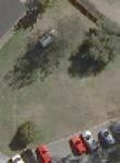
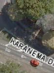
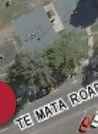
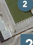
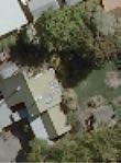
8 INTRODU CING HAVELOCK NORTHH DOMAIN LAND STATUS The Domain is classified as Recreation Reserve under the Reserves Act 1977 and comprises an area of hectares. NO 1 LAND PARCEL Town Section 87 Havelock CERT OF TITLE HBJ3/951 LAND STATUS Crown RESERVES ACT Recreation Reserve AREA This land parcel is shown on the map below, with additional, more detailed information included in Appendix 2. ST COLUMBA S CHURCH LAND PURCHASE Following public consultation via the Annual Plan process, Council resolved in November 2014 to purchase 1724m 2 of land from the Presbyterian Church Property Trustees. This purchase provided the opportunity to increase the size of the Havelock North Domain and provide an important link through to the Village Centre. Two separate titles will be issued in NO 2 LAND PARCEL CERT OF TITLE LAND STATUS Fee Simple RESERVES ACT Recreation Reserve AREA 1244m 2 3 Fee Simple Fee Simple 480m 2 There are two separate areas which were gazetted by the Crown at different times as component parts of the Domain, both of whichh are shown on the same certificate of title, CFR HBJ3/ /951. The first is Town Section 87 Havelock, an area of hectares bounded by Napier Road, Karanema Drive, Te Mata Road and the St Columba Church property. This is the area containing the sportsground, swimming pool, skatebowl, playground and Plunket rooms that the general public would regard as being all of The Domain. This area is shown on the map above, and was gazetted as a recreation reserve in The second area is an area that forms part of the land currently managed as Tainui Reserve. Its legal description is Lot 67 DP 7867 and it has an area of hectares. This area was gazetted as recreation reservee in 1952 as part of Havelock Domain. The current situation is therefore that Town Section 87 Havelock and Lot 67 DP 7867, although separated by more than a kilometre of residential land, are both held in one computer freehold register as land owned by the Crown as recreation reserve, but the control and administration of the reserve has been vested in the Hastings District Council (by means of local government amalgamation in 1989). Section 26A of the Reserves Act 1977 provides that where any administering body that is a territorial authority had, before 21 st January 1980 been appointed to control and manage any reserve classified under section 16 of the Act as a recreation reserve or local purpose reserve, that reserve shall, without further authority than this section, vest in that administering body. The way that the Department of Conservation has previously approached this issue is, upon request from a council, to publish a notice in the New Zealand Gazette revoking that council s appointment to control and manage the reservee and to vest the reserve in Council to be held in trust for the previously established purpose. A new title can then be issued. Council has applied to the Department of Conservation to vest both reserves in Council, and that two new titles be issued, one for the actual Domain and another one for the land which is physically administered as part of Tainui Reserve. DOMAIN GOVERNANCE As Havelock had no local body in the early days of its existence, apart from its Road Board formed in 1870, the locality was administeredd by the Hawke s Bay Provincial Council. When this Council was abolished in 1876, the Hawke s Bay County Council took over, and in 1894 also incorporated the road board. According to S W Grant, a board was formed to look after the reserve in He cites a Domain minute book, which was not referenced and unable to be located. After Havelock North formed as a Town Board in 1912, they requested (in June 1913) that the Domain be vested in the Town Board. The Commissioner of Lands assigned control to the Board in July When Havelock North was declared a Borough in 1952, the Domain came under the authority of the Borough Council, with the agreement of the Lands and Survey Department. The only Domain minute book that is known to exist is dated 1948 to 1957, but decisions related to the Domain passed through the ordinary minutes of the Havelock North Town Board and the Borough Council from The Borough Council in 1958 disbanded the Domain Board, and appointed a committee to look after the reserves it owned, ncluding the Domain. The Committee consisted of eight members: three Borough Councillors, four Sports Association members, and one from the Citizens Association. When land was needed for the bypass road through the Domain, the Council paid for the land taken, indicating the existence of a separate bank account relating to the Domain. Correspondence shows the existence of a Domain Board until at least the early 1970s. Upon local government reorganisation in 1989, management of the reserve passed to the new Hastings District Council. 8 HAVELOCK NORTH DOMAIN DRAFT RESERVE MANAGEMENT PLAN Part 1: Introduction & Background

 Children s")
 Open Event Area Plunket Society Building By a deed")


 the Domain was")

 had been obtained.")


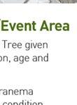
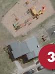
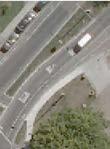
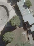
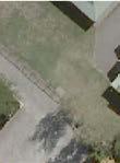
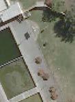
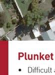
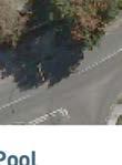
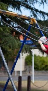
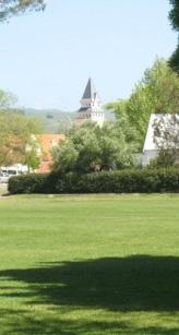
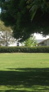
9 INTRODUCING HAVELOCK NORTH DOMAIN PHYSICAL DESCRIPTION The Domain is located between Napier Road, Te Mata Road and Karanema Drive. Most of the Domain is flat open space which is used for informal recreation. Current facilities and management areas on the Domain include (1) Children s Play Area; (2) Village Pool complex; (3) Plunket Society Building; (4) Cricket Pavilion and (5) Open Event Area Plunket Society Building By a deed datedd 1 August 1968 the Havelock North Borough Council granted a licencee of a part of the Domain to the Plunket Society for a period of 33 years from 28 November This licence contained one right of renewal, which will expiree in November When the Borough granted the licence to the Royal New Zealand Plunket Society in 1968 (but with effect from 28th November 1965) the Domain was administeredd under the provisions of the Reserves and Domains Act The Havelock North Borough Council Minutes for the Council meeting of 17th August 1965 note that written consent from the Minister (of Lands and Survey) had been obtained. The Plunket Rooms are therefore a validly established use on the Domain. The size and location of this building is not optimal in terms of the requirements of Plunket, and is located on valuable recreation land of the Domain. Council will continue to support Plunket in the continuation of their work within the Havelock North community. Children s Play Area The recreation area includes the children s playground and skate bowl. The play area is defined as a Key Urban Playscape and has a variety of brightly coloured play equipment, completed in The playground includes a combination piece, whale see saw and swings. The skateboard bowl was added in the 1990s. Cricket Pavilion Designed by Eric Phillips, the Pavilion opened on the Domain in In the early days, the cricket pavilion was a landmark and an important community resource. Historically it has been used for meetings by a variety of community groups ncluding swimming, tennis and football clubs. The pavilion was built overlooking the original cricket field before Karanema Drive was constructed and severed the land. Village Pool Complex Waimarama Surf Club train at the pools, and the Havelock North Swimming Club is based there. The complex is being increasingly used by local school groups. The pool was constructed in the 1920s. In the 1930s it was extended at one end and divided into a deep water pool, a learner s pool and a toddlers pool. The newer main lap pool was built in There is bleacher seating alongside the lap pool. Open Space/Event Area Current use of the open space area include the St Columba s Fair, Gypsy Fair, the Circus, Triple Peaks and other one off events. No formal sport is currently played on the fields, but it has in the past been used for soccer and athletics. The fire brigade use the reserve for training. There are four concrete pads indicating the underground water tanks on the reserve. Part 1: Introduction & Background HAVELOCK NORTH DOMAIN DRAFT RESERVE MANAGEMENT PLAN 9


.")


10 INTRODUCING HAVELOCK NORTH DOMAIN HISTORY Havelock (North added in 1910) was named and subdivided for sale in 1859 by Napier surveyor Henry Tiffin, after the Crown purchased an area of land known as Karanema s Reserve from locall Maori. It was common for most settlements in New Zealand to include a green space for recreation purposes, in line with the English Village Green concept. It is not known exactly when the Domain was referred to for the first time, but after is most likely, when it was registered under the Public Domains Act Up to that point it was known as the Havelock Recreation Ground. From earlier photographs, maps and recorded history, it appeared that the Domain extended to the land now occupied by the St John s Ambulance Hall, Boy Scouts Hut, Girl Guides Hut and kindergarten, but this land was privately owned by the Havelock North Town Board on a separate land title, and was likely purchased in the early 1900s. In June 1913 it was first discussed at a Havelock North Town Board meeting that a road linking Napier and Te Mataa Roads should be formed, but no location was given. In 1960 the Borough Council purchased from the Domain Board part of the Domain land for the bypass road and used its own land opposite the Domain up to the original location of the Havelock North Plunket Rooms which was on a separate land title facing Te Mata Road. In 1965, the Borough Council built the bypasss road. Land between the Havelock North Bridge and Napier Road for the bypass was purchased from the owners, after much negotiation. The Havelock North Plunket Rooms, which had opened on 5 March 1960 on Te Mata Road, stood in the way of the bypass road between Napier and Te Mata Roads (Appendix 1). Council began negotiations in 1965 with the Plunket Society, which resulted in agreement to shift their building to Havelock North Domain, near St Columba s Church. Approval was given by the Department of Lands and Survey to site the Plunket Society building as the land was a registered Domain. The bypass road was named on 31 January 1966 as Karanema Drive, reflecting the first name of the location at the time of the sale to the Crown. Minster of Lands MP Duncan McIntyre opened the road on 13 September Sections 77 (original domain land) and 83 (severed land) were combined in 1981 into Town Section 87, totalling ha. Sports The Domain has largely been used for rugby and cricket. The Havelock North Rugby Club used the Domain from the 1930s. The Havelock North Cricket Club requested use of the Domain for their games in the 1931/32 season when the cricket club reformed. The cricket club, which was struggling for funds, could not afford the rental of the Domain, and went into recess only two years later in The club was revived in the 1946/47 season, when a new concrete cricket wicket was built. Following the demise of the cricket club, the Athletics Association began to use the Domain in When Anderson Park was opened in the early 1960s both cricket and rugby moved to those sports grounds. Across the road from the Domain Baths, currently the St John s Ambulance Hall area, were once tennis courts and a croquet lawn. This was not part of the Domain land, and when Anderson Park opened up, the Tennis Club shifted there in 1965/66. Playground Playground equipment was donated by the Hastings Jaycees in Plans for a more elaborate playground weree offered by the Hastings Jaycees in 1973, but rejected by the Havelock Borough Council as it would have encroached on the playing field. A WWII Grumman Avenger aeroplane was given to the Borough Council for the playground in 1965 by the Jaycees, but was removed in 1974 and gifted to MOTAT in Auckland. Domain Swimming Baths A swimming pool was built on the Domain, with the permission of the Domain Board, and was opened by MP Sir George Hunter in November Havelock School principal P J Sefton was instrumental in raising funds for this project. The baths were extended when another pool was added as part of the province s centennial project in The second pool was opened in December The original pool was later divided in the 1960s into two pools, one being a diving pool and the other a learners pool. Other Uses of the Domain The Havelock North Fire Brigade has also been a long time user of the Domain for practice and demonstrations. Wet plugs were installed in the Domain in 1931 for the fire brigade to use instead of engine water tanks. St Columba's Church St Columba s Church is located adjacent to the Domain. The first St Columbas Church was situated on a property in Middle Road. The second St Columba s Church was built on Town Section 68 in The land was first owned by John Bray, but given to St Columba s by Peter McHardy, who had used the site for his Havelock Hotel. In August 1971, the present St Columba s Church was opened, replacing the 1894 building. St Columba s Churchh c1906 Hot Air Balloon, St Columba s Gala, HAVELOCK NORTH DOMAIN DRAFT RESERVE MANAGEMENT PLAN Part 1: Introduction & Background


11 INTRODUCING HAVELOCK NORTH DOMAIN KEY MANAGEMENT ISSUES Part 1: Introduction & Background HAVELOCK NORTH DOMAIN DRAFT RESERVE MANAGEMENT PLAN 11

12 OBJECTIVES AND POLICIES PART 2 OBJECTIVES AND POLICIES 12 HAVELOCK NORTH DOMAIN DRAFT RESERVE MANAGEMENT PLAN Part 2: s and


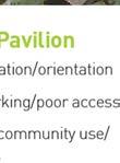
13 OBJECTIVES AND POLICIES STRATEGIC MANAGEMENT AIM AND OBJECTIVES The protection, management and enhancement of the recreation values of Havelock North Domain and its promotion as the recreation and outdoor event centre for the village. CHILDREN S PLAY AREA Improve the facilities, layout and safety of the existing playground to better cater for the needs of the local community Provision of new toilet facilities Provision of a Splash Pad and new Urban Skate Plaza VILLAGE POOL COMPLEX Improve entrance to Village Pool Complex and integration with the Domain PLUNKET SOCIETY BUILDING Continue to support the use of the Domain by Plunket in accordance with their lease, either (a) within its existing building; or (b) in a new facility that meets their needs. CRICKET PAVILION Improve the integration of the pavilion with the Domain by re- and seating activating the space around it. Pavilion will provide shade for parents and spectators observing the users of the skate plaza OPEN SPACE/EVENT AREA Encourage and facilitate use of the open space area as the outdoor event centre for the village Part 2: s and HAVELOCK NORTH DOMAIN DRAFT RESERVE MANAGEMENT PLAN 13
14 1.0 RECREATION RECREATION 1.1 USE OF RESERVES The Domain is classified as a Recreation Reserve under the Reserves Act, which means its purpose is to provide an area for the recreation and sporting activities and the physical welfare and enjoyment of the public, and for the protection of the natural environment and beauty of the countryside, with emphasis on the retention of open spaces and on outdoor recreational activities. The Domain is also categorised under the Reserves Strategy as a Community Reserve. s The primary purpose of the Domain is for community recreation use To allow and encourage the public use of the Domain in accordance with its classified purpose as a Recreation Reserve Ensure that the Domain remains as open space for informal recreation by the community The s and of Section 1.1 of the District Wide Reserve Management Plan related to the Use of Reserves shall also apply where relevant. 1.2 ORGANISED SPORT The primary purpose of the Domain is open space for informal recreation and leisure. The Domain is not currently used for any permanent sporting activities; however it is identified as an area that may be used on a one off permit basis by sporting codes for off season training. Historically the Domain was used for cricket in the summer, with cricket enthusiasts watching the game from the Pavilion. This type of organised sport is an acceptable use of the Domain, provided it is controlled to ensure its primary purpose is maintained. Any use of the Domain for organised events will require prior Council approval To ensure that the primary purpose of the Domain is maintained for informal recreation and encourage organised sport to take place on other reserves, specifically set aside for that purpose. 1.3 DOGS Many of the reserves within the District provide excellent areas of open space for people to walk their dogs. Dogs should however be under direct and continuous control by being on a lead at all times within parks, unless where it is a designated off lead area. These areas are identified in Part 9 Dog Control Bylaw The Domain is not a designated off lead area, therefore dogs must be on a lead at all times. This is due to the presence of the children s playground and use of the area by small children. Feedback from the public consultation and survey has shown that the Domain is rarely used for dog walking, and this is likely to be attributable to its size, lack of fences and proximity to three busy roads To allow dogs in the Domain in accordance with Council policy and bylaws Dogs are to be retained on a lead at all times Prohibit dogs, even if on a lead, from within 25m of the children s playground The s and of Section 1.3 of the District Wide Reserve Management Plan related to Dogs shall also apply where relevant. 1.4 HORSE RIDING The use of the Domain for riding horses is not appropriate, given its location and use for passive activities by the community. Horse riding is therefore not permitted on the Domain To prohibit horse riding on the Domain The s and of Section 1.4 of the District Wide Reserve Management Plan related to Horse Riding shall also apply where relevant Require any organised use of the Domain to obtain the prior approval of Council The s and of Section 1.2 of the District Wide Reserve Management Plan related to Organised Sport shall also apply where relevant. 14 HAVELOCK NORTH DOMAIN DRAFT RESERVE MANAGEMENT PLAN Part 2: s and


15 RECREATION 1.5 CYCLING While cycling has many positive health benefits it can create conflicts with other park users. It is important that people are aware of where cycling can be undertaken and that Council provide suitable facilities in those locations. Cycling is encouraged within the Domain, and dedicated walking and cycle paths will be provided through the Domain to facilitate access and use To provide for cycling on the Domain on pathways to ensure that unnecessary conflict is not created between pedestrians and other Domain users The s and of Section 1.5 of the District Wide Reserve Management Plan related to Cycling shall also apply. 1.7 RESTRICTED ACTIVITIES There are a number of activities that are not permitted on reserves due to their impact on amenity and the enjoyment of other users. These activities are restricted through Section 94 of the Reserves Act and through Council bylaws. Breaches of bylaws can result in court imposed fines, confiscation of equipment or court orders for various purposes. Relevant bylaws include: Part 9 Dog Control Bylaw Part 12 Mobile Shops and Traders Bylaw Part 14 Public Places Bylaw Part 15 Recreation and Cultural Facilities Bylaw Part 24 Public Places Liquor Control Bylaw In addition to those activities restricted under the Reserves Act and Council bylaws, specific activities are also restricted under this management plan due to their potential impact on the unique characteristics of the reserve. 1.6 MOTORHOMES & CAMPING Self contained motorhomes are not permitted on the Domain, given its use for community and sporting events which rely on the open grassed area which is fenced for security and amenity Overnight camping on the Domain is not permitted due to the use of it for community and sporting events which rely on the open grassed area To prevent activities from occurring that have an adverse impact on the natural environment and amenity values of the Domain or significantly detract from the enjoyment of other reserve users The s and of Section 1.7 of the District Wide Reserve Management Plan related to Restricted Activities shall also apply The s and of Section 1.6 of the District Wide Reserve Management Plan related to Motorhomes & Camping shall also apply. Part 2: s and HAVELOCK NORTH DOMAIN DRAFT RESERVE MANAGEMENT PLAN 15
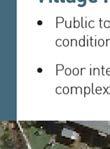
16 2.0 FURNITURE & FACILITIES FURNITURE & FACILITIES 2.1 DEVELOPMENT There is scope for further development on the Domain to provide enhanced facilities to increase the enjoyment and use by the community. s To ensure that any development meets the needs of approved use and users without significant adverse effects To ensure that any new development respects and protects the character of the Village, promotes linkages, improves accessibility and promotes good urban design principles To ensure that any new buildings are designed to be more environmentally sustainable in terms of their function, design and long term maintenance and are sympathetic to, and compliment the character of the Havelock North Village and adjacent St Columbas Church Ensure that any future development on the Domain is consistent with the Concept Plan The s and of Section 2.1 of the District Wide Reserve Management Plan related to Development shall also apply where relevant. 2.3 FENCES & WALLS Bollards are currently located around the perimeter of the Domain to restrict vehicle access. While functional, they do little to enhance the amenity or character to the Domain. In addition, there is a need to provide fencing around the proposed new Splash Pad and children s playground, given its close proximity to Te Mata Road. It is proposed to construct seating walls of limestone around the perimeter of the Domain, children s playground and walkways for functionality, security and amenity. These walls will replicate those at the adjacent Community Centre, and enhance the village green character of the Domain To erect fences and walls where required to ensure that the Domain can be used safely while enhancing or complimenting the Village Green character Construct seating walls of limestone for safety, security and amenity The s and of Section 2.3 of the District Wide Reserve Management Plan related to Fences & Walls shall also apply where relevant. 2.2 BUILDINGS & STRUCTURES It is proposed to provide new public toilets to replace the existing facilities which are in poor condition. Any new facility will be designed to be in keeping in scale and character with the surrounding environment. The Plunket Society holds a ground lease with Council for 33 years from 1988 to October 2031, to enable the occupation of its building on the Domain. While the existing building however does not currently meet the needs of Plunket staff and visitors (in terms of quality, size and inadequate parking), in the absence of funding for alternative premises, and until a review of all Hastings services is complete, they wish to retain their presence on the Domain. This building is however located on land within the Domain that is required to enable the expansion of the children s recreation area. Council will therefore work with the Plunket Society to support their presence within Havelock North in alternative premises in order to meet the needs of both the Society and the community. The existing cricket pavilion will be retained on site in recognition of its historical links to the community and Domain. 2.4 LIGHTING Current lighting in the Domain around the skatebowl and public toilets comprises two strong flood lights on tall poles. The quality of this lighting is poor as it is harsh, casts strong shadows and leaves significant areas without sufficient light, both for security purposes and for amenity To provide new feature lighting to provide safe night use along new pathways and other amenity areas The s and of Section 2.4 of the District Wide Reserve Management Plan related to Lighting shall also apply To ensure that any development on the Domain meets the needs of approved use and users without significant adverse effects on other users, the reserve, or neighbouring properties Work with the Plunket Society to facilitate the provision of alternative premises either within the Domain or Havelock North The s and of Section 2.2 of the District Wide Reserve Management Plan related to Buildings and Structures shall also apply where relevant. 16 HAVELOCK NORTH DOMAIN DRAFT RESERVE MANAGEMENT PLAN Part 2: s and
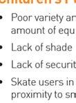
17 FURNITURE & FACILITIES 2.5 PLAYGROUNDS Hastings District Council s Play Strategy Hastings Coming Out to Play, identifies opportunities for play in the District over the next 10 years. It identifies 3 categories of playscapes: Premier, Key Urban and Neighbourhood. The Domain is identified as a Key Urban Playscape. Key Urban Playscapes should cater to a range of users and have a minimum of 5 play components. They will serve a residential area of approximately 10,000 people and provide large scale areas for both active and passive recreation as well as acting as gathering points for social interaction. The playground in the Domain located adjacent to the skatebowl and has a variety of brightly coloured play equipment. Latest additions to the playground were completed in The main issue with the existing playground is that it is located close to the skatebowl which can result in conflict between the two user groups. There is also a lack of shade and shelter for users and caregivers. Given the prominence of the Domain within the Village, and its value as a premier park, it is intended to upgrade the existing playground to incorporate additional play features, and provide shelter and safety fencing around the perimeter. Given the success of the water features at Cornwall and Flaxmere Parks, it is also proposed to construct a Splash Pad as part of the improved playground To develop and provide for enhanced opportunities for children s play within the Domain To ensure that the play equipment in the Domain meets the needs of reserve users and is in keeping with the characteristics and amenity of the surrounding area. 2.6 INFORMAL SPORTING ACTIVITIES The reserves within the District are used for a number of informal sporting activities, including basketball and skateboarding. Council needs to take these activities into account in the forward planning of reserves, to ensure that adequate provision is made for these activities, while taking into account the potential impact of these activities on the reserves, reserve users and adjoining neighbours. The current skate facility at the Domain is in poor condition. The surface is exposed, joints are uneven, and geometries in parts of the bowl are poor. There is also concern about young children obstructing the activity, given its close proximity to the children s playground. Consultation has shown support for the retention of an upgraded and improved skate facility in the Domain To provide a new enhanced skate facility Replace the skatebowl with a new urban skate facility to ensure its continued use by the local community The s and of Section 2.6 of the District Wide Reserve Management Plan related to Informal Sporting Facilities shall also apply where relevant Enhance the existing playground to provide: (a) (b) (c) (d) Additional playground equipment Splash Pad Enhanced urban skate area Shade and shelter The s and of Section 2.5 of the District Wide Reserve Management Plan related to Playgrounds shall also apply where relevant. Part 2: s and HAVELOCK NORTH DOMAIN DRAFT RESERVE MANAGEMENT PLAN 17

18 FURNITURE & FACILITIES 2.7 TOILETS & CHANGING FACILITIES The current toilet facilities form part of the Village Pool complex, and are in poor condition. It is proposed to construct a new toilet block adjacent to the children s playground, to better meet the needs of Domain users The s and of Section 2.8 of the District Wide Reserve Management Plan related to Signs shall also apply where relevant To ensure that the toilet facilities are safe, adequate, accessible to the whole community and comply with appropriate legislation To provide a new toilet facility within the Domain The s and of Section 2.7 of the District Wide Reserve Management Plan related to Toilets & Changing Facilities shall also apply where relevant. 2.9 RESERVE FURNITURE Reserve furniture provides a range of opportunities and settings for users of reserves, and enhances experience by providing facilities for rest, picnicking and services (rubbish bins). Reserve furniture may include tables and seating, rubbish bins and drinking fountains. Council has recently adopted a standard bin and seat design that will give consistency in reserve furniture being installed and improve amenity. All new and replacement furniture will be in this new design, that incorporates stainless steel for its endurance and robustness, unless a unique and individual design is specifically requested by the community that is cost effective and durable. It is proposed that additional seating and picnic tables will be installed given the intended higher use of the Domain with the proposed improvements. 2.8 SIGNS Council has prepared a Reserve Sign Guidelines that will ensure consistency and improve amenity. Unless specifically stated in a Reserve Management Plan, all signs shall be in accordance with the policies included within this Plan when adopted. Remote advertising is generally not acceptable; however, Council will consider applications on a case by case basis. Advertising without Council consent will be classified as an encroachment (See Section 5.10). While Council has adopted a standard design for all reserve name signage throughout the District, there is the ability for the community to request a unique identity for the Domain signage to be adopted. s To minimise visual clutter while maximising necessary and useful information to users of the Domain To provide for new signs on the Domain only where required and appropriate. s To provide new and replacement reserve furniture to facilitate the public use and enjoyment of the Domain To ensure that all new and replacement furniture is of the approved standard design, except where an alternative has been specifically requested by the community and approved by Council To provide additional reserve furniture within the Domain to enhance the use and enjoyment of it The s and of Section 2.9 of the District Wide Reserve Management Plan related to Reserve Furniture shall also apply where relevant Allow signage that is related to the reserve or the use of the Domain only Prohibit the use of the Domain for the remote advertising of events that are not being held on the Domain, without the consent of Council. 18 HAVELOCK NORTH DOMAIN DRAFT RESERVE MANAGEMENT PLAN Part 2: s and
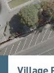
19 FURNITURE & FACILITIES 2.10 VEHICLE PARKING Current vehicular access to and from the Domain is via an accessway next to the Plunket building, which can be used by vehicles when events are being held, and maintenance vehicles. As there is no formal carpark on the Domain, users currently park either along Te Mata Road or Napier Road. These parks are time unlimited, and therefore usually occupied all day. In addition, parents and caregivers find the angle parking along Te Mata Road difficult with young children. Council has a partnership with the St Columba s Church to construct a carpark that may be used by Domain users at those times not required for church purposes. These carparking spaces will provide easy and safe access for those people wishing to use the Domain. It is also proposed to alter the layout of Te Mata Road to change the existing parallel parking spaces to angle parking to increase provision and ease of use. s To improve the carparking layout along Te Mata Road for enhanced safety and accessibility To provide off street carparking for reserve users in a carpark adjacent to St Columba s Church, at those times when not in use by the Church The s and of Section 2.10 of the District Wide Reserve Management Plan related to Vehicle Parking shall also apply where relevant ACCESS Access to and through features of interest is an important consideration in the management of the Domain. Pedestrian access and circulation within a reserve needs to be appropriate and safe. It also needs to allow access to the variety of facilities that are located within reserves. Many people have restricted mobility (such as wheelchairs and prams) that makes it difficult to gain access to and through the reserves of the District. Council will ensure there are facilities within the Domain to cater for people with restricted mobility To provide access to people of all ages and abilities to and through the Domain Provide safe access to and through the Domain The s and of Section 2.11 of the District Wide Reserve Management Plan related to Access shall also apply where relevant WALKWAYS & CYCLEWAYS The Council Walking and Cycling Strategies encourage healthy and alternative travel, which are supported by Council s wider Play Strategy. Walkways and cycleways provide access through reserves and can provide alternatives to using the road network. Vehicular access to and from the Domain is via an access way next to the Plunket Building (adjacent to Te Mata Road). It is used by vehicles when an event is held at the Domain and Council maintenance vehicles. Other users of the Domain park in the car parking spaces on adjoining roads. Pedestrian access and circulation within the reserve needs to be appropriate and safe. It also needs to allow access to the variety of recreational and leisure resources. Access from the playground to Te Mata Road between the Plunket Building and the church car park is difficult for prams, being a soft surface and slightly uphill Access to people of all ages and abilities will be provided to and through The Domain where possible Develop safe and accessible walking tracks through and around the Domain to improve access The s and of Section 2.12 of the District Wide Reserve Management Plan related to Walkways & Cycleways shall also apply where relevant. Part 2: s and HAVELOCK NORTH DOMAIN DRAFT RESERVE MANAGEMENT PLAN 19


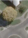
20 3.0 N NATURAL VALUES ATURAL VALUES 3.1 TREES & GARDENS The Domain is largely open green space, with a number of trees planted around the perimeter, of different variety and condition. Theree is a high hedge that separates the Domain from St Columba s Church, which causes safety concerns and creates a visual barrier. There is a large Blue Gum treee located within the land that Council has recently acquired as an extension to the Domain, from the St Columba s Church. This tree is protected under the Hastings District Plan. The tree has most recently been assessed as a moderate level risk to the users of the area beneath the trees. 3.2 LANDSCAPE A key focus of reserves is on the visual and natural qualities of the area. There are spectacular panoramic views from some reserves that enhance the experience and enjoyment of the visitor. Development, natural re growth and re vegetation programmes can diminish and obliterate thesee views, and need to be sensitively managed to retain their amenity. The landscape features found within the Domain are that of a community park located within the centre of the village. It consists of a large grassed area of open space, with views up to Te Mata Peak, and towards the Village To provide a range of natural shade and shelter opportunities within the Domain To provide for healthy gardens environments which provide attractive settings for the users of the Domain To remove those trees along the Napier and Karanema Road frontages which are in poor condition and replace with a consistently themed avenue of trees Ensure that any planting, replacement or removal of any trees or shrubs within the Domain is consistent with the aims of the Concept Plan identified in Appendix The s and of Section 3.1 of the District Wide Reserve Management Plan related to Trees & Gardens shall also apply where relevant. s To protect significant landmarks, landscapes and views within the Domain to the surrounding landscape To ensure that any building development on the Domain does not visually compromise any views or landscape features The s and of Section 3.2 of the District Wide Reserve Management Plan related to Landscape shall also apply where relevant. 3.3 WATER The HBRC is primarily responsible for the management of our water resources, including the coast, streams, lakes and wetlands. There are no watercourses in the Domain, however a children s Splash Pad is proposed in the vicinity of the children s playground To provide a Splash Pad in the vicinity of the children s playground The s and of Section 3.2 of the District Wide Reserve Management Plan related to Landscape shall also apply where relevant. 20 HAVELOCK NORTH DOMAIN DRAFT RESERVE MANAGEMENT PLAN Part 2: s and


21 NATURAL VALUES 3.4 BIODIVERSITY The reserves of the District contain a variety of ecosystems and natural habitats that are unique to the area. The enhancement of these areas is required to maintain a balance between public use and protection. The Domain is not identified by the Department of Conservation as a Protected Natural Area or a Recommended Area for Protection To protect any native flora and fauna on the Domain The s and of Section 3.4 of the District Wide Reserve Management Plan related to Biodiversity shall also apply where relevant. 3.5 PLANT & ANIMAL PESTS There are many plant and animal pests within the District that if left uncontrolled, can have an impact on the viability and survival of indigenous plants or animals, or the sustainability of natural and developed ecosystems, ecological processes and biological diversity. Being located within the urban environment, the impact of plant and animal pests on native flora and fauna is less of an issue than those reserves surrounded by rural land uses where goat and possums represent a large threat. Council will work in conjunction with the Hawkes Bay Regional Council and control any pest species when they do represent a threat to the native flora and fauna within the Domain. 3.6 NATURAL HAZARDS In order to manage the use, protection and development of reserves within the District, Council needs to be aware of natural hazards, and their potential impact on the use and safety of these areas of public open space. Flooding, coastal inundation and erosion/land instability are the main natural hazards that can occur in areas of the Hawkes Bay region that are likely to impact on reserves. While this plan does not specifically address these issues, the emphasis is on avoidance rather than protection. The Domain is in an identified moderate liquefaction zone in the Proposed District Plan To assess the risks of natural hazards on Council facilities and visitors to the Domain To identify and minimise the effects of natural hazards on the Domain Require the siting of facilities and planting on reserves to have regard to avoiding natural hazard threats Ensure that the development or use of any reserve does not exacerbate the adverse effects of natural hazards The s and of Section 3.6 of the District Wide Reserve Management Plan related to Natural Hazards shall also apply where relevant To manage and control animals, pests and plants identified in the Hawkes Bay Regional Council Plant Pest Management Strategy To control other animal, plants or pests where reserve values are threatened and as prioritised The s and of Section 3.5 of the District Wide Reserve Management Plan related to Plant & Animal Pests shall also apply where relevant. Part 2: s and HAVELOCK NORTH DOMAIN DRAFT RESERVE MANAGEMENT PLAN 21
22 4.0 SOCIAL & CULTURAL VALUES SOCIAL & CULTURAL VALUES 4.1 CULTURAL & HERITAGE SIGNIFICANCE A number of parks within the District contain sites of heritage significance, such as buildings, landscapes, structures, archaeological sites and trees. Many of these are listed in the Historic Places Trust Register, and include registered historic places, historic areas, registered Waahi Tapu sites and recorded archaeological sites. Trees of outstanding heritage values are also identified under the Notable Trees Registration Scheme. Many of these heritage resources have protection under the Historic Places Act, or the District Plan. None of the buildings located on the Domain are currently registered as Historic Buildings by the New Zealand Historic Places Trust. There is one Outstanding Tree within the Domain, a Blue Gum. There are no other trees currently located within the Domain that are worthy of protection under the provisions of the District Plan or Notable Tree Register Ensure that any identified sites of heritage and cultural significance are protected and maintained The s and of Section 4.1 of the District Wide Reserve Management Plan related to Cultural and Heritage Significance shall apply where relevant. 4.2 TANGATA WHENUA Many activities on reserves within the District, as well as their features, are particularly important to local hapu. These include not only the protection of waahi tapu and sites of historical significance, but also the value of reserves as places for gathering food, rongoa and materials for crafts such as weaving and carving. The Domain is within the boundary of Karanema Reserve. The mana of Karanema Reserve is the legacy of the descendants of Heiporo maintained by the hapu, Ngati Mihiroa. The marae is Mihiroa located at Paki Paki. Council will consult the relevant hapu in the future development and management of the Domain Consult relevant hapu in the future development and management of the Domain The s and of Section 4.2 of the District Wide Reserve Management Plan related to Tangata Whenua shall also apply where relevant. 4.3 ART The Landmarks philosophy has been adopted by the Council to promote civic pride through the enhancement of the natural and built environment. Part of this philosophy is to use art, especially within the urban environment, to develop an element of style within the District, and in turn, civic pride. Art is a great mechanism to attract community response and develop civic pride by creating an environment of diversity, vibrancy and cultural sophistication. It is generally associated with permanent installations like painting, sculpture or carving. Art within reserves also increases interest and enjoyment of the environment and assists in the reduction of graffiti. Council will work with the community and local artists on the provision or commission of public art installations within the Domain Provide opportunities for the community to contribute to creating unique features within the Domain such as art works, carvings, local history markers or information boards The s and of Section 4.3 of the District Wide Reserve Management Plan related to Art shall apply where relevant. 4.4 COMMUNITY PARTNERSHIPS The management of the Domain must be responsive to the community, with respect to identity and sense of place in order to account for: A sense of community ownership Appreciation of the Domain and fostering civic pride The development and management of the Domain to acknowledge social diversity within the community Council will actively work with those school and community groups who use the Domain, to ensure that it caters for the needs and values of the whole community. Council will encourage representatives of the community to take an active part in supporting the Concept Plan, to embed and sustain community identity, interest and ownership in the park To ensure that the Domain caters for the needs and values of the community The s and of Section 4.4 of the District Wide Reserve Management Plan related to Community Partnerships shall apply where relevant. 4.5 COMMEMORATIVE FEATURES Members of the public frequently make requests to place commemorative features on parks and reserves. Whilst such commemorations can assist in developing community values and mark important historic events, the location and number of such features must be managed. Commemorative features can add cost to the ongoing maintenance of reserves, and can cause difficulties when the features are damaged, vandalised or require significant maintenance. Council needs to be in a position to control the nature, number and location of such features. In 2013 a tree and plaque was installed along the Napier Road frontage to commemorate Graeme Lowe, who was instrumental in his support of the Havelock community. The community consultation has raised the potential to continue a memorial walk of trees along the Napier Road and Karanema Drive frontages of the Domain, given the current poor condition and location of the existing trees To consider any request for bequeathed land, gifts and commemorative features to ensure that they are managed in a sustainable manner and are beneficial to the Domain and wider community The s and of Section 4.5 of the District Wide Reserve Management Plan related to Commemorative Features shall apply where relevant. 22 HAVELOCK NORTH DOMAIN DRAFT RESERVE MANAGEMENT PLAN Part 2: s and


23 5.0 ADMINISTRATION & MANAGEMENT ADMINISTRATION & MANAGEMENT 5.1 MANAGEMENT & MAINTENANCE The management and operation of the Domain is undertaken collectively between the Strategic Asset Management staff and the Parks Maintenance Group. Most routine maintenance is carried out under a Parks and Sportsgrounds Service Level Agreement. The management of the Domain must take into account the objectives and policies of this Management Plan. The primary mechanism by which the provisions of this management plan will be implemented is through the Council LTP and more specifically the Asset Management Plan. This specifies the works and actions which will be undertaken in any financial year. s To maintain the Domain to a standard that gives all members of the community access to an environment to meet their recreational needs To implement the provisions and actions of this Management Plan in a structured and integrated manner through the Asset Management Plan and Long Term Plan 5.2 SUSTAINABILITY Council will endeavour to incorporate sustainable practices into the development and management of the Domain. The key management objective for this reserve is about maintenance and enhancement of the existing area and protection of natural values. To this end, sustainability is already occurring, with the provision of a premier park within the District for future generations to enjoy Incorporate sustainable practices into the provision, management and development of the Domain wherever practicable The s and of Section 5.2 of the District Wide Reserve Management Plan related to Sustainability shall apply where relevant The Hastings District Council is primarily responsible for the maintenance and management of the Domain The Domain will be maintained and managed to the levels of service identified in the Parks and Sportsground Service Level Agreement The s and of Section 5.1 of the District Wide Reserve Management Plan related to Management and Maintenance shall apply where relevant. Part 2: s and HAVELOCK NORTH DOMAIN DRAFT RESERVE MANAGEMENT PLAN 23


, in the absence of funding for alternative premises, and")

24 ADMINISTRATION & MANAGEMENT 5.3 CONCESSIONS: LEASES, LICENCES & PERMITS Any person, organisation or company wishing to occupy any part of the Domain requires a concession agreement between themselvess and the Council. In undertaking its role in providing recreational opportunities to the community, Council provides leases, licences and permits of land and/or buildings to a wide range of groups undertaking a variety of activities on the reserve. Applications for concessions on the Domain must meet the statutory requirements defined in the Reserves Act, as well as the objectives and policies of this Plan. Leases will be issued where a person or organisation requires the exclusive long term use of a building or land on the Domain, while a Licence will be issued for the non exclusive use of a building or land on the Domain. Both leases and licences can be issued for a maximum of 18 years. Permits will be issued for activities or events to occur on the Domain where the use is non exclusive and temporary. Local community and Commercial Permits will be issued for a maximum of 3 consecutive days. Further information on the types of concessions is provided in Section 5.3 of the District Wide Reserve Management Plan. LEASES The Plunket Society holds a lease with Council for 33 years from 1988 to October 2031, with no right of renewal. While the existing building does not currently meet the needs of Plunket staff and visitors (in terms of quality, size and inadequate parking), in the absence of funding for alternative premises, and until a review of all Hastings services is complete, they wish to retain their presence on the Domain. The relocation of the building, or facilitation of alternative premises for the Society would however provide the opportunity to optimise and increase the size of the children s playground area. LICENCES/PERMITS The Domain does not contain any of the District Sportsfields and therefore no licences will be issued to sporting codes to occupy the Domain for either the winter or summer sporting season. The Domain is however identified as an acceptable alternative venue for use by sporting codes for training purposes or one off tournaments outside of their specified seasons. Permits must be issued for such use, and will be determined by Council on a case by case basis. The use of the Domain for temporary events is controlled via rules in the Proposed District Plan. This allows for up to 12 temporary events of a commercial nature per year, and up to 24 temporary events of a local community nature per year. The number of people permitted to attend such events is unlimited. The Domain has traditionally been used throughout the year by a number of commercial events such as the Zirka Circus and Tinkers and Traders; as well as local community events such as The Big Easy, Triple Peaks and St Columbas Church Fair. More recently music and jazz events have been successfully introduced in this community space. Te provision of a formal event space and services is likely to increase the popularity of this space for such events Allow unlimited permits to be issued per year on the Domain provided that the use is compatible with the designated purpose of the reserve Continue to support the use of the Domain by Plunket in accordance with its lease, or facilitate its relocation to a new facility that meets their needs in order to optimise the size of the children s playground Permits will be issued for commercial or local community activities to occur on the Domain where the use is non of 3 exclusive and temporary and for a maximum period consecutive days The s and of Section 5.3 of the District Wide Reserve Management Plan related to Concessions shall apply wheree relevant. s To allow for the occupation of the Domain for approved uses and facilities by the granting of a lease, licence or permit To control the leasee agreements to ensure the most effective use of the Domain for the enjoyment of the whole community To allow the use of the Domain for special activities and events where compatible with its primary purpose. 24 HAVELOCK NORTH DOMAIN DRAFT RESERVE MANAGEMENT PLAN Part 2: s and
25 ADMINISTRATION & MANAGEMENT 5.4 RENTAL & CHARGES In granting leases, licences and permits, Council has a right to charge those who benefit from the Domain and its facilities, and has a rental policy for buildings on Council parks and reserves. This identifies three categories of lessees (1) Sporting/Recreation Groups; (2) Community Groups; and (3) Commercial Users with associated tiered rental charges. The Council sets fees and charges for the short term use of Council reserves in the form of permits and licenses on an annual basis as part of its annual planning process. In the granting of any leases, licences and permits for activities on the Domain, Council will set fees and charges in accordance with its rental policy. 5.6 TITLE & RESERVE CLASSIFICATION Any land that has the status of reserve subject to the Reserves Act must have a classification. Classification is a mandatory process under Section 16 of the Reserves Act which involves assigning a reserve (or parts of a reserve) to the appropriate class. The class determines the principal or primary purpose of the reserve. The Domain is classified under the Reserves Act 1977 as Recreation Reserve. The community consultation has identified a desire to rename the Domain as the Havelock North Village Green, to more accurately define the purpose and use of the space. s To recover costs to the Council and community for the processing of applications and managing the Domain To ensure that all leases on Council buildings are identified and being charged in accordance with Council policy for consistency and transparency The s and of Section 5.1 of the District Wide Reserve Management Plan related to Rental and Charges shall apply where relevant. 5.5 NETWORK UTILITIES Reserves are often seen by Utility Operators as convenient places to locate infrastructure such as drains, water supply and electricity substations. However, such infrastructure can have an adverse impact on the character of a reserve and its open space qualities and make the maintenance of a reserve more difficult and costly. Section 48 of the Reserves Act requires that all services through, or rights of way over land held under the Act, to service, or benefit a third party located outside a particular reserve be laid or constructed within a formal easement registered on the title of the reserve. Provision exists under the Act for Council to approve such applications, where the easement is not going to materially alter or permanently damage the reserve, and the rights of the public in respect of the reserve are not likely to be permanently affected by the establishment and lawful exercise of the easement. Prior to granting an easement over a Council reserve, Council will determine whether public consultation is required, and consider the potential impact of the easement on the amenity and existing development of the reserve, as well as the potential impact on any future development of the reserve. s To only allow network utilities to locate on the Domain where the effects can be remedied or mitigated To minimise the impact of utilities on the public use, enjoyment or general visual amenity of the Domain Ensure that any change in reserve classification follows the process outlined in the Reserves Act Rename the Domain as the Havelock North Village Green The s and of Section 5.3 of the District Wide Reserve Management Plan related to Title and Reserve Classification shall apply where relevant. 5.7 FUTURE RESERVE ACQUISITION Council needs to consider the future acquisition of reserve land whether through actual purchase, reserve contribution funding, or resource consent subdivision. The Reserves Strategy identifies existing reserve resources, analyses current and future demand for reserves, public amenities and open space, and identifies current deficiencies and future needs for each type of reserve by community. The Domain is bounded on all sides by road reserve or land held in ownership by the St Columba s Church Property Trustees. In 2015 Council purchased 1725m 2 of land from the Trustees to form part of the Domain, to guarantee future connections and linkages through to the Village To acquire future reserve land that provides for enhanced community recreation space and improved accessibility and connectivity from the Village Centre The s and of Section 5.7 of the District Wide Reserve Management Plan related to Future Reserve Acquisition shall apply where relevant Any upgrades of or installation of future public utilities that may cross the Domain are to be located underground The s and of Section 5.5 of the District Wide Reserve Management Plan related to Network Utilities shall apply where relevant. Part 2: s and HAVELOCK NORTH DOMAIN DRAFT RESERVE MANAGEMENT PLAN 25
26 ADMINISTRATION & MANAGEMENT 5.8 SALE OF RESERVES A number of statutes afford a level of protection over the sale of park land, such as the Local Government Act 2002 which requires public consultation, and the Reserves Act which requires the consent of the Minister of Conservation prior to sale (if the reserve is vested under the Reserves Act). However public submissions to the Long Term Plan in 2004 raised concern over the potential sale of Council parks. This resulted in a Council resolution to afford a greater level of protection to the premier parks of the District. The Domain is identified as one of the premier parks of the District which is reflective of its history, size, prominence and use by the community. As a premier park, ownership will be retained with the Council in accordance with the requirements of Section 5.8 of the District Wide Reserve Management Plan. s To ensure that any revocation and sale of reserve land follows the due process as outlined in the Reserves Act To identify the Domain as one of the premier parks of the District The s and of Section 5.8 of the District Wide Reserve Management Plan related to Sale of Reserves shall apply where relevant. 5.9 RESERVE BOUNDARIES Council will work actively with owners of land adjoining reserve land to ensure the efficient and effective management of the reserve. The Domain shares its northern, southern and western boundaries with Napier Road, Te Mata Road and Karanema Drive. To the east it adjoins private property in the ownership of the St Columbus Church To encourage neighbours to be responsive to reserve issues To allow Council as an affected party to give approval for any adjoining proposal where there is no adverse effect on the reserve values or use The s and of Section 5.3 of the District Wide Reserve Management Plan related to Reserve Boundaries shall apply where relevant ENCROACHMENT An encroachment is the use of the Domain for private purposes which have not been authorised by Council. This includes structures, earthworks, gardens, plantings, access ways, retaining walls and other uses that give the appearance of private ownership, such that the public are discouraged from using that portion of the reserve. Problems with encroachments are exacerbated when properties are sold without the purchaser realising that land they believe they are buying is actually part of the reserve. New encroachments will not be permitted because they impact on reserve values. Council may seek removal of existing encroachments without formal agreements, where they adversely impact on reserve values. There are currently no formal agreements authorising any adjoining property owners to use any part of it for private purposes To allow no new encroachment on the Domain from adjoining properties without Council consent The s and of Section 5.10 of the District Wide Reserve Management Plan related to Encroachment shall apply where relevant SAFETY & VANDALISM The Domain is widely used by responsible members of the community who use it for the purpose for which it is intended. It can however be an area where anti social behaviour occurs, due to its location close to the village centre. It is important that the Domain remains safe and enjoyable for all, so the Council does all it can to reduce incidents of anti social behaviour in this area. Regular maintenance inspections are undertaken by Council and its service contractors to ensure that playground equipment and other reserve infrastructure meet safety standards. A Safety Audit of the Domain was carried out in 2010 to identify safety issues and operational recommendations to alleviate them, where possible. The Concept Plan incorporates many of these recommendations. s To minimise the incidence of vandalism to play equipment and other structures within the Domain To maintain the integrity and safety of park assets and structures To ensure as far as practicable the personal safety of reserve users The s and of Section 5.11 of the District Wide Reserve Management Plan related to Safety and Vandalism shall apply where relevant. 26 HAVELOCK NORTH DOMAIN DRAFT RESERVE MANAGEMENT PLAN Part 2: s and
27 ADMINISTRATION & MANAGEMENT 5.12 PROMOTION To ensure that the Domain is not under utilised, it is important that Council promotes the use of it and the recreational opportunities it provides. Promotion is seen as important to ensure maximum community benefit is achieved from the provision and maintenance of the Domain. Promotion can be undertaken a number of ways such as on the Council s website, press releases and pamphlets, the development of information brochures, providing maps and interpretation panels. Signage is also an important method to advertise the location and facilities within a reserve. Given its location on a prominent corner site, within the centre of Havelock North Village, the Domain forms a central part of the village character, and is widely used by local residents To provide quality promotional communication for access to and information on the Domain The s and of Section 5.12 of the District Wide Reserve Management Plan related to Promotion shall apply where relevant REVIEW & MONITORING All parts of this Reserve Management Plan will be kept under a continuous review in order to be able to adapt to changing circumstances or to adapt in accordance with increased knowledge. Notwithstanding this, a full review will be undertaken ten years from the final date of approval by Council of this Plan. s To keep this Management Plan under continuous review in accordance with the Reserves Act To review this Management Plan regularly in order to conserve, maintain and enhance the values and character of the Domain Review this Plan every ten years. In the interim, Council may determine to review part of, or the entire plan, in response to: (a) (b) (c) (d) information from monitoring which indicates the need for a review or change; the identification of new management issues or problems for which policy is required; changes in national policy including new or amended laws, regulations or other actions; policy changes Publicly notify any review or change to this Management Plan as detailed in Sections 41(5)(a) 41(6)(a) and 119(1)(c) of the Reserves Act Annually review the Proposed Development programme component of this Reserve Management Plan. Part 2: s and HAVELOCK NORTH DOMAIN DRAFT RESERVE MANAGEMENT PLAN 27
28 6.0 ACTION PLAN ACTION PLAN The following table identifies that required actions that have evolved out of the objectives and policies identified in this Reserve Management Plan. NO. ACTION POLICY # 1 Limestone seating walls for amenity and seating Park Lighting Splash Pad Enhanced Children s playground Shade Structures New Urban Skate Park New Public Toilets Provide Park Furniture Angle parking and safe pedestrian crossing thresholds Provide walking paths through and around the Domain Replace poor tree species along the Napier Road and Karanema Drive and replace with consistent themed edge Consider and provide for the future of the Blue Gum Tree HAVELOCK NORTH DOMAIN DRAFT RESERVE MANAGEMENT PLAN Part 2: s and


29 APPENDIX 1: HISTORICAL PLANS PART 3 APPENDICES Part 3: Appendices HAVELOCK NORTH DOMAIN DRAFT RESERVE MANAGEMENT PLAN 29


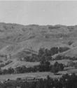


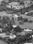
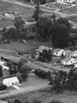

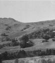


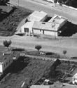


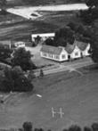
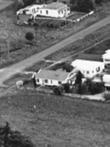
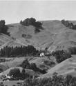

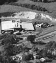


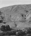


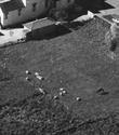


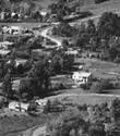
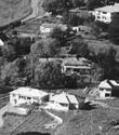
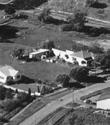
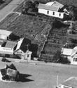


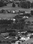


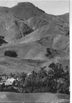
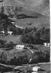

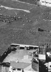
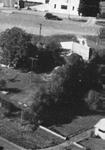
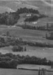

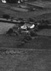

30 APPENDIX 1: 1 HISTTORIC CAL PLA ANS Havelock CB BD 1947 Havelock No orth Domain HAVELOCK NOR RTH DOMAIN DRAFT REESERVE MANAGEMENT PLAN Part 3: Appendices


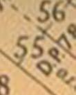


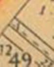


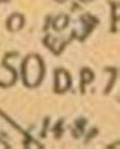
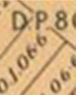


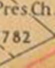
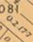


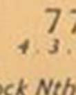


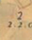


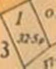


31 APPENDIX 1: HISTORICAL PLANS Havelock North 1952 showing the correct boundaries of the Domain before the bypass road. Note the existence of the road reserve, with Karanema St retrospectively hand written, and an outline of the bypass road (now Karanema Drive). D. P was owned by the Havelock North Town Board, and not part of the Domain. Part 3: Appendices HAVELOCK NORTH DOMAIN DRAFT RESERVE MANAGEMENT PLAN 31


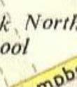


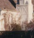


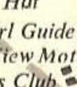
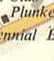

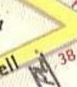


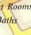


32 Havelock North pre-1965 showing position of original Plunket buildings. At this point the road reservee has been named Karanema Street. This map is not drawn to scale, and the tennis courts were not inside the Domain land as indicated. St Columbas Church c HAVELOCK NORTH DOMAIN DRAFT RESERVE MANAGEMENT PLAN Part 3: Appendices

33 APPENDIX 2: LOCATION PLAN APPENDIX 2: LOCATION PLAN Part 3: Appendices HAVELOCK NORTH DOMAIN DRAFT RESERVE MANAGEMENT PLAN 33
34 APPENDIX 3: LAND STATUS REPORT HDC RESERVE Property Description Land Status HAVELOCK NORTH DOMAIN, HAVELOCK NORTH 1. Napier Road, Karanema Drive and Te Mata Road, Havelock North Fee Simple in the name Her Majesty the Queen Purpose Classified a Reserve for Recreation Purposes in GN (1981 page 2923) Comprised In CFR HBJ3/951 Legal Description Town Section 87 Area hectares Acquisition History (a) Gazette Notice (1888 page 492) was registered on the 12/2/1982 permanently reserving Section No. 77 Blk IV Te Mata SD for recreation purposes, pursuant to the Land Act (b) Gazette Notice (1888 page 990) was registered on the 12/2/1982 declared the within Domain to be brought under the provisions of The Public Domains Act 1881, to be known as The Havelock Recreation ground. (c) CFRHBA1/169 issued on the 31 August 1961 and on the 2/7/1971 the balance land transferred pursuant to Section 44 of the Reserves & Domains Act 1953 to Her Majesty the Queen as an addition to the Havelock Domain. Gazette Notice was registered on the 29/9/1971 for the land in Transfer pursuant to Section 44 of the Reserves and Domains Act 1953 to form part of the Havelock Domain to be administered as a Public Domain by the Domain Board, subject to Part III of the Reserves and Domains Act (d) CFRHB93/176 issued on the 31 May 1935 and on the 2/7/1971 the balance land transferred pursuant to Section 44 of the Reserves & Domains Act 1953 to Her Majesty the Queen as an addition to the Havelock Domain. Gazette Notice was registered on the 29/9/1971 for the land in Transfer pursuant to Section 44 of the Reserves and Domains Act 1953 to form part of the Havelock Domain to be administered as a Public Domain by the Domain Board, subject to Part III of the Reserves and Domains Act (e) K Change of Appellation for land in Transfer to Part Town Section 83 Havelock registered 5/8/1971. (f) (g) Change of Appellation for all GN and GN to be Part Town Section 87 Havelock Gazette Notice 1981 page 2923 classified the reserve for recreation purposes subject to the provisions of the Reserves Act Gazette Notice cancelled and CFR HBJ3/951 issued on the 12/2/1982. (h) CFR HB116/52 issued on the 15 August Pursuant to Section 13 of The Land Subdivision Counties Act 1946, Lot 67 DP 7867 vested in His Majesty the King for the purposes of a Recreation Reserve and subject to The Public Reserve, Domains and National Parks Act 1928 on the 23/6/1950. (i) (j) (k) Encumbrances Subject to the Reserves Act Gazette Notice (1952 page 1682) declared the Recreation Reserve to be brought under Part II of the Public Reserves, Domains and National Parks Act 1928 and form part of the Havelock Domain and dealt with as a Public Domain by the Havelock Domain Board Change of Appellation for all GN and GN to be Part Town Section 87 Havelock Gazette Notice 1981 page 2923 classified the reserve for recreation purposes subject to the provisions of the Reserves Act Gazette Notice cancelled and CFR HBJ3/951 issued on the 12/2/1982. Comments Two areas are held in the same title. Details of the second area have also been provided. 34 HAVELOCK NORTH DOMAIN DRAFT RESERVE MANAGEMENT PLAN Part 3: Appendices
35 APPENDIX 4: PROPOSED CONCEPT PLAN APPENDIX 4: PROPOSED CONCEPT PLAN Part 3: Appendices HAVELOCK NORTH DOMAIN DRAFT RESERVE MANAGEMENT PLAN 35


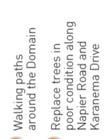
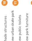


36 36 HAVELOCK NORTH DOMAIN DRAFT RESERVE MANAGEMENT PLAN Part 3: Appendices
Community Occupancy Guidelines
 Community Occupancy Guidelines Auckland Council July 2012 Find out more: phone 09 301 0101 or visit www.aucklandcouncil.govt.nz Contents Introduction 4 Scope 5 In scope 5 Out of scope 5 Criteria 6 Eligibility
SPORTING AND COMMUNITY LEASING POLICY
 SPORTING AND COMMUNITY LEASING POLICY Classification: Statutory Policy. Trim Container TRIM Container Number Trim Document Number: TRIM Document Number First Issued / Approved: 24 April 2018 Last Reviewed:
Summary of powers Limitation of powers Proposed level of delegation 6(3) Revoke a Gazette notice and issue a fresh notice or amend the original notice
 Revoke a Gazette notice and issue a fresh notice or amend the original notice") Reserves Act s to GWRC from the Minister A. Restatement s 6(3) Revoke a Gazette notice and issue a fresh notice or amend the original notice Only applies to notice in the Gazette given by the territorial
Reserves Act s to GWRC from the Minister A. Restatement s 6(3) Revoke a Gazette notice and issue a fresh notice or amend the original notice Only applies to notice in the Gazette given by the territorial
Written submission from John Muir Trust
 Written submission from John Muir Trust Background to the John Muir Trust and its position on land reform The John Muir Trust is a conservation charity with over 10,500 members dedicated to protecting
Section Three, Part 8 Reserves and Community Services
 PART 8 RESERVES AND COMMUNITY SERVICES RESERVES, RECREATION AND COMMUNITY FACILITIES/SERVICES 8.1 INTRODUCTION This part of the District Plan sets out the provisions for reserves and areas of community
ADOPTION OF 2018/19 FEES AND CHARGES FOR REGULATORY SERVICES
 RS-18-498 Mayor and Councillors COUNCIL 31 MAY 2018 Meeting Status: Public Purpose of Report: For Decision ADOPTION OF 2018/19 FEES AND CHARGES FOR REGULATORY SERVICES PURPOSE OF REPORT 1 This report proposes
PAPAKAINGA DISTRICT WIDE ACTIVITY
 SECTION 13.1 PAPAKAINGA DISTRICT WIDE ACTIVITY 13.1.1 INTRODUCTION The Resource Management Act 1991 introduced specific and new obligations for those exercising functions and powers under the Act to provide
Woollahra Local Environmental Plan 2014
 New South Wales Local Environmental Plan 2014 under the Environmental Planning and Assessment Act 1979 I, the Minister for Planning, pursuant to section 33A of the Environmental Planning and Assessment
Activities which do not satisfy the General Rules and are not provided for as Restricted Discretionary activities... 9
 16.0 PAPAKAINGA AND MARAE SETTLEMENTS... 1 16.1 INTRODUCTION... 1 16.2 ISSUES... 1 16.3 OBJECTIVE (PAPAKAINGA)... 2 16.4 POLICIES (PAPAKAINGA)... 2 16.5 OBJECTIVE (SURROUNDING ENVIRONMENT)... 2 16.6 POLICIES
MAKING THE MOST EFFECTIVE AND SUSTAINABLE USE OF LAND
 165 SOC146 To deliver places that are more sustainable, development will make the most effective and sustainable use of land, focusing on: Housing density Reusing previously developed land Bringing empty
PRACTICAL APPLICATION OF LEASING RESERVE LAND
 PRACTICAL APPLICATION OF LEASING RESERVE LAND Local Authority Property Association Conference 2012 Presented by: Michael Wood Simpson Grierson and Wendy O Neill Auckland Transport What are Reserves? Land
Acquiring & Disposing Of Land
 SECTION 5 Acquiring & Disposing Of Land 5.1 Acquiring Open Space It is intended that this Strategy be used to identify if, what, where and when future open spaces should be acquired and developed. The
THE COUCHICHING CONSERVANCY LAND STEWARDSHIP POLICY. As approved by the Board, April 30, 2007
 THE COUCHICHING CONSERVANCY LAND STEWARDSHIP POLICY As approved by the Board, April 30, 2007 When one tugs at a single thing in nature, he finds it attached to the rest of the world. John Muir This policy
PROPERTY DISPOSAL POLICY
 PROPERTY DISPOSAL POLICY Date Adopted Next Review Officer Responsible Legal and Property Manager The purpose of this policy is to: Provide a consistent approach when considering the possible disposal of
Parramatta City Centre Local Environmental Plan 2007
 New South Wales Parramatta City Centre Local Environmental Plan 2007 under the Environmental Planning and Assessment Act 1979 I, the Minister for Planning, make the following local environmental plan under
A Guide to the Municipal Planning Process in Saskatchewan
 A Guide to the Municipal Planning Process in Saskatchewan A look at the municipal development permit and the subdivision approval process in Saskatchewan May 2008 Prepared By: Community Planning Branch
Environmental Planning and Assessment Act 1979
 New South Wales State Environmental Planning Policy (Major Development) Amendment (State Significant Sites South Wallarah Peninsula) 2010 under the Environmental Planning and Assessment Act 1979 His Excellency
Hurstpierpoint & Sayers Common Neighbourhood Plan. Habitats Regulations Assessment Screening Report. 4 th April 2014
 Hurstpierpoint & Sayers Common Neighbourhood Plan Habitats Regulations Assessment Screening Report 4 th April 2014 1.0 Introduction 1.1 This Habitats Regulations Assessment (HRA) screening report has been
Communal Areas Policy
 Communal Areas Policy Originator: Executive Management Team Approval Date: Review date: Policy and Strategy Team 24 th October 2017 October2020 1 Introduction 1.1 1.2 One Vision Housing s (OVH) mission
Notified Concession Officer s Report to Decision Maker
 Notified Concession Officer s Report to Decision Maker Officer s Report to Decision Maker: Greg Lind Operations Manager Te Anau Notified Application: Variation to concession OT-31008-GUI to build and operate
Environmental Planning and Assessment Act 1979
 New South Wales State Environmental Planning Policy (Sydney Region Growth Centres) Amendment (East Leppington Precinct) 2013 under the Environmental Planning and Assessment Act 1979 Her Excellency the
Neighbourhood Management
 Neighbourhood Management Circle Housing offers greater opportunities for independent, affordable and secure living to people in housing need. 1 Scope 1.1 This policy applies to Circle Housing. For the
REPORT BY THE CHAIRPERSON OF THE LYTTELTON/MT HERBERT COMMUNITY BOARD 28 SEPTEMBER 2010
 31. 3. 2011 REPORT BY THE CHAIRPERSON OF THE LYTTELTON/MT HERBERT COMMUNITY BOARD 28 SEPTEMBER 2010 PART A - MATTERS REQUIRING A COUNCIL DECISION 1. 47 DUBLIN STREET, LYTTELTON ADDITIONAL INFORMATION REPORT
PLANNED AND RESPONSIVE MAINTENANCE POLICY
 PLANNED AND RESPONSIVE MAINTENANCE POLICY 1. Purpose 3. Policy Statement This Policy explains how Evolve Housing (Evolve) will provide repairs and maintenance services to its Tenants. Evolve believes that
Renewal - Higher Std - Growth. Priority
 5.15 Didsbury Drive Drainage Reserve Reserve Classification: Local Purpose Drainage Current Inventory ID 217 Area Current State Concept Plan 1.2736 Ha Drains. No Background: Subdivision drainage reserves.
TOTTENHAM SECONDARY PLAN
 TOTTENHAM SECONDARY PLAN AMENDMENT NO. 11 TO THE OFFICIAL PLAN OF THE TOWN OF NEW TECUMSETH The following text and schedules to the Official Plan of the Town of New Tecumseth constitute Amendment No. 11
Council Policy. Council policy title: Lease and Licence Policy 2018
 Council Policy Council policy title: Lease and Licence Policy 2018 Council policy owner: Adopted by: 1. Policy intent Council is the custodian of land and building assets that support a wide range of community
WETLAND PROTECTION CHAPTER 14 MONICA PETERS CONTENTS INTRODUCTION 1 ENSURING WETLAND ACCESS
 CHAPTER 14 WETLAND PROTECTION MONICA PETERS CONTENTS INTRODUCTION 1 ENSURING WETLAND ACCESS 2 WETLAND PROTECTION ON PRIVATE LAND 2.1 Conservation covenants 2.2 Management agreements 2.3 Purchase and bequests/gifts
Representation re: Sullivans Cove Planning Scheme /2015 Amendments - Macquarie Point Site Development: Affordable housing
 General Manager, Hobart City Council, GPO Box 503, Tas 7001 16 November, 2015 Representation re: Sullivans Cove Planning Scheme 1997-2/2015 Amendments - Macquarie Point Site Development: Affordable housing
SECTION B - GUIDELINES
 SECTION B - GUIDELINES APPLICATION KIT FOR SUBDIVISION RESOURCE CONSENT UNDER SECTION 88 OF THE RESOURCE MANAGEMENT ACT 1991 CONTENTS: PLEASE READ AND COMPLETE 1. Making an Application for a Subdivision
Recreation Activity Management Plan
 WAITAKI DISTRICT COUNCIL Recreation Activity Management Plan 2015-25 July 2015 Page 1 Contents EXECUTIVE SUMMARY... 1 1 Activity Description... 1 2 Levels of Service and Performance Measures... 2 3 Demand
LAKE MACQUARIE COASTAL WETLANDS PARK PROPOSAL. FINAL DRAFT MEMORANDUM OF UNDERSTANDING (September 2010)
") LAKE MACQUARIE COASTAL WETLANDS PARK PROPOSAL FINAL DRAFT MEMORANDUM OF UNDERSTANDING ( FOREWORD The Lake Macquarie Coastal Wetlands Park proposal was initiated by community groups and was formally endorsed
LAKE MACQUARIE COASTAL WETLANDS PARK PROPOSAL FINAL DRAFT MEMORANDUM OF UNDERSTANDING ( FOREWORD The Lake Macquarie Coastal Wetlands Park proposal was initiated by community groups and was formally endorsed
GREATER SHEPPARTON CITY COUNCIL
 GREATER SHEPPARTON CITY COUNCIL Policy Number 58.POL1 Version 1.0 Adopted: 21 October 2014 Last Reviewed: 2 September 2013 Business Unit: Responsible Officer: Approved By: Business Manager Citizen Services
LAND USE AND ZONING OVERVIEW
 OVERVIEW OF PLANNING POLICIES LAND USE AND ZONING OVERVIEW The Minneapolis Plan for Sustainable Growth and Other Adopted Plans Community Planning and Economic Development Development Services Division
DRAFT PROPOSED CHAPTER 21 SPECIFIC PURPOSE - FLAT LAND RECOVERY ZONE
 DRAFT PROPOSED CHAPTER 21 SPECIFIC PURPOSE - FLAT LAND RECOVERY ZONE Note: The Specific Purpose (Flat Land Recovery) Zone is a "holding" zone that will be subject to a later plan change to confirm the
Qualification Snapshot CIH Level 3 Certificate in Housing Services (QCF)
") Qualification Snapshot CIH Certificate in Housing Services (QCF) The Chartered Institute of Housing (CIH) is an awarding organisation for national qualifications at levels 2, 3 and 4. CIH is the leading
Qualification Snapshot CIH Certificate in Housing Services (QCF) The Chartered Institute of Housing (CIH) is an awarding organisation for national qualifications at levels 2, 3 and 4. CIH is the leading
Generic Management Plan for Business Areas. Community Land Management Plans
 Generic Management Plan for Business Areas Community Land Management Plans Last updated: May 2018 Contents Introduction... 1 Generic Management Plan for Business Areas...1 Legislative Requirements...1
Regeneration & Property Committee. 29 June Tankerton Football Club. Tricia Marshall - Director of Resources. This report is open to the public
 Regeneration & Property Committee 29 June 2017 Subject: Director/Head of Service: Tankerton Football Club Tricia Marshall - Director of Resources Decision Issues: These matters are within the authority
H4. Residential Mixed Housing Suburban Zone
 H4. Residential Mixed Housing Suburban Zone H4.1. Zone description The Residential Mixed Housing Suburban Zone is the most widespread residential zone covering many established suburbs and some greenfields
THE LAND POOLING RULES OF THE KINGDOM OF BHUTAN 2009 ROYAL GOVERNMENT OF BHUTAN MINISTRY OF WORKS AND HUMAN SETTLEMENT
 THE LAND POOLING RULES OF THE KINGDOM OF BHUTAN 2009 ROYAL GOVERNMENT OF BHUTAN MINISTRY OF WORKS AND HUMAN SETTLEMENT July 2009 1 CONTENTS CHAPTER 1 PRELIMINARY... 3 Title, extent and commencement...
Warringah Local Environmental Plan 2011
 New South Wales Warringah Environmental Plan 2011 under the Environmental Planning and Assessment Act 1979 I, the Minister for Planning and Infrastructure, pursuant to section 33A of the Environmental
1 Extraordinary Council meeting Doc No.: RDC March 2018 NOTICE OF AN EXTRAORDINARY MEETING OF COUNCIL
 1 Extraordinary Council meeting File No: 01-15-010\25 NOTICE OF AN EXTRAORDINARY MEETING OF COUNCIL to be held on Thursday, 15 March 2018 at 2pm in the Council Chamber, Rotorua Lakes Council Chairperson:
CASE STUDY: INCENTIVE MEASURES PROTECTION OF NATURAL HERITAGE ON PRIVATE LAND. Submitted by the Government of New Zealand
 CASE STUDY: INCENTIVE MEASURES PROTECTION OF NATURAL HERITAGE ON PRIVATE LAND Submitted by the Government of New Zealand CASE STUDY: INCENTIVE MEASURES PROTECTION OF NATURAL HERITAGE ON PRIVATE LAND Background
PUBLIC RIGHTS OF WAY. Guidance for Planners and Developers
 PUBLIC RIGHTS OF WAY Guidance for Planners and Developers 1. Introduction Public rights of way (PROW) are significant highway assets, highly valued by local people. They are a material consideration in
Terms of Reference for the Regional Housing Affordability Strategy
 Terms of Reference for the Regional Housing Affordability Strategy Prepared by: CRD Regional Planning Services September, 2001 Purpose The Capital Region is one of the most expensive housing markets in
Commemorative Naming Policy for Park Board Community Facilities
 SUBJECT: Commemorative Naming Policy for Park Board Community Facilities CATEGORY: Corporate Services POLICY NUMBER: 1. Preamble Commemorative Naming refers to the naming of a property in honour of outstanding
Town of Niagara-on-the-Lake Official Plan Review. Discussion Paper: Second Residential Units. Prepared for: The Town of Niagara-on-the-Lake
 Town of Niagara-on-the-Lake Official Plan Review Discussion Paper: Second Residential Units Prepared for: The Town of Niagara-on-the-Lake October 15, 2015 PLANSCAPE Inc. Building Community through Planning
H6 Residential Terrace Housing and Apartment Buildings Zone
 H6. Residential Terrace Housing and Apartment Buildings Zone [CIV-2016-404-002333: Franco Belgiorno-Nettis]-Note: The properties affected by this appeal are identified on the Auckland Unitary Plan viewer.
Auckland Council Rates Remission and Postponement Policy Consultation Submission
 Auckland Council Rates Remission and Postponement Policy Consultation Submission 13 April 2018 To: Auckland Council Private Bag 92300 Auckland 1142 From: Queen Elizabeth the Second National Trust PO Box
A. Preserve natural resources as identified in the Comprehensive Plan.
 1370.08 Conservation Residential Overlay District. Subd. 1 Findings. The City finds that the lands and resources within the Conservation Residential Overlay District are a unique and valuable resource
State Highway Revocation: Policy and Guidance
 State Highway Revocation: Policy and Guidance Revocation and consultation 1. Where there are changes to the state highway network that create duplicate sections of State highway serving the same function
City of Brandon Brownfield Strategy
 City of Brandon Brownfield Strategy 2017 Executive Summary A brownfield is a property, the expansion, redevelopment, or reuse of which may be complicated by the presence or potential presence of a hazardous
Central Pennsylvania Conservancy Project Selection Criteria Form
 Central Pennsylvania Conservancy Project Selection Criteria Form The following criteria guide the actions of the Central Pennsylvania Conservancy s Land Protection Committee and Board of Directors in selecting
CONSERVATION COVENANT (Section 77 Reserves Act 1977) IN RESPECT OF IDENTIFIED (NA???/???)
 IN RESPECT OF IDENTIFIED (NA???/???)") CONSERVATION COVENANT (Section 77 Reserves Act 1977) IN RESPECT OF IDENTIFIED (NA???/???) BETWEEN AND Insert the landowner names here (Please use capital, bold letters and check that the landowner is the
CONSERVATION COVENANT (Section 77 Reserves Act 1977) IN RESPECT OF IDENTIFIED (NA???/???) BETWEEN AND Insert the landowner names here (Please use capital, bold letters and check that the landowner is the
Rotorua Air Quality Control Bylaw
 Rotorua Air Quality Control Bylaw Administration and Enforcement Strategy Strategic Policy Publication 2011/04 ISSN 1176 4112 (print) ISSN 1178 3907 (online) September 2011 Bay of Plenty Regional Council
Development of a temporary grass multisport pitch and associated works (in addition to the previously approved park - Phase A).
.") To the Lord Mayor and Report No. 163/2018 Members of Dublin City Council Report of the Chief Executive (a) Planning and Development Act 2000 (as amended) & Planning and Development Regulations 2001 (as
To the Lord Mayor and Report No. 163/2018 Members of Dublin City Council Report of the Chief Executive (a) Planning and Development Act 2000 (as amended) & Planning and Development Regulations 2001 (as
Part 9 Specific Land Uses - Multi Dwelling Housing
 11 MULTI DWELLING HOUSING This section of the DCP only provides Council s specific requirements for Multi Dwelling Housing developments. Other requirements that must be addressed are contained in the relevant
Crown Lands Act, the MOU with AMSA & NSW Men s Sheds
 Crown Lands Act, the MOU with AMSA & NSW Men s Sheds Introduction The State Government Department responsible for Crown reserves is the Dept of Primary Industries. Reserves are created to protect and manage
NORTH LEEDS MATTER 2. Response to Leeds Sites and Allocations DPD Examination Inspector s Questions. August 2017
 NORTH LEEDS MATTER 2 Response to Leeds Sites and Allocations DPD Examination Inspector s Questions August 2017 CLIENT: TAYLOR WIMPEY, ADEL REFERENCE NO: CONTENTS 1.0 INTRODUCTION 2.0 TEST OF SOUNDNESS
Assistant Director of Housing and Built Environment. 109 St Helens Park Road, Hastings, TN34 2JW
 AGENDA ITEM NO: 6 (d) Report to: PLANNING COMMITTEE Date of Meeting: 10 October 2018 Report from: Assistant Director of Housing and Built Environment Application Address: Proposal: Application No: 109
H5. Residential Mixed Housing Urban Zone
 H5. Residential Mixed Housing Urban Zone [ENV-2016-AKL-000197: Robert Adams] Addition sought H5.1. Zone description The Residential Mixed Housing Urban Zone is a reasonably high-intensity zone enabling
NSW Travelling Stock Reserves Review Public consultation paper
 NSW Travelling Stock Reserves Review Public consultation paper A collaborative project between: Local Land Services Department of Industry Lands Contents Executive summary 2 1. About TSRs 3 What are TSR
ACCOUNTING STANDARDS BOARD INTERPRETATION OF THE STANDARDS OF GENERALLY RECOGNISED ACCOUNTING PRACTICE
 ACCOUNTING STANDARDS BOARD INTERPRETATION OF THE STANDARDS OF GENERALLY RECOGNISED ACCOUNTING PRACTICE INTANGIBLE ASSETS WEBSITE COSTS (IGRAP 16) Issued by the Accounting Standards Board March 2012 Acknowledgment
MARK TWAIN LAKE MASTER PLAN CLARENCE CANNON DAM AND MARK TWAIN LAKE MONROE CITY, MISSOURI
 MARK TWAIN LAKE MASTER PLAN CLARENCE CANNON DAM AND MARK TWAIN LAKE MONROE CITY, MISSOURI CHAPTER 4 LAND ALLOCATION, LAND CLASSIFICATION, WATER SURFACE, AND EASEMENT LANDS This Master Plan is a land use
Neds Corner Station. What is a Conservation Covenant?
 Neds Corner Station What is a Conservation Covenant? www.trustfornature.org.au What is a conservation covenant? A conservation covenant (deed of covenant) is a voluntary, legal agreement made between a
SCHEDULE 12 TO THE URBAN GROWTH ZONE. Shown on the planning scheme map as UGZ12. Kororoit Precinct Structure Plan
 SCHEDULE 12 TO THE URBAN GROWTH ZONE Shown on the planning scheme map as UGZ12. Kororoit Precinct Structure Plan 1.0 The plan Map 1 below shows the future urban structure proposed in the Kororoit Precinct
CORPORATE STANDARD FUNDING AND DELIVERY OF GROWTH INFRASTRUCTURE VERSION: 1.0
 CORPORATE STANDARD FUNDING AND DELIVERY OF GROWTH INFRASTRUCTURE VERSION: 1.0 Contents 1. Purpose... 3 2. Scope... 3 3. Definitions... 3 4. Growth Plan... 4 5. Funding and delivery categories... 4 5.1
CHAPTER 35 PARKS AND RECREATION
 35.01 INTRODUCTION CHAPTER 35 PARKS AND RECREATION Latest Revision 1994 Local park and recreation activities are becoming more important in the lives of Ohioans. Many residents are "rediscovering" the
Chapter CITY PARKS
 Chapter 11.03 CITY PARKS Sections: 11.03.010 Purpose 11.03.020 Definitions 11.03.030 Allowable hours of operation 11.03.040 Prohibited activities 11.03.050 Use of parks and permits for exclusive or special
SCOTTISH GOVERNMENT RESPONSE TO PRIVATE RENTED HOUSING (SCOTLAND) BILL STAGE 1 REPORT
 BILL STAGE 1 REPORT") SCOTTISH GOVERNMENT RESPONSE TO PRIVATE RENTED HOUSING (SCOTLAND) BILL STAGE 1 REPORT I am writing in response to the Local Government and Communities Committee s Stage 1 Report on the Private Rented Housing
SCOTTISH GOVERNMENT RESPONSE TO PRIVATE RENTED HOUSING (SCOTLAND) BILL STAGE 1 REPORT I am writing in response to the Local Government and Communities Committee s Stage 1 Report on the Private Rented Housing
Horse Gulch Management Plan Final Draft: April 18, 2013
 I. INTRODUCTION This Plan provides a framework for the sound stewardship of the City of Durango Horse Gulch open space area. The Plan includes baseline information regarding the area, management objectives
Agenda Item 14 REPORT TO CABINET
 Agenda Item 14 REPORT TO CABINET 15 November 2017 Subject: Presenting Cabinet Member: Director: Contribution towards Vision 2030: Regeneration opportunity - Junction Two Councillor Paul Moore - Cabinet
The underlying zones and Auckland-wide objectives apply in this precinct, in addition to those specified below.
 I454 Opaheke 1 I454.1 Precinct description The Opaheke 1 precinct comprises some 27 hectares of land between Bellfield Road and Opaheke Park, approximately 1.5km south of the Papakura Metropolitan Centre.
Protection for Residents of Long Term Supported Group Accommodation in NSW
 Protection for Residents of Long Term Supported Group Accommodation in NSW Submission prepared by the NSW Federation of Housing Associations March 2018 Protection for Residents of Long Term Supported Group
PLACEMENT OF SECURITY HUTS ON CITY OWNED LAND
 PLACEMENT OF SECURITY HUTS ON CITY OWNED LAND Policy No: 17957 Approved by Council 29 May 2014 C 39/05/14 Contents 1. Definitions 2. Problem Statement 3. Desired Outcomes 4. Strategic Intent 5. Role Players
PLANNING PROPOSAL. Reclassification of Community Land to Operational Land at. 2C T C Frith Avenue BOOLAROO. (Part Lot 2 DP )
") PLANNING PROPOSAL Version for Final Report to DoPE Reclassification of Community Land to Operational Land at 2C T C Frith Avenue BOOLAROO (Part Lot 2 DP 1183441) Amendment to Lake Macquarie Local Environmental
PLANNING PROPOSAL Version for Final Report to DoPE Reclassification of Community Land to Operational Land at 2C T C Frith Avenue BOOLAROO (Part Lot 2 DP 1183441) Amendment to Lake Macquarie Local Environmental
Section Three, Part 9 - Subdivision
 PART 9 SUBDIVISION SUBDIVISION AND DEVELOPMENT OF LAND 9.1 INTRODUCTION This part of the District Plan sets out the provisions in respect of the subdivision and development of land in the urban part of
Inverness Area Planning Advisory Committee Inverness County Planning Advisory Committee Inverness County Council Planning Staff (EDPC)
") STAFF REPORT To: From: Inverness Area Planning Advisory Committee Inverness County Planning Advisory Committee Inverness County Council Planning Staff (EDPC) Date: January 18, 2018 Reference: Request for
STAFF REPORT To: From: Inverness Area Planning Advisory Committee Inverness County Planning Advisory Committee Inverness County Council Planning Staff (EDPC) Date: January 18, 2018 Reference: Request for
Minister s Function under the Public Works Act 1981
 Further information on Ministerial functions under Public Works Act, Crown Pastoral Leases Act, Overseas Investment Act, New Zealand Geographic Board Act Minister s Function under the Public Works Act
C Secondary Suite Process Reform
 2018 March 12 Page 1 of 9 EXECUTIVE SUMMARY On 2017 December 11, through Notice of Motion C2017-1249 (Secondary Suite Process Reform) Council directed Administration to implement several items: 1. Land
Cressingham Gardens Estate, Brixton. DRAFT Masterplan Objectives for discussion. September 2015
 Cressingham Gardens Estate, Brixton DRAFT Masterplan Objectives for discussion September 2015 Contents Introduction 1 Project objectives 2 Masterplan objectives 4 Draft masterplan objectives for the Cressingham
Land Conservation Agreements Project Guidance
 Land Conservation Agreements Project Guidance Stakeholder Informed OTHER OPTIONS Introduction Enhanced or permanent protection of corporate lands through land conservation agreements means that companies
Resource Consent Application Form
 Resource Consent Application Form Section 88 of the Resource Management Act 1991. This form provides us with your contact information and details about your proposal. Please print clearly and complete
COMMUNITY PLAN PLANNING & URBAN DESIGN
 WHALE COVE COMMUNITY PLAN PLANNING & URBAN DESIGN WHALE COVE COMMUNITY PLAN Prepared for: Department of Community and Government Services Government of Nunavut Rankin Inlet, Nunavut Prepared by: FoTenn
Flinders Avenue, Lara Planning Scheme Amendment Combined Application for Rezoning and Multi-Lot Subdivision Reference : Decembe
 143-179 Flinders Avenue, Lara Planning Scheme Amendment Combined Application for Rezoning and Multi-Lot Subdivision Reference: 14134-03 TGM Group Geelong Melbourne Ballarat 1/27-31 Myers Street (PO Box
The Corporation of the District of Central Saanich
 The Corporation of the District of Central Saanich COMMITTEE OF THE WHOLE REPORT For the Committee of the Whole meeting on November 28, 2016 To: Patrick Robins Chief Administrative Officer File: From:
Planning & Development. Background. Subject Properties
 Planning & Development APPLICATION BRIEFING Prepared For: Planning Advisory Committee Submitted by: Jason Fox, Director of Planning & Development Date: Subject: Application by Meech Holdings Limited to
Community Empowerment and Renewal Bill A Consultation. Response from the Chartered Institute of Housing Scotland
 Consultation response Community Empowerment and Renewal Bill A Consultation Response from the Chartered Institute of Housing Scotland September 2012 www.cih.org/scotland Introduction The Chartered Institute
Community Leadership Sub- Committee 13 October 2016
 Community Leadership Sub- Committee 13 October 2016 Title Report of Wards Status Community Right to Bid: Templars Lawn Tennis Club, St Andrews Road, NW11 0PJ Susie Kemp, Director of Strategy, Innovation
RESERVE REVOCATION FOR HUNDERTWASSER PROJECT Ruben Wylie - Manager - Infrastructure Planning
 MEETING: COUNCIL - 10 AUGUST 2017 Name of item: Author: Date of report: 09 June 2017 Document number: Executive Summary RESERVE REVOCATION FOR HUNDERTWASSER PROJECT Ruben Wylie - Manager - Infrastructure
TOWN OF MIDDLEBOROUGH COMMUNITY PRESERVATION PLAN
 TOWN OF MIDDLEBOROUGH COMMUNITY PRESERVATION PLAN Vision The residents of Middleborough desire a community which is family-oriented and which retains its small town character while preserving an abundance
Planning Rationale in Support of an Application for Plan of Subdivision and Zoning By-Law Amendment
 Planning Rationale in Support of an Application for Plan of Subdivision and Zoning By-Law Amendment The Kilmorie Development 21 Withrow Avenue City of Ottawa Prepared by: Holzman Consultants Inc. Land
Community Leadership & Libraries Sub - Committee 19 th December 2018
 Community Leadership & Libraries Sub - Committee 19 th December 2018 Title Community Right to Bid: Greensquare, the Land between Briarfield Avenue and Rosemary Avenue accessed From Tangle Tree Close, N3
ADMINISTRATIVE GUIDANCE
 11 ADMINISTRATIVE GUIDANCE ON CONTAMINATED SITES Effective date: April 1, 2013 Version 1.1 May 2013 Expectations and Requirements for Contaminant Migration Introduction This guidance focusses on the ministry
Riverton Properties Ltd Proposed Special Housing Area
 Riverton Properties Ltd Proposed Special Housing Area Housing Accords and Special Housing Areas Act 2013 Expression of Interest 1 This Expression of Interest is made on behalf of Riverton Properties Ltd,
CA/15/2006/OUT. Canterbury City Council Military Road Canterbury Kent CT1 1YW. Crown copyright and database rights 2015 Ordnance Survey
 Scale 1:1,250 Map Dated: 28/10/2015 CA/15/2006/OUT Crown copyright and database rights 2015 Ordnance Survey 100019614 Canterbury City Council Military Road Canterbury Kent CT1 1YW AGENDA ITEM NO 10 PLANNING
9.3.5 Dual occupancy code
 9.3.5 Dual occupancy code 9.3.5.1 Application (1) This code applies to accepted development and assessable development identified as requiring assessment against the Dual occupancy 1 code by the tables
IFA submission to the Law Reform Commission of Ireland s review of the current law on compulsory acquisition of land.
 IFA submission to the Law Reform Commission of Ireland s review of the current law on compulsory acquisition of land. The Irish Farm Centre Bluebell Dublin 12 February 2018 Introduction The Issues Paper
Report to COUNCIL for decision
 10/327 Subject: Prepared by: Te Araroa Domain Leasing Decisions Angus Glengarry (Community Property Officer) Meeting Date: 27 May 2010 Report to COUNCIL for decision SUMMARY There are two sporting clubrooms
CHAPTER 3: IDENTIFYING SECTION 4(f) PROPERTIES
 PROPERTIES") CHAPTER 3: IDENTIFYING SECTION 4(f) PROPERTIES Section 4(f) and its provisions state that publicly owned parks, recreation areas, wildlife and waterfowl refuges, and publicly and privately owned historic
CHAPTER 3: IDENTIFYING SECTION 4(f) PROPERTIES Section 4(f) and its provisions state that publicly owned parks, recreation areas, wildlife and waterfowl refuges, and publicly and privately owned historic