Ontario Ministry of the Environment and Climate Change - Record of Site Condition #
|
|
|
- Calvin Lang
- 5 years ago
- Views:
Transcription
1 Ontario Ministry of the Environment and Climate Change - Record of Site Condition # Record of Site Condition Under Part XV.1 of the Environment Protection Act Summary Record of Site Condition Number Date Filed to Environmental Site Registry 2015/08/18 Certification Date 2015/04/02 Current Property Use Commercial Intended Property Use Residential Certificate of Property Use Number No CPU Applicable Site Condition Standards** ESA Phase 1 Property Municipal Address 20 SURE STRIKE ROAD, ASTORVILLE, ON, P0H 1B0 Notice to Readers Concerning Due Diligence This record of site condition has been filed in the Environmental Site Registry to which the public has access and which contains a notice advising users of the Environmental Site Registry who have dealings with any property to consider conducting their own due diligence with respect to the environmental condition of the property, in addition to reviewing information in the Environmental Site Registry. Contents of this Record of Site Condition This record of site condition consists (RSC) of this document which is available to be printed directly from the Environmental Site Registry as well as all supporting documentation indicated in this RSC to have been submitted in electronic format to the Ministry of the Environment and Climate Change. Filed Record of Site Condition # on 2015/08/18 1 of 10
2 PART 1: PROPERTY OWNERSHIP, PROPERTY INFORMATION AND OWNER'S CERTIFICATIONS Information about the owner who is submitting or authorizing the submission of the RSC Owner Name Mailing Address Postal Code WAYNE SMITH 40 RASPBERRY LANE, ASTORVILLE ONTARIO, CANADA P0H 1B0 Phone (705) Fax (705) Address Filed Record of Site Condition # on 2015/08/18 2 of 10
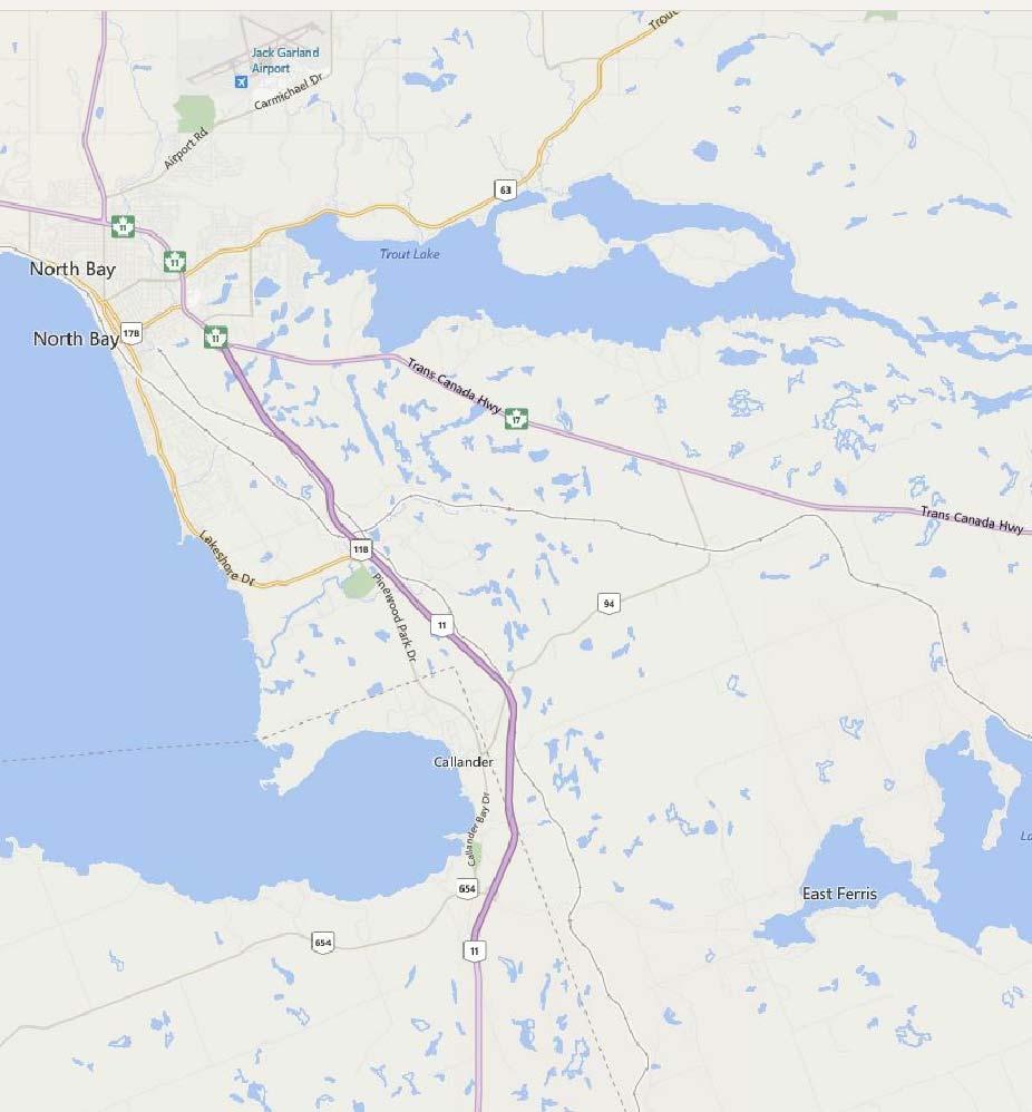
3 RSC Property Location Information Municipal Address(es) Municipality Legal Description Assessment Roll Number(s) Property Identifier Number(s) 20 SURE STRIKE ROAD, ASTORVILLE, ON P0H 1B0 East Ferris See Attached Lawyer s Letter (LT) (LT) (LT) (LT) (LT) (LT) RSC Property Geographical References Coordinate System UTM Datum NAD 83 Zone 17 Easting 633, Northing 5,117, RSC Property Use Information The following types of property uses are defined by the Regulation: Agricultural or other use, Commercial use, Community use, Industrial use, Institutional use, Parkland use, and Residential use. Current Property Use Intended Property Use Certificate of Property Use has been issued under section of the EPA Commercial Residential No Filed Record of Site Condition # on 2015/08/18 3 of 10
4 Please See the Signed Statements of Property Owner, or Agent, or Receiver at the End of this RSC The rest of this page has been left intentionally blank Filed Record of Site Condition # on 2015/08/18 4 of 10
5 PART 2: LIST OF REPORTS, SUMMARY OF SITE CONDITIONS AND QUALIFIED PERSON S STATEMENTS AND CERTIFICATIONS Qualified Person's Information Name Type of Licence Under Professional Engineers Act JAKE BERGHAMER Licence Licence Number QP Employer Name Mailing Address ENGLOBE CORP PROGRESS COURT, NORTH BAY ONTARIO, P1A 0C2 CANADA Phone (705) Fax (705) Address northbay@lvm.ca Municipal Information Local or Single-Tier Municipality East Ferris Ministry of the Environment and Climate Change District Office District Office District Office Address Sudbury District Office Suite 1201, 199 Larch St., Sudbury ON P3E 5P9 Filed Record of Site Condition # on 2015/08/18 5 of 10
6 Phase One Environmental Site Assessment Report Document used as the phase one environmental site assessment report and updates in submitting the RSC for filing The date the last work on all of the records review, interviews and site reconnaissance components of the phase one environmental site assessment was done (refer to clause 28(1)(a) of O. Reg. 153/04) (YYYY/MM/DD) Type of Report Report Title Date of Report (YYYY/MM/DD) Author of Report Name of Consulting Company P1 ESA Sure Strike Camp Property, 20 Sure Strike Road, Astorville, Ontario - Phase One Environmental Site Assessment Report Jake Berghamer ENGLOBE CORP. Reports and Other Documents Related to the Phase One Environmental Site Assessment Reports and other documents relied upon in certifying the information set out in section 10 of Schedule A or otherwise used in conducting the phase one environmental site assessment Report Title Date of Report (YYYY/MM/DD) Author of Report Name of Consulting Company N/A Filed Record of Site Condition # on 2015/08/18 6 of 10
7 Site Condition Information Certification date (YYYY/MM/DD) 2015/04/02 Total area of RSC property (in hectares) Number of any previously filed RSC that applies to any part of the RSC property Number of any previously filed Transition Notice that applies to any part of the RSC property Soil brought from another property to this RSC property to remain there following the filing of the RSC? No Filed Record of Site Condition # on 2015/08/18 7 of 10
8 Qualified Person s Statements and Certifications As the qualified person, I certify that: A phase one environmental site assessment of the RSC property, which includes the evaluation of the information gathered from a records review, site reconnaissance, interviews, a report and any updates required, has been conducted in accordance with the regulation by or under the supervision of a qualified person as required by the regulation. As of 2015/04/02, no phase two environmental site assessment is required by the regulation for the RSC property and based on the phase one environmental site assessment for the RSC property, in my opinion, it is not necessary for any other reason to conduct a phase two environmental site assessment for the RSC property. As of 2015/04/02, in my opinion, based on the phase one environmental site assessment, there is no evidence of any contaminants in the soil, ground water or sediment on, in or under the RSC property that, if the RSC property were put to any of the types of property uses listed in subsection 1 (2) of the regulation, are likely to interfere with any of those types of property uses. I am a qualified person and have the qualifications required by section 5 of the regulation. I have in place an insurance policy that satisfies the requirements of section 7 of the regulation. I acknowledge that the RSC will be submitted for filing in the Environmental Site Registry, that records of site condition that are filed in the Registry are available for examination by the public and that the Registry contains a notice advising users of the Registry who have dealings with any property to consider conducting their own due diligence with respect to the environmental condition of the property, in addition to reviewing information in the Registry. The opinions expressed in this RSC are engineering or scientific opinions made in accordance with generally accepted principles and practices as recognized by members of the environmental engineering or science profession or discipline practising at the same time and in the same or similar location. I do not hold and have not held and my employer ENGLOBE CORP. does not hold and has not held a direct or indirect interest in the RSC property or any property which includes the RSC property and was the subject of a phase one or two environmental site assessment or risk assessment upon which this record of site condition is based To the best of my knowledge, the certifications and statements in this part of the RSC are true as of 2015/04/02. By signing this RSC, I make no express or implied warranties or guarantees. By checking the boxes above, and entering my membership/licence number in this submission, I, JAKE BERGHAMER, a qualified person as defined in section 5 of O. Reg. 153/04 am, on 2015/07/09: a) signing this record of site condition submission as a qualified person; and b) making all certifications required as a qualified person for this record of site condition. I Agree Filed Record of Site Condition # on 2015/08/18 8 of 10
9 Additional Documentation Provided by Property Owner or Agent The following documents have been submitted to the Ministry of the Environment and Climate Change as part of the record of site condition Lawyer s letter consisting of a legal description of the property Copy of any deed(s), transfer(s) or other document(s) by which the RSC property was acquired A Current plan of Survey Table of Current and Past Uses of the Phase One Property Phase 1 Conceptual Site Model Owner or agent certification statements Filed Record of Site Condition # on 2015/08/18 9 of 10

10 Filed Record of Site Condition # on 2015/08/18 10 of 10
11
12
13
14

15 PARCEL REGISTER (ABBREVIATED) FOR PROPERTY IDENTIFIER LAND PAGE 1 OF 1 REGISTRY PREPARED FOR Lucie001 OFFICE # (LT) ON 2015/07/09 AT 16:21:57 * CERTIFIED IN ACCORDANCE WITH THE LAND TITLES ACT * SUBJECT TO RESERVATIONS IN CROWN GRANT * PROPERTY DESCRIPTION: PCL SEC WF; PT BROKEN LT 17 CON 3 EAST FERRIS PT 12, 36R5829; EAST FERRIS ; DISTRICT OF NIPISSING PROPERTY REMARKS: CROWN GRANT SEE NP859. ESTATE/QUALIFIER: RECENTLY: PIN CREATION DATE: FEE SIMPLE FIRST CONVERSION FROM BOOK 2005/02/21 ABSOLUTE OWNERS NAMES CAPACITY SHARE SMITH, WAYNE ROWN REG. NUM. DATE INSTRUMENT TYPE AMOUNT PARTIES FROM PARTIES TO CERT/ CHKD ** PRINTOUT INCLUDES ALL DOCUMENT TYPES AND DELETED INSTRUMENTS SINCE: 2005/02/18 ** 36R /05/21 PLAN REFERENCE C LT /10/28 TRANSFER *** COMPLETELY DELETED *** REMARKS: PLANNING ACT CONSENT LECLAIR, HECTOR 36R /12/05 PLAN REFERENCE C BS /06/19 TRANSMISSION LAND *** COMPLETELY DELETED *** LECLAIR, HECTOR (DECEASED) SWANNELL, CONSTANCE LECLAIR, DONALD LECLAIR, HECTOR ESTATE BS /06/19 TRANS PERSONAL REP $2 SWANNELL, CONSTANCE SMITH, WAYNE C LECLAIR, DONALD REMARKS: PLANNING ACT STATEMENTS. NOTE: ADJOINING PROPERTIES SHOULD BE INVESTIGATED TO ASCERTAIN DESCRIPTIVE INCONSISTENCIES, IF ANY, WITH DESCRIPTION REPRESENTED FOR THIS PROPERTY. NOTE: ENSURE THAT YOUR PRINTOUT STATES THE TOTAL NUMBER OF PAGES AND THAT YOU HAVE PICKED THEM ALL UP.
16
17
18
19
20
21 YEAR NAME OF OWNER DESCRIPTION OF PROPERTY USE 2015 Present Wayne Smith Tourist camp with cabin and Helen Lena LeClair and Hector LeClair Current and Past Uses PIN (LT) PIN (LT) boat Tourist camp with cabin and boat Claude Charbonneau Tourist camp with cabin and boat Paul A. Hanson, Jacalyn Hanson Tourist camp with cabin and boat Theophile Cantin Agricultural or Other Use Fields Augustine Cantin Agricultural or Other Use Fields Tobie Rochefort Agricultural or Other Use Fields PROPERTY USE 1 Agricultural or Other Use Agricultural or Other Use Agricultural or Other Use Pre 1902 Crown Unknown Agricultural or Other Use Notes: 1 Regulatory Types as defined in O. Reg. 153/04 OTHER OBSERVATIONS FROM AERIAL PHOTOGRAPHS, FIRE INSURANCE PLANS, ETC. Title search records indicate the lands were transferred to Wayne Smith in Title search records indicate the PIN was registered in 1981, and transferred to Helen and Hector LeClair in Hector Leclaire owned the Property until 2015 when the Property was transferred to Wayne Smith. Title search records indicate the lands were transferred to Claude Charbonneau in Title search records indicate the lands were transferred to Paul A. Hanson and Jacalyn Hanson in An aerial photograph from 1970 does not show any structures on the Property, while an aerial photograph from 1977 depicts a few structures present at the Property; as such, it is surmised that the first developments at the Site began sometime between 1970 and Title search records indicate the lands were transferred to Theophile Cantin in Title search records indicate parcels 3172WF, 3483WF, and 3543WF were re-entered in in the year Title search records indicate the lands were transferred to Augustine Cantin in Records indicate the lands were leased by Hector LeClair in Title search records indicate the lands were transferred to Tobie Rochefort in 1902 following Patent from Crown land. Title search documents indicate the land was patented to Crown Land in No records before this date or records are illegible.
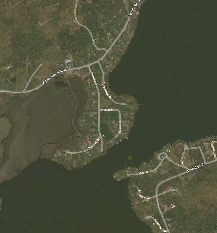
22 PHASE ONE CONCEPTUAL SITE MODEL DISCUSSION OF THE CONCEPTUAL SITE MODEL (CSM) DRAWING OF THE PHASE ONE STUDY AREA LVM-Merlex was retained to undertake a Phase One Environmental Site Assessment (ESA) for the entire property located at 20 Sure Strike Road, in Astorville, Ontario (the Site, Subject Site, or Property). The Site represents both the Phase One property and the Record of Site Condition (RSC) property. LVM-Merlex has created figures to help in understanding the current and historical conditions of the Subject Site and surrounding properties within 250 meters of the Site. These drawings make up the Conceptual Site Model (CSM) and are discussed below. i. Buildings at the Site include one (1) permanent year-round residential dwelling with a workshop, twelve (12) permanent cabins for rent, a few permanent storage sheds, and an area of nonpermanent Recreational Vehicle (RV) parking. Buildings off-site at adjacent properties are shown on the Conceptual Site Model Drawing (Drawing No. 2, Appendix 1), and generally consists of mainly dwellings and one (1) mixed Commercial/ building located to the northwest of the Subject Site along Astorville Road. Buildings are labelled on the CSM Drawing (Drawing No. 2, Appendix 1). ii. iii. iv. Water bodies within the study area (250 m radius) include Lake Nosbonsing which is located partly within the 250 m radius from the Subject Site immediately east of the Subject Site, and a wetland area is located to the far west of the Site, and drains to Lake Nosbonsing. Water bodies are labelled on the CSM Drawing (Drawing No. 2, Appendix 1). No areas of natural significance are located wholly or partly within the minimum 250 m radius from the Subject Site, based on available information. Twenty-one (21) drinking water wells are depicted in the Phase One Study Area (250 m radius) and are detailed in the ERIS Report and locations are shown on the CSM Drawing (Drawing No. 2, Appendix 1). The Subject Site and the adjacent properties utilize drinking water wells as their sole source of drinking water. It should be noted that a dug drinking water well is present at the Subject Site within the basement of the main residential structure at the Site. This drinking water well is depicted on the CSM drawing, however, no records are available regarding the construction of the well (i.e. no Water Well Information System (WWIS) records are available). v. Roadways within the Study Area (250 m radius) include Astorville Road to the north of the Subject Site, Blanche Road to the west and southwest of the Site, Perron Crescent to the south of the Site, and Sure Strike Road to the north of the Subject Site. Roadways are labelled on the CSM Drawing (Drawing No. 2, Appendix 1). vi. The Phase One Conceptual Site Model drawing illustrates the property uses within 250 m of the Site. Property uses in the study area include mainly properties, a mix of vacant forested and wetland areas, and one (1) mixed Commercial/ property (Bernard Rochefort Ltd.) with two (2) Underground Storage Tanks. The property uses within the Study 15/02/15006 PHASE ONE ESA CONCEPTUAL SITE MODEL SURE STRIKE CAMP PROPERTY, 20 SURE STRIKE ROAD, ASTORVILLE, ONTARIO 1
23 vii. viii. Area, as well as the approximate location of the USTs are depicted on the CSM Drawing (Drawing No. 2, Appendix 1). No Potentially Contaminating Activities (PCAs) were identified on-site. One (1) PCA was identified off-site which has not resulted in an APEC to the Subject Site, as discussed below. The off-site PCA was identified to be two (2) 50,000 Litre capacity Underground Storage Tanks containing gasoline fuel at the mixed Residential/Commercial Use (Bernard Rochefort Ltd.) property to the northwest of the Site. The PCA property and USTs are labelled on the CSM Drawing (Drawing No. 2, Appendix 1). No Areas of Potential Environmental Concern (APECs) are depicted on any drawings as the off- Site PCA identified is not considered to affect the Subject Site, as discussed below. In conclusion, LVM-Merlex is of the opinion that there are no PCAs located on the Phase One Site, and as such, no APECs were identified to be present at the Site. One (1) Potentially Contaminating Activity was identified in the Phase One Study Area (250 m radius) that has not resulted in any Areas of Potential Environmental Concern at the Phase One Property. As such, a Phase Two Environmental Site Assessment is not required at this time. DESCRIPTION AND ASSESSMENT 15/02/15006 Current and Past Land uses of the Subject Site YEAR NAME OF OWNER DESCRIPTION OF PROPERTY USE 2002 Present Wayne Smith Tourist camp with Helen Lena LeClair and Hector LeClair Current and Past Uses PIN (LT) Tourist camp with Claude Charbonneau Tourist camp with Paul A. Hanson, Jacalyn Hanson Tourist camp with Theophile Cantin Agricultural or Other Use Fields PIN (LT) PROPERTY USE 1 PHASE ONE ESA CONCEPTUAL SITE MODEL SURE STRIKE CAMP PROPERTY, 20 SURE STRIKE ROAD, ASTORVILLE, ONTARIO OTHER OBSERVATIONS FROM AERIAL PHOTOGRAPHS, FIRE INSURANCE PLANS, ETC. transferred to Wayne Smith in Title search records indicate the PIN was registered in 1981, and transferred to Helen and Hector LeClair in transferred to Claude Charbonneau in transferred to Paul A. Hanson and Jacalyn Hanson in An aerial photograph from 1970 does not show any structures on the Property, while an aerial photograph from 1977 depicts a few structures present at the Property; as such, it is surmised that the first developments at the Site began sometime between 1970 and transferred to Theophile Cantin in Title search records indicate parcels 3172WF, 3483WF, and 3543WF were reentered in in the year
24 YEAR NAME OF OWNER DESCRIPTION OF PROPERTY USE Augustine Cantin Agricultural or Other Use Fields Tobie Rochefort Agricultural or Other Use Fields PIN (LT) PROPERTY USE 1 OTHER OBSERVATIONS FROM AERIAL PHOTOGRAPHS, FIRE INSURANCE PLANS, ETC. transferred to Augustine Cantin in Records indicate the lands were leased by Hector LeClair in transferred to Tobie Rochefort in 1902 following Patent from Crown land. Pre 1902 Crown Unknown Title search documents indicate the land was patented to Crown Land in No records before this date or records are illegible. Notes: 1 Regulatory Types as defined in O. Reg. 153/04 YEAR NAME OF OWNER DESCRIPTION OF PROPERTY USE 2002 Present Wayne Smith Tourist camp with Lena Helen LeClair Tourist camp with Paul A. Hanson, Jacalyn Hanson Current and Past Uses PIN (LT) Tourist camp with Hector LeClair Tourist camp with Theophile Cantin Agricultural or Other Use Fields Augustine Cantin Agricultural or Other Use Fields Tobie Rochefort Agricultural or Other Use Fields PIN (LT) PROPERTY USE 1 OTHER OBSERVATIONS FROM AERIAL PHOTOGRAPHS, FIRE INSURANCE PLANS, ETC. transferred to Wayne Smith in Title search records indicate lands were transferred to Lena Helen LeClair in transferred to Paul A. Hanson and Jacalyn Hanson in An aerial photograph from 1970 does not show any structures on the Property, while an aerial photograph from 1977 depicts a few structures present at the Property; as such, it is surmised that the first developments at the Site began sometime between 1970 and transferred to Hector LeClair in transferred to Theophile Cantin in Title search records indicate parcels 3172WF, 3483WF, and 3543WF were reentered in in the year transferred to Augustine Cantin in Records indicate the lands were leased by Hector LeClair in transferred to Tobie Rochefort in 1902 following Patent from Crown land. 15/02/15006 PHASE ONE ESA CONCEPTUAL SITE MODEL SURE STRIKE CAMP PROPERTY, 20 SURE STRIKE ROAD, ASTORVILLE, ONTARIO 3
25 YEAR NAME OF OWNER DESCRIPTION OF PROPERTY USE PIN (LT) PROPERTY USE 1 OTHER OBSERVATIONS FROM AERIAL PHOTOGRAPHS, FIRE INSURANCE PLANS, ETC. Pre 1902 Crown Unknown Title search documents indicate the land was patented to Crown Land in No records before this date or records are illegible. Notes: 1 Regulatory Types as defined in O. Reg. 153/04 YEAR NAME OF OWNER DESCRIPTION OF PROPERTY USE 2002 Present Wayne Smith Tourist camp with Lena Helen LeClair Tourist camp with Claude Charbonneau Tourist camp with Paul A. Hanson, Jacalyn Hanson 15/02/15006 Current and Past Uses PIN (LT) Tourist camp with Rheal R. Perron Agricultural or Other Use Fields Theophile Cantin Agricultural or Other Use Fields Augustine Cantin Agricultural or Other Use Fields Tobie Rochefort Agricultural or Other Use Fields PIN (LT) PROPERTY USE 1 PHASE ONE ESA CONCEPTUAL SITE MODEL SURE STRIKE CAMP PROPERTY, 20 SURE STRIKE ROAD, ASTORVILLE, ONTARIO OTHER OBSERVATIONS FROM AERIAL PHOTOGRAPHS, FIRE INSURANCE PLANS, ETC. transferred to Wayne Smith in Title search records indicate lands were transferred to Lena Helen LeClair in Title search records indicate a portion of the lands were transferred to Claude Charbonneau in Title search records indicate a portion of the lands were transferred to Hector LeClair in transferred to Paul A. Hanson and Jacalyn Hanson in An aerial photograph from 1970 does not show any structures on the Property, while an aerial photograph from 1977 depicts a few structures present at the Property; as such, it is surmised that the first developments at the Site began sometime between 1970 and transferred to Hector LeClair in 1971, followed by an additional transfer to Rheal R. Perron in the same year. Title search records indicate parcels 3172WF, 3483WF, and 3543WF were reentered in in the year Title search records indicate the lands were transferred to Theophile Cantin in transferred to Augustine Cantin in Title search records indicate that the lands were leased to Hector LeClair in Records also indicate a portion of the lands were transferred to Theophile Cantin in transferred to Tobie Rochefort in 1902 following Patent from Crown land. 4
26 YEAR NAME OF OWNER DESCRIPTION OF PROPERTY USE PIN (LT) PROPERTY USE 1 OTHER OBSERVATIONS FROM AERIAL PHOTOGRAPHS, FIRE INSURANCE PLANS, ETC. Pre 1902 Crown Unknown Title search documents indicate the land was patented to Crown Land in No records before this date or records are illegible. Notes: 1 Regulatory Types as defined in O. Reg. 153/04 YEAR NAME OF OWNER DESCRIPTION OF PROPERTY USE 2002 Present Wayne Smith Tourist camp with Lena Helen LeClair Tourist camp with Claude Charbonneau Tourist camp with The Corporation of the Township of East Ferris Current and Past Uses PIN (LT) PIN (LT) PROPERTY USE 1 OTHER OBSERVATIONS FROM AERIAL PHOTOGRAPHS, FIRE INSURANCE PLANS, ETC. transferred to Wayne Smith in Title search records indicate lands were transferred to Helen LeClair in Title search records indicate the former right of way portion of the lands were transferred to Claude Charbonneau in Road Allowance Title search records indicate a portion of the lands were transferred to Hector E. LeClair in Records also indicate an application to close the Lakeshore Road allowance was filed in 1982 and the lands were subsequently transferred to The Corporation of the Township of East Ferris in Pre-1982 Crown Unknown Title search documents indicate there are no records before this date or records are illegible. As this portion of the land was previously utilized for a road allowance, it would have been Crown Land prior to Notes: 1 Regulatory Types as defined in O. Reg. 153/04 15/02/15006 PHASE ONE ESA CONCEPTUAL SITE MODEL SURE STRIKE CAMP PROPERTY, 20 SURE STRIKE ROAD, ASTORVILLE, ONTARIO 5
27 YEAR NAME OF OWNER DESCRIPTION OF PROPERTY USE 2002 Present Wayne Smith Tourist camp with Lena Helen LeClair Tourist camp with Hector LeClair Tourist camp with Claude Charbonneau Tourist camp with Paul A. Hanson, Jacalyn Hanson Current and Past Uses PIN (LT) Tourist camp with Theophile Cantin Agricultural or Other Use Fields Augustine Cantin Agricultural or Other Use Fields Tobie Rochefort Agricultural or Other Use Fields PIN (LT) PROPERTY USE 1 OTHER OBSERVATIONS FROM AERIAL PHOTOGRAPHS, FIRE INSURANCE PLANS, ETC. transferred to Wayne Smith in Title search records indicate lands were transferred to Lena Helen LeClair in Title search records indicate a portion of the lands were transferred to Hector LeClair in transferred to Claude Charbonneau in transferred to Paul A. Hanson and Jacalyn Hanson in An aerial photograph from 1970 does not show any structures on the Property, while an aerial photograph from 1977 depicts a few structures present at the Property; as such, it is surmised that the first developments at the Site began sometime between 1970 and Title search records indicate parcels 3172WF, 3483WF, and 3543WF were reentered in in the year Title search records indicate the lands were transferred to Theophile Cantin in transferred to Augustine Cantin in Title search records indicate that the lands were leased to Hector LeClair in transferred to Tobie Rochefort in 1902 following Patent from Crown land. Pre 1902 Crown Unknown Title search documents indicate the land was patented to Crown Land in No records before this date or records are illegible. Notes: 1 Regulatory Types as defined in O. Reg. 153/04 15/02/15006 PHASE ONE ESA CONCEPTUAL SITE MODEL SURE STRIKE CAMP PROPERTY, 20 SURE STRIKE ROAD, ASTORVILLE, ONTARIO 6
28 YEAR NAME OF OWNER DESCRIPTION OF PROPERTY USE 2002 Present Wayne Smith Tourist camp with Lena Helen LeClair Tourist camp with Hector LeClair Unknown prior to the late 1970 s. Tourist camp with recently Theophile Cantin Agricultural or Other Use Fields Augustine Cantin Agricultural or Other Use Fields Tobie Rochefort Agricultural or Other Use Fields Current and Past Uses PIN (LT) PIN (LT) PROPERTY USE 1 OTHER OBSERVATIONS FROM AERIAL PHOTOGRAPHS, FIRE INSURANCE PLANS, ETC. transferred to Wayne Smith in Title search records indicate lands were transferred to Lena Helen LeClair in Title search records indicate a portion of the lands were transferred to Hector LeClair in An aerial photograph from 1970 does not show any structures on the Property, while an aerial photograph from 1977 depicts a few structures present at the Property; as such, it is surmised that the first developments at the Site began sometime between 1970 and transferred to Theophile Cantin in transferred to Augustine Cantin in Title search records indicate that the lands were leased to Hector LeClair in transferred to Tobie Rochefort in 1902 following Patent from Crown land. Pre 1902 Crown Unknown Title search documents indicate the land was patented to Crown Land in No records before this date or records are illegible. Notes: 1 Regulatory Types as defined in O. Reg. 153/04 I. Potentially Contaminating Activities (PCAs) and Areas of Potential Environmental Concern (APECs) in the Phase One Study Area One (1) Current and historical Potentially Contaminating Activity (PCA) was identified off-site at the mixed Commercial/ (Bernard Rochefort Ltd.) property to the northwest of the Site, along Astorville Road. Two (2) Underground Storage Tanks with a capacity of 50,000 Litres are present at the PCA property (Bernard Rochefort Ltd.) and are reportedly utilized for gasoline fuel storage. The tanks were installed in 1991 and there are no records indicating any spills or leaks. The local topography is the area of the tanks slopes towards the wetland area located immediately to the south of the tanks, opposite Astorville Road. As such, the groundwater in the area is expected to flow to the wetland which drains to Lake Nosbonsing further south of the PCA property, southwest of the Subject Site. In combination with the location of the PCA (2 USTs containing gasoline fuel) to the Subject Site and the anticipated groundwater flow from the Commercial/ property (PCA Property) to the wetland area present immediately to the south, away from the Subject Site, the PCA has not resulted in any Areas of Potential Environmental Concern to the Subject Site. 15/02/15006 PHASE ONE ESA CONCEPTUAL SITE MODEL SURE STRIKE CAMP PROPERTY, 20 SURE STRIKE ROAD, ASTORVILLE, ONTARIO 7
29 The concerns present at the adjacent property to the northwest of the Site present a very low risk to the Subject Site due to a combination of its location in comparison to the Subject Site, as well as the local topography in the area of the PCA which slopes to the south towards a wetland which drains to Lake Nosbonsing further south; thus the anticipated groundwater flow in the area of the PCA property is anticipated to be to towards the wetland area located immediately south of the PCA property, Astorville Road, and the Underground Storage Tanks present at the Commercial/Residential use property. Therefore, if any spills or potentially contaminating incidents occur at the mixed Commercial/Residential Use property to the northwest of the Subject Site, they should migrate away from the Subject Site, to the wetland area present immediately to the south of Astorville Road and the location of the PCA property (west of the Subject Site), and eventually drain into Lake Nosbonsing. Anticipated surface/groundwater flow is depicted on the CSM drawing (Drawing No. 2, Appendix 1). TSSA records indicate that historically there are two (2) Underground Storage Tanks (USTs) at the Commercial/ property, off-site, with no records of any spills or leaks. II. Contaminants of Potential Concern Contaminants of potential concern associated with these PCA identified off-site (2 USTs containing gasoline fuel) include PHCs in the F1 F4 range, PAHs, BTEX, and Metals. III. Potential for Underground Utilities to Affect Contaminant Distribution and Transport All of the municipal addresses within 250 m of the Site are currently connected to overhead utilities (at least one) and are serviced by private septic systems and drinking water wells. Based on the suspected depth of the buried services, the corridors created by the services may act as channels of faster groundwater flow. IV. Regional and Site Specific Geological and Hydrogeographical Information Based on available information obtained from a Northern Ontario Engineering Geology Terrain Study (NOEGTS) Map, the surficial geology and topographic variety on the Site consists of organic terrain comprised of peat and muck. Local relief is considered to be mainly low plains, and drainage is wet. Based on a Geology Highway Map of Northern Ontario, surficial geology of the bedrock at the Site is comprised of late Precambrian felsic anorthosite suite comprised of granitic to syenitic rocks and derived gneisses. The topography of the general area of the Subject Site is relatively flat, however sloped slightly toward the east and south. The topography of the general surrounding area is sloped to the southeast. The anticipated localized surface/groundwater flow at the Property is expected to flow generally to the east towards Lake Nosbonsing, situated immediately to the east of the Site. Regional surface/groundwater flow is expected to drain to the south and east towards Lake Nosbonsing, and eventually flowing northeast into Lake Talon located approximately ±17.5 km northeast of the Subject Site. Surface conditions mainly consist of grassy areas or small trees and shrubs, therefore decreasing the amount of surface runoff. 15/02/15006 PHASE ONE ESA CONCEPTUAL SITE MODEL SURE STRIKE CAMP PROPERTY, 20 SURE STRIKE ROAD, ASTORVILLE, ONTARIO 8
30 V. Conclusions and Validity of the Conceptual Site Model It should be noted that it is possible that Potentially Contaminating Activities (PCAs), Areas of Potential Environmental Concern (APECs), and/or previous land uses have not been identified during this Phase One ESA investigation. Information was gathered from a number of different sources, decreasing the chances that a PCA, APEC, and/or previous land use was not identified during this investigation. Historical and current information provided verbally was considered to be accurate unless otherwise contradicted by factual information. Based on the findings of the Phase I ESA investigation, including a review of historical environmental reports, an EcoLog Environmental Risk Information Service (ERIS) database search, chain of title searches, City directories, aerial photographs, Fire Insurance Plans (FIPs), interviews, and a Site reconnaissance, no current or historical Potentially Contaminating Activities (PCAs) were identified on the Subject Site. A Potentially Contaminating Activity (PCA) was identified at an adjacent property that did not result in any Areas of Potential Environmental Concern (APECs) to the Phase One Property. The potential environmental risk associated with the PCA identified at an adjacent property is considered to be very low due to a combination of the distance and location of the PCA relative to the Subject Site, the topography in the surrounding area as detailed herein, and the anticipated localized groundwater flow in the area of the PCA away from the Subject Site. There is also an absence of historical environmental incidents at the adjacent property (i.e. no spills have been reported). As such, it is the opinion of LVM- Merlex that it is not necessary to alleviate the risks identified at the adjacent property through an intrusive environmental investigation in the form of a Phase Two ESA. G:\2015\ ESA I & RSC, SURE STRIKE CAMP (STANTEC)\' RSC 15/02/15006 PHASE ONE ESA CONCEPTUAL SITE MODEL SURE STRIKE CAMP PROPERTY, 20 SURE STRIKE ROAD, ASTORVILLE, ONTARIO 9
31
32

33
Ontario Ministry of the Environment - Record of Site Condition # B0
 Ontario Ministry of the Environment - Record of Site Condition # 214066 Record of Site Condition Under Part XV.1 of the Environment Protection Act Summary Record of Site Condition Number 214066 Date Filed
Ontario Ministry of the Environment and Climate Change - Record of Site Condition #
 Ontario Ministry of the Environment and Climate Change - Record of Site Condition # 218489 Record of Site Condition Under Part XV.1 of the Environment Protection Act Summary Record of Site Condition Number
Ontario Ministry of the Environment - Record of Site Condition #
 Ontario Ministry of the Environment - Record of Site Condition # 214588 Record of Site Condition Under Part XV.1 of the Environment Protection Act Summary Record of Site Condition Number 214588 Date Filed
Ontario Ministry of the Environment and Climate Change - Record of Site Condition #
 Ontario Ministry of the Environment and Climate Change - Record of Site Condition # 215286 Record of Site Condition Under Part XV.1 of the Environment Protection Act Summary Record of Site Condition Number
Ontario Ministry of the Environment and Climate Change - Record of Site Condition #
 Ontario Ministry of the Environment and Climate Change - Record of Site Condition # 216966 Record of Site Condition Under Part XV.1 of the Environment Protection Act Summary Record of Site Condition Number
Ontario Ministry of the Environment - Record of Site Condition #
 Ontario Ministry of the Environment - Record of Site Condition # 214328 Record of Site Condition Under Part XV.1 of the Environment Protection Act Summary Record of Site Condition Number 214328 Date Filed
Ontario Ministry of the Environment and Climate Change - Record of Site Condition #
 Ontario Ministry of the Environment and Climate Change - Record of Site Condition # 217977 Record of Site Condition Under Part XV.1 of the Environment Protection Act Summary Record of Site Condition Number
Ontario Ministry of the Environment - Record of Site Condition # L2G 2C5
 Ontario Ministry of the Environment - Record of Site Condition # 213514 Record of Site Condition Under Part XV.1 of the Environment Protection Act Summary Record of Site Condition Number 213514 Date Filed
Ontario Ministry of the Environment and Climate Change - Record of Site Condition #
 Ontario Ministry of the Environment and Climate Change - Record of Site Condition # 220169 Record of Site Condition Under Part XV.1 of the Environment Protection Act Summary Record of Site Condition Number
Ontario Ministry of the Environment - Record of Site Condition # Record of Site Condition Under Part XV.1 of the Environment Protection Act
 Ontario Ministry of the Environment - Record of Site Condition # 205787 Record of Site Condition Under Part XV.1 of the Environment Protection Act Summary Record of Site Condition Number 205787 Date Filed
Ontario Ministry of the Environment and Climate Change - Record of Site Condition #
 Ontario Ministry of the Environment and Climate Change - Record of Site Condition # 217226 Record of Site Condition Under Part XV.1 of the Environment Protection Act Summary Record of Site Condition Number
Ontario Ministry of the Environment and Climate Change - Record of Site Condition #
 Ontario Ministry of the Environment and Climate Change - Record of Site Condition # 221468 Record of Site Condition Under Part XV.1 of the Environment Protection Act Summary Record of Site Condition Number
Ontario Ministry of the Environment and Climate Change - Record of Site Condition #
 Ontario Ministry of the Environment and Climate Change - Record of Site Condition # 220387 Record of Site Condition Under Part XV.1 of the Environment Protection Act Summary Record of Site Condition Number
Ontario Ministry of the Environment - Record of Site Condition # Record of Site Condition Under Part XV.1 of the Environment Protection Act
 Ontario Ministry of the Environment - Record of Site Condition # 202012 Record of Site Condition Under Part XV.1 of the Environment Protection Act Summary Record of Site Condition Number 202012 Date Filed
Ontario Ministry of the Environment and Climate Change - Record of Site Condition #
 Ontario Ministry of the Environment and Climate Change - Record of Site Condition # 217206 Record of Site Condition Under Part XV.1 of the Environment Protection Act Summary Record of Site Condition Number
Ontario Ministry of the Environment - Record of Site Condition # Record of Site Condition Under Part XV.1 of the Environment Protection Act
 Ontario Ministry of the Environment - Record of Site Condition # 203311 Record of Site Condition Under Part XV.1 of the Environment Protection Act Summary Record of Site Condition Number 203311 Date Filed
Ontario Ministry of the Environment - Record of Site Condition # Record of Site Condition Under Part XV.1 of the Environment Protection Act
 Ontario Ministry of the Environment - Record of Site Condition # 208786 Record of Site Condition Under Part XV.1 of the Environment Protection Act Summary Record of Site Condition Number 208786 Date Filed
Ontario Ministry of the Environment and Climate Change - Record of Site Condition #
 Ontario Ministry of the Environment and Climate Change - Record of Site Condition # 216611 Record of Site Condition Under Part XV.1 of the Environment Protection Act Summary Record of Site Condition Number
Ontario Ministry of the Environment - Record of Site Condition # Record of Site Condition Under Part XV.1 of the Environment Protection Act
 Ontario Ministry of the Environment - Record of Site Condition # 211229 Record of Site Condition Under Part XV.1 of the Environment Protection Act Summary Record of Site Condition Number 211229 Date Filed
Ontario Ministry of the Environment - Record of Site Condition # Record of Site Condition Under Part XV.1 of the Environment Protection Act
 Ontario Ministry of the Environment - Record of Site Condition # 208766 Record of Site Condition Under Part XV.1 of the Environment Protection Act Summary Record of Site Condition Number 208766 Date Filed
Ontario Ministry of the Environment and Climate Change - Record of Site Condition #
 Ontario Ministry of the Environment and Climate Change - Record of Site Condition # 220334 Record of Site Condition Under Part XV.1 of the Environment Protection Act Summary Record of Site Condition Number
Ontario Ministry of the Environment and Climate Change - Record of Site Condition #
 Ontario Ministry of the Environment and Climate Change - Record of Site Condition # 219068 Record of Site Condition Under Part XV.1 of the Environment Protection Act Summary Record of Site Condition Number
Ontario Ministry of the Environment and Climate Change - Record of Site Condition #
 Ontario Ministry of the Environment and Climate Change - Record of Site Condition # 221251 Record of Site Condition Under Part XV.1 of the Environment Protection Act Summary Record of Site Condition Number
Ontario Ministry of the Environment - Record of Site Condition # Record of Site Condition Under Part XV.1 of the Environment Protection Act
 Ontario Ministry of the Environment - Record of Site Condition # 207771 Record of Site Condition Under Part XV.1 of the Environment Protection Act Summary Record of Site Condition Number 207771 Date Filed
Ontario Ministry of the Environment - Record of Site Condition # Record of Site Condition Under Part XV.1 of the Environment Protection Act
 Ontario Ministry of the Environment - Record of Site Condition # 202646 Record of Site Condition Under Part XV.1 of the Environment Protection Act Summary Record of Site Condition Number 202646 Date Filed
Ontario Ministry of the Environment and Climate Change - Record of Site Condition #
 Ontario Ministry of the Environment and Climate Change - Record of Site Condition # 218292 Record of Site Condition Under Part XV.1 of the Environment Protection Act Summary Record of Site Condition Number
Ontario Ministry of the Environment and Climate Change - Record of Site Condition #
 Ontario Ministry of the Environment and Climate Change - Record of Site Condition # 219047 Record of Site Condition Under Part XV.1 of the Environment Protection Act Summary Record of Site Condition Number
Ontario Ministry of the Environment - Record of Site Condition # Record of Site Condition Under Part XV.1 of the Environment Protection Act
 Ontario Ministry of the Environment - Record of Site Condition # 205387 Record of Site Condition Under Part XV.1 of the Environment Protection Act Summary Record of Site Condition Number 205387 Date Filed
Ontario Ministry of the Environment - Record of Site Condition # Record of Site Condition Under Part XV.1 of the Environment Protection Act
 Ontario Ministry of the Environment - Record of Site Condition # 203986 Record of Site Condition Under Part XV.1 of the Environment Protection Act Summary Record of Site Condition Number 203986 Date Filed
Ontario Ministry of the Environment - Record of Site Condition # Record of Site Condition Under Part XV.1 of the Environment Protection Act
 Ontario Ministry of the Environment - Record of Site Condition # 202008 Record of Site Condition Under Part XV.1 of the Environment Protection Act Summary Record of Site Condition Number 202008 Date Filed
ENVIRONMENTAL SITE ASSESSMENT (AAI COMPLIANT PHASE I)
") ENVIRONMENTAL SITE ASSESSMENT (AAI COMPLIANT PHASE I) IPP.MORELAND AVENUE ASSEMBLAGE 785-793 MORELAND AVENUE ATLANTA, GEORGIA, 30316 ONE GROUP PROJECT #A6092 JANUARY 28, 2008 PREPARED FOR: FAIRVIEW COMMERCIAL
ENVIRONMENTAL SITE ASSESSMENT (AAI COMPLIANT PHASE I) IPP.MORELAND AVENUE ASSEMBLAGE 785-793 MORELAND AVENUE ATLANTA, GEORGIA, 30316 ONE GROUP PROJECT #A6092 JANUARY 28, 2008 PREPARED FOR: FAIRVIEW COMMERCIAL
Ontario Ministry of the Environment - Record of Site Condition # Record of Site Condition Under Part XV.1 of the Environment Protection Act
 Ontario Ministry of the Environment - Record of Site Condition # 202408 Record of Site Condition Under Part XV.1 of the Environment Protection Act Summary Record of Site Condition Number 202408 Date Filed
Ontario Ministry of the Environment and Climate Change - Record of Site Condition #
 Ontario Ministry of the Environment and Climate Change - Record of Site Condition # 215846 Record of Site Condition Under Part XV.1 of the Environment Protection Act Summary Record of Site Condition Number
Environmental Audit Standards
 Environmental Audit Standards Lender requires an acceptable Phase I Environmental Audit Report, directed to Lender and historical in nature, which is to be prepared in accordance with the standards set
Contents. Schedules and Appendices. Page. 1.0 Introduction Condominium Sale Process Urbancorp CCAA Entities...A. Title Searches...
 Eighteenth Report to Court of KSV Kofman Inc. as CCAA Monitor of Urbancorp Toronto Management Inc., Urbancorp (St. Clair Village) Inc., Urbancorp (Patricia) Inc., Urbancorp (Mallow) Inc., Urbancorp (Lawrence)
Ontario Ministry of the Environment and Climate Change - Record of Site Condition #
 Ontario Ministry of the Environment and Climate Change - Record of Site Condition # 221248 Record of Site Condition Under Part XV.1 of the Environment Protection Act Summary Record of Site Condition Number
PHASE ONE ENVIRONMENTAL SITE ASSESSMENT
 PHASE ONE ENVIRONMENTAL SITE ASSESSMENT 484-490 PLAINS ROAD EAST, BURLINGTON, ONTARIO Project No. 161-09479-00 Prepared for: National Homes (Plains Road) LP July 5, 2017 WSP Canada Inc. 100 Commerce Valley
1976 Fargo, ND City Directory - R.L. Polk & Co.
 1986 Fargo, ND City Directory - R.L. Polk & Co. 1981 Fargo, ND City Directory - R.L. Polk & Co. 1976 Fargo, ND City Directory - R.L. Polk & Co. 1971 Fargo, ND Directory - R.L. Polk & Co. 1971 Fargo, ND
PHASE I ENVIRONMENTAL SITE ASSESSMENT
 PHASE I ENVIRONMENTAL SITE ASSESSMENT ACME Gas 55 Garden Street Columbus, Ohio, 45123 Prepared for ACME Oil & Gas Ltd. Prepared by GAEA Environmental Services 87 Garden Street Whitby, Ontario L1N 9E7 November
Record of Site Condition For Part XV.1 of the Environmental Protection Act
 Summary Record of Site Condition For Part XV.1 of the Environmental Protection Act Registration Number 51516 Status Submitted Submit Date 2009/04/03 Certification Date 2008/04/24 Current Property Use Intended
Phase I Environmental Site Assessment Update Memorandum Vacant Property 1585 Santa Clara Avenue Santa Ana, California 92507
 March 1, 2011 Mr. Vincent C. Fregoso, AICP City of Santa Ana 20 Civic Center Plaza Santa Ana, CA 92702 Re: Phase I Environmental Site Assessment Update Memorandum Vacant Property 1585 Santa Clara Avenue
Ontario Ministry of the Environment and Climate Change - Record of Site Condition #
 Ontario Ministry of the Environment and Climate Change - Record of Site Condition # 215472 Record of Site Condition Under Part XV.1 of the Environment Protection Act Summary Record of Site Condition Number
CITY OF VAUGHAN POLICY AND PROCEDURES FOR DEALING WITH CONTAMINATED OR POTENTIALLY CONTAMINATED SITES
 CITY OF VAUGHAN POLICY AND PROCEDURES FOR DEALING WITH CONTAMINATED OR POTENTIALLY CONTAMINATED SITES MAY 2001 This Report should be read in conjunction with the City of Vaughan BACKGROUND REPORT ON POLICY
Committee of Adjustment The Planning Act - Section 53 Application for Consent
 The Planning Act - Section 53 Please Type or Print In Ink File No. 1. (a) Registered Owner(s): Mailing Address: City: Province: Postal Code: Telephone: Fax: Email: Owner's Solicitor (if any): Mailing Address:
TOWNSHIP OF GEORGIAN BLUFFS APPLICATION FOR AMENDMENT TO THE ZONING BY-LAW
 TOWNSHIP OF GEORGIAN BLUFFS APPLICATION FOR AMENDMENT TO THE ZONING BY-LAW NOTE A PRECONSULTATION MEETING IS REQUIRED PRIOR TO THE SUBMISSION OF APPLICATIONS FOR A ZONING BY-LAW AMENDMENT OR REZONING.
Change is in the air with regard. feature
 em feature Amy L. Edwards is a partner in the law firm of Holland & Knight LLP, Washington, DC, where she co-chairs the firm s national environmental team. Sarah C. Smith is an associate at Holland & Knight.
MAJOR SUBDIVISION PRELIMINARY PLAT CHECKLIST
 TOWNSHIP OF EGG HARBOR PLANNING BOARD/ZONING BOARD OF ADJUSTMENT 3515 BARGAINTOWN ROAD EGG HARBOR TOWNSHIP, NJ 08234 MAJOR SUBDIVISION PRELIMINARY PLAT CHECKLIST The following checklist is designed to
Environmental Protection Division
 Environmental Protection Division 6 Name of procedure: Establishing the Boundaries of a Site Staff affected: Ministry of Environment and Land Remediation Section staff Authority: Environmental Management
Environmental Site Assessment for Land Conveyances
 Engineering Review Engineering and Construction Services Environmental Site Assessment for Land Conveyances Directive No. ENV-01-2013 Rev. 1 August 21, 2013 Purpose: When to Apply: (Triggers) To rescind
Application for Draft Plan Approval of Subdivision or Condominium Updated: August 2017
 Application for Draft Plan Approval of Subdivision or Condominium Updated: August 2017 PRECONSULTATION Preconsultation with City Planning staff is required under By-law No. 2009-170. Preconsultation identifies
CONSENT APPLICATION FORM
 CONSENT APPLICATION FORM Date Application Received: Application Reviewed by: Planning initials & date For Office Use Only Received by (and date of pre-con if applicable): Fee Paid: Municipal paid LTC paid
Application for Validation Order
 Ministry of Municipal Affairs and Housing Application for Validation Order Under Section 57 of the Planning Act Note to applicants: This application form is to be used where the Minister of Municipal Affairs
COUNTY OF HURON APPLICATION FOR CONSENT Under Section 53 of the Planning Act 8.3.1
 NOTE TO THE APPLICANT / AGENT / OWNER COUNTY OF HURON APPLICATION FOR CONSENT Under Section 53 of the Planning Act 8.3.1 This application is to be used if the County of Huron is the consent granting authority.
Glen Abbey Golf Club, 1333 Dorval Drive, Oakville, Ontario
 TITLE SUMMARY Glen Abbey Golf Club, 1333 Dorval Drive, Oakville, Ontario As of October 28, 2016 NOTE: Surrounded by the Golf Club are: (1) the former Delta Hotel Lands sold by ClubLink to DGA Hotel Holdings
For use by Principal Authority. Township of Georgian Bay (Name of municipality, upper-tier municipality, board of health or conservation authority)
") SEPTIC Application for a Permit to Construct or Demolish This form is authorized under subsection 8(1.1) of the Building Code Act. For use by Principal Authority Application number: Permit number (if different):
SEPTIC Application for a Permit to Construct or Demolish This form is authorized under subsection 8(1.1) of the Building Code Act. For use by Principal Authority Application number: Permit number (if different):
PHASE I ENVIRONMENTAL SITE ASSESSMENT REPORT 3.3-ACRE ECKENRODE PROPERTY WARWICK TOWNSHIP, TUSCARAWAS COUNTY, OHIO. Prepared for: OHIOLAND, LLC
 PHASE I ENVIRONMENTAL SITE ASSESSMENT REPORT 3.3-ACRE ECKENRODE PROPERTY WARWICK TOWNSHIP, TUSCARAWAS COUNTY, OHIO Prepared for: OHIOLAND, LLC Prepared by: CIVIL & ENVIRONMENTAL CONSULTANTS, INC. COLUMBUS,
Ontario Ministry of the Environment - Record of Site Condition # Record of Site Condition Under Part XV.1 of the Environment Protection Act
 Ontario Ministry of the Environment - Record of Site Condition # 210610 Record of Site Condition Under Part XV.1 of the Environment Protection Act Summary Record of Site Condition Number 210610 Date Filed
Due Diligence for Property Acquisitions
 Due Diligence for Property Acquisitions Presenters: Mary Guinee Principal, Due Diligence Services Ray Sinagra, AIA Sr. Project Manager, Property Condition Assessment Services April 28, 2009 Conference
5. That the Owner shall agree that all development Blocks shown within the Draft Plan will be connected to full municipal services.
 Conditions Relating to Draft Plan of Subdivision Approval East Fonthill 26T 01014 (Draft Plan dated December 1, 2013, and revised August 28, 2014), the Town of Pelham 1. This approval applies to the Draft
Township of Georgian Bay (Name of municipality, upper-tier municipality, board of health or conservation authority)
") Application for a Permit to Construct or Demolish This form is authorized under subsection 8(1.1) of the Building Code Act. Application number: For use by Principal Authority Permit number (if different):
Application for a Permit to Construct or Demolish This form is authorized under subsection 8(1.1) of the Building Code Act. Application number: For use by Principal Authority Permit number (if different):
Different Levels of Environmental Site Assessment and the Benefits to M&A Due Diligence
 Different Levels of Environmental Site Assessment and the Benefits to M&A Due Diligence A White Paper by Dennis Papa, PE, BCEE, Principal of dpstudio environmental consulting & design LLC November 2016
Applicant: SOBEYS CAPITAL INCORPORATED Huntington Road, Woodbridge
 File: A111/14 Item # 11 Ward #2 Applicant: SOBEYS CAPITAL INCORPORATED Address: Agent: 8265 Huntington Road, Woodbridge OZ KEMAL MacNaughton Hermsen Britton Clarkson Planning Limited Adjournment Status:
PLANNING RATIONALE ONTARIO LTD. APLLICATION FOR PLAN OF SUBDIVISION APPROVAL
 PLANNING RATIONALE 1384341 ONTARIO LTD. APLLICATION FOR PLAN OF SUBDIVISION APPROVAL PART OF LOTS 18 & 19, CONCESSION 1 GEOGRAPHIC TOWNSHIP OF MARCH NOW IN CITY OF OTTAWA FEBRUARY 2013 1 Planning Rationale
Ontario Ministry of the Environment - Record of Site Condition # Record of Site Condition Under Part XV.1 of the Environment Protection Act
 Ontario Ministry of the Environment - Record of Site Condition # 211728 Record of Site Condition Under Part XV.1 of the Environment Protection Act Summary Record of Site Condition Number 211728 Date Filed
Phase I Environmental Site Assessments for Corridors
 Phase I Environmental Site Assessments for Corridors Prepared by: Kimberly Perkins and Jill Biesma 1 Environmental Advisors and Engineers 19211 W. 64 th Terrace, Shawnee, KS 66218 (913) 599-4326 Goal Of
SALE OF LAND BY PUBLIC TENDER
 FORM 6 Municipal Act, 2001 SALE OF LAND BY PUBLIC TENDER THE CORPORATION OF THE TOWNSHIP OF NORWICH Take Notice that tenders are invited for the purchase of the lands described below and will be received
PLANNING RATIONALE REPORT
 PLANNING RATIONALE REPORT Zoning By-law Amendment Application 2920 Danbury Way Prepared for: Bravar Custom Builders Inc. and Village View Estates Ltd. by: 6393 Roslyn Street Ottawa (Orleans), Ontario K1C
PHASE I ENVIRONMENTAL SITE ASSESSMENT
 PHASE I ENVIRONMENTAL SITE ASSESSMENT ST. MALACHY PROPERTY, BROWNSBURG HENDRICKS COUNTY, INDIANA Terra Project No. 13-013 Environmental Audit Report Privileged Document PREPARED FOR: Town of Brownsburg
Due Diligence & Environmental Compliance Issues for Tribal Energy Projects: Hazardous Waste
 Due Diligence & Environmental Compliance Issues for Tribal Energy Projects: Law Seminars International Seattle, WA October 23, 2007 Connie Sue Manos Martin Hazardous Waste Overview Environmental Due Diligence:
Ontario Ministry of the Environment - Record of Site Condition #
 Ontario Ministry of the Environment - Record of Site Condition # 214488 Record of Site Condition Under Part XV.1 of the Environment Protection Act Summary Record of Site Condition Number 214488 Date Filed
October 29, 2013 Florida Brownfields Association Conference, Orlando
 Site Inventories October 29, 2013 Florida Brownfields Association Conference, Orlando Andrew M. Lawn, M.S., P.G. Principal Hydrogeologist Holden Heights Areas HSW & Orange County Environmental Protection
Voluntary standard; accepted by USEPA to comply with AAI rule. 2. Regulatory/Developmental History
 This table summarizes some of the primary differences between the New Jersey Department of Environmental Protection (NJDEP) Preliminary Assessment Report (PAR), pursuant to the April 2013 NJDEP Site Remediation
Phase I ESAs and the USEPA's All Appropriate Inquiry Final Rule
 Page 1 of 8 Phase I ESAs and the USEPA's All Appropriate Inquiry Final Rule An Electronic Newsletter of EEA's Environmental Consulting Activities Spring 2007 EEA, Inc. 55 Hilton Avenue, Garden City, New
TOWN OF HANOVER APPLICATION FOR OFFICIAL PLAN AND/OR ZONING BY-LAW AMENDMENT Under Sec. 22 (4) of the Ontario Planning Act, R.S.O.
 of the Ontario Planning Act, R.S.O.") TOWN OF HANOVER APPLICATION FOR OFFICIAL PLAN AND/OR ZONING BY-LAW AMENDMENT Under Sec. 22 (4) of the Ontario Planning Act, R.S.O. 1990, as amended (FOR OFFICE USE ONLY) FILE NO. OPA - - FILE NO. Z - -
TOWN OF HANOVER APPLICATION FOR OFFICIAL PLAN AND/OR ZONING BY-LAW AMENDMENT Under Sec. 22 (4) of the Ontario Planning Act, R.S.O. 1990, as amended (FOR OFFICE USE ONLY) FILE NO. OPA - - FILE NO. Z - -
610 LAND DIVISIONS AND PROPERTY LINE ADJUSTMENTS OUTSIDE A UGB
 ARTICLE VI: LAND DIVISIONS AND PROPERTY LINE ADJUSTMENTS VI-21 610 LAND DIVISIONS AND PROPERTY LINE ADJUSTMENTS OUTSIDE A UGB 610-1 Property Line Adjustments (Property Line Relocation) A property line
The Subdivision Regulations, 2014
 SUBDIVISION REGULATIONS, 2014 P-13.2 REG 2 1 The Subdivision Regulations, 2014 being Chapter P-13.2 Reg 2 (effective July 18, 2014). NOTE: This consolidation is not official. Amendments have been incorporated
For Help. Address Postal Code Fax No. Concession Number(s) Lot Number(s) Registered Plan No. Lot(s)/Block(s)
 Lot Number(s) Registered Plan No. Lot(s)/Block(s)") FILE #B APPLICATION FOR CONSENT Under Section 53 of the Planning Act Note to Applicants: This application form is to be used if the CENTRAL ALMAGUIN PLANNING BOARD is the consent granting authority. In
FILE #B APPLICATION FOR CONSENT Under Section 53 of the Planning Act Note to Applicants: This application form is to be used if the CENTRAL ALMAGUIN PLANNING BOARD is the consent granting authority. In
APPLICATION FOR CONSENT IMPORTANT NOTE TO APPLICANTS
 APPLICATION FOR CONSENT IMPORTANT NOTE TO APPLICANTS The April 2019 - April 2020 fee for an application is set by County Council and changes from time to time. The current fee for consent is $880 for planning
CONSENT APPLICATION GUIDE
 Box 5000, Station 'A' 200 Brady Street, Tom Davies Square Sudbury ON P3A 5P3 Tel. (705) 671-2489 Ext. 4376/4346 Fax (705) 673-2200 CONSENT APPLICATION GUIDE APPLYING FOR CONSENT Consent granting authority
PROPOSED SUBDIVISION PRELIMINARY LAYOUT APPROVAL
 PROPOSED SUBDIVISION PRELIMINARY LAYOUT APPROVAL Our File 02-015-15367 Date (yyyy/mm/dd) 2010/12/06 Proposed Subdivision of Lot 8, Section 18, Township 23, Range 16, W6M, KDYD, Plan KAP86170 This Preliminary
Building Permit Requirements Back Flow Prevention Device
 Building Permit Requirements Back Flow Prevention Device NOTE TO APPLICANT: The following application information applies to new buildings and building retrofits for all occupancies other than for a house
MUNICIPALITY OF CHATHAM-KENT Application for Site Plan Approval
 MUNICIPALITY OF CHATHAM-KENT Application for Site Plan Approval File Number Assess Roll No. 3650-1. Name of Owner: Street Address (If numbered company please also indicate the name of principal(s)) Address:
Staff Report. November 16, 2016 Page 1 of 6
 November 16, 2016 Page 1 of 6 Report No.: PDSD-P-62-16 Meeting Date: November 16, 2016 Submitted by: Subject: Ben Puzanov, RPP, Senior Planner Applications for Consent (B-21/16) and Zoning By-law Amendment;
Conceptual Scheme SE W4
 December 2012 1. PURPOSE 1.1. The purpose of a Conceptual Scheme (CS) is as follows: a) To provide a framework for the subsequent subdivision and/or development of land within the Country Residential Policy
DRAFT - Subject to Change. Cathedral Building 212 North Ash Street Crookston, Minnesota. Prepared For. Project FA June 29, 2011
 DRAFT Phase I Environmental Site Assessment Cathedral Building 212 North Ash Street Crookston, Minnesota Prepared For Braun Intertec Corporation Ms. Kay Hegge Prairie Skyline Foundation 27048 310th Street
PHASE I ENVIRONMENTAL ENGINEERING PHASE I REPORT 3264 PREPARED FOR: Mark Hopkins. Liberty Real Estate, LLC. 741 North State Road.
 PHASE I ENVIRONMENTAL ENGINEERING PHASE I REPORT 3264 PREPARED FOR: Mark Hopkins Liberty Real Estate, LLC 741 North State Road Salem, Utah 84653 May 25, 2012 SITE LOCATION Hawthorn Mobile Home Park 10682
Building Permit Requirements
 Building Permit Requirements Below Grade Entrance NOTE TO APPLICANTS: Please check with the Zoning Plans Examiner of the Building Division to determine whether the below grade entrance is permitted in
Corte Madera Marsh Restoration Project Update
 Corte Madera Marsh Restoration Project Update Building and Operating Committee Agenda Item No. 5 August 25, 2016 Photo credit: WRA Background of Site 1. 72 acre parcel carved out of larger property acquired
4601 N. 5th Street Highway Temple, PA 19560
 For Sale or Lease Retail Corner 4601 N. 5th Street Highway Property Features 23,982 Cars per Day Traffic Count High Profile Corner Ready for Redevelopment For more information, contact Steve Willems, SIOR
Date Received: Application Complete? YES / NO
 OFFICE USE ONLY Section 22 (Official Plan Amendment) Section 34 (Zoning Amendment), Section 36 (Holding Zone Removal), Section 41 (Site Plan Approval) and Section 45 (Minor Variance) of the Planning Act
Draft Continuing Authorities Program Section 1135 Detailed Project Report and Integrated Environmental Assessment
 Appendix G Real Estate Shorty s Island / Meander Reach Ecosystem Restoration Kootenai River, Idaho Draft Continuing Authorities Program Section 1135 Detailed Project Report and Integrated Environmental
Section I General Information
 General Information Table of Contents A. Introduction... I-2 1. Purpose... I-2 2. Scope... I-2 3. Maintenance... I-3 4. Units... I-3 B. Public Relations... I-3 1. General Public... I-3 2. Property Owners...
FORM F1 TECHNICAL REPORT TABLE OF CONTENTS
 FORM 43-101F1 TECHNICAL REPORT TABLE OF CONTENTS TITLE CONTENTS OF THE TECHNICAL REPORT Item 1: Item 2 Item 3 Item 4 Item 5 Item 6 Item 7 Item 8 Item 9 Item 10 Item 11 Item 12 Item 13 Item 14 Item 15 Item
RESIDENTIAL ACCESSORY BUILDINGS (Detached Garage, Gazebo, Shed serving a Single Detached, Semi-Detached, Duplex Dwellings and Row Houses)
") 6 Oak Street, P.O. Box 220, Lancaster, ON, K0C 1N0 T: (613) 347-1166 F: (613) 347-3411 RESIDENTIAL ACCESSORY BUILDINGS (Detached Garage, Gazebo, Shed serving a Single Detached, Semi-Detached, Duplex Dwellings
6 Oak Street, P.O. Box 220, Lancaster, ON, K0C 1N0 T: (613) 347-1166 F: (613) 347-3411 RESIDENTIAL ACCESSORY BUILDINGS (Detached Garage, Gazebo, Shed serving a Single Detached, Semi-Detached, Duplex Dwellings
DUE DILIGENCE. Presented at. Lydia Work, Senior Chemist Licensed Remediation Specialist Triad Engineering, Inc.
 DUE DILIGENCE Presented at Lydia Work, Senior Chemist Licensed Remediation Specialist Triad Engineering, Inc. due dil i gence appropriate carefulness: the degree of care that a prudent person would exercise,
Homeowners Guide to Accessory Dwelling Units
 Homeowners Guide to Accessory Dwelling Units Applicable to Buildings in existence AFTER July 14, 1994 In accordance with Zoning By law 2010 050 and the Ontario Building Code 2012 Town of Bradford West
Hazardous Materials in Project Development Additional Guidance
 Hazardous Materials in Project Development Additional Guidance Contents:...2 AASHTO Guidance...3 USDOT Brownfields Guidance...4 ASTM Standard Practices...6 Hazardous Materials in Project Development 1
Address Southeast Quadrant of U.S. Highway 41 and Sumter Boulevard City. North Port State. FL Zip Code County
 SUBJECT AERIAL LOCATION LAND AREA THREE-YEAR OWNERSHIP HISTORY OF SUBJECT Address Southeast Quadrant of U.S. Highway 41 and Sumter Boulevard City North Port State FL Zip Code 34287 County Sarasota Nearest
THE CORPORATION OF THE TOWNSHIP OF NORTH FRONTENAC BY-LAW #123-13
 THE CORPORATION OF THE TOWNSHIP OF NORTH FRONTENAC BY-LAW #123-13 Being a By-law to Adopt an Assumption of Unmaintained Municipal Roads and Private Lanes Policy and Minimum Road Construction Standards
PLEASE READ THE ENTIRE APPLICATION FORM PRIOR TO COMPLETING
 APPLICATION FOR EXEMPTION FROM PART LOT CONTROL The Corporation of the Town of Whitby 575 Rossland Road East, Whitby Ontario, L1N 2M8 Telephone: 905.430.4306 ~ Facsimile: 905.668.7812 PLEASE READ THE ENTIRE