Palm Ave Hialeah Building Data Palm Avenue
|
|
|
- Candice Phillips
- 6 years ago
- Views:
Transcription
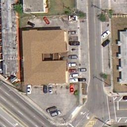
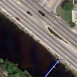
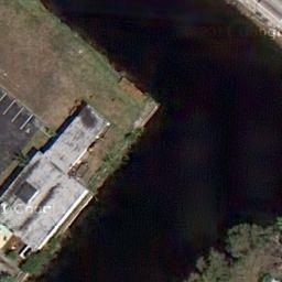
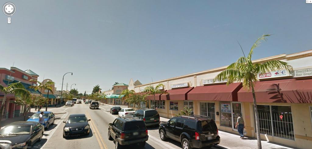
1 Palm Ave Hialeah Building Data Address Palm Avenue City, State Hialeah, Florida County Miami Dade parcel # and 1960 Zoning Retail Commercial - BU2 Land Size Type Construction / Parking CBS - 6 parking Spaces Building Size 9067 Year Built Built 1951 renovated 2006 Tenant/Lease Data Rent Square feet term Tenant Palm Av Cuba Pack Envio $ 31, Tenant Palm Ave Liberty Tax $ 15, Tenant Palm Ave Argenty Bakery $ 19, $ Tenant Palm Ave Pichardo $ 11, $ 11 mo-mo Tenant Palm Ave Jose Martinez Clothing $ 32, $ Tenant Palm Ave Jose Martinez Clothing in above $ 109, EXPENSES: Cash Flow $ 109,926 Taxes paid by tenant $ 12,700 Insurance paid by tenant $ 8,970 maint & reserves paid by tenant $ 6,111 Net Cash Flow $ 91,320 6 cap $1,522,000 price / sf $ rent / sf $ $ Aug $ Apr

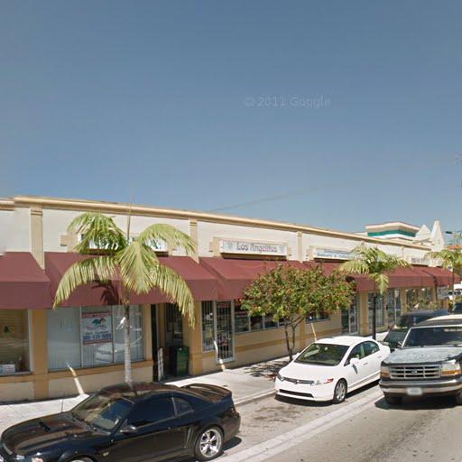
2 2012 Google


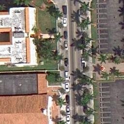
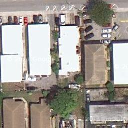


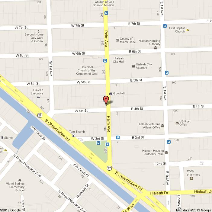
3 450 palm ave - Google Maps 4/17/12 1:57 PM To see all the details that are visible on the screen, use the "Print" link next to the map. qtocw&sa=x&oi=geocode_result&ct=title&resnum=1&ved=0ccmq8gewaa Page 1 of 1
4 LEGEND = Arc = Asphalt = Bench Mark = Bearing = Catch basin = Catch basin = Concrete Block Structure = Chord A ASPH BM BRG CATV CB CBS CH Chatta.= Chattahoochee C L = Center Line CLF = Chain Link Fence CL. = Clear CONC.= Concrete D = Delta = Diameter DH = Drill Hole DME = Drainage & Maintenance Easement E.B. = Electric Box Enc. = Encroachment F.F. = Finish Floor F.H. = Fire Hydrant F.I.R. = Found Iron Rebar FPL = Florida Power & Light F.I.P. = Found Iron Pipe FD. = Found L.P. = Light Pole M = Measured M.F. = Metal Fence M.H. = Manhole M L = Monument Line MON. = Monument N/A = Not Applicable N/D = Nail & Disc NOTE: a) All clearances and/or encroachments shown hereon are of the apparent physical use, fence legal ownership not determined. b) The issue of this survey is only for the exclusive and specific use of those persons, parties or institutions in the certification. c) Code restrictions and title search not reflected in this survey d) Underground utilities, improvements, footings and encroachments, if any not located. e) The flood information shown hereon does not imply that the subject property will or will not be free from flooding or damage and does not create liability on the part of the firm or employee thereof, for any damage that occurs from reliance on said information. f) Lands depicted hereon were surveyed per legal description provided by client and no claims as to ownership or matters of title are made or implied. g) All roads shown hereon are public unless otherwise noted. h) No identification cap found on property corners unless otherwise noted. i) Distance along boundary are record and measured unless otherwise noted. j) The graphic portions of this document are intended to be displayed at the graphic/name scales as depicted. Said scale may be altered in reproductions and as such, should be considered when obtaining scaled data. k) Accuracy: The expected use of land as classified in the minimum technical standards (5J17-FAC), is "Suburban". The Minimum relative distance accuracy for the type of boundary survey is 1 foot in 7,500 feet. The accuracy obtained by measurement and calculation of a closed geometric figure was found to exceed this requirement. l) Contact the appropriate authorities prior to any design work or excavation on the herein described parcel for building, zoning information and utilities location. ADJACENT BUILDING ' NTS = Not to Scale O/S = Offset O.U.L. = Overhead Utility Lines OH = Overhang P = Plat PB = Plat Book PC = Point of Curvature P.C.C. = Point of Compound Curvature PCP = Permanent Control Point PG = Page P.I. = Point of Intersection PL = Property Line PL = Planter P.O.B. = Point of Beginning P.O.C. = Point of Commencement P.P. = Power Pole P.R.M. = Permanent Reference Monument P.R.C. = Point of Reverse Curvature PT = Point of Tangency R = Radius R/R = Railroad PSM = Professional Surveyor Mapper E. 5th STREET ' ONE STORY COMMERCIAL BUILDING # This property described as: Lot 13 and 14, Block 15, TOWN OF HIALEAH, according to the Plat thereof as recorded in Plat Book 5, Page 77, of the Public Records of Miami-Dade County, Florida. Certified to: Lease Florida Hialeah LLC = Right-of-Way = Sidewalk R/W SWK = Section = Typical Sec. (TYP) = Tangent T Address: 400 Palm Avenue, Hialeah, FL = Utility Easement = Wood Fence = Water Meter = Water Valve U.E. W.F. W.M. W.V. X.XX Elevations shown refer to N.G.V.D BM # M-74 (Miami-Dade County) Elevation = 9.41 ft (N.G.V.D.) PALM AVENUE = Denotes Spot Elevations Taken N/A (reference) N/A Bearing, if any, shown based on Alvarez, Aiguesvives and Associates, Inc. TOPOGRAPHIC SURVEY. I HEREBY CERTIFY: that this survey meets the standards of practice as set forth by the FLORIDA BOARD OF PROFESSIONAL SURVEYORS AND MAPPERS in chapter 5J-17 Florida Administrative Code, pursuant to Section Florida Statutes. REVISIONS: Surveyors, Mappers and Land Planners 5701 S.W. 107th Avenue #204, Miami, FL Phone Fax L.B. No / aaasurvey@aol.com Not valid unless it bears the signature and the original raised seal of Florida licensed Surveyor and Mapper. FLOOD ZONE COMM. No. PANEL No. SUFFIX: 0283 L AH Field Date Scale: Drawn by: Drwg. No. 03/15/16 1"= 20' R.S RENE AIGUESVIVES 03/22/16 PROFESSIONAL SURVEYOR AND MAPPER No State of Florida. BASE ELEV. F.I.R.M.INDEX F.I.R.M.DATE "THIS SURVEY DECLARATION IS MADE ON THE FIELD DATE INDICATED, TO THE OWNER(S) LISTED. IT IS NOT TRANSFERABLE TO ADDITIONAL INSTITUTIONS OR SUBSEQUENT OWNERS." + 8 FT N.G.V.D. 09 / 11 / / 11 / 09 W 4th STREET

5
SITE TO BE DEMOLISHED
 STE TO BE DEMOLSHED City Hall/Moca 357' 2 7 3 Subject 97,400sf magery 2017 Google, Map data 2017 Google 200 ft -----------------,...j J2J_ t --... --F-Lj-\u:111-ii-1-1-1:f1-1-111-L/-t "l(pkgje1 '_-o 15(PK6)135'-0"
Development Review Committee Application
 City of Coral Gables, Florida Level 2 Review Development Review Committee Application Address: 427 Biltmore Way, 2 nd Floor, Coral Gables, Florida 33134 Email: planning@coralgables.com Phone: 305.460.5211
PLAT OF SURVEY VICINITY MAP (NOT TO SCALE) N N W E SITE BENCHMARK # 2 W E N&D ON BACK OF CURB NAVD 88 S S 0' 10' 20' 40' 60' 1" = 20' TOP=106.7
 N N W E SITE BENCHMARK # 2 W E N&D ON BACK OF CURB NAVD 88 S S 0' 10' 20' 40' 60' 1 = 20' TOP=106.7") PLAT OF SURVEY VICINITY MAP (NOT TO SCALE) N N W E SITE BENCHMARK # 2 W E N&D ON BACK OF CURB 106.21 NAVD 88 S S 0' 10' 20' 40' 60' 1" = 20' TOP=106.72 N INV PVC=99.27 S INV PVC=99.32 E INV CLAY=99.39
PLAT OF SURVEY VICINITY MAP (NOT TO SCALE) N N W E SITE BENCHMARK # 2 W E N&D ON BACK OF CURB 106.21 NAVD 88 S S 0' 10' 20' 40' 60' 1" = 20' TOP=106.72 N INV PVC=99.27 S INV PVC=99.32 E INV CLAY=99.39
SKETCH OF BOUNDARY SURVEY ALTA / ACSM LAND TITLE SURVEY
 SKETCH OF BOUNDARY SURVEY ALTA / ACSM LAND TITLE SURVEY SURVEYOR'S NOTES: All distances as shown hereon are based on the US Survey foot. Subject property lies inside the UBD (Urban Development Boundary),
AIR ONE. 829 HULL ROAD Ormond Beach, Florida BENCHMARK #1 EL NAIL IN POWER POLE EASTERLY RIGHT-OF-WAY LINE TOMOKA AIRPORT ROAD (UR) HULL ROAD
 HULL ROAD") NORTH LINE LOT 2 SOUTH LINE LOT 1 S75 46'55"E 2 NORTH LINE LOT 3 SOUTH LINE LOT 2 N75 43'32"W(UR) S75 43'32"E(D) N75 43'32"W(URD) NORTH LINE LOT 1 SOUTH LINE LOT 12 225.15'(M)225'(UR) P.O.R. PARCELS II
NORTH LINE LOT 2 SOUTH LINE LOT 1 S75 46'55"E 2 NORTH LINE LOT 3 SOUTH LINE LOT 2 N75 43'32"W(UR) S75 43'32"E(D) N75 43'32"W(URD) NORTH LINE LOT 1 SOUTH LINE LOT 12 225.15'(M)225'(UR) P.O.R. PARCELS II
MtU of Nort4 Port. Resolution No.: 2011-R-32. Page 1 of 3 RESOLUTION NO R-32
 Resolution No.: 2011-R-32 4 F oo,~ly Title: Emerald Oaks R-O-W to Easement W o ~ N ti OR% MtU of Nort4 Port RESOLUTION NO. 2011-R-32 (A Resolution for non-enforcement of the reverter clause in Petition
SECTION SITE SURVEYS
 PART 1 - GENERAL 1.1 DESCRIPTION SECTION 02 21 00 SPEC WRITER NOTES: 1. Use this section only for NCA projects. 2. Delete between //---// if not applicable to project. Also delete any other item or paragraph
PRELMINARY PLAT CHECKLIST
 PRELMINARY PLAT CHECKLIST A. All preliminary plat submitted for approval shall be prepared by a Registered Professional Land Surveyor. B. Preliminary plats must be drawn to a scale of XXX with such accuracy
PUBLIC NOTICE REQUEST FOR PROPOSALS AND NOTICE OF INTENT TO ACCEPT PROPOSAL IN THE CITY OF DELRAY BEACH, FLORIDA, FOR REDEVELOPMENT
 PUBLIC NOTICE REQUEST FOR PROPOSALS AND NOTICE OF INTENT TO ACCEPT PROPOSAL IN THE CITY OF DELRAY BEACH, FLORIDA, FOR REDEVELOPMENT Pursuant to Section 63.380, Florida Statutes, notice is hereby given
CITY OF PORT ST LUCIE
 CITY OF PORT ST LUCIE COUNCIL AGENDA MEMORANDUM Agenda Item #: 11B Meeting Date: 5/22/17 TO: Mayor and City 1Council 2 VIA: Russ Blackburrit, ity Manager Patricia Roeblirg, P.E., Assistant City Manager
CERTIFIED SURVEY MAP
 SCONSIN STATE PLANE N:389676.12 E:2130390.15 Center of Section 23 CERTIFIED SURVEY MAP 734.06' THE (PRITCHETTE) ORIGINAL PLAT OF ALL IN THE NW 1 4 OF THE SE 1 4 OF FRACTIONAL SECTION 23, T7N, R9E, IN THE
COUNTY OF ADAMS, STATE OF COLORADO E. 40TH AVE. TOWER RD. E. 38TH AVE. SALIDA ST. HIGH LINE CANAL PROJECT LOCATION E. 32ND PKWY.
 LEGAL DESCRIPTION:, GATEWAY EAST AT TOWER SUBDIVISION FILING NO. 1, SAID PARCEL CONTAIN 598,154 SQUARE FEET OR MORE OR LESS GENERAL NOTES: 1. NOTICE: ACCORDING TO COLORADO LAW YOU MUST COMMENCE ANY LEGAL
SALE FOR 8,034 SQ. FT. FULLY LEASED MULTI TENANT MEDICAL BUILDING CONDITIONALLY SOLD! 8330 FAIRMOUNT DR SE CALGARY, AB
 FOR SALE 8,034 SQ. FT. FULLY LEASED MULTI TENANT MEDICAL BUILDING CONDITIONALLY SOLD! 8330 FAIRMOUNT DR SE CALGARY, AB For additional information contact: JIM EDWARDSON (403) 540-0238 EMAIL: jim@manchesterproperties.ca
Map Filing Law. 46: Effective date This act shall take effect January first, one thousand nine hundred and fiftyfour.
 46:23-9.8. Effective date This act shall take effect January first, one thousand nine hundred and fiftyfour. L.1953, c. 358, p. 1941, s. 8. 46:23-9.9. Short title This act shall be known and may be cited
2213 BUTLER PAD SITE NEAR NEW PARKLAND HOSPITAL. Butler Street at Redfield Dallas, Texas EDGE REALTY PARTNERS
 PAD SITE NEAR NEW PARKLAND HOSPITAL 2213 BUTLER Butler Street at Redfield Dallas, Texas EDGE REALTY PARTNERS 2213 BUTLER // Dallas, Texas LOCATION 2213 Butler Street Dallas, Texas 75235 SIZE 83,370 square
This Page Intentionally Blank
 10.0 Certificates of Correction This Page Intentionally Blank 11.0 RIVERSIDE COUNTY SURVEYOR ACCEPTED ABBREVIATIONS AND ACRONYMS 197 A.C.S.M. A.O. A.T.& S.F. A/C Ac. Ave. B.C. B.C.R B.L.M. B.M. B.O.B.
CLARK 3925 E. US 377 COMMERCIAL $699,000 COMMERCIAL PAD SITE IN FRONT OF NEW KROGER. Granbury, Texas
 PAD SITE IN FRONT OF NEW KROGER $699,000 1.858 Acres Monument sign on 377 377 road frontage Platted Zoned Utilities to the site PROPERTY INFORMATION Property Information: Adjacent to recently opened Kroger
Standards of Practice for Surveying in the State of Alabama
 Standards of Practice for Surveying in the State of Alabama Effective January 1, 2017 RULE NO. 1.01 PURPOSE The purpose of these rules is to establish standards for the practice of surveying in the State
VICINITY MAP SCALE 1'' = 2000'
 CITY CREEK ANNEXATION TO THE CITY OF THORNTON LOCATED IN THE SOUTHWEST QUARTER OF SECTION 11 AND THE WEST HALF OF SECTION 14, TOWNSHIP 1 SOUTH, RANGE 68 WEST OF THE 6TH PRINCIPAL MERIDIAN, COUNTY OF ADAMS,
[] Workshop
![[] Workshop](/thumbs/95/123671251.jpg "[] Workshop") PALM BEACH COUNTY BOARD OF COUNTY COMMISSIONERS AGENDA ITEM SUMMARY Agenda Item #: 1/C. ---------------------------------------------------------------- ----------------------------------------------------------------
PALM BEACH COUNTY BOARD OF COUNTY COMMISSIONERS AGENDA ITEM SUMMARY Agenda Item #: 1/C. ---------------------------------------------------------------- ----------------------------------------------------------------
DATE: May 16, Honorable Mayor City Council Members. Laura Holey, Planner
 DATE: May 16, 2015 TO: FROM: Honorable Mayor City Council Members Laura Holey, Planner AGENDA ITEM: 11 C. Vacation of Easement 821 Corporate Drive REQUIRED ACTION: The City Council is asked to conduct
MINIMUM STANDARDS MANUAL FOR THE PRACTICE OF LAND SURVEYING IN SOUTH CAROLINA. Effective September 26, 2008
 49-400. Purpose. Effective September 26, 2008 A. These regulations are intended to establish a minimum standards manual for the practice of land surveying in South Carolina. (1) The standards set forth
Subdivision of existing two lots into three lots.
 PP-15-00189 Item No. 4-1 PC Staff Report 06/22/2015 PLANNING COMMISSION REPORT NON PUBLIC HEARING ITEM PUBLIC HEARING ON THE VARIANCE ONLY ITEM NO 4: PRELIMINARY PLAT FOR DEERFIELD WOODS SUBDIVISION NO.
E. 140TH AVE. VICINITY MAP SCALE: 1"=600' LAND USE TABLE NET AREA 599,946 SQFT AC. GROSS AREA 741,420 SQFT AC.
 SHEET OF PURPOSE STATEMENT: THIS PLAT IS INTENDED TO SUBDIVIDE. ACRES INTO SINGLE FAMILY ATTACHED LOTS, TRACTS, DEDICATE AND GRANT EASEMENTS. LEGAL DESCRIPTION: THE UNDERSIGNED BEING THE OWNER(S) OF A
R/W PREQUALIFICATION ODOT, 3/14/2018
 R/W PREQUALIFICATION ODOT, 3/14/2018 BRETT SHEARER, C.O. REAL ESTATE PROPOSED RIGHT OF WAY DESIGN 172 PROPOSED RIGHT OF WAY DESIGN PROPOSED RIGHT OF WAY DESIGN Section 3200 Types of Title 173 PROPOSED
DIVISION 2 - CONSTRUCTION PLAN AND MISCELLANEOUS REQUIREMENTS
 DIVISION 2 - CONSTRUCTION PLAN AND MISCELLANEOUS REQUIREMENTS 2.1 Required Plan Sheets 2.2 Drawing Requirements 2.3 Graphic Standards 2.4 Easements 2.5 Utility Locations 2.6 Private Facility Locations
QUEBEC STREET EAST 130TH AVENUE ONEIDA STREET E. 130TH AVE. VALENTIA ST TAMARAC ST EAST 128TH AVENUE MONACO STREET BACHMAN DR. SITE QUINCE ST.
 SHEET OF CASE NO.: SUBA 0-0 PURPOSE STATEMENT: THIS PLAT IS INTENDED TO SUBDIVIDE. ACRES INTO 0 SINGLE FAMILY LOTS, AND TRACTS FOR PARKS, OPEN SPACE, DRAINAGE AND DETENTION, DEDICATE RIGHT-OF-WAY AND GRANT
D OWNER'S AGENT 0 PROPERTY OWNER D CONTRACT PURCHASER
 Last Updated 12/20 I 5 REZONING APPLICATION AN APPLICATION TO AMEND THE OFFICIAL ZONING MAP OF GWINNETT COUNTY, GA. APPLICANT INFORMATION PROPERTY OWNER INFORMATION* NAME: Jose Sanchez NAME: Jose Sanchez
FOR SALE ACRES UNDEVELOPED COMMERCIAL LAND DURHAM LAKES, CITY OF FAIRBURN, FULTON COUNTY, GA
 FOR SALE - 7.23 ACRES UNDEVELOPED COMMERCIAL LAND DURHAM LAKES, CITY OF FAIRBURN, FULTON COUNTY, GA COMMENTS This bank owned opportunity 7.23 acres of undeveloped commercial land located within the city
PORT ST. LUCIE CITY COUNCIL
 PORT ST. LUCIE CITY COUNCIL AGENDA ITEM SUMMARY Meeting Date: November 27, 2017 PLACEMENT: First Reading of Ordinances ACTION REQUESTED: Motion / Vote Agenda Item #: 1 OB 11-27-1 7 AN ORDINANCE PROVIDING
CITY OF FAYETTEVILLE, ARKANSAS FINAL PLAT FOR STAFF USE ONLY FINAL PLAT FEE: $ $ Date Application Submitted: Date Accepted as Complete:
 CITY OF FAYETTEVILLE, ARKANSAS FINAL PLAT FOR STAFF USE ONLY FINAL PLAT FEE: $200.00-$800.00 Date Application Submitted: Date Accepted as Complete: Project Number: Public Hearing S-T-R: PP#: Zone: Please
Location Map. Subject Site. Project Name: Boulder Lakes 4th Addn. Request: Preliminary Subdivision Case No.: 01-PS INVER GROVE HEIGHTS
 HOLIDAY LN LOUIS LANE INVER GROVE HEIGHTS AMES CROSSING RD STATE TRUNK HWY. NO. 55 CHAPEL LANE O'NEILL DR VIKINGS PARKWAY LONE OAK DRIVE C.S.A.H. NO. 26 (LONE OAK RD.) COURTHOUSE LN TRUNK HWY. NO. 55 JOYCE
Counl! Administrato~s SiQn~
 Consent Agenda D Regular Agenda Counl! Administrato~s SiQn~ BOARD OF COUNTY COMMISSIONERS DATE: January 15, 2013 AGENDA ITEM NO. {;; D Public Hearing [if Subject: Quasi-Judicial Petition to Vacate a Portion
RIVERDALE CITY PLANNING COMMISSION APPLICATION FOR RESIDENTIAL SUBDIVISION SITE PLAN APPROVAL
 Community Development 4600 So. Weber River Drive Riverdale, Utah 84405 RIVERDALE CITY PLANNING COMMISSION APPLICATION FOR RESIDENTIAL SUBDIVISION SITE PLAN APPROVAL CASE NO: DATE SUBMITTED: APPLICANT S
CONSTRUCTION PLANS for HALCYON A RESIDENTIAL SUBDIVISION 6100 MIDNIGHT PASS ROAD, SARASOTA, FL 34242
 CONSTRUCTION PLANS for HALCYON A RESIDENTIAL SUBDIVISION 6100 MIDNIGHT PASS ROAD, SARASOTA, FL 34242 SECTION 18, TOWNSHIP 37 SOUTH, RANGE 18 EAST SARASOTA COUNTY, FLORIDA PID: 0030001 A DEVELOPMENT BY
CHAPTER Committee Substitute for House Bill No. 3223
 CHAPTER 98-20 Committee Substitute for House Bill No. 3223 An act relating to land platting; amending s. 177.031, F.S.; defining terms relating to platting; amending s. 177.041, F.S.; requiring plats and
QUEBEC STREET EAST 130TH AVENUE ONEIDA STREET E. 130TH AVE. VALENTIA ST TAMARAC ST EAST 128TH AVENUE MOACO STREET BACHMAN DR. SITE QUINCE ST.
 SHEET OF CASE NO.: SUBA - PURPOSE STATEMENT: THIS PLAT IS INTENDED TO SUBDIVIDE. ACRES INTO SINGLE FAMILY LOTS, AND TRACTS FOR PARKS, OPEN SPACE, DRAINAGE AND DETENTION, DEDICATE RIGHT-OF-WAY AND GRANT
City of Palmetto Florida
 Date Submitted: CIT A9LME o City of Palmetto Florida Final Plat Application PROJECT NAME: Final Plat Review Small Scale 1, 500 Plans consistent with a prior preliminary Under 10 acres) Site Plan approval
ABBREVIATION LEGEND SITE INFORMATION:
 SITE INFORMATION: Current Zone: R-3 PUD, governed by Fox Hollow 2nd MDA Basis of Elevations: Northeast Corner of Section 13, T6S, R1W, S.L.B. & M Elevation: 4599.26 (Benchmark) ABBREVIATION LEGEND Owners:
ARTICLE 900 PLAT AND PLAN REQUIREMENTS
 ARTICLE 900 PLAT AND PLAN REQUIREMENTS SEC. 900.1 ITEMS TO BE SHOWN ON PLAT OR PLAN General (1) Property lines of all property owners adjacent to the exterior boundaries of the project shall be located
City of Grand Forks Staff Report
 City of Grand Forks Staff Report Planning and Zoning Commission March 6, 2019 City Council March 18, 2019 Agenda Item: 4-1 (Preliminary) Preliminary approval of the plat of University Place First Resubdivision
Rule 21 STANDARDS OF PRACTICE FOR SURVEYING
 Rule 21 STANDARDS OF PRACTICE FOR SURVEYING 21.1 Whenever a survey is performed, it shall comply with Section 73-13-71 (4) and Section 73-13- 73 and the Standards of Practice for Surveying in Mississippi
of Professional Surveyors
 Mississippi Association of Professional Surveyors Standards of Practice for Surveying in the State of Mississippi Exam Answer all questions. Sign and date the statement on last page. Send completed exam
WATERFORD LANDING COMMUNITY DEVELOPMENT DISTRICT REGULAR MEETING AGENDA
 WATERFORD LANDING COMMUNITY DEVELOPMENT DISTRICT REGULAR MEETING AGENDA January 31, 2019 Waterford Landing Community Development District OFFICE OF THE DISTRICT MANAGER 2300 Glades Road, Suite 410W Boca
MINOR SUBDIVISION PLAT CHECKLIST
 MINOR SUBDIVISION PLAT CHECKLIST Project Name: Tax ID #: Project Number: Date: _ Reviewed By: Telephone: NOTES: All lots on septic systems must comply with the Fulton County Health Department requirements
DRIVEWAY REQUIREMENTS
 APPLICATION FOR: RESIDENTIAL DRIVEWAY / ACCESS Zoning Review Mail: - 101 White Ave. S.E. - Live Oak, FL 32064 Office: City Hall Annex - 416 Howard Street E - Live Oak, FL 32064 Phone: 386.362.2276 ofc.
SECTION 6 - APPROVAL OF PLATS. Whenever any subdivision of land is proposed, and before any permit for the
 SECTION 6 - APPROVAL OF PLATS 6-1 APPROVAL REQUIRED BEFORE SALE Whenever any subdivision of land is proposed, and before any permit for the erection of a structure shall be granted, the subdivider or his
Sketch & Legal Description of Mitigation Bank and Ingress/Egress Access Easements
 Appendix H: Sketch & Legal Description of Mitigation Bank and Ingress/Egress Access Easements Tippen Bay Wetland Mitigation Bank DeSoto County, Florida Prepared by: September, 2017 Original file
PRIME HIGHWAY LOCATION Multi - Family Land Acres Waxahachie, Texas
 PRIME HIGHAY LOCATION Multi - Family Land 6.525 Acres axahachie, Texas LOCATION: SIZE: The subject property is located on the south side of U.S. Highway 287 Bypass, approximately 1.5 miles west of I-35E
PLANNING COMMISSION REPORT Non-Public Hearing Item
 PC Staff Report 09/21/2015 Item No. 2B - 1 PLANNING COMMISSION REPORT Non-Public Hearing Item PC Staff Report 09/212015 ITEM NO. 2B: FINAL PLAT FOR MORGAN ADDITION; 800 MONTEREY WAY (MKM) : Consider a
RULES OF THE GEORGIA STATE BOARD OF REGISTRATION FOR PROFESSIONAL ENGINEERS AND LAND SURVEYORS CHAPTER APPLICATIONS TABLE OF CONTENTS
 RULES OF THE GEORGIA STATE BOARD OF REGISTRATION FOR PROFESSIONAL ENGINEERS AND LAND SURVEYORS CHAPTER 180-7 APPLICATIONS TABLE OF CONTENTS 180-7-.07 Maps and Plats. All maps, plats and similar documents
ARTICLE 900 PLAT AND PLAN REQUIREMENTS
 Final SEC. 900.01 ARTICLE 900 PLAT AND PLAN REQUIREMENTS General provisions. (a) Scale. The scale of all plats and plans shall be a minimum of 1 to 100 ft. (b) Size. The minimum page size for all plats
Department of Development Services Engineering; Survey Plat Review Group SPRG
 Department of Development Services Engineering; Survey Plat Review Group SPRG CITY OF DALLAS LEGAL DESCRIPTION PREPARATION GUIDELINE AND CHECKLIST The following guideline and checklist are provided to
CODE OF PRACTICE FOR LAND SURVEYORS
 CODE OF PRACTICE FOR LAND SURVEYORS PREPARED BY DELAWARE-HUDSON PROFESSIONAL LAND SURVEYORS ASSOCIATION P.O. BOX 502 HIGHLAND MILLS, NY 10930 ADOPTED DECEMBER 9, 1987 REVISED FEBRUARY 9, 1988 Preamble
PLANNING COMMISSION STAFF REPORT
 PLANNING COMMISSION STAFF REPORT Alder-Robinson Subdivision Amending the Amended Plat of the Arcadia Heights Plat A Subdivision Case #PLNSUB2010-00044 2857 East 2100 South June 23, 2010 Applicant: Greg
ANSWERS TO QUESTIONS IN VARIATION APPLICATION
 ANSWERS TO QUESTIONS IN VARIATION APPLICATION BACKGROUND: Working with Cliff Town of Town Studios Architects and Cliff Toberman of Toberman & Associates Civil Engineers and Surveyors petitioner, the architect,
DAWSON COUNTY MINOR PLAT REVIEW CHECKLIST $50.00 FEE PER PLAT REVIEW, $5.00 FEE FOR SCAN & CD FOR RECORDING
 DAWSON COUNTY MINOR PLAT REVIEW CHECKLIST $50.00 FEE PER PLAT REVIEW, $5.00 FEE FOR SCAN & CD FOR RECORDING NAME ON PLAT: CONTACT/PHONE #: NAMED STREET/ADDRESS: LAND LOT: DISTRICT: SECTION: ZONING: SETBACKS:
Grand Forks Growth Fund, A Jobs Development Authority Staff Report
 Grand Forks Growth Fund, A Jobs Development Authority Staff Report Growth Fund Committee March 20, 2017 JDA March 20, 2017 Agenda Item: Business Park Infrastructure Submitted by: Ryan Brooks, Deputy City
MAPLETON CITY CORPORATION. Step 7: Upon final approval and prior to plat recording the applicant shall provide the following:
 MAPLETON CITY CORPORATION Subdivision Process The City s subdivision requirements are designed to facilitate orderly, safe and efficient development and to implement the adopted General Plan. Below is
WASTEWATER BACKFLOW RELEASE PROCEDURES
 WASTEWATER BACKFLOW RELEASE PROCEDURES PROCEDURE FOR OBTAINING A WASTEWATER RELEASE FOR PRIVATE DEVELOPMENT PROJECTS: PLEASE NOTE THAT THE WASTEWATER BACKFLOW RELEASE DOCUMENT MUST FOLLOW THE CITY S PROCEDURES.
Application For Development Review (Subdivisions and Site Plan Review)
") Application For Development Review (Subdivisions and Site Plan Review) Thank you for your interest in Pickens County, South Carolina. This packet includes the necessary documents for review of subdivision
Application For Development Review (Subdivisions and Site Plan Review) Thank you for your interest in Pickens County, South Carolina. This packet includes the necessary documents for review of subdivision
Synergy Park Addition (Companion to item 3)
") Synergy Park Addition (Companion to item 3) Attachments: 1. Locator 2. Replat staff report 3. Replat W P G r es rg eo e s Bu hh wy Lot 6A 4.02-acres Lot 4C 13.02-acres Fran k Lots 4C and 6A, Block A Synergy
Synergy Park Addition (Companion to item 3) Attachments: 1. Locator 2. Replat staff report 3. Replat W P G r es rg eo e s Bu hh wy Lot 6A 4.02-acres Lot 4C 13.02-acres Fran k Lots 4C and 6A, Block A Synergy
FINAL PLAT APPLICATION
 FINAL PLAT APPLICATION (Page 1 of 3) LEGAL OWNER(s): NAME: STREET ADDRESS OWNER(s): CITY, STATE, ZIP CODE: PHONE NUMBER: BILLING ADDRESS: NAME OF ENGINEER/SURVEYOR: Engineer/Surveyor Address, Phone: PROPERTY
Count)! Administrator's Signatu~ f' 1:4"'
! Administrator's Signatu~ f' 1:4'") Consent Agenda D Regular Agenda Count)! Administrator's Signatu~ f' 1:4"' Subject: BOARD OF COUNTY COMMISSIONERS Quasi-Judicial Petition to Vacate a Portion of an Easement DATE: March 12, 2013 AGENDA ITEM
Consent Agenda D Regular Agenda Count)! Administrator's Signatu~ f' 1:4"' Subject: BOARD OF COUNTY COMMISSIONERS Quasi-Judicial Petition to Vacate a Portion of an Easement DATE: March 12, 2013 AGENDA ITEM
Real Property Services Division 2016 SUBDIVISION PLAT CHECKLIST
 Real Property Services Division 2016 SUBDIVISION PLAT CHECKLIST Created primarily for the use of Surveyors, CAD operators, and technical support staff for the preparation of subdivision plats. INTRODUCTION:
PUBLIC HEARING* N/A. C I T Y O F T A C O M A Planning & Development Services Department 747 Market St, Rm 345 Tacoma, WA 98402
 C I T Y O F T A C O M A Planning & Development Services Department 747 Market St, Rm 345 Tacoma, WA 98402 PUBLIC HEARING* Date of Notifcation: 10/5/2018 Application Received: 04/19/2018 Application Complete:
CHECK LIST FOR REVIEW OF SURVEY PLATS FOR COMPLIANCE WITH MISSOURI MINIMUM STANDARDS FOR PROPERTY BOUNDARY SURVEYS NAME OF SURVEYOR: DATE OF SURVEY:
 CHECK LIST FOR REVIEW OF SURVEY PLATS FOR COMPLIANCE WITH MISSOURI MINIMUM STANDARDS FOR PROPERTY BOUNDARY SURVEYS NAME OF SURVEYOR: DATE OF SURVEY: REVIEWED BY: DATE: DESCRIPTION OF SURVEY: GENERAL LAND
MINOR SUBDIVISION APPLICATION
 Planning and Development 510 N. Baker St. Mount Dora, FL 32757 352-735-7112 Fax: 352-735-7191 plandev@cityofmountdora.com Date: Project Name: MINOR SUBDIVISION APPLICATION 1. Applicant s Name: 2. Property
EXHIBIT 3 Page 1 of 6
 Page 1 of 6 08-TE.11-06/98 This instrument prepared under the direction of: Laurice C. Mayes, Esq. Sketch and Legal Description prepared by: Pete Diaz. P.S.M. (04-09-13) Document prepared by: Grace K.
Dact= Bk:31661 Ps: 116
 Dact= 33591 Bk:31661 Ps: 116 AMENDMENT TO THE MASTER DECLARATION OF COVENANTS, CONDITIONS AND RESTRICTIONS FOR DUNSTAN CROSSING [Submission of Project Phase IIIl CHAMBERLAIN CONSTRUCTION, INC., a Maine
Windridge Market. Build-to-Suit or Ground Lease. Location: Available Space: Highlights: Jamie Knight x1
 Location: NWC of W San Antonio St & Mockingbird Ln 1601 W. San Antonio St, Lockhart, Texas 78644 Highlights: Signalized Intersection Zoned CMB (Commercial Medium Business) which allows for fuel sales,
FINAL PLAT. Community Development Department 8101 Ralston Road Arvada, Colorado 80002
 FINAL PLAT Community Development Department 8101 Ralston Road Arvada, Colorado 80002 September 2015 FINAL SUBDIVISION PLAT Final Subdivision Plat Review Applications for a Final Plat shall be submitted
Lila Foster, Planning Technician. Motion to accept the minutes was made by Ms. Welder, seconded by Ms. Trevino, Motion passed unanimously
 P L A N N I N G C O M M I S S I O N MEETING MINUTES Date and Time: July 20, 2017 at 5:15pm MEMBERS PRESENT: Greg Spears Philip Johns Michael Atkinson John Hyak James Johnson Julia Welder Bruce Woods Jill
Enforcement of Minimum Survey Standards
 Presented By: F. Anthony Rettke, P.S., Tax Map Supervisor, Franklin County John Greenhalge, Executive Director, State Board of Registration n the Ohio Revised Code, Section 315.251: If a deed conveying
CITY OF LEE S SUMMIT MINOR PLAT PROCESS. Purpose of Minor Plats
 MINOR PLAT PROCESS Purpose of Minor Plats The City of Lee s Summit requires that all property be platted before a building permit is issued. Platting involves the subdivision of land into lots or tracts.
SUBDIVISION AND LAND DEVELOPMENT. 185 Attachment 20
 185 Attachment 20 APPENDIX S Plat No. Date of Submission Twp. Fee $ Dauphin Co. Fee $ TOWNSHIP OF DERRY SUBDIVISION OR LAND DEVELOPMENT PLAN SUBMISSION APPLICATION This block for Twp. use only 1. Title
SUBDIVISION APPLICATION
 SUBDIVISION APPLICATION Preliminary Plat Minor Plat Final Plat Amended Plat Applicant Name: Owner (if different from applicant) Name: Company: Company: Address: Address: City, State, Zip City, State, Zip
LAND USE PERMIT APPLICATION
 LAND USE PERMIT APPLICATION Date Application No. TYPE OF PERMIT Subdivision Short Plat Conditional Use Binding Site Plan Final Plat Final Short Plat Variance Final Binding Site Plan Plat Amendment Short
BOARD OF COUNTY COMMISSIONERS AGENDA ITEM SUMMARY
 4C1 BOARD OF COUNTY COMMISSIONERS AGENDA ITEM SUMMARY PLACEMENT: CONSENT PRESET: TITLE: THE FLORIDA DEPARTMENT OF TRANSPORTATION IS REQUESTING THAT THE COUNTY TRANSFER OWNERSHIP OF RIGHT-OF-WAY AND A PERPETUAL
Change In The Name Of Owner (s) Of Land.
 Of Land.") Clermont County TRANSFER AND CONVEYANCE STANDARDS OF THE CLERMONT COUNTY AUDITOR AND THE CLERMONT COUNTY ENGINEER AS ADOPTED UNDER OHIO REVISED CODE SECTION 319.203, AS A RESULT OF TWO PUBLIC HEARINGS
Clermont County TRANSFER AND CONVEYANCE STANDARDS OF THE CLERMONT COUNTY AUDITOR AND THE CLERMONT COUNTY ENGINEER AS ADOPTED UNDER OHIO REVISED CODE SECTION 319.203, AS A RESULT OF TWO PUBLIC HEARINGS
Township of Collier 2418 Hilltop Road Presto, PA 15142
 Township of Collier 2418 Hilltop Road Presto, PA 15142 Fees: Major: 2 checks $600 + $50 per lot & $1700 Escrow) APPLICATION FOR SUBDIVISION major FINAL only Plans must be folded Rolled plans will not be
New Jersey Administrative Code Title 13, Chapter 40 State Board of Professional Engineers and Land Surveyors
 New Jersey Administrative Code Title 13, Chapter 40 State Board of Professional Engineers and Land Surveyors SUBCHAPTER 1. TITLE BLOCKS AND SEALS FOR PROFESSIONAL ENGINEERS AND LAND SURVEYORS 13:40-1.1
APPLICATION for MINOR SUBDIVISION REVIEW for CONCEPT and FINAL PLAT within COALVILLE CITY. Project Name: Project Address or Area: Name of Owner:
 APPLICATION for MINOR SUBDIVISION REVIEW for CONCEPT and FINAL PLAT within COALVILLE CITY For Office Use Only: Application #: Application Date: PC Approval Date: CC Approval Date: Community Development
BOSSIER CITY PARISH METROPOLITAN PLANNING COMMISSION 620 Benton Rd. Bossier City, LA Phone: Fax: PRELIMINARY PLAT
 (OFFICE USE ONLY) Application Fee: Paid: Date: CASE # Project Information BOSSIER CITY PARISH METROPOLITAN PLANNING COMMISSION 620 Benton Rd. Bossier City, LA 71111 Phone: 318-741-8824 Fax: 318-741-8827
The Filing Fee for a Minor Plat is $ PLUS $20.00 per lot created
 DEPARTMENT OF COMMUNITY DEVELOPMENT MINOR PLAT PROCEDURE The Filing Fee for a Minor Plat is $250.00 PLUS $20.00 per lot created Description: The purpose of a Minor Plat is to allow property to be platted
Department of Natural Resources
 Rules of Department of Natural Resources Division 30 Land Survey Chapter 2 Missouri Minimum Standards for Property Boundary Surveys Title Page 10 CSR 30-2.010 Application of Standards...3 10 CSR 30-2.020
TOWN OF MELBOURNE BEACH 2016 DEVELOPMENT APPLICATION
 TOWN OF MELBOURNE BEACH 2016 DEVELOPMENT APPLICATION I. SUBMITTAL REQUIREMENTS: 1. Fees per current schedule. 2. Deed to property. 3. Pre-Application meeting is mandatory. Contact the Building Official
Survey and Recording Requirements
 Article C: Sec. 14-1-40 Survey and Recording Requirements Survey Requirements. (a) (b) (c) Prior to the final approval of land divisions to which this Chapter applies, the owner of the land shall have
Plan and Zoning Commission Review Process
 . Village of Northfield Plan and Zoning Commission Review Process.......... Department of Community Development and Building Village of Northfield Department of Community Development and Building 361 Happ
Planning & Zoning Commission Staff Report for Honey Bee Acres Subdivision, SD-PH
 Planning & Zoning Commission Staff Report for Honey Bee Acres Subdivision, SD-PH2018-0009 Hearing Date: August 16, 2018 Development Services Department Applicant: Kelley & Carrie Dick Staff: Kyle McCormick,
Walton County Planning and Development Services
 Walton County Planning and Development Services 31 Coastal Centre Boulevard, Suite 100 47 N 6 th Street Santa Rosa Beach, Florida 32459 DeFuniak Springs, Florida 32433 Phone 850-267-1955 Phone 850-892-8157
Alvarez Engineers, Inc.
 Certificate of Authorization No. 7538 10305 NW 41 Street Suite 103 Doral, Florida 33178 Tel. (305) 640-1345 Fax (305) 640-1346 E-Mail: Juan.Alvarez@AlvarezEng.com June 29, 2015 Mr. Neil Kalin District
Condominium Unit Requirements.
 ARTICLE 19 CONDOMINIUM REGULATIONS Section 19.01 Purpose. The purpose of this Article is to regulate projects that divide real property under a contractual arrangement known as a condominium. New and conversion
AGENDA REQUEST AGENDA ITEM NO: IV.A.2. Consent Agenda No. 1. June 4, 2018 BY Development Services Timothy Litchet City Engineer DavisShaw SUBJECT:
 AGENDA HEADING: Consent Agenda No. 1 AGENDA REQUEST COMMISSION MEETING DATE: June 4, 2018 BY Development Services Timothy Litchet City Engineer DavisShaw AGENDA ITEM NO: IV.A.2. Originating Department
AGREEMENT FOR SALE AND PURCHASE OF INTEREST IN PROPERTY
 AGREEMENT FOR SALE AND PURCHASE OF INTEREST IN PROPERTY THIS AGREEMENT, is by and between PASCO COUNTY, a political subdivision of the State of Florida, acting by and through its Board of County Commissioners,
APPLICATION TO CONSTRUCT A DOCK
 APPLICATION TO CONSTRUCT A DOCK (In Accordance with Orange County Code Chapter 15, Article IX, Orange County Code) Mail or Orange County Environmental Protection Division Deliver To: 800 Mercy Drive, Suite
DALLAS WATER UTILITIES WATER/WASTEWATER COVENANT
 DALLAS WATER UTILITIES WATER/WASTEWATER COVENANT Procedure for obtaining a water and wastewater covenant, water covenant, or wastewater covenant; Required for initial submittal: 1. One letter from the
MINOR SUBDIVISION PLAT
 MINOR SUBDIVISION PLAT Community Development Department 8101 Ralston Road Arvada, Colorado 80002 MINOR SUBDIVISION PLAT Subdivisions consisting of five (5) or fewer lots are eligible for the minor subdivision
343 King St, Charleston, SC 29401
 Prime Retail on King Street, Suite: A 343 King St, Charleston, SC 29401 Listing ID: 30054864 Status: Active Property Type: Retail-Commercial For Lease Retail-Commercial Type: Street Retail Contiguous Space:
AGENDA ITEM G-2 Public Works
 AGENDA ITEM G-2 Public Works STAFF REPORT City Council Meeting Date: 2/23/2016 Staff Report Number: 16-035-CC Consent Calendar: Adopt a resolution accepting Easements and approving the abandonment of two