SHORELINE MANAGEMENT PLAN
|
|
|
- Francis Lane
- 6 years ago
- Views:
Transcription


1 SHORELINE MANAGEMENT PLAN Tygart Lake West Virginia APPENDIX F TO PROJECT MASTER PLAN U.S. ARMY CORPS OF ENGINEERS PITTSBURGH DISTRICT 0
2 SHORELINE MANAGEMENT PLAN APPENDIX F TO MASTER PLAN FOR TYGART LAKE WEST VIRGINIA TABLE OF CONTENTS PARAGRAPH PAGE 1. INTRODUCTION 4 a. Purpose 4 b. Authority 4 c. References 4 d. Applicability 4 e. History 5 f. Archeological Significance 5 2. OBJECTIVES OF THE PLAN 5 a. General 5 b. Commercial Concessions 5 c. Private Exclusive Use 6 d. Preliminary Study 6 e. Public Involvement 6 3. DESCRIPTION OF THE SHORELINE 7 a. General 7 b. Present Land Use 7 c. Private Development 7 d. Existing Access 7 e. Prior Commitments 8 f. Indian Lands 8 g. Joint Jurisdiction Federal 8 h. Joint Jurisdiction State 8 i. Joint Jurisdiction Municipal 8 4. LAKESHORE ALLOCATION 8 a. General 8 b. Allocations 8 c. Shoreline Allocation Master Map 9 1
3 PARAGRAPH PAGE 5 PERMITS 9 a. General 9 b. Application Procedures 9 c. Honoring of Past Commitments 10 d. Flowage Easement Areas 10 e. Community Docks and Boat Clubs 10 f. Shoreline Use Permits 11 g. Department of the Army Permits 11 h. Real Estate Instruments 11 i. Conditions PRIVATE MOORAGE FACILITIES 12 a. General 12 b. Basic Minimum Requirements VEGETATION ALTERATION 13 a. Mowing Permits LICENDED STRUCTURES ISSUED WITHIN LIMITED 14 DEVELOPMENT AREAS AND EASEMENT LANDS a. General 14 b. Electric Lines and Light Poles 14 c. Steps, Walkways and Footbridges 14 d. Erosion Control Devices FEES 14 a. Private Floating Dock Permits 14 b. Mowing Permits 15 c. Licenses PROHIBITED FACILITIES AND ACTIVITIES 15 a. General REVIEW 16 2
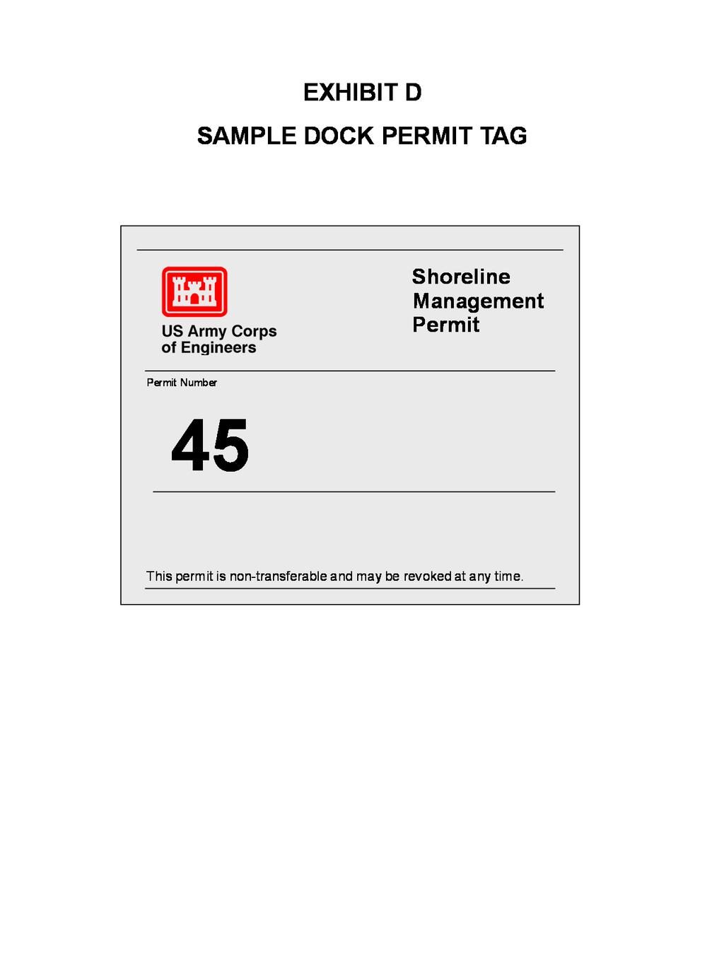
4 LIST OF EXHIBITS Tygart Lake Shoreline Allocations Map Summary of Application Procedures Application for Shoreline Use Permit (Sample) Dock Permit Tag (Sample) Shoreline Use Permit Conditions Exhibits A B C D E 3
5 U.S. ARMY CORPS OF ENGINEERS PITTSBURGH DISTRICT APPENDIX F SHORELINE MANAGEMENT PLAN Tygart Lake West Virginia 1. INTRODUCTION. a. Purpose. The Shoreline Management Plan establishes policy and furnishes guidelines for the protection and preservation of the desirable environmental characteristics of the Tygart Lake shoreline. The plan also considers means of restoration or the shoreline where degradation has occurred because of private exclusive use. b. Authority. The authority to establish this plan is ER , Lakeshore Management at Civil Works Projects, 12 December c. References. (1) Section 4, 1944 Flood Control Act, as amended, P.L (2) The Act of 31 August 1951 (31 USC 483a). (3) The National Environmental Policy Act of 1969, P.L (4) The Federal Water Pollution Control Act of 1972 (FWPCA). (5) Title 36, Chapter III, Part 327 Code of Federal Regulations, Rules and Regulations Governing Public Use of Water Resource Development Projects administered by the Chief of Engineers. (6) Executive Order (7) 33 CFR , Regulatory Program of the Corps of Engineers. d. Applicability. This plan is applicable to all Tygart project lands held in fee simple title by the Corps of Engineers, excluding lands leased for commercial concession activities. Facilities used in connection with commercial concessions are not affected by this plan as these operations are effectively controlled under their lease agreements. Activities upon easement lands will continue to be regulated by the original easement restrictions. These restrictions generally require a letter of consent to erect any structure or alter the land contour in any manner at or below the flood pool elevation of 1190 mean sea level. Floating facilities moored to easement lands require a dock permit from the U.S. Army Corps of Engineers. 4
6 e. History. Tygart Lake was authorized by the Public Works Administration, 11 January 1934, and adopted by the River and Harbor Act approved 30 August Construction of the dam was initiated January 1935 and was completed 3 years later in February Shortly thereafter, both the private and public recreational development of Tygart Lake took place. With the exception of the federal administration area in the vicinity of the dam, the development of the public recreational facilities and the management of the fish and game resources were, and still are, the responsibility of the West Virginia Division of Natural Resources. Such private recreational development as boat docks, paths, steps, erosion control devices, and mowing also took place on Tygart s shoreline. As the trend for expansion of private exclusive use facilities became more pronounced, permit procedures had to be implemented. If a proposed facility was structurally sound, and the applicant had a residence adjacent to government property, a permit or license for the facility was then granted. f. Archeological Significance. The Tygart Lake area is one of the least known archeological areas in the State of West Virginia. As a result, a survey of the archeological resources has been contracted to the West Virginia Geological and Economic Survey by the United States Department of the Interior. Salvage excavation were conducted by a Geologic and Economic Survey team during the late winter and spring months of The results of this survey indicated that an Indian village site, possibly of the Monongahela culture of the late prehistoric period, existed along Tygart s shoreline. 2. OBJECTIVES OF THE PLAN. a. General. Experience has shown that management is necessary in order to prevent large sections and possibly all of Tygart s shoreline from becoming congested with private uses and facilities. These private exclusive uses and demands have resulted in significantly reducing the amount of shoreline space left available for use by the general public. Sound lakeshore management will maximize the recreational use and enjoyment of Tygart Lake by all segments of the population and at the same time promote a greater compatibility between the recreating public, the environment, and the project purposes and resources. The objectives of this plan are to manage and protect the Tygart Lake shoreline, to establish and maintain acceptable fish and wildlife habitat, to preserve the aesthetic quality and natural environmental conditions, to honor past commitments to private individuals, and finally, to promote the safe and healthful use of the lake and shoreline for recreational purposes by all members of the visiting public. b. Commercial Concessions. Boat owners will be encouraged to moor their boats at the commercial marina, utilize dry storage facilities off project lands or trailer their boats to the public launching ramps which are provided by the West Virginia Division of Natural Resources at not charge. The concessionaire will be encouraged to increase the storage capacity based on public demand. Additional public marina concessions will be considered when the need is demonstrated. 5
7 c. Private Exclusive Use. Private exclusive use is the usage of public lands or waters by a private citizen or organization such that any benefit to be derived therefrom is in the predominate interest of the individual or organization. Private exclusive use may occur as an activity, e.g. mowing, or as spatial use that occurs when facilities, such as steps, docks, light-poles, etc. are placed upon public lands or waters. Ownership of private land adjoining government property does not convey any special rights or privileges on public lands and waters. All exclusive use of public lands and waters will be by permit or outgrant instrument only. d. Preliminary Study. A preliminary study of Tygart Lake for the development of the shoreline management plan began during the summer recreation season of This involved inspection of the shoreline, review of current problems, assessment of the extent of private exclusive use facility development, and the potential for future development. Proposals were discussed with individuals, groups, agencies, West Virginia Division of Natural Resources authorities, and local law enforcement agencies. e. Public Involvement. The public has been directly involved in the draft of this plan from its inception to final completion. The first public comments were received when the proposed ER Lakeshore Management at Civil Works Projects regulation was published in the Federal Register on 30 May The Pittsburgh District of the U.S. Army Corps of Engineers followed this action by holding a general public meeting at a local high school in Grafton, WV on 14 November The purpose of this meeting was to acquaint the public with the need for sound long-range lakeshore management on Tygart Lake, and to request volunteers from those in attendance to serve on a planning committee. A planning committee was later formed and met on five separate occasions during the early spring, summer, and late fall of The composition of this planning committee was a representative cross section of the interest groups that had expressed concern over the use of Tygart Lake s shoreline. Representatives from the West Virginia Division of Natural Resources, local sportsman s clubs, the West Virginia Wildlife Federation, three boat clubs, and adjacent property owners all served on the planning committee. Planning committee members provided input for this plan by preparing and submitting maps which illustrated each member s recommendations on shoreline allocation. A composite map was then prepared, reviewed, and approved by the planning committee. This composite map embodied the committee s collective ideas on a lakeshore allocation system for Tygart Lake. On May the 7 th 1978 the draft Shoreline Management Plan for Tygart Lake was presented at a final public meeting held at the Grafton High School auditorium in Grafton, West Virginia. Those present at this meeting were provided with the opportunity to make suggestions both, oral and in writing, concerning possible revisions to this proposed plan. Those who were unable to attend this meeting were also encouraged by the local newspapers and television to submit their ideas and comments relating to the lakeshore management of Tygart Lake within thirty days. Immediately after this thirty day period, a final draft of the Tygart Lake Shoreline Management Plan was prepared which embodied many of the recommendations received from both the planning committee and the general public. As a result of this advocacy planning process, the U.S. Army Corps of Engineers feel that this Tygart Lake Shoreline Management Plan will 6
8 provide meaningful direction to the long-range management of the public resources that make up Tygart Lake. 3. DESCRIPTION OF THE SHORELINE. a. General. Tygart Lake is located on the Tygart Valley River in Taylor and Barbour counties, north-central West Virginia. This particular valley is relatively narrow and is bordered by abruptly sloping hills and mountains. As a result, much of Tygart s 31 mile shoreline is extremely steep, irregular, and remains in a rugged state. The forests that surround and occupy much of the project s lands are classified as mixed mesophytic with the White Oak-Hickory and the Yellow Poplar subtypes being the most dominant. The recreational development, both private and public, is concentrated and limited to those natural bench areas where the slope presents few obstacles to construction. Primarily because of the unspoiled natural character of the lake and because of the recent completion of Interstate 79 and U.S. 48, the National Freeway, Tygart Lake is a recreational asset that is quickly becoming more and more popular with the residents of eastern Ohio, western Pennsylvania, and western Maryland, as well as, continuing to attract visitors from north-central West Virginia. b. Present Land Use. The Tygart Lake Project contains a total of 5,612 acres of land and water, of which 2,683 acres are owned in fee by the Federal Government. An additional 1,197 acres of privately owned land are managed by the Corps of Engineers as flowage easement. Forty acres of fee owned land in the vicinity of the dam are currently being used as a project operations area, overlook, a Corps operated picnic area, and a one-half mile long interpretive nature trail. In 1945, 1,732 acres of the Federally owned land was transferred to the West Virginia Conservation Commission. This plot later became the nucleus of the holdings which now comprise Tygart Lake State Park. The remaining land held in fee by the Federal Government is under long-term license/lease agreements with the West Virginia Division of Natural Resources for park and recreation purposes, and for fish and wildlife management. The lake has a maximum summer low water regulation pool of 1094 mean sea level which creates a pool of 1,750 acres. Toward the close of the recreation season in the fall, the pool is dropped to accommodate the operation of the project for flood control purposes. c. Private Development. Tygart Lake is located within easy driving distance of most of the major population centers of western Pennsylvania, northeastern Ohio, and north central-west Virginia. Nonetheless, the private development of Tygart s shoreline is rather limited and concentrated. This is a direct result of the severe slope and topography which impedes the construction of access roads and private dwellings. Extensive private recreational development has, however, occurred along all those sections of the shoreline where the topography was not a limiting factor. As a result, private floating facilities on Tygart Lake tend to be unevenly distributed and concentrated in three main areas: West Hill, Frog Run and Wildcat Hollow. d. Existing Access. In addition to pedestrian access, several roads and developed ramps provide six launching points to Tygart Lake. 7
9 e. Prior Commitments. Historically private boat docks have always been permitted on Tygart Lake. Presently (1978) there are sixty private and community type docks under valid permit on the reservoir. It is the intention of the Corps of Engineers to continue to honor all past commitments made to individuals concerning private floating structures and other exclusive uses of the shoreline. This commitment is, however, only extended to those persons who obtained valid shoreline use permits during that one year period immediately preceding the announcement of the general moratorium. f. Indian Lands. There are no Indian lands within the boundaries of the Tygart Lake project. g. Joint Jurisdiction Federal. No other federal jurisdiction exists on the project. h. Joint Jurisdiction State. The West Virginia Division of Natural Resources, Division of Parks and Recreation have a current lease with the Corps of Engineers on 1,453 acres of land and water for public park and recreation purposes. The Fish and Wildlife Division of the West Virginia Division of Natural Resources also has a license with the Corps on 2,217 acres of land and water for fish and wildlife management. i. Joint Jurisdiction Municipal. There are no license, lease or cost sharing agreements for recreation purposed at this time between the U.S. Army Corps of Engineers and any local municipalities. 4. LAKESHORE ALLOCATION. a. General. Development of adjoining private land increases the demand for private floating facilities; therefore, it is readily apparent that a plan for systematic development of the shoreline is essential. This approach is intended to protect the natural beauty of the shoreline and to control exclusive use of the lakeshore. b. Allocations. A comprehensive study of the entire fee lakeshore, involving public participation, resulted in development of a shoreline management plan for Tygart Lake which establishes shoreline allocations (See Exhibit A, Shoreline Allocation Map). No attempt is being made to include easement lands into the lakeshore allocation system. These areas are not owned in fee by the U.S. Government and are currently being effectively managed by individual perpetual easement agreements. (1) Limited Development Areas. Certain private facilities may be permitted in areas designated for limited development. In no case will the density of floating facilities exceed fifty percent of the shoreline allocated for limited development when the lake level is at summer pool (El msl). The density of development may be less than 50 percent if the proposed use adversely affects the general public safety, the resources of the project or the recreation opportunities provided by the project as determined by the District Engineer. 8
10 (2) Public Recreation Areas. Private exclusive use facilities and vegetation modification are not permitted within or adjacent to developed recreation areas, or in areas in close proximity to parks where the structures would detract from the view or the aesthetic appeal of the shoreline. In addition, no shoreline use permits will be issued in undeveloped designated recreation areas. These areas are excluded from private exclusive use in order to set aside certain segments of public lands for possible future expansion of existing recreation areas and facilities. (3) Protected Lakeshore Areas. Private exclusive use facilities are not permitted in protected lakeshore areas. These areas were designated to protect aesthetic, environmental, and fish and wildlife values. Other reaches of the shoreline were included under this allocation for physical protection reasons including shallow areas and reaches of the shoreline subject to exposure to winds or currents. Land access and boating are permitted along the shoreline within these areas as long as aesthetic, environmental, and natural resource values are not damaged or destroyed. Modification of the landform or vegetation may be permitted only after a thorough review of the long-term effects on the environmental and physical characteristics of the area. (4) Prohibited Access Areas. Private exclusive use facilities are prohibited in these areas. Such areas are so designated for the physical protection of the recreating public or for the protection of unique or fragile ecosystems. Examples of such would be unique fish spawning beds and certain hazardous areas near dams. c. Shoreline Allocation Master Map. A master map depicting the shoreline allocation system will be on display at the office of the Resource Manager at Tygart Lake. This map also appears as Exhibit A in this plan. 5. PERMITS. a. General. All private exclusive uses or facilities located on government lands or waters at Tygart Lake must be covered by permit, lease, or license. (See Exhibit B, Summary of Application Procedures). Private exclusive uses or facilities not so covered by such legal instruments will be considered as unauthorized uses or structures and subject to discontinuance or removal in accordance with U.S. Code of Federal Regulations, Title 36, Chapter III, Part 327. b. Application Procedures. The moratorium imposed on the issuance of new shoreline use permits and licenses on 14 December 1976 will be rescinded upon the approval date of this plan. Applications for real estate licenses and Shoreline Use Permits, such as dock permits and mowing permits, must be obtained in person from the Tygart Lake Resource Manager. A copy of the completed application (Exhibit C) is signed by the Resource Manager and placed on file. The applicant is then required to mail a second copy of the approved, signed, and completed shoreline use application with a check for the proper amount (made payable to: FAO, USAED, Pittsburgh) to the following address: U.S. Army Corps of Engineers Tygart Lake 530 Paul E Malone Road Grafton, WV
11 c. Honoring of Past Commitments. All previously issued leases, licenses or permits will be subject to reapplication upon implementation of this plan. In the case where the husband or wife dies and his or her name appears on the permit, the permit will be honored for the surviving spouse and the children as of the approval date of this plan. d. Flowage Easement Areas. Easement lands are those sections of the Tygart Lake shoreline from which the U.S. Government purchased only the perpetual right to flood or clear to the 1190 mean sea level elevation contour. Activities on easement lands are generally restricted to those which, in the opinion of an authorized U.S. Army Corps of Engineers representative, pose no real threat t the continued operation and maintenance of Tygart Lake and/or Tygart Dam. The U.S. Army Corps of Engineers, therefore, requests that individual easement property owners become familiar with their respective easement agreements and notify the Tygart Lake Resource Manager before undertaking any major vegetative alteration or construction projects below the 1190 msl contour. In order to defray the administrative costs borne by the Government, a fee is always charged when a real estate license is issued on easement land. In addition, any license issued on easement land for altering the land contour, which causes a loss of water storage for the lake, will also result in a fee being imposed. Water pumps and their associated lines which draw water from Tygart Lake for residences on easement property will require a real estate license. A fee will be charged based on the fair market value of the water being used for domestic consumption. In addition, easement property owners are also required to have their private docking facilities covered under a current and valid shoreline use permit. In all three of the above examples a fee is charged the easement property owner because a private exclusive use of public property (the water of Tygart Lake) is being made. e. Community Docks and Boat Club Docks. Applications for community boat docks or boat club docks must be accompanied with a photocopy of appropriate Articles of Incorporation of a non-profit corporation. A complete and current listing of the names and addresses of all members utilizing the facility must be provided. Only one application should be filed under the official name of the non-profit corporation. The District Engineer reserves the right to require all non-profit corporation community docks to submit an annual financial statement covering all dock income. These measures are being taken in order to insure that all benefits derived from non-profit corporations are distributed equally among their members. Community boat dock members that do not wish to be incorporated must file individual boat dock applications. 10
12 f. Shoreline Use Permits. Permits are issued and enforces in accordance with provisions of Section , Chapter III, Title 36, Code of Federal Regulations. Applications for all structures or actions requiring a permit, lease or license will be made to the Resource Manager at the Tygart Lake project office. These permits are non-transferable and shall become null and void upon sale or transfer of the structure, or upon the death of the permittee. Existing permittees will be allowed to place the name of the spouse or children on a renewal permit to be issued under this plan. Dock permits located with limited development areas shall remain in effect for five years and will be renewed as long as either spouse or children shall live provided the facility is properly maintained. Shoreline use permits are also issued for vegetative modification activities on the land which does not involve in any way a disruption to or a change in landform. Violators of the conditions of the permit, or any unauthorized modification of the permitted structure or activity, will be grounds for revocation of the permit. Shoreline use permits are subject to revocation with thirty (30) days notice if removal of the permitted structure or activity is required to conform to the law, this plan, or the operational procedures of the lake. For brevity, the term shoreline use permit and permit shall be used interchangeably. g. Department of the Army Permits. Permits will be required for the discharge of dredged material or the placement of fill material below the elevation of ordinary high water under the authority of Section 404 of the Clean Water Act. EPA guidelines (40 CFR Part 230) and the Corps public interest review (33 CFR Part 320 et seq.) will be applied when evaluating the permit applications. Shoreline use permits will not be issued under these circumstances. h. Real Estate Instruments. Real estate instruments shall cover all commercial development activities and all activities by individuals that are not covered in Sections 8 and 9. All right-ofways for waterlines, stairways, livestock movement, and watering shall also be included and must be covered by a real estate instrument. Real estate instruments are issued at fair market value. i. Conditions. Any individual or group wishing to use, change, landscape, build upon, or place upon government property any facility, must obtain written permission through the project office. Plans and specifications for construction of any structure on government lands or water are required. These documents will include structural design, anchorage methods, construction material, size, location, owner s address and telephone number, and expected duration of use. In addition, required plans and specifications for any alterations or improvements to existing permitted facilities shall be submitted to the Resource Manager before being undertaken. 11
13 6. PRIVATE MOORAGE FACILITIES. a. General. All members of the public have an equal opportunity to moorage privileges in limited development areas provided the applicant has public access to government land and that the density of development, as outlined in Paragraph 4.b.(1) Limited Development Areas, has not been exceeded. When the density of moorage development reaches the maximum percentage as determined for the allocated limited development area, permits for new private floating facilities will not be issued and present facilities will not be permitted to enlarge until space becomes available by the cancellation or termination of another docking permit. b. Basic Minimum Requirements. All private moorage facilities are subject to those conditions which are set forth in both the boat dock application and the Shoreline Management Plan. Those private docks under valid permit for that one year period immediately preceding the announcement of the general moratorium will continue to be issued shoreline use permits for their facilities as they were originally constructed. At such times when major repairs or replacement becomes necessary, it then becomes the owner s responsibility to insure that all guidelines and standards for construction or private moorage facilities are strictly adhered to. The Shoreline Management Plan requirements for private floating structures are as follows: (1) Docks shall be of a basic tee, U-shape or some other similar design that would facilitate the formation of future community docking sites. The dock size is not to exceed 500 square feet. (2) Walkway portions will be at least 32 inches and not more than 48 inches in width. (3) Framing will consist of 2 x 6 inch lumber or its equivalent in strength. (4) Docks, if painted, will be painted a solid neutral color so as not to detract from, or compete with, the aesthetic appeal of the shoreline. (5) Flotation devices must consist of a material that is specifically manufactured for boat docks and meets the specifications for flotation materials used for boat docks approved by the U.S. Army Corps of Engineers. Reuse of plastic, metal or other previously used drums or containers for encasement or flotation purposes is prohibited. (6) Electric lines, lights, or outlets will not be permitted upon docks unless both state and national electric code standards are strictly adhered to. (7) No signs will be erected upon docks. The words private dock may be painted on the upper surface of the dock. (8) Each section or slip of a community dock shall be identified by the name or number corresponding to those which are recorded on the approved shoreline use application. This is done to facilitate compliance inspections and to act as an aid in the identification of dock ownership in the event of storm damage. 12
14 (9) Vegetation, on government land, alive or dead, will at no time be used to anchor a dock. Easement property owners are also requested to voluntarily comply with this provision. This action is necessary in order to prevent the destruction of healthy vegetation which could eventually result in the needless erosion of the Tygart Lake shoreline. (10) Each permittee will post two permit tags on the permitted facility. These tags will be provided by the project office. The tags will be displayed so that they can be visually checked from the shore or by boat. (11) It is expected that docks will be maintained in a safe state or repair for the entire boating season. Unsafe structures, as determined by the Resource Manager, will be corrected as soon as possible, or the permit will be subject to revocation. At the end of the season, or in no case later than 1 November, all floating facilities must be secured in such a fashion so as to prevent winter ice from causing the structure to break loose from its moorings. Because of Tygart s extremely steep shoreline, docks will be permitted to be stored only on those sections of government land which are located below the summer pool vegetation line. Docks that are not properly secured at the end of the recreation season may be subject to impoundment and disposition in accord with the U.S. Code of Federal Regulations, Title 36, Chapter III, Part , Personal Property. 7. VEGETATION ALTERATION. a. Mowing Permits. All previous mowing that was under a current valid permit at the time the general moratorium was announced will be considered for reapplication upon completion of this plan. Guidance for issuance of new mowing permits is as follows. (1) Mowing and Clearing Permits on Easement Lands. If an authorized representative of the U.S. Government determines that the operation and maintenance of Tygart Dam is not threatened, clearing or vegetative alteration on easement lands by the property owner will not require a shoreline use permit. (2) Mowing Permits in Limited Development Areas. Mowing permits maybe issued by the Resource Manager for dock owners to mow an area adjacent to their docks no greater than 40 feet by 40 feet from the edge of the summer pool vegetation line. (3) Areas Where Mowing is Restricted. Mowing permits will not be issued in protected areas, recreation areas, future recreation areas or area designated prohibited access. 8. LICENSED STRUCTURES ISSUED WITHIN LIMITED DEVELOPMENT AREAS AND EASEMENT LANDS. a. General. Application should be made to the Resource Manager for a license to cover authorized lakeshore uses or facilities other than boat dock s or mowing. The Resource Manager will review these applications and forward to the Real Estate division for approval. There will be a fee associated with the issuance of these licenses based upon fair market value of the 13
15 structure. (Erosion control devices and most structures on easement lands are exempt from these fees). b. Electric Lines and Light Poles. Light poles and their accompanying electric lines may be licensed where necessary as safety items. Electric lines shall either be buried or strung no lower than 8 feet above the ground and have a shut-off device above the flood pool elevation of 1190 msl. In no case will electric lines or lights be attached to trees. All applicable state and local health and electrical codes shall be adhered to. All electrical plans and work must be certified by a licensed electrician and documentation provided to the project Resource Manager. c. Steps, Walkways and Footbridges. Steps, walkways, and footbridges are considered as dock support facilities and will continue to be licensed in limited development and easement areas. These types of support facilities shall be permitted to remain only as long as the dock is in use and under a valid shoreline use permit. d. Erosion Control Devices. Erosion control devices may be permitted were bank erosion is causing a problem or endangering adjacent private facilities. The erosion control structure may be of a riprap (stone) type, wooden, placed concrete or masonry. These erosion control devices will require authorization under Section 404 of the Clean Water Act. Plans must be submitted to the Resource Manager before any such work is done on government property. The Resource Manager will forward the request to the District Office for approval. 9. FEES a. Private Floating Dock Permits will be issued for a five-year period and the charge for the permit will be $30 for the five-year term. This total is based on a $10 issuance fee (including an initial inspection) plus a $5 annual inspection fee for the remaining four-year period. This fee is needed to help defray expenses associated with the issuance and administration of the permits and the inspections that are required. Fees will go into effect upon implementation of this plan. (1) Unincorporated Individual Docks in community dock areas, will each be issued a permit and charged a fee of $30 for a five-year period. (2) Boat Clubs or Community Area Docks that are incorporated will be issued one dock permit for their group. Accordingly, there will be a charge of $30 for a five-year period. b. Mowing Permits will be issued for a five-year period. There will be an administrative fee of $50 for issuing a mowing permit. Whenever both a mowing and a dock permit are issued to an individual or group, the fees may be adjusted so that the terms of the permits run concurrent with each other. Fees will go into effect upon implementation of this plan. 14
16 c. Licenses. There will be a fee associated with issuance of a license based upon what is considered fair market value of the structure being licensed. (Erosion control devices and most structures on easement lands are exempt from these fees). 10. PROHIBITED FACILITIES AND ACTIVITIES. a. General. All private exclusive uses or facilities that are located on United States Government fee owned land, and are not covered by a valid permit, are prohibited. In order to properly preserve, manage and protect the Tygart Lake shoreline for present, as well as, for future generations or recreational users, certain activities must be adequately controlled and in some cases prohibited. Examples include, but are not limited to the following: (1) Piers. Any type of fixed pier or platform either on the land or extending into the water from the lakeshore is prohibited. (2) Pilings or Posts. Any type of piling or post driven into the lake bottom for the purpose of mooring or tying boats is prohibited. (3) Vegetative Alteration. Tree cutting, pruning or other forms of vegetative alteration not covered by valid written permission is prohibited. (4) Sewage or Outfall Structures. Any type of sewage or outfall structure is prohibited. (5) Fences. Any type of fence or similar structure is prohibited, unless authorized in conjunction with an agricultural lease. (6) Landform Modification. Any type of landform modification, excavation or fill, is prohibited unless the modification is in compliance with the approved plans for a permitted activity. (7) Buoys or Waterway Markers. Privately-owned buoys or waterway markers are prohibited unless permitted by the West Virginia Division of Natural Resources, Law Enforcement Section. (8) Gardens. Vegetable, flower or rock gardens are prohibited. (9) Burning. Burning of any material by private individuals is prohibited on any government-owned lands managed by the Corps of Engineers, unless prior permission is granted by the Resource Manager. (10) Trash. Accumulation of garbage, trash, refuse, litter or similar materials is prohibited. (11) Mooring. Boat owners that do not possess a valid shoreline use permit for a private dock must moor their boats at the public marina or trailer their craft to and from the free public launching ramps. In no case will boats be permitted to be left unattended or temporarily moored, anchored or tied to trees along the Tygart Lake shoreline overnight. 15
17 (12) Storage. The construction of outbuildings and sheds or the storage of any equipment, supplies or materials on U.S. Government fee owned land is strictly prohibited. (13) Herbicides. No herbicide may be used for vegetation control. (14) Painting. Tree trunks, boulders, stumps or rock outcroppings shall not be painted or whitewashed, but remain in their natural condition. (15) Other. Picnic tables, lawn furniture, ornamental structures and figurines, playground equipment, fireplaces, patios, signs, flag poles, and swim floats will not be permitted. 11. REVIEW. The shoreline management plan presented in this Appendix is a flexible and working document. The Resource Manager and Ranger will continually monitor the needs of the recreational users of the lake and recommend revisions that will minimize conflicts between various interests. Additional public meetings will be held in advance of recommending any major revision to this plan. The plan will be completely reevaluated and submitted for approval every five years from the date of approval of this plan. 16
18 EXHIBIT A TYGART LAKE SHORELINE ALLOCATION MAP 17
19 18
20 EXHIBIT B SUMMARY OF APPLICATION PROCEDURES 19
21 SUMMARY OF APPLICATION PROCEDURES Structure or Use Type of Instrument Where to Apply Current Fee Duration of Instrument Additional Information Boat Dock (Single) Permit Resource Manager s Office $ Years Plans & Specifications Boat Dock (Community) Permit Resource Manager s Office $ Years Plans & Specifications Boat Dock (Club) Permit Resource Manager s Office $ Years Plans & Specifications Mowing Permit Resource Manager s Office $ Years Plans & Specifications Dock Support Facilities, ie. Steps, electric lines, lights, etc. License Resource Manager s Office Call for Current License & Admin. Fees 5 Years Plans & Specifications Erosion Control Devices License Resource Manager s Office Call for Current Admin. Fees 5 Years Plans & Specifications 20
22 EXHIBIT C APPLICATION FOR SHORELINE USE PERMIT 21
23 22
24 23
25 EXHIBIT D SAMPLE DOCK PERMIT TAG 24
26 25
27 EXHIBIT E SHORELINE USE PERMIT CONDITIONS 26
28 SHORELINE USE PRERMIT CONDITIONS Reference: ER , Shoreline Management At Civil Works Projects, Appendix C, Shoreline Use Permit Conditions. 1. This permit is granted solely to the applicant for the purpose described on the attached permit. 2. The permittee agrees to and does hereby release and agree to save and hold the Government harmless from any and all causes of action, suits at law or equity, or claims or demands or from any liability of any nature whatsoever for or on account of any damages to persons or property, including a permitted facility, growing out of the ownership, construction, operation or maintenance by the permittee of the permitted facilities and/or activities. 3. Ownership, construction, operation, use and maintenance of a permitted facility are subject to the Government s navigation servitude. 4. No attempt shall be made by the permittee to forbid the full and free use by the public of all public waters and/or lands at or adjacent to the permitted facility or to unreasonably interfere with any authorized project purposes, including navigation in connection with the ownership, construction, operation or maintenance of a permitted facility and/or activity. 5. The permittee agrees that if subsequent operations by the Government requires the alteration in the location of a permitted facility and/or activity or if in the opinion of the district commander a permitted facility and/or activity shall cause unreasonable obstruction to navigation or that the public interest so requires, the permittee shall be required, upon written notice form the district commander t remove, alter, or relocate the permitted facility, with out expense to the Government. 6. The Government shall in no case be liable for any damages or injury to a permitted facility which may be caused by or result from subsequent operations undertaken by the Government for the improvement of navigation or for other lawful purposes, and no claims or right to compensation shall accrue from any such damage. This includes any damage that may occur to private property if a facility is removed for noncompliance with the conditions of the permit. 7. Ownership, construction, operation, use and maintenance of a permitted facility and/or activity are subject to all applicable Federal, state and local laws and regulations. Failure to abide by these applicable laws and regulations may be cause for revocation of the permit. 8. This permit does not convey any property rights either in real property or material; and does not authorize any injury to private property or invasion of private rights or any infringement of Federal, state or local laws or regulations, nor does it obviate the necessity of obtaining state or local assent required by law for the construction, operation, use or maintenance of a permitted facility and/or activity. 27
29 9. The permittee agrees to construct the facility within the time limit agreed to on the permit issuance date. The permit shall become null and void if construction is not completed within that period. Further, the permittee agrees to operate and maintain any permitted facility and/or activity in a manner so as to provide safety, minimize any adverse impact on fish and wildlife habitat, natural, environmental, or cultural resources values and in a manner so as to minimize the degradation of water quality. 10. The permittee shall remove a permitted facility within 30 days, at his/her expense, and restore the waterway and lands to a condition accepted by the Resource Manager upon termination or revocation of this permit or if the permittee ceases to use, operate or maintain a permitted facility and/or activity. If the permittee fails to comply to the satisfaction of the Resource Manager, the district commander may remove the facility by contract or otherwise and the permittee agrees to pay all costs incurred thereof. 11. The use of a permitted boat dock facility shall be limited to the mooring of the permittee s vessel or watercraft and the storage, in enclosed locker facilities, of his/her gear essential to the operation of such vessel or watercraft. 12. Neither a permitted facility nor any boathouse, cabin cruiser, or other vessel moored thereto shall be used as a place of habitation or as a full or part-time residence or in any manner which gives the appearance of converting the public property, on which the facility is located, to private use. 13. Facilities granted under this permit will not be leased, rented, sub-let or provided to others by means of engaging in commercial activity(s) by the permittee or his/her agent for monetary gain. This does not preclude the permittee from selling total ownership to the facility. 14. At the time of installation or renovation, floats and the flotation material for all docks shall be extruded polystyrene, expanded polystyrene, or a copolymer of polyethylene and polystyrene moldable foam all with 0.9 lbs./cu. ft. minimum density. No-foam modular blocks using interior air chambers for flotation with a minimum wall thickness of.25 may also be used. On all foam products, water absorption shall be less than 3.0 lbs./cu. ft. at seven days when a 1/16 cu. ft. cube (5 x5 x4.32 ) is immersed under \1/2\ head of water for seven days and dripped for five seconds before weighing. All systems using foam (except extruded polystyrene foam) must encase the foam totally with concrete, galvanized steel, aluminum, recycled plastic lumber, polyethylene, fiberglass, or tough flexible plastic. Reuse of plastic, metal or other previously used drums or containers for encasement or flotation purpose is prohibited. The encasement shall be designed to resist puncture and penetration by floating debris, boats, animals or other sources. In addition, the protective coating encasement shall be warranted by the manufacturer for a period of at least eight years against cracking, peeling, sloughing and deterioration from ultra violet rays. Extruded polystyrene foam products must be warranted for a period of at least eight years against cracking, peeling, sloughing and deterioration from ultra violet rays. Extruded polystyrene flotation shall be designed to resist puncture and penetration by floating debris, boats, animals or other sources. Manufacturers of no-foam modular blocks using interior chambers for floatation must warrant their products for a period of at least eight 28
30 years against cracking, peeling, sloughing and deterioration from ultra violet rays. Any flotation which is within 40 feet of a line carrying fuel shall, in addition to the requirements for protective coating mentioned above, be 100% impervious to water and fuel. Existing flotation is authorized until it has severely deteriorated and is no longer serviceable or capable of supporting the structure, at which time it shall be replaced with approved flotation. For any floats installed after the effective date of this specification, repair or replacement is required when the foam becomes visible through the encasement protective covering, or the float no longer performs its designed function. 15. Permitted facilities and activities are subject to periodic inspection by authorized Corps representatives. The Resource Manager will notify the permittee of any deficiencies and together establish a schedule for their correction. No deviation or changes from approved plans will be allowed without prior written approval of the Resource Manager. 16. Floating facilities shall be securely attached to the shore I accordance with the approved plans by means of mooring which do not obstruct general public use of the shoreline or adversely affect the natural terrain or vegetation. Anchoring to vegetation is prohibited. 17. The permit display tag shall be posted on the permitted facility and/or on the land areas covered by the permit so that it can be visually checked with ease in accordance with instructions provided by the Resource Manager. 18. No vegetation other than that prescribed in the permit will be damaged, destroyed, or removed. No vegetation of any kind will be planted, other than that specifically prescribed in the permit. 19. No change in landform such as grading, excavation, or filling is authorized by this permit. 20. This permit is non-transferable. Upon the sale or other transfer or the permitted facility or the death of the permittee and his/her legal spouse, this permit is null and void. 21. By 30 days written notice, mailed to the permittee by certified letter, the District Commander may revoke this permit whenever the public interest necessitates such revocation or when the permittee fails to comply with any permit condition or term. The revocation notice shall specify the reasons for such action. If the permittee requests a hearing in writing to the District Commander through the Resource Manager within the 30 day period, the District Commander shall grant a hearing at the earliest opportunity. In no event shall the hearing date be more than 60 days from the date of the hearing request. Following the hearing, a written decision will be rendered and a copy mailed to the permittee by certified mail. 22. Notwithstanding the conditions cited in condition 21 above. If in the opinion of the District Commander, emergency circumstances dictate otherwise, the District Commander may summarily revoke the permit. 29
31 23. When vegetation modification on these lands is accomplished by chemical means, the program will be in accordance with appropriate Federal, state and local laws, rules and regulations. 24. The Resource Manager or his/her authorized representative shall be allowed to cross the permittee s property, as necessary, to inspect facilities and/or activities under permit. 25. When vegetation modification is allowed, the permittee will delineate the Government property line in a clear, but unobtrusive manner approved by the Resource Manager and in accordance with the project Shoreline Management Plan. 26. If the ownership of a permitted facility is sold or transferred, the permittee or new owner will notify the Resource Manager or the action prior to finalization. The new owner must apply for a Shoreline Use Permit within 14 days or remove the facility and restore the use area within 30 days from the date of ownership transfer. 27. If the permitted facilities are removed for storage or extensive maintenance, the Resource Manager may require all portions of the facility be removed from public property. 30
Shoreline Use Permits
 The primary objective of the Corps of Engineers in the management of the Table Rock Lake shoreline is to insure the general public full recreational enjoyment and fish and wildlife benefits on public lands
INFORMATION REQUIRED FOR ALABAMA GENERAL PERMITS - BW&T LAKES
 INFORMATION REQUIRED FOR ALABAMA GENERAL PERMITS - BW&T LAKES THE FOLLOWING COMPLETED DOCUMENTS MUST BE RETURNED BEFORE PERMIT CAN BE ISSUED: 1. DESCRIPTION INFORMATION LIST 2. JOINT APPLICATION FORM 1668-02
U. S. Army Corps of Engineers, Kansas City District Stockton Lake Project Shoreline Management Plan
 Table of Contents 1. Authority 2. Purpose U. S. Army Corps of Engineers, Kansas City District Stockton Lake Project Shoreline Management Plan 3. Land Allocations a. Limited Development Areas b. Public
WISCONSIN RIVER POWER COMPANY DOCK MANAGEMENT POLICY FOR EXISTING DOCKS UPDATED: May 9, 2018
 WISCONSIN RIVER POWER COMPANY DOCK MANAGEMENT POLICY FOR EXISTING DOCKS UPDATED: May 9, 2018 In accordance with Article 413 of the Federal Energy Regulatory Commission (FERC or Commission) Order Issuing
Rarity Pointe Commercial Recreation and Residential Development on Tellico Reservoir, Loudon and Monroe Counties, TN
 ======================================================================= Federal Register: September 10, 2003 (Volume 68, Number 175) =======================================================================
K. All adjoining lots under common deed, for use as a single residence, are considered to be one lot.
 Yadkin Project Shoreline Management Plan (FERC No. 2197) Appendix E: Specifications for Private Recreation Facilities at High Rock and Narrows Reservoirs I. General A. These Specifications of Cube Yadkin
I. General. 1 Property managed by Cube includes the land below waters of the reservoirs and the generating facilities.
 Yadkin Project Shoreline Management Plan (FERC No. 2197) Appendix E: Specifications for Private Recreation Facilities at High Rock and Narrows Reservoirs I. General A. These Specifications of Cube Yadkin
Little Rock District. Norfork Lake Shoreline Management Plan
 Little Rock District Norfork Lake Shoreline Management Plan Appendix A To Operational Management Plan August 2006 WHITE RIVER WATERSHED NORFORK RIVER NORFORK DAM AND LAKE OPERATIONAL MANAGEMENT PLAN FOR
CONCHAS LAKE SHORELINE MANAGEMENT PLAN U. S. ARMY ENGINEER DISTRICT ALBUQUERQUE CORPS OF ENGINEERS ALBUQUERQUE, NEW MEXICO 87103
 CONCHAS LAKE SHORELINE MANAGEMENT PLAN U. S. ARMY ENGINEER DISTRICT ALBUQUERQUE CORPS OF ENGINEERS ALBUQUERQUE, NEW MEXICO 87103 EFFECTIVE 01 JANURAY 2002 1 TABLE OF CONTENTS 1. Introduction Purpose Authority
DEFINITIONS STANDARDS. Abandoned Dock: A dock that (1) is adrift; or (2) owner cannot be located within a reasonable amount of time.
 is adrift; or (2) owner cannot be located within a reasonable amount of time.") Safety and Construction Standards for New and Existing Residential Docks Located on Grand River Dam Authority Lakes GRDA Board of Directors Approved: April 18, 2017 PURPOSE AND PREFACE These standards
Safety and Construction Standards for New and Existing Residential Docks Located on Grand River Dam Authority Lakes GRDA Board of Directors Approved: April 18, 2017 PURPOSE AND PREFACE These standards
DEPARTMENT OF THE ARMY U.S. ARMY CORPS OF ENGINEERS, SAVANNAH DISTRICT 100 WEST OGLETHORPE AVENUE SAVANNAH, GEORGIA
 DEPARTMENT OF THE ARMY U.S. ARMY CORPS OF ENGINEERS, SAVANNAH DISTRICT 100 WEST OGLETHORPE AVENUE SAVANNAH, GEORGIA 31401-3604 June 8, 2018 Regulatory Branch SAS-2018-00375 PUBLIC NOTICE Reissuance of
DEPARTMENT-OF THE ARMY SOUTHWESTERN DIVISION, CORPS OF ENGINEERS 1100 COMMERCE STREET, Suite 831 DALLAS, TEXAS
 DEPARTMENT-OF THE ARMY SOUTHWESTERN DIVISION, CORPS OF ENGINEERS 1100 COMMERCE STREET, Suite 831 DALLAS, TEXAS 75242-1317 CESWD-PDO JAN :3 0 2018 MEMORANDUM FOR Commander, Tulsa District SUBJECT: Shoreline
Should you have any additional questions, you may contact Appalachian s Shoreline Management staff at
 APPLICATION FOR ASSIGNMENT OF NON-COMMERCIAL PERMIT Dear Smith Mountain and Leesville Lake Property Owners: As licensee for the Smith Mountain Pumped Storage Project (Project), Appalachian Power Company
Shoreline Management Plan
 Shoreline Management Plan Eufaula Lake Canadian River, Oklahoma 2013 SHORELINE MANAGEMENT PLAN SUPPLEMENT TO THE EUFAULA LAKE OPERATIONAL MANAGEMENT PLAN DEPARTMENT OF THE ARMY TULSA DISTRICT CORPS OF
GRANT OF TRAIL ACCESS EASEMENT, COVENANTS AND RESTRICTIONS
 This is a sample easement provided for discussion and illustrative purposes only. Easements for each property will be customized based upon the needs of each landowner and the Path. GRANT OF TRAIL ACCESS
GENERAL GUIDELINES FOR RESIDENTIAL SHORELINE PERMITTING & PERMIT TERMS AND CONDITIONS
 GENERAL GUIDELINES FOR RESIDENTIAL SHORELINE PERMITTING & PERMIT TERMS AND CONDITIONS Corporate Real Estate Shoreline Management 5558 Curry Highway, Suite #3 Jasper, AL 35503 SMITH LAKE FERC Project No.
DEPARTMEN:f-OF THE ARMY SOUTHWESTERN DIVISION, CORPS OF ENGINEERS 1100 COMMERCE STREET, Suite 831 DALLAS, TEXAS
 DEPARTMEN:f-OF THE ARMY SOUTHWESTERN DIVISION, CORPS OF ENGINEERS 1100 COMMERCE STREET, Suite 831 DALLAS, TEXAS 75242-1317 CESWD-PDO JAN 3 0 2010 MEMORANDUM FOR Commander, Tulsa District SUBJECT: Shoreline
PENNSYLVANIA RESIDENCY REQUIRED: Forest Camp Leases may be granted to Pennsylvania residents only for health and recreation.
 COMMONWEALTH OF PENNSYLVANIA DEPARTMENT OF CONSERVATION AND NATURAL RESOURCES BUREAU OF FORESTRY GUIDELINES FOR LEASED FOREST CAMPSITES INTRODUCTION These guidelines set forth the procedures for the leasing
DRAFT Youghiogheny River Lake Shoreline Management Plan. Part II.7.a of the Operational Management Plan
 DRAFT Youghiogheny River Lake Shoreline Management Plan Part II.7.a of the Operational Management Plan August 2009 DRAFT US ARMY CORPS OF ENGINEERS PITTSBURGH DISTRICT YOUGHIOGHENY RIVER LAKE SHORELINE
GENERAL GUIDELINES FOR RESIDENTIAL SHORELINE PERMITTING & PERMIT TERMS AND CONDITIONS
 GENERAL GUIDELINES FOR RESIDENTIAL SHORELINE PERMITTING & PERMIT TERMS AND CONDITIONS Corporate Real Estate Shoreline Management 1296 South Tallassee Street Dadeville, AL 36853 LAKES: MARTIN, YATES & THURLOW
DRAFT - Shoreline Management Plan John H. Kerr Dam and Reservoir Roanoke River Basin, North Carolina and Virginia April 2, 2015
 DRAFT - Shoreline Management Plan John H. Kerr Dam and Reservoir Roanoke River Basin, North Carolina and Virginia April 2, 2015 1. PURPOSE. This plan has been developed to provide guidance and information
Shoreline Management Plan
 Louisville District Shoreline Management Plan Cagles Mill Lake 1 January 1997 CAGLES MILL LAKE SHORELINE MANAGEMENT PLAN Table of Contents Section Title Page 1. Administrative and Regulatory Guidelines
Box Elder County Land Use Management & Development Code Article 3: Zoning Districts
 Chapter 3-6 Mobile Homes, Mobile Home Subdivisions, & Recreational Vehicle Parks Box Elder Zoning Ordinance as Adopted October 2007 Sections. 3-6-010. Purpose and Intent. 3-6-020. Conditional Use Permit
Part 5 - Accommodating Utility Facilities Within Public Freeway Rights-of-Way and Public Railroad Rights-of-Way
 290-RICR-20-00-5 TITLE 290 - DEPARTMENT OF TRANSPORTATION CHAPTER 20 - GOVERNMENT AND UTILITIES SUBCHAPTER 00 - N/A Part 5 - Accommodating Utility Facilities Within Public Freeway Rights-of-Way and Public
Operational Management Plan. Appendix M To Park Management Shoreline Management Plan. Lake Barkley. US Army Corps of Engineers
 Operational Management Plan Lake Barkley Appendix M To Park Management Shoreline Management Plan US Army Corps of Engineers Nashville District (DRAFT Update) 2015 U.S. ARMY CORPS OF ENGINEERS NASHVILLE
TENTATIVE PARCEL MAP APPLICATION GUIDE TENTATIVE PARCEL MAP APPLICATION REQUIREMENTS
 TENTATIVE PARCEL MAP APPLICATION GUIDE SISKIYOU COUNTY PLANNING DIVISION 806 South Main Street, Yreka CA 96097 Phone: (530) 841-2100 / Fax: (530) 841-4076 TENTATIVE PARCEL MAP APPLICATION REQUIREMENTS
ORDINANCE NO WHEREAS, the Town of Jupiter ( Town ) has adopted a Comprehensive Plan
 has adopted a Comprehensive Plan") 0 0 ORDINANCE NO. -0 AN ORDINANCE OF THE TOWN COUNCIL OF THE TOWN OF JUPITER, FLORIDA, AMENDING CHAPTER OF THE TOWN CODE TO AMEND SECTION -, ENTITLED INTENT TO ADD PERMITTING LANDGUAGE; TO AMEND SECTION
0 0 ORDINANCE NO. -0 AN ORDINANCE OF THE TOWN COUNCIL OF THE TOWN OF JUPITER, FLORIDA, AMENDING CHAPTER OF THE TOWN CODE TO AMEND SECTION -, ENTITLED INTENT TO ADD PERMITTING LANDGUAGE; TO AMEND SECTION
MARK TWAIN LAKE MASTER PLAN CLARENCE CANNON DAM AND MARK TWAIN LAKE MONROE CITY, MISSOURI
 MARK TWAIN LAKE MASTER PLAN CLARENCE CANNON DAM AND MARK TWAIN LAKE MONROE CITY, MISSOURI CHAPTER 4 LAND ALLOCATION, LAND CLASSIFICATION, WATER SURFACE, AND EASEMENT LANDS This Master Plan is a land use
(Chapter Flood Damage Prevention)
") Chapter 13.10 Flood Damage Prevention Section: 13.10.010 Purpose and Policy 13.10.020 Definitions 13.10.030 Applicability and Areas of Special Flood Hazard 13.10.040 Administration 13.10.050 Provisions
Chapter 13.10 Flood Damage Prevention Section: 13.10.010 Purpose and Policy 13.10.020 Definitions 13.10.030 Applicability and Areas of Special Flood Hazard 13.10.040 Administration 13.10.050 Provisions
Buckhorn Lake Shoreline Management Plan
 Buckhorn Lake Shoreline Management Plan Table of Contents Section Title Page 1. Purpose and Scope 2 2. Policy.2 3. References..2 4. Objectives..3 5. Development of Shoreline Management Plan...3 6. Shoreline
Shoreline Management Plan
 Shoreline Management Plan Bull Shoals Lake White River and Tributaries, Arkansas and Missouri 01 SHORELINE MANAGEMENT PLAN SUPPLEMENT TO THE BULL SHOALS LAKE OPERATIONAL MANAGEMENT PLAN DEPARTMENT OF THE
ARKANSAS RIVER WATERSHED ARKANSAS DARDANELLE DAM AND LAKE DESIGN MEMORANDUM NO. 13-4
 ARKANSAS RIVER WATERSHED ARKANSAS DARDANELLE DAM AND LAKE DESIGN MEMORANDUM NO. 13-4 UPDATED MASTER PLAN FOR DEVELOPMENT AND MANAGEMENT LAKE DARDANELLE APPENDIX A SHORELINE MANAGEMENT PLAN SECTION I INTRODUCTION
Local units of government control the use of private
 9 Land Use REEB 24.085 Chapter Overview Land use issues are one of the hottest topics in the area of real estate. This chapter outlines the basics of land use regulation. Important Terminology conditional
SHORELINE MANAGEMENT PLAN. Mississippi River. Nine-Foot Channel. Navigation Project RIVERS PROJECT
 SHORELINE MANAGEMENT PLAN Mississippi River Nine-Foot Channel Navigation Project RIVERS PROJECT Mississippi River from Pool 24 to Chain of Rocks Canal & Illinois River from LaGrange Lock & Dam to Grafton,
Sabine River Authority, State of Louisiana
 Sabine River Authority, State of Louisiana Policy for Administering the Shoreline Management Plan (SMP) Encroachments Adopted by SRA Board of Commissioners: Introduction The Federal Energy Regulatory Commission
GUIDE FOR APPLICANTS APPLYING FOR A PERMIT FOR DOCKING AND MOORING. Completed application form
 Town of Milo, New York Department of Buildings 137 Main Street Town Hall Penn Yan, New York 14527 Telephone No.: (315) 531-8042 Facsimile No.: (315) 536-9760 Email: codeofficer@townofmilo.com GUIDE FOR
Shoreline Management Guidelines GEORGIA POWER LAKES
 Shoreline Management Guidelines GEORGIA POWER LAKES Mission Georgia Power is committed to preserving the scenic, environmental and recreational value of the lakes General Guidelines A valid lease agreement
GBRA USE ONLY Date Application Submitted: Received by: Receipt No. Permit No.
 GBRA USE ONLY Date Application Submitted: Received by: Receipt No. Permit No. Date of Approval from GBRA to begin construction: 12 month completion clock expires on: Date of First Inspection by GBRA: Date
ARTICLE 1 GENERAL PROVISIONS
 ARTICLE 1 GENERAL PROVISIONS SECTION 100 TITLE This Ordinance shall be known and cited as the "Rice Township Subdivision and Land Development Ordinance." SECTION 101 AUTHORITY Rice Township is empowered
SPRING BROOK TOWNSHIP 966 STATE ROUTE 307 SPRING BROOK TOWNSHIP, PA PHONE (570) FAX (570)
 FAX (570)") PERMIT # - D SPRING BROOK TOWNSHIP 966 STATE ROUTE 307 SPRING BROOK TOWNSHIP, PA 18444 PHONE (570) 842-7028 FAX (570) 842-0633 Date: PART I APPLICATION DRIVEWAY INSTALLATION APPLICATION AND PERMIT Name:
PERMIT # - D SPRING BROOK TOWNSHIP 966 STATE ROUTE 307 SPRING BROOK TOWNSHIP, PA 18444 PHONE (570) 842-7028 FAX (570) 842-0633 Date: PART I APPLICATION DRIVEWAY INSTALLATION APPLICATION AND PERMIT Name:
Public Notice. Notice No Closing Date: August 16, 2018
 Public Notice U.S. Army Corps of Engineers Pittsburgh District In Reply Refer to Notice No. below US Army Corps of Engineers, Pittsburgh District 1000 Liberty Avenue Pittsburgh, PA 15222-4186 Application
20 MOORAGE AGREEMENT
 20 MOORAGE AGREEMENT Watson s Harverene Resort Inc. 7750 S. Lakeshore Rd. #2 Chelan, WA. 98816 (509)687-3720 watsons@watsonsresort.com Read Agreement in its entirety. Indicate which moorage type, sign
WEST VIRGINIA DIVISION OF FORESTRY Cooperative Forest Legacy Program. Sample Conservation Easement
 WEST VIRGINIA DIVISION OF FORESTRY Cooperative Forest Legacy Program Sample Conservation Easement This document is included in the forest legacy kit as an example for information and possible guidance
CHARLES CITY COUNTY SITE PLAN ORDINANCE. This Ordinance shall be known as the Charles City County Site Plan Ordinance.
 CHARLES CITY COUNTY SITE PLAN ORDINANCE Section 1. Title This Ordinance shall be known as the Charles City County Site Plan Ordinance. Section 2. Authority. This Ordinance is enacted pursuant to the authority
Qualifications Mat-Su Dock Permit on Anadromous Lakes
 Qualifications Mat-Su Dock Permit on Anadromous Lakes ALL DOCKS 1. Will your dock be constructed on a lake? If you desire to construct a dock on a stream or river, an individual Fish Habitat Permit is
Osprey Isles HOA, Inc. Rules & Regulations (updated 7/2016)
") Osprey Isles HOA, Inc. Rules & Regulations (updated 7/2016) These Rules & Regulations are summary in nature, please read all of the Community documents to help with compliance Automobile, Vehicles And
Osprey Isles HOA, Inc. Rules & Regulations (updated 7/2016) These Rules & Regulations are summary in nature, please read all of the Community documents to help with compliance Automobile, Vehicles And
Lakes Robinson and Cunningham. Date:
 Lakes Robinson and Cunningham Date: Welcome to Lakes Robinson and Cunningham. Please do not hesitate to call on us at (864) 895-3645 at any time. We want to assist you in any way we can, or answer questions
Ministry of Forest, Lands and Natural Resource Operations
 WHEREAS: PROVINCIAL GENERAL PERMISSION FOR THE USE OF CROWN LAND FOR PRIVATE MOORAGE VERSION: January 17, 2017 (Land Act) A. The Ministry of Forests, Lands and Natural Resource Operations ( the Ministry
THIS DECLARATION OF RESTRICTIVE COVENANTS is made this day of, 20, by ("Covenantor"). RECITALS
. RECITALS") Model for Use with Permits Without Mitigation Plans STATE OF COUNTY OF DECLARATION OF RESTRICTIVE COVENANTS THIS DECLARATION OF RESTRICTIVE COVENANTS is made this day of, 20, by ("Covenantor"). RECITALS
Model for Use with Permits Without Mitigation Plans STATE OF COUNTY OF DECLARATION OF RESTRICTIVE COVENANTS THIS DECLARATION OF RESTRICTIVE COVENANTS is made this day of, 20, by ("Covenantor"). RECITALS
Dear Smith Mountain and Leesville Lake Property Owners:
 APPLICATION FOR OCCUPANCY & USE PERMIT Dear Smith Mountain and Leesville Lake Property Owners: As licensee for the Smith Mountain Pumped Storage Project (Project), Appalachian Power Company (Appalachian)
DECLARATION OF PROTECTIVE COVENANTS ROSITA HILLS, LTD
 DECLARATION OF PROTECTIVE COVENANTS ROSITA HILLS, LTD KNOW ALL MEN BY THESE PRESENTS: That, WHEREAS the Declarant, ROSITA HILLS, LTD, hereinafter sometimes called Rosita Hill Property Owners Association,
4-1 TITLE 6 MOBILE HOME AND RECREATIONAL VEHICLE PARKS 4-3
 4-1 TITLE 6 MOBILE HOME AND RECREATIONAL VEHICLE PARKS 4-3 Chapter 4 RECREATIONAL VEHICLE PARKS Sec. 4-1: Sec. 4-2: Sec. 4-3: Sec. 4-4: Sec. 4-5: Sec. 4-6: Sec. 4-7: Sec. 4-8: Sec. 4-9: Sec. 4-10: Sec.
ARTICLE VII. NONCONFORMITIES. Section 700. Purpose.
 ARTICLE VII. NONCONFORMITIES. Section 700. Purpose. The purpose of this chapter is to regulate and limit the development and continued existence of legal uses, structures, lots, and signs established either
BULL POINT PLANTATION Property Owners Association, Inc.
 BULL POINT PLANTATION Property Owners Association, Inc. Via Email Attn: POA Owners/Members Bull Point Plantation Seabrook, SC 29940 Re: Maintenance of Lots; Limits and Rights Dear Members: At the last
TOWN OF WYTHEVILLE LICENSE REGULATIONS FOR OUTDOOR DINING/ OUTDOOR FURNITURE
 TOWN OF WYTHEVILLE LICENSE REGULATIONS FOR OUTDOOR DINING/ OUTDOOR FURNITURE Adopted June 11, 2018 SECTION 1. GENERAL PURPOSE 1. 1 The Open Air Dining/Outdoor Furniture regulations are intended for the
GARDEN HIGHWAY SPECIAL PLANNING AREA
 GARDEN HIGHWAY SPECIAL PLANNING AREA 501-250. INTENT. The land area between the Garden Highway and the Sacramento River possesses unique environmental amenities that require special treatment and regulation.
CHAPTER 21.11: NONCONFORMITIES...1
 0 0 TABLE OF CONTENTS CHAPTER.: NONCONFORMITIES.....0 General Provisions... A. Purpose... B. Authority to Continue... C. Determination of Nonconformity Status... D. Nonconformities Created Through Government
WATAB TOWNSHIP, BENTON COUNTY, STATE OF MINNESOTA. ORDINANCE #4 (Amended November 2014) AN ORDINANCE REGULATING TOWN ROAD RIGHTS-OF-WAY
 AN ORDINANCE REGULATING TOWN ROAD RIGHTS-OF-WAY") WATAB TOWNSHIP, BENTON COUNTY, STATE OF MINNESOTA ORDINANCE #4 (Amended November 2014) AN ORDINANCE REGULATING TOWN ROAD RIGHTS-OF-WAY The Board of Supervisors of Watab Township, Benton County, hereby
WATAB TOWNSHIP, BENTON COUNTY, STATE OF MINNESOTA ORDINANCE #4 (Amended November 2014) AN ORDINANCE REGULATING TOWN ROAD RIGHTS-OF-WAY The Board of Supervisors of Watab Township, Benton County, hereby
CHAPTER 154 RIGHTS OF WAY
 CHAPTER 154 RIGHTS OF WAY 154.01 Purpose and Rule of Interpretation 154.09 City Construction and Paving 154.02 Franchise, License or Lease Required 154.10 Design Notice to City 154.03 Fees Required 154.11
Crystal View Estates Association Rules July 2016
 Crystal View Estates Association Rules July 2016 The Covenants, Conditions and Restrictions (CC&Rs) of Crystal View Estates, Sections 4.10, 6.3 and others, describe the authority of the Board with regard
CITY OF FORT COLLINS NATURAL AREAS AND CONSERVED LANDS EASEMENT POLICY
 CITY OF FORT COLLINS NATURAL AREAS AND CONSERVED LANDS EASEMENT POLICY Adopted January 3, 2012 PURPOSE: The purpose of the policy statement is to clarify the policies and procedures of the City of Fort
Evaluating and Processing Road and Utility Easement Proposals on Corps Lands and Flowage Easements
 Evaluating and Processing Road and Utility Easement Proposals on Corps Lands and Flowage Easements Don Wiese Natural Resources Manager Fort Worth District September 13, 2017 US Army Corps of Engineers
Crown Land Use Operational Policy: Trapline Cabin Policy APPROVED AMENDMENTS: Summary of Changes: Note /Approval
 Crown Land Use Operational Policy: Trapline Cabin Policy APPROVED AMENDMENTS: Effective date May 3, 2014 September 22, 2015 February 29 th, 2016 Briefing Note /Approval FLNR DN #205239 BN 217947 Email
ARTICLE 2: General Provisions
 ARTICLE 2: General Provisions 2-10 Intent The basic intent of the Town of Orange s Zoning Ordinance is to implement the goals and objectives of the adopted Town of Orange Comprehensive Plan, hereafter
Ministry of Natural Resources and Forestry
 Ministry of Natural Resources and Forestry Application for Docks or Single-Storey Boathouse Authorization(s) under the Public Lands Act Instructions Use this form if you intend to construct or place any
Protective and Restrictive Covenants
 Protective and Restrictive Covenants Marion s Garden Homeowners Association DECLARATION OF PROTECTIVE AND RESTRICTIVE COVENANTS MARION S GARDEN SUBDIVISION CITY OF FORT PIERRE, STANLEY COUNTY, SOUTH DAKOTA
Operational Management Plan. Cheatham Lake Appendix G To Park Management Shoreline Management Plan
 Operational Management Plan Cheatham Lake Appendix G To Park Management Shoreline Management Plan May 2012 U.S. ARMY CORPS OF ENGINEERS NASHVILLE DISTRICT CHEATHAM LAKE 2012 SHORELINE MANAGEMENT PLAN TABLE
The Application Process
 The Application Process This document is intended as a guide and does not constitute a legal document. For further and more detailed information, please refer to the following Acts and Regulations: The
CHAPTER 3 PRELIMINARY PLAT
 10-3-1 10-3-3 SECTION: CHAPTER 3 PRELIMINARY PLAT 10-3-1: Consultation 10-3-2: Filing 10-3-3: Requirements 10-3-4: Approval 10-3-5: Time Limitation 10-3-6: Grading Limitation 10-3-1: CONSULTATION: Each
LANGLADE COUNTY ANIMAL WASTE STORAGE ORDINANCE
 Langlade County Code of Ordinances Chapter 24 Ordinance #2-2001 LANGLADE COUNTY ANIMAL WASTE STORAGE ORDINANCE 24.01 AUTHORITY This ordinance is adopted under authority granted by Section 59.02 and 92.16,
Town of Alexandria. Floodplain Management Ordinance
 1 of 7 8/8/2009 4:56 PM Town of Alexandria Floodplain Management Ordinance SECTION 1 PURPOSE Certain areas of the Town of Alexandria, New Hampshire are subject to periodic flooding, causing serious damages
Electric Transmission Right-of-Way Usage Policy
 Electric Transmission Right-of-Way Usage Policy For over 50 years, VELCO has managed the safe, reliable and economical delivery of electric energy through Vermont s high voltage transmission system. Maintaining
CULTURAL RESOURCES CULTURAL PROPERTIES AND HISTORIC PRESERVATION REVIEW OF PROPOSED STATE UNDERTAKINGS THAT MAY AFFECT REGISTERED CULTURAL PROPERTIES
 TITLE 4 CHAPTER 10 PART 7 CULTURAL RESOURCES CULTURAL PROPERTIES AND HISTORIC PRESERVATION REVIEW OF PROPOSED STATE UNDERTAKINGS THAT MAY AFFECT REGISTERED CULTURAL PROPERTIES 4.10.7.1 ISSUING AGENCY:
STONEWALL RESORT MARINA 2018 BOAT SLIP LEASE AGREEMENT
 STONEWALL RESORT MARINA 2018 BOAT SLIP LEASE AGREEMENT THIS AGREEMENT, made this the day of, 2018, between Stonewall Resort, 940 Resort Drive, Roanoke, West Virginia, 26447, hereinafter called LESSOR,
***** Subchapter A. GENERAL PROVISIONS ***** PERMIT APPLICATIONS
 105.11. Permit requirements. 105.12. Waiver of permit requirements. Title 25 Environmental Protection Part I. Department of Environmental Protection Subpart C. Protection of Natural Resources Article I.
Construction & Earthwork Request Form (CERF)
") ShoreLand Traditions Construction & Earthwork Request Form (CERF) SECTION 1 SECTION 2 SECTION 3 Definitions and Points to Remember Requirements and Process Site Sketch Requirements and Sample If you have
ShoreLand Traditions Construction & Earthwork Request Form (CERF) SECTION 1 SECTION 2 SECTION 3 Definitions and Points to Remember Requirements and Process Site Sketch Requirements and Sample If you have
ARTICLE I. IN GENERAL
 Adopted by City Council on December 7, 2009 AN ORDINANCE TO AMEND AND REORDAIN CHAPTER 10 (WATER PROTECTION) OF THE CODE OF THE CITY OF CHARLOTTESVILLE, 1990, AS AMENDED, BY DELETING SECTIONS 10-51 AND
DRAFT PARK COUNTY US HIGHWAY 89 SOUTH EAST RIVER ROAD OLD YELLOWSTONE TRAIL ZONING DISTRICT REGULATIONS
 Formatting: Changes recommended by the Board and accepted by the County Commission are formatted in RED: Changes made by the Park County Commission are formatted in YELLOW highlight: and changes made by
Port Malabar Holiday Park Mobile Home Park Recreation District. Deed Restrictions, Rules and Regulations. Restriction of Deed
 Port Malabar Holiday Park Mobile Home Park Recreation District Deed Restrictions, Rules and Regulations Restriction of Deed The Declaration of Restrictions, Conditions, Covenant and Reservations affecting
DECLARATION OF RESTRICTIVE COVENANTS
 DECLARATION OF RESTRICTIVE COVENANTS The Declarant,, is the fee simple owner of the certain real property located in County, Kansas, as described on Exhibit A, which is attached hereto and incorporated
DRIVEWAY/ACCESS PERMIT APPLICATION INSTRUCTIONS Douglas County Trunk Highways
 DRIVEWAY/ACCESS PERMIT APPLICATION INSTRUCTIONS Douglas County Trunk Highways It is the policy of the Douglas County Highway Department that permission must be obtained to construct or maintain a driveway
EXHIBIT A ENVIRONMENTAL COVENANT AND ACCESS AGREEMENT
 ENVIRONMENTAL COVENANT AND ACCESS AGREEMENT AFTER RECORDING RETURN TO: Laura Wishik, Esq. Director, Environmental Protection Section P. O. Box 94769 Seattle, WA 98124-4769 GRANTOR AND OWNER: City of Seattle
CHAPTER 14: DRIVEWAYS, TOWN HIGHWAYS, AND PRIVATE ROADS
 CHAPTER 14: DRIVEWAYS, TOWN HIGHWAYS, AND PRIVATE ROADS TABLE OF CONTENTS CHAPTER 14: PRIVATE DRIVEWAYS, TOWN HIGHWAYS AND PRIVATE ROADS 14-1 14.0100 AUTHORITY... 14-1 14.0200 TITLE... 14-1 14.0300 REGULATION
EXHIBIT "A" THE PRESERVE AT WILDERNESS LAKE COMMUNITY DEVELOPMENT DISTRICT 5844 Old Pasco Road, Suite 100, Wesley Chapel, Florida 33544
 EXHIBIT "A" THE PRESERVE AT WILDERNESS LAKE COMMUNITY DEVELOPMENT DISTRICT 5844 Old Pasco Road, Suite 100, Wesley Chapel, Florida 33544 NATURAL AREAS POLICY STATEMENT The following is the policy statement
CITY PLANNING COMMISSION COMPREHENSIVE PLAN AND REVIEW CRITERIA
 Page 3 CITY PLANNING COMMISSION COMPREHENSIVE PLAN AND REVIEW CRITERIA COMPREHENSIVE PLAN: The City Planning Commission uses the Comprehensive Plan as a guide in all land use matters. The Plan is available
The following regulations shall apply in the R-E District:
 "R-E" RESIDENTIAL ESTATE DISTRICT (8/06) The following regulations shall apply in the R-E District: 1. Uses Permitted: The following uses are permitted. A Zoning Certificate may be required as provided
CONSERVATION EASEMENT AND RESTRICTION
 CONSERVATION EASEMENT AND RESTRICTION The purpose of a Conservation Easement is to protect in perpetuity significant natural features and to minimize the environmental impact of activities associated with
PIEDMONT HILLS HOMEOWNERS ASSOCIATION RULES AND REGULATIONS PREFACE
 PIEDMONT HILLS HOMEOWNERS ASSOCIATION RULES AND REGULATIONS PREFACE The Piedmont Hills Homeowners Association, Inc. was organized for the purpose of maintaining, administering and owning the Common Properties,
Heavily Wooded Acreage Lots at Navarro Mills Lake
 Heavily Wooded Acreage Lots at Navarro Mills Lake Looking for a place to get away from the big city? Three parcels to choose from ranging from 11.25 to 13.44 acres. All are heavily wooded with recently
1.0 REQUEST. SANTA BARBARA COUNTY ZONING ADMINISTRATOR Coastal Zone Staff Report for Vincent New Single-Family Dwelling & Septic System
 SANTA BARBARA COUNTY ZONING ADMINISTRATOR Coastal Zone Staff Report for Vincent New Single-Family Dwelling & Septic System Hearing Date: February 26, 2007 Supervisorial District: First Staff Report Date:
WITNESSETH: WHEREAS, Declarants are the owners of more than ninety percent (90%) of the following described lots:
 of the following described lots:") AMENDMENT TO PROTECTIVE COVENANTS LOTS 1-19, BLOCK 21; LOTS 1-21, BLOCK 22; LOTS 1-28, BLOCK 23, LOTS 1-10, BLOCK 24; AND LOTS 1-101, BLOCK 26, ALL IN BUCCANEER BAY THIS DECLARATION, made on the date hereinafter
AMENDMENT TO PROTECTIVE COVENANTS LOTS 1-19, BLOCK 21; LOTS 1-21, BLOCK 22; LOTS 1-28, BLOCK 23, LOTS 1-10, BLOCK 24; AND LOTS 1-101, BLOCK 26, ALL IN BUCCANEER BAY THIS DECLARATION, made on the date hereinafter
CHAPTER 6 CHESAPEAKE BAY PRESERVATION AREAS AND STREAM PROTECTION AREAS
 CHAPTER 6 CHESAPEAKE BAY PRESERVATION AREAS AND STREAM PROTECTION AREAS 6.1 INTRODUCTION Virginia s Chesapeake Bay Preservation Area (CBPA) Designation and Management Regulations (9VAC10-20 et seq.) require
ORDINANCE NO. 875 (AS AMENDED THROUGH 875
 ORDINANCE NO. 875 (AS AMENDED THROUGH 875.1) AN ORDINANCE OF THE COUNTY OF RIVERSIDE TO ESTABLISH A LOCAL DEVELOPMENT MITIGATION FEE FOR FUNDING THE PRESERVATION OF NATURAL ECOSYSTEMS IN ACCORDANCE WITH
TAMARAC BY-THE-GULF, INC. SUBDIVISION DEED RESTRICTIONS SECTION: #2
 TAMARAC BY-THE-GULF, INC. SUBDIVISION DEED RESTRICTIONS SECTION: #2 TAMARAC By-The-Gulf, Inc. Amended and Restated Use and Building Restrictions The following are the Amended and Restated Use and Building
DECLARATION OF RESTRICTIVE COVENANTS. THIS DECLARATION OF RESTRICTIVE COVENANTS made this day of, 200_, by ( Declarant ). RECITALS
. RECITALS") DECLARATION OF RESTRICTIVE COVENANTS THIS DECLARATION OF RESTRICTIVE COVENANTS made this day of, 200_, by ( Declarant ). RECITALS WHEREAS, Declarant is the owner of the surface of certain real property
DECLARATION OF RESTRICTIVE COVENANTS THIS DECLARATION OF RESTRICTIVE COVENANTS made this day of, 200_, by ( Declarant ). RECITALS WHEREAS, Declarant is the owner of the surface of certain real property
RULES AND REGULATIONS OF THE COLONY CONDOMINIUM TRUST
 Rules & Regulations Page 1 of 5 September 21, 2018 RULES AND REGULATIONS OF THE COLONY CONDOMINIUM TRUST Pursuant to Article V, Section 5 of the By-Laws, and for the benefit of all Unit Owners and the
PROPERTY LEASE AGREEMENT
 Facility: Claytor Project Lands LeaseNo.: 14403 Plat/Tract: Par No. 165 and 174 PROPERTY LEASE AGREEMENT This Property Lease Agreement (the "Lease") by and between APPALACHIAN POWER COMPANY ("Lessor")
AMENDED PROTECTIVE COVENANTS OF TIDES WEST I. RECITALS
 AMENDED PROTECTIVE COVENANTS OF TIDES WEST I. RECITALS 1) Properties West, Inc., were the fee owners or contract purchasers of certain lands in Pacific County, Washington, on which it has been established
DEVELOPMENT PLAN ORDINANCE
 DEVELOPMENT PLAN ORDINANCE CITY OF GLASGOW Ordinance No. 2026 SECTION A. Section 1. INTENT AND PURPOSE The purpose of this Ordinance is to establish and define development plans, which may be utilized
WETLAND PROTECTION BY-LAW
 WETLAND PROTECTION BY-LAW Article 3.7 Wetland and Natural Resources Protection As Amended at Town Meeting October 26, 2009 Section 3.7.1 Intent, Purpose and Jurisdiction: The intent and purpose of this