Sustainable land information for sustainable development
|
|
|
- Griselda Poole
- 6 years ago
- Views:
Transcription

1 Sustainable land information for sustainable development Clare Hadley Ordnance Survey Commonwealth Peoples Forum, Malta, November 2005
2

3 This Presentation Why is land information necessary for sustainable development? What added value can good land information offer others working in the field? Why does land information have to be sustainable? How can sustainable land information be collected, maintained and used for the benefit of all? Why is this not happening everywhere? Current initiatives to create sustainable information infrastructures What can you do?

4 Why is land information necessary for sustainable development? The 7 Triads of Sustainable Development (GDRC) At No. 5: Knowledge and Information Sustainability is about managing knowledge and information - with appropriateness, timeliness and accessibility

5 Why is land information necessary for sustainable development? Agenda 21 Chapter 40 Information for Decision-making The need for information arises at all levels, from that of senior decision makers at the national and international levels to the grass-roots and individual levels. The following two programme areas need to be implemented to ensure that decisions are based increasingly on sound information: (a) Bridging the data gap; (b) Improving information availability. And The gap in the availability, quality, coherence, standardization and accessibility of data between the developed and the developing world has been increasing, seriously impairing the capacities of countries to make informed decisions concerning environment and development.
6 Why is land information necessary for sustainable development? The Bathurst Declaration on Land Administration for Sustainable Development Came from an International Workshop on cadastral infrastructures for sustainable development held in Bathurst, Australia in 1999 Organised jointly by the UN and the International Federation of Surveyors 20 recommendations A few quotes from the text
7 Why is land information necessary for sustainable development? If relevant and good decisions are to be made by public authorities, private resource users or community bodies, they must be based on sound information about the land and environment in order to contribute to sustainable development. Rec 3: A global commitment to investing in the. dissemination of land information required to achieve these reforms; Good land information underpins good governance
8 Why is land information necessary for sustainable development? Experts are saying it is important: Agenda 21 (United Nations) The 7 Triads of Sustainability (Global Development Research Centre) The Bathurst Declaration (Joint United Nations - FIG) And in the real world, evidence and case studies: Nigeria UK


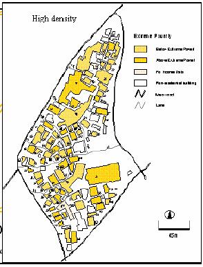
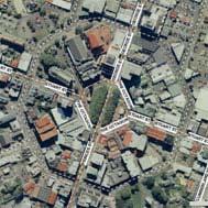
9 Ibadan, Nigeria 2005 Felicia Olufunmilayo Akinyemi
10 Sustainable Communities, UK: The Thames Gateway The largest regeneration zone in Western Europe Investments in schools, sports facilities, business opportunities, health, arts and training centres, libraries, nature parks, theatres, and sustainable transport links. The Gateway has 1.6 million residents and approximately 700,000 households, averaging 2.4 people per household. Over 17% of it is previously developed land brownfield sites development potential of the Gateway lies in its location next to the economic heart of London and on the route of the increasingly accessible markets of North West Europe.

11 Sustainable Communities, UK: The Thames Gateway
12 What added value can good land information offer others working in the field? The G factor location, location, location New insights Integration horizontal, vertical, and along a timeline Cross-disciplinary approach meet and work with your peers! Efficiencies, effectiveness Higher level of confidence in decision-making


13 What added value can good land information offer others working in the field? The State of Karnataka, India Land Information System called BHOOMI For the land owner: Kiosks provide access to records Land records provided in 2 minutes, not 30 days Removed corruption in land dealings - now transparent For everyone: Result is reduction in times to get loans, get utilities, change ownerships, subdivide parcels A better functioning land market Ability to access the collated records at State level Ability to use with other datasets 2005 Dharmaraj, Rakai and Mioc
14 Why does land information have to be sustainable? Expensive to collect + Useless if out of date = Must be maintained at reasonable cost

15 The added value of location information Location information (Ordnance Survey products and services) underpins 100 billion of national GDP For an operating cost of 66 million Ratio of 1:1500 Source: OXERA report 1999 using 1996 figures

16 Why does land information have to be sustainable? Athens after the Olympics Major investments made in the infrastructure Plans for future sustainability less clear

17 Why does land information have to be sustainable?


18 How can sustainable land information be collected, maintained and used for the benefit of all? Key principles: Collect once at appropriate level and use many times
19 How can sustainable land information be collected, maintained and used for the benefit of all? Key principles: Collect once at appropriate level and use many times Use common identifiers to integrate data St Anne Street 12 St Anne s Street 12 St Annes Street DGT654DO HU hf

20 Linking Through Identifiers Citizen ID: 9876 (secret) Name: Mr Smith Refs: Property ID: 1234 Address: 1, Merrymap Way. Refs: 010, 009, 011, 013, GPS Coordinate X: m Y: m Location Calculating Found Ref: Conservation Area ID: 9012 Refs: 001,, 010, 009, etc Land Registration ID: 5678 Owner: Mr Jones Refs: 010, 009, 011, 013, 014, 004, 003, 017, 002, 005, 008, 007, 006.
21 How can sustainable land information be collected, maintained and used for the benefit of all? Key principles: Collect once at appropriate level and use many times Use common identifiers to integrate data Define and implement the concept of data custodianship RIGHTS RESPONSIBILITIES


22 How can sustainable land information be collected, maintained and used for the benefit of all? Key principles: Collect once at appropriate level and use many times Use common identifiers to integrate data Define and implement the concept of data custodianship Make appropriate use of technology and skills

23 How can sustainable land information be collected, maintained and used for the benefit of all? Key principles: Collect once at appropriate level and use many times Use common identifiers to integrate data Define and implement the concept of data custodianship Make appropriate use of technology and skills Plan for data maintenance when collecting
24 How can sustainable land information be collected, maintained and used for the benefit of all? Key principles: Collect once at appropriate level and use many times Use common identifiers to integrate data Define and implement the concept of data custodianship Make appropriate use of technology and skills Plan for data maintenance when collecting Use standards where appropriate
25 Why is this not happening everywhere? Lack of land information Inconsistent or incompatible information No one knows where to find information Poor coordination of land administration functions Traditional tools and techniques are inappropriate Information is not passed between users horizontally or vertically and and
26 Current initiatives to create sustainable information infrastructures What is an information infrastructure?
27 Spatial data infrastructures the basics standards metadata policies reference data technologies institutional arrangements


28 Nationally, some examples Australia South Africa India Malaysia Japan
29 Pan-nationally Pan-national SDI initiatives in: Asia Pacific Africa Americas Europe (INSPIRE)


30 Locally Many examples of initiatives at municipality and local authority level around the world..e.g. Delaware State, USA Nairobi City, Kenya North Rhein Westphalia State, Germany


31 What can you do? Everyone: Be aware of the role of good land information Collectors/ creators: Consider how to maintain it and link it to other data Investors/ government: Realise the value it adds and invest in it!

32 The 7 Triads of Sustainability - GDRC Website Roll the credits Many and various papers from FIG events - FIG website Sustainable Communities material - UK Office of the Deputy Prime Minister The Geography Jigsaw RICS Foundation Agenda 21- UN website Oxera Report Ordnance Survey website Property Identifiers Clare.Hadley@ordnancesurvey.co.uk DNF Expert Group and finally Thank You! Google, for finding me so much information!
33 Thank You!
Creation Land Administration in Formal and Informal Environment. FIG Commission 7 Working Group 1
 Creation Land Administration in Formal and Informal Environment András OSSKÓ, Hungary Key words: land administration, informal land tenure, customary tenure, sustainable Development. SUMMARY FIG Commission
The Bathurst Declaration on Land Administration for Sustainable Development
 United Nations and International Federation of Surveyors The Bathurst Declaration on Land Administration for Sustainable Development The Story The cumulative evolution of society s land administration
Progress in modern cadastre Challenging existing models and paradigms
 Progress in modern cadastre Challenging existing models and paradigms Gerda Schennach, Austria Chair of FIG Commission 7 Federal Office of Metrology and Surveying, Austria The Value of Cadastre for Society
The Profession between Cadastre and Citizen
 The Profession between Cadastre and Citizen Gerda Schennach, Austria Chair of FIG Commission 7 1 A human right UN DECLARATION OF HUMAN RIGHTS Article 17 par (1) Everyone has the right to own property alone
Click to edit Master title style
 Click to edit Master title style Modern Cadastre and Land Administration Session 5a. The toolbox approach Jude Wallace 2007 Click to edit Overview Master title style Objectives To understand the circumstances
Flying high and Keeping the feet on the ground
 Building the Capacity The Agenda and Achievements 2007-2010 FIG handover ceremony, FIG headquarters, Copenhagen, 26 November 2010 The Agenda Building the Capacity through Flying high and Keeping the feet
National Technical University of Athens School of Rural and Surveying Engineering
 National Technical University of Athens School of Rural and Surveying Engineering INFORMAL SETTLEMENTS REAL ESTATE MARKET NEED FOR GOOD LAND ADMINISTRATION AND PLANNING FIG COM3, UNECE CHLM & WPLA JOINT
Supporting Capacity Development for Sustainable Land Administration Infrastructures
 THE EIGHTH UNITED NATIONS REGIONAL CARTOGRAPHIC CONFERENCE FOR THE AMARICAS (UNRCCA) 27 June 1 July 2005, United Nations Headquarters, New York Supporting Capacity Development for Sustainable Land Administration
Developing a Prototype Marine Cadastre for Chedabucto Bay, Nova Scotia, Canada or is it St. Margaret s Bay?
 Developing a Prototype Marine Cadastre for Chedabucto Bay, Nova Scotia, Canada or is it St. Margaret s Bay? Dr. Michael Sutherland, CANADA Chair-Elect, Commission 4 FIG EILAT 2009, FIG WORKING WEEK, EILAT,
Importance of Spatial Data Infrastructure in the UNECE Region. Amie Figueiredo INSPIRE Conference 2016 Barcelona, 26 September 2016
 Importance of Spatial Data Infrastructure in the UNECE Region. Amie Figueiredo INSPIRE Conference 2016 Barcelona, 26 September 2016 United Nations Economic Commission for Europe 56 member States in Europe,
Overview of PCGIAP-WG3 and Spatially Enabled Government
 Working Group 3 3 rd Land Administration Forum Overview of and Spatially Enabled Government Abbas Rajabifard Vice Chair, Established in 2000 based on a Resolution from the 15th UNRCC-AP in Malaysia. With
UN-HABITAT s Mission and Vision. Sustainable urban development Adequate shelter for all
 GLTN contributes to the implementation of pro poor land policies to achieve secure land rights for all www.gltn.net GLTN Secretariat, facilitated by PO Box 30030, Nairobi 00100, Kenya Tel: +254 20 762
Agenda. Introduction to participants First Meeting UN-GGIM - GROUP OF EXPERTS ON LAND ADMINISTRATION AND MANAGEMENT UN-GE-LAM
 First Meeting UN-GGIM - GROUP OF EXPERTS ON LAND ADMINISTRATION AND MANAGEMENT Kees de Zeeuw, The Netherlands Chair Mahashe Chaka, Lesotho Co-Chair Brent Jones, ESRI (USA) -Rapporteur Agenda Opening Introduction
Lessons for federated countries that have state land registries the Australian experience
 Lessons for federated countries that have state land registries the Australian experience Ian Williamson Centre for SDI and Land Administration Department Infrastructure Engineering University of Melbourne
UNPLANNED URBAN DEVELOPMENT
 National Technical University of Athens School of Rural and Surveying Engineering UNPLANNED URBAN DEVELOPMENT Chryssy A Potsiou, Lecturer NTUA chryssyp@survey.ntua.gr UNECE WPLA WORKSHOP EFFECTIVE AND
COMMISSION 7 CADASTRE AND LAND MANAGEMENT WORK PLAN
 Appendix to item 34.7 FIG Congress in Washington, 19-26 April 2002 COMMISSION 7 CADASTRE AND LAND MANAGEMENT WORK PLAN 2002 2006 1. Title Cadastre and Land Management 2. Terms of Reference Commission 7
Land Administration And Spatial Data Infrastructures
 Land Administration And Spatial Data Infrastructures Ian WILLIAMSON, Donald GRANT and Abbas RAJABIFARD Centre for SDIs and Land Administration Department of Geomatics University of Melbourne, Australia
Spatially Enabled Society Role of the Cadastre
 armasuisse Bundesamt für Landestopografie swisstopo Swiss Federal Directorate for Cadastral Surveying Spatially Enabled Society Role of the Cadastre XXIV FIG International Congress 2010 FIG-Task Force
Presented at the FIG Congress 2018, May 6-11, 2018 in Istanbul, Turkey
 Presented at the FIG Congress 2018, May 6-11, 2018 in Istanbul, Turkey 5 Bibliometric Analysis of Articles Presented Under Commission 7: A Case of the 25th Fig Congress in Malaysia in 2014 Zeynel Abidin
Seventh Session of the United Nations Committee of Experts on Global Geospatial Information Management
 Report of the Forum P a g e 1 Seventh Session of the United Nations Committee of Experts on Global Geospatial Information Management Report of the Forum Secure Land Rights and Smart Cities - Making It
Smart Infrastructure Benefits and Key Players from a Global Perspective
 Smart Infrastructure Benefits and Key Players from a Global Perspective Spatial@gov 2010 October 5-7 Canberra Jude Wallace and Abbas Rajabifard Centre for Spatial Data Infrastructures and Land Administration
Understanding the Land Management Paradigm
 FIG COM 7 SYMPOSIUM ON INNOVATIVE TECHNOLOGIES FOR LANDADMINISTRATION 19 25 June 2005, Madison, Wisconsin, USA. Understanding the Land Management Paradigm Prof. Stig Enemark Vice-President of FIG Department
STATUS REPORT
 Working Group 3 Land Administration STATUS REPORT 2006-2009 2009 Prof Ian Williamson (Chair) Mr Ahmad Fauzi Nordin (Vice Chair) Assoc. Prof Abbas Rajabifard (Vice Chair) 18th UNRCC-AP Conference Bangkok
Land Tools for Tenure Security for All
 Land Tools for Tenure Security for All PROF. JAAP ZEVENBERGEN UNIVERSITY OF TWENTE - ITC 1 ST JUNE 2017 HELSINKI, FINLAND GLOBAL LAND CHALLENGES 70 % Dealing with the affordability issue - how to modernize
Participants of the Ministerial Meeting on Housing and Land Management on 8 October 2013 in Geneva
 Summary At its meeting on 2 April 2012, the Bureau of the Committee on Housing and Land Management of the United Nations Economic Commission for Europe agreed on the need for a Strategy for Sustainable
FIG Commission 3 Spatial Information Management. Report of Activities 2009
 Appendix to item 10.3 Report to the 33 rd General Assembly FIG Congress in Sydney, Australia 2010 FIG Commission 3 Spatial Information Management Report of Activities 2009 1. General Since 2007, FIG Commission
Building a European Spatial Data Infrastructure: The Role of EuroGeographics
 Building a European Spatial Data Infrastructure: The Role of EuroGeographics Richard Kirwan President of EuroGeographics 1st Congress on Cadastre in the EU 1 Presentation overview EuroGeographics - the
Project Management Forum. Eilat 2009
 Project Management Forum Eilat 2009 May 2009 FIG Working Week 1 Purpose To build on the sessions in Hong Kong and Stockholm To review the elements of PM To review examples of the stages of development
CADASTRE 2014: New Challenges and Direction
 CADASTRE 2014: New Challenges and Direction Anna KRELLE and Abbas RAJABIFARD, Australia Key words: Cadastre, Cadastre 2014, Land Administration SUMMARY Land and land related activities form part of the
IMPROVING GOVERNANCE OF TENURE IN UNECE REGION: FAO/WORLD BANK/UNECE/EU JRC PARTNERSHIP
 IMPROVING GOVERNANCE OF TENURE IN UNECE REGION: FAO/WORLD BANK/UNECE/EU JRC PARTNERSHIP RUMYANA TONCHOVSKA, GULNARA ROLL, KATHRINE KELM FAO of the UN, Rome, Italy, Rumyana.Tonchovska@fao.org UNECE, Geneva,
MEMORANDUM OF UNDERSTANDING between THE UNITED NATIONS HUMAN SETTLEMENTS PROGRAMME (UN-HABITAT) and THE INTERNATIONAL FEDERATION OF SURVEYORS (FIG)
 and THE INTERNATIONAL FEDERATION OF SURVEYORS (FIG)") Appendix to item 20.2 MEMORANDUM OF UNDERSTANDING between THE UNITED NATIONS HUMAN SETTLEMENTS PROGRAMME (UN-HABITAT) and THE INTERNATIONAL FEDERATION OF SURVEYORS (FIG) WHEREAS the United Nations Human
Appendix to item 20.2 MEMORANDUM OF UNDERSTANDING between THE UNITED NATIONS HUMAN SETTLEMENTS PROGRAMME (UN-HABITAT) and THE INTERNATIONAL FEDERATION OF SURVEYORS (FIG) WHEREAS the United Nations Human
The Society of Chartered Surveyors Ireland - enhancing, advancing and enforcing professional standards in construction, land and property.
 The Society of - enhancing, advancing and enforcing professional standards in construction, land and property. 1 Overview Independent Expert Qualified The Society of is the leading professional body for
The Real Estate and Land Market of Russia: Factors of the Sustainable Development
 The Real Estate and Land Market of Russia: Factors of the Sustainable Development Vasily Nilipovskiy (State University of Land Use Planning, Moscow, Russia) ? &! and! &? There is no definite answer in
Good Land Governance for the 2030 Agenda
 Good Land Governance for the 2030 Agenda Addis Ababa, Ethiopia 20-22 April, 2014 Role of Geospatial Information in Good Land Policy and Governance Oumar Sylla UN-Habitat/GLTN oumar.sylla@unhabitat.org
Land Management and Cadastre a Symbiotic Interaction?
 Land Management and Cadastre a Symbiotic Interaction? Dr. Alexander Kohli, Switzerland geosuisse, Delegate to Commission 8, Sydney, Australia, TS 8E Law and Planning Agenda 1. Introduction and Motivation
Scenic Nepal. Land Administration Systems. Outline of Presentation. Interests in land. Rights: Registration and security of tenure positions
 Scenic Nepal Land Administration Systems Managing Rights, Restrictions, and Responsibilities in Land Prof. Stig Enemark President Aalborg University, Denmark SURVEY DEPARTMENT KATHMANDU, NEPAL. 16 FEBRUARY
A beautiful setting. The Evolving Role of Cadastral Systems in Support of Good Land Governance. Setting the scene
 The Evolving Role of Cadastral Systems in Support of Good Land Governance Prof. Stig Enemark President Aalborg University, Denmark THE DIGITAL CADASTRAL MAP FIG COMMISSION 7 OPEN SYMPOSIUM KARLOVY VARY,
AFRICA REGIONAL NETOWORK
 Facing the Global Agenda - The Role of Land Professionals Prof. Stig Enemark FIG Honorary President Aalborg University, Denmark AFRICA REGIONAL NETOWORK Challenges and Opportunities in Facing the SDG s:
Land Administration in support of the Global Agenda: Current FIG Policies
 Land Administration in support of the Global Agenda: Current FIG Policies Prof. Stig Enemark President Aalborg University, Denmark FIG COMMISSION 7 ANNUAL MEETING VERONA, ITALY, SEPTEMBER 2008 Current
Key Concepts, Approaches and Tools for Strengthening Land Tenure Security
 Key Concepts, Approaches and Tools for Strengthening Land Tenure Security Dr. Samuel Mabikke Land & GLTN Unit / UN-Habitat Urban CSO Cluster Learning Exchange on Strengthening Land Tenure Security for
Commission 7 Cadastre and Land Administration. Work Plan
 Commission 7 Cadastre and Land Administration Work Plan 2011 2014 Appendix to item 17.7 1. Title Cadastre and Land Administration 2. Terms of Reference Commission 7 deals with land administration and land
TSO1C: Land Reforms. Commission 7
 TSO1C: Land Reforms. Commission 7 Development of & Implementation LIS. Building an effective Partnership to Reform Uganda s Land Administration (7320) Gasant Jacobs, Head: Business Development. Tax & Accounting
The Message FIG-WB Partnership on Land Governance in Support of the Global Agenda
 FIG-WB Partnership on Land Governance in Support of the Global Agenda Prof. Stig Enemark, Denmark President 2007-2010 Mr. Teo Chee Hai, Malaysia President Elect 2011-2014 WORLD BANK LAND GROUP, WASHINGTON,
Land Governance in Support of The Millennium Development Goals. Stig Enemark Paul van der Molen Robin McLaren
 Land Governance in Support of The Millennium Development Goals Stig Enemark Paul van der Molen Robin McLaren INV 1 - Land Governance in Support of the Millennium Development Goals Sydney, Australia, 11-16
Results of Central European Land Knowledge Center (CELK) Activities
 Activities") Results of Central European Land Knowledge Center (CELK) Activities András OSSKÓ, Hungary Key words :CELK Center, Property Rights and Land Market Development, Networking, direct knowledge transfer SUMMARY
Results of Central European Land Knowledge Center (CELK) Activities András OSSKÓ, Hungary Key words :CELK Center, Property Rights and Land Market Development, Networking, direct knowledge transfer SUMMARY
Informal Urban Development in Europe: Experiences from Albania and Greece
 Informal Urban Development in Europe: Experiences from Albania and Greece Dr Clarissa AUGUSTINUS, Kenya Dr Chryssy POTSIOU, Greece 1 Bridging the Gap Between Cultues FIG UN HABITAT GLTN publication http://www.fig.net/pub/others/un-habitat_informal_urban_dev.pdf
UNECE workshop on: Cadastral and real estate registration systems: Economic information for real estate markets in the UNECE region
 UNECE workshop on: Cadastral and real estate registration systems: Economic information for real estate markets in the UNECE region Roma, 5-65 6 May 2011 Maurizio Festa Agenzia del Territorio Head of Statistics
CONCEPT NOTE EFFECTIVE LAND ADMINISTRATION IN AFRICA TRAINING WORKSHOP
 CONCEPT NOTE EFFECTIVE LAND ADMINISTRATION IN AFRICA TRAINING WORKSHOP Innovative Concepts, Tools and Practices for Effective Land Administration Land Conference Pre-Conference Workshop Advocating & Implementing
Presented at the FIG Working Week 2016, May 2-6, 2016 in Christchurch, New Zealand
 Presented at the FIG Working Week 2016, May 2-6, 2016 in Christchurch, New Zealand The IMPULS Project Is a Project About Cooperation, Coordination, Transparency and Data Sharing A SDI project in the Western
EXPERIENCES FROM THE KENYAN PROCESS
 EXPERIENCES FROM THE KENYAN PROCESS Contents: 1) Introduction: Kenya 2) Current Land Administration Practices 3) Consequences of Poor Practice 4) Context of Land Policy Formulation in Africa 5) Kenya National
Land Markets and Land Rights in support of the Millennium Development Goals
 Land Markets and Land Rights in support of the Millennium Development Goals A Global Perspective Prof. Stig Enemark President Aalborg University, Denmark 3rd LAND ADMINISTRATION FORUM FOR THE ASIA AND
LOW-COST LAND INFORMATION SYSTEM FOR SUSTAINABLE URBAN DEVELOPMENT
 Presented at the FIG Congress 2018, May 6-11, 2018 in Istanbul, Turkey LOW-COST LAND INFORMATION SYSTEM FOR SUSTAINABLE URBAN DEVELOPMENT Case Examples in Kenya and Zambia Presented by John Gitau Land
FIG Working group Valuation and Real estate management through Fin-tech. Manohar Velpuri
 FIG Working group 9.2 - Valuation and Real estate management through Fin-tech Manohar Velpuri Introduction Projects Timeline and working group project updates II plenary - ISO TC 307 report Integration
AN OVERVIEW OF LAND TOOLS IN SUB- SAHARAN AFRICA: PAST, PRESENT AND FUTURE
 AN OVERVIEW OF LAND TOOLS IN SUB- SAHARAN AFRICA: PAST, PRESENT AND FUTURE BY CLARISSA AUGUSTINUS CHIEF, LAND AND TENURE SECTION UNHABITAT Nairobi, 11-11-2004 WHY UN-HABITAT HAS CO-SPONSORED THIS EGM UN-HABITAT
Land Rights Adjudication in off-register, formalising and non-formal contexts in South Africa Rosalie Kingwill LEAP-Mbumba Development Services
 SEEKING EQUILIBRIUM Land Rights Adjudication in off-register, formalising and non-formal contexts in South Africa Rosalie Kingwill LEAP-Mbumba Development Services Expert Group Meeting on secure land tenure:
Centre for SDIs and Land Administration Department of Geomatics Spatial systems to support sustainable development
 Centre for SDIs and Land Administration Department of Geomatics MODERN CADASTER and LAND ADMINISTRATION تهران-مرداد 1386 2014 ..... 2 ماه Centre for SDIs and Land Administration Department of Geomatics
Agenda Project Overview Project Objectives Registration Service Re-Engineering System Overview
 Agenda Project Overview Project Objectives Registration Service Re-Engineering System Overview Sydney, Australia, 11 16 April 2010 1 Project Overview Future Vision There is a vision within senior levels
GLTN LAND TOOLS -SOME EXAMPLES-
 GLTN LAND TOOLS -SOME EXAMPLES- Dr. Jaap Zevenbergen University of Twente What are GLTN Land Tools? GLTN considers that a tool is a practical method to achieve a defined objective in a particular context.
Spatial Enablement and the Response to Climate Change and the Millennium Development Goals
 Spatial Enablement and the Response to Climate Change and the Millennium Development Goals Prof. Stig Enemark President Aalborg University, Denmark 18th UNITED NATIONS REGIONAL CARTOGRAPHIS CONFERENCE
Housing Ireland A Journal for Irish Housing Professionals
 www.cih.org Learn with us. Improve with us. Influence with us. Housing Ireland A Journal for Irish Housing Professionals A Chartered Institute of Housing Publication Winter 2013 Issue 03 Inside this issue:
Cadastral Template. FIG-Commission 7 Annual Meeting, Verona, Italia, 12 Sept Daniel Steudler
 armasuisse Bundesamt für Landestopografie swisstopo Cadastral Template FIG-Commission 7 Annual Meeting, Verona, Italia, 12 Sept. 2008 Design Principles for the Template keep it simple in order to attract
Land surveying is probably the (second) oldest profession in the world
 oldest profession in the world") Land Surveying and Land Management in an International Perspective Prof Stig Enemark Honorary President Aalborg University, Denmark CADASTRE IN A DIGITAL WORLD NORDIC AND GLOBAL PRESPECTIVES INTERNATIONAL
Land Surveying and Land Management in an International Perspective Prof Stig Enemark Honorary President Aalborg University, Denmark CADASTRE IN A DIGITAL WORLD NORDIC AND GLOBAL PRESPECTIVES INTERNATIONAL
LAND TENURE IN ASIA AND THE PACIFIC CHALLENGES, OPPORTUNITIES AND WAY FORWARD
 LAND TENURE IN ASIA AND THE PACIFIC CHALLENGES, OPPORTUNITIES AND WAY FORWARD Workshop on Land Administration and Management 20th United Nations Regional Cartographic Conference for Asia and the Pacific
FIG Task Force on: Property and Housing
 International Federation of Surveyors Fédération Internationale des Géomètres International Vereinigung der Vermessungsingenieure FIG Task Force on: Property and Housing Chryssy Potsiou, Assist Prof, FIG
Flying high and Keeping the feet on the ground
 Building the Capacity The FIG Agenda and Achievements 2007-2010 Prof. Stig Enemark President FACING THE CHALLENGES BUILDING THE CAPACITY FIG CONGRESS, SYDNEY, AUSTRALIA, 11-16 APRIL 2010 The Agenda Building
The importance of changes in land surveyors education
 András OSSKÓ Key words: land administration, roles of land surveyors, extended education, lifelong learning SUMMARY It s a world wide experience, especially in developed countries that the interest in
University of Nairobi LAND INFORMATION SYSTEM FOR LAND MANAGEMENT IN KENYA. CASE STUDY: NAIROBI COUNTY, BURUBURU PHASE I ESTATE
 University of Nairobi LAND INFORMATION SYSTEM FOR LAND MANAGEMENT IN KENYA. CASE STUDY: NAIROBI COUNTY, BURUBURU PHASE I ESTATE BY Justus Amdavi F56/69371/2013 Supervisor: Mr Jasper Mwenda CONTENTS Introduction
Fit-For-Purpose what is it?
 FIG Commission 7 Annual Meeting 2016 Working Group 7.1 Fit-For-Purpose Land Administration Christiaan Lemmen October, 24th 2016 Coimbra, Portugal Fit-For-Purpose what is it? Fit-for-purpose: The systems
From Measurement to Management
 From Measurement to Management The changing role of the land surveyors Prof. Stig Enemark Aalborg University, Denmark LAND MANAGEMENT AND HUMAN RIGHTS INTERNATIONAL SEMINAR, HØGSKOLEN I BERGEN, 8 9 SEPTEMBER
Annual Meeting II/2016 FIG Commission 7 Cadastre & Land Management. Report
 Annual Meeting II/2016 FIG Commission 7 Cadastre & Land Management Report 1 Structure Chair G. Schennach (AT) V-Chair for communications, social media, web Hyunsook LEE (KR) WG 7.1 Fit-For-Purpose LA Ch.
THE APPLICATION OF GIS AND LIS Solutions and Experiences in East Africa. Lenny Kivuti
 Using GIS and LIS for Planning Sustainable Development Bepic Group CHOGM, Malta 2005 THE APPLICATION OF GIS AND LIS Solutions and Experiences in East Africa Lenny Kivuti 21 November, 2005 Presented by
Challenges for the multi purpose cadastre
 Jens RIECKEN, Markus SEIFERT, Germany Key words: Multi purpose cadastre, 3d-cadastre, land use, SDI, solar cadastre SUMMARY Over the past 30 years, with the progress of information technologies the development
OUR GLOBAL FOOTPRINT INDEPENDENT, INTERNATIONAL, COMMERCIAL, RESIDENTIAL. Locally expert, globally connected.
 OUR GLOBAL FOOTPRINT INDEPENDENT, INTERNATIONAL, COMMERCIAL, RESIDENTIAL. Locally expert, globally connected. ABOUT THE GROUP THERE S A HUMAN ELEMENT IN THE WORLD OF PROPERTY THAT IS TOO EASILY OVERLOOKED.
Facing the global agenda Outline of presentation
 The global surveying profession Global Trends towards a Spatially Enabled Society Prof. Stig Enemark President Aalborg University, Denmark AREAL OG EJENDOM 2009 - NORGES JORDSKIFTEKANDIDATFORENING VESTBY
What does Social Housing
 What does Social Housing Reform mean for Practitioners? Jennie Donald, Deputy Chief Executive, NIFHA Background 2011 Review of NI Housing Executive by PwC & mature conversation 2013 Social Housing Reform
Adequate Shelter for All Sustainable Human Settlements Development in an Urbanising World
 KARIBU Welcome! UN-HABITAT Urban Policies and Operations 00 UN-HABITAT Implementing the Habitat Agenda (Istanbul 996) Adequate Shelter for All Sustainable Human Development in an Urbanising World YEAR
FIG Task Force on: Property and Housing
 International Federation of Surveyors Fédération Internationale des Géomètres International Vereinigung der Vermessungsingenieure FIG Task Force on: Property and Housing Chryssy Potsiou, Assist Prof, FIG
Croatian SDI: a Tool for Accelerated Development of the Geo-Conscious Society
 STATE GEODETIC ADMINISTRATION Croatian SDI: a Tool for Accelerated Development of the Geo-Conscious Society Prof.Dr.Sc. Željko Bačić, Mr.Sc. Ljerka Rašić FIG Working Week 2009 - Surveyors Key Role in Accelerated
REGISTRATION OF PROPERTIES IN STRATA
 REGISTRATION OF PROPERTIES IN STRATA REPORT ON THE WORKING SESSIONS INTRODUCTION A cadastre is usually, and in most countries, a parcel-based, and up-to-date land information system containing records
KHANALIBAYLI UNECE WPLA
 UNECE Working Party on Land Administration The role of the UNECE Working Party on Land Administration (WPLA) in the promotion and improvement of land administration and land management in the UNECE region
Addressing Land Sector Opportunities with Geospatial Information in Nepal
 The 20th UNRCC-AP and the 4th UN-GGIM-AP 5-10 October 2015 Jeju Island, Republic of Korea Addressing Land Sector Opportunities with Geospatial Information in Nepal Krishna Raj BC Executive Director Land
People, Politics and Places - responding to the Millennium Development Goals
 LAND POLICIES & LEGAL EMPOWERMENT OF THE POOR INTERNATIONAL WORKSHOP, WOLD BANK, WSHINGTON, 2-3 NOVEMBER 2006 1. INTRODUCTION People, Politics and Places - responding to the Millennium Development Goals
Land Information System as new instrument for Land Administration: Case Examples. Mike Cheremshynskyi Consultant, Land Administration Expert
 Land Information System as new instrument for Land Administration: Case Examples Mike Cheremshynskyi Consultant, Land Administration Expert Background Growth of population and fast urbanization in many
Underpinning Sustainable Land Administration Systems for Managing the Urban and Rural Environment
 Underpinning Sustainable Land Administration Systems for Managing the Urban and Rural Environment Stig ENEMARK, Denmark Key words: Cadastre, Land Administration, Land Management, FIG. SUMMARY The paper
A CADASTRAL GEODATA BASE FOR LAND ADMINISTRATION USING ARCGIS CADASTRAL FABRIC MODEL A CASE STUDY OF UWANI ENUGU, ENUGU STATE, NIGERIA
 A CADASTRAL GEODATA BASE FOR LAND ADMINISTRATION USING ARCGIS CADASTRAL FABRIC MODEL A CASE STUDY OF UWANI ENUGU, ENUGU STATE, NIGERIA BY Ndukwu, Raphael. Ike Department of Geoinformatics & Surveying University
Hong Kong Prime Office Monthly Report. October 2011 RESEARCH NON-CORE DISTRICTS LEAD THE MARKET
 RESEARCH October 2011 Hong Kong Prime Office Monthly Report NON-CORE DISTRICTS LEAD THE MARKET Business and investment activity slowed in Hong Kong over the past month, on the back of negative economic
Fit-For-Purpose Land Administration: Guiding Principles FACILITATED BY:
 Fit-For-Purpose Land Administration: Guiding Principles 1. GLTN overview - GLTN BRIEFING AND PROGRAMME 2. Geospatial Data - Sustainable Development - 3. Fit-for-purpose Land Administration Guiding Principles
Land Management and Development
 CLGE INTERNATIONAL CONFERENC 2005 EUROPEAN PROFESSIONAL QUALIFICATIONS IN GEODETIC SURVEYING BRUSSELS, 1-2 DECEMBER 2005 Land Management and Development Professor Stig Enemark Department of Development
Re-engineering engineering the cadastre to support e-governmente
 Centre for SDIs and Land Administration Department of Geomatics Re-engineering engineering the cadastre to support e-governmente Ian Williamson UN sponsored Third Land Administration Forum, Tehran, 2009
PREPARING SURVEY TENDER GIS DATABASE OUTCOMES
 PREPARING SURVEY TENDER SPECIFICATIONS FOR PROJECT GIS DATABASE OUTCOMES Presentation by Ian Harper GEODATA AUSTRALIA ESRI User Conference 2009 24 st July 2009 BACKGROUND GIS databases now provide a more
FIG Working Week 2008 and XXXI. General Assembly, Stockholm, Sweden, June FIG Commission 7 Annual Meeting 15 September 2008
 FIG Working Week 2008 and XXXI. General Assembly, Stockholm, Sweden, 14-19 June 2008 András s OSSKÓ FIG Commission 7 Annual Meeting Verona, Italy, 11-15 15 September 2008 The Working Week held in Stockholm,
REPORT ON UN-HABITAT ACTIVITIES REGARDING INDIGENOUS ISSUES
 REPORT ON UN-HABITAT ACTIVITIES REGARDING INDIGENOUS ISSUES Submitted to the Tenth Session of the Permanent Forum on Indigenous Issues 16-27 May 2011, United Nations, New York Executive summary UN-HABITAT
Keith Clifford Bell The World Bank -East Asia and the Pacific Region WASHINGTON D.C., USA
 Keith Clifford Bell The World Bank -East Asia and the Pacific Region WASHINGTON D.C., USA 4th Land Administration Forum for the Asia and Pacific Region Beyond Spatial Enablement October 5-7, 2011 Melbourne,
7 th international LANDNET Conference 5-7 October 2015, Ankara, Turkey. Land banks and land funds an overview and presentation of FAO publication
 7 th international LANDNET Conference 5-7 October 2015, Ankara, Turkey Land banks and land funds an overview and presentation of FAO publication With contributions from Frank van Holst, Francisco Onega
NSDI assessment for the Netherlands
 for the Netherlands Ruby Beltman, Geonovum May 24 2007 Presentation the Dutch public geo-information playing field Geonovum and the Dutch NSDI need for results The Dutch public geo-information playing
Esri Middle East and Africa User Conference. December Abu Dhabi, UAE. Land Administration. Mark Baker
 Esri Middle East and Africa User Conference December 10 12 Abu Dhabi, UAE Land Administration Mark Baker Our Agenda 0900 0930 Welcome Mark Baker, Esri 0930 1030 New Directions The New Addressing System
Commission 7, Land Administration and IT. Paul van der Molen INTERNATIONAL INSTITUTE FOR GEO-INFORMATION SCIENCE AND EARTH OBSERVATION
 Commission 7, Land Administration and IT Paul van der Molen INTERNATIONAL INSTITUTE FOR GEO-INFORMATION SCIENCE AND EARTH OBSERVATION FIG Commission 7 on cadastre and land management Study Visits (e.g.
PROBLEMS IN REGISTRATION IN THE THIRD VERTICAL DIMENSION IN THE UNIFIED LAND REGISTRY IN HUNGARY, AND POSSIBLE SOLUTION
 3D Cadastres Technical and Legal Aspects II PROBLEMS IN REGISTRATION IN THE THIRD VERTICAL DIMENSION IN THE UNIFIED LAND REGISTRY IN HUNGARY, AND POSSIBLE SOLUTION ANDRÁS Osskó Budapest Land Office Hungary
Land Administration In Public Private Partnerships
 Land Administration In Public Private Partnerships Workshop Customers - Co-operation - Services Vienna, 12-13 September 2002 Peter Creuzer Content Land Administration - Tasks History Spatial Data Infrastructure
A Geocoded Cadastral Fabric as a Precondition for a Sustainable Land Management System
 A Geocoded Fabric as a Precondition for a Sustainable Land Management System Gottfried KONECNY, Germany; J.P. LAUZON, Canada; Abdul Salam MOHAMMED, India Key words: SDI,, Parcel Boundaries, GPS-GNSS, Land