CHESTER COUNTY CHALLENGE GRANT PROGRAM FOR FARMLAND PRESERVATION
|
|
|
- Amy Mitchell
- 5 years ago
- Views:
Transcription

1 CHESTER COUNTY CHALLENGE GRANT PROGRAM FOR FARMLAND PRESERVATION A Program of the Chester County Board of Commissioners PROGRAM REGULATIONS Application Deadline: August 1 Funded through the Chester County Open Space Preservation Department CHESTER COUNTY BOARD OF COMMISSIONERS Michelle Kichline Kathi Cozzone Terence Farrell
2 TABLE OF CONTENTS Page Introduction... 1 Purpose... 1 Eligibility Criteria... 1 Funding Requirements... 2 Application Procedures... 2 Application Evaluation... 2 General Procedures for Purchasing Easements... 2 Farmland Preservation Application... 3 Ranking Criteria Calculating the Score of an Application Policies of the Chester County Challenge Grant Program for Farmland Preservation Subdivision Regulations Appraisal Standards Agricultural Easement Inspection/Enforcement Policy Rural Resource Areas Map, Landscapes Agricultural Land Preservation Board Membership... Inside Back Cover Chester County Challenge Grant Program for Farmland Preservation Page i
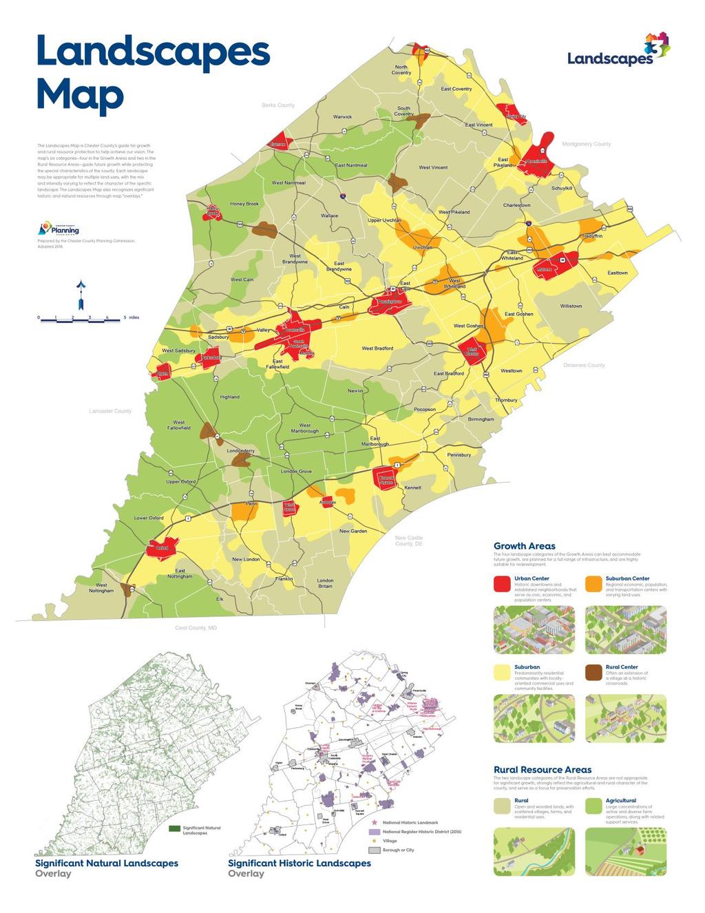
3 CHALLENGE GRANT PROGRAM FOR FARMLAND PRESERVATION Introduction The Chester County Board of Commissioners support farming in a variety of ways including land preservation which is overseen by the Chester County Agricultural Land Preservation Board (ALPB) and carried out by the Chester County Department of Open Space Preservation (DOSP). For questions, concerns or assistance, please contact Geoff Shellington, Agricultural Programs Coordinator, Department of Open Space Preservation, 601 Westtown Road, Suite 390, P.O. Box 2747, West Chester, PA , phone , gshellington@chesco.org, or visit Recognizing the significant economic, cultural, and environmental benefits farmland provides and the need to stretch its limited funds, the Board of County Commissioners established the Challenge Grant Program. This program provides opportunities for the County to partner with municipalities and other public and/or private entities in ways that may otherwise not be possible. Partners can include farmland owners, private businesses, non-profit organizations, foundations and contributors. Purpose: The purpose of this program is to permanently preserve agricultural land by purchasing development rights in accordance with the County s adopted strategic plan and land use policies. Agricultural lands in Chester County that are designated Rural Resource Areas in the County s Comprehensive Policy Plan, Landscapes 2, are located in locally adopted Agricultural Security Areas, or provide a unique agricultural benefit to the County, are farmland preservation priorities. These areas contain some of the most productive non irrigated agricultural soils in the world, are generally designated for agriculture in local comprehensive plans and support concentrations of actively farmed land. Eligibility Criteria: All of the following criteria must be met for a farm to be eligible for County Funds: Availability of 50% matching funds. The most common sources of matching funds are donated value from the landowner, funds from the township in which the farm is located, other private funds, or a combination of funding from these sources. To assess the potential for the County to partner with local townships, the County annually requests that Township Board of Supervisors who wish to participate, provide a written commitment of funds they intend to utilize for this purpose. The above may be waived if applicant indicates 50 percent bargain sale on their application or if local match funds are available from other sources and committed in writing. See Funding Requirements section of these regulations for further details; Enrolled in an adopted municipal Agricultural Security Area(s); Located in areas where farmland preservation has been determined to be consistent with adopted County Policy, or possessing unique attributes that make preservation appropriate as determined by the CCALPB. The farmland tract shall encompass 25 acres if not contiguous to an existing protected tract, or a minimum of 10 acres if contiguous to another protected tract; Contain at least 50 percent cropland, pasture or grazing land. This includes equestrian uses. 1
4 Funding Requirements: Applications for the purchase of easements require a match of at least 50 percent of the acquisition costs. Applications that provide more than 50 percent towards the acquisition cost may be considered before those requiring more County funding. For each easement purchase offer, the County will commit to funding no more than 50 percent of the purchase price, with a funding limit of $12,000 per acre on each project (whichever is the lesser of the two). The minimum 50 percent match to meet the challenge (or result in priority consideration if greater than 50%) may be achieved in one or a combination of the following ways: A township, or townships (if farm overlaps municipal lines) committing to providing the match; A private (including applicant donation of value) or private non-profit entity committing to provide the match; A commitment or contribution to the County of Chester for incorporation into the County s certification of funds to the Commonwealth for use in the Commonwealth Program; A commitment from the Commonwealth of Pennsylvania; Funding from the Federal Farm and Ranch Land Protection Program; or, a combination of any of the abovementioned options to provide the match. The total easement purchase price shall include the easement price accepted by farm owner and the incidental costs of the acquisition, such as appraisal, survey, title, legal and other appropriate fees. The total easement purchase price shall be itemized in a Statement of Costs exhibit contained in the Agreement of Sale. The County reserves the right to apply municipally certified Challenge Grant match funding to the Commonwealth/County Program if farm(s) from municipality have also ranked high enough in Commonwealth/County Program to be funded. Application Procedures: Applications for conservation easement sale will be accepted until the August 1 st deadline. Applications will be open to all eligible landowners. If the applicants farm is not enrolled in an Agricultural Security Area (ASA) the applicant must submit the ASA application to their Township prior to applying to the Farmland Preservation Program. Applications that meet the criteria for an Urgent Situation may apply throughout the year. Urgent Situations are defined on Page 25. Application Evaluation: Applications will be evaluated according to the Ranking Criteria as outlined in these regulations. The CCALPB will be responsible for evaluating applications and recommending easement purchases to the Chester County Board of Commissioners. General Procedures for Purchasing Easements: Based on the a review of applications pursuant to these regulations, appraisals will be authorized by the CCALPB. Offers based on the appraisal may be made to qualifying applicants; no offer may be made in excess of the appraised value. Landowner shall respond to the offer in writing to accept by signing and returning the enclosed Agreement of Sale or reject the offer, or notify that farm owner is commissioning an appraisal within 30 days from the date of the County offer letter. In the event the Landowner elects to have a second appraisal prepared, all costs are the responsibility of the landowner and the landowner-commissioned appraisal must follow the standards for appraisal process, as detailed in Chapter 138e.64 of the program regulations. In the event an offer is accepted, such acceptance shall be provided in the form of an agreement of sale. Upon receipt of an executed agreement of sale, the CCALPB will commission a survey, title report and title policy insurance. In addition, any necessary conservation plan writing or update must be prepared for the farm operation at the landowner s expense. Any existing mortgages, liens, or judgments shall be subordinated, satisfied, or resolved to the satisfaction of the CCALPB. After all necessary work is finished, settlement will occur, at which time the farm owner executes the agricultural conservation easement deed and receives compensation for the development rights. 2
5 FARMLAND PRESERVATION APPLICATION DEADLINE FOR SUBMISSION Delivered by August 1 at 4:00 P.M. Check which program you are applying to (must pick one): County Challenge Grant State Program Both We, applicants agree to be bound by the program regulations and, hereby offer to sell an agricultural conservation easement on farm property consisting of acres, located on, in Township, Chester County, Pennsylvania. The property is identified in the land records of Chester County, Deed Book(s), Page(s). Agricultural conservation easement sale to the Chester County Agricultural Land Preservation Board (CCALPB) is offered in consideration of a mutually agreed price per acre to be determined by appraisal and the bargain sale offered by the applicant. A copy of the program regulations is available at or by contacting the Department of Open Space Preservation via phone at , at gshellington@chesco.org, or 601 Westtown Rd Suite 390, West Chester, PA Date: APPLICANT(s) NAME (printed) SIGNATURE(s) By signature, applicant hereby authorizes the Conservation Plan preparer to release copies of the Conservation Plan and Nutrient Management Plan (Act 38, if applicable) to the CCALPB and the PA Bureau of Farmland Preservation. Mailing Address: Telephone Number: Total Farm Acreage: Acres Proposed for Easement Sale: If applying a portion of the farm, attach a map to your application and identify the omissions from the proposed easement. Please note normal procedures will exclude existing structures using minimum setbacks from the easement area. There is no need for applicant to show this exclusion. 3
6 Is the farmland tract is less than: 25 acres 50 acres If you checked either box above, complete the two questions below: (a) Producing a crop unique to the area? Yes No (b) Adjacent to a property with a perpetual easement? Yes No If adjacent, list the name and tax parcel(s) of landowner with perpetual easement below: Name(s): Tax Parcel Number(s): Farm is located in Township(s) Agricultural Security Area. ASA must be recorded in the County Recorder of Deeds office. Parcels are recorded in Deed Book, Page Number Directions from nearest State route: County Tax Parcel # For each parcel: Please check that the above parcel numbers include all parcels concerned in the easement and are correct. These are the identifiers used to track this application throughout the process. Are you willing to participate in the Federal Farmland Preservation Program and accept federal funds if the County is able to secure them, in an effort to make the most of the County limited farmland preservation funds? Yes No Subdivision Activity Do you have a subdivision plan or other matter before the township for consideration? Yes No Please note: Subdivision of land between the time of easement sale application and easement sale settlement is PROHIBITED. Please contact staff with questions or for clarification. List any Mortgage(s), Lien Holder(s), or owners of mineral rights: 4
7 Title issues such as mortgages, liens, etc. must be resolved prior to the agricultural conservation easement proceeding to settlement. Should discovery be made that any of the issues pertaining to title prohibits the sale of an agricultural conservation easement, the property owner is responsible for the incidental cost (title, survey, etc.) incurred by the County. Verification of Agricultural Production Please describe in detail the type and operation of the farm: Crop & Livestock Report For Recent Calendar Year On Land Proposed for Easement (Please fill in with as much information as possible. If more space is needed please attach a separate sheet). Commodity Acres Grown Yield Per Acre Annual Sales Livestock Average Numbers Product Sold Annual Sales Commercial Equine Activity Are you engaged in any commercial equine activities on the proposed eased land? Yes No Check the type of commercial equine activity you engage in on the proposed eased land (check all that apply) boarding equine use of equine for riding or driving training equine pasturing of equines instructing people in handling, driving or riding equine other equine activities Do you collect a fee for commercial equine activities? Yes No Average fee collected for commercial equine activities $ Stewardship Practices Does the land applied have a USDA Soil Conservation Plan? Yes No 5
8 If yes, attach a copy of the plan map. Plan Number Does the land applied have a Nutrient Management Plan? Yes If yes, provide the following information. No Date of Plan Plan Number NOTE: An approved conservation plan and implementation agreement is required before settlement on the sale of an agricultural conservation easement through this program. After settlement, participating farms will be visited annually to make sure the conservation plan is up to date, that the conservation practices are working and implementation of the approved plan is on schedule. Please describe the conservation practices currently used on the farm: Is your farm leased to another farmer? Yes No If yes, who farms it? Name: Telephone Number: Who should be contacted to arrange a meeting to view the farm and discuss the Program? Name: Address: Telephone Number: Bargain Sale Donation By checking this box, I, the farmland owner, acknowledge and understand that applicants who offer to donate easement value (sell the development rights for less than the appraised value) may be offered the chance to participate in this program ahead of applicants who score higher but do not offer a donation or who score the same or less but offer a smaller donation. The sale of an agricultural easement for a price that is less than the appraised value of the easement (i.e. bargain sale) has been included in the Numerical Ranking System. Please indicate if you are interested in a bargain sale. Yes No If yes, indicate specific percentage of the bargain sale you are offering %. 6
9 Minimum donation for ranking points is 10%. A greater percentage donation may result in more favorable consideration. Please refer to the Ranking System and the preceding paragraph. The Agricultural Land Preservation Board and the County of Chester make no representations regarding the applicant's ability to receive favorable tax treatment as a result of this transaction. All applicants are advised to consult their own attorney or tax consultant for advice in this regard. Will the proceeds be used in a Like Kind Exchange? Yes No If yes, is there a signed agreement? Yes No If there is a signed agreement, is the exchange property a Chester County Farm? Yes No Availability of Public Water and Sewer (Please check the box next to the description for the property offered for consideration in this application.) Public Water Public water is available within 1 mile Public water is available within 3 miles As far as I know there is no public water available within 3 miles Public Sewer Public sewer is available within 1 mile Public sewer is available within 3 miles As far as I know there is no public sewer service available within 3 miles Road Frontage Approximate extent of road frontage. (Please check the box next to the description that applies to the property offered for consideration in this application.) More than 1 mile 1/2-1 mile Less than 1/2 mile Extent of Non-Agricultural Use (Please check the box next to the description that applies to the property offered for consideration in this application.) Are there 15 or more developed lots? Adjacent to your farm There are not 15 developed lots adjacent to your farm. Land Use (Please fill in the blank). Percent of farm used for Harvested Cropland, Pasture and Grazing Land: % 7
10 Is timber harvested from woodlands? Yes If yes, please list commodity, acres grown and yield information on page 5. Proximity of application tract to other Active Sale Applications: Adjacent within ½ mile within one mile Proximity to Other Farmland Easements: Is subject farm within 1 mile of a farm that is under a perpetual conservation easement? If so, please provide the following information about the eased land (i.e., owner's name, organization holding the easement, tax parcel number, acreage, etc.). No Historic, Scenic and Environmentally Sensitive Qualities Is farm adjacent to a park*, protected natural area** or a National Historic Resource or District***? Yes No If yes, please identify: * Park = passive, low intensity recreational use by individuals or small groups in natural surroundings. **Protected Natural Area = Land, other than farmland, owned in fee by or under easement with a private conservation organization or public entity for conservation purposes. ***National Historic Resource or District = Must be on or have potential to be on the National Register. Please provide a non-returnable photograph of the historic building. Have any development rights been transferred from your land or any land use restrictions, including deed restrictions, subdivision restrictions, or any other covenants, exist on your property? Yes No Please Note: Subdivision of land offered for easement sale between the time of easement sale application and easement settlement is PROHIBITED. 8
11 If your property is approved for an appraisal by the CCALPB, a $750 deposit will be required at that time if the landowner wishes to proceed. Additional fees are required if previous offers have been rejected (see Administrative Deposit Policy at page 20 for more details). A current conservation plan or a commitment and timeline for obtaining a plan will also be required. See the Page 21 for the Conservation Plan Policy. Please be certain that you have completed and/or enclosed the following items: A tax map, soils map, or USDA topographic map with proposed easement area delineated. If you are applying a portion of your farm, all land to be excluded from the easement sale other than the existing buildings must be excluded at the time of application and delineated on the above mentioned map submitted with the application. A picture of the historic buildings contained on the farm or adjacent to the farm Signatures of all applicants Make sure all applied parcels are in the recorded ASA of your township. I would like to learn how private non-profit organizations can assist with my preservation goals. Permission is granted to release address to local organizations, so I may receive information concerning agriculture meetings, conferences, etc. I wish to keep my application active and under consideration this year and subsequent years until it is withdrawn or until an updated application is submitted to take its place. DEADLINE FOR SUBMISSION August 1 at 4:00 P.M. Submit to: Agricultural Preservation Application Chester County Department of Open Space Preservation Government Services Center, Suite Westtown Road, P.O. Box 2747 West Chester, PA , Telephone: , fax: No data from the application is available pursuant to the Right to Know Act until the Agreement of Sale for agricultural conservation easement purchase is fully executed. Townships will be notified of applications within their jurisdiction in order to determine appropriate match funding. Applications will remain active for two funding rounds unless withdrawn by the applicant. Updates to the application must be submitted by the annual submission deadline. Updates received after the submission deadline will only be accepted if they are permitted by the Policies and Procedures for application modifications as stated in these regulations. If they are not submitted prior to the annual deadline and are not otherwise permitted by the Policies and Procedures, then the modifications will be incorporated into the application the following (and subsequent) rounds as offered by the County Commissioners. 9
12 Challenge Grant Program for Farmland Preservation Ranking Criteria LAND or SOILS EVALUATION = 40% Soils of a farm are organized into soil groups established through the Land Evaluation Site Assessment System and each group is assigned a relative value for agricultural productivity. Multiplication of the acreage of each soil group by its relative value determines the Land or Soils Evaluation Score. SITE ASSESSMENT = 60% Development Potential = 10% Farmland Potential = 30% Cluster Potential = 20% LAND OR SOILS EVALUATION 40% (Geographic Information System [GIS] software program of Land Evaluation Site Analysis [LESA] system is a 100 point based system multiplied by 40%) DEVELOPMENT POTENTIAL (10%) 1. Availability of Public Water and Sewer Points Farm is within 1 mile or less of public water andsewer... 0 Farm is within 3 miles of public water and sewer... 1 Farm is 3 or more miles away from public water and sewer... 2 Determination made on existing lines, but will consider municipality verification of proposed lines. 2. Extent of Road Frontage Points More than 1 mile /2-1 mile... 6 Less than 1/2 mile... 4 FARMLAND POTENTIAL (30%) 1. Acreage of Proposed Farm Tract Points 70 or more acres acres acres acres acres acres
13 2. Percent of Farm Used for Harvested Cropland, Pasture and Grazing Land Points 85% or greater %-84% % - 74% Possession of Soil Conservation Plan Points Current Soil Conservation Plan with 100% implementation... 7 Current Soil Conservation Plan with 75% - 99% implementation... 6 Current Soil Conservation Plan with 50% - 74% implementation... 4 Current Soil Conservation Plan with implementation < 50%... 2 Soil Conservation Plan is not current or does not exist but is in process... 1 No Plan and not yet in process... 0 Historic, Scenic and Environmentally Sensitive Qualities Points Adjacent to Park, Protected Natural Area, National Historic Resource or District... 1 Park =Passive, low intensity recreational use by individuals or small groups in natural surroundings. Protected Natural Area =land owned in fee by or under conservation easement with a private conservation organization or public entity for conservation purposes. Historic Resource or District must be on, or have potential to be on, National Register. 5. Bargain Sale. Percentage less than appraised easement value or percentage less than the cap (whichever is less) which the applicant is willing to accept. Applications that score in the top 75% and offer a bargain sale of 50% or more may be considered ahead of higher ranking farms. Points 80%-99% donation %-79% donation %-69% donation %-59% donation %-49% donation %-39% donation %-29% donation %-19% donation... 1 Applicant History of Agricultural Conservation Easement Purchase Offers Points Never Received or Rejected Offer on same farm... 1 Rejected Offer on same farm as currently applied
14 CLUSTERING POTENTIAL (20%) 1. Farm is located in an area designated for Rural or Agricultural Use. Points Yes... 1 No Proximity of Subject to Preserved Farmland* Points Within 1 mile of 350+ acres of preserved farmland... 7 Within 1 mile of acres of preserved farmland... 5 Within 1 mile of acres of preserved farmland... 3 Within 1 mile of between acres of preserved farmland... 1 *Preserved Farmland includes land, predominately agricultural, that is owned in fee simple by, or under a perpetual conservation with, a qualified conservation organization as defined in Section 170(h)(3) of the Internal Revenue Code, or a public entity for agricultural preservation purposes. 3. Proximity of Subject to Other Active Sale Applications (in same round or in Process from prior rounds. Applications from applicants who split their Farm into two submissions will not count towards adjacency). Points Adjacent... 3 Within 1/2 mile... 2 Within 1 mile Percent of Land Enrolled in the Agricultural Security Area Adjacent to Subject Points 75%-100% %-74% % - 49%... 1 Percent of Land Owned that is Applied Points 100% % % % % %... 1 Less than 95%
15 Calculating the Score of an Application Determine the Land Evaluation, or Soils, score by calculating the average relative value of the land from the Agricultural Productivity Worksheet, as follows: A. Use GIS to evaluate the soils located on site. B. The GIS will calculate the acreage of each soil on the site and the appropriate soil value group for each soil (see Column 1 of Agricultural Productivity Worksheet). The number of acres of soils in each soil value group will be multiplied by the relative value in Column 6 of the Worksheet (or use Column 5 if conservation practices are utilized). A sum of the products of the multiplication performed in Step C will be performed The total value obtained in Step D will be divided by the total acreage of the farm parcel. The quotient will represent the average relative value for the farm. The average relative value obtained in Step E will be multiplied by.40 to adjust for soils being a maximum of 40 percent of the system. 2. Assess the farm parcel for each factor listed in the Site Factors portion of the system. The Site Factors are under the heading the Numerical Ranking System for the Chester County Challenge Grant Program for Farmland Preservation. Sum each category. Add the sums together. 3. Determine total score for farm parcel by adding the soils analysis value (40 maximum) to the points obtained in the Site Factors portion of the system (60 maximum). 13
16 Map unit symbol Map unit name Rating Acres in AOI Percent of AOI Ba Baile silt loam 5 3, % BaB Baile silt loam, 3 to 8 BbB Baile silt loam, 0 to 8, very stony 5 3, % 7 1, % Bo BrB BrC BrD BxB Bowmansville-Knauers silt loams Brecknock channery silt loam, 3 to 8 percent Brecknock channery silt loam, 8 to 15 percent Brecknock channery silt loam, 15 to 25 percent Brecknock channery silt loam, 0 to 8 percent, extremely stony % % % % % BxD Brecknock channery silt loam, 8 to 25 percent, extremely stony % CaA Califon loam, 0 to 3 CaB Califon loam, 3 to 8 CaC Califon loam, 8 to 15 CbB Califon loam, 0 to 8, extremely stony CdA Chester silt loam, 0 to 3 CdB Chester silt loam, 3 to 8 CdC Chester silt loam, 8 to 15 ChB Chrome silt loam, 3 to 8 ChC Chrome silt loam, 8 to , % 2 9, % % % 1 1, % 2 4, % % 6 1, % 6 1, % 14
17 Map unit symbol Map unit name Rating Acres in AOI Percent of AOI ChD ChE Chrome silt loam, 15 to 25 Chrome silt loam, 25 to 45 ClA Clarksburg silt loam, 0 to 3 ClB Clarksburg silt loam, 3 to % % % 2 1, % Co Codorus silt loam 2 7, % CpA CpB CqB Cokesbury silt loam, 0 to 3 Cokesbury silt loam, 3 to 8 4 7, % 4 3, % Cokesbury silt loam, 0 to % 8, very stony Cs Comus silt loam % CtA Conestoga silt loam, 0 to 3 CtB Conestoga silt loam, 3 to 8 CtC Conestoga silt loam, 8 to 15 CwA Conowingo silt loam, 0 to 3 CwB Conowingo silt loam, 3 to 8 CwC Conowingo silt loam, 8 to 15 CyA CyB Croton silt loam, occasionally ponded, 0 to 3 Croton silt loam, occasionally ponded, 3 to 8 1 1, % 2 8, % 3 1, % % % % % % DAM Dams % DfA Duffield silt loam, 0 to 3 DfB Duffield silt loam, 3 to 8 DfC Duffield silt loam, 8 to 15 EdB EdC Edgemont channery loam, 3 to 8 percent Edgemont channery loam, 8 to 15 percent % % % 2 10, % 3 8, % 15
18 Map unit symbol Map unit name Rating Acres in AOI Percent of AOI EdD ExB Edgemont channery loam, 15 to 25 percent Edgemont channery sandy loam, 0 to 8, extremely stony 4 3, % % ExD ExF Edgemont channery sandy loam, 8 to 25, extremely stony Edgemont channery sandy loam, 25 to 60, extremely stony GaD Gaila silt loam, 15 to , % 7 1, % 4 1, % Gb Gibraltar silt loam % GdA GdB GdC GdD Gladstone gravelly loam, 0 to 3 percent Gladstone gravelly loam, 3 to 8 percent Gladstone gravelly loam, 8 to 15 percent Gladstone gravelly loam, 15 to , % 2 46, % 3 26, % 4 3, % GdE Gladstone gravelly loam, 25 to % GeD GfB GfD GfF Gladstone-Parker gravelly loams, 15 to 25 Gladstone gravelly loam, 0 to 8 percent, very bouldery Gladstone gravelly loam, 8 to 25 percent, very bouldery Gladstone gravelly loam, 25 to 50, very bouldery GgA Glenelg silt loam, 0 to 3 GgB Glenelg silt loam, 3 to 8 GgC Glenelg silt loam, 8 to , % % 6 2, % % 1 2, % 2 60, % 3 19, % 16
19 Map unit symbol Map unit name Rating Acres in AOI Percent of AOI GgD Glenelg silt loam, 15 to 25 GlA Glenville silt loam, 0 to 3 GlB Glenville silt loam, 3 to 8 GlC Glenville silt loam, 8 to 15 GxB Glenville silt loam, 0 to 8, extremely stony 4 1, % 2 1, % 2 9, % % % Ha Hatboro silt loam 4 12, % HlB Hollinger silt loam, 3 to 8 HlC HlD HlE Hollinger silt loam, 8 to 15 Hollinger silt loam, 15 to 25 Hollinger silt loam, 25 to % % % % Ho Holly silt loam 3 1, % JoB Joanna loam, 3 to 8 JoC Joanna loam, 8 to 15 JoD Joanna loam, 15 to 25 JpB Joanna loam, 0 to 8, extremely stony JpD Joanna loam, 8 to 25, extremely stony JpF Joanna loam, 25 to 50, extremely stony LbA LcB Lamington silt loam, 0 to 3 Lawrenceville silt loam, 3 to 8 LeA Legore silt loam, 0 to 3 LeB Legore silt loam, 3 to 8 LeC Legore silt loam, 8 to , % 3 2, % % % 7 1, % % % % % 2 2, % 3 1, % 17
20 Map unit symbol Map unit name Rating Acres in AOI Percent of AOI LfD Legore gravelly silt loam, 15 to % LgB LgD Legore gravelly silt loam, 0 to 8 percent, extremely stony Legore gravelly silt loam, 8 to 25 percent, extremely stony % % LgF Legore gravelly silt loam, 25 to 50, extremely stony % LhB LhC LkB Lehigh channery silt loam, 3 to 8 percent Lehigh channery silt loam, 8 to 15 percent Lehigh channery silt loam, 0 to 8 percent, extremely stony % % % Ln Lindside silt loam % MaA Manor loam, 0 to 3 MaB Manor loam, 3 to 8 MaC Manor loam, 8 to 15 MaD Manor loam, 15 to 25 MaE Manor loam, 25 to 35 MaF Manor loam, 35 to 60 MbB Manor loam, 0 to 8, very stony MbD Manor loam, 8 to 25, very stony MbF Manor loam, 25 to 60, very stony McA Mattapex silt loam, 0 to 2, northern coastal plain % 2 12, % 3 23, % 4 14, % 6 6, % 7 1, % % % 7 1, % % 18
21 Map unit symbol Map unit name Rating Acres in AOI Percent of AOI MlA Mount Lucas silt loam, 0 to 3 MlB Mount Lucas silt loam, 3 to 8 MlC Mount Lucas silt loam, 8 to 15 MnB Mount Lucas silt loam, 0 to 8, extremely stony MuB Murrill gravelly loam, 3 to 8 NeA Neshaminy silt loam, 0 to 3 NeB Neshaminy silt loam, 3 to 8 NeC Neshaminy silt loam, 8 to 15 NeD Neshaminy silt loam, 15 to % 2 2, % % % % % 2 1, % % % NfB NfD NfF NvA Neshaminy gravelly silt loam, 0 to 8 percent, extremely bouldery Neshaminy gravelly silt loam, 8 to 25 percent, extremely bouldery Neshaminy gravelly silt loam, 25 to 60 percent, extremely bouldery Neshaminy silt loam, very deep over mafic gneiss, 0 to 3 percent % % % % NvB NvC NvD NxB Neshaminy silt loam, very deep over mafic gneiss, 3 to 8 percent Neshaminy silt loam, very deep over mafic gneiss, 8 to 15 percent Neshaminy silt loam, very deep over mafic gneiss, 15 to 25 percent Neshaminy silt loam, very deep over mafic gneiss, 0 to 8 percent, very stony 2 6, % 3 1, % % % 19
22 Map unit symbol Map unit name Rating Acres in AOI Percent of AOI NxD Neshaminy silt loam, very deep over mafic gneiss, 8 to 25 percent, very stony % NxF Neshaminy silt loam, very deep over mafic gneiss, 25 to 60 percent, very stony % PaB Parker gravelly loam, 3 to 8 PaC Parker gravelly loam, 8 to 15 PaD Parker gravelly loam, 15 to 25 PaE Parker gravelly loam, 25 to 35 PaF Parker gravelly loam, 35 to 60 PbB Parker loam, 0 to 8, extremely stony PbD Parker loam, 8 to 25, extremely stony PbF Parker loam, 25 to 60, extremely stony PdA Penlaw silt loam, 0 to 3 PdB Penlaw silt loam, 3 to 8 PeB Penn silt loam, 3 to 8 PeC Penn silt loam, 8 to 15 PeD Penn silt loam, 15 to 25 PeE Penn silt loam, 25 to , % 3 3, % 4 2, % 6 1, % % % % % % % 2 12, % 3 5, % 4 1, % % PfC Penn channery silt loam, 8 to 15 PgB Penn silt loam, 0 to 8, very stony PgD Penn silt loam, 8 to 25, very stony % % % 20
23 Map unit symbol Map unit name Rating Acres in AOI Percent of AOI PgF Penn silt loam, 25 to 50, very stony % Pt Pits, quarry % RaB Raritan silt loam, 3 to 8 ReA Readington silt loam, 0 to 3 ReB Readington silt loam, 3 to % % 2 1, % Ro Rowland silt loam % Th Thorndale silt loam 4 1, % ToA Towhee silt loam, 0 to 3 ToB Towhee silt loam, 3 to 8 4 1, % % TxB Towhee silt loam, 0 to %, very stony UdlB Udorthents, limestone, 0 to 8 Udp UdsB UdsD UdtB Ura Udorthents, sanitary landfill Udorthents, schist and gneiss, 0 to 8 percent Udorthents, schist and gneiss, 8 to 25 percent Udorthents, shale and sandstone, 0 to 8 Urban land, occasionally flooded UrB Urban land, 0 to 8 UrbB UrcB UrdB UrdD Urban land-baile complex, 0 to 8 Urban land-califon complex, 0 to 8 Urban land-chester complex, 0 to 8 Urban land-chester complex, 8 to % % % % % % 8 4, % % % % % 21
24 Map unit symbol Map unit name Rating Acres in AOI Percent of AOI UreB UrfB UrfD UrgB UrgD UrhB UrkB UrkD UrlB UrlD UrmB UrmD UrnB Uro Urp UrqB Urr UrsB Urban land-chrome complex, 0 to 8 Urban land-cokesbury complex, 0 to 8 percent Urban land-cokesbury complex, 8 to 25 Urban land-conestoga complex, 0 to 8 percent Urban land-conestoga complex, 8 to 25 Urban land-duffield complex, 0 to 8 Urban land-edgemont complex, 0 to 8 Urban land-edgemont complex, 8 to 25 Urban land-gladstone complex, 0 to 8 Urban land-gladstone complex, 8 to 25 Urban land-glenelg complex, 0 to 8 Urban land-glenelg complex, 8 to 25 Urban land-glenville complex, 0 to 8 Urban land-hatboro complex Urban land-holly complex Urban land-legore complex, 0 to 8 Urban land-lindside complex Urban land-manor complex, 0 to % % % 8 3, % % % % % 8 7, % 8 1, % 8 8, % 8 2, % % % % % % % 22
25 Map unit symbol Map unit name Rating Acres in AOI Percent of AOI UrsD UrtB UruB UrvB UrvD UrwB UrxB UrxD UryB UudB UudD UugB UugD Urban land-manor complex, 8 to 25 Urban land-mount Lucas complex, 0 to 8 percent Urban land-neshaminy complex, 0 to 8 percent Urban land-parker complex, 0 to 8 Urban land-parker complex, 8 to 25 Urban land-penlaw complex, 0 to 8 Urban land-penn complex, 0 to 8 Urban land-penn complex, 8 to 25 Urban land-towhee complex, 0 to 8 Urban land-udorthents, limestone complex, 0 to 8 Urban land-udorthents, limestone complex, 8 to 25 Urban land-udorthents, schist and gneiss complex, 0 to 8 percent Urban land-udorthents, schist and gneiss complex, 8 to % % % % % % 8 4, % % % 8 5, % % 8 12, % 8 3, % UuhB UusB UusD Urban land-udorthents, serpentine complex, 0 to 8 Urban land-udorthents, shale and sandstone complex, 0 to 8 percent Urban land-udorthents, shale and sandstone complex, 8 to % % % 23
26 Map unit symbol Map unit name Rating Acres in AOI Percent of AOI W Water 3, % WaA WaB Watchung silt loam, 0 to 3 Watchung silt loam, 3 to % % Totals for Area of Interest 486, % 24
27 Policies of the Chester County Challenge Grant Program for Farmland Preservation The Chester County Challenge Grant Farmland Preservation Program is offered under the authority of Pennsylvania Act 153 of 1996 (commonly referred to as the Open Space Lands Act ) and administered according to the policies and procedures as set forth in these regulations. These regulations have been authorized by the Chester County Commissioners, adopted by the CCALPB, and are administered by the Chester County Open Space Preservation Department. Application Deadline: 4:00 PM August 1 Application Modifications: Applications may be modified after the submission deadline if the modification consists of increased acreage that has a positive or neutral impact on applicant s score, to increase the amount of funds from noncounty sources, or if determined to be in the best interest of the CCALP program. The CCALPB reserves the right to consider a reduction in acreage if such reduction is acceptable to the applicant, as proposed by the applicant if approved by the CCALPB based on a determination that such reduction is in the best interests of the Program, or additional modifications as permitted herein. Application acreage may differ from final acreage due to exclusion of improvements or increased accuracy as a result of the surveying process. Administrative Deposit Policy: A $750 deposit will be required of any applicant approved for an appraisal. If an applicant has rejected one purchase offer within the preceding three years, a $1,500 deposit is required. The deposit fee shall be refunded to the applicant if no easement purchase offer is made by the Board, or if the easement purchase proceeds to settlement, the application was accurate and the applicant followed the program regulations as directed by County Staff. Applicant shall forfeit all deposit fees if an offer is rejected. Bargain Sale of an Agricultural Conservation Easement: Landowners may sell their Agricultural Easement for a price less than the appraised value of those rights. Willing applicants must specify the exact percentage of the lesser of the cap or appraised easement value that they are willing to accept on the application. An application receives points for offering a bargain sale and may receive priority consideration over other applications. A Bargain Sale may also have tax advantages to the landowner, their estate and/or heirs. Please consult your tax advisor. Bargain Sale of Woodland and Stream Corridor Conservation Easements: The purpose of the stream corridor or woodland conservation easement is to preserve those portions of a farm that a landowner may not apply to the agricultural conservation easement program. Designed as a complement to the agricultural conservation easement sale, the stream or woodland conservation easement attempts to preserve as much of the farm as possible. The stream corridor or woodland conservation easement is a perpetual legally binding document restricting the land to agricultural, associated uses, and to the conservation of resources in that area. The woodland or stream corridor conservation easement is a $1.00 sale of one s development rights and is contingent upon an associated agricultural easement sale. It may be possible for the landowner to be eligible for a charitable contribution 25
28 deduction from the $1.00 sale of such an easement; please consult professional tax advice. Minimum criteria for the stream corridor or woodland conservation easement include: 1) situated adjacent to, and contingent upon, an agricultural sale application, 2) contain at least 10 acres, 3) must not break the contiguity of the agricultural application tracts, 4) landowner is responsible for survey and appraisal, 5) survey shall include a soils overlay. Conservation/Nutrient Management Plans: All agricultural operations shall be conducted in accordance with a Conservation Plan and a Comprehensive Nutrient Management Plan (if required by the Nutrient Management Act, Act 38). Conservation Plans and Conservation Plan Implementation Agreements must be approved and signed prior to settlement. Preparation and completion of these plans are the responsibility of local certified plan writers upon request. Landowners are required to inform the County of the selected plan writer and plan completion date when they submit their administrative deposit. All costs associated with the preparation of these plans are the responsibility of the landowner. Customary, Part-Time, or Off-Season, Minor or Rural Enterprises and Activities Regulations: Agricultural conservation easements shall not prevent customary part-time or off-season minor or rural enterprises and activities. For purposes of definition, these are limited to the following: 1. Direct sale to the public of agricultural products produced principally on the farm, provided that at least 50 percent of such products are produced by the farm operator; 2. The accommodation of tourists and visitors within principally residential and/or agricultural structures of the farm property, so long as this use is incidental to the agricultural and open space character of the property; 3. Religious uses, including the conducting of religious ceremony on the property and family cemeteries; 4. Structures associated with the production of energy for use principally on the farm, including wind, solar, hydroelectric, methane, wood, alcohol fuel and fossil fuel systems and structures and facilities for the storage and treatment of animal wastes; 5. The provision of services or production and sale, by persons in residence, of incidental agricultural goods, services, supplies, and repairs and/or the conduct of traditional trades and the production and sale of home occupation goods, arts and crafts, so long as these uses remain incidental to the agricultural and open space character of the farm and are limited to occupying residential and/or principally agricultural structures of the property; 6. Agricultural-related services or activities associated with customary parttime or off-season minor rural enterprises or activities incidental to agricultural production. These services and activities are permissible as long as they remain incidental to the agricultural and open space 26
29 character of the farm. No excavating, paving, gravelling, construction of permanent structures, or other activities that would diminish the productive capacity of the soils are permitted in connection with such activities. The County Board reserves the right to review and approve these activities on a case-by-case basis; 7. The installation of communications antennae on existing structures along with associated equipment and structures shall be permitted, provided that the installation and construction of any permanent non-agricultural equipment or structures associated with the communications antennae shall be located within the existing curtilage at the base of the existing structure supporting the communications antennae and such associated equipment or structures shall remain incidental to the agricultural and open space character of the property; 8. Passive agricultural composting use is permitted for on-farm use only if a Conservation Plan that addresses the composting use is approved by a properly certified individual or organization as preapproved by the CCALPB (including but not limited to the Chester County Conservation District) and implemented. In addition, an owner or operator of land encumbered with an agricultural conservation easement may accept spent mushroom substrate generated for field spreading only in accordance with an approved conservation plan and only from sources operating in compliance with an approved Mushroom Farm Environmental Management Plan (MFEMP); 9. Other similar uses may be considered upon written request to the CCALPB. Excepted Parcels: All land to be withheld from an easement application, other than the existing building envelope, shall be delineated on a map and submitted to the CCALPB. Exclusion of Residential Right: The applicant may elect to extinguish the residential structure right that is allowed through the agricultural conservation easement. Full Bargain Sale of an Agricultural Conservation Easement: The CCALPB will gladly work with a landowner that is interested in selling the development rights of one s farm to the County of Chester for $1.00. This type of sale can be a very effective estate-planning tool. Please talk to your tax advisor for tax advantages. Limits on Spray Irrigation: The program may permit certain types of spray irrigation consistent with Act 43. CCALPB further stipulates its permission requires: the irrigation must be consistent with the needs and goals of the agricultural operation and the agricultural conservation easement; the use of spray irrigation and associated best management practices must be contained in a Conservation Plan for the operation; the agricultural operator must 27
30 control the timing and quantity of effluent application and such authority shall not be transferable to any public or private utility. Partial Bargain Sale/Donation: In situations where the applicant s appraised established easement value is above the payment cap of $12,000 established by the CCALPB, the applicant s stated donation will be applied to the $12,000 payment cap. The Bargain Sale option may have tax advantages to the landowner, their estate and/or heirs. Please consult your tax advisor to determine if you can claim the difference between the appraised value and the sale value as a charitable contribution deduction. Parcel Annexation: Payment Caps: Perpetual Easements: The CCALPB reserves the right, where applicable, to require parcel annexation through a deed consolidation or deed merger. Not more than $12,000 per acre shall be paid for a perpetual easement. Chester County will only consider conservation easements for purchases that are perpetual in duration. Rights specifically included: Rights specifically included in the sale of an agricultural easement that will be purchased and therefore eliminated through this program include, but are not limited to the following: 1. Drip or Spray irrigation where the effluent contributes to water usage EDUs; 2. Any development rights or density credits associated with the eased land, including current or future TDR programs. Right to apply municipal match to Commonwealth/County Program: The County reserves the right to apply municipally certified Challenge Grant match funding to the Commonwealth/County Program if farm(s) from municipality have ranked high enough in Commonwealth/County Program to be funded. Right to Refuse Application Consideration: The CCALPB may decide to not consider a property for easement sale if the land is subject to a deed restriction, conservation easement, covenant, restriction imposed by a subdivision, agricultural preservation ordinance, or a legal document that is consistent with the deed of agricultural conservation easement in terms of resource protection. Second Appraisals: Subdivision: If the applicant should elect to retain an appraiser to do a second appraisal, the easement value shall be up to the average of the first appraised value (which was obtained by the Board) and the second appraised value (which was obtained by the applicant). The Board retains the right to make the original offer or a different offer. In addition to applicable subdivision ordinances, all farms entering Chester County Challenge Grant Program for Farmland Preservation shall be subject to Subdivision regulations, as attached in these Program Regulations. These are in addition to local land use regulations and any other development 28
31 approvals or permits required for subdivision or subsequent land development. Title Issues: Township Lack of Offer: The CCALPB may decide to not proceed with the agricultural conservation easement process upon discovery of issues of title which prevent such an agricultural conservation easement to occur on the land. Should these concerns present themselves, the landowner shall forfeit the administrative deposit and is responsible for the incidental costs incurred by the County. In cases where Township does not extend offer to applicant, no lesser scoring farms in that township that requires a township contribution may be considered for funding in that specific round. The County will contact the landowner in the event they wish to offer to sell their development rights at a 50% bargain sale. Transfer of Development Rights: As long as farmland meets this program s eligibility criteria, owners of farmland located in areas municipally zoned as eligible to transfer development rights (TDR) may apply to sell all or all remaining (in the event some have been transferred) development rights to the CCALPB. The owner of the land shall agree to extinguish any and all remaining transferable rights provided under the TDR zoning to the CCALPB s satisfaction as a condition prior to settlement with the CCALPB. Urgent Situations: The CCALPB may consider preserving a farm sooner than the ranking indicates if the farm is subject to an Urgent Situation. CCALPB has the discretionary authority to authorize appraisals and preserve a farm out of ranking order if there is potential to leverage additional funding such as federal, township, or private contribution pursuant to these program regulations. Applications subject to an Urgent Situation may be submitted at anytime, are eligible for immediate consideration by the CCALPB and may be preserved as soon as funds are available. Well and Septic Infrastructure: The CCALPB will not permit private septic or private water infrastructure to be placed on land subject to an agricultural conservation easement that is intended to service a parcel that is not subject to a permanent farmland preservation easement. Withdrawal from Consideration: In situations where the applicant withdraws from easement sale consideration or breaches the agreement of sale prior to closing, it shall be the applicant s responsibility to reimburse the County for all incidental costs incurred. These may include but are not limited to administrative, appraisal, survey and title fees. Woodland Cap: For farms containing more than 15 percent woodland (excluding Christmas tree farms) easement purchase offers will not exceed 90 percent of appraised easement value. 29
32 Subdivision Regulations for Lands Preserved through the Challenge Grant Program (These are in addition to local land use regulations, land development permits and/or approvals). PURPOSE: The purpose of these regulations is to specify the subdivision provisions of County and Township Agricultural Conservation Easement Challenge Grant Program. No subdivision will be permitted which will: (a) (b) Harm the economic viability of the farmland for agricultural production; or Convert land which has been devoted primarily to agricultural use to another primary use, other than a tract of two acres or less upon which construction and use as the landowner s principal residence or housing for seasonal or full-time farm employees, as permitted to the easement deed. APPLICATION OF THESE REGULATIONS: These regulations shall apply to all agricultural conservation easements acquired through the Chester County Challenge Grant Program for Farmland Preservation. Subdivision of land offered for easement sale between the time an application for an easement is submitted and the time said easement purchase is completed is prohibited. Any subdivision during this period will cause the application to be denied. The application may be resubmitted after subdivision is complete. DEFINITIONS: Contiguous Acreage: All portions of one operational unit as described in the deed, or deeds, whether or not the portions are divided by streams, public roads, bridges and whether or not described as multiple tax parcels, tracts, purports, or other property identifiers. It includes supportive lands, such as unpaved field access roads, drainage areas, border strips, hedgerows, submerged lands, marshes, ponds, and streams. Economic viability of farmland for agricultural production: The capability of a particular tract of restricted land (other than a tract of two acres or less upon which construction and use as the landowner s principal residence or housing for seasonal or full-time farm employees, as permitted in the easement deed), to meet all of the criteria set forth in Program Regulations. Harm the economic viability of the farmland for agricultural production: To cause a particular tract of restricted land to fail to meet the criteria set forth in the Program Regulations at the time of application for subdivision or to create, through subdivision, a tract of restricted land that would fail to meet the aforesaid criteria. Specifically excepted is a tract of two acres or less upon which construction and use as the landowner s principal residence or housing for seasonal or full-time farm employees, as permitted in the easement deed. 30
33 Land development: Either of the following activities: (a) (b) The improvement of one lot or two or more contiguous lots, tracts or parcels of land for any purpose involving a group of two or more residential buildings, whether proposed initially or cumulatively; or A subdivision of land. Land which has been devoted primarily to agricultural use: Acreage which is a part of restricted land and is harvested cropland, grazing or pasture land, or land used for the production of timber and wood products, or land containing non-residential structures used for agricultural production, or other acreage immediately available for agricultural production, and which excludes any acreage upon which immediate agricultural production is impracticable due to residential structures and their curtilages, wetlands, soil quality, topography or other natural or man-made features, and which further excludes any tract of two acres or less designated as the site upon which the landowner s principal residence or housing for seasonal or full-time employees, as permitted in the easement deed. Pennsylvania Municipalities Planning Code: The Act of December 21, 1988 (P.L. 1329, No 1 170)(53 P.S. sec ). Subdivision: The division or redivision of lot, tract or parcel of land by any means into two or more lots, tracts, parcels or other divisions of land, including changes in existing lot lines for the purpose, whether immediate or future, or lease, partition by the court for distribution to heirs or devisees, transfer of ownership or building or lot development. SUBDIVISION APPLICATION PROCEDURE: (a) (b) (c) (d) An application for subdivision shall be submitted on a form prescribed by the CCALPB. The forms may be obtained from the administrator of the CCALPB. Upon receipt of the completed application, the administrator for the CCALPB shall note the date upon which the application is received and forward written notification to the County Planning office and to the Township Supervisors. The CCALPB shall note the date upon which each reviewing agency receives said notice. These agencies (reviewing agencies) shall have 60 days from the receipt (receipt presumed to be within three days of mailing) to review, comment and make recommendations on the proposed application to the CCALPB. The CCALPB will only consider comments and recommendations received beyond said deadline if the landowner agrees in writing. Upon receipt of the application, the CCALPB shall review it to determine whether subdivision complies with these regulations and the Program Regulations. Within 120 days of receipt of the application, the CCALPB shall decide whether to approve or deny the application. This deadline may be extended with the written approval of the landowner and reviewing agencies. Failure of the CCALPB to approve or reject an application for subdivision before said 120-day period will result in the deemed approval of the application. Notice of the decision shall be mailed to the applicant and Township Supervisors on the next business day following the decision. Approval by the CCALPB, acting on behalf of all Grantees, shall not supersede the approval process required by the Municipalities Planning Code. If the application to subdivide land is rejected, the application shall be returned to the landowner with a written statement of the reasons for the rejection. Within 30 days after the receipt (receipt presumed to be within three days of mailing) of the statement of rejection, the landowner may appeal the rejection in accordance with 2 PA.C.S. CH. 5 31
34 Subch B (relating to practice and procedure of local agencies) and CH. 7 Subch. B (relating to judicial review of local agency action). (e) At all times, the burden of proof is upon the landowner. CRITERIA FOR SUBDIVISION: A landowner may subdivide a tract of land subject to an Agricultural Conservation Easement (the easement) per the Program if the CCALPB finds that such subdivision does not harm the economic viability of the farmland for agricultural production; convert land devoted primarily to agricultural use to another primary use; or violate any one or more of the following criteria: (a) (b) (c) (d) (e) (f) (g) (h) (i) Subdivision is not inconsistent with any provision of the Program Regulations, easement deed, or the Municipalities Planning Code, or local land use law or regulations. The size of the parcels of land after subdivision is not inconsistent with the agricultural use of the property as it existed prior to subdivision. However, no subdivision will be allowed if it results in a tract of land which is less than 25 acres in size, unless the tract is at least 10 acres in size and is either utilized for a crop unique to the area, or is contiguous to a property which has a perpetual conservation easement in place which is held by a qualified conservation organization as that term is defined at Section 170(h)(3) of the Internal Revenue Code or an IRS 501(c)(3) non-profit land trust, or by a qualified public entity. The soil types of the parcels of land after subdivision is not inconsistent with the agricultural use of the property as it existed prior to subdivision. The location of any structures to be built (which are permitted by the easement deed) is not inconsistent with the agricultural use of the property as it existed prior to subdivision. The subdivision is not inconsistent with any soil conservation plan in existence prior to the subdivision. The subdivision is not inconsistent with the easy administration and enforcement of the laws and regulations pertaining to the easement. Subdivision is not inconsistent with or detrimental to any conservation easement of adjoining property. The shape and location of the subdivided tracts are not inconsistent with the agricultural use of the property as it existed prior to subdivision. The land to be subdivided is not (as of the time of the vote on the application) in violation of the easement or any soil conservation plan, and law or regulation, federal, state or local. 32
35 RESERVATION OF RIGHT TO CONSTRUCT AFTER SUBDIVISION: If the restricted land is subdivided prior to the construction of a residential structure under authority of the easement deed, the landowner shall do the following: (a) (b) (c) Inform the County board, at the time an application for subdivision under these regulations is submitted, of the specific subdivided tract where said residential structure is to be built; and Ensure that the deed to the subdivided tract where said residential structure is to be built clearly sets forth the reservation of this right to build said residential structure; and Ensure that the deeds to any remaining subdivided tracts recite that no residential structure may be constructed on said subdivided tracts. NOTICE OF SUBDIVISION REGULATIONS: The CCALPB shall file these regulations in the deed of agricultural conservation easement. 33
36 Appraisal Standards 138e.64. Appraisal. (a) An offer to purchase an easement shall be based upon one or more appraisal reports which estimate the market value and the farmland value of the farmland tract, as those terms are defined in 138e.3 (relating to definitions). The initial appraisal shall be at the county board s expense. This expense may be reimbursed as a cost incident to easement purchase in accordance with section 14.1(h)(6) of the act (3 P. S (h)(6)) and 138e.68 (relating to statement of costs). (b) An appraisal of market value and farmland value shall be based on an analysis of comparable sales, and shall be conducted in accordance with standards in the most recent edition of the Uniform Standards of Professional Appraisal Practice, published by the Appraisal Standards Board of the Appraisal Foundation. If an appraiser cannot practicably conduct an appraisal based on an analysis of comparable sales, the appraiser may conduct an appraisal using another methodology only if that methodology is an acceptable methodology under the Uniform Standards of Professional Appraisal Practice and the appraisal report clearly describes the information considered, the appraisal procedures followed and the reasoning that supports the analyses, opinions and conclusions. (c) The value of a building or other improvement on the farmland tract will not be considered in determining the easement value. (d) The appraiser shall be a State-certified General Real Estate Appraiser who is qualified to appraise a property for easement purchase. An appraiser shall be selected by a county board on the basis of experience, expertise and professional qualifications. (e) The appraiser shall supply a minimum of three copies of a narrative report which contains the following information and is in the following format: (1) Introduction. (i) A letter of transmittal. (ii) The appraiser s certificate of value as to market value, farmland value and easement value. (iii) A table of contents. (iv) A summary of salient facts and conclusions. (v) The purpose of the appraisal. (vi) The definitions, including definitions of market value, farmland value and easement value. (2) Description of property. (i) A brief area of neighborhood description. (ii) A description of appraised property. (A) A legal description. (B) Property data and zoning. (C) A brief description of improvements. (D) Color photos of subject property s fields and improvements. (E) Tax map or official map used for tax assessment purposes showing the subject property and its relationship to neighboring properties. (F) A legible sketch or aerial photograph of subject property showing boundaries, roads, driveways, building locations, rights of way and land use. (G) A location map showing the location of the subject farmland tract in a county or municipality. (H) Soils map showing property boundaries. 34
37 (3) Analyses and conclusions. (i) An analysis of highest and best use. (ii) The valuation methodology: market value. (A) Comparable sales data. (B) An adjustment grid. (C) A location map of comparable sales showing the location of the subject farmland tract with respect to the comparables. A single location map shall be submitted with respect to each county from which comparable sales are drawn. (iii) The market value estimate. (iv) The valuation methodology: farmland value. (A) Comparable sales data. (B) An adjustment grid. (C) A location map of comparable sales showing the location of the subject farmland tract with respect to the comparables. A single location map shall be submitted with respect to each county from which comparable sales are drawn. (v) A farmland value estimate. (vi) The easement value. (vii) An appendix containing a brief statement of the appraiser s professional qualifications and a copy of the appraiser s current certification issued in accordance with the Real Estate Appraisers Certification Act (63 P. S ). (f) The appraiser shall supply information concerning comparable sales as follows: (1) At least three comparable sales shall be used for estimating market value and at least three comparable sales shall be used for estimating farmland value in an appraisal. If the appraiser cannot obtain sufficient comparable sales data within the same county as the subject farmland tract, the appraiser may use comparable sales from other counties, with the approval of the county board. The use of comparable sales which require adjustment of 50% or more is permitted only with the approval of the county board. (2) Pertinent data for each comparable sale used in the preparation of the appraisal shall be stated in the appraisal report, including the date of sale, the purchase price, zoning, road frontage in feet (for determining market value) and soil mapping units (for determining farmland value). The appraisal shall include an analysis comparing the pertinent data for each comparable sale to the subject farmland tract. This analysis shall be in the form of a narrative statement of the information considered and the reasoning that supports the analyses, opinions and conclusions, and an adjustment grid assigning, when practicable and within the Uniform Standards of Professional Appraisal Practice referenced in subsection (b), approximate dollar values to adjustment shown on the adjustment grid. (3) The location of each market value comparable sale used in the appraisal report shall be shown accurately on a comparable sales map depicting the entire county in which the comparable sale is located, and shall be sufficiently identified and described so it may be located easily. If the comparable sales map depicts the county in which the property that is the subject of the appraisal is located, that property shall also be sufficiently identified and described so it may be located easily. (4) The location of each farmland value comparable sale used in the appraisal report shall be shown accurately on a comparable sales map depicting the entire county in which the comparable sale is located, and shall be sufficiently identified and described so it may be located easily. If the comparable sales map depicts the county in which the property that is the subject of the appraisal is located, that property shall also be sufficiently identified and described so it may be located easily. If a farmland value comparable sales map and a market value comparable sales map would depict the same county, they may be combined in a single map. (5) For comparable sales used to estimate the farmland value, the appraiser may use sales of land that are confined to agricultural use because of agricultural conservation easements or other legal restrictions or physical impairments that make the land valuable only for agricultural use. 35
38 Comparable sales shall be in primarily agricultural use. Data may also be gathered from farm real estate markets when farms have no apparent developmental value. (6) The appraiser shall set forth the reasons the farmland comparable sales are confined primarily to agricultural use. Examples of these reasons include: (i) The farmland tract has public or private land use restrictions. (ii) The farmland tract is within a flood plain or a wetland (in whole or in part). (iii) The farmland tract is landlocked, subject to additional easements, subject to restrictive zoning or has other physical attributes which limit its developmental capability. (7) The appraiser shall provide at least one original and two copies of each report to the county board. The original of each report and all copies shall be bound with rigid covers. (8) The appraisal shall include the entire acreage offered for easement sale. If, following completion of the appraisal, acreage is added to or deleted from the proposed easement sale for any reason, the appraisal shall be revised accordingly or the appraiser shall agree in writing to the use of a per acre value to account for the change in easement value resulting from such a change in acreage. (9) If acreage is voluntarily withheld from the easement sale by the landowner through subdivision accomplished in accordance with the Pennsylvania Municipalities Planning Code, the appraiser shall, in making the estimate of agricultural conservation easement value, take into account any increase in the value of the subdivided acreage because of the placement of the easement on the remaining farmland. Source The provisions of this 138e.64 amended December 26, 1997, effective December 27, 1997, 27 Pa.B Immediately preceding text appears at serial page (202919). Cross References This section cited in 7 Pa. Code 138e.19 (relating to purchasing procedures); and 7 Pa. Code 138e.66 (relating to offer of purchase by county board). 36
39 CHESTER COUNTY AGRICULTURAL LAND PRESERVATION BOARD AGRICULTURAL EASEMENT INSPECTION/ENFORCEMENT POLICY 1. Inspections (a) The County Board shall inspect eased land at least annually to determine compliance with the applicable deed of easement. The first inspection shall be completed within 1 year to the date of easement sale (b) Written notice of an inspection to be conducted shall be mailed to the owner at least 10 days prior to the inspection. (c) An inspection shall be performed between the hours of 8 a.m. and 5 p.m. on a weekday that is not a legal holiday or a date and time agreeable to the county and the landowner. (d) Within 10 days of conducting an inspection, the county board shall prepare a written inspection report setting forth the following information: (1) The identification of the land inspected. (2) The name of the owner of the farmland at the time the easement was originally acquired and the name of the current owner of the land inspected. (3) A description of modifications in the number, type, location or use of any structures on the land since the date of the filing of the deed of easement. (4) A description of deviations from the conservation plan observed on the restricted land (5) A statement of whether the provisions of the deed of easement are being observed. (6) A statement indicating whether a structure has been constructed on the restricted land, the month and year construction was completed, and a description of the structure and its location on the land. (e) A copy of the inspection report shall be mailed or hand delivered to the owner. (f) The CCALPB may inspect the restricted land without prior notice if they have reasonable cause to believe that any provision of the easement has been or is being violated. 2. Notification to landowner (a) Within 10 days of the discovery of a violation of the terms of an easement, either through an inspection or otherwise, the County Board shall send written notice of the violation to the owner of the restricted land and the County governing body. (b) The written notice required by this section shall be sent by certified mail and shall set forth the following information: (1) A copy of the inspection report. (2) A copy of the deed of easement. (3) A description of the action or condition which constitutes the alleged violation. (4) A statement of the measures necessary to correct the alleged violation. 37
40 3. County Assistance The landowner shall be granted 20 days from the date of the notification letter to meet with the County Board to discuss remedial actions. The County Board, in conjunction with the Chester County Soil Conservation District, shall offer its assistance through either a site visit and/or meeting with interested parties at the Government Services Center to discuss implementation of remedial actions. At this time, a sequence of remedial actions and an implementation schedule shall be discussed, agreed to, and a statement of agreement shall be signed by the landowner and the Chester County Board. In the agreement, the landowner shall agree to review the implementation schedule with the land user, if the landowner and land user are two separate persons. However, the landowner agrees to all legal responsibility for implementation of the schedule further implied as compliance with the easement. It shall also be agreed that the corrective measures shall be completed in a period not to exceed one year from the date of this meeting. 4. Follow-up Inspection (a) A follow-up inspection of the property shall be conducted by the County Board 30 days after remedial measures as stated in the agreement are scheduled to commence. (b) A Statement of compliance shall be sent to the landowner following the inspection. (1) If the landowner is not in compliance with the agreement, the County Board shall send a statement of non-compliance to the landowner, advising the landowner that the County Board has referred this matter to counsel who shall wait 7 days from the date of the noncompliance letter to file papers with the Chester County Court of Common Pleas requesting an injunction; cost and attorney s fees to be reimbursed. (2) If the landowner is in compliance with the schedule, the compliance letter shall verify corrective procedures implemented and those remaining on the schedule and remind the landowner that corrective measures must be completed by the date ending the established one year period. 5. Enforcement Actions (a) Upon violation of the statement of agreement or if corrective measures have not been completed within the established one year period, the County Board shall commence and prosecute an action in the Chester County Court of Common Pleas seeking an order requiring correction of the violation, enjoining further violation of the terms of the easement, and other appropriate relief, including costs and attorney s fees. (b) The owner of the restricted land shall bear all costs associated with the correction of a violation of the easement, including; (1) Costs of work required and materials used to correct the violation. (2) Administrative costs incurred by the County Board. (3) Court costs and reasonable attorney s fees incurred by the County Board in enforcing the easement. 38
41 39
Application for Sale of Agricultural Conservation Easement to the Commonwealth of Pennsylvania
 Application for Sale of Agricultural Conservation Easement to the Commonwealth of Pennsylvania 1. General Information Farm Owner(s): Address: Telephone #: (H) (C) E- Mail Address: Primary Contact Person:
PERMITTED ACTS and RURAL ENTERPRISES
 PERMITTED ACTS and RURAL ENTERPRISES Pennsylvania s Agricultural Area Security Law, known as Act 43, 3 P.S. 901. et seq., and the Regulations promulgated thereunder by the Pennsylvania Department of Agriculture
Ch. 138e EASEMENT PURCHASE PROGRAM 7. CHAPTER 138e. AGRICULTURAL CONSERVATION EASEMENT PURCHASE PROGRAM GENERAL
 Ch. 138e EASEMENT PURCHASE PROGRAM 7 CHAPTER 138e. AGRICULTURAL CONSERVATION EASEMENT PURCHASE PROGRAM GENERAL Sec. 138e.1. 138e.2. 138e.3. Purpose. Eligibility. Definitions. REQUIREMENTS FOR CERTIFICATION
Clean and Green LEBANON COUNTY UNDERSTANDING THE PROGRAM
 LEBANON COUNTY UNDERSTANDING THE Clean and Green PROGRAM When a county implements a Clean and Green program, it places two values on each parcel of land that qualifies. These values are known as the Fair
Kent/MSU Extension Attn: Stacy Byers 775 Ball Ave NE Grand Rapids, MI Tel: (616)
") 2017 KENT COUNTY PURCHASE OF DEVELOPMENT RIGHTS (PDR) PROGRAM Kent/MSU Extension Attn: Stacy Byers 775 Ball Ave NE Grand Rapids, MI 49503 Email: stacy@sheridanland.com Tel: (616) 632-7878 FOR OFFICIAL
2017 KENT COUNTY PURCHASE OF DEVELOPMENT RIGHTS (PDR) PROGRAM Kent/MSU Extension Attn: Stacy Byers 775 Ball Ave NE Grand Rapids, MI 49503 Email: stacy@sheridanland.com Tel: (616) 632-7878 FOR OFFICIAL
Subtitle H Agricultural Conservation Easement Program
 1 1 1 1 1 1 0 1 0 1 0 Subtitle H Agricultural Conservation Easement Program SEC.. [1 U.S.C. ] ESTABLISHMENT AND PURPOSES. (a) Establishment. The Secretary shall establish an agricultural conservation easement
Torch Lake Township Antrim County, Michigan
 Torch Lake Township Antrim County, Michigan Farmland and Open Space Development Rights Ordinance Ordinance No. 04-01 Effective September 3, 2004 AN ORDINANCE creating a farmland and open space protection
CLINTON COUNTY AGRICULTURAL LAND PRESERVATION BOARD Agricultural Conservation Easement Application Form
 CLINTON COUNTY AGRICULTURAL LAND PRESERVATION BOARD Agricultural Conservation Easement Application Form A separate application shall be required for each farmland tract offered for easement purchase. The
BLAIR COUNTY. UNDERSTANDING THE Clean and Green PROGRAM. COUNTY OF BLAIR Blair County Courthouse 423 Allegheny Street Hollidaysburg, PA
 BLAIR COUNTY UNDERSTANDING THE Clean and Green PROGRAM When a county implements a Clean and Green program, it places two values on each parcel of land that qualifies. These values are known as the Fair
Open Space Preservation Program
 Open Space Preservation Program Open Space Purchase of Development Right Program Deadline: June 1, 2016 at 11:00 a.m. Ingham County Purchasing Department c/o Farmland and Open Space Preservation Board
Understanding the Clean and Green Program
 Understanding the Clean and Green Program Venango County, Pennsylvania DISCLAIMER: The material contained in this booklet is intended to provide only general information concerning the Pennsylvania Farmland
Understanding the Clean and Green Program
 Understanding the Clean and Green Program Perry County, Pennsylvania DISCLAIMER: The material contained in this document is intended to provide only general information concerning the Pennsylvania Farmland
PURCHASE OF DEVELOPMENT RIGHTS (PDR) APPLICATION
 APPLICATION") OTTAWA COUNTY PURCHASE OF DEVELOPMENT RIGHTS (PDR) PROGRAM (Contact Information) FOR OFFICIAL USE ONLY Application Number PURCHASE OF DEVELOPMENT RIGHTS (PDR) APPLICATION This information is required by
OTTAWA COUNTY PURCHASE OF DEVELOPMENT RIGHTS (PDR) PROGRAM (Contact Information) FOR OFFICIAL USE ONLY Application Number PURCHASE OF DEVELOPMENT RIGHTS (PDR) APPLICATION This information is required by
FARMLAND IMPLENTATION PROTECTION GRANT ELIGIBLITY CHECKLIST AND PREAPPLICATION 2009
 FARMLAND IMPLENTATION PROTECTION GRANT ELIGIBLITY CHECKLIST AND PREAPPLICATION 2009 OTSEGO COUNTY AGRICULTURAL AND FARMLAND PROTECTION BOARD c/o Otsego County Planning Director 197 Main Street Cooperstown,
Cecil County, Maryland Purchase of Development Rights Program APPLICATION TO SELL AN EASEMENT
 Cecil County, Maryland Purchase of Development Rights Program APPLICATION TO SELL AN EASEMENT PART A I/We, landowner(s) of agricultural land in Cecil County, Maryland, apply to the Board of County Commissioners
(Draft Glenville ordinance, June 2008) ARTICLE XXII Transfer of Development Rights
 ARTICLE XXII Transfer of Development Rights") (Draft Glenville ordinance, June 2008) ARTICLE XXII Transfer of Development Rights 270-161. Purpose. The primary purpose of establishing a transfer of development rights (TDR) program is to permanently
(Draft Glenville ordinance, June 2008) ARTICLE XXII Transfer of Development Rights 270-161. Purpose. The primary purpose of establishing a transfer of development rights (TDR) program is to permanently
APPENDIX D BUTLER COUNTY AGRICULTURAL LAND PRESERVATION BOARD AGRICULTURAL CONSERVATION EASEMENT PROGRAM APPLICATION FORM
 APPENDIX D BUTLER COUNTY AGRICULTURAL LAND PRESERVATION BOARD AGRICULTURAL CONSERVATION EASEMENT PROGRAM APPLICATION FORM A. General Information: Owner(s) of Property Social Security Number(s) Address
AGRICULTURAL LAND PRESERVATION EASEMENT PURCHASE PROGRAM
 AGRICULTURAL LAND PRESERVATION EASEMENT PURCHASE PROGRAM Montgomery County, Pennsylvania April 2014 MONTGOMERY COUNTY BOARD OF COMMISSIONERS Josh D. Shapiro, Chair Leslie S. Richards, Vice Chair Bruce
Purchase of Development Rights
 Purchase of Development Rights Application for PILOT PROGRAM JANUARY, 2009 Stafford County 1300 Courthouse Road P.O. Box 339 Stafford, VA 22555-0339 Phone: 540-658-8668 Fax: 540-658-6824 www.co.stafford.va.us
ARTICLE III GENERAL PROCEDURES, MINOR PLANS AND FEE SCHEDULES
 ARTICLE III GENERAL PROCEDURES, MINOR PLANS AND FEE SCHEDULES 301. Prior to Submission a. Copies of this Ordinance shall be available on request, at cost, for the use of any person who desires information
MUSKEGON COUNTY BOARD OF COMMISSIONERS ORDINANCE NO MUSKEGON COUNTY FARMLAND DEVELOPMENT RIGHTS ORDINANCE APPROVAL DATE: MAY 10, 2005
 MUSKEGON COUNTY BOARD OF COMMISSIONERS ORDINANCE NO. 2005-217 MUSKEGON COUNTY FARMLAND DEVELOPMENT RIGHTS ORDINANCE APPROVAL DATE: MAY 10, 2005 PUBLISH DATE: JUNE 25, 2007 An ordinance creating the Muskegon
WYOMING COUNTY PURCHASE OF DEVELOPMENT RIGHTS (PDR) PROGRAM. NYS Farmland Protection Implementation Grants (FPIG) PRE-APPLICATION
 PROGRAM. NYS Farmland Protection Implementation Grants (FPIG) PRE-APPLICATION") WYOMING COUNTY PURCHASE OF DEVELOPMENT RIGHTS (PDR) 2019-2020 PROGRAM NYS Farmland Protection Implementation Grants (FPIG) PRE-APPLICATION Applicant (Farm) Name: Total Acres included in this pre-application
WYOMING COUNTY PURCHASE OF DEVELOPMENT RIGHTS (PDR) 2019-2020 PROGRAM NYS Farmland Protection Implementation Grants (FPIG) PRE-APPLICATION Applicant (Farm) Name: Total Acres included in this pre-application
WILLIAMSON ACT CONTRACTS GUIDELINES
 NEVADA COUNTY COMMUNITY DEVELOPMENT AGENCY PLANNING DEPARTMENT ERIC ROOD ADMINISTRATION BUILDING 950 Maidu Avenue Nevada City, California 95959-8617 Phone: (530) 265-1222 FAX : (530) 265-9851 WILLIAMSON
Understanding. Clean and Green
 Understanding Clean and Green Lycoming County Assessment Office 48 West Third Street Williamsport PA 17701 (570) 327-2301 DISCLAIMER: The material contained in this booklet is intended to provide only
Farmland Preservation Program Application
 Farmland Preservation Program Application Purchase of Development Rights Program Application Deadline: Wednesday June 1, 2016 at 11:00a.m. Ingham County Purchasing Department c/o Farmland and Open Space
Understanding. Clean and Green. Lycoming County Assessment Office 48 West Third Street Williamsport PA (570)
") Understanding Clean and Green Lycoming County Assessment Office 48 West Third Street Williamsport PA 17701 (570) 327-2301 DISCLAIMER: The material contained in this booklet is intended to provide only
Understanding Clean and Green Lycoming County Assessment Office 48 West Third Street Williamsport PA 17701 (570) 327-2301 DISCLAIMER: The material contained in this booklet is intended to provide only
STATEMENTS OF POLICY Title 7 AGRICULTURE
 3072 STATEMENTS OF POLICY Title 7 AGRICULTURE DEPARTMENT OF AGRICULTURE [7 PA. CODE CH. 137a] Clean and Green The Department of Agriculture (Department) gives notice of the interim regulations for implementing
DEED OF AGRICULTURAL CONSERVATION EASEMENT TO THE COMMONWEALTH OF PENNSYLVANIA IN PERPETUITY
 Prepared By: Return To: UPI# DPERSF (6-2006) EXHIBIT C DEED OF AGRICULTURAL CONSERVATION EASEMENT TO THE COMMONWEALTH OF PENNSYLVANIA IN PERPETUITY THIS DEED OF AGRICULTURAL CONSERVATION EASEMENT, made
SUBDIVISION GUIDELINES (As Approved by the State Agricultural Land Preservation Board on July 10, 1996)
") SUBDIVISION GUIDELINES (As Approved by the State Agricultural Land Preservation Board on July 10, 1996) Section XI: CONSTRUCTION OF AN ADDITIONAL STRUCTURE AND SUBDIVISION A. Authority Authority for the
SUBDIVISION GUIDELINES (As Approved by the State Agricultural Land Preservation Board on July 10, 1996) Section XI: CONSTRUCTION OF AN ADDITIONAL STRUCTURE AND SUBDIVISION A. Authority Authority for the
*SB0046* S.B. 46 S.B AGRICULTURE SUSTAINABILITY ACT. LEGISLATIVE GENERAL COUNSEL 6 Approved for Filing: V. Ashby :38 AM 6
 LEGISLATIVE GENERAL COUNSEL 6 Approved for Filing: V. Ashby 6 6 01-27-12 10:38 AM 6 S.B. 46 1 AGRICULTURE SUSTAINABILITY ACT 2 2012 GENERAL SESSION 3 STATE OF UTAH 4 Chief Sponsor: Scott K. Jenkins 5 House
TRANSFER OF DEVELOPMENT RIGHTS (TDR) ORDINANCE Revised November 2013
 ORDINANCE Revised November 2013") ARTICLE III Transfer of Development Rights (TDR) Program Part 301 Establishment and Purpose. 165-301.01. Purpose. Pursuant to the authority granted by 15.2-2316.1 and 2316.2 of the Code of Virginia, there
ARTICLE III Transfer of Development Rights (TDR) Program Part 301 Establishment and Purpose. 165-301.01. Purpose. Pursuant to the authority granted by 15.2-2316.1 and 2316.2 of the Code of Virginia, there
Clean and Green ADAMS COUNTY UNDERSTANDING THE PROGRAM. COUNTY OF ADAMS Adams County Courthouse Baltimore Street Gettysburg, PA 17325
 ADAMS COUNTY UNDERSTANDING THE Clean and Green PROGRAM When a county implements a Clean and Green program, it places two values on each parcel of land that qualifies. These values are known as the Fair
LEGISLATIVE PURPOSES. 2. Provide sources of agricultural products within the state for the citizens of the state
 LEGISLATIVE PURPOSES 1. Assist in sustaining the farming community 2. Provide sources of agricultural products within the state for the citizens of the state 3. Control the urban expansion which is consuming
General Development Plan Background Report on Agricultural Land Preservation
 General Development Plan 2008 Background Report on Agricultural Land Preservation February 2008 I. Introduction Anne Arundel County has been an agricultural community for over 350 years, beginning with
FINAL DRAFT 12/1/16, Rev. to 7/18/17
 FINAL DRAFT 12/1/16, Rev. to 7/18/17 (As Adopted 8/8/17 Effective 9/1/17) SHELTON PLANNING AND ZONING COMMISSION Proposed Amendments to Zoning Regulations I. Amend Section 23 PERMITTED USES by inserting
CONSERVATION EASEMENTS FREQUENTLY ASKED QUESTIONS
 CONSERVATION EASEMENTS FREQUENTLY ASKED QUESTIONS CCALT Founder and Steamboat rancher, Jay Fetcher notes, You shouldn t even be considering a conservation easement unless two things have happened: (1)
Forsyth County. Farmland Preservation Program Guidelines. July 1997
 Forsyth County Farmland Preservation Program Guidelines July 1997 Forsyth County, North Carolina Farmland Preservation Program Guidelines Table of Contents I. Introduction Page A. General 1 B. Duties and
Natural Resources Assistance Council DISTRICT 12 - LUCAS COUNTY, OHIO
 Natural Resources Assistance Council DISTRICT 12 - LUCAS COUNTY, OHIO Program Eligibility Application Information Sheet Any local political subdivision or any non-profit organization within District 12
Central Pennsylvania Conservancy Project Selection Criteria Form
 Central Pennsylvania Conservancy Project Selection Criteria Form The following criteria guide the actions of the Central Pennsylvania Conservancy s Land Protection Committee and Board of Directors in selecting
Creating an Agricultural Security Area Advisory Committee (ASAAC)
") TABLE OF CONTENTS CHAPTER 1 Section 1.1 Section 1.2 Section 1.3 Section 1.4 Section 1.5 CHAPTER 2 Section 2.1 Section 2.2 Section 2.3 Section 2.4 Section 2.5 Section 2.6 Section 2.7 Section 2.8 Section
TABLE OF CONTENTS CHAPTER 1 Section 1.1 Section 1.2 Section 1.3 Section 1.4 Section 1.5 CHAPTER 2 Section 2.1 Section 2.2 Section 2.3 Section 2.4 Section 2.5 Section 2.6 Section 2.7 Section 2.8 Section
Agricultural Leasing in Maryland
 Agricultural Leasing in Maryland By: Paul Goeringer, Research Associate, Center for Agricultural and Natural Resource Policy Note: This publication is intended to provide general information about legal
CT Department of Agriculture
 CT Department of Agriculture FARMING PROTECTED LAND Workshop DoAg Agriculture Viability Grant, American Farmland Trust, CT Farmland Trust & CT Land Conservation Council Senexet Grange, Woodstock, CT October
FARMLAND PRESERVATION
 INTRODUCTION TO FARMLAND PRESERVATION "A nation that destroys its soil, destroys itself." - Franklin D. Roosevelt FARMLAND PRESERVATION: How is it done and why is it important? Berks County Agricultural
Open Space Taxation Act JULY 2017
 Open Space Taxation Act JULY 2017 The information and instructions in this publication are to be used when applying for assessment on the basis of current use under the open space laws, chapter 84.34 RCW
Farmland Preservation Agreements INSTRUCTIONS
 Wisconsin Department of Agriculture, Trade and Consumer Protection Division of Agricultural Resource Management P.O. Box 8911 Madison, WI 53708-8911 (608) 224-4633 Rev. (7/14) Farmland Preservation Program
Chapter 52 FARMLAND AND OPEN SPACE PRESERVATION
 Chapter 52 FARMLAND AND OPEN SPACE PRESERVATION [HISTORY: Adopted by the Town Board of the Town of Troy 10-11-1999 by Ord. No. 99-2. Amendments noted where applicable.] GENERAL REFERENCES Building construction
CHAPTER Committee Substitute for Committee Substitute for Senate Bill No. 2188
 CHAPTER 2004-372 Committee Substitute for Committee Substitute for Senate Bill No. 2188 An act relating to land development; amending s. 197.502, F.S.; providing for the issuance of an escheatment tax
Conservation Design Development Amendment to Zoning Ordinance as adopted by Town Council December 8, 2010
 Conservation Design Development Amendment to Zoning Ordinance as adopted by Town Council December 8, 2010 Definitions Add: Cluster- A site planning technique that concentrates buildings in specific areas
CONSERVATION EASEMENTS FREQUENTLY ASKED QUESTIONS
 CONSERVATION EASEMENTS FREQUENTLY ASKED QUESTIONS CCALT Founder and Steamboat rancher, Jay Fetcher notes, You shouldn t even be considering a conservation easement unless two things have happened: (1)
Chapter 100 Planned Unit Development in Corvallis Urban Fringe
 100.100 Scope and Purpose. Chapter 100 Planned Unit Development in Corvallis Urban Fringe (1) All applications for land divisions in the Urban Residential (UR) and Flood Plain Agriculture (FPA) zones within
The Farmland Preservation Program in Sussex County
 The Farmland Preservation Program in Sussex County Preserved Tranquility Farm The Importance of Saving Farmland and Farmers Photo by Tanya Nolte Farmland, an irreplaceable natural resource, and the farmers
DEED OF EASEMENT STATE OF NEW JERSEY AGRICULTURE RETENTION AND DEVELOPMENT PROGRAM. This Deed is made, 20. BETWEEN, and is referred to as the Grantor;
 DEED OF EASEMENT E3E Page 1 of 7 STATE OF NEW JERSEY AGRICULTURE RETENTION AND DEVELOPMENT PROGRAM This Deed is made, 20 BETWEEN whose address is, and is referred to as the Grantor; AND the State Agriculture
CHAPTER 156: FARMLAND PRESERVATION. General Provisions. Qualifications and Certification of Farmland. Voluntary Agricultural Districts
 CHAPTER 156: FARMLAND PRESERVATION Section General Provisions 156.001 Definitions 156.002 Title 156.003 Authority 156.004 Purpose 156.005 Jurisdiction 156.020 Requirements 156.021 Certification Qualifications
PARTNERSHIP AGREEMENT
 Agreement #_ WORKING GRASSLAND PARTNERSHIP AGREEMENT This agreement (with attachments) made this day of, 20, by and between Name (Husband/Wife) and Address, herein after referred to as (whether one or
Conservation Easement Assistance Program
 PENNSYLVANIA LAND TRUST ASSOCIATION Conservation Easement Assistance Program GUIDELINES last updated 3/12/2013 Introduction... 2 Qualify an Organization... 2 The Basics... 2 Open Application Period...
A. Owner s Name: Owner s Address: Description of Land as Shown on Property Tax Statement: Location of Property:,
 ODA - Ag. Adm. Form 11 Rev. - 12/2006 New Application Renewal Application APPLICATION FOR PLACEMENT OF FARMLAND IN AN AGRICULTURAL DISTRICT (O.R.C. Section 929.02) (See pages 5 & 6 for General Information
Farmland and Open Space Preservation Purchase of Development Rights Program Frequently Asked Questions
 Farmland and Open Space Preservation Purchase of Development Rights Program Frequently Asked Questions Why should a community consider farmland preservation programs? Farmland preservation is important
ARTICLE XXVI. TRANSFER OF DEVELOPMENT RIGHTS (TDR) SECTION PURPOSE
 SECTION PURPOSE") ARTICLE XXVI. TRANSFER OF DEVELOPMENT RIGHTS (TDR) SECTION 2601. PURPOSE Within the Township, there are certain areas that, because of their unique natural, agricultural, cultural, and scenic resources,
ARTICLE XXVI. TRANSFER OF DEVELOPMENT RIGHTS (TDR) SECTION 2601. PURPOSE Within the Township, there are certain areas that, because of their unique natural, agricultural, cultural, and scenic resources,
TOWNSHIP OF DOYLESTOWN APPLICATION FOR REVIEW OF SUBDIVISION OR LAND DEVELOPMENT PROPOSAL. Please PRINT; all information MUST be filled out completely
 TOWNSHIP OF DOYLESTOWN APPLICATION FOR REVIEW OF SUBDIVISION OR LAND DEVELOPMENT PROPOSAL Please PRINT; all information MUST be filled out completely Date: Name of Subdivision or Land Development: Location:
Cumberland County Agricultural Land Preservation Program. Program Guidelines
 Cumberland County Agricultural Land Preservation Program Program Guidelines Cumberland County Agricultural Land Preservation Program Program Guidelines December 16, 2004 State Board Approval for Recertification
ANSWERS TO COMMONLY ASKED QUESTIONS ABOUT AGRICULTURAL LAND VALUE IN KANSAS
 ANSWERS TO COMMONLY ASKED QUESTIONS ABOUT AGRICULTURAL LAND VALUE IN KANSAS By The Ag Use Section Property Valuation Division (PVD) February 28, 2017 General Questions: Who establishes the appraised value
CONSERVATION EASEMENTS
 CONSERVATION EASEMENTS Prepared for the Colorado Cattlemen's Agricultural Land Trust January 2007 By Lawrence R. Kueter, Esq. Isaacson, Rosenbaum, Woods & Levy, P.C. Suite 2200 633 17th Street Denver,
ARTICLE VII TDR. 701 Purpose.
 ARTICLE VII TDR 701 Purpose. The primary purpose of establishing a TDR program is to permanently preserve prime farmland, sensitive natural areas, and rural community character that would be lost if the
APPLICATION FOR TRANSFER OF DEVELOPMENT RIGHTS PROGRAM CERTIFICATE
 APPLICATION FOR TRANSFER OF DEVELOPMENT RIGHTS PROGRAM CERTIFICATE RETURN TO: Eric R. Lawrence Director of Planning and Development Frederick County Department of 107 North Kent, Suite 202 Winchester,
DRAFT FOR PUBLIC HEARING (rev. March, 2016)
") Chapter 200. ZONING Article VI. Conservation/Cluster Subdivisions 200-45. Intent and Purpose These provisions are intended to: A. Guide the future growth and development of the community consistent with
Chapter 200. ZONING Article VI. Conservation/Cluster Subdivisions 200-45. Intent and Purpose These provisions are intended to: A. Guide the future growth and development of the community consistent with
Planning Incentive Grant (PIG) Easement Purchase Application
 Easement Purchase Application") Planning Incentive Grant (PIG) Easement Purchase Application Section I: To be completed by Landowner or Applicant Section II: To be completed by County or Municipality PROPERTY INFORMATION Section I County
Planning Incentive Grant (PIG) Easement Purchase Application Section I: To be completed by Landowner or Applicant Section II: To be completed by County or Municipality PROPERTY INFORMATION Section I County
A. Preserve natural resources as identified in the Comprehensive Plan.
 1370.08 Conservation Residential Overlay District. Subd. 1 Findings. The City finds that the lands and resources within the Conservation Residential Overlay District are a unique and valuable resource
DEED OF EASEMENT STATE OF NEW JERSEY AGRICULTURE RETENTION AND DEVELOPMENT PROGRAM. BETWEEN, whose address is and is referred to as the Grantor;
 Page 1 of 8 E3-E DEED OF EASEMENT STATE OF NEW JERSEY AGRICULTURE RETENTION AND DEVELOPMENT PROGRAM This Deed is made, 20. BETWEEN, whose address is and is referred to as the Grantor; AND, whose address
NOW THEREFORE, BE IT ORDAINED BY THE BOARD OF COUNTY COMMISSIONERS. Adoption of Transferable Development Rights Land Development
 NOW THEREFORE, BE IT ORDAINED BY THE BOARD OF COUNTY COMMISSIONERS OF ST. LUCIE COUNTY, FLORIDA, AS FOLLOWS: Section 1. Recitals Adopted. Each of the above stated recitals is hereby adopted and confirmed.
PRE-APPLICATION FREQUENTLY ASKED QUESTIONS (FAQ) GENERAL PURCHASE OF DEVELOPMENT RIGHTS (PDR) FAQs
 GENERAL PURCHASE OF DEVELOPMENT RIGHTS (PDR) FAQs") PRE-APPLICATION FREQUENTLY ASKED QUESTIONS (FAQ) Q: Question #26 asks me to describe how protecting my land will buffer and enhance important public natural areas. What types of natural areas do you mean?
PRE-APPLICATION FREQUENTLY ASKED QUESTIONS (FAQ) Q: Question #26 asks me to describe how protecting my land will buffer and enhance important public natural areas. What types of natural areas do you mean?
UNOFFICIAL COPY OF HOUSE BILL 1272 A BILL ENTITLED
 UNOFFICIAL COPY OF HOUSE BILL 1272 M4 6lr0525 By: Delegates Smigiel, Kelley, Rosenberg, and Sossi Introduced and read first time: February 10, 2006 Assigned to: Environmental Matters 1 AN ACT concerning
BROCHURE # 37 OPEN SPACE
 BROCHURE # 37 OPEN SPACE The information and instructions in this publication are to be used when applying for assessment on the basis of current use under the open space laws, chapter 84.34 RCW and chapter
Ingham County Land Bank Fast Track Authority RESIDENTIAL REAL ESTATE PROFESSIONALS
 3024 Turner Street, Lansing MI 48906 517.267.5221 www.inghamlandbank.org Ingham County Land Bank Fast Track Authority REQUEST FOR QUALIFICATIONS FOR RESIDENTIAL REAL ESTATE PROFESSIONALS RFQ # Real Estate
ALBEMARLE COUNTY CODE APPENDIX A.1 ACQUISITION OF CONSERVATION EASEMENTS PROGRAM
 APPENDIX A.1 ACQUISITION OF CONSERVATION EASEMENTS PROGRAM Sections: A.1-100 A.1-101 A.1-102 A.1-103 A.1-104 A.1-105 A.1-106 A.1-107 A.1-108 A.1-109 A.1-110 A.1-111 A.1-112 A.1-113 Short title. Purpose.
Tools for Conservation: Land Trusts & Easements
 Tools for Conservation: Land Trusts & s CSS 235 Dr. Ed Krumpe 2 4 Basic Ways to Protect Land Acquisition the only permanent solution? Regulation Protect sensitive areas Control development patterns Address
About Conservation Easements
 Section Three: Farm Transfer Tools About Conservation Easements Editor s note: One question that our education collaborative has fielded consistently throughout the years is about conservation easements.
Guidelines for Construction of Recreational Buildings and Improvements Greater than 1000 Square Feet Outside Acceptable Development Areas
 Guidelines for Construction of Recreational Buildings and Improvements Greater than 1000 Square Feet Outside Acceptable Development Areas The following guidelines are established by the Easement Committee
Transfer of Development Rights
 Ordinance Transfer of Development Rights King County s (WA) 2008 ordinance establishes a transfer of development rights program. The ordinance: Sets eligibility criteria for sending and receiving sites
PROPERTY TAX BULLETIN NO. 20 (Published under Appropriation No ) Issued February 4, 2008; Replaces January 5, 2005
 Issued February 4, 2008; Replaces January 5, 2005") JOHN ELIAS BALDACCI GOVERNOR STATE OF MAINE MAINE REVENUE SERVICES PROPERTY TAX DIVISION PO BOX 9106 AUGUSTA, MAINE 04332-9106 ADMINISTRATIVE & FINANCIAL SERVICES RYAN LOW COMMISSIONER MAINE REVENUE SERVICES
JOHN ELIAS BALDACCI GOVERNOR STATE OF MAINE MAINE REVENUE SERVICES PROPERTY TAX DIVISION PO BOX 9106 AUGUSTA, MAINE 04332-9106 ADMINISTRATIVE & FINANCIAL SERVICES RYAN LOW COMMISSIONER MAINE REVENUE SERVICES
This Deed is Exempt from Taxation under Virginia Code (A)(3) and (C)(4) [no retention of dwelling unit rights] PIN DEED OF EASEMENT
![This Deed is Exempt from Taxation under Virginia Code (A)(3) and (C)(4) [no retention of dwelling unit rights] PIN DEED OF EASEMENT](/thumbs/84/89690785.jpg "This Deed is Exempt from Taxation under Virginia Code (A)(3) and (C)(4) [no retention of dwelling unit rights] PIN DEED OF EASEMENT") This Deed is Exempt from Taxation under Virginia Code 58.1-811(A)(3) and 58.1-811(C)(4) [no retention of dwelling unit rights] PIN DEED OF EASEMENT THIS DEED OF EASEMENT made this day of, 2007, by and
This Deed is Exempt from Taxation under Virginia Code 58.1-811(A)(3) and 58.1-811(C)(4) [no retention of dwelling unit rights] PIN DEED OF EASEMENT THIS DEED OF EASEMENT made this day of, 2007, by and
KANE COUNTY AGRICULTURE COMMITTEE AGENDA
 SMITH, Kenyon, Davoust, Haimann, Lewis, Taylor, Vazquez KANE COUNTY AGRICULTURE COMMITTEE AGENDA Monday, June 17, 2013 9:00 a.m. 1. Call to Order 2. Opening Remarks 3. Approval of Minutes: May 20, 2013
Chapter XX Purchase of Development Rights Program
 Chapter XX Purchase of Development Rights Program Short Title. This ordinance is to be known and may be cited as the Purchase of Development Rights ( PDR ) Program. Purpose Pursuant to the authority granted
Special Consideration Multiple jurisdictions is cumbersome
 Elements of Agricultural Land Preservation Hawaii Technique Comments Status in Hawaii Agriculture Zoning Most effective if it minimizes farmland conversion and prevents the intrusion of nonfarm uses into
Farmland Preservation Agreements. -Frequently Asked Questions-
 Farmland Preservation Agreements -Frequently Asked Questions- The timing of when a farmland preservation agreement was entered into is important when determining applicable laws, requirements and tax credits.
IS THE CLEAN AND GREEN PROGRAM FOR YOU? POTTER COUNTY COMMISSIONERS. Douglas C. Morley, Chairman Paul W. Heimel Susan S. Kefover CHIEF ASSESSOR
 IS THE CLEAN AND GREEN PROGRAM FOR YOU? POTTER COUNTY COMMISSIONERS Douglas C. Morley, Chairman Paul W. Heimel Susan S. Kefover CHIEF ASSESSOR Jacob W. Ostrom, CPE Potter County Assessment Office 1 GUIDELINES
APPLICATION FOR YAMHILL COUNTY, OREGON
 APPLICATION FOR YAMHILL COUNTY, OREGON For Special Assessment of Farmland As Defined Under ORS 308A.050 308A.128 Note: All sections of this application must be filed with the county assessor on or before
Marin County Agricultural Land Conservation Program March 1, 2014
 Marin County Agricultural Land Conservation Program March 1, 2014 I. Purpose of this Document This document describes the Marin County Agricultural Land Conservation Program (County Program). The Marin
Open Space Taxation Act
 Open Space Taxation Act WASHINGTON STATE DEPARTMENT OF REVENUE JUNE 2007 The information and instructions in this brochure are to be used when applying for assessment on the basis of current use under
Crawford County Agricultural Easement Purchase Program. Prepared for the Crawford County Agricultural Land Preservation Board
 Crawford County Agricultural Easement Purchase Program Prepared for the Crawford County Agricultural Land Preservation Board 2011 (printed 11/15/2011) PART Crawford County Agricultural Land Preservation
TRENDS IN QUALIFIED CONSERVATION EASEMENTS. By: Melinda M. Beck, Esq.
 TRENDS IN QUALIFIED CONSERVATION EASEMENTS By: Melinda M. Beck, Esq. What is a Conservation Easement? An easement interest granted by a landowner to a land trust or governmental entity that voluntarily
ELMORE COUNTY LAND USE & BUILDING DEPARTMENT 520 E 2 nd South Mountain Home, ID (208) Preliminary Plat Application
 Preliminary Plat Application") ELMORE COUNTY LAND USE & BUILDING DEPARTMENT 520 E 2 nd South Mountain Home, ID 83647 (208) 587-2142 www.elmorecounty.org Preliminary Plat Application We are unable to accept facsimile copies. (Subdivisions
ELMORE COUNTY LAND USE & BUILDING DEPARTMENT 520 E 2 nd South Mountain Home, ID 83647 (208) 587-2142 www.elmorecounty.org Preliminary Plat Application We are unable to accept facsimile copies. (Subdivisions
ARTICLE PERMISSIVE USES. A building or premises shall be permitted to be used for the following purposes in the A-1 Agricultural District:
 ARTICLE 3.00 A-1 AGRICULTURAL SECTIONS: 3.01 Intent 3.02 Permissive Uses 3.03 Permitted Special Uses 3.04 Conditional Uses 3.05 Accessory Uses 3.06 Parking Regulations 3.07 Sign Regulations 3.08 Density,
VACANT LAND SALES CONTRACT
 VACANT LAND SALES CONTRACT 1. Mutual Covenants. DAVID L. ANDERSON and SUSAN B. ANDERSON ( ANDERSON ), MICHAEL D. UNZICKER and CHRISTY J. UNZICKER ( UNZICKER ), and DARIN S. HOFFMIRE and JANE ANN HOFFMIRE
APPLICATION FOR SUBDIVISION APPROVAL OF A SKETCH PLAN with checklist
 Prior to filing any application for SUBDIVISION approval, the applicant shall request in writing that the zoning administrator schedule a pre-submission conference. APPLICATION TO THE PLANNING BOARD TOWN
OPEN SPACE TIMBER PROGRAM OKANOGAN COUNTY CODE, CHAPTER 14.09
 OPEN SPACE TIMBER PROGRAM OKANOGAN COUNTY CODE, CHAPTER 14.09 14.09.010 - Short Title 14.09.020 - Purpose 14.09.030 - Administration 14.09.040 - Compliance with Regulations 14.09.050 - Scope 14.09.060
Examples of Agricultural Easement Language
 Examples of Agricultural Easement Language Compiled by: Judy Anderson, Columbia Land Conservancy Jerry Cosgrove, American Farmland Trust October 1999, Updated 2003 Based on the belief that a working, commercially-viable,
Umatilla County Department of Land Use Planning
 Umatilla County Department of Land Use Planning 216 SE 4 th ST, Pendleton, OR 97801, (541) 278-6252 Property Line Adjustment, Type V Application & Information Packet PROCESSING THE APPLICATION The application
Acquisition IOWA 2015 CDBG MANAGEMENT GUIDE APPENDIX 2 PAGE: 79
 Acquisition IOWA 2015 CDBG MANAGEMENT GUIDE APPENDIX 2 PAGE: 79 WHEN A PUBLIC AGENCY ACQUIRES YOUR PROPERTY Introduction U.S. Department of Housing And Urban Development Office of Community Planning and
Carroll County Planning Commission Report and Recommendation to the Board of County Commissioners
 Carroll County Planning Commission Report and Recommendation to the Board of County Commissioners Rezoning Case No. 219 Long Reach Farms Inc. (Robert Summary: Petitioner: Robert R. Clarke, petitioner 129