THE BOARD OF COUNTY COMMISSIONERS
|
|
|
- Mildred Gordon
- 5 years ago
- Views:
Transcription
1 THE BOARD OF COUNTY COMMISSIONERS RESOLUTION NO. A RESOLUTION ADOPTING AN AMENDED, CONSOLIDATED, AND RESTATED DEVELOPMENT ORDER APPROVING, WITH CONDITIONS, THE WIREGRASS RANCH DEVELOPMENT OF REGIONAL IMPACT NO WHEREAS, on December 27, 2004, in accordance with Section , Florida Statutes, as amended, Wiregrass Ranch, Inc. (Original Applicant/Owner) et. al. filed an Application for Development Approval (ADA) and five (5) Responses to Request for Additional Information for a Development of Regional Impact (DRI) known as Wiregrass Ranch DRI (Project); and, WHEREAS, on July 17, 2007, in accordance with Section , Florida Statutes, the Pasco County Board of County Commissioners adopted Resolution approving a development order for the Project (Original DO); and, WHEREAS, on September 14, 2007, the State of Florida Department of Community Affairs (DCA) appealed Resolution No (Appeal); and, WHEREAS, the primary basis for the Appeal was the lack of requirements in the Original DO for the identification of the Phase 2 and 3 proportionate share transportation mitigation for the Project; and, WHEREAS, Pasco County and the Original Applicant/Owner disputed the allegations set forth in the Petition for Appeal; however, Pasco County and the Original Applicant/Owner agreed to enter into an agreement with the DCA pursuant Section (3), Florida Statutes to amicably resolve the concerns raised by the DCA in the Petition for Appeal; and, WHEREAS, on September 25, 2007, the Board of County Commissioners approved the Section (3) agreement with the DCA (DCA Agreement), which required the Board of County Commissioners to amend the Original DO, and specifically Note 1 to Exhibit I, to add additional requirements relating to the identification of the Phase 2 and 3 proportionate share mitigation, as more specifically set for the in the DCA Agreement (DO Amendment); and, 7/21/ :59:36 PM Wiregrass Rev DO Page 1 of 68
2 WHEREAS, the DCA Agreement also required the DCA to dismiss with prejudice the Petition for Appeal within five (5) days of Pasco County rendering the DO Amendment, and waived any appeal of the DO Amendment, provided the DO Amendment complied with the DCA Agreement; and such appeal was formally dismissed by the State of Florida Land and Water Adjudicatory Commission; and, WHEREAS, the DCA Agreement also acknowledged that the DO Amendment did not require a Notice of Proposed Change (NOPC) or any additional regional review; and, WHEREAS, the Board of County Commissioners found that the utilization of the Phase 2 and 3 proportionate share for facility or mobility improvements that benefit the Strategic Intermodal System, and specifically I-75 from the I-75/I-275 apex north to S.R. 52 or S.R. 54/56 east of U.S. 41, is (a) in the best interest of the citizens and businesses of Pasco County, the State of Florida, and the Wiregrass Ranch DRI, (b) consistent with the priorities established by Section (2), Florida Statutes, and (c) consistent with Pasco County s Comprehensive Plan financial feasibility requirements pursuant to Section , Florida Statutes; and, WHEREAS, on October 9, 2007, the Board of County Commissioners adopted the DO Amendment (Resolution No ), which amended the Original DO consistent with the DCA Agreement in order to settle the Appeal; and, WHEREAS, on May 5, 2009, in accordance with Section (19), Florida Statutes, as amended, Locust Branch LLC (Developer) filed a NOPC to the previous ADA for the Project. The NOPC, collectively with the ADA, are referred to herein as the application (Application); and, WHEREAS, the Pasco County Board of County Commissioners is the governing body having jurisdiction over the review and approval of the DRI in accordance with Section , Florida Statues, as amended; and, WHEREAS, the culmination of review pursuant to Section , Florida Statutes, requires the approval, approval with conditions, or denial of an NOPC; and, WHEREAS, the NOPC requested the following: 1) change the Applicant and Developer of Record to Locust Branch, LLC; 2) modify the Land Use Equivalency Matrix (LUEM) attached hereto 7/21/ :59:36 PM Wiregrass Rev DO Page 2 of 68
3 and incorporated herein as Exhibit F to a) update the LUEM to reflect allowable conversions consistent with the revised land use table, b) allow the introduction of light industrial uses through a land use exchange, c) revise the cap on conversions of approved uses from 10% per phase to 10% of the total specifically approved entitlements, and d) add a maximum/minimum table to the LUEM; 3) amend the requirements for land use conversions; 4) change name of Porter Boulevard to Wiregrass Ranch Boulevard; 5) modify the Master Development Plan (Map H) to reflect: a) an exchange of locations and associated Project entitlements between Parcels O3 and M13; b) re-designation of Parcel V4 as Parcel M18 to allow mixed uses; c) addition of 50+ acres of Parcel S3 to Parcel O3 to allow Office development; d) increase in the size of the Town Center (Parcel M7) to 138 acres and Parcel M15 by 10+ acres; e) reduction in the size of Parcel S4 by 148+ acres; 6) modify Exhibit E/Map H-3 (Land Use Schedule) to reflect the changes in Parcel acreages and conceptual entitlement allocations; 7) modify Exhibit I, the Wiregrass DRI Transportation Mitigation Terms and Conditions, to: a) reflect the renaming of Porter Boulevard to Wiregrass Ranch Boulevard; b) extend the due dates associated with the required performance guarantees; c) increase the Phase 1 proportionate share credit to reflect the hospital, medical office and hotel, employment center uses and community college limited exemption use; d) allocate entitlements attributable to each pipeline improvement; e) update the proportionate share mitigation dollar amount of phases 1-3 to reflect the Florida Department of Transportation July 2009 cost index and update Exhibit H, Proportionate Share Calculations as applicable; 8) modify the Land use Table to a) correct a scriveners error to recognize that 1,000 not (400) of the Phase 1 and 1,500 (not 600) of the Phase 2 single-family residential units will be age restricted housing; and b) to establish 99,180 sq. ft. of Medical Office as a subset of the approved 400,000 square feet of the Office uses approved for Phase 1 (which included 90,000 square feet assumed in the traffic study plus 9,180 square feet which corresponds to a reduction in 34 singlefamily residential units from Phase 3); 9) extend the build-out dates associated with Phases 1-3 to by three (3) years from December 31, 2016 to December 31, 2019 and the development order expiration date by three (3) years from December 31, 2020 to December 31, 2023; and 10) recognize the 7/21/ :59:36 PM Wiregrass Rev DO Page 3 of 68
4 conversion of 84 single-family residential units from Phase 3 to a 707-student Community College campus advanced to Phase 1 (Proposed Changes). WHEREAS, subsequent to the Developer s DRI declaration of sufficiency on January 20, 2010, the Developer and/or the County requested the following additional changes to the Proposed Changes: 1) amend the development order to correct various scrivener s errors and to provide for internal consistency within the development order; 2) revise the required annual reporting requirement to biennial; 3) define and explain the term Limited Exemption uses within the project; 4) revise the assignment of DRI entitlements requirements and add an Exhibit Q which lists vested assignments for DRI entitlements; 5) provide sub-phases for Phase 1 consistent with the revised Exhibit I; 6) modify the GPS control point due date; 7) acknowledge submittal and approval of the EMP and GSMP; 8) amend the deadline for approval of the Development Agreement; 9) modify the requirements for the Community and District Parks; 10) Revise the Master Development Plan (Map H) to reflect: a) an exchange of locations and associated conceptual entitlements on Exhibit E (Map H-3) between Parcel O3, M13, and a portion of S5; b) creation of Parcel M20 along S.R. 56; c) a decrease in Parcel S-5 by 118 acres d) an increase in Parcel O3 by 36 acres; e) addition of 50+ acres of Parcel S3 to Parcel M8 to allow mixed use; 11) a) provide for Attractions and Recreation Facilities (ARF) as a new land use in the LUEM; convert and advance 837 SFD units from Phase 2 to 300,000 square feet of ARF in Phase 1A; b) convert and advance 250 SFD units from Phase 3 to 360 hotel rooms in Phase 1A; c) convert and advance 250,000 square feet of office in Phase 3 to 100,000 square feet of medical office in Phase 1A; 12) further clarify land use exchange provisions and entitlement advancement provisions; 13) correct scrivener s error to reflect the 18-hole golf course in Table 1; and 14) provide a revised severability clause (the Proposed Changes in addition to and as modified by the foregoing additional changes shall be referred to as the Revised Proposed Changes); and WHEREAS, all date extensions granted herein are inclusive of, and not in addition to, any extensions for which the Project may be eligible pursuant to Resolution , Ordinance No and Chapter , Laws of Florida; and, 7/21/ :59:36 PM Wiregrass Rev DO Page 4 of 68
5 WHEREAS, in order to provide a single development order document incorporating all applicable provisions of the Original DO, the DO Amendment, and the NOPC, an amended, consolidated, and restated development order (DO) has been prepared; and, WHEREAS, the Board of County Commissioners has approved the NOPC as modified by the Revised Proposed Changes on September 7, 2010, and hereby adopts this DO for the Project, which shall replace and supersede the Original DO and the DO Amendment in their entirety. NOW, THEREFORE, BE IT RESOLVED by the Board of County Commissioners of Pasco County, Florida, in regular session assembled that: The NOPC for the Project is approved with conditions, as set forth in this DO, which is hereby adopted by the Board of County Commissioners: WIREGRASS RANCH DEVELOPMENT ORDER 1. General Findings of Fact The Board of County Commissioners makes the following general Findings of Fact: a. The foregoing Whereas clauses are hereby incorporated as Findings of Fact. b. The Application is incorporated into this DO by reference as Exhibit A. c. The nature, type, scope, intensity, costs, and general impact of the Project, as revised, are summarized in the Application, the Tampa Bay Regional Planning Council (TBRPC) DRI Final Report, and the TBRPC NOPC Report, which collectively are incorporated into this DO by reference as Exhibit B. d. A description of the real property (Property) is attached hereto as Exhibit C which is made part of this DO. e. The current Pasco County Comprehensive Plan (Comprehensive Plan) Future Land Use Map classifications for the Property are MU (Mixed-Use), RES-3 (Residential - 3 du/ga) and CON (Conservation Lands). The proposed development is consistent with the applicable provisions of the MU (Mixed-Use), RES-3 (Residential - 3 du/ga) and CON (Conservation Lands), and other applicable Goals, Objectives, and Policies of the Comprehensive Plan. 7/21/ :59:36 PM Wiregrass Rev DO Page 5 of 68
6 f. An application to rezone the Project to MPUD Master Planned Unit Development is on file with the County. g. On March 8, 2010, the TBRPC notified the County that the TBRPC had prepared its NOPC Report and that the local government should act upon the pending application. h. The Board of County Commissioners scheduled and held a public hearing on the NOPC application on September 7, i. Notice of the hearing has been published in a newspaper of general circulation at least fifteen (15) days prior to the date set for the Board of County Commissioners hearing. j. At such public hearing, all parties were afforded the opportunity to present evidence and argument on all issues and submit rebuttal evidence. k. Additionally, at such public hearing, any member of the general public requesting to do so was given the opportunity to present written or oral communications. l. The Board of County Commissioners has received and considered the TBRPC NOPC Report on the NOPC application. m. The Board of County Commissioners has received and considered various other reports and information including, but not limited to, the recommendation of the Planning and Growth Management Department and the Development Review Committee (DRC). n. The Developer, Locust Branch, LLC, is the Applicant and the Developer of Record (sometimes referred to as either the Master Developer or Developer of Record or Developer ). o. The DO is a valid final development order within the provisions of Section (8), Florida Statutes, affecting the Property. 2. Conclusions of Law The Board of County Commissioners hereby finds as follows: a. The Project will not unreasonably interfere with the achievement of the objectives of the State Land Development Plan applicable to the area encompassed by the DO. 7/21/ :59:36 PM Wiregrass Rev DO Page 6 of 68
7 b. As conditioned, this DO addresses issues raised consistent with the reports and recommendation of the TBRPC. c. As conditioned, this DO is consistent with the applicable provisions of the County Land Development Code (Land Development Code). d. As conditioned, this DO, is consistent with the applicable provisions of the adopted Comprehensive Plan. e. The land that is the subject of this DO is not in an Area of Critical State Concern. f. As conditioned, this DO, is consistent with the applicable provisions of the adopted State Comprehensive Plan, as amended. g. Pursuant to Chapter (19)(e), Florida Statutes, the Revised Proposed Changes are presumed to be a substantial deviation; however, it is the opinion of the County, TBRPC, and other participating agencies that the Applicant has provided clear and convincing evidence to rebut the presumption of a substantial deviation and that no unmitigated regional impacts shall result. The Revised Proposed Changes, therefore, do not constitute a substantial deviation, pursuant to Chapter (19)(c), Florida Statutes. 3. Approval Stipulations a. The requirements of and conditions contained in this DO shall regulate the development of the Property. Following the adoption of this DO, all plans for development on the Property shall be consistent with the conditions and restrictions set forth herein. Such conditions and restrictions shall be binding upon all Developer's successors in interest to the Property (Successors in Interest). In the event the Pasco County Administrator or his designee (Administrator) determines that a violation of the provisions hereof has occurred, the Administrator may issue a Notice of Noncompliance to the Developer or its Successors in Interest. If noncompliance is not cured by the date stated in the Notice of Noncompliance, the Administrator may require that all development 7/21/ :59:36 PM Wiregrass Rev DO Page 7 of 68
8 related to the violation shall cease until the violation has been corrected. The Developer, or its Successors in Interest if applicable, may appeal the determination to the Board of County Commissioners pursuant to Article 317 of the Land Development Code. Notwithstanding the foregoing, violations of the Development Agreement (DA) hereinafter described, if required, shall be addressed in accordance with the provisions of the DA. b. All development specifically authorized by this DO shall be carried out in accordance with the provisions hereof: (1) Adverse impacts shall be mitigated as specified in this DO. (2) The Developer's commitments set forth in Exhibit D shall be honored by the Developer and Successors in Interest, except as they may be superseded by specific terms of this DO. c. Development of the Project shall also be governed by the applicable standards and procedural provisions of the applicable portions of the Comprehensive Plan. Land development regulations shall be applied in a manner that is consistent with Section (1)(b), Florida Statutes, and the Pasco County Land Development Regulations (including the Land Development Code). Conflicts between the Land Development Regulations and this DO shall be resolved in accordance with applicable law. d. The approved DRI shall not be subject to downzoning, unit density reduction, or intensity reduction until December 31, 2023, unless the County can demonstrate that substantial changes in the conditions underlying the approval of the DO have occurred; or that the DO was based on substantially inaccurate information provided by the Developer; or that the change is clearly established by the local government to be essential to the public health, safety, or welfare. Compliance with this DO, the DA, the MPUD Master Planned Unit Development conditions, the Comprehensive Plan, and the Land Development Code, shall not constitute downzoning, unit density reduction, or intensity reduction for purposes of the prohibition contained in this paragraph. 7/21/ :59:36 PM Wiregrass Rev DO Page 8 of 68
9 e. As provided in Chapter 190, Florida Statutes, and subject to the Board of County Commissioners separate approval, Community Development District(s) (CDD) are hereby authorized to undertake the funding and construction of any of the projects, whether within or outside the boundaries of the CDD, that are identified within this DO. Further, any obligations of the Developer contained in this DO may be assigned to a CDD, homeowners'/property owners' association or other entity approved by the County. However, such CDD shall not be authorized to levee assessments on any property either owned or to be owned by the County or District School Board of Pasco County that are located within the boundary of the CDD. All applicable documents pertaining to the undertaking of funding and construction by the CDD shall reflect the following: (1) All CDD-related assessments shall not apply to any property either owned or to be owned by the County or District School Board of Pasco County. (2) No debt or obligation of such CDD shall constitute a burden on any property either owned or to be owned by the County or District School Board of Pasco County.. f. The Property is currently utilized for agricultural activities. It is understood that while the use will cease when the Project is built out, portions of the Property may continue to be used for agricultural activities until the Property is developed in accordance with this DO, but at no greater intensity than at present. No silvicultural or agricultural activities shall be initiated on land not currently under such use. g. For the purposes of this Development Order, the terms Limited Exemption or Limited Exemption Uses shall include but not be limited to hospital, medical office, office, community college, hotel, light industrial, and/or entitlements developed in accordance with the County s standards for Traditional Neighborhood Development (TND) and Transit Oriented Design (TOD); provided these uses qualify as limited exemption uses under County Land Development Code Section or are otherwise approved by the Board of County Commissioner or the County Administrator (Limited Exemption Use[s]). Subject to a separate Board of County Commissioner or County 7/21/ :59:36 PM Wiregrass Rev DO Page 9 of 68
10 Administrator approval, any new Limited Exemption Use, not previously set forth on Exhibit I, may be granted a proportionate share credit and shall not require an amendment to this DO. The development of these Limited Exemption Uses are subject to the development standards contained within Section 5.b.(2)-(7), inclusive, of this DO. 4. Phasing and Duration a. Phasing Schedule/Concurrency. Phases 1 through 3 of the DRI are specifically approved subject to requirements of this DO. Phase 4 of the DRI is conceptually approved. Specific approval of Phase 4 shall be granted upon submittal and approval of additional analyses of the project's impacts on Transportation and Air Quality, only, performed pursuant to the requirements of Section , Florida Statutes. Specific approval shall not be a reservation or guarantee of concurrency capacity for any public facility other than transportation and parks and recreation. For public transit, fire/ems services, sheriff/public safety services, affordable housing and governmental administrative facilities, the County shall credit any land, facilities and any cash mitigation payments provided under this DO against future concurrency requirements. Any concurrency requirements for schools shall be determined by Exhibit N attached to this DO and applicable law. The reservation/guarantee of concurrency capacity for parks shall be through the build-out date of Phase 4 (December 31, 2023) subject to any extensions granted pursuant to Pasco County's Concurrency Management Ordinance and subject to compliance with the Recreation and Open Space conditions of the DO. The reservation/guarantee of concurrency capacity for transportation shall be through December 31, 2019 for Phases 1 through 3, subject to any extensions granted pursuant to Pasco County's Concurrency Management Ordinance after the effective date of this DO, and subject to compliance with the transportation conditions of this DO and any associated DA. Notwithstanding the entitlement limitations for each phase as set forth herein, the Developer may advance any specifically approved Office/Employment Center, Medical Office, Town Center, Hotel, Hospital, Community College, ARF, or Light Industrial entitlements [see Specific condition 5.b.(2)] or other Limited Exemption entitlements under Section of Pasco County's Concurrency 7/21/ :59:36 PM Wiregrass Rev DO Page 10 of 68
11 Management Ordinance to an earlier phase without the requirement of a NOPC, MPUD amendment, or other amendment to this DO or the approved zoning for the Project. Any such advancement shall follow the requirements of Section 4.e and shall be reported to the County prior to, or concurrent with, such advancement, and then also shall be reported in the next biennial report for the DRI. b. Effective Date and Duration (1) The DO for the Project shall take effect upon transmittal to the DCA, the TBRPC, and the Developer. The effectiveness of this DO shall be stayed by the filing of a notice of appeal pursuant to Section , Florida Statutes. (2) The effective period of this DO shall be until December 31, The effective period may be extended by the Board of County Commissioners upon a showing of good cause and as provided by statutes. Application for such an extension shall be made at least sixty (60) days prior to the expiration date. All extensions shall be subject to a substantial deviation determination pursuant to Chapter (19), Florida Statutes. (3) Development of the Project shall proceed in accordance with Map H attached hereto and incorporated herein as Exhibit G and the schedule indicated in Table 1 below: 7/21/ :59:36 PM Wiregrass Rev DO Page 11 of 68
12 Land Use Phase Residential. d.u. 6,000 Wiregrass Ranch DRI Land Use Table Table 1 Phase 2 Phase , Phase ,000 TOTAL 11,821 (Single family) (4,000)* (3,163)** (132) (7,295) (Multi family) (2,000) (1,526) (1,000) (4,526) Retail s.f. 1,580, , , ,000 3,180,800 Hotel rooms Office s.f. 310, , , ,000 1,934,080 Medical Office s.f. 199, ,180 Hospital beds Community College (f.t.e. students) Attractions & Recreation Facilities (ARF) 707 (f.t.e) 707 f.t.e. 300, ,000 Golf Course 18 holes 18 holes Elementary Schools *Includes 1,000 Retirement Housing units **Includes 1,500 Retirement Housing units 7/21/ :59:36 PM Wiregrass Rev DO Page 12 of 68
13 c. Commencement of Development. Commencement of development of the Project has commenced consistent with the Agreement between the DCA and the original Applicant, Owner and/or Developer dated October 8, 2004 (Exhibit O). d. Build-Out of Project (1) Unless extended by the Board of County Commissioners pursuant to the Concurrency Management Ordinance, the build-out date of the specifically approved portions of the Project shall be December 31, (2) Any delay in the build-out date beyond December 31, 2019 may require a new transportation analysis, in accordance with applicable law as the basis for a DO amendment which may include re-evaluation of required transportation mitigation. The Administrator or Board of County Commissioners may waive any applicable transportation analysis requirement for any entitlements within the DRI that satisfy the Limited Exemption criteria of Section of the County's Concurrency Management Ordinance; however, build-out extensions for such entitlements are still subject to applicable statutory requirements in Section (19), Florida Statutes, as amended from time to time. e. Assignment of DRI Entitlements (1) Because the DRI entitlements authorized in this DO are not assigned to specific development parcels, or portions thereof, within the Project, the Master Developer shall control the allocation, exchange, advancement and assignment of the phased entitlements to specific parcels, or portions thereof, within the Project, by written instrument executed by an authorized officer of Master Developer as described below. Upon submittal of any preliminary plan/preliminary site plan that utilizes land use entitlements within the Project, the preliminary plan/preliminary site plan applicant shall include with each such submittal to the County an original, executed "Assignment of Wiregrass DRI Entitlements" that: 7/21/ :59:36 PM Wiregrass Rev DO Page 13 of 68
14 i. specifically identifies the type and number of entitlements assigned, advanced or exchanged to the specific DRI parcel(s), or portions thereof, that is the subject of the permit application (i.e., 100,000 s.f. office use entitlements for Parcel O3); ii. specifically states the DRI phase for which said entitlements are assigned, advanced or exchanged (i.e., Phase 1A, 1B, 1C, 1D, 2 or 3); iii. is dated and executed by the Master Developer, witnessed by two witnesses, and notarized; iv. includes an accurate metes and bounds legal description of the specific DRI parcel(s), or portions thereof, to which the entitlements have been assigned, advanced or exchanged; and, v. is recorded in the public records of Pasco County, Florida. (2) All such assignments, advancements and exchanges of entitlements shall be reported in the next biennial report for the DRI, and Exhibit E (Map H-3) of the DO shall be updated if applicable to reflect such assignment, advancement, or exchange of entitlements the next time the DO is otherwise amended. The allocation, assignment, advancement, exchange, or use of DRI entitlements and land uses shall be controlled by the Master Developer and shall be subject to the Assignment of Wiregrass DRI Entitlements requirements. For clarification, any and all reassignments, transfers or conveyances of DRI entitlements from a property particularly described in a previously recorded Assignment of DRI Entitlements to a lesser included property or a different property shall be treated as a new assignment and be subject to the Assignment of DRI Entitlements requirements and require the preliminary plan/preliminary site plan applicant to provide to the County a new original executed Assignment of DRI Entitlements including items (i) through (v), above, along with the following additional item: (vi) is dated and executed by the authorized assignor of such entitlements, witnessed by two witnesses, and notarized. No allocation, assignment, advancement, exchange or use of DRI entitlements or land uses shall be valid, effective, binding or authorized 7/21/ :59:36 PM Wiregrass Rev DO Page 14 of 68
15 unless approved by the Master Developer as required in this subsection. Only the Master Developer shall be authorized to amend Exhibit E (Map H-3), subject to the Land Use Exchange provisions in Section 5.c of this DO. All assignments are subject to compliance with the applicable zoning or MPUD Master Planned Unit Development Conditions of Approval and shall be consistent with the underlying Future Land Use classification. (3) Unless otherwise determined by a court of competent jurisdiction, Exhibit Q lists the Assignment of DRI Entitlements that have been issued by the Master Developer as of April 1, 2010, and such listed Assignment of DRI Entitlements are therefore vested from the requirements of this Section 4.e. However, any and all reassignments, transfers or conveyances of listed Assignment of DRI Entitlements shall not be so vested and shall comply with this Section 4.e. 5. Specific Conditions a. Development Components. The project consists of the land uses shown on Map H (Exhibit G) and described in Exhibit E (DRI Map H-3 Land Use Schedule). Land uses may be exchanged in accordance with the Land use Equivalency Matrix attached hereto and incorporated herein as Exhibit F, subject to the restrictions set forth in Specific Condition 5.c. b. Land Use Development: (1) Retirement Housing: (a) The following number of residential dwelling units, 1,000 d.u. in Phase 1 and 1,500 d.u. in Phase 2, shall be deed restricted, designated and developed as adult communities pursuant to the assumptions of the ADA and Section , Florida Statutes (Retirement Housing) unless otherwise approved under the Land Use Equivalency Matrix in Specific Condition 5.c. The Developer shall comply with all Federal and State statutes and County requirements in establishing these deed restricted communities. (b) Because the submitted traffic analysis assumes certain quantities of retirement, age restricted, 55 and older, or 62 and older housing, prior to the approval of each plat for such product areas, or where platting is not required, prior to approval of each 7/21/ :59:36 PM Wiregrass Rev DO Page 15 of 68
16 construction plan for such product areas, the Developer shall provide the County Attorney's office executed and recorded covenants or deed restrictions that restrict the said plat or construction plan for such product areas to housing for persons 55 and older or 62 and older, as applicable. If the Developer fails to timely provide the required covenants or deed restrictions, or fails to comply with such covenants or deed restrictions, or does not follow the Land Use Equivalency Matrix process pursuant to Specific Conditions 5.c., below, then the Developer for such product areas shall be required, in addition to any County remedies set forth in the County-approved covenants/deed restrictions, to submit a Notice of Proposed Change pursuant to Section (19), Florida Statutes, including an updated traffic study without any reduction in trip generation based on retirement, age restricted, 55 and older, or 62 and older housing; and additional approvals for said area(s) within the development shall be held in abeyance until the County approves an amendment to the DO based on the updated traffic study and determines the transportation mitigation for the revised development plan. The County may impose additional conditions based on the updated County approved traffic analysis. (2) Town Center/Employment Center: (a) The Town Center in Parcel M7 of Map H shall be designed and constructed in accordance with the Town Center requirements of the Traditional Neighborhood Development (TND) ordinance including the required mixture of uses. A master plan consistent with the requirements of the TND ordinance shall be approved prior to any development within Parcel M7 of DRI Map H (see Exhibit G) or prior to final plat or construction plan approval of twenty five (25) percent of the specifically approved residential entitlements in the DRI. (b) Parcels O1 and O3 consisting of 117 and 118 gross acres respectively designated "Office" on Map H-3, Land Use Schedule, must be developed in accordance with the "Corporate Business Park or Targeted Primary Businesses or Light Industrial Uses" categories portion of the Employment Center requirements of the County's adopted Comprehensive Plan and the Land Development Code (Section D.1), unless comparable quantities of said 7/21/ :59:36 PM Wiregrass Rev DO Page 16 of 68
17 development type is constructed on other DRI parcels, and approved by a 4/5 majority vote of the Pasco County Board of County Commissioners, or such other uses that may be approved by the Pasco County Board of County Commissioners. Notwithstanding the above requirements, Parcel O3 shall be allowed to be developed with support commercial uses developed between SR 56 and the proposed reverse frontage road required through Parcel O3. Such support commercial uses may include but shall not be limited to restaurants, banks, office supply stores, grocery stores, cafes, coffee shops, dry cleaners, day care facilities, electronics retailers, health clubs, gas stations, personal services, hotel or other similar retail uses. These support commercial uses shall only be considered Limited Exemption uses if qualified under Section of the Code. A minimum of 190 gross acres of Parcels O1 and O3 in the aggregate, approximately 100 acres and 90 gross acres respectively, shall be reserved for the Office development as defined above exclusive of support commercial that does not meet the limited exemption criteria of Section of the Land Development Code. (c) Unless otherwise approved by the Board of County Commissioners, the Developer shall be responsible for designing and constructing all necessary public infrastructure for the Town Center in Parcel M7 and Office/Employment Center areas in Parcels O1 and O3, including all road, intersections, and utility improvements, prior to approval of the first record plat(s) or construction plan approval(s) for fifty (50) percent of the specifically approved residential entitlements in the DRI, or as necessary to serve adjacent development or development within the Town Center and/or the Office/Employment Center areas, whichever occurs first. Such improvements shall be designed and constructed in accordance with the approved Map H, and shall be sized to accommodate the approved entitlements assigned to the Town Center and the Office/Employment Center uses. (3) Hospital/Employment Center. The hospital and medical office within Parcel O2 have been designated and approved as a Corporate Business Park/Employment Center by Pasco County as approved by Preliminary Site Plan (DR ) dated December 9, /21/ :59:36 PM Wiregrass Rev DO Page 17 of 68
18 (4) Community College (a) Parcel M18, which is denoted on Map H (Exhibit G) as a mixed use site, may also be utilized for any office use entitlements or mixed use entitlements, as well as for schools, colleges, churches, library, hospital, research, warehouse/distribution or similar uses if authorized by the MU (Mixed Use) future land use classification and the MPUD Master Planned Unit Development zoning for the Project, without any required amendment to this DO. (b) If parcel M18 or any other parcel is developed as a Community College, that portion of the project shall qualify as a Limited Exemption as defined within the Pasco County land development code section and shall be exempt from transportation concurrency. As such, neither the Community College, nor the Master Developer, shall be required to pay any proportionate share mitigation for any trips that may be generated in association with the Limited Exemption uses. The Community College shall be as defined in Section , Florida Statutes. In no event shall the master developer be precluded from receiving proportionate share credit on parcel M18 for the Community College use as set forth in Exhibit I, nor shall the uses on M18 utilize or reduce the DRI entitlements other than the 707 fte students assigned to Parcel M18. (5) Hotel. The project has received proportionate share credit for the proposed 120 room Hotel use which is set forth within Exhibit I. The proposed hotel shall be developed in accordance with the requirements of section D.1.a.6 of the Pasco County land development code and must include a minimum 1,000 square feet of conference meeting space, with on-site catering services. The proposed Hotel may be located within a parcel designated as M or O subject to the underlying MPUD Master Planned Unit Development conditions of approval and shall be located within ¼ mile walking distance from Parcel O1, O2, O3, or from another parcel designated or constructed as Corporate Business Park, Targeted Primary Businesses, or Light Industrial Uses pursuant to the Employment Center Future Land Use requirements of the Comprehensive Plan and Section D.1, Land Development Code. 7/21/ :59:36 PM Wiregrass Rev DO Page 18 of 68
19 (6) Attractions and Recreation Facilities (ARF) Phase 1A shall include the entitlements for Attractions and Recreation Facilities (ARF). The ARF may include any uses described in Section (3)(b), Florida Statutes. In recognition of the economic development and employment opportunities that the ARF may generate, the ARF shall be deemed to have satisfied the requirements of the land use exchange in Section 5.c and Exhibit F pursuant to this NOPC and the advancement of entitlements from one phase to another contained within Section 4.a and shall be allowed to be developed in Phase 1A (see paragraph 5(i) of Exhibit I). Subject to separate BCC or County Administrator approval, the ARF may be approved as a Limited Exemption Use and qualify for additional proportionate share credit under Exhibit I. (7) Requirements for Limited Exemption Uses (a) In the event the respective project owner or project developer of a property that contains a Limited Exemption use, its successors, assigns, or other end-user (the End-user ) converts any Limited Exemption uses or entitlements of the project to retail (that is not a retail use restricted to one (1) story of a multistory building, or within a Town Center or Transit Oriented Development, which conversions are permitted), residential, or other use or entitlement that does not meet the Limited Exemption use requirements of the Pasco County Land Development Code within twenty (20) years after the structure containing the applicable Limited Exemption use or entitlement received a Certificate of Occupancy, the End-user shall be required to i) pay to the County the project s respective proportionate share amount, or ii) identify and construct a mitigation pipeline project acceptable to the County and equivalent to the project s proportionate share amount, or iii) otherwise demonstrate compliance with the County's transportation concurrency requirements. The County and the Master Developer shall determine which of the above three options, option (i), (ii) or (iii), shall be required of the End-user. If there is no Master Developer or if no one claims to be the Master Developer, then the County alone shall determine which of the above options, option (i), (ii) or (iii), shall be required of the End-user. 7/21/ :59:36 PM Wiregrass Rev DO Page 19 of 68
20 (b) The owner of any qualified Limited Exemption use shall record against their respective property a private restrictive covenant (the private use restriction ) which evidences and establishes all of the foregoing use and conversion restrictions and associated obligations as an encumbrance against their respective property, names the County and Master Developer as third party beneficiaries of such private use restriction, and provides the County and Master Developer with specific enforcement rights with respect thereto. The project developer and owner of the Limited Exemption use shall obtain the County Attorney s and Master Developer s prior written approval of the form of the private use restriction, which approvals shall not be unreasonably withheld. The project developer or owner of the Limited Exemption use shall forward a copy of the recorded private use restriction to the County and Master Developer prior to the issuance of the first certificate of occupancy for the project. (8) Land Use Consistency. To the extent that, and as long as, any portions of land lying within the DRI are located within the RES-3 FLU designation of the Comprehensive Plan, such land shall be governed by the RES-3 uses, densities, intensities and provisions until such time as the RES-3 requirements or the RES-3 FLU designation on such land has been amended. Upon amendment of the RES-3 requirements or the RES-3 FLU designation on such land, the foregoing restriction shall be released, and such land shall be governed by the uses, densities, intensities and provisions of the FLU designation and Comprehensive Plan then in effect. Anything to the contrary notwithstanding, to the extent that development contemplated by Section 5.b(2)(b) is not allowed on any portion of land lying in Parcel O3 as of December 31, 2012, the Developer shall designate other land to replace such land, and the replacement land must be within the Project, be a comparable size to the portion of land to be replaced, have S.R. 56 frontage, and allow development in accordance with Section 5.b(2)(b); and thereafter, the portion of land to be replaced shall be released from the requirements of Section 5.b(2)(b). Such a replacement shall be reported in the next biennial report for the DRI, and Exhibit G (Map H) shall be updated the next time the DO is otherwise amended. 7/21/ :59:36 PM Wiregrass Rev DO Page 20 of 68
21 (9) Interconnectivity (a) The Developer shall design development in Parcels M20, C5 and M8 that lie between the Town Center (M7) and "lifestyle" center (C6) to ensure adequate pedestrian/bicycle/vehicular traffic connections between the Town Center in Parcel M7 and lifestyle center in Parcel C6. Such connections shall allow users of both centers to reduce usage of S.R. 56 and Wiregrass Ranch Boulevard. (b) Unless otherwise approved by the DRC, prior to the issuance of any approvals or permits for any retail or office uses along SR 56, Wiregrass Ranch Boulevard, SR 581, and/or the SR 581 Realignment, and/or Chancey Road, or prior to approval of the final design plans for such roadways submitted by the developer, whichever occurs first, the Developer shall submit to Planning & Growth Management Department for review and approval, a plan depicting pedestrian/bike crossing design and standards for such roads or shall have incorporated such design and standards into the construction plans for each roadway. The following accredited publications shall be used as references for pedestrian facility design: i. Design & Safety of pedestrian Facilities, by the institute of Traffic Engineers (ITE), Publication No. RP-026. ii. iii. iv. Sections (7), (8), (9), and (14). Florida Statutes. Safety Tool Box, By ITE. Highway Design Handbook for Older Drivers and Pedestrians, by the Federal Highway Administration (FHWA), Report No. FHWA-RD v. Intersection Geometric Design and Operational Guidelines for Older Drivers and Pedestrians, by the FHWA. Report No. FHWA-RD (c) The alignment of Wiregrass Ranch Boulevard and the SR 581 Realignment may change consistent with the settlement agreement with Pasco County and the Florida Department of Transportation (FDOT) dated December 22, 2006 attached here to as Exhibit M, or in accordance with Exhibit I, or as otherwise approved by the County and FDOT. The 7/21/ :59:36 PM Wiregrass Rev DO Page 21 of 68
22 Developer's obligations in the settlement agreement are incorporated herein as additional conditions of approval. c. Land Use Exchange (1) Development entitlements within the Project may be exchanged pursuant to the Land use Equivalency Matrix (LUEM) set out in Exhibit F attached hereto; subject to the following restrictions: (a) Exchanges between phases (e.g. Phase 2 to Phase 3) shall not be permitted. However, an exchange that has been made within the same phase may thereafter be advanced to an earlier phase if such advancement is allowed pursuant to Section 4.a. Entitlements advanced from one phase to another pursuant to Section 4.a shall not be considered a land use exchange. (b) Office entitlements within the Wiregrass Ranch DRI and a minimum of 190 gross acres of the land area allocated to such entitlements (Parcels O1 and O3) shall not be reduced, exchanged or traded off for any other approved uses in the project, except for medical office or light industrial provided the medical office or light industrial is a Targeted Primary Business or is constructed consistent with the Corporate Business Park categories portion of Section D.1, Land Development Code, or unless otherwise approved by a 4/5 majority vote by the Pasco County Board of County Commissioners. (c) Hospital beds, medical office, and community college uses may be exchanged to office, medical office, light industrial, community college or other corporate business park, target industry, employment center or Limited Exemption Uses provided the uses are constructed consistent with Section D.1, Land Development Code requirements. (d) Retail use shall not be reduced, exchanged or traded off for any other approved uses in the project if it results in a reduction of the jobs to housing ratio below 1 to 1 for the specifically approved phases. 7/21/ :59:36 PM Wiregrass Rev DO Page 22 of 68
23 (e) Retail entitlements in the Town Center in Parcel M7 shall not be reduced. (f) Any conversion of age restricted units to non-age restricted units, or retail or office uses to residential uses, will require additional analysis of impacts on educational facilities, acceptable to the School Board, unless the School Board comments in writing that no such analysis is needed or except as otherwise provided in the Agreement with School Board attached hereto as Exhibit N. (g) Except for the restrictions set forth above, the Master Developer may exchange/convert not greater than ten percent (10%) of the total specifically approved entitlements for any individual land use that is authorized through phase 3, but shall first notify the County and TBRPC and then shall report such conversion in the next biennial report. Notwithstanding the foregoing, the Master Developer may convert/exchange in excess of ten percent (10%) of the total specifically approved entitlements for any individual use to any Office (including medical office)/employment Center or Town Center entitlements [see Specific condition 5.b.(2)] or other Limited Exemption entitlements subject to approval by Pasco County, and provided the Master Developer can demonstrate to the satisfaction of the County (at the time of land use exchange submittal to the County) and TBRPC that the proposed exchange does not result in a deviation greater than 2.5% in either the total entering or total exiting trip generation as approved. (h) Except as may be provided for above in 5.c.1.g, any requested exchange that exceeds ten percent (10%) of the total specifically approved entitlements of any individual land use that is authorized through phase 3, shall require a Notice of Proposed Change (NOPC) for Wiregrass Ranch DRI. The NOPC shall include reevaluation of the approved list of transportation improvements as identified in the proportionate share table and mitigation table for each phase using the original approved traffic study data and analysis. The NOPC shall also include any additional data and analysis required by TBRPC and DCA. 7/21/ :59:36 PM Wiregrass Rev DO Page 23 of 68
24 (2) Land use exchange requests may only be requested by the Master Developer. The land use requested shall be consistent with the LUEM, this DO, the underlying Future Land Use classification, and the MPUD Master Planned Unit Development conditions of approval. The land use exchange request shall be provided to the County, with information only copies to the DCA and the TBRPC, for review and verification by the County that the requested land use will be consistent with the LUEM, this DO, the Comprehensive Plan, as amended, and the MPUD Master Planned Unit Development conditions of approval. Upon such verification, which shall not be unreasonably withheld or delayed, the Planning and Growth Management Department shall submit such exchange for approval (based on the same verification criteria state above) on the consent agenda at the next available DRC meeting which is at least fourteen (14) days from submittal to the County, DCA, and TBRPC. The use of the LUEM shall be reported in the next biennial report, which shall include an updated Exhibit E (Map H-3). (3) Any other amendments to the land use mix or proposed phasing schedule shall be subject to the NOPC review process as required by Section (19), Florida Statutes. d. Water Quality and Drainage (1) Development of the project shall be consistent with the Level of Service (LOS) in Comprehensive Plan Policy DGR and the Land Development Code as may be amended from lime to time. (2) The project's stormwater management system shall be designed, constructed, and maintained to meet Chapters 62-25, and 40D-4, or 40D-40, Florida Administrative Code (FAC), and Pasco County stormwater management requirements as may be amended from time to time. Treatment shall be provided by biological filtration wherever feasible. Best Management Practices (BMP) for reducing adverse water quality impacts, including those which prevent construction-related turbidity, as required by the regulations of Pasco County and other appropriate 7/21/ :59:36 PM Wiregrass Rev DO Page 24 of 68
25 regulatory bodies shall be implemented. In addition, the Developer shall comply with the following design requirements: (a) (b) All swales shall be fully vegetated and operational. Dry stormwater, retention/detention areas, including side slopes and bottoms, shall be vegetated as required. (c) The Developer or other responsible entities shall ensure that the stormwater management system is being properly maintained in keeping with its design and is providing the level of stormwater storage and treatment as established in the Environmental Resource Permit (ERP) or by Pasco County ordinance, whichever is most stringent. (d) Should the Developer discover that any portion of the stormwater system is not being adequately maintained or that the system is not functioning properly, the Developer shall, within seven (7) days, report such fact to the County and shall promptly undertake any necessary repairs or modifications to the system. The biennial report shall include any such problems and the necessary repairs or modifications to remedy them as well as what repairs or modifications to the system have been undertaken since the previous biennial report. (e) Landscape and irrigation shall be in conformance with the Land Development Code in effect at the time of preliminary plan/preliminary site plan approval. (f) The Developer should advise future residents of seasonal variations within created water features and should not be perceived as lakes with constant water levels. (g) The stormwater-management system should be designed to restore and maintain the natural hydroperiod of the on-site receiving wetlands and provide compensation for impacted floodplain areas in substantial conformance with permit requirements by appropriate agencies. The design and construction techniques listed below shall be utilized unless otherwise determined not to be required during the review process: 7/21/ :59:36 PM Wiregrass Rev DO Page 25 of 68
26 i. Lining stormwater ponds with clay or synthetic material if no natural clay layer exists; ii. iii. iv. ensuring that ponds and swales are properly grassed; setting a maximum depth for stormwater storage; implementation of a site-specific groundwater and surface water quality monitoring system; and the top of the confining layer for the Floridan aquifer. v. maintaining a minimum distance between pond bottoms (h) An integrated pest management program (IPM) for the golf course and roadway buffers and common areas within residential portions of the project shall be implemented to minimize the use of fertilizers and pesticides. Commercial and Office uses and neighborhood park common areas less than 3 acres in size shall be encouraged to utilize IPM but it shall not be required. (i) The Developer shall encourage the use of water conserving landscapes, the responsible use of water in common areas and non-residential areas, and the responsible use of water by occupants. Existing native vegetation shall be incorporated into the landscape design to the greatest extent practicable, following examples such as the Florida Yards and Neighborhoods program. Construction BMP's shall be used to prevent construction-related turbidity and erosion problems. (j) Native plant species shall be incorporated into the landscape design. (k) As committed, when reclaimed water becomes available to the project site, the developer or its assigns shall utilize it for all irrigation on-site where practical. (l) Appropriate subsurface investigations shall be performed prior to construction of stormwater management and floodplain compensation ponds, and to determine proper development scenarios to protect against sinkhole damage. 7/21/ :59:36 PM Wiregrass Rev DO Page 26 of 68
27 (m) Water quality sampling to collect baseline information for the Trout Creek watershed portion of the site, shall be included in the Ground Water and Surface Water Monitoring Plan (GSMP). (n) Site development shall use techniques that minimize the impervious surface area throughout the development to the extent technically feasible. (o) On-site stormwater wet-detention ponds shall be designed in accordance with Southwest Florida Water Management District (SWFWMD) and Pasco County standards to include littoral zones constructed on slopes no steeper than a 4:l horizontal to vertical ratio and shall be planted with or allowed to be colonized by native emergent and submergent vegetation. The Developer shall ensure, by supplemental replanting if necessary, that at least eighty (80) percent cover by native aquatic vegetation is established within the littoral zone (to include at a minimum the area between ordinary high water and ordinary low-water). At such time as SWFWMD releases the Developer from further obligation to provide certification of operation and maintenance as defined in the permit, the Developer shall be relieved of this obligation. (3) The pre-development hydrologic/hydraulic properties of onsite and offsite wetlands shall not be adversely impacted by development, as defined by the SWFWMD rules regulating wetlands. The SWFWMD shall have review and approval authority of the stormwater design and the County shall have final review and approval authority for the stormwater design. (4) No wetland outlet or conveyance, either natural or man-made, should be lowered in elevation, which could cause lower water levels and reduced hydroperiods. No changes to wetland outlets or conveyances should occur unless to restore artificially connected or drained wetlands to a more natural state such that historic wetland water levels and flow quantities are restored. The development activities shall not breach the clay-confining layer (aquiclude). A breach of the aquiclude shall be defined as any excavation into the confining layer that degrades the integrity of that confining layer as determined by SWFWMD or the County on a site-by-site basis. In those geographical areas of the County where there is no aquiclude present, excavation shall not proceed 7/21/ :59:36 PM Wiregrass Rev DO Page 27 of 68
28 to within five feet of the underlying limestone which is part of a groundwater aquifer as identified by the geotechnical engineer of record and confirmed by the County and SWFWMD. It shall be assumed that excavation which exceeds either of these criteria shall constitute adverse groundwater effects. Applicant's/Developer's responsibilities to prevent this occurrence and any remedial actions that are required should it occur shall be required to be addressed by the Developer prior to development. At the time the master drainage plan is submitted to the County, the Developer shall also submit the plan to Tampa Bay Water (TBW). (5) Other infiltration techniques will be maximized, such as Low Impact Development techniques to maintain wetland hydroperiods, where practical and appropriate. (6) Planning and development of the Project shall conform to the rules adopted by SWFWMD as amended from time to time. (7) All drainage system components shall comply with Section 40D-4, FAC. as well as all other applicable local, State, and Federal rules and regulations. (8) In order to protect surface water quality, stormwater exiting the site shall meet all applicable State water quality standards. (9) Ground Water and Surface Water Monitoring Plan (GSMP) (a) A Ground Water and Surface Water Monitoring Plan (GSMP) has been approved by Pasco County (on January 15, 2010) that includes a ground water monitoring component and a surface water monitoring component. The Developer has developed the GSMP in accordance with Rules , and , FAC and in coordination with the Florida Department of Environmental Protection (FDEP), SWFWMD, and TBW in order to establish parameters, methodology, sampling frequency, establishment of baseline data and locations of monitoring sites. The GSMP includes a surface water component to include sampling of those stormwater discharge points exiting the site and upstream and downstream sampling points within surface water systems adjacent to the site as described in the GSMP. The Monitoring Plan shall identify, measure and report any continuous and/or long term pre- and post- development changes in 7/21/ :59:36 PM Wiregrass Rev DO Page 28 of 68
29 water quality. The Monitoring Plan shall include the establishment of baseline conditions at points where surface water enters the property and where it exits the property as approved within the GSMP. Analysis shall include all primary drinking water standards contaminants as approved within the GSMP. If reclaimed water for irrigation purposes is used in the future, the GSMP may be amended as required for the use of reclaimed water. (b) The GSMP was submitted to the FDEP, SWFWMD, TBW and Pasco County within 180 days of DO approval. The GSMP was approved by Pasco County and SWFWMD on January 15, The GSMP shall be instituted within 90 days of approval of the GSMP. Baseline monitoring and reporting shall be completed and submitted to the Pasco County Engineering Services, before the start of any construction activities on parcels other than those parcels approved under the existing MPUD, C-1 and C-2 zonings, the pending C-2 zoning on Parcel C6 (Lifestyle Center) or SR 56, Mansfield Blvd. and Chancey Blvd. infrastructure. If baseline monitoring and reporting has commenced and the GSMP is not approved within 90 days of submittal, the design and permitting of the project shall not be delayed. Subsequent monitoring shall continue through the build-out of the project/site unless otherwise determined by Pasco County Engineering Services. Analysis and reporting shall be annual unless degradations are identified and then monthly monitoring for the degradations until such time as the degradations are corrected. Degradations are any increase in any contaminant (as defined by applicable water quality criteria) that adversely impacts human health or causes a water to become impaired. There can be no increase in any current impairment that exists as defined by the baseline data. The Developer shall comply with any existing or future state or federal water quality criteria pursuant to SWFWMD, Pasco County, FDEP and/or U.S. Environmental Protection Agency (USEPA) rules and/or Pasco County Ordinance. Should FDEP determine that Total Maximum Daily Load (TMDL) contaminants occur at levels exceeding established standards/thresholds within the Wiregrass Ranch Watershed, the Developer shall amend the GSMP to incorporate TMDL monitoring and reporting in accordance with adopted future water quality criteria/rules. 7/21/ :59:36 PM Wiregrass Rev DO Page 29 of 68
30 (c) The monitoring results of the GSMP shall be submitted to FDEP, SWFWMD, TBW and Pasco County at least annually, (or more often as may be required due to a compliance issue) and shall be included in the biennial report. Should the monitoring results indicate that applicable State water quality standards as required in the GSMP are not being met, the results shall be reported to FDEP, Pasco County and other appropriate regulatory bodies immediately. In the event FDEP, SWFWMD or Pasco County determines there is a violation of any State or federal waterquality standard, the specific construction or other activity identified as causing the violation shall cease until the violation is corrected. Should an unresolved compliance issue exist at the time of project build-out completion data collection, analysis and reporting shall continue until all issues are resolved. (d) Should the Developer wish to add new land areas to the DRI which are not subject to the GSMP in place at the time of a NOPC submittal, the developer shall update the GSMP and such update shall be submitted to the County, TBW, FDEP and SWFWMD unless FDEP or SWFWMD and the County determine that the GSMP update/revision is not necessary. (e) The Developer shall provide updates to the Wiregrass Ranch stormwater model to Pasco County so that the County may incorporate such updates into its Trout Creek Stormwater Management Master Plans (SWMMP) as appropriate. e. Wellfield Protection (1) The Developer shall comply with the Wellhead Protection Ordinance (Section 612 of the Land Development Code as amended) (2) Appropriate subsurface investigations shall be performed prior to construction of stormwater and/or floodplain compensation ponds to determine proper development scenarios to protect against potential sinkhole damage. 7/21/ :59:36 PM Wiregrass Rev DO Page 30 of 68
31 (3) Should any noticeable soil slumping or sinkhole formation become evident, the Developer shall immediately notify the County, TBW, and SWFWMD, and adopt one (1) or more of the following procedures as determined to be appropriate by the County and SWFWMD: (a) If the slumping or sinkhole formation becomes evident before or during construction activities, stop all work (except for mitigation activities) in the affected area and remain stopped until the County and SWFWMD approve resuming construction activities. (b) Take immediate measures to ensure no surface water drains into the affected areas. (c) (d) Visually inspect the affected area. Excavate and backfill as required to fill the affected area and prevent further subsidence. (e) Use geotextile materials in the backfilling operation, when appropriate. (f) If the affected area is in the vicinity of a water-retention area, maintain a minimum distance of five (5) feet from the bottom of the retention pond to the surface of the limerock clay or karst connection. (g) If the affected area is in the vicinity of a water-retention area and the above methods do not stabilize the collapse, relocate the retention area. (4) Discharge of stormwater into depressions with direct or demonstrated hydrologic connection to the Floridian Aquifer shall be prohibited. (5) Test or foundation holes as defined in Rule 40D-3.021(8), FAC shall be drilled by an appropriately bonded, licensed test or foundation hole contractor. (6) All existing wells which have no planned future use or attempted wells or test foundation holes shall be cement plugged by a licensed water well contractor [under SWFWMD Well Abandonment Permit(s)], or by test foundation hole contractor in accordance with Rule 40D-3.041(1), FAC. 7/21/ :59:36 PM Wiregrass Rev DO Page 31 of 68
32 f. Wetlands (1) Onsite category I, II and III wetlands classified in accordance with Policy CON are generally identified on Exhibit K. At the time of preliminary plan/preliminary site plan approval for any development area, the County may decide to authorize impacts to Category I wetlands, but only in accordance with the DRI Master Roadway Plan and/or the provisions of the Objective CON 1.3 and implementing Policies, as applicable. Impacts to Category I wetlands and wetland buffering are recognized as having been approved/authorized in accordance with: (a) Those roadway crossings identified on the Master Roadway Plan; (b) Existing agency (SWFWMD, ACOE, FDOT or County) approvals for onsite roadways, residential, commercial or multi-use projects prior to DO issuance. (2) Wetland protection shall be in accordance with Objective CON 1.3 and implementing Policies as well as all applicable County, State, and Federal laws, permits, rules, and regulations. (3) Preliminary plans, preliminary site plans and construction plans for each parcel in the project shall include specific limits of wetlands pursuant to wetland delineation surveys conducted in coordination with SWFWMD and other regulatory agencies as may be applicable. (4) Existing wetland hydroperiods, normal pool elevations, and seasonal high-water elevations shall be maintained in substantial conformance with permit requirements by appropriate jurisdictional entities. (5) Buffering around all post development wetland areas shall comply with Policy CON and implementing land development regulations. All mitigation areas and littoral shelves shall be monitored in accordance with the requirements of the appropriate permitting agency. Allowable uses within buffer areas shall include the following: 7/21/ :59:36 PM Wiregrass Rev DO Page 32 of 68
33 (a) In cases where a lot line abuts the 25 foot buffer, and supplemental buffer plantings are proposed/required, such plantings shall consist of native, noninvasive vegetation. (b) Dredging or filling shall be allowed in the 25 foot buffer to accommodate drainage swales, outfall structures, grade transitioning, floodplain compensation areas, wetland mitigation areas or stormwater features, as permitted/approved by permitting agencies to the extent not inconsistent with implementing land development regulations that may be adopted. (c) At-grade interpretive walking trails or elevated pedestrian boardwalks, as approved by the permitting agencies. (d) All other uses shall be those uses as allowed and permitted by SWFWMD or in accordance with the Land Development Code as amended, whichever is more restrictive. (6) The Developer has developed a coordinated wetlands mitigation plan consistent with Policy CON which requires mitigation of impacts to Category I wetlands through preservation, enhancement, and/or restoration of uplands and wetlands. For the Wiregrass Ranch DRI, the identified onsite Conservation Corridor as identified in Exhibit L to this DO is inclusive of an identified regionally significant resource and is adjacent to onsite named tributaries. Therefore, wetland mitigation, in the form of onsite wetland creation and/or preservation, enhancement or restoration of onsite wetlands and/or uplands within or immediately adjacent to the Conservation Corridor shall be considered as appropriate mitigation pursuant to Policy for approved impacts to Category I wetlands and shall be approved as consistent with the coordinated wetlands mitigation plan. Consistency with this plan shall be demonstrated to the Pasco County Planning & Growth Management Department and County Biologist at the time of the preliminary plan/preliminary site plan submittal for the affected area and shall be approved by the County Biologist. 7/21/ :59:36 PM Wiregrass Rev DO Page 33 of 68
34 (7) The Developer shall implement a management plan for Wetland H25, as contemplated by the TBRPC Final Report (Exhibit B). This management plan is included as part of the Environmental Management Plan (EMP) for the Project. (8) The Developer shall only use wetlands for water quality improvement with adequate environmental and design controls consistent with Policy CON and as authorized by the SWFWMD. g. Flood Plains/Disaster Preparedness (1) Development within the 100-year floodplain shall comply with section 701 of the Land Development Code. Elevation for all habitable structures shall be at, or above, a 100- year floodplain elevation plus one foot. All preliminary plan/preliminary site plan submittals shall show 100-year floodplain elevations. Elevations for roadways providing access to residential areas shall comply with the Pasco County Comprehensive Plan and Land Development Code. (2) No fill shall be added within the 100-year floodplain without approval by the appropriate permitting agencies. (3) Compensation for the loss of 100-year flood storage capacity shall be provided, as approved by the appropriate permitting agencies. h. Vegetation and Wildlife (1) The Developer shall comply with the rules and regulations, including the adopted Comprehensive Plan, Rule 9J-2.041, FAC, and all applicable agency regulations regarding the protection of listed wildlife and plant species found on-site. (2) The Developer shall conduct breeding season surveys for documented on site listed species, including Florida Sandhill Cranes, Sherman's Fox Squirrel, Wood Storks and Wading birds, within and adjacent to any parcel which contains suitable habitat (as defined through ADA surveys) and is planned for development immediately preceding or coinciding with the breeding season of these listed species. The results of the surveys shall be submitted to Pasco County Planning & Growth Management Department, Pasco County Biologist and the Florida Fish and 7/21/ :59:36 PM Wiregrass Rev DO Page 34 of 68
35 Wildlife Conservation Commission (FFWCC) for review and approval of conditions to protect listed species and their habitat consistent with statutory and rule requirements, including Section 68A-27, F.A.C., Rule 9J-2, F.A.C., and Policy CON Such conditions if appropriate shall be incorporated into the DO at the next time the DO is amended. (3) In the event any additional State or Federally listed species, nesting colonies of wading birds, or nesting Florida sandhill cranes not detected during the ADA preparation or the surveys required in Condition 5.h(2) above are discovered on-site during project development, the a Developer shall immediately notify Pasco County Planning & Growth Management Department, Pasco County Biologist, the FFWCC and/or the USFWS for review and approval of conditions to protect such species and their habitat consistent with statutory and rule requirements, including Section 68A-27, F.A.C., Rule 9J-2, F.A.C., and Policy CON Such conditions shall be incorporated into the DO at the next time the DO is amended. (4) The project site excluding the Conservation Corridor may continue to be used for agricultural activities during development, but at no greater intensity than at present. No silvicultural or agricultural activities shall be initiated on land not currently under such use. (5) Conservation Corridor (a) The Developer shall provide a Conservation Corridor to include the regionally significant resource to be substantially consistent with that originally depicted on Exhibit 14-5 of the ADA (the "Conservation Corridor"). (b) The uses within the Conservation Corridor as identified on Exhibit L to this DO shall be limited to recreational and conservation education land uses, including picnic shelters and a pedestrian trail system for recreational uses, e.g., walking/jogging, cycling, and rollerblading, parking areas to access the area, observation points strategically located for wildlife viewing, interpretive signs describing native flora and fauna, and wetland mitigation, floodplain mitigation and stormwater facilities. The trails will be constructed of asphalt, concrete, wood, or other suitable material. Conservation Corridors shall be maintained for recreational purposes in perpetuity 7/21/ :59:36 PM Wiregrass Rev DO Page 35 of 68
36 by the CDD(s), or similar entity as may be approved by Pasco County, to allow continued pedestrian access. (c) Management and maintenance of the Conservation Corridor consistent with the Environmental Management Plan shall be the responsibility of the CDD or another entity acceptable to Pasco County and the Conservation Corridor shall be owned by the CDD or another entity acceptable to Pasco County. However, Pasco County retains the authority to assume maintenance responsibility for the Conservation Corridor. The Conservation Corridor shall be depicted as an overlay on all preliminary plan/preliminary site plan and construction plans where appropriate and any amended MPUD master plans. The Conservation Corridor shall be designated on the plat(s) as conservation area(s). (d) Planned roadway crossings and transit alignments within the Conservation Corridor shall be consistent with crossing locations depicted on the Master Roadway Plan and all roadway and preliminary/construction plan under review or approved prior to DO adoption. (e) The EMP includes the design of the Conservation Corridor wildlife undercrossings. Wildlife undercrossings will be required where shown on the Master Roadway Plan and as indicated in the Project. All wildlife undercrossings will be designed to facilitate the movements of targeted species. The conceptual design for each crossing will be included in the EMP. The final design for each crossing shall be included with each respective preliminary plan/preliminary site plan. Wildlife crossings shall meet the following criteria or best available design at the time of approval by Pasco County: i. Undercrossings shall be above seasonal high water; ii. All undercrossings shall incorporate vegetation extending from the Wildlife undercrossing to an adjacent natural system that is designed to guide target wildlife species from the natural system thru the Wildlife undercrossing and to the adjacent natural system and provide cover for the safe hiding of small wildlife (such as rabbits, rodents, and amphibians); 7/21/ :59:36 PM Wiregrass Rev DO Page 36 of 68
37 iii. All undercrossings shall incorporate berms and/or fencing outward of the funnel edges near the road to discourage wildlife from crossing the roadway outside a designated crossing. iv. Conspan designs are not acceptable for small mammal under crossings. (f) The Developer shall also comply with Section 6 of this DO for the Conservation Corridor. (6) Environmental Management Plan (EMP) (a) The Developer has submitted an Environmental Management Plan for review and approval by Pasco County Planning & Growth Management Department, Pasco County Biologist, and the FFWCC. The EMP has been approved by Pasco County Planning & Growth Management Department and the Pasco County Biologist and is incorporated by reference into the DO as Exhibit P. Implementation of the EMP shall be the responsibility of the CDD or another entity acceptable to Pasco County. (b) The EMP is consistent with the commitments made in the review of the ADA and sufficiency responses and all items included in the Developer's Commitments section of the TBRPC Final Report concerning protection of listed and other wildlife species and their habitats and protected wetlands. (c) The EMP includes but is not be limited to the following: i. Protection of Category I wetlands, including Wetland H25; listed species and their habitat and Category II and Ill wetlands unless otherwise approved by Pasco County, SWFWMD or U.S. Army Corps of Engineers (ACOE). ii. Special design measures to minimize secondary impacts to Category I wetlands containing listed plant species such as Blue Butterwort, Yellow Butterwort and the Pitcher Plant (Pinguicula caerulea, Pinguicula lutea, and Sarracenia minor, respectively). 7/21/ :59:36 PM Wiregrass Rev DO Page 37 of 68
38 iii. Management for specific listed species including but not limited to Wood Stork, Florida Sandhill Crane, Wading birds, Gopher Tortoise, Eastern Indigo snake, Sherman's Fox Squirrel and other listed species documented on-site. iv. Provides for the regular monitoring of target wildlife populations. v. Includes specific limits of wetlands pursuant to wetland delineation surveys to be conducted in coordination with SWFWMD, the ACOE and other regulatory agencies as may be appropriate. vi. The EMP provides for assignment of responsibility for implementation of the EMP to a responsible entity, such as the CDD(s), or similar entity as may be approved by Pasco County. vii. The EMP includes how nuisance and exotic species will be controlled in both the Conservation Corridor and within other proposed preservation/natural areas. viii. Conservation Corridor 1. The EMP ensures the preservation of existing onsite native and non-invasive vegetation and plant communities within the Conservation Corridor subject to Section 5.b. 2. The EMP ensures that the Conservation Corridors remain free of structures inhibiting animal migration such as fences and buildings, unless said structure is directly related to animal movement through the corridors or roadway undercrossing systems specifically designed for use by wildlife or approved boardwalks, pedestrian trails, recreational trails, parking areas to access the area, observation points strategically located for wildlife viewing, interpretive signs describing native flora and fauna, and drainage mitigation features. All plats containing lots adjacent to conservation Corridors and the community's deed restrictions shall include specific language to ensure compliance with this condition and shall be detailed in the EMP. 7/21/ :59:36 PM Wiregrass Rev DO Page 38 of 68
39 3. Specific scheduling for all activities that are necessary for the management of the Conservation Corridor are included in the EMP. At a minimum, the management of the Conservation Corridor shall include maintenance, monitoring, and other activities necessary to maintain these areas in perpetuity. 4. The EMP includes the design of all wildlife crossings. Wildlife undercrossings will be required in accordance with approved Master Roadway Plan. All crossings will be designed to facilitate the movement of targeted species. The conceptual design for each crossing will be included in the EMP. The final design for each crossing shall be included with each respective preliminary plan/preliminary site plan. Wildlife crossings shall meet the following criteria at the time of approval by Pasco County: a. Undercrossings design shall be in conformance with Pasco County standard specifications; b. Undercrossings shall be above seasonal high water; c. Undercrossings shall incorporate vegetation where appropriate extending from the Wildlife undercrossing to an adjacent natural system that is designed to guide target wildlife species from the natural system through the Wildlife undercrossing and to the adjacent natural system and provide cover for the safe hiding of small wildlife (such as rabbits, rodents, and amphibians); d. Undercrossings shall incorporate berms and/or fencing outward of the tunnel edges near the road to discourage wildlife from crossing the roadway outside a designated crossing. The addition of berms or fencing shall not be required where additional wetland impact and mitigation would result. e. Where undercrossings are not specified (Exhibit L) but protective measures are determined to be necessary to promote continuity of the 7/21/ :59:36 PM Wiregrass Rev DO Page 39 of 68
40 Conservation Corridor, wildlife crossing signage shall be provided as recommended by the County on a case-by-case basis. ix. The EMP shall incorporate the Audubon Signature Silver Program for the golf course to ensure that maximum habitat will be maintained while minimizing use of pesticides. x. The EMP shall provide for assignment of responsibility for implementation of the EMP to a responsible entity, such as the CDD(s), or similar entity as may be approved by Pasco County. xi. The EMP shall encourage conservation education for the residents and other users of the development. Details, methods, and examples of educational materials to be provided to residents and users of Wiregrass Ranch DRI shall be included and described in the EMP. xii. A biennial progress report and an update to the EMP shall be submitted to Pasco County Planning & Growth Management Department, Pasco County Biologist, and FFWCC and shall be included in the biennial report. (d) Strategy to address nuisance and exotic invasive plant species including removal from the project site during site development and maintenance to ensure such species do not reoccur in accordance with the EMP. Implementation of this strategy shall be the responsibility of entities such as the Home Owners Association (HOA); the CDD(s), or similar entity as may be approved by Pasco County. (e) Within the building sites, development shall preserve existing onsite native and non-invasive vegetation and plant communities to the greatest extent practicable on a site-by-site basis. i. Air Quality (1) Best Management Practices (BMP), as identified in the Application, shall be employed during site preparation and construction to minimize air quality impacts. 7/21/ :59:36 PM Wiregrass Rev DO Page 40 of 68
41 (2) Prior to the first preliminary plan/preliminary site plan approval in Phase 4 of the project, the Developer or its successor shall submit an air-quality analysis regarding applicable Phase 4 transportation improvements consistent with the statutes and rules in effect at that time. If any unmitigated, adverse, air-quality impacts are identified as being caused by traffic generated by the project, this DO shall be amended to incorporate conditions for curing or mitigating such impacts. j. Land (1) BMP, including those identified in the Application, to reduce soil erosion and fugitive dust shall be implemented and employed during site preparation and construction to prevent wind and water-borne erosion. (2) Within 60 days after completion of S.R. 56 construction from SR 581 to Meadow Pointe Blvd., the Developer shall provide the Pasco County Engineering Services Department, Survey Division, with two (2) pair of Global Positioning Satellite (GPS) control points with twenty-four (24) hour access. The Developer and the County Surveyor shall mutually determine the location. The Developer's existing survey shall be valid for permitting purposes until final plat approval is requested. All final plats will be referenced from this point in accordance with Rule 61G17-6, FAC. All the GPS points shall be installed in accordance with standards contained in Rule 61G17-6, FAC. k. Utilities (1) Water Supply and Wastewater Treatment (a) Pasco County has determined that the Wiregrass Ranch DRI is within the County service area and that the County intends to serve the Wiregrass Ranch DRI. (b) Pasco County has determined that capacity exists subject to the County receiving all the necessary permits and approvals to implement and construct the planned system improvements and plan expansions needed to serve the development, and water and wastewater services will be provided by Pasco County in accordance with Section 110 of the Pasco County Code of Ordinances as amended. The Developer shall construct all water and wastewater 7/21/ :59:36 PM Wiregrass Rev DO Page 41 of 68
42 facilities within the development to Pasco County standards in effect when construction drawings are approved by the Pasco County Utilities Services Branch (PCUSB). (c) The Developer shall provide the PCUSB with a master water and wastewater utility plan prior to the first preliminary plan/preliminary site plan approval for any entitlements beyond those approved prior to the DO adoption, i.e., the Pulte S.R. 56 MPUD, or C-2 zonings. (d) Development of the project shall not result in LOS for water and wastewater services below the acceptable LOS established in the Comprehensive Plan. (e) The Developer shall encourage the use of high-efficiency, lowvolume, plumbing fixtures; appliances; and irrigation throughout the project through the establishment of an educational program. Water conservation educational materials shall be distributed to all homeowners, other landowners, and businesses. (f) The project shall utilize the lowest quality water reasonably available, suitable, and appropriate for a particular use. (g) The use and potential use of reclaimed water shall be maximized where available and practicable as determined by the PCUSB. (h) Separate lines for irrigation shall be installed in the development during construction unless otherwise established in the Utility Services Agreement with the County. Reuse connections shall also be metered when they occur. (i) Local water resources are very limited and to the maximum extent practical, the Developer shall minimize water demand. Water saving fixtures shall be required in the project as mandated by the Florida Water Conservation Act (Section , F.S). The Developer shall comply with Section 603, Land Development Code. The Developer shall encourage at the time of construction: 7/21/ :59:36 PM Wiregrass Rev DO Page 42 of 68
43 i. Low-volume irrigation systems in all nonturf areas and all irrigation (turf and nonturf) in accordance with the irrigation design standards described in Appendix J of the Florida Building Code. ii. Common-area laundry rooms versus separate laundry hook-ups in each multifamily unit, or require/install low-volume laundry machines and dishwashers where individual hook-ups are used. iii. Water meters on all irrigation systems (j) Florida-friendly landscaping materials and techniques shall be used that, once established, the landscape will be prepared for more extreme weather conditions. The Developer shall incorporate principles of the Florida Yards and Neighborhoods program to implement integrated pest management, landscape design, plant material selection, and irrigation system installation. (k) As committed, all wastewater flows from the project will be collected and directed to the public, wastewater-treatment plant. Consequently, wastewater shall not be treated on-site or by a private utility, unless approved by Pasco County. (l) No septic tanks shall be installed on the Wiregrass Ranch DRI site. For the temporary disposal of sewage or wastewater from temporary construction trailers during the interim period before central sewer is installed, the Developer shall comply with the applicable Florida Department of Health and DEP regulations. These temporary measures shall be abandoned when central sewer becomes available. (2) Water Rights and Water Use Permits. In consideration of Pasco County's agreement to provide potable water service to Wiregrass Ranch DRI, the Developer and its successors and assigns agree to the following: (a) In the event of production failure or shortfall by TBW, as set forth in Section of the Interlocal Agreement creating TBW, the Developer, regardless of the permitted use, shall grant Pasco County access to, and shall cooperate with the County in the allocation of 7/21/ :59:36 PM Wiregrass Rev DO Page 43 of 68
44 water generated within the project pursuant to any and all Water Use Permits or water use rights the Developer may have to use or consume surface or ground water within Pasco County. (b) Prior to the Developer releasing, transferring, or selling any water or Water Use Permits or water use rights, the Developer shall notify Pasco County, and Pasco County shall have a right of first refusal to purchase such water or Water Use Permits or water use rights. (3) Solid/Hazardous/Biohazardous Waste and Recycling (a) The collection, transportation, and disposal of solid waste are controlled by Section 90 of the Pasco County Code of Ordinances and shall take place in accordance with the terms thereof. (b) Development and operation of the project shall not cause the LOS for solid-waste collection/disposal to fall below the acceptable LOS established in the Comprehensive Plan. Documentation of adequate disposal capacity, including assurance of adequate hazardous/biohazardous waste and material disposal to service the project, shall be obtained from Pasco County or other appropriate entities. (c) With the exception of the hospital, it is not anticipated that hazardous or toxic waste will be generated by the project. The Developer or his designee shall advise businesses within the project of applicable statutes and regulations regarding hazardous waste and materials, including those listed in Rule 9J-2.044, FAC. (d) Solid-waste recycling shall be given a high priority, and a specific plan was submitted prior to December 31, 2008, and shall be approved by PCUSB to maximize solidwaste recycling for all types of development within the Wiregrass Ranch DRI. A monitoring report updating the implementation and progress of such recycling plan shall be submitted to the PCUSB by the Developer, HOA, CDD, or other entity approved by the PCUSB and shall also be included in the biennial report. 7/21/ :59:36 PM Wiregrass Rev DO Page 44 of 68
45 (e) In the event that businesses using or producing hazardous materials or medical waste locate within the project, these materials shall be handled in a manner consistent with applicable Federal, State, and Local regulations. l. Energy (1) The energy conservation measures referenced in the Developer's Commitments, attached hereto as Exhibit D, shall be implemented. (2) All Wiregrass Ranch DRI tenants, businesses, and residents in the project shall be encouraged to: (a) Use energy alternatives, such as solar energy. waste-heat recovery, and cogeneration. (b) Use landscaping, building orientation, and building construction and design to reduce heat gain. employees, buyers, suppliers, and the public. (c) Institute programs to promote energy conservation by (d) (e) Institute recycling programs. Reduce levels of operation of all air conditioning, heating, and lighting levels during nonbusiness hours. m. Transportation Transportation system improvements required to mitigate the impact of this proposed development have been identified during the development-review process. These transportation system improvements are set forth in Exhibit I (Transportation Mitigation Table) attached hereto. (1) Proportionate Share and Mitigation Alternatives The Developer's proportionate-share mitigation dollar amount for Phases 1 through 3 of Wiregrass Ranch DRI is Three Hundred Eighty-Two Million, Five Hundred 7/21/ :59:36 PM Wiregrass Rev DO Page 45 of 68
46 Eleven Thousand, Three Hundred Fifteen and 00/100 Dollars ($382,511,315.00) in June 2009 Dollars (the "Proportionate Share") as provided in Exhibit H. The Developer shall mitigate for the proportionate share traffic impacts of the development through the mitigative measures as set forth on Exhibit I. The Developer s compliance with this DO shall satisfy the Developer's Proportionate Share, and transportation concurrency obligations through December 31, 2019 for Phases 1 through 3, subject to any extensions granted pursuant to the Concurrency Management Ordinance. For any entitlement within subphase 1C or 1D (as further described in Exhibit I), a payment in the amount of $45,557 per trip shall be required (Phase 1C/1D Per Trip Fee). The Phase 1C/1D Per Trip Fee shall be based on the trips generated by the applicable entitlement using the trip generation rates in the attached LUEM (Exhibit F). The Phase 1C/1D Per Trip Fee shall follow the procedure set forth in Exhibit I. (2) Development Agreement The County and Developer shall enter into a development agreement (DA) which shall be approved no later than 180 days after the MPUD zoning approval for the Project. However, notwithstanding the foregoing, the DA shall be submitted by the Developer within 150 days after the effective date of this DO and approved no later than one year after the effective date of this DO. Such DA shall set forth the terms and conditions governing the design, permitting, construction, and right-of-way acquisition for the Pipeline Projects in Exhibit I. The DA shall be prepared consistent with Exhibits H and I. In addition, the DA shall also contain: (a) the agreed schedule for the required Pipeline Projects to ensure such Pipeline Projects are expeditiously constructed; (b) a requirement that if the Developer should fail to adhere to the schedule in the DA, then no further Building Permits or development approvals shall be issued until the Pipeline Projects obligations have been recommenced to the satisfaction of Pasco County; (c) provisions for assistance from Pasco County in the acquisition of right-of-way, for the Pipeline Projects as needed; (d) requirements for financial performance guarantees to be provided by the Developer to ensure that the Pipeline Projects will be completed in accordance with the applicable schedule; (e) provisions addressing the required 7/21/ :59:36 PM Wiregrass Rev DO Page 46 of 68
47 payment of transportation impact fees, transportation impact fee credits, and any required cash mitigation payments; (f) insurance and indemnification requirements; and (g) other provisions as deemed appropriate by Pasco County. Changes to the DA which materially affect the requirements in Subsection (1) above, Exhibit H or Exhibit I, or which remove any condition required by Rule 9J-2.045, FAC, shall be amended in the DO through the NOPC process pursuant to Chapter 380, Florida Statutes. All other amendments to the DA shall not require an NOPC or DO amendment. The County may also address any of the foregoing requirements in the conditions of any rezoning approval within the DRI that predates adoption of the DA. (3) All access and intersection improvements, number of access points, spacing, and geometry of access points shown on page 1 of 2 of Exhibit J (Site Access/Intersection Improvements) attached hereto shall be subject to compliance with the provisions of Pasco County's and the FDOT's access-management regulations. The Developer shall be responsible for construction of all access improvements shown on Exhibit J unless otherwise approved by the DRC prior to or concurrent with construction of infrastructure improvements to serve the portions of the project necessitating such improvements as determined by the County at the time of preliminary plan/preliminary site plan approval and/or at the time of issuance of access permits for the project, except where the DA provides a different deadline for such construction. At each preliminary plan/preliminary site plan approval, the DRC or Development Review Division may also require further site access/site-related intersection improvements and site access/site-related improvements. The need and analysis for turn lanes, traffic signals, turn lane lengths, and other site access/site related improvements shall also consider future DRI and non-dri traffic that will utilize the same site access/site related improvements. Except where specifically allowed pursuant to the DA or this DO, these improvements are not creditable against the proportionate-share dollar amount or against the Pasco County Transportation Impact Fee requirements of the development. 7/21/ :59:36 PM Wiregrass Rev DO Page 47 of 68
48 (4) Trip Generation Monitoring (a) Eighteen (18) months following construction plan approval for vertical construction of fifty (50) percent of the Phase 1 of the DRI in terms of the p.m. peak-hour project trip generation, or prior to construction plan approval for vertical construction of sixty-five (65) percent of the Phase 1 of the DRI in terms of p.m. peak-hour project trip generation or December 31, 2014, whichever occurs first, the Developer shall institute a monitoring program to provide external p.m. peak-hour counts and projected counts at the project entrances as set forth below. Monitoring shall continue on a biennial basis until project build-out. Each monitoring event shall be conducted within a six (6) month period from the due date of each biennial report to ensure that the counts are relatively current. The December 31, 2014 date includes the One Year Extension, the Two Year Extension, and the additional two (2) year extension granted pursuant to SB (b) The monitoring program shall consist of weekday p.m. peak-hour directional counts from 4:00 to 6:00 p.m., with subtotals at fifteen (15) minute increments, at all project entrance driveways to the perimeter boundary of Wiregrass Ranch DRI. The sum of the project entrance trips will be totaled in fifteen (15) minute increments and the highest four (4) consecutive fifteen (15) minute totals will be summed to determine the project's total p.m. peak-hour traffic volume. This total will include net external trips, diverted trips, pass-by trips, and diverted pass-by trips. For Phase I the total pm peak-hour project trips at the project entrance driveways was estimated to be 10,288 (5,287 inbound and 5,001 outbound), which included 968 internal capture and 648 pass-by trips. For Phases I and II (cumulative) the total pm peak-hour project trips at the project entrance driveways was estimated to be 17,581 (9,131 inbound and 8,450 outbound), which included 2,670 internal capture and 690 pass-by trips. For Phases I, II, and Ill (cumulative) the total pm peak-hour project trips at the project entrance driveways was estimated to be 19,818 (10,077 inbound and 9,741 outbound), which included 3,428 internal capture and 786 pass-by trips. (c) If monitoring results demonstrate that the project is generating more than two and one-half (2.5) percent above the number of trips estimated in the original analysis 7/21/ :59:36 PM Wiregrass Rev DO Page 48 of 68
49 or a biennial report is not submitted within thirty (30) days of its due date, Pasco County shall conduct a substantial deviation determination pursuant to Subsection (19), Florida Statutes, and may amend the DO to require additional roadway improvements. Any required transportation analysis shall be subject to review by all appropriate review entities. (d) The results of each monitoring event shall be submitted to Pasco County, TBRPC, and FDOT. (5) Public Transit: The Developer shall comply with applicable County and Pasco County Public Transportation Department (PCPT) requirements to accommodate mass transit service to and within the project. In addition, the County and Developer shall enter into an agreement which shall be approved by the Board of County Commissioners prior to any preliminary plan/preliminary site plan approval within Parcel M7. The agreement shall set forth the terms and conditions governing the dedication and construction of public transit easements and amenities within the project including but not limited to: (a) ingress and egress route(s) for buses; (b) bus stop amenities to service the project, such as benches, bicycle racks, shelters, lighting, pedestrian walkways, and landscaping; (c) locations for bus stop pads along both sides (within the right of way) of all major roadways and frontage roadways at appropriate intervals as shown on the Wiregrass Ranch Master Roadway Plan (MRP) and along such roadways at major activity locations, such as high school, town center, employment center, and major commercial development areas, unless otherwise approved by PCPT, the DRC, or the Board of County Commissioners. For purposes of this requirement major roadways shall include those roadways shown on the MRP that have not received construction plan approval or 100 percent design approval as of the adoption date of this DO. Major roadways and frontage roadways (as defined above) shall be designed and constructed to accommodate bus stop amenities without retrofit to existing roadway cross section improvements (i.e., sidewalk, landscaping, drainage, etc) at the time when installation of bus stop amenities is required by PCPT. The Developer shall incur the cost for purchase, installation and maintenance of all shelters and accompanying concrete pads as required 7/21/ :59:36 PM Wiregrass Rev DO Page 49 of 68
50 by the PCPT, DRC or the Board of County Commissioners. Transit amenities within the Traditional Neighborhood Development Town Center shall be reviewed for conformance with LDC 800 at the time of preliminary plan/preliminary site plan review and approval for Parcel M-7. Preliminary and construction plan submittals/approvals for Parcel M-7, and for all major roadways and frontage roadways (as defined above) shall satisfy the foregoing requirements. The Developer will be entitled to a credit for any land areas dedicated to transit against any future transit infrastructure, transit concurrency mitigation, or the land portion of any future transit impact fee requirements and for the cost of all facilities provided by the Developer, against the facilities portion of any such future transit impact fee requirements. The Developer shall receive impact fee credit against the land portion of any future transit impact fee ordinance for the foregoing conveyances in the amount of Twenty Five Thousand and 00/100 ($25,000.00) per upland developable acre actually conveyed, by easement or deed, to Pasco County. Transit impact fee credits shall not begin to accrue until such conveyance is complete. The Developer and/or their successors agree to maintain the transit accommodations facilities in good working condition as determined by PCPT. The Developer and their successors shall not refuse PCPT or any other transit authority, or any of their users/patrons, access to such facilities. (6) Transportation Demand Management (TDM Program) In the first year following the completion of development in Phase 1, the Developer shall initiate a TDM Program to seek to divert vehicle trips from the p.m. peak-hour. The TDM Program shall include a biennial assessment of the actual achievement of trips diverted from the p.m. peak-hour as a result of the program using a methodology approved by Pasco County. Results of the TDM Program shall be included in each biennial report. If the County approved methodology is utilized, the Developer shall be entitled to a credit for any documented trips diverted from the p.m. peak-hour as a result of the TDM program in any future traffic analysis or monitoring requirement for the DRI. (7) Master Roadway Plan (MRP) 7/21/ :59:36 PM Wiregrass Rev DO Page 50 of 68
51 The Developer previously obtained approval of a MRP in connection with a prior MPUD approval for a portion of the DRI, which included various alternative standard requests and conditions. Unless otherwise approved by the DRC prior to or concurrent with the MPUD approval for the entire DRI but no later than 180 days after the effective date of this DO, a revised MRP for the entire DRI shall be approved by the DRC or Board of County Commissioners. The MRP shall include, at a minimum, subject to any approved variances or alternative standards, right-of-way widths (including right-of-way widths consistent with the Comprehensive Plan Corridor Preservation Table), roadway cross sections, number of lanes, intersection geometry, construction phasing, design speed, internal access points, bus stop pads, and alignment for all major County collector and arterial roadways within or adjacent to the DRI and not required by the Wiregrass Transportation Mitigation Table and Development Agreement. The MRP shall also demonstrate compliance with the County's collector and arterial design and spacing standards (Land Development Code, Section 610.3) subject to any approved variances or alternative standards. n. Educational Facilities (1) The Developer shall comply with the terms of the School Impact Fee Ordinance No , adopted February 27, 2001, as amended. (2) The development of the Wiregrass Ranch DRI will generate the need for educational facilities. The Applicant/Owner and the Pasco County School Board (School Board) have determined that there will be a need for one (1) high school site, one (1) middle school site, and up to four (4) elementary school sites. On March 2, 2004, the Applicant/Owner and the School Board entered into an Agreement intended to identify and address the school site needs described herein. This Agreement, as currently constituted and as it may be amended, is an enforceable obligation of the Developer. The Agreement provides for the conveyance of the school sites described herein and directs the Developer to provide road access and utility facilities to each school site. The Agreement with the School Board is hereby incorporated by reference into and made part of this DO as Exhibit N. The on and off-site infrastructure needed for the school sites in the Wiregrass Ranch DRI shall be the 7/21/ :59:36 PM Wiregrass Rev DO Page 51 of 68
52 responsibility of the Developer and School Board pursuant to the foregoing Agreement, or the responsibility of the School Board to the extent such infrastructure needs are not addressed in the foregoing Agreement. Pasco County shall not have any responsibility for the on and off-site infrastructure needed for the school sites in the Wiregrass Ranch DRI pursuant to any existing interlocal agreements between the School Board and Pasco County, except to the extent Pasco County has specifically agreed to be responsible for the Wiregrass Ranch DRI infrastructure as a whole in this DO or is otherwise required to provide such infrastructure pursuant to state law. The Developer is not entitled to school impact fee credits for the parcels described in the Agreement. (3) The Agreement described in paragraph (2), above contemplates the sale to the School Board of one (1) high school parcel; one (1) middle school parcel; and up to four (4) elementary school parcels. The Developer and the School Board have agreed that each parcel will be provided road access and utility facilities. Educational facilities have already been constructed on the high school and middle school parcels. The Developer and School Board have identified parcels for three (3) elementary schools. The parcels are shown as V-I, V-2, and V-3 on Map H. The location of the fourth elementary school parcel has not been determined as of the date of adoption of this DO. The Developer and School Board anticipate that this parcel will be selected at a later date, pursuant to the Agreement, if the School Board determines such site is necessary. Based upon the foregoing, it is a condition of this DO that Pasco County shall not, without prior written agreement of the School Board, approve amendments to this DO or Map H which would cause or require the relocation or realignment of the road network depicted on Map H so as to either: (i) restrict or eliminate the required public road access to the school parcels selected by the School Board, or (ii) create an unsafe condition for the school sites which contravenes acceptable access management standards. This provision applies to public access serving the fourth elementary school once the location of said parcel is determined by the Developer and the School Board. o. Recreation and Open Space 7/21/ :59:36 PM Wiregrass Rev DO Page 52 of 68
53 (1) The Developer shall comply with the provisions of Pasco County Parks and Recreation Impact Fee Ordinance No , adopted by the Board of County Commissioners on January 29, 2002, and the Neighborhood Parks Ordinance, No , as amended, subject to any variances granted under the ordinance. The Developer shall co-locate any required Neighborhood Parks with the Elementary School site V3 and the potential 4th elementary school site, if required, described in Section 5(n) unless (1) the approval of preliminary plans adjacent to the school sites prior to the DRI approval prevent such collocation, or (2) the Developer provides evidence acceptable to the DRC demonstrating that Land Development Code requirements or other governmental agency requirements prevent such collocation or (3) the School is already collocated with a District or Community Park. (2) Within 90 days of written request by Pasco County, the Developer shall convey to Pasco County without compensation other than impact fee credits the following: (a) A District Park Site comprising 80 contiguous, upland developable acres as depicted on Map H, with access from Mansfield Boulevard. The specific location and configuration of the site shall be acceptable to the Parks and Recreation Department and the Developer. The request for the District Park Site will be made no earlier than January 1, (b) A Community Park Site comprising 16 contiguous, upland developable acres in Parcel M4A or another mutually acceptable location on DRI Map H, adjacent to the 24-acre Tennis Stadium site which already is subject to a Donation Agreement between the Applicant/Owner and Pasco County (which will therefore provide a 40-acre Community Park site, inclusive of the Tennis Center). The specific location and configuration of the site shall be acceptable to the Parks and Recreation Department and the Developer. The 16 acres of the Community Park may include future right of way required by the county collector road system as required within the MRP. As an alternative, the Developer may provide a forty (40) acre Community Park Site elsewhere within the DRI subject to approval by the BCC and contingent upon the County deeding the twentyfour (24) acre tennis stadium site back to the Developer, subject to compliance with applicable law. 7/21/ :59:36 PM Wiregrass Rev DO Page 53 of 68
54 (3) The Developer shall receive credits in accordance with the land portion of the Pasco County Parks and Recreation Impact Fee Ordinance No , as amended, for the 80- acre District Park Site and the 16-acre Community Park Site (but not for the 24-acre Tennis Center site which is to be donated to the County). The Developer shall receive impact fee credit against the land portion of the parks and recreation impact fee for the foregoing conveyances in the amount of Twenty Five Thousand and 00/100 Dollars ($25,000) per upland developable acre actually conveyed to Pasco County. Park Impact Fee Credits shall not begin to accrue until such conveyance is complete. All conveyances pursuant to this section shall be in accordance with Section 5(t)(3) of this DO. These requirements shall not affect any obligations of the Project relating to payment of applicable Parks and Recreation Impact fees if no credit is available pursuant to this Section 5.0 and the Parks and Recreation Impact Fee Ordinance. Wetlands, required buffers around wetland areas, and jurisdictional buffers shall not be eligible to be counted toward the required contiguous, developable, upland acres, unless such areas are usable in accordance with Section 5(f)(5) of this DO. (4) If a roadway conveyance or any park site conveyance creates a strip of land between the proposed access roads and the park site, the Developer shall be required to adjust or provide additional conveyances as requested by, and at no cost to Pasco County. (5) The Developer shall provide all off-site infrastructure, including but not limited to, access roads, intersection improvements, stormwater drainage, and utilities (including but not limited to water, sewer, electric, cable and telephone) to the proposed entrance to the park sites, and all such connections shall be brought to the physical boundaries of said site such that no additional jack and bore work will be required under any access roads. Such infrastructure shall be completed prior to final plat or construction plan approval of fifty (50) percent of the specifically approved residential entitlements of the DRI or December 31, 2017, whichever comes first. In addition, the Developer shall convert to upland and mitigate for any isolated wetlands located within the park boundaries and designated for impacts on the park site location approval, prior to final plat or 7/21/ :59:36 PM Wiregrass Rev DO Page 54 of 68
55 construction plan approval of fifty (50) percent of the specifically approved residential entitlements of the DRI or December 31, 2017, whichever comes first. To the extent necessary, Pasco County shall provide all necessary consents, easements, approvals, or other permit applications requested by the Developer that are necessary to provide such roads, utilities, and mitigation. Pursuant to Pasco County Parks and Recreation Impact Fee Ordinance No , as amended, the Developer may enter into an agreement with Pasco County for park facility improvements. Credits/offsets against the facilities portion of the Parks and Recreation Impact Fee shall be granted pursuant to Section 3.04 of the Parks and Recreation Impact Fee Ordinance No , subject to the Board entering into a separate written agreement with the Developer for the provision of such facilities within the District or Community park site. p. Fire/Police/Libraries/General Government Services (1) Pasco County shall provide fire and emergency medical services to the project. The Pasco County Sheriff's Office shall provide law enforcement services to the project. The Developer shall pay applicable impact fees for libraries, fire/emergency medical services (EMS), law enforcement and general government service buildings, subject to impact fee credits as provided for herein and applicable impact fee ordinances. (2) The Developer shall convey to the County without compensation other than impact fee credit, three (3) sites for (i) a general government service center, (ii) fire/ems facility, and (iii) sheriff substation in one or more of the following parcels (unless the Developer and County otherwise agree in writing): M7, M15, M4B, M6 or M8 of Map H. The specific location of each site shall be identified and agreed to by Pasco County and the Developer no later than the approval of the master plan for the Town Center in Parcel M7 by Pasco County. In addition, if Pasco County has not agreed to the specific location for each site prior to preliminary plan/preliminary site plan submittals for Parcels M15, M4B, M6 or M8, the Developer shall consult with the County Administrator, or his designee, regarding the location of the foregoing sites, and provide written evidence of the results of such consultation with the preliminary plan/preliminary site plan submittals for Parcels M15, M4B, M6 7/21/ :59:36 PM Wiregrass Rev DO Page 55 of 68
56 and M8. If Pasco County has agreed to locate any of the foregoing sites within any of the foregoing parcels, the preliminary plan/preliminary site plan submittal for such parcel shall depict the location, size and required infrastructure for such site. The fire/ems site will be a maximum of 2 upland developable acres, and the sheriff substation will be a maximum of 1 upland developable acre (the County may agree to less acreage depending on the exact location and developer accommodation of parking, drainage/floodplain mitigation, etc.). The government services center site must be large enough to accommodate a 25,000 square foot building footprint for a 3-story building (total of 75,000 square feet) including sufficient parking, drainage/floodplain mitigation areas, etc., to accommodate such a building. Part of the government services center building may include a library. Subject to Pasco County and Sherriff's Office approval, the fire/ems site and sheriff substation site may be combined into one site. Within 90 days of written request by Pasco County, each site, as applicable, shall be conveyed to the County and the Developer shall provide the County a legal description, sketch, and all other conveyance documents as required by the County for such site. The conveyances shall be deed-restricted to the foregoing governmental purposes. The Developer shall provide all off-site infrastructure, including but not limited to, access roads, intersection improvements, and utilities (including but not limited to water, sewer, electric, cable and telephone) to the proposed entrance to each site, and all such connections shall be brought to the physical boundaries of such site such that no additional jack and bore work will be required under any access roads. Such infrastructure shall be completed prior to approval of the first record plat or construction plan approval of fifty percent (50%) of the specifically approved residential entitlements in the DRI or as necessary to serve adjacent development or development within the Town Center. Except as set forth in this paragraph, the Developer shall not have any concurrency obligation(s) or DRI traffic mitigation obligations for such sites. The Developer shall allocate 75,000 square feet of office entitlement in Phase 3 for the government services building and Pasco County shall be responsible for any transportation proportionate share mitigation and/or any impact fees for such entitlements. 7/21/ :59:36 PM Wiregrass Rev DO Page 56 of 68
57 (3) In addition, the Developer shall mitigate any isolated wetlands located within each site's boundaries, if required to accommodate the improvements, prior to approval of the first record plat or construction plan approval of fifty percent (50%) of the specifically approved residential entitlements in the DRI or as necessary to serve adjacent development or development within the Town Center. To the extent necessary, Pasco County shall provide all necessary consents, easements, approvals, or other permit applications requested by Developer that are necessary for Developer to provide such roads, utilities, and mitigation. All conveyances shall be in a form acceptable to the County, free and clear of all liens, exempt from assessments and architectural/design requirements and/or design approval of all special districts, and exempt from all covenants and deed restrictions, except the specified public use. (4) If a roadway conveyance adjacent to any of the foregoing site conveyances creates a strip of land between the proposed access road(s) and such site, the Developer shall be required to adjust or provide additional conveyances as requested by, and at no cost to Pasco County, to ensure road access to the site. (5) Wetlands, required buffers around wetland areas, and jurisdictional buffers shall not be eligible to be counted toward the required acreages for the foregoing conveyances, unless such areas are usable in accordance with Section 5(f)(5) of this DO. (6) The Developer shall receive impact fee credit against the land portion of each applicable existing impact fee ordinance for the foregoing conveyances in the amount of Twenty Five Thousand and 00/100 Dollars ($25,000.00) per upland developable acre actually conveyed to Pasco County. Impact fee credits for all applicable impact fee ordinances shall not begin to accrue until such conveyance is complete. Credits for sites containing more than one public facility (i.e. fire/ems and law enforcement) shall be prorated based on the percentage of the site occupied by each creditable public facility determined by the County Administrator or his designee. (7) Wiregrass Ranch DRI shall be constructed to meet or exceed State and local fire codes and regulations. Prior to the issuance of Building Permits, the Developer shall provide 7/21/ :59:36 PM Wiregrass Rev DO Page 57 of 68
58 assurance that the buildings (excluding residential or other buildings not otherwise required to be sprinklered) will be supplied with sprinkler systems and that functioning fire hydrants in sufficient number and appropriate locations to accommodate the firefighting operations will be provided (8) The Developer shall review the concepts of "fire safe communities," as provided by the Florida Division of Forestry, and implement all appropriate measures. q. Hurricane Preparedness The Developer shall coordinate with the Pasco County Office of Emergency Management regarding incorporation of hurricane and wind resistant technology into the design criteria of all development. The Developer shall comply as applicable with the Pasco County Hurricane Mitigation for New Development in the Hurricane Vulnerability Zone (HVZ) and For New Mobile Homes Ordinance, No , adopted September 21, r. Affordable Housing (1) With respect to the various buildings actually constructed within Phases 1 through 4 of Wiregrass Ranch DRI, the following cash mitigation payments shall be required to voluntarily address the affordable housing needs of the County: $100 per single family residential unit $80 per multi-family residential unit $0.35 per gross square foot of retail space $0.25 per gross square foot of office space No cash mitigation shall be required for affordable housing units provided in accordance with subsection r.(4) or r.(8). (2) The cash mitigation payments shall be made prior to issuance of the certificate of occupancy as to each residential unit, and at the time of issuance of the final building permit for the tenant/occupant's interior build-out improvements as to all retail and office space. (3) The cash mitigation payments shall be placed into a designated County special revenue fund for "Wiregrass Ranch DRI Affordable Housing Mitigation Fund" for a period of 7/21/ :59:36 PM Wiregrass Rev DO Page 58 of 68
59 not less than three (3) years after final approval of this Development Order, pending the potential approval of one (1) or more "on-site" affordable housing programs as set forth below. At the end of said three (3) year period, Pasco County may utilize the then-existing special revenue fund and any future cash mitigation payments, in its discretion within its affordable housing program(s), if no such "on-site" program has been proposed and approved for the Project. (4) In lieu of the cash mitigation payments required above, either in whole or in part, Wiregrass Ranch DRI may propose for TBRPC and Pasco County approval, one (1) or more "on-site" affordable housing programs to satisfy such obligation by one (1) or more of the following types of programs; provision of affordable rental or for-sale housing; provision of land for other affordable housing programs: provision of affordable rental or purchase subsidy assistance; provision of down payment, closing cost or other acquisition cost assistance; provision of financial assistance; or other affordable housing assistance deemed appropriate and suitable, in whole or in part, by TBRPC and Pasco County. If one or more such "on-site" programs are approved, then the funds in the mitigation special revenue fund above, shall be utilized for such program(s). (5) This Section r. shall not apply to any building structure within Wiregrass DRI that has been issued a final certificate of occupancy (CO) as of the date of approval of this Development Order. (6) The terms "affordable" or "affordable price" for purposes of subsection r. (4) above, shall mean a price that is affordable to a family with a median income that does not exceed one hundred twenty (120) percent of the median income for the Tampa-St. Petersburg-Clearwater Standard Metropolitan Statistical Area (SMSA). For a housing unit to qualify as "affordable," the housing unit, or the larger development that includes the housing unit, must be designated as affordable by Pasco County's Community Development Manager consistent with the foregoing definition and applicable federal, state and local income and expense criteria for affordable housing, and the housing unit must be sold to a family that satisfies the foregoing income criteria, as determined by the County Community Development Manager. 7/21/ :59:36 PM Wiregrass Rev DO Page 59 of 68
60 (7) Pasco County will proceed diligently and in good faith with development of an ordinance to adopt mandatory affordable housing requirements throughout its jurisdiction, including DRI level and sub-dri level development projects, and to apply substantially consistent requirements as set forth herein for Wiregrass DRI to all other pending or future DRI projects within Pasco County, Florida, on a non- discriminatory basis. If the County adopts affordable housing requirements and the required contributions are higher than the contributions required in the development order, development within the Wiregrass DRI that (i) has not already paid the contribution amounts set forth in subsection r.(2) above, or (ii) has not been mitigated for pursuant to subsection r.(4) above or r.(8) below, or (iii) is not otherwise exempt pursuant to the County affordable housing ordinance, shall thereafter pay the higher ordinance amount instead of the cash mitigation requirements in subsection r.(1). (8) Without limiting programs which may be approved pursuant to subsection r.(4) above, the developer may satisfy such obligations, and receive credits against the required payments as follows: (a) Assumable Equity Mortgage for Affordable Units Provided On- Site. i. Any entity within the Wiregrass Ranch DRI that sells a housing unit at an affordable price with an assumable equity mortgage satisfying the requirements of this subsection shall be entitled to a credit against the required cash mitigation requirement at the time the assumable equity mortgage is assigned to, and accepted by, Pasco County. An assumable equity mortgage is a mortgage equivalent to the difference in value between the affordable price for the housing unit and the appraised market price for the housing unit at the time it is sold, and provided to the seller of the housing unit in consideration for the seller agreeing to sell the housing unit at a reduced affordable price, which is sometimes referred to as an equity mortgage. To qualify for a credit against the required affordable housing cash payment, the assumable equity mortgage must: (a) be a recorded assignable and assumable first or second mortgage on the property, (b) 7/21/ :59:36 PM Wiregrass Rev DO Page 60 of 68
61 require repayment at closing in the event the housing unit is resold at a price that is not affordable, (c) have a value that is no less the value of the credit for one housing unit, as calculated pursuant to the formula set forth below and (d) is sold to a household that earns less than 120% of the adjusted median income for the Tampa-St. Petersburg-Clearwater SMSA. In the event of a repayment of an assumable equity mortgage, the County shall utilize the repayment proceeds in accordance with subsection r.(3). ii. Unless the County-wide affordable housing ordinance discussed in subsection r.(7) allows for a different credit amount, the amount of the credit for each assumable equity mortgage assigned to the County shall be determined in accordance with the following formula: ([$100* specifically approved single family units]+[$80*specifically approved multifamily units]+[$.35*specifically approved retail square footage]+[$.25*specifically approved office square footage])/($.10*specifically approved total dwellings for the project). For example, if the Wiregrass Ranch DRI is specifically approved for the following entitlements: 8,500 single family units, 4,000 multi-family units, 2,740,000 square feet of retail, and 1,200,000 square feet of office, the amount of the credit for each assumable equity mortgage assigned to the County would be $1,943.00, computed as follows: ([8500*$100]+[4000*$80]+[2,740,000'$.35]+[1,200,000*$.25]/(12,500*.1)=$1,943 (b) Donation or Reduced Sale of Land or Lots to a County Sponsored Affordable Housing Non-Profit. i. Any entity within the Wiregrass Ranch DRI that donates, or sells for a reduced price, land or lots to a County sponsored affordable housing non-profit corporation to construct affordable housing units ("Non-Profit") shall be entitled to a credit against the required cash mitigation requirement at the time the land or lot is conveyed to the Non-Profit, and the value and unit yield of the land or lot(s) is confirmed in writing by the Pasco County Community Development Manager consistent with the credit calculation set forth below. To be eligible for credit, 7/21/ :59:36 PM Wiregrass Rev DO Page 61 of 68
62 the land or lots conveyed to the Non-Profit must be acceptable to the County Community Development Manager. ii. Unless the County-wide affordable housing ordinance discussed in subsection r.(7) allows for a different credit amount, the amount of the credit for land or lots donated, or sold for a reduced price, to a Non-Profit shall be the actual appraised market value of the land or lots conveyed less the price paid by the Non-Profit, not to exceed $30,000 per lot. In the event the conveyance involves land for more than one lot, or more than one dwelling unit can be built on the land conveyed, the maximum credit shall be $30,000 multiplied times the maximum number of units that can be built on the property pursuant to applicable DRI, Comprehensive Plan, zoning and land development code requirements (as determined by the County Community Development Manager after consultation with the County Development Director). iii. Credits shall be issued to the entity that either (1) assigns the assumable equity mortgage in accordance with subsection r.(8)(a), or (2) donates or sells for a reduced price the land or lots in accordance with subsection r.(8)(b). Credits shall be issued by the County Community Development Manager. Credits, once established and issued, are assignable in accordance with the procedures set forth in the Transportation Impact Fee Ordinance. Credits are only assignable within the Wiregrass Ranch DRI, unless the County-wide affordable housing ordinance discussed in subsection r.(7) allows for assignment of credits to developments outside the Wiregrass Ranch DRI. Development in the Wiregrass Ranch DRI shall make the cash payments set forth in subsections r.(l) or r.(7) whenever it does not have County approved credits pursuant subsection r.(8) sufficient to cover the required cash payments when they are due. Cash payments and credits may only be used to satisfy the affordable housing obligations set forth in this subsection r., and are not refundable or eligible for exchange for cash from the County, except to the extent the County-wide affordable housing ordinance discussed in subsection r.(7) allows for refunds. s. Historical and Archaeological 7/21/ :59:36 PM Wiregrass Rev DO Page 62 of 68
63 Should any historical or archaeological resources be encountered within the project, measures shall be taken in coordination with the Florida Department of State, Division of Historical Resources, and Pasco County to either protect and preserve the site(s) in place or to mitigate any adverse impacts consistent with the requirements in Rule 9J-2.043, FAC. This DO shall be amended to incorporate any required mitigation consistent with Rule 1A-46, FAC. If any significant resources are found, a Certificate of Appropriateness must be obtained from Pasco County pursuant to requirements of the Land Development Code. t. General Conditions (1) Any outstanding amount for initial review by the TBRPC shall be paid within thirty (30) days after a detailed billing in accordance with the rule. Payment for any future activities of the TBRPC with regard to this development including, but not limited to, monitoring or enforcement actions, shall be paid to the TBRPC by the Developer in accordance with the Rule 9J , FAC. (2) Should the Developer divest himself of all interest in the project prior to the expiration of this DO, the Developer shall designate the successor entity to be responsible for preparation of the biennial report. (3) All conveyance(s) required pursuant to this DO shall be in a form acceptable to the Pasco County Real Estate Division, free and clear of all liens, excluded from the assessments of all special districts, and exempt from all covenants and deed restrictions. (4) If there is an internal conflict between provision(s) of this DO, then the more stringent provision(s) shall prevail. (5) In the event ordinances or resolutions are adopted by the Board of County Commissioners establishing County impact fees for the purpose of funding solid waste, public safety, and/or wildlife mitigation, the Developer shall be required to pay the fees from the point of such adoption, forward, subject to applicable credits, in accordance with the terms of the ordinance(s) or resolution(s). 7/21/ :59:36 PM Wiregrass Rev DO Page 63 of 68
64 (6) Should development significantly depart from the parameters set forth in the Application to an extent that such departure or change creates a reasonable likelihood of additional regional impact, or creates any type of regional impact not previously reviewed by the regional planning agency, the project will be subject to substantial deviation review pursuant to Section , Florida Statutes. (7) Approval of Wiregrass Ranch DRI shall, at minimum, satisfy the provisions of Subsection (15), Florida Statutes, and the following provisions of the FAC, Rule 9J-2.041, Listed Plant and Wildlife Resources Uniform Standard Rule; Rule 9J-2.044, Hazardous Material Usage, Potable Water, Wastewater, and Solid Waste Facilities Uniform Standard Rule; Rule 9J-2.043, Archaeological and Historical Resources Uniform Standard Rule; Rule 9J-2.045, Transportation Uniform Standard Rule; and 9J-2.048, Adequate Housing Uniform Standard Rule. (8) Approval of this development shall require that all of the Developer's commitments set forth in Exhibit D be honored, except as they may be superseded by specific terms of the DO. u. Procedures (1) Biennial Reports (a) Monitoring of Wiregrass Ranch DRI by the County shall be the responsibility of the County Administrator or his designee. (b) The Developer shall provide a biennial report on the required form to the Pasco County Planning & Growth Management Department, the TBRPC, and the DCA on the two (2) year anniversary date of final adoption of the Original DO as amended by the DO Amendment on October 9, 2007 and every two (2) years thereafter during the term of this DO. The contents of the biennial report shall meet the requirements of Section (18), Florida Statutes and Section 9J-2.025(7) FAC, and shall include all additional data and information, as required in this DO. (c) If the biennial report is not submitted within sixty (60) days after the due date, Pasco County shall notify the Developer and shall declare the project not to be in 7/21/ :59:36 PM Wiregrass Rev DO Page 64 of 68
65 compliance with this DO. Should the report not be submitted within thirty (30) days after such notification, all on-going development activity, the further issuance of Building Permits, and the extension of services to the project shall cease immediately pursuant to Section (17), Florida Statutes, as amended, until a public hearing has been held pursuant to Section (19), Florida Statutes, as amended, to determine if a substantial deviation has occurred. (d) In addition to the required elements of the biennial report, the Developer shall include: i. The cumulative number of units developed through the land use tradeoff mechanism. ii. The cumulative number of units (dwelling units by type, square feet of retail, etc.) with site plan approval (preliminary plan, construction plan, and site plan), final plat approval, and COs. iii. iv. A synopsis of all DRI and zoning amendments. A synopsis of ownership (major parcels). v. A list of DRI/DO conditions of approval and whether the Developer has met the conditions. vi. All applicable monitoring reports as identified in this DO for ground water, storm water, transportation, and environmental issues. (2) Amendments/Substantial Deviations Proposed changes to this DO are subject to review pursuant to the provisions of Section (19), Florida Statutes, as amended, prior to implementation of such changes. Application to amend any provision of this DO shall be made on the required form (NOPC to a Previously Approved DRI), and shall be provided by the Developer to the TBRPC, DCA, and Pasco County. (3) Notice of Adoption 7/21/ :59:36 PM Wiregrass Rev DO Page 65 of 68
66 (a) A Notice of Adoption of this resolution shall be filed and recorded in the Public Records of Pasco County, Florida, in accordance with Section (14)(a), Florida Statutes, as amended. (b) The Clerk of the Board of County Commissioners shall return five (5) signed and certified copies of this DO, the Notice of Adoption and an additional original executed Notice of Adoption to the Pasco County Planning & Growth Management Department. The Pasco County Planning & Growth Management Department shall then send copies of each document to the DCA, TBRPC, and to attorneys of record in these proceedings. (c) The DO shall be deemed rendered upon transmittal of copies to all recipients identified in Chapter , Florida Statutes. (4) Severability. Each provision of this DO is material to the Board of County Commissioners approval of this DO. Accordingly, the provisions are not severable. In the event any section, subsection, sentence, clause, or provision of this resolution is declared illegal or invalid by a body with jurisdiction to make such determination, the remainder of the resolution shall be suspended until such time that the Board of County Commissioners modifies the DO to address the illegal or invalid provision; provided, however, that such suspension shall not exceed nine (9) months in duration and such determination shall not affect the validity of 1) Limited exemption entitlements or DRI entitlements for which a complete application has been submitted, or approval has been received, for a preliminary plan, preliminary site plan, plat, construction plan, Building Permit, or CO; or 2) any DRI mitigation committed to or performed as of the date the determination is made. Notwithstanding the foregoing, the resolution shall not be suspended if the Applicant/Developer and all affected successors or assigns agree to abide by all of the provisions of the resolution until an NOPC is adopted to modify the DO in order to address the illegal or invalid provision. NOPCs to the DO shall not be considered challenges to the DO, and decisions by the Board of County Commissioners regarding any NOPC or the like shall not have the effect of suspending the DO under 7/21/ :59:36 PM Wiregrass Rev DO Page 66 of 68
67 any circumstances. Notwithstanding the foregoing, if a third party challenges any section, subsection, sentence, clause, or provision of this resolution and the challenged portion of the resolution is subsequently declared illegal or invalid, the resolution shall not be suspended and shall remain in full force and effect except for that portion declared illegal or invalid. If any section, subsection, sentence, clause, or provision of this resolution is declared illegal or invalid as the result of a third party challenge, the Applicant/Developer shall cooperate with the County to amend this resolution to address the portion which has been declared invalid or illegal. DONE AND RESOLVED this day of,. (SEAL) ATTEST: BOARD OF COUNTY COMMISSIONERS OF PASCO COUNTY, FLORIDA PAULA S. O'NEIL, Ph.D., CLERK AND COMPTROLLER PAT MULIERI ED.D., CHAIRMAN 7/21/ :59:36 PM Wiregrass Rev DO Page 67 of 68
68 EXHIBITS A. Application* (ADA and Sufficiency Responses) B. TBRPC DRI Final Report* and NOPC Report C. Legal Description D. Developer s Commitments E. Land Use Schedule (Map H-3) F. Land Use Equivalency Matrix G. Map H Master Plan H. Proportionate Share Calculation I. Wiregrass Ranch DRI Transportation Mitigation Table J. Site Access/Intersections K. Wetlands Categorization Map L. Conservation Corridor M. Settlement Agreement with Pasco County and FDOT dated December 22, 2006 N. Agreement with School Board# O. Agreement with Florida Department of Community Affairs dated October 8, 2004 P. Environmental Management Plan* Q. Assignment of DRI Entitlements by Master Developer (as of April 2010) *Incorporated by reference only 7/21/ :59:36 PM Wiregrass Rev DO Page 68 of 68
69 EXHIBIT A WIREGRASS RANCH DRI NO. 260 APPLICATION FOR DEVELOPMENT APPROVAL AND SUFFICIENCY RESPONSES* & NOTICE OF PROPOSED CHANGE APPLICATION *INCORPORATED BY REFERENCE AND ON FILE WITH THE PLANNING AND GROWTH MANAGEMENT DEPARTMENT
70 EXHIBIT B WIREGRASS RANCH DRI NO. 260 TBRPC FINAL REPORT AND NOPC REPORT
, the Applicant submitted a Notice of Proposed Change application requesting modifications to the Development Order.")
71 Consent Agenda 3/08/10 Agenda Item #3.E.2. NOPC Notice of Proposed Change Report 4000 Gateway Centre Boulevard, Suite 100, Pinellas Park, FL Phone (727) / FAX (727) DRI #260 - WIREGRASS RANCH PASCO COUNTY On May 6, 2009 (dated May 4, 2009), the Applicant submitted a Notice of Proposed Change application requesting modifications to the Development Order. Supplemental information was received on October 30, 2009 (dated the same) and January 20, 2010 (dated January 13, 2010). The latter correspondence included a Declaration of Sufficiency, indicating that no additional information would be provided in conjunction with the NOPC application. The following provides a summary of project entitlements and history, a description of the proposal, and the Council recommendation. PROJECT DESCRIPTION On August 3, 2007, the Pasco County Board of County Commissioners rendered to the Tampa Bay Regional Planning Council (TBRPC) Resolution No , a Development Order adopted on July 17, The Development Order granted specific approval for the first three (of four) project phases to Wiregrass Ranch, Inc. Specific approval of Phase 4 is contingent upon further transportation and air quality analyses. The mixed-use project is situated on 5,100-acres in south-central Pasco County, east of the Seven Oaks DRI and S.R. 581, south of S.R. 54, southwest of the New River DRI, west of the Wesley Chapel DRI and north of the Meadow Pointe DRI. The Development Order currently expires on December 31, The project has was amended once, on October 9, 2007 (Resolution No ), to resolve an appeal by the Florida Department of Community Affairs, whereby Exhibit I was amended to clarify the Phases 2 and 3 proportionate share mitigation requirements. PROPOSED CHANGES UNDER THIS NOPC The Applicant has requested authorizations for the following modifications of the Development Order:! change the Developer of Record to Locust Branch, LLC;! modify the Land Use Equivalency Matrix to potentially allow the introduction of Industrial uses and to modify the extent of flexibility of approved uses from 10% per phase to 10% of the total specifically approved entitlements ;! modify the Master Development Plan (Map H) to reflect: an exchange of locations (and associated project entitlements) between Parcels O3 and M13; redesignate Parcel V4 as Parcel M18 (to allow mixed uses); add 50+ acres of Parcel S3 to Parcel O3 (to allow Office development); increase the size of the Town Center (Parcel M7 ) to 138+ acres and Parcel M15 by 10+ acres; reduce the size of Parcel S4 by 148+ acres; establish a Parcel S3A ; designate 80 acres of Parcel S5 as a County Park; convert approximately
72 220 acres of Parcel S5 to new Parcels M17 and M19 ; slightly amend the boundaries for Parcel C-8; designate approximately 21+ acres of former Parcel M4A as County Park; depict the proposed realignment of Bruce B. Downs Blvd.; and rename Porter Boulevard to Wiregrass Ranch Boulevard ;! modify Exhibit E/Map H-3/ Land Use Schedule (i.e. contains project acreages and designates parcel development by phase) to reflect changes in Parcel acreages and entitlement allocations reflected above and to be consistent with the Development Order ;! modify Exhibit I (entitled Wiregrass DRI Transportation Mitigation Terms and Conditions ) to: reflect renaming of Porter Boulevard as Wiregrass Ranch Boulevard ; extend the due dates associated with the required Letters of Credit ; increase the Phase 1 proportionate share credit for the hospital and medical office employment center uses; allocate entitlements attributable to each pipeline improvement and the subphasing of improvements 6 and 7; and update the proportionate share costs to reflect July 2009 FDOT cost indexes; and add the Pasco County 2 year extension to construction start dates and financial assurance column; and! modify the Land Use Table to: correct a scriveners error to: recognize that 1,000 (not 400) of the Phase 1 and 1,500 (not 600) of the Phase 2 Single-Family Residential units will be housing units for the elderly, consistent with the transportation analysis and Map H-3; and to establish 90,000 sq. ft. of Medical Office as a subset of their approved 400,000 sq. ft. of General Office uses approved for Phase 1;! modify numerous tables within Exhibit H to reflect the use of June 2009 FDOT cost indexes;! extend the buildout dates associated with Phases 1-3 (to December 31, 2019) and the Development Order expiration date (to December 31, 2023), each by a period of three years;! recognize the conversions of: 34 Single-Family residential units (from Phase 3) for 9,180 sq. ft. of Medical Office to be advanced to Phase 1; and 84 Single-Family residential units (from Phase 3) to 707-student Community College campus to be advanced to Phase 1; The following constitutes the proposed/revised phasing schedule that shall be recognized within the amendatory language. The associated revisions are inclusive of the revisions requested above: LAND USE PHASE 1 (2019) PHASE 2 (2019) PHASE 3 (2019) PHASE 4 3 (2023) TOTAL 3 RESIDENTIAL # 6,000 5, ,000 12,908 2 (Single-Family) (Multi-Family) (4,000) 1 (2,000) (4,000) 1 (1,526) (382) 2 ( 0) ( 0) (1,000) (8,382) 2 (4,526) RETAIL Sq. Ft. 1,580, , , ,000 3,180,800 OFFICE Sq. Ft. 310, , , ,000 2,184,080 MEDICAL OFFICE Sq. Ft. 99, ,180 2 HOTEL Rooms HOSPITAL Beds COMM. COLLEGE Students SCHOOLS/ELEMENTARY # Single-Family residential entitlements are inclusive of 1,000 elderly housing units within Phase 1 and 1,500 within Phase Reflected entitlements are inclusive of a Land Use Equivalency Matrix conversion requests included in the October 30, 2009 NOPC responses. The conversions cumulatively requested conversions of 118 Single-Family units (from Phase 3) for 9,180 sq. ft. of Medical Office and a 707-Student Community College campus, each to be advanced to Phase Specific approval of Phase 4 is contingent upon further transportation and air quality analyses. -2-
73 CONSISTENCY WITH SUBSECTION (19), FLORIDA STATUTES Subsections (19)(c), (19)(e)2.a., (19)(e)2.d., (19)(e)2.i. and (19)(e)3, F.S. identify the provisions applicable to this proposal. These citations reads as follows, respectively: An extension of the date of buildout of a development, or any phase thereof, by more than 7 years shall be presumed to create a substantial deviation subject to further development-of-regionalimpact review. An extension of the date of buildout, or any phase thereof, of more than 5 years but not more than 7 years shall be presumed not to create a substantial deviation... These presumptions may be rebutted by clear and convincing evidence at the public hearing held by the local government. An extension of 5 years or less is not a substantial deviation. For the purpose of calculating when a buildout or phase date has been exceeded, the time shall be tolled during the pendency of administrative or judicial proceedings relating to development permits. Any extension of the buildout date of a project or a phase thereof shall automatically extend the commencement date of the project, the termination date of the development order, the expiration date of the development of regional impact, and the phases thereof if applicable by a like period of time. In recognition of the of the 2007 real estate market conditions, all phase, buildout, and expiration dates for projects that are developments of regional impact and under active construction on July 1, 2007, are extended for 3 years regardless of any prior extension. The 3-year extension is not a substantial deviation, is not subject to further development-of-regional-impact review, and may not be considered when determining whether a subsequent extension is a substantial deviation under this subsection. changes in the name of the project, developer, owner, or monitoring official is not a substantial deviation. changes in the configuration of internal roads that do not affect external access points is not a substantial deviation. Any renovation or redevelopment within a previously approved development of regional impact which does not change land use or increase density or intensity of use is not a substantial deviation. However, by contrast, the introduction of a new land use (Light Industrial) could be presumed to constitute a substantial deviation. Except for the change authorized by subsubparagraph 2.f., any addition of land not previously reviewed or any change not specified in paragraph (b) or paragraph (c) shall be presumed to create a substantial deviation. This presumption may be rebutted by clear and convincing evidence. [underline has been added to express intended provisions of current application] DISCUSSION The following statements serve as representations made by, or on behalf of, the applicant or are statements or recommendations made by Tampa Bay Regional Planning Council staff. These references/recommendations were relied upon by the Tampa Bay Regional Planning Council to determine that no further information would be required in conjunction with the current proposal: -3-
74 1. Locust Branch, LLC will be responsible for all biennial reporting and is a replacement as Developer of Record, not an addendum. (October 30, 2009 correspondence/response to TBRPC #1/Page 17) 2. Additional impacts to wetlands and/or natural resources of regional significance are not anticipated by the proposed revisions to Map H. (October 30, 2009 correspondence/response to TBRPC #3/Page 17) 3. The Applicant has requested the designation of a Parcel S3A based on a real estate sale to Pulte Homes. It is important to separate this parcel on Map H to clarify the limits of ownership and entitlement allocations as provided in the D.O. (October 30, 2009 correspondence/response to TBRPC #4.G./Page 19) 4. No changes to the Development Agreement are required to address the changes proposed in the NOPC as the existing Development Agreement only addresses the construction of SR 56, which is unaffected by this NOPC. An additional Development Agreement will be proposed to reflect the changes proposed in the NOPC, subsequent to approval of an Amended and Restated Development Order issued in response to this NOPC. (October 30, 2009 correspondence/response to TBRPC #9/Page 22) 5. Light Industrial shall be restricted (in location) to M or O parcels that have a Mixed use future land use designation, or other land use classification that allows for Light Industrial. (October 30, 2009 correspondence/response to Pasco County #3/Page 30) 6. The Applicant will continue to work with the Parks Department to determine the appropriate time to dedicate the park facilities [in accordance with Development Order Conditions 5.o.2.a. & 5.o.2.b.]. (October 30, 2009 correspondence/response to Pasco County #7/Page 31) 7. The revision of Phase 1 costs proposed in Exhibit I, does not result in changes to the Phase 1 mitigation tables. The costs on both the proportionate share and mitigation tables for Phase 1 were adjusted accordingly. The Applicant understands that the Phase 1 mitigation as required shall be constructed regardless of cost and Phase 1 mitigation projects remain the same. (October 30, 2009 correspondence/ Response to Pasco County #16/Page 34) 8. There are no land use or entitlement revisions proposed as a result of the acreage changes. The acreage changes are proposed to deal with situations like the shifting alignment of Wiregrass Ranch Boulevard. (October 30, 2009 correspondence/response to URS #6/Page 38) 9. With footnote (3) [of the Phase 1 Pipeline Projects table], the Applicant is requesting that any excess Phase 1 proportionate share credit be applied against, or credited to, the required Phase 2 proportionate share. (January 13, 2010 correspondence/response to TBRPC #2.a./Page 1) 10. The Phase 1 Office was originally approved and included 90,000 sq. ft. of Medical Office as shown on Map H-3. The original Development Order table did not identify this Medical Office separately so it will be added to the Development Order land use table as a separate land use... With this land use table revision for Medical Office, a corresponding 90,000 sq. ft. shall be reduced from the Office total in the table. Finally, the conversion of Phase 3 residential units to 9,180 Medical Office are also included within the NOPC, therefore the Medical Office will be 99,180 sq. ft. in Phase 1. (January 13, 2010 correspondence/ Response to TBRPC #3./Page 2) -4-
75 11. The Applicant acknowledged that by changing parcel boundaries and sizes, the potential exists for the creation of parcels that are too small to be developed without wetland impacts (e.g. Parcel M19) and that such approval, if granted, should not serve as future justification for further wetland impacts. (January 13, 2010 correspondence/response to TBRPC #4./Page 2) 12. The Applicant has requested a three year extension (of the initial five years) for the phase buildout and Development Order expiration dates granted to all Developments of Regional Impact under Subsection (19)(c), F.S. This particular citation (in part) species that An extension of 5 years or less is not a substantial deviation. It is hereby stated that the project did not qualify for the three-year extension granted under the latter portion of Subsection (19)(c), F.S. (i.e legislative revisions) since the Development Order was not initially adopted until July 17, 2007 and therefore couldn t have met the prerequisite to be under active construction on July 1, Additionally, the project did not qualify for the two-year extension recognized in SB 360 (2009 legislative revisions) since the current phase buildout dates fall outside the specified window of September 1, 2008 to January 1, 2012, a pre-requisite for such extension. (January 13, 2010 correspondence/response to TBRPC #6/Page 3). 13. The maximum and minimum table [associated with the Land Use Equivalency Matrix] will be added to Exhibit F in the final Development Order adopted by Pasco County along with the removal of any formulas not approved by Pasco County. The associated minimum: and maximum levels shall be reasonable and acceptable to Pasco County. (January 13, 2010 correspondence/response to TBRPC #11.a./Page 4) 14. Since Wiregrass Ranch is part of the Short Distance Rail Service Corridor - Wesley Chapel to Tampa, the Applicant will work with the County and consider the planned corridor in future planning on Wiregrass. (January 13, 2010 correspondence/response to Pasco County #9/Page 7) 15. Mansfield Boulevard will provide the access to the Count s 80-acre park site. (January 13, 2010 correspondence/response to Pasco County #10.c./Page 8) 16. The [16-acre] county park will have direct access to Wiregrass Ranch Boulevard. (January 13, 2010 correspondence/response to Pasco County #10.d./Page 8) 17. The County has made references (and acknowledged by Applicant) to the potential construction of a multisports complex within the NOPC application (January 13, 2010 correspondence/responses to Pasco County #10.c. & #10.e./Page 8). No clarification and/or response was provided by the Applicant as part of the NOPC application. However, based on a subsequent conversation with Pasco County staff, if constructed on the future Community Park parcel, these future amenities would be limited to recreational sports fields (i.e. football, baseball & soccer) and a possible concession stand. It is Council s staff s opinion that these particular uses, if constructed, would not warrant classification as a Single (or Serial) Performance facilities within the Wiregrass Ranch DRI. However, any deviation from these named amenities may subject the proposal to further DRI review and analyses. 18. The Applicant has proposed revisions to the Land Use Equivalency Matrix, including the introduction of Light Industrial to the project and modifications to the minimums and maximums associated with each project use. Pasco County shall determine the extent of flexibility for these uses and incorporate the revised Matrix (with corresponding minimums and maximums ) within the amendatory language. -5-
76 19. Pasco County shall recognize and incorporate the Proposed/Revised Master Development Plan (Exhibit 2 of this Report) and the corresponding listing of entitlements (Exhibit 3 of this Report) into the amendatory language. RECOMMENDED ACTION Indicate to Pasco County and the Florida Department of Community Affairs that the proposal is presumed to create a Substantial Deviation, as defined above. However, it is the opinion of this agency that no unmitigated regional impacts would be expected upon inclusion of the recommendations/representations stated in the Discussion above within the amendatory language, as may be appropriate. -6-

77 EXHIBIT 1 GENERAL LOCATION MAP -7-

78 EXHIBIT 2 PROPOSED/REVISED MASTER DEVELOPMENT PLAN (MAP H) -8-
")
79 EXHIBIT 3 MAP H-3 (PROPOSED) -9-
80

81
82 EXHIBIT C WIREGRASS RANCH DRI NO. 260 LEGAL DESCRIPTION
83 II. LEGAL DESCRIPTION (of the entire Wiregrass Ranch DRI): ALL THAT PORTION OF SECTIONS 7, 17, 18, 19, 20, 21, 22, 27, 28, 29 AND 30, ALL IN TOWNSHIP 26 SOUTH, RANGE 20 EAST, PASCO COUNTY, FLORIDA, AND BEING MORE PARTICULARLY DESCRIBED AS FOLLOWS: COMMENCING AT THE NORTHEAST CORNER OF SECTION 7, TOWNSHIP 26 SOUTH, RANGE 20 EAST, PASCO COUNTY, FLORIDA; THENCE S.00 29'59"W., ALONG THE EAST LINE OF THE NORTHEAST ¼ OF SAID SECTION 7, A DISTANCE OF 1, FEET TO THE INTERSECTION OF SAID EASTERLY LINE OF SECTION 7 WITH THE SOUTHERLY RIGHT-OF-WAY LINE OF STATE ROAD 54 (AS IT NOW EXISTS) FOR A POINT OF BEGINNING; THENCE LEAVING SAID RIGHT-OF-WAY LINE, S.00 29'59"W., ALONG SAID EAST LINE OF SECTION 7, A DISTANCE OF 1, FEET TO THE SOUTHEAST CORNER OF THE NORTHEAST ¼ OF SAID SECTION 7; THENCE S.00 17'31"W., A DISTANCE OF 2, FEET TO THE SOUTHEAST CORNER OF SAID SECTION 7; THENCE S.00 17'04"W., ALONG THE LINE BETWEEN SAID SECTIONS 17 AND 18, A DISTANCE OF 1, FEET TO THE SOUTHWEST CORNER OF THE NORTH ¼ OF SAID SECTION 17; THENCE S.89 54'52"W., A DISTANCE OF FEET; THENCE S.32 00'57"E., A DISTANCE OF FEET; THENCE N.89 54'52"E., A DISTANCE OF 1, FEET; THENCE N.01 21'00"W., A DISTANCE OF FEET; THENCE N.58 17'36"E., A DISTANCE OF FEET; THENCE N.10 07'36"E., A DISTANCE OF FEET; THENCE N.15 01'14"W., A DISTANCE OF FEET; THENCE N.00 16'25"W., A DISTANCE OF FEET; THENCE N.28 14'49"W., A DISTANCE OF FEET; THENCE N.35 23'51"W., A DISTANCE OF FEET; THENCE N.42 01'17"W., A DISTANCE OF FEET; THENCE S.53 29'29"W., A DISTANCE OF 3.88 FEET; THENCE N.67 22'47"W., A DISTANCE OF FEET; THENCE N.66 07'39"W., A DISTANCE OF FEET; THENCE N.61 50'08"W., A DISTANCE OF FEET; THENCE N.84 10'42"W., A DISTANCE OF FEET; THENCE S.66 03'28"W., A DISTANCE OF FEET; THENCE S.70 44'48"W., A DISTANCE OF FEET; THENCE N.28 06'22"W., A DISTANCE OF FEET; THENCE N.26 14'40"E., A DISTANCE OF FEET; THENCE N.46 01'59"E., A DISTANCE OF FEET; THENCE N.07 56'04"W., A DISTANCE OF FEET; THENCE N.88 45'05"E., A DISTANCE OF FEET; THENCE N.49 32'44"E., A DISTANCE OF FEET; THENCE N.24 21'42"E., A DISTANCE OF FEET; THENCE N.70 30'07"E., A DISTANCE OF FEET; THENCE N.66 14'45"E., A DISTANCE OF FEET; THENCE N.41 18'54"E., A DISTANCE OF FEET; THENCE N.81 19'08"E., A DISTANCE OF FEET; THENCE S.76 54'12"E., A DISTANCE OF FEET; THENCE N.27 45'10"E., A DISTANCE OF FEET; THENCE N.18 00'53"W., A DISTANCE OF FEET; THENCE N.25 30'52"W., A DISTANCE OF FEET; THENCE N.84 40'35"E., A DISTANCE OF FEET; THENCE N.11 10'34"E., A DISTANCE OF FEET; THENCE N.81 20'00"W., A DISTANCE OF FEET; THENCE N.27 24'42"W., A DISTANCE OF FEET; THENCE N.27 24'42"W., A DISTANCE OF FEET TO THE SOUTH LINE OF THE NORTH ¼ OF SAID SECTION 17; THENCE ALONG THE SOUTH LINE OF THE NORTH ¼ OF SAID SECTION 17, N.89 54'52"E., A DISTANCE OF 3, FEET TO THE SOUTHEAST CORNER OF THE NORTH ¼ OF SAID SECTION 17; THENCE S.00 09'55"W., ALONG THE EAST LINE OF SAID SECTION 17, A DISTANCE OF 3, FEET TO THE SOUTHEAST CORNER OF SAID SECTION 17, SAID POINT ALSO BEING THE NORTHWEST CORNER OF SAID SECTION 21; THENCE ALONG THE NORTH LINE OF THE NORTHWEST ¼ OF SAID SECTION 21, S.89 35'53"E., A DISTANCE OF 2, FEET TO THE NORTHEAST CORNER OF THE NORTHWEST ¼ OF SAID SECTION 21; THENCE ALONG THE NORTH LINE OF THE NORTHEAST ¼ OF SAID SECTION 21, S.89 32'37"E., A DISTANCE OF 2, FEET TO THE NORTHEAST CORNER OF SAID SECTION 21; THENCE S.00 01'39"E., ALONG THE EAST LINE OF SECTION 21 A DISTANCE OF 2, FEET TO THE NORTHEAST CORNER OF THE SOUTHEAST ¼ OF SAID SECTION 21; THENCE S.00 09'58"W., ALONG THE EAST LINE OF THE SOUTHEAST ¼ OF SAID SECTION 21 A DISTANCE OF 1, FEET TO THE NORTHWEST CORNER OF THE SOUTH 1600 FEET OF THE WEST 270 FEET OF SAID SECTION 22; THENCE S.89 54'24"E., A DISTANCE OF FEET TO THE NORTHEAST CORNER OF THE SOUTH 1600 FEET OF THE WEST 270 FEET OF SAID SECTION 22; THENCE S.00 09'58"W., A DISTANCE OF 1, FEET TO THE SOUTHEAST CORNER OF THE SOUTH 1600 FEET OF THE WEST 270 FEET OF SAID SECTION 22, SAID POINT ALSO BEING THE NORTHEAST CORNER OF THE NORTH 815 FEET OF THE WEST 270 FEET OF SAID SECTION 27; THENCE S.00 16'42"W., A DISTANCE OF 1 O:\ADMIN\2010\Project\ \Rev CPA\Legal Description.doc
84 FEET TO THE SOUTHEAST CORNER OF THE NORTH 815 FEET OF THE WEST 270 FEET OF SAID SECTION 27; THENCE N.89 54'24"W., A DISTANCE OF FEET TO THE SOUTHWEST CORNER OF THE NORTH 815 FEET OF THE WEST 270 FEET OF SAID SECTION 27, SAID POINT ALSO BEING ON THE EAST LINE OF SAID SECTION 28; THENCE S.00 16'42"W., ALONG THE EAST LINE OF SAID SECTION 28, A DISTANCE OF 4, FEET TO THE SOUTHEAST CORNER OF SAID SECTION 28; THENCE N.89 56'42"W., ALONG THE SOUTH LINE OF SAID SECTION 28, A DISTANCE OF 2, FEET TO THE SOUTHWEST CORNER OF THE SOUTHEAST ¼ OF SAID SECTION 28; THENCE CONTINUE ALONG THE SOUTH LINE OF SAID SECTION 28, N.89 34'44"W., A DISTANCE OF 1, FEET; THENCE LEAVING SAID LINE N.00 25'16"E., A DISTANCE OF FEET TO A POINT OF CURVATURE; THENCE FEET ALONG THE ARC OF A CURVE TO THE LEFT, CONCAVE SOUTHWESTERLY, HAVING A RADIUS OF 1, FEET, DELTA 14 56'41", CHORD BEARING AND DISTANCE N.07 03'04"E., FEET; THENCE N.89 34'44"W., A DISTANCE OF 1, FEET; THENCE N.75 14'58"W., A DISTANCE OF FEET; THENCE N.43 32'32"W., A DISTANCE OF 1, FEET; THENCE N.02 23'47"E., A DISTANCE OF FEET; THENCE N.02 23'47"E., A DISTANCE OF FEET; THENCE N.86 22'56"W., A DISTANCE OF FEET; THENCE S.02 23'47"W., A DISTANCE OF FEET; THENCE S.75 15'08"W., A DISTANCE OF 1, FEET; THENCE S.41 40'57"W., A DISTANCE OF FEET; THENCE S.48 19'03"E., A DISTANCE OF FEET; THENCE S.20 01'02"E., A DISTANCE OF FEET; THENCE S.00 06'28"W., A DISTANCE OF FEET TO THE SOUTH LINE OF THE SOUTHWEST ¼ OF SECTION 29; THENCE CONTINUE ALONG THE SOUTH LINE OF SAID SECTION 29, N.89 58'04"W., A DISTANCE OF 2, FEET TO THE SOUTHWEST CORNER OF SAID SECTION 29, SAID POINT ALSO BEING THE SOUTHEAST CORNER OF SAID SECTION 30; THENCE N.89 58'27"W., ALONG THE SOUTH LINE OF SAID SECTION 30, A DISTANCE OF 2, FEET TO THE SOUTHWEST CORNER OF THE SOUTHEAST ¼ OF SAID SECTION 30; THENCE CONTINUE ALONG THE SOUTH LINE OF SAID SECTION 30, N.89 58'40"W., A DISTANCE OF 2, FEET TO THE EASTERLY RIGHT-OF-WAY LINE OF COUNTY ROAD 581 (BRUCE B. DOWNS BOULEVARD) (A 200' R/W); THENCE ALONG SAID RIGHT-OF-WAY LINE THE FOLLOWING THREE (3) COURSES AND DISTANCES: 1. N.00 29'34"E., A DISTANCE OF 13, FEET TO A POINT OF CURVATURE; 2. THENCE 1, FEET ALONG THE ARC OF A CURVE TO THE RIGHT, CONCAVE EASTERLY, HAVING A RADIUS OF 5, FEET, DELTA 14 08'19", CHORD BEARING AND DISTANCE N.07 33'44"E., 1, FEET; 3. THENCE N.14 37'52"E., A DISTANCE OF 3, FEET; THENCE LEAVING SAID RIGHT-OF-WAY LINE, S.75 21'08"E., A DISTANCE OF FEET; THENCE N.14 37'03"E., A DISTANCE OF FEET; THENCE N.75 23'12"W., A DISTANCE OF FEET; THENCE S.14 38'06"W., A DISTANCE OF FEET; THENCE N.75 16'55"W., A DISTANCE OF FEET; THENCE N.14 41'33"E., A DISTANCE OF FEET; THENCE S.75 22'18"E., A DISTANCE OF FEET; THENCE S.66 23'33"E., A DISTANCE OF FEET; THENCE S.75 21'54"E., A DISTANCE OF FEET; THENCE N.55 20'58"E., A DISTANCE OF FEET; THENCE N.14 38'33"E., A DISTANCE OF FEET; THENCE S.75 21'37"E., A DISTANCE OF FEET; THENCE N.14 37'57"E., A DISTANCE OF FEET; THENCE N.18 18'45"W., A DISTANCE OF FEET; THENCE N.71 41'15"E., A DISTANCE OF FEET; THENCE S.18 18'45"E., A DISTANCE OF FEET; THENCE N71 41'15" E., A DISTANCE OF FEET; THENCE N.18 18'45" W., A DISTANCE OF FEET TO THE SOUTHERLY RIGHT-OF-WAY LINE OF STATE ROAD 54; THENCE ALONG SAID SOUTHERLY RIGHT-OF-WAY LINE, N.71 41'15" E., A DISTANCE OF FEET; THENCE LEAVING SAID RIGHT-OF-WAY LINE, S.18 18'45" E., A DISTANCE OF FEET; THENCE N.71 41'15" E., A DISTANCE OF FEET; THENCE N.18 18'45" W., A DISTANCE OF FEET TO THE SOUTHERLY RIGHT-OF-WAY LINE OF STATE ROAD 54 (R/W VARIES); THENCE ALONG SAID SOUTHERLY RIGHT-OF-WAY LINE THE FOLLOWING FIVE (5) COURSES AND DISTANCES: 1. N.71 40'25"E., A DISTANCE OF FEET; 2. THENCE N.71 43'50"E., A DISTANCE OF FEET; 3. THENCE N.18 18'45"W., A DISTANCE OF FEET; 4. THENCE N.71 41'08"E., A DISTANCE OF 1, FEET TO A POINT OF CURVATURE; 5. THENCE FEET ALONG THE ARC OF A CURVE TO THE RIGHT CONCAVE TO THE SOUTH, HAVING A RADIUS OF 5, FEET, DELTA 06 22'41", CHORD BEARING AND DISTANCE S.74 54'21"E., FEET TO THE INTERSECTION OF THE EAST LINE OF SAID SECTION 7 AND THE POINT OF BEGINNING. CONTAINING 5, ACRES, MORE OR LESS 2 O:\ADMIN\2010\Project\ \Rev CPA\Legal Description.doc
85 EXHIBIT D WIREGRASS RANCH DRI NO. 260 DEVELOPER S COMMITMENTS
86 SECTION III - DEVELOPER COMMITMENTS DRI #260 - WIREGRASS RANCH PASCO COUNTY The following commitments have been made in the Application for Development Approval (ADA), the First Sufficiency Response (SR1), the Second Sufficiency Response (SR2), the Third Sufficiency Response (SR3), the Fourth Sufficiency Response (SR4) or the Fifth Sufficiency Response (SR5): GENERAL 1. The historic agricultural operations will continue during buildout of the DRI project, on portions of the ranch not yet acquired by the developers. Wiregrass Ranch, Inc. will maintain a prudent fencing program to segregate and control the cattle operations from the development areas. (ADA/Page 10-4 & SR3/Page 10-4 [Revised General Project Description]) 2. Maximums and minimums of each land use have been added to the revised Exhibit 10-1 [i.e. proposed Land Use Equivalency Matrix]. The Applicant will accept a 40% limit as suggested by TBRPC. (SR2/Page 10-1) 3. The age-restricted parcels will have Covenants, Conditions and Restrictions in accordance with the Federal Housing for Older Persons Act requiring, at a minimum, that at least 80% of the homes will have at least one occupant who is 55 years or older, with no one under 19 years of age in permanent residence (defined as more than 90 days in any 12-month period). (SR3/Page 10-1) 4. Applicant has agreed to reserve 252-acres of office parcels (which could accommodate 18,406,930 s.f. at F.A.R. of 3.0 and.27 on the Mixed Use and Res-3 parcels) for a period of 10 years to assist the County s goal of encouraging employment centers, with 1.2-million square feet of office uses and a 100-bed hospital to be specifically approved as part of Phases 1-3. (SR3/Page 10-5) 5. The Applicant has agreed to provision which would not allow conversions from Office (or reserved land area) to other project uses and a requirement for Pasco County Development Review Committee to approve all requested conversions from Office uses. (SR3/Page 10-6) 6. The Applicant has acknowledged that a DO condition will be imposed to require a re-analysis, if the proposed build out dates are not achieved. In addition... there will be no time extensions allowed in the DO for the build out date for the amount of time this project will be and have been under review. (SR3/Page 21-22) 7. The Applicant... points out the following public sites already accommodated by Wiregrass Ranch, or already committed: Public High School Site, Public Middle School Site, Four Elementary School Sites, National Tennis Center Site, Regional Hospital Site, Public Library Site, Governmental Services Site, Fire/EMS Facility Site, Sheriff s Operations Facility Site, and Employment Center(s). (SR4/Page 9-4) Wiregrass Ranch Final Report - Developer Commitments Page 29
87 8. The Applicant will agree to this proposed trade-off [i.e. 474 multi-family units for 199,080 sq. ft. of Office] in Phase 3 of the DRI should the 1:1 jobs to housing ratio not be met at that time. (SR5/Page 10-1) 9. Parcel S4... has been analyzed as elderly units... and will be deed-restricted. (SR5/Page 10-4) VEGETATION AND WILDLIFE 1. No listed species will be taken without specific approval from or coordination with the FFWCC, which protects and/or regulates the above species [e.g. epiphytic orchids, wild pine air plants and pitcher plants]. Currently there are no proposed impacts to the habitats harboring the above listed species. Protection of these resources will be incorporated during design and permitting. (SR1/Page 10-10) 2. Wetland H25, within which this species [Hooded pitcher plant] is located on the subject property, will remain intact in the post-development condition. (SR1/Pages 12-2 & 19-7) 3. Development on Wiregrass Ranch will not significantly affect wading bird or bald eagle populations at off-site locations. Site plans call for preservation of the majority of onsite wetlands, particularly the high quality wetlands that are utilized by wading birds. (SR1/Page 12-3) 4. There will be more shallow, wet habitat areas in the post-development condition of the project than exist in the current condition. Therefore, the proposed project will not result in any net habitat loss or adverse impacts to wetland-dependent wildlife. (SR1/Page 12-4) 5. [Due to the existence of Tampa Butterfly Orchid, Green Fly Orchid and Giant Wild Pine Air plant] There are no specific wetland impacts proposed for the forested wetland area located in map grids D24 and D25 in the western portion of the project. (SR1/Page 12-5) 6. The Applicant... intends to provide a plan that maintains and improves those onsite habitat areas that are determined to be regionally significant natural resources - specifically the onsite Riverine Habitat areas. These areas will be incorporated into the overall plan as habitat corridors that will serve to link onsite habitats as well as offsite habitats and resources. (SR2/Page 10-5) 7. The upland and wetland areas where the Giant wild pine air plant occur...will also be preserved within an onsite wildlife corridor in the western portion of the property. The Pine lily, which occurs within upland buffers and shallow, transitional wetland fringes, will likely remain onsite since the majority of onsite wetlands will be avoided by site development and will includde an average 25-foot upland buffer. Maintenance of these areas in their natural condition should ensure the future survival of these plant species on the Wiregrass property. (SR2/page12-6) 8. Roadway crossings of selected streams within the Wiregrass property, where necessary to provide access to developable upland areas, will include appropriately sized culverts to maintain adequate hydrologic connectivity. Wildlife undercrossings (box culverts) will also be specified at such crossings to enable post-development wildlife movement. (SR2/Page 12-7) Wiregrass Ranch Final Report - Developer Commitments Page 30
88 9. The Applicant agrees to conduct pre-development breeding season surveys for listed species including the Florida sandhill crane (within appropriate onsite wetland habitats), Sherman s fox squirrel (within onsite woodland pasture or live oak hammock areas subject to development), wood storks and wading birds (within appropriate nesting habitat subject to development impacts). It is understood that such surveys will only be required when proposed development activities within any onsite parcel will immediately precede or coincide with the recognized breeding season for these listed species (i.e., between late January and May for the Florida sandhill crane and wood stork, between June and September for wading birds, and either May through August or November through March for Sherman s fox squirrel). (SR4/Page 12-1) 10. Onsite creation mitigation areas are being designed and constructed so as to create a matrix of shallow and deep zones which will serve to maximize potential for wading bird foraging opportunities and will potentially afford additional habitat for nesting by Florida sandhill cranes. (SR4/Page 12-2) WETLANDS 1. There will be no effort to further drain the site or lower wetland hydroperiods by way of drainage ditch construction. Where such artificial drainage ditches do occur, each will be assessed individually for potential abandonment at the construction plan development stage. (ADA/Page 13-3) 2. With 377+ acres of creation mitigation identified on the conceptual site plan, the current plan represents greater than 2 acres of wetland creation for each acre to be impacted. (ADA/Page 13-8) 3. Wetland buffers will be provided as well as the maintenance of acceptable hydroperiods. (ADA/Page 14-4) 4. While certain offsite connectivity locations for these roadways are fixed (pre-determined by local government), the Applicant intends to propose an alignment for each of these roadways that accomplishes avoidance and minimization of wetland impacts to the greatest extent practicable. Similarly, site plans for each of the individual residential development parcels will include avoidance and minimization of wetland impacts (especially to higher quality wetlands) to the greatest extent practicable. (SR1/Page 13-8) 5. Prior to permitting and site development for any portion of the project, onsite wetlands will be delineated, surveyed and field verified/approved by the appropriate regulatory agencies to further refine the jurisdictional boundaries of onsite wetlands. (SR2/Page 13-1) 6. [In order to facilitate the development of viable wetland habitats in close proximity to active production wells], Applicant agrees to consult with Tampa Bay Water regarding the creation of any wetlands within the southwestern portion of the site (Parcels C5, C6, C7 and M12). (SR2/Page 13-4) 7. The golf course is not to be located in the environmentally sensitive north/south wetland corridor... The Applicant has agreed to design the golf course in conformance with the Audubon Signature Silver Program. (SR3/Page 10-12) Wiregrass Ranch Final Report - Developer Commitments Page 31
89 8. The Applicant agrees to show [all conservation easements, wildlife corridors and wildlife crossing locations with buffer areas] on all future plan submittals. (SR3/Page 13-1) 9. The Applicant will commit to design the stormwater management system to provide full treatment prior to discharge into Wetland H25. (SR3/Page 13-4) 10. The Applicant further commits to the provision of a natural upland buffer around the perimeter of Wetland H25 which will have an average width of greater than 25, with portions of the buffer expanding well beyond 25 in width. In addition, the proposed stormwater treatment ponds adjacent to Wetland H25 will serve to further buffer the wetland from surrounding residential lots and roadways in the post-development condition. (SR3/Page 13-4) 11. In order to promote long-term persistence of the existing pitcher plant colony associated with Wetland H25, the applicant will implement a management plan for this wetland. The management plan (under the responsibility of the CDD) [Developer Clarification: or other permanent maintenance entity] will include semi-annual mechanical thinning of invasive woody (shrubs & small trees) and weedy (grasses and tall herbs) vegetation. Removal of any grass or leaf build up (by use of hand rakes or other non-invasive means) will also occur during these periodic maintenance events. (SR3/Page 13-4) 12. This wetland [Wetland H25] will be preserved (as will other wetlands within the project) via recording of a conservation easement to be dedicated to Pasco County or the CDD [Developer Clarification: or other permanent maintenance entity]. (SR3/Page 13-4) WATER QUALITY 1. Accepted engineering practices will be utilized within on-site retention, detention, and filtration stormwater management facilities. (ADA/Page14-3) 2. On-site surface waters within Wiregrass Ranch DRI will be protected from construction impacts by various measures, including the use of staked hay bales and silt screen fences in order to reduce both erosion and sediment transport into wetland areas. (ADA/Page 14-4) 3. The deeper clayey semi-confining unit materials will not be excavated for stormwater pond/lake construction; therefore, they will remain in place and provide protection to the Floridan Aquifer system. (SR1/Page 14-1) 4. During the project design phase, prior to permitting, as required by SWFWMD and Pasco County, the project geotechnical engineer will perform a geotechnical assessment of each proposed stormwater pond/lake area, via a series of Standard Penetration Test borings per ASTM D (SR1/Page 14-8) 5. The Applicants will provide SWFWMD Public Awareness Brochures such as Protect Your Family and Our Water Resources from Household Chemicals and Florida Friendly Landscaping within its sales and leasing centers... (SR1/Page 14-11) Wiregrass Ranch Final Report - Developer Commitments Page 32
90 6. As presented within Exhibit 14-5, Wiregrass Ecosystem and Watershed Planning narrative and the riverine habitat corridor exhibit, the Applicant is also providing a +250 acre open space corridor adjacent to this resource [i.e. on-site tributary to Trout Creek] to further protect it in the post development condition [Developer Clarification: as depicted in the ADA]. (SR2/Page 10-3) 7. The Applicant does not propose any golf course in, or adjacent to, the North South Wetland Corridor Preservation Area. (SR2/Page 10-12) 8. The Applicant will create a Groundwater Management Plan to include groundwater and surface water monitoring. The Applicant will consult with FDEP on background water quality sampling points and monitoring requirements. (SR2/Page 14-2) 9. The issue of sinkhole potential will be properly and carefully evaluated in any significant site planned or contemplated effluent holding or storage ponds, and in specific larger scale building or structures areas where deep SPT borings are necessary to the limestone level for prudent geotechnical evaluation/assessment. Appropriate subsurface remediation and/or site plan changes will be made, if necessary, based on geotechnical studies specifically designed related to this matter, at the time such studies are warranted. (SR2/Page 14-9) 10. The applicant commits to preparing a groundwater monitoring plan, and will incorporate this requirement into the Development Order as a condition of approval. (SR2/Page 14-10) 11. The Applicant understands the environmental sensitivity of these off-site water resources [i.e. Trout Creek, Clay Gully/Locust Branch and other tributaries to the Hillsborough River] and has agreed to provide a significant buffer to the Category I wetland on-site that is a tributary to Trout Creek [Developer Clarification: as depicted in the ADA]. (SR3/Page 10-11) 12. The Applicant has agreed to include these items (i.e. Phase I Assessment, all historical test bore subsurface data, and a focus on site-specific areas where rapid or direct discharge of reclaimed water to the Floridan aquifer is to be avoided] in the Groundwater Monitoring Plan. (SR3/Page 14-1) SOILS 1. Buildings will be constructed on compacted fill material, with habitable structures sufficiently elevated to be at or above the determined 100-year flood elevation. (ADA/Page 15-1) 2. The Applicant further agrees to notify Tampa Bay Water in the event of a sinkhole occurrence during site development. (SR2/Page 15-1) 3. At least one pond boring will be provided at each stormwater pond/lake location for the project... (SR3/Page 15-2) Wiregrass Ranch Final Report - Developer Commitments Page 33
91 FLOODPLAINS Finished floor elevations of habitable buildings will be located one foot above the determined Base Floor Elevation in accordance with Pasco County s flood damage prevention ordinance. (ADA/Page 16-2) WATER SUPPLY 1. The developers of Wiregrass Ranch DRI will practice water conservation in both residential and non-residential development... Irrigation systems designs will utilize the best design principles for water conservation and efficient application. (ADA/Page 17-4) 2. The stormwater management plan will place particular emphasis on these methods to enhance water quality by using natural biological mechanisms for the breakdown of pollutants and nutrient uptake. (ADA/Pages 14-3 & 19-2) 3. The applicant will provide infrastructure and pipelines for reclaimed water, and is negotiating with Pasco County regarding the availability of reclaimed water to serve the project. Provided the County can supply reclaimed water to Wiregrass, the Applicant is committed to install the pipeline on-site to make this resource available to the residents. (SR2/Page 17-1) 4. The Applicant agrees to [the following] conditions being placed in the Development Order as stated below...: (SR4/Page 8-1) Water Rights and Water use Permits. In consideration of Pasco County s agreement to provide potable water service to Wiregrass DRI, the Developer and its successors and assigns agree to the following: A. In the event of production failure or shortfall by Tampa Bay Water, as set forth in Section 3.19 of the Interlocal Agreement creating Tampa Bay Water, the Developer, regardless of the permitted use, shall grant Pasco County access to, and shall cooperate with, the County in the allocation of water generated within the project pursuant to any and all Water Use Permits or water use rights the Developer may have to use or consume surface or groundwater with Pasco County. B. Prior to the Developer releasing, transferring, or selling any water or Water Use Permits or water use rights, the Developer shall notify Pasco County, and Pasco County shall have the right of first refusal to purchase such water or Water Use Permits or water use rights. WASTEWATER MANAGEMENT 1. Permanent septic tanks will not be used in Wiregrass Ranch DRI. (ADA/Page 18-3) 2. Temporary septic storage tanks may be used for temporary sales trailers and construction trailers. These facilities will be disposed of off-site as appropriate. No discharge of temporary septic tanks is anticipated on-site. (SR1/Page 18-2) Wiregrass Ranch Final Report - Developer Commitments Page 34
92 EXHIBIT E WIREGRASS RANCH DRI NO. 260 LAND USE SCHEDULE (MAP H-3)
93 Phase 1 ( ) Phase 2 ( ) Phase 3 ( ) Phase 4 ( ) Parcels Gross Acres Office/Retail Dwelling Units Office/Retail Single Family Dwelling Units S ,600 1,300 S S3 and S3-A ,000 1,300 S4 (See Schedule Below) 1,115 1,006 2, Hole Golf Course 1,000 S , TOTAL 8,500 7,295 4,000 Retail C ,000 C , ,000 30K east of Porter Blvd. C ,000 Wiregrass Ranch Blvd C ,000 C ,000 C ,000 (647,500) 725,000 (647,500) C ,000 C8 (old parcel C9) ,000 M ,000 M2 32 M , , , ,800 60k north of loop rd. M4A ,000 S.R. 581 Realignment M4B 17 M4C 16 M4D 14 M5 14 M6 25 M ,000 50,000 M M ,000 M10 26 M , Hotel Rooms M M13 (old parcel C8) ,000 M14 (old parcel M17) 41 M ,000 25,000 M M ,000 M18 (old parcel V4) Students Community College M19 4 M ,000 Att. & Rec. Fac. 300,000 Att. & Rec. Fac. 360 Hotel Rms TOTAL 3,200,000 3,180,800 1,600,000 1,580,800 Office O ,000 Office O2* ,000 99,180 Medical Office 90,000 99,180 Medical Office O ,200,000 1,049,080 Office 260,000 60,000 M M2 32 M M4A M4B 17 M4C 16 M4D 14 M5 14 M6 25 M ,000 50,000 M M9 54 M ,000 25,000 M ,000 0 M M13 (old parcel C8) M14 (old parcel M17) 41 10,000 M M M M18 (old parcel V4) 47 M19 4 M , k med office 300, k med office TOTAL 2,075,000 1,934, , ,000 Multi Family Dwelling Units M M M M4A M4B M4C M4D M5 14 M M M M M10 26 M11 40 M M13 (old parcel C8) M14 (old parcel M17) M M M M18 (old parcel V4) 47 M19 4 M20 79 TOTAL ,526 2,000 Note: '*' Includes 100 bed hospital. The 99,180 sq. ft analyzed as medical office Dwelling Units Office/Retail Dwelling Units Office/Retail Dwelling Units Office/Retail ,500 1, ,000 3, ,000 50,000 25k east of loop rd. S.R. 581 Realignment 215,000 25,000 75, ,000 75,000 50k east of loop rd. S.R. 581 Realignment 35,000 10,000 60,000 50, , ,000 50,000 50,000 30, ,000 50,000 80,000 50, , , , , , , , , ,000 50,000 50,000 10,000 50, ,000 50, , , , , , Dwelling Units ,000 1,526 1,000 Residential Retail Office Medical Hotel Hospital Community Attraction and Elementary Golf Phase SF MF Office Recreation Course DU DU sq. ft. sq. ft. sq. ft. Rooms Beds College Facility Schools (holes) 707 F.T.E Phase 1 ( ) 4,000 2,000 1,580, , ,000 90, , Students 300, Phase 2 ( ) 4,000 3,163 2,000 1, , ,080 0 Phase 3 ( ) , , ,000 0 Specific Approval Total 8,500 7,295 4,000 3,526 2,720,800 1,200,000 1,059,080 90, ,180 Phase 4 ( ) 0 1, , ,000 0 Conceptual Approval Total 8,500 7,295 5,000 4,526 3,180,800 2,075,000 1,934,080 90, , F.T.E. Students 300, F.T.E. Students 300,
94 EXHIBIT F WIREGRASS RANCH DRI NO. 260 LAND USE EQUIVALENCY MATRIX
95 EXHIBIT F ITE LUC To Single Family (Units) To Multi Family (Units) WIREGRASS DRI LAND USE EQUIVALENCY MATRIX (Revised 01/08/ /16/2010) To Town House (Units) To Elderly Housing Detached (Units) To Elderly Housing Attached (Units) To Office (1,000 s.f.) To Retail (1,000 s.f.) To Medical Office (1,000 s.f.) To Hospital (1 bed) To Golf Course (1 hole) To Hotel (1 occupied room) To Jr/Community College (1 FTE student) To General Light Industrial (1000 s.f.) 210 From Single Family - Detached From Multi Family units From S.F. Attached/Townhouse units From Elderly Housing Detached units From Elderly Housing Attached units From Retail (1,000's sq. ft.) From Medical Office (1,000's sq. ft.) From Golf Course (1 hole) From Hospital (1 bed) From Hotel ( 1 occupied room) From Jr/Community College (1 FTE student) From Office (1,000 sq. ft.) From General Light Industrial (1,000's sq. ft.) n/a Attractions & Recreation Facility (1,000 sq.ft.) To Attractions & Recreation Facility (1000 s.f.) Note: 1. Office may be exchanged for medical office and light industrial uses subject to the requirements of the Dev. Order. 2. Hospital beds may be exchanged for office, medical office and light industrial uses subject to the requirements of the Dev. Order. 3. The land use trade-offs may occur pursuant to the thresholds defined within the Development Order and the table below. 4. Trip rate of 2.82 was used for the proposed Attraction & Recreation Facility, which was based on the weighted average of the PM peak hour trip rates for Ice Skating Rink (ITE LUC 465) and Shopping Center (ITE LUC 820). Land Use Residential Office (msf) Medical Office Retail (msf) Hospital (beds) Hotel rooms Attractions and Recreation Facilities (ARF) Community College (f.t.e. students) Golf Course (holes) PM Peak Hour Trip Generation Land Use Rate Proposed Min. Dev. Max. Dev. Single Family Detached (unit) 1.01 Single Family Attached/Townhouse (unit) ,825 9,743 11,908 Multifamily (unit) Elderly Detached (unit) Elderly Attached (unit) Office (1,000s.f.) Retail (1,000s.f.) Medical Office (1,000s.f.) , , ,000 Hospital (bed) Golf Course (hole) Hotel (room) 0.7 Community College (FTE student) Light Indusrial (1,000 s.f.) Attractions and recreation Facility(1,000s.f.) h:\planning\projects\3778\001\000\nopc\do\tradeoff matrix xls
96 EXHIBIT G WIREGRASS RANCH DRI NO. 260 MAP H MASTER PLAN
97 S.R. 54 C2 C1 LEGEND PROPERTY LIMITS PROPOSED OFFICE/RESEARCH PARK C2 PROPOSED RIGHT OF WAY PROPOSED MIXED USE C3 M1 PROPOSED RESIDENTIAL PROPOSED CIVIC USE O1 ESTIMATED WETLAND PROPOSED COMMERCIAL Bruce B. Downs Blvd. M3 Proposed Bruce B. Downs Blvd. (SR 581) Realignment M2 Wiregrass Ranch Blvd. PROPOSED GOLF COURSE WILDLIFE CROSSING M4-A S1 S2 M4-B V3 M4-C M4-D Chancey Road M16 C4 Chancey Road M6 M5 Bruce B. Downs Blvd. V2 Wiregrass Ranch Blvd. M7 S4 S3-A S3 M15 M10 C8 S.R. 56 M8 M9 O3 H:\PLANNING\projects\3778\001\000\Exhibits\Map H\1st NOPC\MapH-04_relocated O3.dwg, May 12, :38 PM, CCL, King Engineering Associate Inc. COPYRIGHT 2008 KING ENGINEERING ASSOCIATES, INC. DRAWINGS AND CONCEPTS MAY NOT BE USED OR REPRODUCED WITHOUT WRITTEN PERMISSION CONSENT IS HEREBY GRANTED SPECIFICALLY TO GOVERNMENTAL AGENCIES TO REPRODUCE THIS DOCUMENT IN COMPLIANCE WITH F.S. CHAPTER 119. S.R. 56 Bruce B. Downs Blvd. O2 M11 C5 C6 WIREGRASS RANCH PASCO COUNTY, FLORIDA C7 M20 S.R. 56 MAP H MASTER DEVELOPMENT PLAN REVISED 5/12/10 M12 M13 M18 Mansfield Blvd. SEE MAP H-3 (EXHIBIT E) FOR PROPOSED LAND USE BY PARCEL AND PHASE 4921 MEMORIAL HIGHWAY ONE MEMORIAL CENTER, SUITE 300 TAMPA, FLORIDA ENGINEERING LICENSE # M14 S5 V1 PHONE FAX M king@kingengineering.com PROPOSED COUNTY PARK JOB NO DATE: SCALE: M17 N.T.S.
98 EXHIBIT H WIREGRASS RANCH DRI NO. 260 PROPORTIONATE SHARE CALCULATION
99 TABLE 21-15A WIREGRASS DRI PHASE 1 PROPORTIONATE SHARE Without Porter, Chancey and the Loop Road - REVISED 6/8/ /26/ PM Peak Hour PM Peak Hour Percent Contribution Cost/ Mile* Total Cost/ Mile* Total Proportionate Share Proportionate Share Peak Hour Peak Hour Capacity Capacity Project (June '09) Project per Direction Total per Direction Total Roadway From To Project Project No. Lane Before Improvement Require Imp After Improvement Length Cost Cost Ref. Proportionate (June '09) Proportionate Mile (June '09) Share Share NB/EB SB/WB NB/EB SB/WB NB/EB SB/WB NB/EB SB/WB NB/EB SB/WB NB/EB SB/WB NB/EB SB/WB NB/EB SB/WB C.R. 577 (Curley Rd) S.R. 54 Zwest DL DL % 29.41% 0.71 $8,682,318 $8,682,318 $12,328,892 $7,155,535 $7,155,535 $10,160,860 (12) $1,388,857 $1,813,072 $3,201,929 $1,144,627 $1,494,244 $2,638,871 S.R. 581 S.R. 56 County Line Rd DL DL % % 1.00 $6,974,500 $6,974,500 $13,949,000 $4,581,549 $4,581,549 $9,163,098 (11) $6,974,500 $6,974,500 $13,949,000 $4,581,549 $4,581,549 $9,163,098 BB Downs Blvd County Line Rd Pebble Creek Dr DL DL % 50.07% 1.37 $20,996,637 $20,996,637 $57,530,785 $14,697,927 $14,697,927 $40,272,320 (4) $12,550,615 $14,403,693 $26,954,308 $8,785,598 $10,082,778 $18,868,376 I-275 I-75 / County Line Rd Bearss Ave F F % 14.37% 6.80 $8,879,109 $8,879,109 $120,755,882 $6,242,206 $6,242,206 $84,894,003 (3) $9,291,169 $8,675,665 $17,966,834 $6,531,893 $6,099,181 $12,631,074 I-75 S.R. 52 S.R F F % 16.82% 6.64 $34,198,204 $34,198,204 $68,396,408 $22,464,800 $22,464,800 $44,929,600 (11) $5,380,227 $5,750,526 $11,130,753 $3,534,271 $3,777,521 $7,311,792 I-75 S.R. 54 S. R F F % 7.35% 3.48 $20,904,746 $20,904,746 $41,809,492 $13,732,328 $13,732,328 $27,464,655 (11) $1,439,236 $1,536,922 $2,976,159 $945,434 $1,009,604 $1,955,039 I-75 S.R. 56 I F F % 22.98% 1.67 $11,009,550 $11,009,550 $22,019,100 $7,232,173 $7,232,173 $14,464,347 (11) $2,701,101 $2,530,145 $5,231,246 $1,774,353 $1,662,052 $3,436,405 I-75 C.R. 581 Fletcher Ave F F % 12.36% 4.34 $8,879,109 $8,879,109 $77,070,666 $6,242,206 $6,242,206 $54,182,349 (3) $5,078,759 $4,762,572 $9,841,331 $3,570,478 $3,348,191 $6,918,669 S.R. 52 C.R. 581 Pasco Rd UL DL % 5.76% 1.31 $14,463,255 $14,463,255 $37,893,728 $9,850,248 $9,850,248 $25,807,651 (1) $1,239,733 $1,090,880 $2,330,613 $844,324 $742,948 $1,587,272 S.R. 52 Pasco Rd I UL DL % 9.19% 0.72 $14,463,255 $14,463,255 $20,827,087 $9,850,248 $9,850,248 $14,184,358 (1) $1,247,054 $957,205 $2,204,258 $849,310 $651,907 $1,501,218 S.R. 52 Mckendree Road C.R UL DL % 5.56% 2.46 $14,463,255 $14,463,255 $71,159,215 $9,850,248 $9,850,248 $48,463,222 (1) $2,547,676 $1,976,645 $4,524,320 $1,735,103 $1,346,201 $3,081,304 S.R. 54 US 41 Collier PKWY DL DL % 8.61% 1.81 $21,561,500 $21,561,500 $43,123,000 $14,163,749 $14,163,749 $28,327,499 (11) $1,617,113 $1,857,122 $3,474,234 $1,062,281 $1,219,943 $2,282,225 S.R. 54 Collier PKWY Livingston DL DL % 12.32% 0.62 $2,246,329 $2,246,329 $4,492,658 $1,475,613 $1,475,613 $2,951,226 (11) $362,364 $276,780 $639,144 $238,037 $181,817 $419,853 S.R. 54 Livingston S.R DL DL % 13.10% 1.95 $13,015,496 $13,015,496 $26,030,992 $8,549,880 $8,549,880 $17,099,759 (11) $2,232,585 $1,704,410 $3,936,995 $1,466,585 $1,119,627 $2,586,212 C.R. 54 S.R. 56 Magnolia UL DL % 15.00% 3.25 $40,850,000 $40,850,000 $81,700,000 $22,637,547 $22,637,547 $45,275,094 (13) $4,702,500 $6,127,500 $10,830,000 $2,605,950 $3,395,632 $6,001,582 C.R. 54 Magnolia I DL DL % 27.35% 1.31 $6,571,907 $6,571,907 $17,218,396 $4,620,193 $4,620,193 $12,104,905 (13) $3,122,441 $2,354,564 $5,477,004 $2,195,143 $1,655,309 $3,850,453 S.R. 54 CR 577 Meadow Pointe Blvd UL DL % 32.41% 1.00 $14,463,255 $14,463,255 $28,926,510 $9,850,248 $9,850,248 $19,700,497 (1) $3,644,740 $4,687,489 $8,332,229 $2,482,263 $3,192,430 $5,674,692 S.R. 54 Meadow Pointe Blvd. New River Road UL DL % 30.12% 2.74 $14,463,255 $14,463,255 $79,258,637 $9,850,248 $9,850,248 $53,979,361 (1) $9,166,782 $11,937,721 $21,104,502 $6,243,067 $8,130,225 $14,373,292 S.R. 54 New River Road Morris Bridge Rd UL DL % 18.19% 0.73 $14,463,255 $14,463,255 $21,116,352 $9,850,248 $9,850,248 $14,381,363 (1) $1,499,261 $1,920,825 $3,420,086 $1,021,077 $1,308,184 $2,329,261 S.R. 56 S.R. 54 I DL DL % 26.99% 0.27 $15,435,989 $15,435,989 $8,335,434 $10,851,835 $10,851,835 $5,859,991 (5) $1,595,640 $1,124,835 $2,720,476 $1,121,770 $790,784 $1,912,553 S.R. 56 SR 581 Commercial UL DL % 51.82% 0.58 $12,032,336 $12,032,336 $13,957,510 $6,847,167 $6,847,167 $7,942,714 (14) $3,182,023 $3,616,663 $6,798,686 $1,810,774 $2,058,112 $3,868,886 S.R. 56 Commercial Entrance Porter Boulevard UL DL % 88.19% 1.03 $7,477,723 $7,477,723 $15,404,109 $4,196,853 $4,196,853 $8,645,517 (15) $6,023,007 $6,792,655 $12,815,662 $3,380,397 $3,812,360 $7,192,757 S.R. 56 Porter Boulevard Wesley Chapel UL DL % 44.46% 1.70 $7,477,723 $7,477,723 $25,424,258 $4,196,853 $4,196,853 $14,269,299 (15) $5,008,579 $5,651,537 $10,660,116 $2,811,052 $3,171,910 $5,982,962 Total Cost: $908,728,113 Total Cost: $604,523,686 Average Source:District 7 October 2006 June 2009 Transportation Costs and Detailed Concept Plans Pasco: #REF! Pasco: $425,175,014 Link Total $190,519,886 Link Total $125,567,847 ROW costs below are estimated based on the D7 Transportation Cost: (Total construction cost - scope contingency) x 120%= ROW, CEI = 15% of Construction, Design = 15% of Construction Hillsborough: #REF! Hillsborough: $179,348,672 Subtotal Construction Column from Subtotal Construction Column from FDOT Tables TOTAL CONSTRUC TION (June Scope Contingency Scope Contingency (June '09) FDOT Tables (June '09) TOTAL CONSTRUCTI ON '09) ROW ROW (June '09) DESIGN & CEI DESIGN & CEI (June '09) TOTAL TOTAL (June '09) Cost/Mile per Direction Cost/Mile per Direction (June '09) Intersections Analysis $81,430,415 Intersections Analysis $53,689,978 (1) Add 2 land to existing 2 lane $2,559,868 $1,743,407 $10,239,473 $6,973,627 $12,799,341 $8,717,034 $12,287,368 $8,368,352 $3,839,802 $2,615,110 $28,926,511 $19,700,497 $14,463,255 $9,850,248 (2) Add 2 lane to existing 6 lane $3,316,581 $2,311,460 $13,266,323 $9,245,841 $16,582,904 $11,557,301 $15,919,588 $11,095,009 $4,974,871 $3,467,190 $37,477,363 $26,119,501 $18,738,681 $13,059,750 GRAND TOTAL $271,950,301 GRAND TOTAL $179,257,826 (3) Add 2 lane to existing 4 lanes (interstate-no ROW) $2,732,033 $1,920,679 $10,928,134 $7,682,715 $13,660,167 $9,603,394 $0 $0 $4,098,050 $2,881,018 $17,758,217 $12,484,412 $8,879,109 $6,242,206 (4) Add 4 lane to existing 4 lane $3,716,219 $2,601,403 $14,864,876 $10,405,612 $18,581,095 $13,007,015 $17,837,851 $12,486,734 $5,574,329 $3,902,105 $41,993,275 $29,395,854 $20,996,637 $14,697,927 Pasco: $135,757,413 Pasco: $87,149,728 (5) Add 2 lane to existing 4 lane $2,732,033 $1,920,679 $10,928,134 $7,682,715 $13,660,167 $9,603,394 $13,113,761 $9,219,258 $4,098,050 $2,881,018 $30,871,978 $21,703,670 $15,435,989 $10,851,835 Hillsborough: $54,762,473 Hillsborough: $38,418,119 (6) Add 4 lane to existing 4 lane (interstate-no ROW) $3,716,219 $2,601,403 $14,864,876 $10,405,612 $18,581,095 $13,007,015 $0 $0 $5,574,329 $3,902,105 $24,155,424 $16,909,120 $12,077,712 $8,454,560 (7) Add 4 lane to existing 4 lane for BBD (SR 581 PD&E study) N/A N/A N/A N/A N/A N/A N/A N/A N/A N/A $8,963,503 $8,963,503 $4,481,752 $4,481,752 (8) Add 2 lane to existing 6 lane (interstate) $3,316,581 $2,311,460 $13,266,323 $9,245,841 $16,582,904 $11,557,301 $0 $0 $4,974,871 $3,467,190 $21,557,775 $15,024,491 $10,778,888 $7,512,246 (9) New 6 lane roadway (SR 56 - No ROW) $5,553,386 $3,160,231 $22,213,543 $12,640,924 $27,766,929 $15,801,155 $0 $0 $8,330,079 $4,740,347 $36,097,008 $20,541,502 $18,048,504 $10,270,751 (10) New 4 lane roadway (SR 56 - No ROW) $4,601,675 $2,582,679 $18,406,702 $10,330,714 $23,008,377 $12,913,393 $0 $0 $6,902,513 $3,874,018 $29,910,890 $16,787,411 $14,955,445 $8,393,705 (11) Total project cost determined from detailed concept plans - for detailed cost breakdown, please see attached worksheet. The concept plan costs were reduced by 34.31%, consistent with the cost reduction of the Wiregrass DRI improvements on the FDOT D7 costs from October 2006 to June (12) Cost of Curley calculated using Construction Cost from FDOT tables - ROW and Design from the County CIP County Method: 2 to 4 lanes (June '09)- Scope Cont. $592,758 Subtotal Const $5,927,583 Total Const $6,520,341 ROW & Design, CEI* $7,790,729 Total $14,311,070 Cost/Mile per direction $7,155,535 *County Method: 2 to 4 lanes (Oct. '06) - Scope Cont. $870,355 Subtotal Const $8,703,552 Total Const $9,573,907 *ROW & Design,CEI Costs derived from Total Per Mile Cost from original tables - ($8,682,318*2)-$9,573,907 = $7,790,729 (13) Cost of CR 54 from SR 56 to Magnolia uses County CIP Cost; from Magnolia to I-75 uses 'Subtotal' column for 4 to 6 lanes from FDOT Oct 2006 June 2009 Costs and applying the County Methodology from the Nov. 3, 2006 TIS Guidelines County Method: 4 to 6 lanes (June '09) - Scope Cont. $653,031 Subtotal Const $6,530,308 Total Const $7,183,339 ROW $1,534,622 Design & CEI $522,425 Total $9,240,385 County Method: 2 to 4 lanes (June '09)- Scope Cont. $592,758 Subtotal Const $5,927,583 Total Const $6,520,341 ROW $1,392,982 Design & CEI $474,207 Total $8,387,530 (14) Cost assumed as 2/3 of the cost of a new 6-lane roadway - (9) above (15) Cost assumed as 1/2 of the cost of a new 4-lane roadway - (10) above * NOTE: Costs from detailed concept plans are not calculated per mile, but using a overall project cost for the segment Cost/Mile per direction $4,620,193 Cost/Mile per direction $4,193,765 KING ENGG. O:\Traffic\ Wiregrass Prelim\NOPC SR1\Red Line\RL_LinkTables_Phase1_ xls
100
101 Wiregrass DRI Improvement Costs - REVISED 03/16/ /26/2009 Concept Plans - Link Improvement Costs Intersection Links Phase(s)* Total Construction Cost PE Design (15%) CEI (15%) ROW Cost Total Project Cost Reduced Total Project Cost** I-75 from I-275 to SR 56 1,2 and 3 $11,409,000 $1,711,350 $1,711,350 $7,187,400 $22,019,100 $14,464,347 I-75 from SR 56 to Overpass Road 1,2 and 3 $54,241,000 $8,136,150 $8,136,150 $8,300,000 $78,813,300 $51,772,457 I-75 from Overpass Road to SR 52 1,2 and 3 $22,389,000 $3,358,350 $3,358,350 $2,286,900 $31,392,600 $20,621,799 SR 54 from US 41 to CR 54/SR 56 1 $35,734,000 $5,360,100 $5,360,100 $27,192,450 $73,646,650 $48,378,484 SR 54 from US 41 to CR 54/SR 56 2 and 3 $22,029,000 $3,304,350 $3,304,350 $27,192,450 $55,830,150 $36,674,826 SR 581 (Bruce B Downs) 1,2 and 3 $10,730,000 $1,609,500 $1,609,500 $0* $13,949,000 $9,163,098 *ROW included in intersection concept plan Phases 1, 2 and 3: Segment Breakdown (Calculated per mile and then segments shifted to match the Wiregrass DRI segments) Reduced Total Project Cost** I-75 from I-275 to 56: $22,019,100 $14,464,347 I-75 from 56 to 54: $41,809,492 $27,464,655 I-75 from 54 to 52: $68,396,408 $44,929,600 Phase 1 Reduced Total Project Cost** SR 54 from US 41 to Collier: $43,123,000 $28,327,499 SR 54 from Collier to Livingston: $4,492,657 $2,951,226 SR 54 Livingston to SR 56: $26,030,993 $17,099,759 Phase 2 and 3 Reduced Total Project Cost** SR 54 from US 41 to Collier: $33,926,800 $22,286,515 SR 54 from Collier to Livingston: $3,223,869 $2,117,760 SR 54 Livingston to SR 56: $18,679,481 $12,270,551 Concept plan costs were reduced by 34.31%, consistent with the cost reduction of the Wiregrass DRI improvements on the FDOT D7 costs from October 2006 to June % Change 34.31% Above %reduction is applied to concept plans throughout O:\Traffic\ Wiregrass Prelim\NOPC SR1\Red Line\RL_LinkTables_Phase1_ xls
102 Improvement 7 TABLE 21-14A WIREGRASS DRI - PHASE 1 PROPORTIONATE SHARE CALCULATIONS - INTERSECTIONS REVISED 05/29/07 10/26/09 Project Traffic Before Capacity After Imp. Capacity Difference in Capacity Total Improvement Cost Total Improvement Cost (June '09) % Contribution 3 Proportionate Cost Proportionate Cost (June '09) 2NBL SR SR ,618 10, WBL $36,813,700 $24,182, % $36,813,700 $24,182,920 Signal Timing Change Receiving lane for NBT NBT Auxiliary lane SBT Auxiliary Lane SR Collier 6 Receiving lane for SBT 434 7,719 12,407 4,688 $41,359,825 $27,169, % $3,829,920 $2,515,874 SBL WBL Signal Timing Change Receiving lane for EBL $3,383,166 $2,209,798 $1,216,600 $794,652 SR Curley Road 908 4,803 7,328 2, % EBL $788,245 $473,645 $283,456 $170,325 Signal Timing Change $52,849 $58,716 $19,005 $21,115 Receiving lane for EBL $3,383,166 $2,209,798 $3,352,959 $2,190,068 SR Morris Bridge Road 333 4,346 4, % EBL $788,245 $473,645 $781,207 $469,416 Signal Timing Change $52,849 $58,716 $52,377 $58,192 Receiving lane for SBL $3,383,166 $2,209,798 $1,448,975 $946,434 Bruce B Downs Regents Park SBL EBL ,950 11,499 3,549 $788,245 $473,645 $788,245 $473, % $337,597 $202,857 $337,597 $202,857 Signal Timing Change $52,849 $58,716 $22,635 $25,147 NBL $788,245 $473,645 $788,245 $473,645 County Line Road@ SR ,426 11, % SBL $788,245 $473,645 $788,245 $473,645 Signal Timing Change $52,849 $58,716 $52,849 $58,716 Interchange US SR US 41-flyover 10,780 22,483 11,703 $160,000,000 $124,145, % $3,130,821 $2,429,224 SBL at SB ramp CR I NBL at NB ramp 16,782 17, $25,724,100 $16,898, % $15,452,467 $10,150,725 Signal Timing Change Interchange Reconstruction SR I ,730 21,644 EBL and NBL at NB Ramp 4,914 $33,710,500 $22,144, % $5,895,966 $3,873,060 EBL $788,245 $473,645 $788,245 $473,645 SR SR ,279 10, % Receiving lane for EBL $3,383,166 $2,209,798 $3,383,166 $2,209,798 SR SR Signal Timing Change $52,849 $58,716 $52,849 $58,716 Each Approach - Triple Lefts, Three Thrus, Excl. Rts (EB Dual Rt) $3,768,700 $2,475, % $2,601,534 $1,708,947 Intersection Total $81,430,415 $53,689,978 Total: $320,691,449 $229,463,724 Total: $81,430,415 $53,689,978 Pasco: $315,678,944 $226,247,920 Pasco: $79,283,611 $52,312,683 Hillsborough: $5,012,505 $3,215,804 Hillsborough: $2,146,804 $1,377,296 Notes: Future Proportionate Share payments will be adjusted to account for inflation based on the actual year of when the road improvement is to be constructed (1) D7 October 2006 June 2009 Construction Cost for 300 feet exclusive right turn lane is $357,334 $251,069 Construction cost for 300 feet exclusive left turn lane is $198,171 $119,078 For intesection turn lanes, assume each turn lane leg is 0.1 miles Total Construction Cost for 0.1 mile exclusive right turn lane is $628,906 $441,881 Total Construction Cost for 0.1 mile exclusive left turn lane is $348,781 $209,577 To obtain the total cost for the turn lane improvement, Right-of-way cost at a rate of 120% of construction cost (less scope contingency) was added to the construction costs Total Improvement Cost for 0.1 mile exclusive right turn lane is $1,421,329 $998,652 Total Improvement Cost for 0.1 mile exclusive left turn lane is $788,245 $473,645 (2) For through lanes, a transition length of 0.25 miles was used. Construction Cost for adding 1 mile of 1 through lane $5,987,905 $3,911,148 Total Improvement Cost for adding 0.25 miles of one (1) through lane, including right-of-way cost at the rate of 120% of construction cost $3,383,166 $2,209,798 (3) Before and After Improvement capacities were considered from HCS and Synchro software for the respective intersections (4) Total cost for new interchange at SR 54 and US 41 is $160,000,000 $124,145,000 (Revised from $160M based on latest estimates) (5) Cost for modifying signal timings and or phasing = $52,849 $58,716 15% of the construction cost for traffic signal was considered as PE Design Cost for signal timing. (6) Updated using costs from detailed concept plans - for detailed cost breakdowns, see attached worksheet. Concept plan costs were reduced by 34.31%, consistent with the cost reduction of the Wiregrass DRI improvements on the FDOT D7 costs from October 2006 to June (7) Improvements provided are in addition to the 'Existing plus Committed' Improvements, with the exception of SR SR 581 O:\Traffic\ Wiregrass Prelim\NOPC SR1\Red Line\RL_Intersection Prop share_phase1_ xls
103 TABLE 21-15B WIREGRASS DRI PHASE 2 PROPORTIONATE SHARE Without Porter, Chancey and the Loop Road - REVISED 6/8/ /26/ PM Peak Hour PM Peak Hour Percent Contribution Cost/ Mile* Total Cost/ Mile* Total Proportionate Share Proportionate Share Peak Hour Peak Hour Capacity Capacity Project Project per Direction Total per Direction Total Roadway From To Project Project No. Lane Before Improvement Require Imp After Improvement Length Cost Cost Ref. Proportionate Proportionate Mile Share Share NB/EB SB/WB NB/EB SB/WB NB/EB SB/WB NB/EB SB/WB NB/EB SB/WB NB/EB SB/WB NB/EB SB/WB NB/EB SB/WB C.R. 577 (Curley Rd) S.R. 54 Zwest UL DL % 42.65% 0.71 $8,682,318 $8,682,318 $12,328,892 $7,155,535 $7,155,535 $10,160,860 (13) $1,953,312 $2,628,955 $4,582,267 $1,609,823 $2,166,654 $3,776,477 S.R. 581 S.R. 56 County Line Rd 1,215 1,104 6DL DL % % 1.00 $6,974,500 $6,974,500 $13,949,000 $4,581,549 $4,581,549 $9,163,098 (11) $6,974,500 $6,974,500 $13,949,000 $4,581,549 $4,581,549 $9,163,098 BB Downs Blvd County Line Rd Pebble Creek Dr. 1, DL DL % 72.19% 1.37 $20,996,637 $20,996,637 $57,530,785 $14,697,927 $14,697,927 $40,272,320 (4) $18,646,138 $20,765,674 $39,411,812 $13,052,547 $14,536,250 $27,588,796 BB Downs Blvd Palm Springs Blvd. Bearss Ave DL DL % 12.11% 3.25 $15,435,989 $15,435,989 $100,333,929 $10,851,835 $10,851,835 $70,536,928 (5) $5,448,240 $6,072,843 $11,521,083 $3,830,231 $4,269,340 $8,099,571 Collier Parkway S.R. 54 Weeks Blvd DL DL % 11.64% 0.64 $6,571,907 $6,571,907 $8,412,041 $4,620,193 $4,620,193 $5,913,847 (14) $435,805 $489,656 $925,461 $306,380 $344,239 $650,619 Collier Parkway Weeks Blvd. Hale Road UL DL % 2.85% 1.93 $8,939,364 $8,939,364 $34,505,945 $6,257,675 $6,257,675 $24,154,625 (14) $438,981 $491,143 $930,124 $307,293 $343,807 $651,099 I-275 I-75 / County Line Rd Bearss Ave F F % 23.98% 6.80 $8,879,109 $8,879,109 $120,755,882 $6,242,206 $6,242,206 $84,894,003 (3) $15,915,156 $14,478,982 $30,394,138 $11,188,700 $10,179,038 $21,367,738 I-75 S.R. 52 S.R F F % 24.84% 6.64 $34,198,204 $34,198,204 $68,396,408 $22,464,800 $22,464,800 $44,929,600 (11) $7,732,715 $8,495,095 $16,227,810 $5,079,620 $5,580,428 $10,660,049 I-75 S.R. 54 S. R F F % 11.68% 3.48 $20,904,746 $20,904,746 $41,809,492 $13,732,328 $13,732,328 $27,464,655 (11) $2,220,722 $2,442,143 $4,662,865 $1,458,792 $1,604,244 $3,063,036 I-75 S.R. 56 I F F % 35.71% 1.67 $11,009,550 $11,009,550 $22,019,100 $7,232,173 $7,232,173 $14,464,347 (11) $4,328,599 $3,931,982 $8,260,582 $2,843,457 $2,582,919 $5,426,376 I-75 C.R. 581 Fletcher Ave F F % 9.10% 4.34 $12,077,712 $12,077,712 $104,834,540 $8,454,560 $8,454,560 $73,385,579 (6) $5,255,167 $4,771,316 $10,026,483 $3,678,687 $3,339,985 $7,018,672 S.R. 52 C.R. 581 Pasco Rd UL DL % 8.48% 1.31 $14,463,255 $14,463,255 $37,893,728 $9,850,248 $9,850,248 $25,807,651 (1) $1,801,122 $1,607,613 $3,408,734 $1,226,660 $1,094,870 $2,321,530 S.R. 52 Pasco Rd I UL DL % 12.83% 0.72 $14,463,255 $14,463,255 $20,827,087 $9,850,248 $9,850,248 $14,184,358 (1) $1,787,016 $1,335,879 $3,122,894 $1,217,053 $909,805 $2,126,858 S.R. 52 McKendree Road C.R UL DL % 10.00% 2.46 $14,463,255 $14,463,255 $71,159,215 $9,850,248 $9,850,248 $48,463,222 (1) $3,198,571 $3,557,961 $6,756,531 $2,178,397 $2,423,161 $4,601,558 S.R. 52 CR 577 Happy Hill Road UL DL % 6.30% 2.44 $14,463,255 $14,463,255 $70,580,684 $9,850,248 $9,850,248 $48,069,212 (1) $1,675,400 $2,221,985 $3,897,385 $1,141,037 $1,513,290 $2,654,327 S.R. 54 US 41 Collier PKWY DL DL % 13.14% 1.81 $16,963,400 $16,963,400 $33,926,800 $11,143,257 $11,143,257 $22,286,515 (11) $1,999,258 $2,228,768 $4,228,026 $1,313,312 $1,464,078 $2,777,390 S.R. 54 Collier PKWY Livingston DL DL % 17.86% 0.62 $1,611,935 $1,611,935 $3,223,870 $1,058,880 $1,058,880 $2,117,760 (11) $388,276 $287,846 $676,122 $255,059 $189,086 $444,144 S.R. 54 Livingston S.R DL DL % 18.99% 1.95 $9,339,741 $9,339,741 $18,679,482 $6,135,276 $6,135,276 $12,270,551 (11) $2,392,883 $1,773,439 $4,166,321 $1,571,884 $1,164,972 $2,736,856 C.R. 54 S.R. 56 Magnolia UL DL % 24.29% 3.25 $40,850,000 $40,850,000 $81,700,000 $22,637,547 $22,637,547 $45,275,094 (15) $7,315,000 $9,920,714 $17,235,714 $4,053,700 $5,497,690 $9,551,390 C.R. 54 Magnolia I DL DL % 39.52% 1.31 $6,571,907 $6,571,907 $17,218,396 $4,620,193 $4,620,193 $12,104,905 (15) $4,638,687 $3,402,189 $8,040,877 $3,261,098 $2,391,813 $5,652,910 S.R. 54 CR 577 Meadow Pointe Blvd UL DL % 49.88% 1.00 $14,463,255 $14,463,255 $28,926,510 $9,850,248 $9,850,248 $19,700,497 (1) $5,438,184 $7,214,202 $12,652,386 $3,703,693 $4,913,256 $8,616,950 S.R. 54 Meadow Pointe Blvd. New River Road UL DL % 45.31% 2.74 $14,463,255 $14,463,255 $79,258,637 $9,850,248 $9,850,248 $53,979,361 (1) $13,329,862 $17,955,506 $31,285,368 $9,078,347 $12,228,658 $21,307,005 S.R. 54 New River Road Morris Bridge Rd UL DL % 27.83% 0.73 $14,463,255 $14,463,255 $21,116,352 $9,850,248 $9,850,248 $14,381,363 (1) $2,217,217 $2,938,480 $5,155,697 $1,510,043 $2,001,262 $3,511,305 S.R. 56 S.R. 54 I DL DL % 53.14% 0.27 $15,435,989 $15,435,989 $8,335,434 $10,851,835 $10,851,835 $5,859,991 (5) $1,832,899 $2,214,844 $4,047,743 $1,288,568 $1,557,083 $2,845,651 S.R. 56 SR 581 Commercial Entrance 1,414 1,285 2UL DL % 80.82% 0.58 $12,032,336 $12,032,336 $13,957,510 $6,847,167 $6,847,167 $7,942,714 (16) $5,112,932 $5,640,063 $10,752,995 $2,909,585 $3,209,556 $6,119,141 S.R. 56 Commercial Entrance Porter Blvd 1,320 1,199 2UL DL % 75.41% 1.03 $12,032,336 $12,032,336 $24,786,612 $6,847,167 $6,847,167 $14,105,164 (16) $8,476,251 $9,345,644 $17,821,895 $4,823,528 $5,318,268 $10,141,796 S.R. 56 Porter Boulevard Wesley Chapel Blvd UL DL % 73.98% 1.70 $7,477,723 $7,477,723 $25,424,258 $4,196,853 $4,196,853 $14,269,299 (17) $8,593,399 $9,403,912 $17,997,312 $4,823,023 $5,277,922 $10,100,945 Total: $1,141,890,591 Total: $766,157,515 Average Source:District 7 October 2006 June 2009 Transportation Costs and Detailed Concept Plans Pasco: #REF! Pasco: $497,068,686 Link Total $292,137,626 Link Total $192,975,287 ROW costs below are estimated based on the D7 Transportation Cost: (Total construction cost - scope contingency) x 120%= ROW, CEI = 15% of Construction, Design = 15% of Construction Hillsborough: #REF! Hillsborough: $269,088,830 Subtotal Construction Column Scope Subtotal Construction from FDOT TOTAL TOTAL CONSTRUCT DESIGN & Cost/Mile Cost/Mile per Contingency Column from Tables (June CONSTRUCTI ION (June ROW DESIGN & CEI TOTAL per Direction (June Scope Contingency (June '09) FDOT Tables '09) ON '09) ROW (June '09) CEI (June '09) TOTAL (June '09) Direction '09) Intersections Analysis $204,326,453 Intersections Analysis $134,533,625 (1) Add 2 land to existing 2 lane $2,559,868 $1,743,407 $10,239,473 $6,973,627 $12,799,341 $8,717,034 $12,287,368 $8,368,352 $3,839,802 $2,615,110 $28,926,511 $19,700,497 $14,463,255 $9,850,248 (2) Add 2 lane to existing 6 lane $3,316,581 $2,311,460 $13,266,323 $9,245,841 $16,582,904 $11,557,301 $15,919,588 $11,095,009 $4,974,871 $3,467,190 $37,477,363 $26,119,501 $18,738,681 $13,059,750 GRAND TOTA $496,464,080 GRAND TOTAL $327,508,914 (3) Add 2 lane to existing 4 lanes (interstate-no ROW) $2,732,033 $1,920,679 $10,928,134 $7,682,715 $13,660,167 $9,603,394 $0 $0 $4,098,050 $2,881,018 $17,758,217 $12,484,412 $8,879,109 $6,242,206 (4) Add 4 lane to existing 4 lane $3,716,219 $2,601,403 $14,864,876 $10,405,612 $18,581,095 $13,007,015 $17,837,851 $12,486,734 $5,574,329 $3,902,105 $41,993,275 $29,395,854 $20,996,637 $14,697,927 Pasco: $200,784,109 Pasco: $128,900,510 (5) Add 2 lane to existing 4 lane $2,732,033 $1,920,679 $10,928,134 $7,682,715 $13,660,167 $9,603,394 $13,113,761 $9,219,258 $4,098,050 $2,881,018 $30,871,978 $21,703,670 $15,435,989 $10,851,835 Hillsborough: $91,353,517 Hillsborough: $64,074,778 (6) Add 4 lane to existing 4 lane (interstate-no ROW) $3,716,219 $2,601,403 $14,864,876 $10,405,612 $18,581,095 $13,007,015 $0 $0 $5,574,329 $3,902,105 $24,155,424 $16,909,120 $12,077,712 $8,454,560 (7) Add 4 lane to existing 4 lane for BBD (SR 581 PD&E study) N/A N/A N/A N/A N/A N/A N/A N/A N/A N/A $8,963,503 $8,963,503 $4,481,752 $4,481,752 (8) Add 2 lane to existing 6 lane (interstate) $3,316,581 $2,311,460 $13,266,323 $9,245,841 $16,582,904 $11,557,301 $0 $0 $4,974,871 $3,467,190 $21,557,775 $15,024,491 $10,778,888 $7,512,246 (9) New 6 lane roadway (SR 56 - No ROW) $5,553,386 $3,160,231 $22,213,543 $12,640,924 $27,766,929 $15,801,155 $0 $0 $8,330,079 $4,740,347 $36,097,008 $20,541,502 $18,048,504 $10,270,751 (10) New 4 lane roadway (SR 56 - No ROW) $4,601,675 $2,582,679 $18,406,702 $10,330,714 $23,008,377 $12,913,393 $0 $0 $6,902,513 $3,874,018 $29,910,890 $16,787,411 $14,955,445 $8,393,705 (11) Total project cost determined from detailed concept plans - for detailed cost breakdown, please see attached worksheet. The concept plan costs were reduced by 34.31%, consistent with the cost reduction of the Wiregrass DRI improvements on the FDOT D7 costs from October 2006 to June (12) TOTAL = Sum of Construction + ROW + Design & CEI (13) Cost of Curley calculated using Construction Cost from FDOT tables - ROW and Design from the County CIP County Method: 2 to 4 lanes (June '09)- Scope Cont. $592,758 Subtotal Const $5,927,583 Total Const $6,520,341 ROW & Design, CEI* $7,790,729 Total $14,311,070 Cost/Mile per direction $7,155,535 *County Method: 2 to 4 lanes (Oct. '06) - Scope Cont. $870,355 Subtotal Const $8,703,552 Total Const $9,573,907 *ROW & Design,CEI Costs derived from Total Per Mile Cost from original tables - ($8,682,318*2)-$9,573,907 = $7,790,729 (14) Cost of Collier Parkway calculated using 'Subtotal' column for 4 to 6 and 2 to 6 lanes from FDOT Oct 2006 June 2009 Costs and applying the County Methodology from the Nov. 3, 2006 TIS Guidelines County Method: 4 to 6 lanes (June '09) - Scope Cont. $653,031 Subtotal Const $6,530,308 Total Const $7,183,339 ROW $1,534,622 Design & CEI $522,425 Total $9,240,385 Cost/Mile per direction $4,620,193 Cost/Mile per County Method: 2 to 6 lanes (June '09) - Scope Cont. $884,477 Subtotal Const $8,844,770 Total Const $9,729,247 ROW $2,078,521 Design & CEI $707,582 Total $12,515,350 direction $6,257,675 (15) Cost of CR 54 from SR 56 to Magnolia uses County CIP Cost; from Magnolia to I-75 uses 'Subtotal' column for 4 to 6 lanes from FDOT Oct 2006 June 2009 Costs and applying the County Methodology from the Nov. 3, 2006 TIS Guidelines County Method: 4 to 6 lanes (June '09) - Scope Cont. $653,031 Subtotal Const $6,530,308 Total Const $7,183,339 ROW $1,534,622 Design & CEI $522,425 Total $9,240,385 Cost/Mile per direction $4,620,193 County Method: 2 to 4 lanes (June '09)- Scope Cont. $592,758 Subtotal Const $5,927,583 Total Const $6,520,341 ROW $1,392,982 Design & CEI $474,207 Total $8,387,530 Cost/Mile per direction $4,193,765 (16) Assumed 2/3 of the cost of a new 6-lane roadway - (9) above (17) Assumed 1/2 of the cost of a new 4-lane roadway - (10) above * NOTE: Costs from detailed concept plans are not calculated per mile, but using a overall project cost for the segment KING ENGG. O:\Traffic\ Wiregrass Prelim\NOPC SR1\Red Line\RL_LinkTables_Phase2_ xls
104 Wiregrass DRI Improvement Costs - REVISED 03/16/ /26/2009 Concept Plans - Link Improvement Costs Intersection Links Phase(s)* Total Construction Cost PE Design (15%) CEI (15%) ROW Cost Total Project Cost Reduced Total Project Cost** I-75 from I-275 to SR 56 1,2 and 3 $11,409,000 $1,711,350 $1,711,350 $7,187,400 $22,019,100 $14,464,347 I-75 from SR 56 to Overpass Road 1,2 and 3 $54,241,000 $8,136,150 $8,136,150 $8,300,000 $78,813,300 $51,772,457 I-75 from Overpass Road to SR 52 1,2 and 3 $22,389,000 $3,358,350 $3,358,350 $2,286,900 $31,392,600 $20,621,799 SR 54 from US 41 to CR 54/SR 56 1 $35,734,000 $5,360,100 $5,360,100 $27,192,450 $73,646,650 $48,378,484 SR 54 from US 41 to CR 54/SR 56 2 and 3 $22,029,000 $3,304,350 $3,304,350 $27,192,450 $55,830,150 $36,674,826 SR 581 (Bruce B Downs) 1,2 and 3 $10,730,000 $1,609,500 $1,609,500 $0* $13,949,000 $9,163,098 *ROW included in intersection concept plan Phases 1, 2 and 3: Segment Breakdown (Calculated per mile and then segments shifted to match the Wiregrass DRI segments) Reduced Total Project Cost** I-75 from I-275 to 56: $22,019,100 $14,464,347 I-75 from 56 to 54: $41,809,492 $27,464,655 I-75 from 54 to 52: $68,396,408 $44,929,600 Phase 1 Reduced Total Project Cost** SR 54 from US 41 to Collier: $43,123,000 $28,327,499 SR 54 from Collier to Livingston: $4,492,657 $2,951,226 SR 54 Livingston to SR 56: $26,030,993 $17,099,759 Phase 2 and 3 Reduced Total Project Cost** SR 54 from US 41 to Collier: $33,926,800 $22,286,515 SR 54 from Collier to Livingston: $3,223,869 $2,117,760 SR 54 Livingston to SR 56: $18,679,481 $12,270,551 Concept plan costs were reduced by 34.31%, consistent with the cost reduction of the Wiregrass DRI improvements on the FDOT D7 costs from October 2006 to June % Change 34.31% Above %reduction is applied to concept plans throughout O:\Traffic\ Wiregrass Prelim\NOPC SR1\Red Line\RL_LinkTables_Phase2_ xls
105 TABLE 21-14B WIREGRASS DRI - PHASE 2 PROPORTIONATE SHARE CALCULATIONS - INTERSECTIONS REVISED 05/29/ /26/09 Intersection Improvement 7 Project Traffic Before Capacity After Imp. Capacity Difference in Capacity Total Improvement Cost Total Improvement Cost (June '09) % Contribution 3 Proportionate Cost Proportionate Cost (June '09) 2NBL SR CR NBR EBR WBL Fly-over Signal Timings ,760 13,974 6,214 $178,396,600 $117,188, % $88,966,384 $58,442,018 Receiving lane for EBL $3,383,166 $2,209,798 $3,063,884 $2,001,251 SR Morris Bridge NBR $1,421,329 $998,652 $1,287,193 $904, ,511 5, % EBL $788,245 $473,645 $713,855 $428,945 Signal Timings $52,849 $58,716 $47,861 $53,175 Receiving lane for EBL $3,383,166 $2,209,798 $1,063,077 $694,375 WBT Auxiliary Lane $3,383,166 $2,209,798 $1,063,077 $694,375 SR Curley Road ,790 9,064 4, % Receiving lane for EBT $3,383,166 $2,209,798 $1,063,077 $694,375 EBL $788,245 $473,645 $247,687 $148,831 Signal Timings $52,849 $58,716 $16,607 $18,450 Receiving lane for SBL $3,383,166 $2,209,798 $2,868,104 $1,873,373 Bruce B Downs Blvd@ Dona Michelle Rd Receiving lane for NBT $3,383,166 $2,209,798 $2,868,104 $1,873, ,140 15,723 1, % NBT Auxiliary Lane $3,383,166 $2,209,798 $2,868,104 $1,873,373 SBL $788,245 $473,645 $668,241 $401,536 Signal Timings $52,849 $58,716 $44,803 $49,777 Receiving lane for SBL $3,383,166 $2,209,798 $1,692,341 $1,105,394 Receiving lane for NBL $3,383,166 $2,209,798 $1,692,341 $1,105,394 SBL $788,245 $473,645 $394,299 $236,928 Bruce B Downs Regents Park NBL NBT Auxiliary Lane ,943 13,409 4,466 $788,245 $473,645 $3,383,166 $2,209, % $394,299 $236,928 $1,692,341 $1,105,394 Receiving lane for NBT $3,383,166 $2,209,798 $1,692,341 $1,105,394 EBL $788,245 $473,645 $394,299 $236,928 Signal Timings $52,849 $58,716 $26,436 $29,371 NBR $1,421,329 $998,652 $842,949 $592,271 SBL $788,245 $473,645 $467,485 $280,905 County Line Road@ SR ,749 13,396 4, % WBL $788,245 $473,645 $467,485 $280,905 NBL $788,245 $473,645 $467,485 $280,905 Signal Timings $52,849 $58,716 $31,343 $34,823 Receiving lane for SBL $3,383,166 $2,209,798 $3,383,166 $2,209,798 Bruce B. Cross Creek EBL $788,245 $473,645 $788,245 $473, ,346 13, % NBL $788,245 $473,645 $788,245 $473,645 SBL $788,245 $473,645 $788,245 $473,645 Signal Timings $52,849 $58,716 $52,849 $58,716 O:\Traffic\ Wiregrass Prelim\NOPC SR1\Red Line\RL_Intersection Prop_share_phase2_ xls
106 TABLE 21-14B WIREGRASS DRI - PHASE 2 PROPORTIONATE SHARE CALCULATIONS - INTERSECTIONS REVISED 05/29/ /26/09 Intersection Improvement 7 Project Traffic Before Capacity After Imp. Capacity Difference in Capacity Total Improvement Cost Total Improvement Cost (June '09) % Contribution 3 Proportionate Cost Proportionate Cost (June '09) Bruce B. Tampa Palms NBL $788,245 $473,645 $14,561 $8, ,192 11,585 11, % Signal Timings $52,849 $58,716 $976 $1,085 Receiving lane for SBL $3,383,166 $2,209,798 $491,233 $320,861 Bruce B. Commerce Palms NBL 620 9,156 12,882 3,726 $788,245 $473, % $114,453 $68,773 SBL $788,245 $473,645 $114,453 $68,773 Signal Timings $52,849 $58,716 $7,674 $8,526 Bruce B. Pebble Creek NBT Auxiliary Lane $3,383,166 $2,209,798 $1,201,747 $784, ,022 12,872 5, % SBL $788,245 $473,645 $279,995 $168,245 Signal Timings $52,849 $58,716 $18,773 $20,857 Bruce B I-75 NBL at WB Ramp $788,245 $473, % $33,441 $20,094 Signal Timings $52,849 $58,716 $2,242 $2,491 $788,245 $473,645 NBL $66,047 $39,687 Bruce B. Amberly Drive SBL 214 9,924 12,478 2,554 $788,245 $473, % $66,047 $39,687 $52,849 $58,716 Signal Timings $4,428 $4,920 Receiving lane for NBL $3,383,166 $2,209,798 $275,158 $179,727 NBL $788,245 $473,645 $64,109 $38,522 Bruce B. Bearss 193 9,377 11,750 2, % EBL $788,245 $473,645 $64,109 $38,522 SBR $1,421,329 $998,652 $115,599 $81,222 Signal Timings $52,849 $58,716 $4,298 $4,775 $788,245 $473,645 EBL $101,310 $60,876 Collier County Line Rd. WBR 123 5,274 6, $1,421,329 $998, % $182,679 $128,353 $52,849 $58,716 Signal Timings $6,793 $7,547 NBR $1,421,329 $998,652 $123,925 $87,072 EBL $788,245 $473,645 $68,727 $41,297 US County Line Road 130 5,860 7,351 1, % EBT Auxiliary Lane $3,383,166 $2,209,798 $294,978 $192,672 Receiving lane for EBT $3,383,166 $2,209,798 $294,978 $192,672 Signal Timings $52,849 $58,716 $4,608 $5,119 O:\Traffic\ Wiregrass Prelim\NOPC SR1\Red Line\RL_Intersection Prop_share_phase2_ xls
107 TABLE 21-14B WIREGRASS DRI - PHASE 2 PROPORTIONATE SHARE CALCULATIONS - INTERSECTIONS REVISED 05/29/ /26/09 Intersection Improvement 7 Project Traffic Before Capacity After Imp. Capacity Difference in Capacity Total Improvement Cost Total Improvement Cost (June '09) % Contribution 3 Proportionate Cost Proportionate Cost (June '09) NBL $788,245 $473,645 $150,704 $90,556 Receiving lane for NBL $3,383,166 $2,209,798 $646,826 $422,490 SR Coats Road 217 3,946 5,081 1, % SBR $1,421,329 $998,652 $271,743 $190,932 EBR $1,421,329 $998,652 $271,743 $190,932 Signal Timings $52,849 $58,716 $10,104 $11,226 NBL $788,245 $473,645 $90,310 $54,266 Receiving lane for NBL $3,383,166 $2,209,798 $387,611 $253,177 SR US ,322 6, % WBT Auxiliary Lane $3,383,166 $2,209,798 $387,611 $253,177 Receiving Lane for WBT $3,383,166 $2,209,798 $387,611 $253,177 Signal Timings $52,849 $58,716 $6,055 $6,727 Receiving lane for EBT $3,383,166 $2,209,798 $1,077,449 $703,762 WBT Auxiliary Lane $3,383,166 $2,209,798 $1,077,449 $703,762 SR SR ,221 13,025 2, % Receiving lane for EBL $3,383,166 $2,209,798 $1,077,449 $703,762 EBL $788,245 $473,645 $251,035 $150,843 Signal Timings $52,849 $58,716 $16,831 $18,699 Interchange SR Collier Pkwy ,068 19,388 10,320 $161,951,025 $106,385, % $9,976,183 $6,553,355 SR 54 Fly-over, WBL Interchange Reconstruction CR I ,948 21,679 5,731 $130,658,700 $85,829, % NBL, SBL $44,110,377 $28,976,107 Interchange Reconstruction SR I ,929 24,367 5,438 $34,562,000 $22,703, % $8,464,234 $5,560,155 EBL, NBL, SBL Interchange US SR 54 4 US 41 Fly-over, NBR,EBR,WBR - free flow turns ,699 21,933 11,234 $160,000,000 $124,145, % $5,088,000 $3,947,811 SR SR Each Approach - Triple Lefts, Three Thrus, Excl. Rights (EB Dual Right) ,060 13,707 4,647 $3,768,700 $2,475, % $3,653, $2,400,009 Total: $781,875,115 $532,067,157 Intersection Total $204,326,453 $134,533,625 O:\Traffic\ Wiregrass Prelim\NOPC SR1\Red Line\RL_Intersection Prop_share_phase2_ xls
108 TABLE 21-14B WIREGRASS DRI - PHASE 2 PROPORTIONATE SHARE CALCULATIONS - INTERSECTIONS REVISED 05/29/ /26/09 Intersection Improvement 7 Project Traffic Before Capacity After Imp. Capacity Difference in Capacity Total Improvement Cost Total Improvement Cost (June '09) % Contribution 3 Proportionate Cost Proportionate Cost (June '09) Pasco: $730,151,399 $498,653,961 Pasco: $178,290,309 $117,710,546 Notes: Hillsborough: $51,723,716 $33,413,196 Hillsborough: $26,036,145 $16,823,079 Future Proportionate Share payments will be adjusted to account for inflation based on the actual year of when the road improvement is to be constructed (1) D7 October 2006 June 2009 Construction Cost for 300 feet exclusive right turn lane is $357,334 $251,069 Construction cost for 300 feet exclusive left turn lane is $198,171 $119,078 For intesection turn lanes, assume each turn lane leg is 0.1 miles Total Construction Cost for 0.1 mile exclusive right turn lane is $628,906 $441,881 Total Construction Cost for 0.1 mile exclusive left turn lane is $348,781 $209,577 To obtain the total cost for the turn lane improvement, Right-of-way cost at a rate of 120% of construction cost (less scope contingency) was added to the construction costs Total Improvement Cost for 0.1 mile exclusive right turn lane is $1,421,329 $998,652 Total Improvement Cost for 0.1 mile exclusive left turn lane is $788,245 $473,645 (2) For through lanes, a transition length of 0.25 miles was used. Construction Cost for adding 1 mile of 1 through lane $5,987,905 $3,911,148 Total Improvement Cost for adding 0.25 miles of one (1) through lane, including right-of-way cost at the rate of 120% of construction cost is $3,383,166 $2,209,798 (3) Before and After Improvement capacities were considered from HCS and Synchro software for the respective intersections (4)Total cost for new interchange at SR 54 and US 41 is $160,000,000 $124,145,000 (Revised from $160M based on latest estimates) (5) Cost for modifying signal timings and or phasing = $52,849 $58,716 15% of the construction cost for traffic signal was considered as PE Design Cost for signal timing. (6) Updated using costs from detailed concept plans - for detailed cost breakdowns, see attached worksheet Concept plan costs were reduced by 34.31%, consistent with the cost reduction of the Wiregrass DRI improvements on the FDOT D7 costs from October 2006 to June (7) Improvements provided are in addition to the 'Existing plus Committed' Improvements, with the exception of SR SR 581 O:\Traffic\ Wiregrass Prelim\NOPC SR1\Red Line\RL_Intersection Prop_share_phase2_ xls
109 TABLE 21-15C WIREGRASS DRI PHASE 3 PROPORTIONATE SHARE Without Porter, Chancey and the Loop Road - REVISED 6/8/ /26/ PM Peak Hour PM Peak Hour Percent Contribution Cost/ Mile Total Cost/ Mile Total Proportionate Share Proportionate Share Peak Hour Peak Hour Capacity Capacity Project Project per Direction Total per Direction Total Roadway From To Project Project No. Lane Before Improvement Require Imp After Improvement Length Cost Cost Ref. Proportionate Proportionate Mile Share Share NB/EB SB/WB NB/EB SB/WB NB/EB SB/WB NB/EB SB/WB NB/EB SB/WB NB/EB SB/WB NB/EB SB/WB NB/EB SB/WB C.R. 577 (Curley Rd) S.R. 54 Zwest UL DL % 45.15% 0.71 $8,682,318 $8,682,318 $12,328,892 $7,155,535 $7,155,535 $10,160,860 (15) $2,183,551 $2,783,066 $4,966,617 $1,799,574 $2,293,665 $4,093,239 S.R. 581 S.R. 56 County Line Rd 1,253 1,200 6DL DL % % 1.00 $6,974,500 $6,974,500 $13,949,000 $4,581,549 $4,581,549 $9,163,098 (13) $6,974,500 $6,974,500 $13,949,000 $4,581,549 $4,581,549 $9,163,098 BB Downs Blvd County Line Rd Pebble Creek Dr. 1,272 1,218 4DL DL % 88.91% 1.37 $20,996,637 $20,996,637 $57,530,785 $14,697,927 $14,697,927 $40,272,320 (4) $21,779,512 $25,573,904 $47,353,415 $15,245,950 $17,902,075 $33,148,025 BB Downs Blvd Palm Springs Blvd. Bearss Ave DL DL % 13.42% 3.25 $15,435,989 $15,435,989 $100,333,929 $10,851,835 $10,851,835 $70,536,928 (5) $5,717,955 $6,732,935 $12,450,890 $4,019,846 $4,733,399 $8,753,246 Collier Parkway S.R. 54 Weeks Blvd DL DL % 14.03% 0.64 $6,571,907 $6,571,907 $8,412,041 $4,620,193 $4,620,193 $5,913,847 (16) $496,614 $590,098 $1,086,713 $349,131 $414,852 $763,983 Collier Parkway Weeks Blvd. Hale Road UL DL % 4.74% 1.93 $8,939,364 $8,939,364 $34,505,945 $6,257,675 $6,257,675 $24,154,625 (16) $694,202 $818,572 $1,512,774 $485,951 $573,011 $1,058,962 Cross Creek Blvd Kinnan Street Morris Bridge Rd UL DL % 6.00% 3.00 $14,463,255 $14,463,255 $86,779,530 $9,850,248 $9,850,248 $59,101,490 (1) $2,219,941 $2,603,386 $4,823,327 $1,511,899 $1,773,045 $3,284,943 I-275 I-75 / County Line Rd Bearss Ave F F % 26.60% 6.80 $8,879,109 $8,879,109 $120,755,882 $6,242,206 $6,242,206 $84,894,003 (3) $16,765,137 $16,061,705 $32,826,842 $11,786,255 $11,291,727 $23,077,981 I-75 S.R. 52 S.R F F % 26.88% 6.64 $34,198,204 $34,198,204 $68,396,408 $22,464,800 $22,464,800 $44,929,600 (13) $8,821,830 $9,192,129 $18,013,958 $5,795,060 $6,038,309 $11,833,369 I-75 S.R. 54 S. R F F % 12.06% 3.48 $20,904,746 $20,904,746 $41,809,492 $13,732,328 $13,732,328 $27,464,655 (13) $2,409,581 $2,520,292 $4,929,873 $1,582,854 $1,655,580 $3,238,434 I-75 S.R. 56 I F F % 39.88% 1.67 $11,009,550 $11,009,550 $22,019,100 $7,232,173 $7,232,173 $14,464,347 (13) $4,581,614 $4,390,144 $8,971,758 $3,009,662 $2,883,885 $5,893,548 I-75 C.R. 581 Fletcher Ave F F % 10.26% 4.34 $12,077,712 $12,077,712 $104,834,540 $8,454,560 $8,454,560 $73,385,579 (6) $5,618,056 $5,376,130 $10,994,186 $3,932,714 $3,763,363 $7,696,077 S.R. 52 C.R. 581 Pasco Rd UL DL % 10.86% 1.31 $14,463,255 $14,463,255 $37,893,728 $9,850,248 $9,850,248 $25,807,651 (1) $1,626,751 $2,058,425 $3,685,176 $1,107,904 $1,401,897 $2,509,801 S.R. 52 Pasco Rd I UL DL % 17.41% 0.72 $14,463,255 $14,463,255 $20,827,087 $9,850,248 $9,850,248 $14,184,358 (1) $1,546,253 $1,812,728 $3,358,981 $1,053,081 $1,234,564 $2,287,646 S.R. 52 Mckendree Road C.R UL DL % 11.60% 2.46 $14,463,255 $14,463,255 $71,159,215 $9,850,248 $9,850,248 $48,463,222 (1) $3,234,510 $4,128,991 $7,363,501 $2,202,874 $2,812,063 $5,014,937 S.R. 52 C.R. 577 Happy Hill Road UL DL % 7.04% 2.44 $14,463,255 $14,463,255 $70,580,684 $9,850,248 $9,850,248 $48,069,212 (1) $1,960,575 $2,483,394 $4,443,969 $1,335,256 $1,691,324 $3,026,580 S.R. 54 US 41 Collier PKWY DL DL % 14.31% 1.81 $16,963,400 $16,963,400 $33,926,800 $11,143,257 $11,143,257 $22,286,515 (13) $2,069,939 $2,426,881 $4,496,819 $1,359,743 $1,594,218 $2,953,961 S.R. 54 Collier PKWY Livingston DL DL % 24.53% 0.62 $1,611,935 $1,611,935 $3,223,870 $1,058,880 $1,058,880 $2,117,760 (13) $336,779 $395,336 $732,115 $221,230 $259,696 $480,926 S.R. 54 Livingston S.R DL DL % 26.06% 1.95 $9,339,741 $9,339,741 $18,679,482 $6,135,276 $6,135,276 $12,270,551 (13) $2,073,645 $2,433,787 $4,507,431 $1,362,177 $1,598,754 $2,960,932 C.R. 54 S.R. 56 Magnolia UL DL % 25.00% 3.25 $40,850,000 $40,850,000 $81,700,000 $22,637,547 $22,637,547 $45,275,094 (17) $7,932,500 $10,212,500 $18,145,000 $4,395,896 $5,659,387 $10,055,283 C.R. 54 Magnolia I DL DL % 43.37% 1.31 $6,571,907 $6,571,907 $17,218,396 $4,620,193 $4,620,193 $12,104,905 (17) $4,831,431 $3,734,110 $8,565,541 $3,396,600 $2,625,160 $6,021,760 S.R. 54 I-75 S.R ,170 1,221 6DL DL % % 0.29 $0 $0 $0 $0 $0 $0 (19) $0 $0 $0 $0 $0 $0 S.R. 54 S.R. 581 Porter Blvd DL DL % % 0.33 $0 $0 $0 $0 $0 $0 (19) $0 $0 $0 $0 $0 $0 S.R. 54 CR 577 Meadow Pointe Blvd UL DL % 52.65% 1.00 $14,463,255 $14,463,255 $28,926,510 $9,850,248 $9,850,248 $19,700,497 (1) $6,045,641 $7,614,991 $13,660,631 $4,117,404 $5,186,215 $9,303,619 S.R. 54 Meadow Pointe Blvd. New River Road UL DL % 44.81% 2.74 $14,463,255 $14,463,255 $79,258,637 $9,850,248 $9,850,248 $53,979,361 (1) $13,890,276 $17,759,806 $31,650,082 $9,460,019 $12,095,375 $21,555,395 S.R. 54 New River Road Morris Bridge Rd UL DL % 30.48% 0.73 $14,463,255 $14,463,255 $21,116,352 $9,850,248 $9,850,248 $14,381,363 (1) $2,555,079 $3,218,336 $5,773,414 $1,740,145 $2,191,858 $3,932,003 S.R. 56 S.R. 54 I DL DL % 54.08% 0.75 $0 $0 $0 $0 $0 $0 (19) $0 $0 $0 $0 $0 $0 S.R. 56 SR 581 Commercial entrance 1,533 1,468 2UL DL % 92.33% 0.58 $12,032,336 $12,032,336 $13,957,510 $6,847,167 $6,847,167 $7,942,714 (21) $5,543,229 $6,443,278 $11,986,507 $3,154,451 $3,666,636 $6,821,087 S.R. 56 Commercial entrance Porter Blvd 1,336 1,279 2UL DL % 80.44% 1.03 $12,032,336 $12,032,336 $24,786,612 $6,847,167 $6,847,167 $14,105,164 (21) $8,578,993 $9,969,207 $18,548,200 $4,881,995 $5,673,115 $10,555,110 S.R. 56 Porter Blvd Wesley Chapel Blvd UL DL % 51.01% 1.70 $12,032,336 $12,032,336 $40,909,942 $6,847,167 $6,847,167 $23,280,368 (21) $8,966,272 $10,433,322 $19,399,594 $5,102,381 $5,937,226 $11,039,607 Chancey Road Project Boundary Meadow Pointe Blvd L 0 0 2UL % 13.33% 0.23 $6,387,472 $6,387,482 $2,938,239 $3,698,657 $3,698,657 $1,701,382 (11) $154,644 $195,883 $350,527 $89,546 $113,425 $202,972 Wesley Chapel Blvd. SR 56 SR UL DL % 27.86% 2.57 $5,135,096 $5,135,096 $26,394,393 $3,497,274 $3,497,274 $17,975,988 (12) $3,130,498 $3,676,362 $6,806,860 $2,132,036 $2,503,798 $4,635,834 Zwest Curley Road Handcart Road UL DL % 8.72% 3.5 $5,135,096 $5,135,096 $35,945,672 $3,497,274 $3,497,274 $24,480,918 (18) $1,328,797 $1,567,398 $2,896,196 $904,982 $1,067,482 $1,972,464 I-75 Fowler Ave. Fletcher Ave F F % 7.09% 1.07 $26,087,034 $26,087,034 $55,826,254 $17,855,305 $17,855,305 $38,210,353 (10) $2,062,105 $1,978,425 $4,040,530 $1,411,410 $1,354,136 $2,765,546 Total: $1,356,924,929 Total: $910,778,724 Total: $332,290,428 Total: $220,100,367 Source:District 7 October 2006 June 2009 Transportation Costs and Detailed Concept Plans Pasco: $830,864,009 Pasco: $544,378,052 ROW costs below are estimated based on the D7 Transportation Cost: (Total construction cost - scope contingency) x 120%= ROW, CEI = 15% of Construction, Design = 15% of Construction Hillsborough: $526,060,920 Hillsborough: $366,400,672 Subtotal Construction Column from Subtotal Constructio n Column from FDOT Tables (June TOTAL CONSTRUC TION (June Cost/Mile per Direction (June '09) Intersections Analysis $246,873,390 Intersections Analysis $162,410,949 Scope Contingency TOTAL CONSTRUCTI ROW DESIGN & DESIGN & CEI TOTAL Cost/Mile per Scope Contingency (June '09) FDOT Tables '09) ON '09) ROW (June '09) CEI (June '09) TOTAL (June '09) Direction (1) Add 2 land to existing 2 lane $2,559,868 $1,743,407 $10,239,473 $6,973,627 $12,799,341 $8,717,034 $12,287,368 $8,368,352 $3,839,802 $2,615,110 $28,926,511 $19,700,497 $14,463,255 $9,850,248 (2) Add 2 lane to existing 6 lane $3,316,581 $2,311,460 $13,266,323 $9,245,841 $16,582,904 $11,557,301 $15,919,588 $11,095,009 $4,974,871 $3,467,190 $37,477,363 $26,119,501 $18,738,681 $13,059,750 GRAND TOTAL $579,163,819 GRAND TOTAL $382,511,316 (3) Add 2 lane to existing 4 lanes (interstate-no ROW) $2,732,033 $1,920,679 $10,928,134 $7,682,715 $13,660,167 $9,603,394 $0 $0 $4,098,050 $2,881,018 $17,758,217 $12,484,412 $8,879,109 $6,242,206 (4) Add 4 lane to existing 4 lane $3,716,219 $2,601,403 $14,864,876 $10,405,612 $18,581,095 $13,007,015 $17,837,851 $12,486,734 $5,574,329 $3,902,105 $41,993,275 $29,395,854 $20,996,637 $14,697,927 Pasco: $219,801,237 Pasco: $141,374,549 (5) Add 2 lane to existing 4 lane $2,732,033 $1,920,679 $10,928,134 $7,682,715 $13,660,167 $9,603,394 $13,113,761 $9,219,258 $4,098,050 $2,881,018 $30,871,978 $21,703,670 $15,435,989 $10,851,835 Hillsborough: $112,489,190 Hillsborough: $78,725,818 (6) Add 4 lane to existing 4 lane (interstate-no ROW) $3,716,219 $2,601,403 $14,864,876 $10,405,612 $18,581,095 $13,007,015 $0 $0 $5,574,329 $3,902,105 $24,155,424 $16,909,120 $12,077,712 $8,454,560 (7) Add 4 lane to existing 4 lane for BBD (SR 581 PD&E study) N/A N/A N/A N/A N/A N/A N/A N/A N/A N/A $8,963,503 $8,963,503 $4,481,752 $4,481,752 (8) Add 2 lane to existing 6 lane (interstate) $3,316,581 $2,311,460 $13,266,323 $9,245,841 $16,582,904 $11,557,301 $0 $0 $4,974,871 $3,467,190 $21,557,775 $15,024,491 $10,778,888 $7,512,246 (9) New 6 lane roadway (SR 56 - No ROW) $5,553,386 $3,160,231 $22,213,543 $12,640,924 $27,766,929 $15,801,155 $0 $0 $8,330,079 $4,740,347 $36,097,008 $20,541,502 $18,048,504 $10,270,751 (10) 6 lanes of Interstate $4,617,175 $3,160,231 $18,468,696 $12,640,924 $23,085,871 $15,801,155 $22,162,435 $15,169,109 $6,925,761 $4,740,347 $52,174,068 $35,710,610 $26,087,034 $17,855,305 (11) Cost of Chancey and the Loop Road (2-laning) calculated using 'Subtotal' column for New Urban 2-Lane from FDOT Oct 2006 June 2008 Costs and applying the County Methodology from the Nov. 3, 2006 TIS Guidelines County Method: New Urban 2 lanes (June '09)- Scope Cont. $626,891 Subtotal Const $6,268,911 Total Const $6,895,802 ROW $0 Design & CEI $501,513 Total $7,397,315 (12) Cost of Wesley Chapel Blvd calculated using 'Subtotal' column for add 2 lanes to existing 2 lanes from FDOT Oct 2006 June 2009 Costs and applying the County Methodology from the Nov. 3, 2006 TIS Guidelines County Method: 2 to 4 lanes (June '09)- Scope Cont. $592,758 Subtotal Const $5,927,583 Total Const $6,520,341 ROW $0 Design & CEI $474,207 Total $6,994,548 (13) Total project cost determined from detailed concept plans - for detailed cost breakdown, please see attached worksheet. The concept plan costs were reduced by 34.31%, consistent with the cost reduction of the Wiregrass DRI improvements on the FDOT D7 costs from October 2006 to June (14) TOTAL = Sum of Construction + ROW + Design & CEI (15) Cost of Curley calculated using Construction Cost from FDOT tables - ROW and Design from the County CIP ROW & Cost/Mile per County Method: 2 to 4 lanes (June '09)- Scope Cont. $592,758 Subtotal Const $5,927,583 Total Const $6,520,341 Design, CEI* $7,790,729 Total $14,311,070 direction $7,155,535 *County Method: 2 to 4 lanes (Oct. '06) - Scope Cont. $870,355 Subtotal Const $8,703,552 Total Const $9,573,907 *ROW & Design,CEI Costs derived from Total Per Mile Cost from original tables - ($8,682,318*2)-$9,573,907 = $7,790,729 (16) Cost of Collier Parkway calculated using 'Subtotal' column for 4 to 6 and 2 to 6 lanes from FDOT Oct 2006 June 2009 Costs and applying the County Methodology from the Nov. 3, 2006 TIS Guidelines Cost/Mile per County Method: 4 to 6 lanes (June '09) - Scope Cont. $653,031 Subtotal Const $6,530,308 Total Const $7,183,339 ROW $1,534,622 Design & CEI $522,425 Total $9,240,385 direction $4,620,193 Cost/Mile per County Method: 2 to 6 lanes (June '09) - Scope Cont. $884,477 Subtotal Const $8,844,770 Total Const $9,729,247 ROW $2,078,521 Design & CEI $707,582 Total $12,515,350 direction $6,257,675 (17) Cost of CR 54 from SR 56 to Magnolia uses County CIP Cost; from Magnolia to I-75 uses 'Subtotal' column for 4 to 6 lanes from FDOT Oct 2006 June 2009 Costs and applying the County Methodology from the Nov. 3, 2006 TIS Guidelines Cost/Mile per County Method: 4 to 6 lanes (June '09) - Scope Cont. $653,031 Subtotal Const $6,530,308 Total Const $7,183,339 ROW $1,534,622 Design & CEI $522,425 Total $9,240,385 direction $4,620,193 Cost/Mile per County Method: 2 to 4 lanes (June '09)- Scope Cont. $592,758 Subtotal Const $5,927,583 Total Const $6,520,341 ROW $1,392,982 Design & CEI $474,207 Total $8,387,530 direction $4,193,765 (18) Cost of Zephyrhills Bypass calculated using 'Subtotal' column for 2 to 4 lanes from FDOT Oct 2006 June 2009 Costs and applying the County Methodology from the Nov. 3, 2006 TIS Guidelines (No ROW assumed at this time) (19) Cost of link widening included in intersection concept plans and costs (20) Cost of Chancey Road and Porter 4-laning calculated using County Methodology (21) Assumed 2/3 of the cost of a new 6-lane roadway - (9) above * NOTE: Costs from detailed concept plans are not calculated per mile, but using an overall project cost for the segment Cost/Mile per direction $3,698,657 Cost/Mile per direction $3,497,274 KING ENGG. O:\Traffic\ Wiregrass Prelim\NOPC SR1\Red Line\RL_LinkTables_Phase3_ xls
110 Wiregrass DRI Improvement Costs - REVISED 03/16/ /26/2009 Concept Plans - Link Improvement Costs Intersection Links Phase(s)* Total Construction Cost PE Design (15%) CEI (15%) ROW Cost Total Project Cost Reduced Total Project Cost** I-75 from I-275 to SR 56 1,2 and 3 $11,409,000 $1,711,350 $1,711,350 $7,187,400 $22,019,100 $14,464,347 I-75 from SR 56 to Overpass Road 1,2 and 3 $54,241,000 $8,136,150 $8,136,150 $8,300,000 $78,813,300 $51,772,457 I-75 from Overpass Road to SR 52 1,2 and 3 $22,389,000 $3,358,350 $3,358,350 $2,286,900 $31,392,600 $20,621,799 SR 54 from US 41 to CR 54/SR 56 1 $35,734,000 $5,360,100 $5,360,100 $27,192,450 $73,646,650 $48,378,484 SR 54 from US 41 to CR 54/SR 56 2 and 3 $22,029,000 $3,304,350 $3,304,350 $27,192,450 $55,830,150 $36,674,826 SR 581 (Bruce B Downs) 1,2 and 3 $10,730,000 $1,609,500 $1,609,500 $0* $13,949,000 $9,163,098 *ROW included in intersection concept plan Phases 1, 2 and 3: Segment Breakdown (Calculated per mile and then segments shifted to match the Wiregrass DRI segments) Reduced Total Project Cost** I-75 from I-275 to 56: $22,019,100 $14,464,347 I-75 from 56 to 54: $41,809,492 $27,464,655 I-75 from 54 to 52: $68,396,408 $44,929,600 Phase 1 Reduced Total Project Cost** SR 54 from US 41 to Collier: $43,123,000 $28,327,499 SR 54 from Collier to Livingston: $4,492,657 $2,951,226 SR 54 Livingston to SR 56: $26,030,993 $17,099,759 Phase 2 and 3 Reduced Total Project Cost** SR 54 from US 41 to Collier: $33,926,800 $22,286,515 SR 54 from Collier to Livingston: $3,223,869 $2,117,760 SR 54 Livingston to SR 56: $18,679,481 $12,270,551 Concept plan costs were reduced by 34.31%, consistent with the cost reduction of the Wiregrass DRI improvements on the FDOT D7 costs from October 2006 to June % Change 34.31% Above %reduction is applied to concept plans throughout O:\Traffic\ Wiregrass Prelim\NOPC SR1\Red Line\RL_LinkTables_Phase3_ xls
111 TABLE 21-14C WIREGRASS DRI - PHASE 3 PROPORTIONATE SHARE CALCULATIONS - INTERSECTIONS REVISED 05/29/ /26/09 Intersection Improvement 7 Project Traffic Before Capacity After Imp. Capacity Difference in Capacity Total Improvement Cost Total Improvement Cost (June '09) % Contribution 3 Proportionate Cost Proportionate Cost (June '09) NBR EBR SR CR NBL ,432 6,203 $178,396,600 $117,188, % $96,115,015 $63,137,953 WBL Fly-over Signal Timings Receiving lane for EBL $3,383,166 $2,209,798 $699,473 $456,878 Receiving lane for EBT $3,383,166 $2,209,798 $699,473 $456,878 WBT Auxiliary Lane $3,383,166 $2,209,798 $699,473 $456,878 SR Morris Bridge 588 4,153 6,997 2, % EBL $788,245 $473,645 $162,970 $97,927 NBR $1,421,329 $998,652 $293,861 $206,472 EBR $1,421,329 $998,652 $293,861 $206,472 Signal Timings $52,849 $58,716 $10,927 $12,140 Receiving lane for EBL $3,383,166 $2,209,798 $1,084,872 $708,611 EBL $788,245 $473,645 $252,765 $151,883 SR Curley Road SBL $788,245 $473,645 $252,765 $151, ,246 8,799 4, % Receiving lane for EBT $3,383,166 $2,209,798 $1,084,872 $708,611 WBT Auxiliary Lane $3,383,166 $2,209,798 $1,084,872 $708,611 Signal Timings $52,849 $58,716 $16,947 $18,828 Receiving lane for SBL $3,383,166 $2,209,798 $3,179,309 $2,076,644 Receiving lane for NBT $3,383,166 $2,209,798 $3,179,309 $2,076,644 Bruce B Downs Blvd@ Dona Michelle Rd ,856 15,416 1, % NBT Auxiliary Lane $3,383,166 $2,209,798 $3,179,309 $2,076,644 SBL $788,245 $473,645 $740,748 $445,105 Signal Timings $52,849 $58,716 $49,665 $55,178 Receiving lane for SBL $3,383,166 $2,209,798 $1,775,227 $1,159,533 Receiving lane for NBL $3,383,166 $2,209,798 $1,775,227 $1,159,533 SBL $788,245 $473,645 $413,611 $248,533 Bruce B Downs Regents Park NBL $788,245 $473,645 $413,611 $248, ,670 13,463 4, % NBT Auxiliary Lane $3,383,166 $2,209,798 $1,775,227 $1,159,533 Receiving lane for NBT $3,383,166 $2,209,798 $1,775,227 $1,159,533 EBL $788,245 $473,645 $413,611 $248,533 Signal Timings $52,849 $58,716 $27,731 $30,810 NBT Auxiliary Lane $3,383,166 $2,209,798 $1,422,747 $929,302 Bruce B. Pebble Creek ,067 12,988 5, % SBL $788,245 $473,645 $331,486 $199,185 Signal Timings $52,849 $58,716 $22,225 $24,692 Receiving lane for SBL $3,383,166 $2,209,798 $3,383,166 $2,209,798 SBL $788,245 $473,645 $788,245 $473,645 Bruce B Downs Highwoods Preserve NBR ,054 14,055 1 $1,421,329 $998, % $1,421,329 $998,652 WBL $788,245 $473,645 $788,245 $473,645 Signal Timings $52,849 $58,716 $52,849 $58,716 NBR $1,421,329 $998,652 $1,061,576 $745,883 SBL $788,245 $473,645 $588,732 $353,761 County Line Road@ SR 581 EBL ,951 13,372 4,421 $788,245 $473, % $588,732 $353,761 WBL $788,245 $473,645 $588,732 $353,761 NBL $788,245 $473,645 $588,732 $353,761 Signal Timings $52,849 $58,716 $39,472 $43,854 O:\Traffic\ Wiregrass Prelim\NOPC SR1\Red Line\RL_Intersection Prop_share_phase3_ xls
112 TABLE 21-14C WIREGRASS DRI - PHASE 3 PROPORTIONATE SHARE CALCULATIONS - INTERSECTIONS REVISED 05/29/ /26/09 Intersection Improvement 7 Project Traffic Before Capacity After Imp. Capacity Difference in Capacity Total Improvement Cost Total Improvement Cost (June '09) % Contribution 3 Proportionate Cost Proportionate Cost (June '09) Receiving lane for SBL $3,383,166 $2,209,798 $3,383,166 $2,209,798 EBL $788,245 $473,645 $788,245 $473,645 Bruce B. Cross Creek ,271 13, % NBL $788,245 $473,645 $788,245 $473,645 SBL $788,245 $473,645 $788,245 $473,645 Signal Timings $52,849 $58,716 $52,849 $58,716 NBL $788,245 $473,645 $61,489 $36,948 Bruce B. Amberly Drive WBL 227 SBL 10,016 12,926 $788,245 $473,645 2, % $788,245 $473,645 $61,489 $36,948 $61,489 $36,948 Signal Timings $52,849 $58,716 $4,123 $4,580 NBL $788,245 $473,645 $15,059 $9,049 Bruce B. Tampa Palms 227 WBL 9,229 11,882 11,882 $788,245 $473, % $15,059 $9,049 Signal Timings $52,849 $58,716 $1,010 $1,122 Receiving lane for SBL $3,383,166 $2,209,798 $537,940 $351,369 Bruce B. Commerce Palms NBL SBL 671 9,499 12,794 $788,245 $473,645 3, % $788,245 $473,645 $125,335 $75,312 $125,335 $75,312 Signal Timings $52,849 $58,716 $8,403 $9,336 Receiving lane for NBL $3,383,166 $2,209,798 $332,718 $217,323 NBL $788,245 $473,645 $77,520 $46,581 Bruce B. Bearss EBL 208 9,390 11,505 2,115 $788,245 $473, % $77,520 $46,581 SBR $1,421,329 $998,652 $139,781 $98,213 Signal Timings $52,849 $58,716 $5,197 $5,774 Bruce B. Skipper Road NBL 228 7,911 10,385 2,474 $788,245 $473, % $72,643 $43,650 Signal Timings $52,849 $58,716 $4,870 $5,411 Bruce B. Lake Forest Road SBL 103 9,327 12,316 2,989 $788,245 $473, % $27,163 $16,322 Signal Timings $52,849 $58,716 $1,821 $2,023 EBL $788,245 $473,645 $113,784 $68,371 Collier County Line Rd. 138 WBR 5,274 6, $1,421,329 $998, % $205,171 $144,157 Signal Timings $52,849 $58,716 $7,629 $8,476 NBR $1,421,329 $998,652 $131,227 $92,202 EBL $788,245 $473,645 $72,776 $43,730 US County Line Road WBL 148 5,308 6,911 1,603 $788,245 $473, % $72,776 $43,730 EBT Auxiliary Lane $3,383,166 $2,209,798 $312,357 $204,024 Receiving lane for EBT $3,383,166 $2,209,798 $312,357 $204,024 Signal Timings $52,849 $58,716 $4,879 $5,421 SR Old Pasco Road EBL 520 4,538 6,906 2,368 $788,245 $473, % $173,094 $104,010 Signal Timings $52,849 $58,716 $11,605 $12,894 Receiving lane for EBL $3,383,166 $2,209,798 $329,878 $215,468 Morris Cross Creek 86 3,525 4, % NBL $788,245 $473,645 $76,858 $46,183 Signal Timings $52,849 $58,716 $5,153 $5,725 O:\Traffic\ Wiregrass Prelim\NOPC SR1\Red Line\RL_Intersection Prop_share_phase3_ xls
113 TABLE 21-14C WIREGRASS DRI - PHASE 3 PROPORTIONATE SHARE CALCULATIONS - INTERSECTIONS REVISED 05/29/ /26/09 Intersection Improvement 7 Project Traffic Before Capacity After Imp. Capacity Difference in Capacity Total Improvement Cost Total Improvement Cost (June '09) % Contribution 3 Proportionate Cost Proportionate Cost (June '09) EBT Auxiliary Lane $3,383,166 $2,209,798 $183,015 $119,541 Receiving lane for EBT $3,383,166 $2,209,798 $183,015 $119,541 WBT Auxiliary Lane $3,383,166 $2,209,798 $183,015 $119,541 Receiving lane for WBT $3,383,166 $2,209,798 $183,015 $119,541 SR US 41 NBT Auxiliary Lane 105 5,243 7,184 1,941 $3,383,166 $2,209, % $183,015 $119,541 Receiving lane for NBT $3,383,166 $2,209,798 $183,015 $119,541 SBT Auxiliary Lane $3,383,166 $2,209,798 $183,015 $119,541 Receiving lane for SBT $3,383,166 $2,209,798 $183,015 $119,541 NBL $788,245 $473,645 $42,641 $25,622 Signal Timings $52,849 $58,716 $2,859 $3,176 EBR $1,421,329 $998,652 $351,030 $246,640 EBL $788,245 $473,645 $194,676 $116,978 Receiving lane for EBL $3,383,166 $2,209,798 $835,552 $545,761 SR Coats Road NBL 306 3,769 5,008 1,239 $788,245 $473, % $194,676 $116,978 Receiving lane for NBL $3,383,166 $2,209,798 $835,552 $545,761 SBR $1,421,329 $998,652 $351,030 $246,640 Signal Timings $52,849 $58,716 $13,052 $14,501 SBR EBL Fly-over Receiving lane for EBT SR SR ,492 16,553 9, ,653,550 72,688, % $11,857,918 $7,789,466 WBT Auxiliary Lane WBR Signal Timings Bruce B I-75 NBL at WB Ramp ,648 14, $788,245 $473, % $788,245 $473,645 Signal Timings $52,849 $58,716 $52,849 $58,716 2WBT $6,766,332 $4,419,597 $302,822 $197,796 NBL $788,245 $473,645 $35,277 $21,198 SR Suncoast Pkwy NB Ramp Receiving lane for EBT 183 5,977 10,066 4,089 $3,383,166 $2,209, % $151,411 $98,898 Receiving lane for EBL $3,383,166 $2,209,798 $151,411 $98,898 Acceleration lane for NBR $3,383,166 $2,209,798 $151,411 $98,898 Signal Timings $52,849 $58,716 $2,365 $2,628 SR Porter Blvd. WBT Auxiliary Lane ,128 12,897 1, % $3,383,166 $2,209,798 $3,383,166 $2,209,798 Receiving lane for EBT $3,383,166 $2,209,798 $3,383,166 $2,209,798 Collier SR 54 6 Interchange 810 8,844 19,328 10,484 $161,951,025 $106,385, % $12,512,431 $8,219,416 SR 54 Fly-over, WBL CR I-75 6 Interchange Reconstruction ,268 22,434 4,166 $130,658,700 $85,829, % $46,135,587 $30,306,467 NBL, SBL SR I-75 6 Interchange Reconstruction ,661 27,842 9,181 $43,774,100 $28,755, % EBL, NBL, SBL $11,674,552 $7,669,014 US SR 54 Interchange 4 US 41 Fly-over, NBR,EBR,WBR - free flow turns ,753 21,830 11,077 $160,000,000 $124,145, % $5,734,405 $4,449,360 SR SR Each Approach - Triple Lefts, Three Thrus, Excl. Rights (EB Dual Right) ,161 4,758 $3,768,700 $2,475, % $3,768,700 $2,475,659 Total: $961,670,932 $649,718,703 Intersection Total $246,873,390 $162,410,949 O:\Traffic\ Wiregrass Prelim\NOPC SR1\Red Line\RL_Intersection Prop_share_phase3_ xls
114 TABLE 21-14C WIREGRASS DRI - PHASE 3 PROPORTIONATE SHARE CALCULATIONS - INTERSECTIONS REVISED 05/29/ /26/09 Intersection Improvement 7 Project Traffic Before Capacity After Imp. Capacity Difference in Capacity Total Improvement Cost Total Improvement Cost (June '09) % Contribution 3 Proportionate Cost Proportionate Cost (June '09) Notes: Pasco: $900,254,704 $607,336,879 Pasco: $211,567,482 $139,281,523 Future Proportionate Share payments will be adjusted to account for inflation based on the actual year of when the road improvement is to be constructed $61,416,228 $42,381,823 Hillsborough: $35,305,908 $23,129,425 (1) D7 October 2006 June 2009 Construction Cost for 300 feet exclusive right turn lane is $357,334 $251,069 Construction cost for 300 feet exclusive left turn lane is $198,171 $119,078 For intesection turn lanes, assume each turn lane leg is 0.1 miles Total Construction Cost for 0.1 mile exclusive right turn lane is $628,906 $441,881 Total Construction Cost for 0.1 mile exclusive left turn lane is $348,781 $209,577 To obtain the total cost for the turn lane improvement, Right-of-way cost at a rate of 120% of construction cost (less scope contingency) was added to the construction costs Total Improvement Cost for 0.1 mile exclusive right turn lane is $1,421,329 $998,652 Total Improvement Cost for 0.1 mile exclusive left turn lane is $788,245 $473,645 (2) For through lanes, a transition length of 0.25 miles was used. Construction Cost for adding one mile of one (1) through lane on the inside $5,987,905 $3,911,148 Total Improvement Cost for adding 0.25 miles of one (1) through lane, including right-of-way cost at the rate of 120% of construction cost is $3,383,166 $2,209,798 (3) Before and After Improvement capacities were considered from HCS and Synchro software for the respective intersections (4)Total cost for new interchange at SR 54 and US 41 is $160,000,000 $124,145,000 (Revised from $160M based on latest estimates) (5) Cost for modifying signal timings and or phasing = $52,849 $58,716 15% of the construction cost for traffic signal was considered as PE Design Cost for signal timing. (6) Updated using costs from detailed concept plans - for detailed cost breakdowns, see attached worksheeet Concept plan costs were reduced by 34.31%, consistent with the cost reduction of the Wiregrass DRI improvements on the FDOT D7 costs from October 2006 to June (7) Improvements provided are in addition to the 'Existing plus Committed' Improvements, with the exception of SR SR 581 O:\Traffic\ Wiregrass Prelim\NOPC SR1\Red Line\RL_Intersection Prop_share_phase3_ xls
115 EXHIBIT I WIREGRASS RANCH DRI NO. 260 WIREGRASS RANCH TRANSPORTATION MITIGATION TABLE

116
117 Item Description Improvement Cost/Mile (D7 Oct. 2006) 1 SR 56/ SR 581 (FDOT ultimate intersection) n/a n/a n/a 2 3 TABLE 1 PROPOSED MITIGATION FOR WIREGRASS DRI - PHASE 1 Date 07/16/07 10/26/09 SR 56 - from SR 581 to Porter Wiregrass Ranch Blvd. 2 lanes to 6 lanes n/a n/a SR 56 - from Porter Wiregrass Ranch Blvd. to Meadow Pointe Blvd. 2 lanes to 4 lanes n/a n/a Cost/Mile (D7 June 2009) Reference Link Length (feet) Link Length (mile) Total Project Cost Source: District 7 Oct Cost Total Project Cost Source: District 7 June 2009 Cost Percentage Proportionate Share Credit Total Proportionate Share Credit (D7 Oct. 2006) Total Proportionate Share Credit (D7 June 2009) County's Final Proportionate Share Tables n/a n/a $3,768,700 $2,475, % $3,768,700 $2,475,659 County's Final Proportionate Share Tables 8, $38,744,122 $22,047, % $38,744,122 $22,047,878 County's Final Proportionate Share Tables 8, $25,424,258 $14,269, % $25,424,258 $14,269,298 4 Mansfield Blvd. - from SR 56 to School Entrance New 4 lanes $18,461,922 $10,361,706 VII 3, $10,612,110 $5,956,019 50% $5,306,055 $2,978,009 5 Meadow Pointe - from SR 54 to SR 56 2 lanes to 4 lanes $10,270,191 $6,994,548 IX 13, $26,394,393 $17,975, % $26,394,393 $17,975,988 6 CR 54 Widening - CCTC to Magnolia Drive 2 lanes to 4 lanes n/a n/a Meeting 07/12/07 n/a n/a $45,275,094 $45,275, % $45,275,094 $45,275,094 7 Porter Wiregrass Ranch Blvd. - from SR 54 to SR 56 New 4 lanes $18,461,922 $10,361,706 VII 15, $52,703,893 $29,579,924 50% $26,351,947 $14,789, SR 581 Realignment New 6 lanes $36,097,008 $20,541,502 I 8, $61,364,912 $34,920, % $61,364,912 $34,920,553 9 Chancey Road - from SR 581 to Porter Blvd. New 4 lanes $18,461,922 $10,361,706 VII 6, $21,993,464 $12,343,775 50% $10,996,732 $6,171, SR 54 ROW Acquisition Fund n/a n/a n/a n/a n/a n/a $5,000,000 $5,000, % $5,000,000 $5,000, Park & Ride Facility n/a n/a n/a Meeting 07/12/07 n/a n/a $3,454,459 $3,454, % $3,454,459 $3,454,459 Total $294,735,406 $193,298,647 $252,080,672 $169,358,788 Phase 1 Net Proportionate Share $252,080,672 $166,134,841 Note: 1) 1 Realignment length was taken from County's Mitigation Proposal 06/13/07 2) 2 To Be paid on a "per trip" basis from the inception of Phase 1 development. 3) Concept plan costs were reduced by34.31%, consistent with the cost reduction of the Wiregrass DRI improvements on the FDOT D7 costs from October 2006 to June Source: Table 1A- Obtained from District 7 Transportation Cost Estimates District 7 October 2006 Costs District 7 June 2009 Costs Ref. Urban Road Construction Cost Per Mile Design & CEI Cost Per Mile Total Cost Per Mile Construction Cost Per Mile Design & CEI Cost Per Mile Total Cost Per Mile I 6 Lane Roadway $27,766,929 $8,330,079 $36,097,008 $15,801,155 $4,740,347 $20,541,502 II 4 Lane Roadway $23,008,377 $6,902,513 $29,910,890 $12,913,392 $3,874,018 $16,787,410 III 2 Lane Roadway $15,920,916 $4,776,275 $20,697,191 $9,218,985 $2,765,696 $11,984,681 VI Add Lanes(2 to 4) $12,799,341 $3,839,802 $16,639,143 $8,717,034 $2,615,110 $11,332,144 V Add Lanes(4 to 6) $13,660,167 $4,098,050 $17,758,217 $9,603,394 $2,881,018 $12,484,412 Table 1B- County Methodology for Cost Calculations Ref. Urban Road FDOT Subtotal Construction Cost Per Mile Pasco County Construction Cost Per Mile District 7 October 2006 Costs Design & CEI Cost Per Mile Scope Contingency Total Cost Per Mile FDOT Subtotal Construction Cost Per Mile Pasco County Construction Cost Per Mile District 7 June 2009 Costs Design & CEI Cost Per Mile Scope Contingency Total Cost Per Mile VI 6 Lane Roadway $22,213,543 $18,881,512 $1,510,521 $1,888,151 $22,280,184 $12,640,924 $10,744,785 $859,583 $1,074,479 $12,678,847 VII 4 Lane Roadway $18,406,702 $15,645,697 $1,251,656 $1,564,570 $18,461,922 $10,330,714 $8,781,107 $702,489 $878,111 $10,361,706 VIII 2 Lane Roadway $12,736,733 $10,826,223 $866,098 $1,082,622 $12,774,943 $7,375,189 $6,268,911 $501,513 $626,891 $7,397,315 IX Add Lanes(2 to 4) $10,239,473 $8,703,552 $696,284 $870,355 $10,270,191 $6,973,627 $5,927,583 $474,207 $592,758 $6,994,548 X Add Lanes(4 to 6) $10,928,134 $9,288,914 $743,113 $928,891 $10,960,918 $7,682,715 $6,530,308 $522,425 $653,031 $7,705,763 Calculation: 1.Subtotal construction cost per mile was taken from District 7 (October 2006) cost and June 2009 costs. 2. Total construction cost per mile is 85% of FDOT District 7 (October 2006) cost and June 2009 costs. 3. Design and CEI is 8% of the Pasco County construction costs. EXHIBIT "I" - Page 2 of Contingency cost is 10% of the Pasco County construction cost. King Engg. 5/4/20109:51 AM O:\Traffic\ Wiregrass Prelim\NOPC SR1\Exhibit I Ph 1 Mitigation plan xls
118 Exhibit I (Continued from Pages 1 & 2) Wiregrass DRI Transportation Mitigation Terms and Conditions: 1. The Owner/Applicant and the County have agreed on the specific pipeline projects required for Phase 1 as identified on Page 1 of this Exhibit I. The remaining pipeline project(s) for Phases 2 and 3 shall be determined by mutual agreement prior to the completion of Phase 1, or March 1, 2014, whichever is first to occur. The Phase 2 and 3 proportionate share shall be utilized for facility or mobility improvements in Pasco County that benefit one or more of the following roadway segments: (I-75 from the I-75/I-275 apex north to S.R. 52, or (2) S.R. 54/56 east of U.S. 41. Prior to the County authorizing the commencement of development for Phases 2 and 3, the specific Phase 2 and 3 improvements shall be identified through the filing of a NOPC and development order amendment. The improvements shall be consistent with s (12). F.S., and the schedule of capital improvements in the comprehensive plan shall be amended at the next regularly scheduled update to include the improvements if they are not already in the schedule. The County has agreed to the total construction costs for all the pipeline projects, except for the Park and Ride Facility, for which a conceptual cost estimate only has been included on Page 1. The final agreed to construction costs for the Park and Ride Facility shall be set forth in the Development Agreement. To the extent the final proportionate share credit amount set forth on Page 1 of this Exhibit I and the DA for the Park and Ride Facility, is less than, or exceeds the final agreed to construction costs for this improvement, then such credit excess (or shortfall) shall be applied to the Phase 2 proportionate share, at the time the Phase 2 transportation mitigation improvements are established. 2. As reflected in the tables set forth on page 1 of this Exhibit I, Wiregrass DRI shall receive proportionate share credit for the pipeline projects to the extent, and as set forth, on Page 1 of this Exhibit I. All such credits shall be provided at the same cost as set forth in this Exhibit I (except for the Park and Ride Facility which shall be determined as set forth in Note 1, above), regardless of the actual cost of construction for such pipeline project. 3. The Phase 1 pipeline projects and proportionate share credit agreed to by Owner/Applicant and the County include the third and fourth lanes of some internal regional collector roadways (Wiregrass Ranch, Mansfield, and Chancey) (the Internal Collector Roadways ). These Internal Collector Roadways would not generally be considered by the County to be viable pipeline projects or proportionate share creditable, because (1) the Internal Collector Roadways were not identified as needed improvements in Exhibit H (the Proportionate Share Calculation Table), and (2) the Internal Collector Roadways are necessary to some extent for the internal development of the DRI. However, the County has agreed that it is in the public interest to include the third and fourth lanes of these roadways as pipeline projects and provide proportionate share credit for the cost of constructing the third and fourth lanes of these Internal Collector Roadways due to the following unique circumstances relating to the Wiregrass DRI: (1) the Wiregrass DRI is uniquely surrounded by 3 major arterial roadways and close to I-75, and the third and fourth lanes of the Internal Collector Roadways serve as parallel collectors to partially relieve congestion on the surrounding arterial and interstate network, (2) the Wiregrass DRI is uniquely surrounded by three existing Developments of Regional Impact with substantial existing development, (3) the Internal Collector Roadways serve unique public facilities provided by the Wiregrass DRI Owner/Applicant, including a Community College, a Government Services Building, a High School/Middle School site, 3 Elementary School sites, and potentially a 4th Elementary School site. (4) Exhibit I Page 3 of 10
119 the Wiregrass DRI contains land uses estimated to generate over 20,000 p.m. peak hour gross trips and over Three Hundred Million Dollars worth of proportionate share mitigation at buildout of Phases 1 through 3. Notwithstanding the foregoing, the County has specifically not provided any proportionate share credit or impact fee credit for the first two lanes of construction, or four lanes of right of way, for the Internal Collector Roadways, because the County has determined, consistent with prior policy and legislative declarations in the Transportation Impact Fee Ordinance and Section of the Land Development Code, that these portions of the Internal Collector Roadways are site access related improvements that primarily serve the internal development of the DRI. The County has additionally determined that the provision of proportionate share credit and impact fee credit for the third and fourth lanes of the Internal Collector Roadways shall not serve as a legal or policy precedent for any other DRI or non-dri project that does not meet all of the unique criteria of the Wiregrass DRI as set forth in this paragraph. 4. The deadlines for provision of a letter of credit, bond, or other form of financial assurance acceptable to the County for each pipeline improvement are set forth in the tables contained on Page 1 of this Exhibit I and in the entitlement-related form of financial assurance requirements set forth below, for each respective pipeline project. Similarly, the deadline for each construction commencement date is set forth in these tables. All construction completion deadlines shall be 18 months after the commencement of construction, unless extended in the DA or the SR 56 Roadway Agreement between Locust Branch, LLC, Meadow Pointe IV CDD and Pasco County as may be amended by agreement of the County (based upon particular circumstances related to such pipeline). 5. Based upon a comparative analysis of expected trip generation versus levels of entitlements for various stages of development within Phase 1, Wiregrass DRI may proceed with the following subphases of Phase 1 of the development: (i) (ii) Phase 1A: The Applicant/Owner (or its designee) has posted the letter of credit, bond or other form of financial assurance and commenced Pipeline Projects 1, 2 and 3, and Pipeline Project 4 has been constructed and opened to the traveling public; therefore, construction plan approvals may be procured for the following additional development : up to 463,891 s.f. of retail space; up to 120 hotel rooms (which hotel development is subject to applicable provisions relating to Limited Exemptions in Section 9, below); up to 950 multi-family units; up to 99,180 s.f. of medical office; up to 100 hospital beds; up to 310,000 s.f. of office space and up to 707 f.t.e. students of community college; up to 300,000 square feet of Attraction and Recreation Facilities ( ARF ) as defined in Section 5.b(6) of the DO, including up to 360 hotel rooms, and 100,000 s.f. of medical office, and 200,000 s.f. of office; or the equivalent pm peak hour trips allowed pursuant to the DO and Equivalency Matrix. In no event shall the Phase 1A non-residential entitlements be converted to residential entitlements ( Phase 1A ). In no event shall the Phase 1A multi-family residential be converted to single family residential entitlements. Phase 1B: Upon provision of the letter of credit, bond or other form of financial assurance; for pipelines, #1, 2, 3, and 5, and Pipeline #4 has been constructed and is opened to the traveling public, plats (or construction plan approvals where no plat is required) may be procured for the following additional development; up to 1,380 single family units and 620 townhome units; and up to 800,000 sf of Exhibit I Page 4 of 10
120 retail space (in addition to the previously approved Wal-Mart store on Parcel C-2 (for 217,522 s.f.) and JC Penney store on Parcel C-6 (for 99,387 s.f.); or equivalent p.m. peak hour trips allowed pursuant to the DO and Equivalency Matrix( Phase 1B ). The Applicant/Owner (or its designee) has posted the letter of credit, bond or other form of financial assurance and commenced Pipeline Projects 1, 2 and 3, and Pipeline Project 4 has been constructed and opened to the traveling public. Therefore, the foregoing paragraph notwithstanding, plats (or construction plan approvals where no plat is required) may be procured for the following portion of the Phase 1B entitlements provided the Applicant/Owner (or its designee) has not exceeded the letter of credit/bond/financial assurance deadlines for pipeline project 5: (i) Up to 800,000 s.f. of retail space; (ii) Up to 217,522 s.f. of retail may be permitted on Parcel C2 for the Wal-Mart store pursuant to the preliminary site plan approval prior to this Development Order upon completion of the improvements required by the Wal-Mart preliminary site plan approval; (iii) Up to 99,387 s.f. of retail may be permitted on Parcel C6 for the J.C. Penney store pursuant to the preliminary site plan approved prior to this Development Order upon completion of SR 56 from SR 581 to the Parcel C6 commercial entrance, including the 56/581 intersection improvements (per approved FDOT plans); (iv) Up to 1,000 residential units on Parcel(s) S1, S3-A and/or S3 may be constructed upon completion of Chancey Road (4 lanes) from SR 581 to the S1 entrance; (v) Up to 1,000 additional residential units on Parcel(s) S1, S3-A and/or S3 may be constructed upon completion of Mansfield Blvd. (4 lanes from SR 56 past the high school entrance, and two lanes south to Meadow Pointe subdivision). (iii) (iv) Phase 1C: Upon provision of the letter of credit, bond or other form of financial assurance for pipelines #1-5, inclusive, and #7 and provision of the required easement agreement for mitigation item #11, plats (or construction plan approvals where no plat is required) may be procured for the following additional development: up to 1,000 single family units, and up to 1,050 multifamily units, and 18 holes of golf course, or the equivalent p.m. peak hour trips allowed pursuant to the DO and Equivalency Matrix ( Phase 1C ). (See also Condition 5(vi) below). Phase 1D: Upon provision of the letter of credit, bond or other form of financial assurance for all Phase 1 pipelines, other than item #10 (which is a per-trip fee), and provision of the required easement agreement for item #11, plats/construction plan approvals may be procured for the following additional development: up to 1,000 single family units or the equivalent p.m. peak hour trips allowed pursuant to the DO and Equivalency Matrix ( Phase 1D ). (See also Condition 5(vi) below). (v) Notwithstanding the foregoing, the required easement agreement for mitigationitem #11 shall be provided no later than construction plan approval for any hotel development on Parcel M11. (vi) Notwithstanding the foregoing, until such time as the letters of credit, bonds or other forms of financial assurance for the Phase 1C/1D Pipeline Projects (Phase 1C/1D Assurance) have been provided, Phase 1C/1D entitlements shall pay a per trip fee at the rate of $47,557 per trip ($125,573,805 Phase 1C/1D proportionate share obligation/2,640.5 Phase 1C/1D peak hour trips) (Phase Exhibit I Page 5 of 10
121 1C/1D Per Trip Fee). The Phase 1C/1D Per Trip Fee shall be based on the number of trips generated by the applicable entitlement using the trip generation rates in the attached LUEM (Exhibit F) and shall be payable at the same time as transportation impact fees. The Phase 1C/1D Per Trip Fee is in addition to any transportation impact fees that may be required. Whenever a a Phase 1C/1D Assurance has been accepted by the County for Pipeline Projects 6, 7, 8, 9 or 11, the Phase 1C/1D Per Trip Fee rate shall be reduced. The new rate shall be determined by dividing the remaining unsecured Phase 1C/1D proportionate share obligation by the remaining Phase 1C/1D trips that have not received a building permit. (Example: Assurance posted for Pipeline Project 6 and there are no Phase 1C/1D entitlements that have received a building permit. The new rate would be [$125,573,805-$45,275,094]/2,640.5=$30,410.) Once the total aggregate contribution of all the Phase 1C/1D funds (both the Phase 1C/1D Per Trip Fees and Phase 1C/1D Assurance amounts) provided to the County equals the total proportionate share obligation for Phase 1C/1D, no additional payments or assurances shall be required for Phase 1C/1D entitlements. The County agrees to account for the Phase 1C/1D Per Trip Fee in a separate line item account (Wiregrass Phase 1C/1D Pipeline Account) that is designated and used for proportionate share funds attributable to Pipeline Projects 6, 7, 8, 9 and 11 for reimbursement to the Credit Receiving Entity as defined in the Development Agreement.. Once the Credit-Receiving Entity has posted any of the Phase 1C/1D financial assurances for any of the corresponding Pipeline Projects 6, 7, 8, 9 or 11, the County agrees to promptly reimburse to the Credit-Receiving Entity a pro-rata share of the Phase 1C/1D Per Trip Fees paid. The pro rata share shall be based on the ratio of the Phase 1C/1D Assurance posted compared to the Phase 1C/1D proportionate share obligation remaining immediately prior to posting. (Example: Bond is posted for Pipeline Project 6 which costs $45,275,094. This represents 36% of the total Phase 1C/1D proportionate share obligation remaining immediately prior to such posting [$45,275,094/$125,573,805]. Therefore, 36% of the Phase 1C/1D Per Trip Fees paid to date would be reimbursed.) (vii) (viii) (ix) Notwithstanding the foregoing, there is no limitation on the timing or quantity (including the advancement within Phase 1 or from Phase 2 or Phase 3 forward) of any specifically approved Town Center, Office/Employment Center, or other Limited Exemption entitlements authorized by this DO or the County s Concurrency Management Ordinance. If plats (or construction plan approvals where no plat is required) have been procured for any entitlements set forth herein, then the C.O. s for such entitlements shall be issued by the County subject only to compliance with all other County regulations including, but not limited to, the Master Roadway Plan. All development shall be subject to and consistent with Section 4.e of the Development Order. 6. The Phase 1 pipeline projects for SR 56 require the Applicant/Owner (or its designee) to add lanes 3 through 6 (Pipeline #2, from SR 581 to Wiregrass Ranch Blvd.) and lanes 3 and 4 (Pipeline #3, from Wiregrass Ranch Blvd. to Meadow Pt. Blvd.) to an existing DO and DA obligation of Wesley Chapel Lakes DRI to build the first 2 lanes of SR 56 through Wiregrass DRI. Therefore, Wiregrass DRI has been provided no proportionate share credit for the first 2 lanes of SR 56 (a credit reduction of $ 9,033,180 ). Exhibit I Page 6 of 10
122 Notwithstanding approval of this DO, Wesley Chapel Lakes DRI shall remain legally obligated for the complete cost of construction of the first 2 lanes of SR 56, the necessary SR56/SR581 intersection improvements, and the necessary SR 56/Meadow Pointe Boulevard intersection improvements, and shall only receive proportionate share and impact fee credits therefore, as limited by and set forth in the DO and DA for Wesley Chapel Lakes DRI. Commencement of pipeline #2 (S.R to Wiregrass Ranch Blvd.) shall constitute commencement of pipeline #3 (S.R. 56- Wiregrass Ranch Blvd. to Meadow Pointe Blvd.). In the event Wiregrass DRI elects to construct the first 2 lanes pursuant to the existing SR 56 Road Agreement between and among Wiregrass DRI, Wesley Chapel Lakes DRI, and the County, Wiregrass DRI reserves the right to negotiate for a cost contribution from Wesley Chapel Lakes DRI for the initial 2 lanes of SR 56, the SR 56/SR 581 intersection, and the SR 56/Meadow Pointe Boulevard intersection, up to the full amount of the proportionate share (FDOT cost) credit reduction that has been made by the County to Wiregrass DRI. Absent a mutual agreement between Wiregrass DRI and Wesley Chapel Lakes DRI for such 2 lane contribution amount, and intersection contribution amounts, Wiregrass DRI shall not be obligated to construct the initial 2 lanes or the intersections under this DO, but shall be required to add the additional lanes (beyond 2 lanes) pursuant to this DO, when Wesley Chapel Lakes DRI fulfills its DO/DA obligations. Provided, however, in no event shall Wiregrass DRI be relieved of any of the deadlines or letter of credit/bond/financial assurance requirements for S.R. 56, or the SR 56/581 intersection, set forth in this Exhibit I. 7. The cost basis for the proportionate share obligation for each pipeline improvement and proportionate share credits is set forth on page 1 of this Exhibit I. With respect to FDOT projects, the June 2009 cost estimates published by FDOT District 7 have been utilized, as required by FDOT and the County. The Phase 2 and Phase 3 proportionate share amounts on Page 1 of this Exhibit I (as adjusted pursuant to Note 1 above) shall be inflated or deflated to the time of payment and/or project identification using the indexing rates of Pasco County's Transportation Impact Fee Ordinance. The Phase 1 developer construction projects shall be constructed by developer regardless of actual cost. However, in the event the FDOT published construction cost figures utilized herein for the current DRI proportionate share calculations are decreased subsequent to adoption of this DO, then the Applicant/Owner shall have the right to recalculate the required proportionate share mitigation amount for Phase 1, 2 and 3 (as adjusted pursuant to Note 1 above), based upon such adjusted FDOT cost figures. Any required adjustment shall be substituted as Exhibits H and I to this DO, after approval thereof by the County, and required adjustments shall be reflected by appropriate amendment(s) to any related DA for Wiregrass Ranch DRI. The revised Exhibits H and I shall also revise the Limited Exemption proportionate share credit shown on page 1 of Exhibit I accordingly, based on the adjusted FDOT cost figures. Exhibit H and I may also be revised as necessary to reflect additional proportionate share credit consistent with condition 16. The Phase 1 proportionate share mitigation amount may be recalculated as referenced above provided the Phase 1 mitigation pipeline projects are not modified. 8. Impact fee credits will be provided based upon the applicable percentage of the total construction cost amount set forth on page 1 of this Exhibit I, or actual cost, whichever is less, subject to the requirements of the DA and the Transportation Impact Fee Ordinance. No fee credits shall be acknowledged by the County for any developer, builder, or parcel buyer within Wiregrass DRI except upon presentation by such party of a written, executed, and notarized assignment of impact fee credits from the legal entity Exhibit I Page 7 of 10
123 that owns/holds such credits. Notwithstanding anything to the contrary in this Exhibit I, no impact fee credits shall be provided for the FDOT and County required Wal-Mart interim improvements required pursuant to the FDOT Settlement Agreement and prior County approvals for Wal-Mart, nor for the prior interim improvements made for the JC Penney store. The CIP allocations for the fee credits, including recognition of the prior impact fees already paid for the JC Penney store, shall be addressed in the DA. Phase 1 pipeline #3 (SR 56 from Wiregrass Ranch Blvd to Meadow Pointe Blvd) shall receive 50% impact fee credit for the on-site portion and 100% credit for the off-site portion, subject to the above provisions. Impact fee credits for pipeline project #1 (the 56/581 intersection) shall be reduced by any impact fee credits provided to the Wesley Chapel Lakes DRI or the Seven Oaks DRI for their required contributions to said project. 9. Limited Exemption (as defined in the DO) entitlements for which proportionate share credit has been granted shall be responsible only for the payment of transportation impact fees to address their proportionate share obligation, subject to any incentives granted pursuant to the Pasco County Economic Development Incentive Ordinance. Pasco County shall address the proportionate share obligation for compliant Limited Exemption (as defined in the DO) entitlements through the application of transportation impact fees or other revenue sources toward one or more of the improvements listed in Exhibit H (the Proportionate Share Calculation Table) or toward alternate road or mobility improvements that benefit the improvements in Exhibit H. 10. The alignment for SR 581 through Wiregrass DRI shall be mutually agreed by the Applicant/Owner and the County, and is subject to FDOT approval and permitting. The County agrees that impacts to wetlands shall be avoided where practical, provided that FDOT and County road design requirements can be met, and provided that the alignment is flexible to allow Wiregrass DRI to maximize the feasibility and marketability of frontage parcels along the SR 581 re-alignment (due to the increased quantity of donated right-of-way acreage that is required for such re-alignment). The County also agrees to support the request for signalization at the Wiregrass Ranch Blvd. and the realigned SR 581 intersections at SR54, subject to the FDOT design approval and permitting process for such pipeline. No frontage road system will be required within Wiregrass DRI for the SR 581 re-alignment, due to the increased quantity of donated right-of-way that is required for such pipeline, provided however, that appropriate interconnects will be required between adjacent parcels in accordance with LDC. 11. The Phase 1 SR 54 Right-of-Way fund contribution (Curley Road to Morris Bridge Road) shall be made on a per-trip basis, at the rate of $ per trip ($5,000,000/8,672 Phase 1 peak hour trips), payable at the same time as transportation impact fees through the permitting of Phase 1 entitlements until the total $5,000,000 is paid to the County, but in any event prior to December 31, Once the total aggregate contribution of all the SR 54 Right-of-Way funds being paid to the County equals $5,000,000 no additional SR 54 Right-of-Ways payments shall be required for any remaining Phase 1 entitlements. No bond or other form of financial assurance is required for this mitigation item. The payment of the Phase 1 SR 54 Right-of-Way fund is in addition to any transportation impact fees that may be required. 12. With respect to the Phase 1 CR 54 pipeline #6 project, the County will be responsible for all design and permit approvals and right-of-way acquisition (this cost already has been deducted from the pipeline credit amount to Wiregrass DRI, which is obligated for construction costs, only, as to this pipeline project). Wiregrass DRI will be required to commence construction of this project by 10/01/17 or 6 months following acquisition of Exhibit I Page 8 of 10
124 all right-of-way and design/permit approvals by the County, whichever is later. Letter of credit, bond, or other form of financial assurance shall be provided prior to March 31, This paragraph and the CR 54 obligations may be modified within the Development Agreement. 13. The Park & Ride Facility (item #11) for Phase 1 may be located by the Applicant/Owner within any of the following DRI parcels C4, S3A, O2, M11, C5, C6, C7, O3, along SR 581 or SR 56 subject to the requirements of paragraph 5 and subject to the approval of PCPT and the County Growth Management Administrator. The facility shall consist of 150 parking spaces to be designed, permitted and constructed by Applicant/Owner, or its designee. The facility must have reasonable access to SR 581, but need not directly abut SR 581. Fee simple ownership and use of the land containing the facility may remain titled in owner or its designee, and a permanent, non-exclusive easement agreement for use of the 150 park-and-ride spaces, in favor of the County or its designated agency, shall suffice for dedication or provision of said facility as the required mitigation pipeline contemplated herein. The Park and Ride Facility shall also be made available to the Hillsborough Regional Transit Authority (HARTline), including, but not limited to, for HARTline routes 51X (the New Tampa/Pasco Express Route) and 52LX (the U.A.T.C./New Tampa/Pasco Limited Express Route). 14. To the extent funds from other sources become available in the County s Capital Improvement Program as a result of the commitment to construct the C.R. 54 widening project (project #6), the County may utilize such funds for improvements to I-75. The County may also utilize Phase 2 or Phase 3 proportionate share funds for improvements to I The DA shall incorporate the foregoing terms and conditions, and shall be materially consistent with this Exhibit I, and the related terms of the DO. 16. Subject to separate approval by the County Administrator or the BOCC, land use exchanges that convert a non-limited Exemption use to a qualifying Limited Exemption use per section of the County Land Development Code may be granted proportionate share credit in addition to the proportionate share credits approved in Exhibit I. If such separate approval is granted, the proportionate share credit to the Master Developer shall be calculated by the formula identified below in addition to what has been allowed and shown on page 1 of Exhibit I. The separate approval may be granted by a concurrency certificate approved by the County Administrator or BOCC and shall not require an amendment to the Development Order. The determination of net trips shall be determined on a case-by-case basis using the following procedure: a. Use the trip generation numbers in the LUEM to determine the equivalent gross trips. b. Subtract 17.3% of the trips (for internal capture based upon the DRI average internal capture rate shown on Table 21-6C of the DRI ADA. c. If the land use requested is retail, subtract an additional 7.7% of the trips (for pass-by trips). d. Determine the resultant net trips. e. Divide the net trips by 15,604 and multiply this percentage times the prop share of $382,511,316. The foregoing paragraph shall also apply to the Attractions and Recreation Facilities ( ARF ) if that facility is determined to qualify as a Limited Exemption per Section Exhibit I Page 9 of 10
125 of the Land Development Code or the BOCC modifies Section to include a Attractions and Recreation Facilities ( ARF ). Net PM Peak Hour Trips of the land use(s) to be converted 15,604 trips X Total Phase 3 Gross Proportionate Share = Additional Share Credit Proportionate Example: Convert 400 mf units (238 net pm peak hour trips) to 168,000 s.f of office Step 1: 400 mf units *.62 = 248 gross trips Step 2: 248 trips 43 trips = 205 trips Step 3: Conversion is not to retail, so skip pass by reduction of 7.7% Step 4: 205 Net trips Step 5 : See formula below 205 trips 15,604 trips X $382,511,316 = $5,025,302 credit Exhibit I Page 10 of 10
126 EXHIBIT J WIREGRASS RANCH DRI NO. 260 SITE ACCESS/INTERSECTIONS
127
128
129 EXHIBIT K WIREGRASS RANCH DRI NO. 260 WETLANDS CATEGORIZATION MAP
130
131 EXHIBIT L WIREGRASS RANCH DRI NO. 260 CONSERVATION CORRIDOR
132
133 EXHIBIT M WIREGRASS RANCH DRI NO. 260 SETTLEMENT AGREEMENT WITH PASCO COUNTY AND FLORIDA DEPARTMENT OF TRANSPORTATION DATED DECEMBER 22, 2006
134
135
136
137
138
139
140
141
142
143
144
145
146
147
148
149
150
151
152
153
154
155
156
157
158
159
160
161
162
163
164
165
166
167
168
169
170
171
172
173
174 EXHIBIT N WIREGRASS RANCH DRI NO. 260 AGREEMENT WITH SCHOOL BOARD* *INCORPORATED BY REFERENCE AND ON FILE WITH THE PLANNING AND GROWTH MANAGEMENT DEPARTMENT
175

176
177
178
179
180
181
182
183
184
185
186
187
188
189
190
191
192
193
194 EXHIBIT O WIREGRASS RANCH DRI NO. 260 AGREEMENT WITH FLORIDA DEPARTMENT OF COMMUNITY AFFAIRS DATED OCTOBER 8, 2004
195
196
197
198
199
200
201
202
203
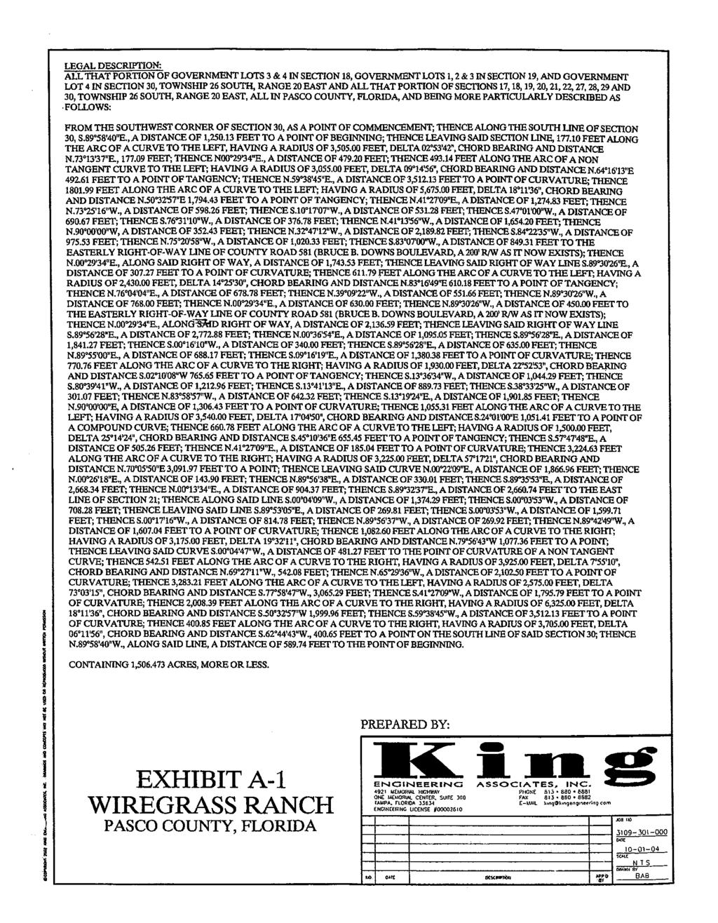
204
205
206
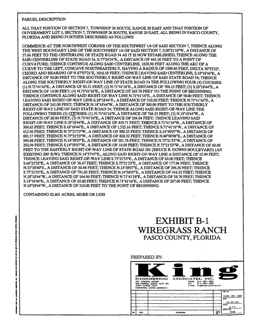
207
208
209
210
211
212
213
214
215
216
217
218
219
220
221
222
223
224
225
226
227
228
229
230
231
232

233
234
235
236
237
238
239
240

241

242
DRI #260 - WIREGRASS RANCH (NOPC #4) PASCO COUNTY
 PASCO COUNTY") DOAR Development Order Amendment Report 4000 Gateway Centre Boulevard, Suite 100, Pinellas Park, FL 33782 Phone (727) 570-5151 FAX (727) 570-5118 www.tbrpc.org DRI #260 - WIREGRASS RANCH (NOPC #4) PASCO
DOAR Development Order Amendment Report 4000 Gateway Centre Boulevard, Suite 100, Pinellas Park, FL 33782 Phone (727) 570-5151 FAX (727) 570-5118 www.tbrpc.org DRI #260 - WIREGRASS RANCH (NOPC #4) PASCO
PASCO COUNTY, FLORIDA INTEROFFICE MEMORANDUM. TO: Development Review Committee DATE: 5/26/11 FILE: PGM11-86 SUBJECT:
 PASCO COUNTY, FLORIDA INTEROFFICE MEMORANDUM TO: Development Review Committee DATE: 5/26/11 FILE: PGM11-86 FROM: Richard E. Gehring Growth Management Administrator SUBJECT: Wiregrass Ranch DRI/MPUD Master
WIREGRASS RANCH DRI/MPUD MASTER ROADWAY PLAN CONDITIONS OF APPROVAL PDD DRC
 WIREGRASS RANCH DRI/MPUD MASTER ROADWAY PLAN CONDITIONS OF APPROVAL DRC 1. This Master Roadway Plan (the MRP) replaces and supersedes the Roadway Alignment and Construction Phasing Plan (File No. GM06-737)
Sufficiency Response 1
 Sufficiency Response 1 Prepared by: Wiregrass Ranch DRI Notice of Proposed Change 3 Sufficiency Response 1 TABLE OF CONTENTS Sufficiency Response Questions Tampa Bay Regional Planning Council...1 Pasco
Kitg of North port. The Commission of the City of North Port hereby makes the following findings of fact and conclusions of law:
 Kitg of North port ORDINANCE NO. 2011-33 (Development Order for Heron Creek a Development of Regional Impact) AN ORDINANCE OF THE CITY OF NORTH PORT, FLORIDA, ADOPTING AN AMENDED AND RESTATED DEVELOPMENT
DEVELOPMENT AGREEMENT RIVER EDGE COLORADO PLANNED UNIT DEVELOPMENT
 DEVELOPMENT AGREEMENT RIVER EDGE COLORADO PLANNED UNIT DEVELOPMENT THIS AGREEMENT, is made and entered into between the BOARD OF COUNTY COMMISSIONERS OF THE COUNTY OF GARFIELD, a body politic and corporate
ORDINANCE NO
 Item 4 Attachment A ORDINANCE NO. 2017-346 AN ORDINANCE OF THE CITY COUNCIL OF THE CITY OF CALABASAS, CALIFORNIA AMENDING CHAPTER 17.22 OF THE CALABASAS MUNICIPAL CODE, AFFORDABLE HOUSING, TO BRING INTO
AN ORDINANCE AMENDING AND SUPPLEMENTING THE REVISED GENERAL ORDINANCES OF THE CITY OF BAYONNE THE, CHAPTER 33 PLANNING AND DEVELOPMENT REGULATIONS
 AN ORDINANCE AMENDING AND SUPPLEMENTING THE REVISED GENERAL ORDINANCES OF THE CITY OF BAYONNE THE, CHAPTER 33 PLANNING AND DEVELOPMENT REGULATIONS WHEREAS, pursuant to N.J.S.A. 40:48-2, the Legislature
RUCKS MASTER PLANNED UNIT DEVELOPMENT CONDITIONS OF APPROVAL REZONING PETITION NO Master Development Plans
 RUCKS MASTER PLANNED UNIT DEVELOPMENT CONDITIONS OF APPROVAL REZONING PETITION NO. 6271 Master Development Plans Development shall be in accordance with the application, plans, and information submitted
ORDINANCE NO AN ORDINANCE AMENDING THE CODE OF ORDINANCES OF THE CITY OF PORT ARANSAS, TEXAS, BY ADOPTING A NEW CHAPTER
 ORDINANCE NO. 2008-09 AN ORDINANCE AMENDING THE CODE OF ORDINANCES OF THE CITY OF PORT ARANSAS, TEXAS, BY ADOPTING A NEW CHAPTER TWENTY-SIX CONCERNING IMPACT FEES FOR ROADWAY FACILITIES; INCORPORATING
ARTICLE 40 AFFORDABLE HOUSING DENSITY BONUS
 ARTICLE 40 AFFORDABLE HOUSING DENSITY BONUS Section 4000: Purpose. This section establishes policies which facilitate the development of affordable housing to serve a variety of needs within the City.
Chapter Development Standards Table of Contents. Section Name Page
 Chapter 900 - Development Standards Table of Contents Section Name Page Section 901 Transportation 901.1-1 901.1 Transportation Corridor Spacing 901.1-1 901.2 Transportation - Corridor Management 901.2-1
Cabarrus County, NC Adequate Public Facilities Ordinance. Contents
 Contents Section 15. Adequate Public Facilities Standards.... 2 Section 15-1. Introduction.... 2 Section 15-2. How to Use this Chapter.... 3 Section 15-3. Basic Terms and Definitions... 4 Section 15-4.
CONTRACT FOR SALE AND PURCHASE
 Page 1 of 5 CONTRACT FOR SALE AND PURCHASE THIS ( Contract ) is made this day of, 20, by and between the Southwest Florida Water Management District, a public corporation of the State of Florida, having
BY BOARD OF COUNTY COMMISSIONERS AN ACT TO BE ENTITLED
 BY BOARD OF COUNTY COMMISSIONERS ORDINANCE NO. AN ACT TO BE ENTITLED AN ORDINANCE AMENDING THE PASCO COUNTY LAND DEVELOPMENT CODE, ARTICLE 700, BY REPEALING EXISTING SECTION 702, ENVIRONMENTALLY SENSITIVE
ARTICLE X. NONCONFORMITIES AND VESTED RIGHTS
 1 0 1 0 1 ARTICLE X. NONCONFORMITIES AND VESTED RIGHTS DIVISION 1. NONCONFORMITIES Section 0-.1. Purpose. The purpose of this division is to provide regulations for the continuation and elimination of
ZONING ORDINANCE: OPEN SPACE COMMUNITY. Hamburg Township, MI
 ZONING ORDINANCE: OPEN SPACE COMMUNITY Hamburg Township, MI ARTICLE 14.00 OPEN SPACE COMMUNITY (Adopted 1/16/92) Section 14.1. Intent It is the intent of this Article to offer an alternative to traditional
Transportation - Corridor Management. Intent and Purpose
 CHAPTER 900. SECTION 90 DEVELOPMENT STANDARDS TRANSPORTATION 90 Transportation - Corridor Management A. Intent and Purpose 3. 4. The intent of this section is to coordinate the full development of roads
REGULATORY AND RESTRICTIVE COVENANTS FOR LAND USE AGREEMENT
 LIHTCP-8 WVHDF (7/14/05) REGULATORY AND RESTRICTIVE COVENANTS FOR LAND USE AGREEMENT Low-Income Housing Tax Credit Program West Virginia Housing Development Fund APPENDIX F THIS REGULATORY AND RESTRICTIVE
ORDINANCE NO. AN ORDINANCE OF THE CITY COUNCIL OF THE CITY OF DALY CITY REPEALING AND REPLACING CHAPTER RE: INCLUSIONARY HOUSING
 ORDINANCE NO. AN ORDINANCE OF THE CITY COUNCIL OF THE CITY OF DALY CITY REPEALING AND REPLACING CHAPTER 17.47 RE: INCLUSIONARY HOUSING The City Council of the City of Daly City, DOES ORDAIN as follows:
City of Sanibel. Planning Department STAFF REPORT
 City of Sanibel Planning Department STAFF REPORT Planning Commission Meeting: July 23, 2013 Planning Commission Agenda Item: No 7b. Application Number: 13-7438DP Applicant Name: Attorney Beverly Grady
CONTRACT FOR SALE AND PURCHASE
 CONTRACT FOR SALE AND PURCHASE THIS Contract for Sale and Purchase ( Contract ) is made this day of, 20, by and between the Southwest Florida Water Management District, a public corporation of the State
CONTRACT FOR SALE AND PURCHASE
 CONTRACT FOR SALE AND PURCHASE THIS Contract for Sale and Purchase ( Contract ) is made this day of, 20, by and between the Southwest Florida Water Management District, a public corporation of the State
PASCO COUNTY, FLORIDA INTEROFFICE MEMORANDUM. REFERENCES: Land Development Code, Development Director
 PASCO COUNTY, FLORIDA INTEROFFICE MEMORANDUM TO: Development Review Committee DATE: 11/12/08 FILE: DR09-100 SUBJECT: Class II, Commercial Development Review - Ashley Furniture Preliminary/Construction
PASCO COUNTY, FLORIDA INTEROFFICE MEMORANDUM
 PASCO COUNTY, FLORIDA INTEROFFICE MEMORANDUM TO: Debra M. Zampetti Zoning/Code Compliance Administrator DATE: 3/11/11 FILE: ZN11-260 SUBJECT: Class II, Commercial Development Review - Trinity Apartments
Chapter 100 Planned Unit Development in Corvallis Urban Fringe
 100.100 Scope and Purpose. Chapter 100 Planned Unit Development in Corvallis Urban Fringe (1) All applications for land divisions in the Urban Residential (UR) and Flood Plain Agriculture (FPA) zones within
ARTICLE III GENERAL PROCEDURES, MINOR PLANS AND FEE SCHEDULES
 ARTICLE III GENERAL PROCEDURES, MINOR PLANS AND FEE SCHEDULES 301. Prior to Submission a. Copies of this Ordinance shall be available on request, at cost, for the use of any person who desires information
STATE OF SOUTH CAROLINA ) AGREEMENT ) OF COUNTY OF RICHLAND ) PURCHASE AND SALE
 AGREEMENT ) OF COUNTY OF RICHLAND ) PURCHASE AND SALE") STATE OF SOUTH CAROLINA ) AGREEMENT ) OF COUNTY OF RICHLAND ) PURCHASE AND SALE THIS AGREEMENT (the Agreement ) executed the day of, 2010 (the Effective Date ), by and between COLUMBIA VENTURE, LLC, a
STATE OF SOUTH CAROLINA ) AGREEMENT ) OF COUNTY OF RICHLAND ) PURCHASE AND SALE THIS AGREEMENT (the Agreement ) executed the day of, 2010 (the Effective Date ), by and between COLUMBIA VENTURE, LLC, a
Town of Bristol Rhode Island
 Town of Bristol Rhode Island Subdivision & Development Review Regulations Adopted by the Planning Board September 27, 1995 (March 2017) Formatted: Highlight Formatted: Font: 12 pt Table of Contents TABLE
THE PARKLANDS DRI IN COLLIER COUNTY DRI # NOTICE OF PROPOSED CHANGE
 THE PARKLANDS DRI IN COLLIER COUNTY DRI #06-8384-43 NOTICE OF PROPOSED CHANGE Background: The Parklands Development of Regional Impact (DRI) is located in both Lee and Collier Counties. The original development
WAYNE COUNTY, UTAH SUBDIVISION ORDINANCE
 WAYNE COUNTY, UTAH SUBDIVISION ORDINANCE A LAND USE ORDINANCE OF WAYNE COUNTY As Adopted by the Wayne County Board of County Commissioners Effective January 01, 2011 Prepared by: PLANNING AND DEVELOPMENT
ORDINANCE WHEREAS, this title is intended to implement and be consistent with the county comprehensive plan; and
 ORDINANCE 2005-015 AN ORDINANCE OF THE BOARD OF COUNTY COMMISSIONERS OF INDIAN RIVER COUNTY, FLORIDA, ADOPTING TITLE X, IMPACT FEES, AND AMENDING CODE SECTION 953, FAIR SHARE ROADWAY IMPROVEMENTS, OF THE
INTERLOCAL AGREEMENT FOR LEESVILLE BRANCH LIBRARY BETWEEN CITY OF RALEIGH, NORTH CAROLINA AND WAKE COUNTY, NORTH CAROLINA
 DRAFT 01-23-08 INTERLOCAL AGREEMENT FOR LEESVILLE BRANCH LIBRARY BETWEEN CITY OF RALEIGH, NORTH CAROLINA AND WAKE COUNTY, NORTH CAROLINA Dated as of, 2008 INTERLOCAL AGREEMENT THIS INTERLOCAL AGREEMENT
LYON COUNTY TITLE 15 LAND USE AND DEVELOPMENT CODE AGREEMENTS AND INCENTIVES CHAPTERS October 19, 2017 Ordinance Draft DRAFT
 DRAFT LYON COUNTY TITLE 15 LAND USE AND DEVELOPMENT CODE AGREEMENTS AND INCENTIVES CHAPTERS 15.100 15.125 October 19, 2017 Ordinance Draft This page left blank intentionally DRAFT DRAFT Lyon County Contents
PASCO COUNTY, FLORIDA INTEROFFICE MEMORANDUM. REFERENCES: Land Development Code, FROM: Cissy Rosenberg
 PASCO COUNTY, FLORIDA INTEROFFICE MEMORANDUM TO: Debra M. Zampetti Zoning/Code Compliance Administrator DATE: 1/27/10 FILE: ZN10-104 SUBJECT: Class II, Commercial Development Review - Lowe's of Land O'
BY THE CITY COMMISSION ORDINANCE NO.:
 BY THE CITY COMMISSION ORDINANCE NO.: 2005-0868 AN ORDINANCE BY THE CITY COMMISSION OF THE CITY OF DADE CITY, FLORIDA CREATING A DEVELOPMENT REVIEW PROCEDURES ORDINANCE; PROVIDING FOR INTENT, PURPOSE,
TRANSFER OF DEVELOPMENT RIGHTS (TDR) ORDINANCE Revised November 2013
 ORDINANCE Revised November 2013") ARTICLE III Transfer of Development Rights (TDR) Program Part 301 Establishment and Purpose. 165-301.01. Purpose. Pursuant to the authority granted by 15.2-2316.1 and 2316.2 of the Code of Virginia, there
ARTICLE III Transfer of Development Rights (TDR) Program Part 301 Establishment and Purpose. 165-301.01. Purpose. Pursuant to the authority granted by 15.2-2316.1 and 2316.2 of the Code of Virginia, there
ARTICLE VII. NONCONFORMITIES. Section 700. Purpose.
 ARTICLE VII. NONCONFORMITIES. Section 700. Purpose. The purpose of this chapter is to regulate and limit the development and continued existence of legal uses, structures, lots, and signs established either
IV. Florida Administrative Code (F.A.C.) Department of Community Affairs Rules
 Department of Community Affairs Rules") IV. Florida Administrative Code (F.A.C.) Department of Community Affairs Rules - 1998 CHAPTER 9J-2 - RULES OF PROCEDURE AND PRACTICE PERTAINING TO DEVELOPMENTS OF REGIONAL IMPACT PART I GENERAL 9J-2.001
IV. Florida Administrative Code (F.A.C.) Department of Community Affairs Rules - 1998 CHAPTER 9J-2 - RULES OF PROCEDURE AND PRACTICE PERTAINING TO DEVELOPMENTS OF REGIONAL IMPACT PART I GENERAL 9J-2.001
ROAD USE AGREEMENT RELATING TO THE DEVELOPMENT OF (WIND FARM NAME) WIND FARM
 WIND FARM") ROAD USE AGREEMENT RELATING TO THE DEVELOPMENT OF (WIND FARM NAME) WIND FARM THIS ROAD USE AGREEMENT (this Agreement ), dated this day of, 20, between the BOARD OF COUNTY SUPERVISORS OF UNION COUNTY, IOWA,
ROAD USE AGREEMENT RELATING TO THE DEVELOPMENT OF (WIND FARM NAME) WIND FARM THIS ROAD USE AGREEMENT (this Agreement ), dated this day of, 20, between the BOARD OF COUNTY SUPERVISORS OF UNION COUNTY, IOWA,
Public Improvement District (PID) Policy
 Policy") Public Improvement District (PID) Policy OVERVIEW Public Improvement Districts ( PIDs ), per the Texas Local Government Code Chapter 372 ( the code or PID Act ), provide the City of Marble Falls ( the
Public Improvement District (PID) Policy OVERVIEW Public Improvement Districts ( PIDs ), per the Texas Local Government Code Chapter 372 ( the code or PID Act ), provide the City of Marble Falls ( the
Expiration of Transportation Certificate of Concurrency for Application for Minor or Major Development; Approval
 Page 1 of 12 CHAPTER 3. CONCURRENCY 3.00.00. GENERALLY 3.00.01. Purpose and Intent The purpose of this chapter is to describe the requirements and procedures necessary to implement the concurrency provisions
RESOLUTION NO. R
 RESOLUTION NO. R-2008-1394 RESOLUTION APPROVING ZONING APPLICATION Z2008-00294 (CONTROL NO. 1995-00044) OFFICIAL ZONING MAP AMENDMENT (REZONING) APPLICATION OF FLORIDA SEVASHRAM SANGHA INC. BY JON E. SCHMIDT
SECTION 1 INTRODUCTION TO THE PANAMA CITY BEACH COMPREHENSIVE GROWTH DEVELOPMENT PLAN
 1. PURPOSE SECTION 1 INTRODUCTION TO THE PANAMA CITY BEACH COMPREHENSIVE GROWTH DEVELOPMENT PLAN The purpose of the City of Panama City Beach's Comprehensive Growth Development Plan is to establish goals,
QUIT CLAIM DEED (Pursuant to F. S )
") Page 1 of 10 Return signed document to: M. Andrée Hammond, Asst. R.E. Officer Real Property Section 115 S. Andrews Avenue, Room 501 Fort Lauderdale, FL 33301 This instrument prepared by: Broward County
Page 1 of 10 Return signed document to: M. Andrée Hammond, Asst. R.E. Officer Real Property Section 115 S. Andrews Avenue, Room 501 Fort Lauderdale, FL 33301 This instrument prepared by: Broward County
ORDINANCE NO. 875 (AS AMENDED THROUGH 875
 ORDINANCE NO. 875 (AS AMENDED THROUGH 875.1) AN ORDINANCE OF THE COUNTY OF RIVERSIDE TO ESTABLISH A LOCAL DEVELOPMENT MITIGATION FEE FOR FUNDING THE PRESERVATION OF NATURAL ECOSYSTEMS IN ACCORDANCE WITH
TOWNSHIP OF HARTLAND ORDINANCE NO. 57-1, AN ORDINANCE AMENDING THE LAND DIVISION ORDINANCE
 TOWNSHIP OF HARTLAND ORDINANCE NO. 57-1, AN ORDINANCE AMENDING THE LAND DIVISION ORDINANCE An ordinance to amend the Land Division Ordinance enacted pursuant to but not limited to the State Land Division
RECITALS. WHEREAS, the GMA requires counties to adopt county-wide planning policies in cooperation with cities within the County; and
 AN INTERLOCAL AGREEMENT FOR THE IMPLEMENTATION OF A DEMONSTRATION PROJECT TO TRANSFER DEVELOPMENT RIGHTS FROM RURAL UNINCORPORATED KING COUNTY TO THE DENNY TRIANGLE IN DOWNTOWN SEATTLE This Agreement is
THE TOWN OF VAIL EMPLOYEE HOUSING GUIDELINES
 THE TOWN OF VAIL EMPLOYEE HOUSING GUIDELINES 10-19-99 10/19/99 Page 1 of 11 I. PURPOSE The purpose of the (Guidelines) is to set forth the occupancy requirements, re-sale procedures, and resale price limitations
Grant Agreement - End Grant for the «1» Project
 Metropolitan Council Municipal Publicly Owned Infrastructure Inflow/Infiltration Grant Program Grant Agreement - End Grant for the «1» Project Funded by the State of Minnesota General Obligation Bond Proceeds
Oregon Statutes Relevant to Quiet Water Home Owners Association
 Oregon Statutes Relevant to Quiet Water Home Owners Association 1 1 1 1 0 1 0 1 0 1 PLANNED COMMUNITIES (General Provisions).0 Definitions for ORS.0 to.. As used in ORS.0 to.: (1) Assessment means any
ORDINANCE NO day of September, 1983, the Board of. County Commissioners did adopt Ordinance 83-19, an Ordinance
 ORDINANCE NO 85-14 AN ORDINANCE AMENDING ORDINANCE NO. 83-19. THIS ORDINANCE RE-ZONES AND,RE-CLASSIFIES THE PROPERTY HEREIN AFTER DESCRIBED, IN NASSAU COUNTY, FLORIDA, ON THE SOUTH END OF AMELIA ISLAND,
DECLARATION OF LAND USE RESTRICTIVE COVENANTS FOR LOW-INCOME HOUSING TAX CREDITS 2019 ALLOCATION YEAR
 DECLARATION OF LAND USE RESTRICTIVE COVENANTS FOR LOW-INCOME HOUSING TAX CREDITS 2019 ALLOCATION YEAR THIS DECLARATION OF LAND USE RESTRICTIVE COVENANTS ( AGREEMENT or LURA ) dated as of, by, a, and its
DEED RESTRICTION AGREEMENT FOR THE OCCUPANCY AND TRANSFER OF CHAMONIX VAIL RESIDENTIAL DWELLING UNITS
 DEED RESTRICTION AGREEMENT FOR THE OCCUPANCY AND TRANSFER OF CHAMONIX VAIL RESIDENTIAL DWELLING UNITS THIS DEED RESTRICTION AGREEMENT (the "Agreement") is entered into this day of, 201_ (the "Effective
DEED RESTRICTION AGREEMENT
 DEED RESTRICTION AGREEMENT THIS DEED RESTRICTION AGREEMENT (the "Agreement") is entered into this day of, 2018 (the "Effective Date") by and between the Town of Vail, Colorado, a Colorado home rule municipality
CITY AND COUNTY OF BROOMFIELD SUBDIVISION IMPROVEMENT AGREEMENT FOR (PROPERTY NAME - ALL CAPS)
") CITY AND COUNTY OF BROOMFIELD SUBDIVISION IMPROVEMENT AGREEMENT FOR (PROPERTY NAME - ALL CAPS) THIS AGREEMENT, made and entered into this day of, 20, by and between The CITY AND COUNTY OF BROOMFIELD, a
CITY AND COUNTY OF BROOMFIELD SUBDIVISION IMPROVEMENT AGREEMENT FOR (PROPERTY NAME - ALL CAPS) THIS AGREEMENT, made and entered into this day of, 20, by and between The CITY AND COUNTY OF BROOMFIELD, a
ORDINANCE NO
 AN ORDINANCE OF THE CITY OF SANTA CRUZ AMENDING TITLE 24 OF THE MUNICIPAL CODE, THE ZONING ORDINANCE, PART 1, INCLUSIONARY HOUSING REQUIREMENTS INCLUDING SECTIONS 24.16.010 THROUGH 24.16.060 BE IT ORDAINED
PLANNED UNIT DEVELOPMENTS (Ordinance No.: 3036, 12/3/07; Repealed & Replaced by Ordinance No.: 4166, 10/15/12)
") 159.62 PLANNED UNIT DEVELOPMENTS (Ordinance No.: 3036, 12/3/07; Repealed & Replaced by Ordinance No.: 4166, 10/15/12) A. PURPOSE 1. General. The Planned Unit Development (PUD) approach provides the flexibility
159.62 PLANNED UNIT DEVELOPMENTS (Ordinance No.: 3036, 12/3/07; Repealed & Replaced by Ordinance No.: 4166, 10/15/12) A. PURPOSE 1. General. The Planned Unit Development (PUD) approach provides the flexibility
F. There is a reasonable and rational relationship between the use of the TUMF and the type of development projects on which the fees are imposed,
 ORDINANCE NO. 824 (AS AMENDED THROUGH 824.15) AN ORDINANCE OF THE COUNTY OF RIVERSIDE AUTHORIZING PARTICIPATION IN THE WESTERN RIVERSIDE COUNTY TRANSPORTATION UNIFORM MITIGATION FEE PROGRAM The Board of
ORDINANCE NO
 ORDINANCE NO. 2014-160 AN ORDINANCE OF THE CITY COUNCIL OF THE CITY OF MENIFEE, CALIFORNIA, REPEALING SECTION 10.35 OF RIVERSIDE COUNTY LAND USE ORDINANCE NO. 460.152 AS ADOPTED BY THE CITY OF MENIFEE
SOUTH BRANCH RANCH MASTER PLANNED UNIT DEVELOPMENT CONDITIONS OF APPROVAL REZONING PETITION NO. 6666
 SOUTH BRANCH RANCH MASTER PLANNED UNIT DEVELOPMENT CONDITIONS OF APPROVAL REZONING PETITION NO. 6666 Master Development Plans 1. Development shall be in accordance with the application, plans, and information
Chapter CONCURRENCY
 Chapter 20.180 CONCURRENCY Sections: 20.180.001 Purpose. 20.180.002 Authority. 20.180.003 Definitions 20.180.004 Exempt development. 20.180.005 Capacity evaluation required for a change in use. 20.180.006
RESOLUTION NO. R
 RESOLUTION NO. R-2016-0554 RESOLUTION APPROVING ZONING APPLICATION ABN/CBIZlCA-2015-00538 (CONTROL NO. 1988-00039) a Class A Conditional Use APPLICATION OF Treatment Center of The Palm Beaches LLC BY Land
BOARD OF COUNTY COMMISSIONERS ARCHULETA COUNTY, COLORADO RESOLUTION 2018-
 BOARD OF COUNTY COMMISSIONERS ARCHULETA COUNTY, COLORADO RESOLUTION 2018- ARCHULETA COUNTY IMPROPERLY DIVIDED PARCELS EXEMPTION INTERIM RESOLUTION - A RESOLUTION ADDRESSING PARCELS UNDER THE SIZE OF 35
St. Mary s County Comprehensive Zoning Ordinance Article 1. GENERAL PROVISIONS
 0 0 0 0 ARTICLE. GENERAL PROVISIONS CHAPTER 0 TITLE, PURPOSE AND ORGANIZATION Sections: 0. Title. 0. Authority. 0. Purpose. 0. Organization of the Zoning Ordinance. 0. Official Zoning Map. 0. Applicability.
Receiving Water Body:
 62-330 ENVIRONMENTAL RESOURCE PERMIT INDIVIDUAL - TECHNICAL STAFF REPORT 23-Nov-2016 APPLICATION #: IND-005-9658-2 Applicant: Agent: Charles Commander CCSH, LLC 2708 Highway 77 Lynn Haven, FL 32444 850-819-5850
CITY OF DEVELOPMENT AGREEMENT FOR
 Return Address: CITY OF DEVELOPMENT AGREEMENT FOR This DEVELOPMENT AGREEMENT ( Agreement ) between ( the Developer ), a corporation [?], and the CITY OF, a municipal corporation of the State of Washington
ARTICLE 2: General Provisions
 ARTICLE 2: General Provisions 2-10 Intent The basic intent of the Town of Orange s Zoning Ordinance is to implement the goals and objectives of the adopted Town of Orange Comprehensive Plan, hereafter
COMPREHENSIVE PLAN FUTURE LAND USE MAP AMENDMENT APPLICATION
 COUNTY STAFF DATA ONLY Date Received: Project No. CPA-20 - GADSDEN COUNTY DEPARTMENT OF PLANNING & COMMUNITY DEVELOPMENT 1-B East Jefferson Street, Post Office Box 1799, Quincy, FL 32353-1799 PLANNING
THE TOWN OF VAIL EMPLOYEE HOUSING GUIDELINES. July 4, 2018
 THE TOWN OF VAIL EMPLOYEE HOUSING GUIDELINES I. PURPOSE July 4, 2018 The purpose of the Employee Housing Guidelines (Guidelines) is to set forth the occupancy requirements, resale procedures, and maximum
PALM BEACH COUNTY PLANNING, ZONING AND BUILDING DEPARTMENT ZONING DIVISION
 PALM BEACH COUNTY PLANNING, ZONING AND BUILDING DEPARTMENT ZONING DIVISION Application No.: Z-2014-01627 Application Name: Dazco Center Control No.: 2003-00040 Applicant: 4730 Hypoluxo LLC Owners: 4730
WATER AND WASTEWATER AGREEMENT (Individual)
") WATER AND WASTEWATER AGREEMENT (Individual) THIS AGREEMENT ("WATER AND WASTEWATER AGREEMENT") made and entered into this day of, 20_, by and between hereinafter referred to as "DEVELOPER" and the CITY
WATER AND WASTEWATER AGREEMENT (Individual) THIS AGREEMENT ("WATER AND WASTEWATER AGREEMENT") made and entered into this day of, 20_, by and between hereinafter referred to as "DEVELOPER" and the CITY
Residential Density Bonus
 Chapter 27 Residential Density Bonus 27.010 Purpose and Intent This chapter is intended to provide incentives for the production of housing for Very Low, Lower Income, Moderate or Senior Housing in accordance
WAKE COUNTY SUBDIVISION ORDINANCE ANNOTATED
 WAKE COUNTY SUBDIVISION ORDINANCE ANNOTATED The Wake County Subdivision Ordinance makes up Chapters 3-1 through 3-5 of the Wake County Code of General Ordinances (as reflected in the numbering of its sections).
KALISPEL RESOLUTION NO $~ Kalispel Tribe of Indians P.O. Box 39 Usk, WA RESOLUTION
 rx ~ ~~~~T "~Ci~ ~._. TRIBE OF INDIANS / '~~~ ~ KALISPEL RESOLUTION NO.2011- $~ Kalispel Tribe of Indians P.O. Box 39 Usk, WA 99180 (509) 445-1147 (509) 445-1705 fax www.kalispeltribe.com RESOLUTION WHEREAS,
Form 11.A.9.17 INSTRUCTIONS FOR APPLICATION FOR PLAT WAIVER (Art. 11.A.8)
") Form 11.A.9.17 INSTRUCTIONS FOR APPLICATION FOR PLAT WAIVER (Art. 11.A.8) All questions in each part must be completed. When a question is not applicable to the property, enter "N/A" or other phrase indicating
Form 11.A.9.17 INSTRUCTIONS FOR APPLICATION FOR PLAT WAIVER (Art. 11.A.8) All questions in each part must be completed. When a question is not applicable to the property, enter "N/A" or other phrase indicating
DEVELOPMENT AGREEMENT
 STATE OF NORTH CAROLINA COUNTY OF CHATHAM DEVELOPMENT AGREEMENT This Development Agreement (this Agreement ) is made and entered into as of the day of, 2009 (the Effective Date ), by and between the COUNTY
From Policy to Reality
 From Policy to Reality Updated ^ Model Ordinances for Sustainable Development 2000 Environmental Quality Board 2008 Minnesota Pollution Control Agency Funded by a Minnesota Pollution Control Agency Sustainable
Article 6: Planned Unit Developments
 LUDC 2013 GARFIELD COUNTY, COLORADO Article 6: Planned Unit Developments ARTICLE 6 PLANNED UNIT DEVELOPMENTS TABLE OF CONTENTS DIVISION 1. GENERAL.... 1 6-101. GENERAL PROVISIONS.... 1 A. Purpose....
Title 8 - ZONING Division AFFORDABLE HOUSING. Chapter RESIDENTIAL DENSITY BONUS
 Sections: 822-2.202 Title. 822-2.204 Purposes. 822-2.206 Definitions. 822-2.208 State law. 822-2.402 Inclusionary unit density bonus. 822-2.404 Affordable unit density bonus. 822-2.406 Land donation density
This is a New Findings of Adequacy for a Recorded Plat (Plat Book 179, Page 131) LAND USE Vacant Effective Plan: Pompano Beach
 LAND USE Vacant Effective Plan: Pompano Beach") Page 1 of 11 Board of County Commissioners, Broward County, Florida Environmental Protection and Growth Management Department Planning and Development Management Division DEVELOPMENT REVIEW REPORT PROJECT
Page 1 of 11 Board of County Commissioners, Broward County, Florida Environmental Protection and Growth Management Department Planning and Development Management Division DEVELOPMENT REVIEW REPORT PROJECT
ARIZONA DEPARTMENT OF TRANSPORTATION RIGHT OF WAY GROUP/PROPERTY MANAGEMENT SECTION EXCESS LAND PURCHASE AGREEMENT AND RECEIPT FOR DEPOSIT
 ARIZONA DEPARTMENT OF TRANSPORTATION RIGHT OF WAY GROUP/PROPERTY MANAGEMENT SECTION EXCESS LAND PURCHASE AGREEMENT AND RECEIPT FOR DEPOSIT Project No.: 010 MA 151 H7441 Date: Month Day, Year Sale No. L-C-047
An ordinance adding Section and amending Section of the Los Angeles Municipal Code to establish an Affordable Housing Linkage Fee.
 ORDINANCE NO. An ordinance adding Section 19.18 and amending Section 16.02 of the Los Angeles Municipal Code to establish an Affordable Housing Linkage Fee. WHEREAS, the City Council of the City of Los
PLANNING PROCEDURES AND FEES BYLAW
 PLANNING PROCEDURES AND FEES BYLAW The following is a consolidated copy of the planning procedures and fees bylaw and includes the following bylaws: Bylaw No. Bylaw Name Adopted Purpose 328 Comox Valley
ARTICLE 1 GENERAL PROVISIONS
 ARTICLE 1 GENERAL PROVISIONS SECTION 100 TITLE This Ordinance shall be known and cited as the "Rice Township Subdivision and Land Development Ordinance." SECTION 101 AUTHORITY Rice Township is empowered
Maureen T. Carson, Community Development Director
 TO: FROM: Honorable Mayor and City Council Attention: Laura C. Kuhn, City Manager Maureen T. Carson, Community Development Director Agenda Item No. 6A March 12, 2013 SUBJECT: ORDINANCE AMENDING THE MUNICIPAL
Multifamily Housing Revenue Bond Rules
 Multifamily Housing Revenue Bond Rules 12.1. General. (a) Authority. The rules in this chapter apply to the issuance of multifamily housing revenue bonds ("Bonds") by the Texas Department of Housing and
GOVERNMENT CODE SECTION
 1 of 18 9/7/2013 10:51 AM GOVERNMENT CODE SECTION 65915-65918 65915. (a) When an applicant seeks a density bonus for a housing development within, or for the donation of land for housing within, the jurisdiction
PLANNED UNIT DEVELOPMENT (PUD)
") SECTION 38.01. ARTICLE 38 PLANNED UNIT DEVELOPMENT (PUD) Purpose The purpose of this Article is to implement the provisions of the Michigan Zoning Enabling Act, Public Act 110 of 2006, as amended, authorizing
SECTION 38.01. ARTICLE 38 PLANNED UNIT DEVELOPMENT (PUD) Purpose The purpose of this Article is to implement the provisions of the Michigan Zoning Enabling Act, Public Act 110 of 2006, as amended, authorizing
PLANNING COMMISSION AGENDA REPORT. 17-CA-02 Accessory Dwelling Unit Ordinance. Jon Biggs, Community Development Director
 PLANNING COMMISSION AGENDA REPORT Meeting Date: May 3, 2018 Subject: Prepared by: Initiated by: 17-CA-02 Accessory Dwelling Unit Ordinance Jon Biggs, Community Development Director City Council Attachments:
TAX ABATEMENT GUIDELINES SUMMARY
 TAX ABATEMENT GUIDELINES SUMMARY OBJECTIVES Primary job creation -- target industries. Amount abatement -- minimum to be competitive. Fair to taxing jurisdictions -- It is a local option. Fair to existing
RESOLUTION NO. ZR
 RESOLUTION NO. ZR-2016-004 RESOLUTION APPROVING ZONING APPLICATION SD-155 CONTROL NO. 2003-055 SUBDIVISION VARIANCE (STAND ALONE) APPLICATION OF FIRST AND TEN REAL ESTATE CORP. BY JON E. SCHMIDT AND ASSOCIATES,
RESOLUTION NO. R
 RESOLUTION NO. R-2017-0004 RESOLUTION APPROVING ZONING APPLICATION ZlCA-2016-00849 (CONTROL NO. 2016-00079) a Class A Conditional Use APPLICATION OF George Moraitis BY iplan and Design LLC, AGENT (Children's
CONSTRUCTION AGENCY AGREEMENT. dated as of March 1, between. BA LEASING BSC, LLC, as Lessor, and
 EX-10.1 2 nsconstructionagmt-030519.htm CONSTRUCTION AGENCY AGREEMENT EXECUTION VERSION CONSTRUCTION AGENCY AGREEMENT dated as of March 1, 2019 between BA LEASING BSC, LLC, as Lessor, and NORFOLK SOUTHERN
RESOLUTION NO. R
 RESOLUTION NO. R-2012-0778 RESOLUTION APPROVING ZONING APPLICATION ZV/DOA-2011-02350 (CONTROL NO. 1984-00139) a Development Order Amendment APPLICATION OF SPBC Federation Housing Inc BY Land Design South,
RESOLUTION NO
 MIA 184152500v2 RESOLUTION NO. 15-028 A RESOLUTION OF THE SCHOOL BOARD OF OSCEOLA COUNTY, FLORIDA, AUTHORIZING EXECUTION OF AMENDED AND RESTATED SCHEDULE 1995A AND AMENDED AND RESTATED SCHEDULE 2004A TO
WEBSTER TOWNSHIP LAND DIVISION ORDINANCE. Summary Table of Amendments
 WEBSTER TOWNSHIP LAND DIVISION ORDINANCE Ordinance No. 2012 02 As Adopted 04-17-12 Summary Table of Amendments Adoption Date Affected Sections Summary October 10, 3 Added definition of Township Engineer
CONTRACT TO BUY AND SELL REAL ESTATE
 CONTRACT TO BUY AND SELL REAL ESTATE THIS CONTRACT TO BUY AND SELL REAL ESTATE ( Contract ) is made and entered into as of April 9, 2018 (the Effective Date ) by and between the City of Pueblo, Colorado,
Goals and Policies Concerning Use of MELLO-ROOS COMMUNITY FACILITIES ACT OF 1982
 Goals and Policies Concerning Use of MELLO-ROOS COMMUNITY FACILITIES ACT OF 1982 Section TABLE OF CONTENTS Page Introduction 1 1 Policy & Goals 1 2 Definitions 2 3 Eligible Public Facilities 3 4 Value-to-Lien
ARTICLE VII TDR. 701 Purpose.
 ARTICLE VII TDR 701 Purpose. The primary purpose of establishing a TDR program is to permanently preserve prime farmland, sensitive natural areas, and rural community character that would be lost if the