COMMUNITY AND ECONOMIC DEVELOPMENT DEPARTMENT
|
|
|
- Alexis Morgan
- 5 years ago
- Views:
Transcription
1 Mark J. Hendrickson Director COMMUNITY AND ECONOMIC DEVELOPMENT DEPARTMENT 2222 M Street Merced, CA (209) (209) Fax Equal Opportunity Employer MINOR MODIFICATION TO ADMINISTRATIVE PERMITS AND CONDITIONAL USE PERMITS WHAT IS A MINOR MODIFICATION? A modification, or change, to a approved Administrative Permit or Conditional Use Permit may be approved by the Planning Director if it is minor in nature. A modification is considered minor if the Planning Director can make the following findings: 1. The modification will not have a significant effect on the environment; 2. The modification is a minor change to the approved permit form the standpoint of: the area, space, or volume occupied by the uses; 3. The modification will not be materially detrimental to other properties or land uses in the area. PROCESSING PROCEDURE: An applicant submits a request for a modification with an Environmental Information Form, a project description, a plot plan, a modification processing fee, and information indication how it meets the required findings above. A Planner is assigned and referrals are made to affect County Departments for a seven-day review and comment period. If there are existing uses on the property, they are reviewed by the Zoning Enforcement Officer for code compliance and to determine if there has been any complaints form the neighbors. After the seven-day review period, the modification is approved, conditionally approved or denied by the Planning Director and the applicant is informed in writing. Any decision of the Planning Director may be appealed to the Planning Commission within five days. MM to AA & CUP.doc
2 MINOR MODIFICATION FLOW CHART Application Submitted Planner Determines If Sufficient Grounds For Minor Modification And Fees Collected Minor Modification OR Major Modification Application Determined Exempt / Non Exempt New Administrative Permit Application New Conditional Use Permit Application (Either application follows applicable processing procedures.) Exempt From Environmental Review OR Initial Environmental Study * 7 Day Review / Comment From County Departments Directors Determination ** Permit Mailed To Applicant OR Appeal To Planning Commission Building Permit Or Use Established * See separate flow chart for more complete environmental review process. ** If appealed within 5 days, permit is stayed for resolution. MM to AA & CUP.doc
3 COMMUNITY AND ECONONIC DEVELOPMENT DEPARTMENT 2222 M STREET MERCED, CA PHONE NO. (209) /FAX (209) STAFF USE ONLY DATE SUBMITTED: APPLICATION NO: SUB-TYPE: RELATED APPS: CHECK APPROPRIATE BOX(ES) FOR YOUR APPLICATION TYPE(S): * MAJOR SUBDIVISION PLOT PLAN REVIEW * GENERAL PLAN AMENDMENT * ZONE VARIANCE * MINOR SUBDIVISION ADMINISTRATIVE PERMIT * ZONE CHANGE MODIFICATION * PROPERTY LINE ADJUSTMENT CONDITIONAL USE PERMIT * GEN. PLAN TEXT AMENDMENT * MAJOR DEVIATION REPLAMATION PL AN * ZONE CODE TEXT AMENDMENT *See Page 2 for Required Additional Information Assistance in filling out this application packet will be provided at the Customer Service Counter during regular business hours. ASSESSOR'S PARCEL NUMBER(S) NAME OF PROPERTY OWNER: ADDRESS: PHONE: /FAX: CELL: NAME OF APPLICANT / AGENT IF OTHER THAN PROPERTY OWNER: ADDRESS: PHONE: /FAX: CELL: ENGINEER: ADDRESS: PHONE: /FAX: CELL: (A) BRIEFLY DESCRIBE APPLICATION PROPOSAL: (B) EXPLAIN IN DETAIL THE PROPOSED USE AND DEVELOPMENT OF THE PROPERTY: PLEASE PROVIDE A DETAILED OPERATIONAL ON A SEPARATE SHEET(S) OF PAPER. INDEMNITY AND HOLD HARMLESS AGREEMENT: Applicant has the contracted duty (hereinafter "the duty") to indemnify, defend and hold harmless, County, its Board of Supervisors, commissions, officers, employees, agents and assigns (hereinafter "COUNTY") from and against any and all claims, petitions, demands, liability, judgments, awards, interest, attorney's fees, expert witness and consultant fees and other costs and expenses of whatsoever kind or nature, at any time arising out of or in any way connected with the performance of this Agreement, whether in tort, contract, writ of mandamus, or otherwise. This duty shall include, but not be limited to, claims, petitions, or the like for bodily injury, property damage, personal injury, contractual damages, writ of mandamus, or otherwise alleged to be caused to any person or entity including, but not limited to employees, agents, commissions, boards, and officers of Applicant. Applicant's liability for indemnity under this Agreement shall apply, regardless of fault, to any acts or omissions, willful misconduct, or negligent conduct of any kind, on the part of the Applicant, its employees, subcontractors, agents, and officers. The duty shall extend to any allegation or claim of liability, or petition, except in circumstances found by a jury or judge to be the sole and legal result of the willful misconduct of COUNTY. This duty shall arise at the first notice of filing a lawsuit, claim, petition, or allegation of liability against COUNTY. Applicant will on request and at its expense, defend any action suit or proceeding arising hereunder. This clause and shall not be limited to any claim, petition, demand, liability, judgment, award, interest, attorney's fees, expert or consultant witness fees, legal research fees, staff and administrative costs, administrative record costs, materials, and costs and expenses of whatsoever kind or nature, that may arise during the term of this Agreement, but shall also apply to all such claims and the like, after the term of this contract, including but not limited to actions arising from public interest, land use and environmental legal actions, brought against the COUNTY following PROJECT approval, modification, denial, or the exercise or exhaustion of administrative appeals. Attorney's fees shall include any and all attorneys fees but not be limited to attorneys fees and staff time incurred by the offices of COUNTY counsel. COUNTY shall have full discretion to select legal counsel of its own choosing to represent COUNTY, at a cost not exceeding the prevailing and reasonable rates for counsel practicing environmental and land use law in the State of California, or practicing any other area of law that the COUNTY determines the Claim may reasonably require. This clause for indemnification shall be interpreted to the broadest extent permitted by law. I have read, agree and accept the County Indemnity and Hold Harmless Agreement: SIGNED: APPLICANT There are no deed restrictions on this land that would prohibit this type of use or development. I (We) depose and say that I am the property owner involved in this application and the forgoing statements and answers herein contained and the information herewith submitted are in all respects true and correct to the best of my knowledge and belief. Signed: PROPERTY OWNER DATE PROPERTY OWNER DATE To check the status of your application go to our web site at: DATE
4 REQUIRED ADDITIONAL INFORMATION (FOR APPLICATIONS WITH AN *ASTERICK) *MAJOR SUBDIVISION Subdivision Name: Number of Proposed Lots: Average Lot Size: Proposed Use: Proposed Phasing: *MINOR SUBDIVISION *PROPERTY LINE ADJUSTMENT A. Total Area Sq. Ft./Acres of Proposed Parcels: No. 1 Sq. Ft./Acres No. 2 Sq. Ft./Acres No. 3 Sq. Ft./Acres No. 4 Sq. Ft./Acres B. Proposed Services: Public Water System Private Sewer System Public Sewer System Private Water System C. If Approved, will proposed parcels abut a public road right of way Yes No D. Name and Width of Roads Abutting Property: Road: Width: Road: Width: * ZONE VARIANCE (Please attach separate sheets to describe the proposed variance) The landowner must explain below how their application can meet the following findings in accordance with Merced County Zoning Code Title 18, Section C.2 A. The variance does not authorize a use or activity which is not allowed in the zone: B. Because of physical circumstances such as size, shape, topography and location of surroundings, the strict application of the zoning ordinance deprives such property of privileges enjoyed by other property in the vicinity under identical zoning classification C. The variance shall not constitute a grant of special privileges inconsistent with the limitations upon other properties in the vicinity and zone in which the property is situated: Note: A Zone Variance shall expire within two years unless exercised or extended by the Planning Commission. * MINOR DEVIATION (Please attach separate sheets in response to A and B below) The landowner must explain how their application can meet the following findings in accordance with Merced County Zoning Code Title 18, Section C.3 A. The deviation does not grant such property privileges not enjoyed by other properties in the vicinity under identical zoning classification, and B. That the minor deviation is not materially detrimental to surrounding property. Indicate which setback or height limit is proposed to be exceeded and by how many feet: Up to 25 % of front yard setback requirements but not closer than 15 feet from the property line ft Up to 40 % of the side yard setback requirements but not closer than 3 feet from the property line ft Up to 40% of the rear yard setback requirements but not closer than 15 feet from the property line ft Up to 10 % increase in height allowed for buildings and structures ft Note: A Minor Deviation shall expire within two years unless exercised or extended by the Planning Commission. * GENERAL PLAN AMENDMENT (Please attach separate sheets describing the proposed amendment) Proposed Change From: To: If you are proposing a Text Amendment please attach a separate sheet identifying the section and proposed text. Also, Explain how the request complies with the Urban Centered Concept and agricultural land preservation goals of the General Plan? * ZONE CHANGE (Please attach separate sheets describing the proposed zone change) Proposed Change From: To: If you are proposing a Text Amendment please attach a separate sheet identifying the section and proposed text. Also, Explain how the proposed zone change implements the objectives and policies of the General Plan?
5 COMMUNITY AND ECONOMIC DEVELOPMENT DEPARTMENT Operational Statement An operational statement is required prior to scheduling of the Completeness of your application. An operational statement should be printed on a separate sheet of paper and shall contain the following: 1. Describe the exact nature of the proposal, including all types of uses-sales, processing, manufacturing, storage commercial etc. 2. Detail existing, proposed and future anticipated operations. 3. Give a brief summary of the proposed operating hours and periods of peak use. 4. Estimate the number of people that will be on the site during peak activity use. 5. Provide a vicinity map highlighting truck routes. 6. Explain the proposed method of waste removal and disposal show on plot plan trash receptacle. 7. Explain how the proposed operation related to any nearby uses. 8. Intended use of all structures. 9. Sizes for all buildings proposed. STRIVING FOR EXCELLENCE Operational Statement.doc
6 Mark J. Hendrickson Director COMMUNITY AND ECONOMIC DEVELOPMENT DEPARTMENT 2222 M Street Merced, CA (209) (209) Fax Equal Opportunity Employer HAZARDOUS WASTE AND SUBSTANCES STATEMENT This form is to determine if the development project and any alternatives proposed in this application are contained on the lists compiled pursuant to Section of the Government Code. Accordingly, the project applicant is required to submit a signed statement, which contains the following information: NAME OF OWNER: ADDRESS: NAME OF APPLICANT (If different than owner): ADDRESS: ADDRESS OF SITE: Number Street City Zip Code PROJECT SITE ASSESSOR'S PARCEL NUMBER: LOCAL AGENCY: MERCED COUNTY NOT ON LIST SPECIFY LIST: Pursuant to section of the Government Code REGULATORY IDENTIFICATION NO: DATE OF LIST: (See Cover) APPLICANT SIGNATURE: Date STRIVING FOR EXCELLENCE
7 USE AND PROCESSING OF THE HAZARDOUS WASTE AND SUBSTANCES STATEMENT The California Government Code requires that applicants for all development projects, excluding building permits, must check the Comprehensive Hazardous Waste and Substances Statement list to determine if the site of the proposed project is on the list. This is to be completed as part of the application materials. The purpose of this is to provide information to be verified and used in the environmental review of the project.
8 Mark J. Hendrickson Director COMMUNITY AND ECONOMIC DEVELOPMENT DEPARTMENT ENVIRONMENTAL INFORMATION FORM CHECKLIST 2222 M Street Merced, CA (209) (209) Fax Equal Opportunity Employer APPLICANT S NAME APN TYPE OF APPLICATION DATE To Applicant: Please address all applicable items specifically. If your application description or plot plan is incomplete, we will return this list to you with complete items as checked ( ) and incomplete items as circled (O). When the first twelve (12) items are determined to be complete, a Planner will review your application prior to accepting fees. In this way, we hope to assist you better in processing your application. CHECKLIST FOR ENVIRONMENTAL INFORMATION FORM: 1. Name / address / telephone of developer / contact person; and, name and address of project with Assessor s Parcel Number. (Items 1-3) 2. Zoning and general plan designation. (Items 4 & 5) 3. Proposed use with permit and application types required. (Items 6 & 7) 4. Federal to city permits required. (Item 8) 5. Project: Site and structure size, additional parking. (Items 9-12) 6. Landscaping and Project scheduling / phasing. (Items 13 & 14) 7. Associated projects and anticipated development. (Item 15) 8. Details for residential, commercial, industrial, and institutional projects. (Items 16-18) 9. Hazardous / toxic wastes. (Item 19) 10. Water, sewage, and storm water run-off figures and systems descriptions and approvals for each. (Items 20 & 21) 11. Solid wastes and disposal method. (Item 22) 12. Additional traffic and roads affected. (Item 23) 13. Earthwork and dust control methods used during construction. ( Items 24) 14. Changes in physical features, ground water, absorption rate, drainage, views, patterns, and scale. (Items 25-32) 15. Changes in housing or housing demand or planned land use? (Items 33 & 34) 16. Significant amounts of solid waste, substantial air emissions, changes in odor, noise, vibration level or glare? (Items 35-40) 17. Project on filled land or slope of 10 percent or more cutting or fill onsite? (Items 41 & 42) 18. Use of potentially hazardous materials? (Item 43) 19. Substantial change in public services, or increased in fuel consumption? (Items 44 & 45) 20. Relationship to other projects? (Item 46) 21. Change in diversity of number of species in area, reduction in agricultural acreage or deterioration of habitats? ( Items 47-49) 22. Project site and surrounding properties in detail, as they existed before this project. (Items 50 & 51) 23. Applicant s signature and date. 24. Other.
9 COMMUNITY AND ECONOMIC DEVELOPMENT DEPARTMENT ENVIRONMENTAL INFORMATION FORM (To be completed by Applicant and Submitted with Application) GENERAL PROJECT INFORMATION (Please Type or Print Neatly) 1. Name, address, and telephone number of developer or project sponsor: 2. Name, address, and telephone number of person to be contacted concerning this project: 3. Address of project: Assessor's Parcel Number(s): 4. Existing zoning district: 5. Existing land use designation: 6. Proposed use of site (Project for which this form is filed): 7. Indicate the type of permit(s) application(s) to which this form pertains: 8. List and describe any other related permit(s) and other public approvals required for this project, including those required by city, regional, state and federal agencies: PROJECT DESCRIPTION (Attach Additional Sheets as Necessary) Mark J. Hendrickson Director 2222 M Street Merced, CA (209) (209) Fax Equal Opportunity Employer 9. Project Area: Parcel Size: 10. Square footage (structures): S.F.; S.F. (NEW) (EXISTING) Percentage of lot coverage: 11. Number of floors of construction: New Construction: Floors; Ft. High Existing Construction: Floors; Ft. High FOR PLANNING DEPARTMENT USE ONLY Date Received for Review (Use Date Stamp also): By: Application Type and Number: Date Returned for More Information: By: Date Accepted as Complete: By: Fee: $ Receipt Number: 1 FORM111.EIF.doc
10 PROJECT DESCRIPTION 12. Number of off-street parking spaces: Existing: Spaces; Handicapped: Spaces. Proposed: Spaces; Handicapped: Spaces. Total area of parking lot(s) and parking spaces: Square Feet. 13. School district(s) the project is located in: 14. Describe any proposed landscaping: 15. Describe proposed scheduling/phasing of project: 16. Describe any associated project(s) or incremental development: 17. If residential, include the number of units, schedule of unit sizes, range of sale prices or rents, and type of household size expected. Units; Unit Size(s) Price Range; Household Size(s) 18. If commercial or industrial, indicate the type (neighborhood, city or regionally oriented) square footage of sales area, square footage of storage area, estimated employment per shift, and loading facilities. Type: ; Sales Area: S.F. Storage Area: ; Active Work Area: S.F. Employees: Per Shift; Daily Shifts Loading Area: ; Square Feet: 19. If institutional, indicate its major function, estimated employment per shift, and describe community benefits to be derived from the project: 20. List any hazardous or toxic materials, chemicals, pesticides, flammable liquids, or other similar product used as a part of the operations and storage container sizes (please consult with the Merced County Environmental Health Division and Fire Department): 21. Describe any estimated consumption of water, the estimated sewage, which will be generated, and the estimated amount of storm water run-off during a 10-year storm for 24 hours. Water: Gallons Per Day; Sewage: Gallons Per Day; Storm water: Cubic Feet. 22. Provide a description of proposed water delivery system(s), sewage treatment system(s), drainage system(s) and water flow or storage requirements for fire suppressions. (A can-and-will serve letter from the appropriate sewer and water district, or percolation tests, may be necessary). 2 FORM111.EIF.doc
11 23. Describe the estimated amount of solid waste (garbage and/or manure), and the method of disposal: Cubic Yards Per Day; Disposed of By: 24. Indicate the estimated amount of traffic, which would result from the project and the roads to which the project would have access: ADTs, (Average Daily Trips); traffic will Access: (Roads) 25. Describe any earthwork (grading) to be done and dust control methods to be used during construction and for proposed access roads. Cubic yards of cut; cubic yards of fill. Cubic yards of earth material to be removed from the site. Dust Control Measures: ARE THE FOLLOWING ITEMS APPLICABLE TO THE PROJECT OR ITS EFFECTS? DISCUSS BELOW, IN DETAIL, ALL ITEMS CHECKED YES OR MAYBE. YOUR ANSWERS TO THESE QUESTIONS MAY BE DIFFERENT FROM THE COUNTY'S. THEREFORE, PROVIDE EVIDENCE OR DOCUMENTATION TO SUPPORT YOUR STATEMENTS. (Attach Additional Sheets As Necessary). Yes Maybe No 26. Change in existing features of any vegetation, lakes, streams, rivers or hills, or substantial alteration of ground contours. 27. Any change in quantity, direction or flow rate of groundwater? 28. Change in lake, stream, or groundwater quality, quantity and/or alteration of existing drainage patterns. 29. Changes in absorption rates, drainage patterns, or the rate and amount of surface runoff? 30. Discharge into any surface water, or any alteration of surface water quality, i.e., temperature, dissolved oxygen, turbidity, etc.? 31. Change in amount of surface water in any water body? 32. Change in scenic views or vistas from existing residential areas, public lands or roads? 33. Change in pattern, scale or character of the general area of the project? 34. Will the project affect existing housing or create a demand for additional housing? 35. Will the project result in a substantial alteration of the present or planned land use of the area? 36. Significant amounts of solid waste (garbage or manure) or litter? 37. Substantial air emissions or deterioration of ambient air quality? 38. Change in dust, ash, smoke, fumes or odors in the vicinity? 39. Creation of objectionable odors? 3 FORM111.EIF.doc
12 40. Change in existing noise or vibration levels in the vicinity, or exposure of people to major noise sources (railroad, aircraft, highways, etc.). 41. Will the project produce new light or glare? 42. Site on filled land or on slope of 10 percent or more? 43. Substantial disruptions, displacements, compaction or over covering of soil? 44. Any use of disposable or potentially hazardous materials, such as toxic substances, flammables or explosives. 45. Substantial change in demand for municipal services (police, fire, water, sewage treatment, maintenance, etc.)? 46. Substantially increase fossil fuel consumption (electricity, oil, natural gas, etc.)? 47. Relationship to a larger project or series of projects? 48. Any change in diversity of species, or number of species (plants or animals)? 49. Reduce the amount of acreage of any agricultural crop? 50. Will the project cause deterioration to existing wildlife or fish habitat? ENVIRONMENTAL SETTING (Attach Additional Sheets as Necessary) 51. Describe in detail the project site as it exists before the project, including information on topography, soil stability, soil classifications, soil Storie Index rating(s), plants and animals (wetlands, if any), different crops, irrigation systems, streams, creeks, rivers, canals, water table depth, utilities available, and any cultural, historical or scenic aspects. Attach photographs of the site. 52. Describe the surrounding properties, including information on plants and animals and any cultural, historical or scenic aspects. Indicate the type of land use (residential, commercial, agricultural, etc.), intensity of land use (one-family, apartment houses, shops, dairy, row crops, orchards, etc.), and scale of development for residential, commercial, industrial or institutional projects (height, frontage, set-backs, etc.). Attach photographs of the vicinity. CERTIFICATION I hereby certify that the statements furnished above and in the attached exhibits present the data and information required for this initial evaluation to the best of my ability, and that the facts, statements, and information presented are true and correct to the best of my knowledge and belief. Date Signature For (Note: This is only an initial environmental information form; other information may be requested as necessary). 4 FORM111.EIF.doc

13 Mark J. Hendrickson Director COMMUNITY AND ECONOMIC DEVELOPMENT DEPARTMENT 2222 M Street Merced, CA (209) (209) Fax Equal Opportunity Employer ACKNOWLEDGEMENT OF MAINTAINING EXISTING SITE CONDITIONS Application: APN: As the Property Owner, I hereby acknowledge that until the final approval of the above application by the County of Merced, no work will be performed such as grading or land leveling, land clearing, construction, trenching, or other work that would alter the existing conditions of the project site. I understand that if the project site is altered prior to project approval, the review of the project by the County will be more difficult and potentially expensive and that additional mitigation measures and/or conditions of approval may be imposed. Further, unauthorized work may cause enforcement by other agencies and/or the denial of the application. I have also instructed my agent and/or the project applicant of the importance of maintaining existing site conditions. Exception to the above may be approved by the Planning Department upon a written request. Signed Date STRIVING FOR EXCELLENCE
14 Mark J. Hendrickson Director COMMUNITY AND ECONOMIC DEVELOPMENT DEPARTMENT 2222 M Street Merced, CA (209) (209) Fax Equal Opportunity Employer ENVIRONMENTAL EVALUATION STANDARDS LAND USE GENERATION FACTORS WEEKDAY SELECTED TRIP END GENERATION RATES ASSUMING 100% OCCUPANCY (FROM TRIP GENERATION MANUAL, 5 TH EDITION) Single Family Patio Homes / Duplexes Townhouses Condominiums Apartments Mobile Homes Retirement Communities Motel Fast Food Restaurant Specialty Retail Center` Sit-down Restaurant Single Tenant Office Building Elementary School High School Churches Light Industry Mini Warehouse 9.5 trips / DU 9.5 trips / DU 5.9 trips / DU 5.9 trips / DU 6.5 trips / DU 4.8 trips / DU 3.3 trips / DU 10.2 trips / room 632 / trips / 1000 sq. ft. building area with drive thru 40.7 trips / 1000 sq. ft. building area 205 trips / 1000 sq. ft. building area 11.5 trips / 1000 sq. ft. building area 1.1 trips per student 1.4 trips per student 9.3 trips / 1000 sq. ft. building area 7 trips / 1000 sq. ft. building area 2.6 trips / 1000 sq. ft. building area ESTIMATED WATER CONSUMPTION RATES (GALLONS / DAY) (FROM CITY OF MERCED AND VARIOUS WATER DISTRICTS WITHIN MERCED COUNTY) Single Family Residential 606 / DU / metered or 1000 / DU / not metered or 190 / resident (includes landscaping) STRIVING FOR EXCELLENCE Land Use Generation Factors.doc
15 Multi Family Residential Offices 240 / DU or 125 / resident 120 gallons / day / 1000 sq. ft. floor area Retail Commercial 120 gallons / day / 1000 sq. ft. floor area or 2000 gallons / acre / day Other Land Uses Estimate amount ESTIMATED SEWAGE GENERATION RATES (GALLONS / DAY) (FROM CITY OF MERCED) Single - Family Residential Multi - Family Residential Commercial Office Industrial 354 gallons / DU or 111 gallons / day / resident 213 gallons / DU or 111 gallons / day / resident 108 gallons / day / 1000 sq. ft. floor area 108 gallons / day / 1000 sq. ft. floor area Variable - Please describe the sewage requirements for any industrial uses in your project. (General projection = 2500 gallons / day / acre. ESTIMATED SOLID WASTE GENERATION RATES (POUNDS / DAY) (FROM COUNTY SOLID WASTE DIVISION AND CITY OF MERCED) Single - Family Residential Multi - Family Residential Retail Commercial Industrial / Heavy Commercial Poultry or Dairy 11.2 / DU 5.3 / DU 21 lbs / 550 sq. ft. area Variable - Please describe the projected solid waste to be generated by your project. Please consult with the Environmental Health Division (209) POPULATION PER HOUSEHOLD = 3.3 (FROM STATE DEPARTMENT OF FINANCE, 1990) NOTE: IF YOU HAVE INFORMATION THAT DIFFERS WITH THESE STANDARDS, PLEASE PROVIDE US WITH YOUR FIGURES AND THE SOURCE OF YOUR INFORMATION. THANK YOU! Land Use Generation Factors.doc
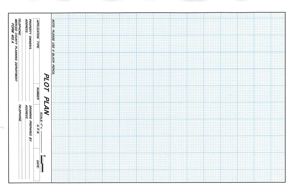
16 COMMUNITY AND ECONOMIC DEVELOPMENT DEPARTMENT PLOT PLAN CHECKLIST APPLICANT S NAME A.P.N. # *TYPE OF APPLICATION DATE TO APPLICANT: Please address all items that are applicable. If your application description or plot plan is incomplete, we will return this list to you with complete items as checked ( ) and incomplete items as circled ( O ). When the Planning Department determines that your plot plan complies with this checklist and all other required items have been received, a letter will be mailed or given to you acknowledging receipt of your application. It will then be assigned to a Planner who will review it to determine whether or not the entire application is complete for acceptance of fees and processing. If you have any questions, on this checklist or at anytime during the processing of your application, please call the Planning Department at (209) PLOT PLAN CHECKLIST* (see attached example) 1. Size of drawing shall be maximum of 11in. x 17in., legible and be of reproducible quality. 2. North is to be at the top of the page unless parcel shape dictates otherwise. Indicate direction with North arrow and draw to an easily measured bar scale; for example, 1 inch = 20 feet or 200 feet. (North arrow and bar scale printed on plot plan). 3. Name, address, and zip code of Property Owner, Assessor s Parcel Number, and date. 4. Name, address, zip code and telephone number of Draftsman or Engineer. 5. Show streets bordering property and closest if not on a corner. Indicate width of streets and label by full name and type (Road, Street, Lane, Boulevard, Etc) 6. Identify adjacent land uses and distances to any dwellings within 500 feet of subject property. 7. Show noise and flood zone contours, if applicable. (The Planning Department has maps and other information related to these items) 8. Show, identify, and dimension all rights-of-way and / or easements. (Including roads, natural and man-made water courses, etc.) 9. Show entrances to, and exits from property, and dimensions of driveways. 10. Dimension entire property, showing parcels and lots where applicable, and showing size of property / parcels / lots in acres or square feet. 11. Locate, identify and dimension all existing and proposed buildings and uses such as: parking fences, trash enclosures, outside lighting, screening and landscaping. Indicate percent of lot coverage by buildings. STRIVING FOR EXCELLENCE Form 401 plot plan list.doc
17 12. Indicate distances between buildings and distances to closest side, rear, and front lot lines. 13. Indicate who will be living in the existing and proposed dwellings on the property (owner, owner s family, agricultural employees, etc.) 14. Show proposed landscaping and irrigation systems on a separate plan, if applicable. 15. Show detailed drawing of floor plans, with elevations to scale and identify exterior materials for all proposed buildings in applications for conditional use permits in urban areas and in applications for multiple-family residential projects. 16. Show number of parking spaces, dimensions, and square footage of parking area and type of surfacing proposed. (Parking requirements can be determined by referring to Chapter of the County Zoning Code) 17. Show elevation contours and proposed finished grades if appropriate. (Elevation contours are shown on U.S.G.S. 7 ½ Minute Quadrangle (Topographic Maps) 18. Show drainage plan location, direction of flow and final disposal, if applicable. 19. Show location and dimension of all existing or proposed signs. Indicate on a detailed drawing the size, height aboveground if free standing, and what will be on the face of the sign(s). Also, indicate if the sign(s) will be illuminated and how. 20. Locate by dimension all existing and / or proposed water wells and septic systems. ** 21. Indicate uses to be brought into conformance with the Building or Zoning Codes (buildings, areas, etc.) with this application. * Subdivision Applications and those with Animal Confinement Facilities use a different checklist. ** The County Environmental Health Division must approve all septic systems. Where a project is to be located within a Specific Urban Development Plan (SUDP) of an unincorporated community, which is served by a local urban utility district for sewer and water, a Can-and-Will-Serve letter shall be provided from the district. Form 401 plot plan list.doc
18
CITY OF SONORA PLANNING COMMISSION SITE PLAN REVIEW APPLICATION
 CITY OF SONORA PLANNING COMMISSION SITE PLAN REVIEW APPLICATION APPLICANT: MAILING ADDRESS: PHONE: CELL#: EMAIL: OWNER S NAME: MAILING ADDRESS: PHONE: CELL#: EMAIL: ADDRESS OF PROPERTY INVOLVED: ASSESSOR
CITY OF CUDAHY CALIFORNIA Incorporated November 10, 1960 P.O. Box Santa Ana Street Cudahy, California
 CITY OF CUDAHY CALIFORNIA Incorporated November 10, 1960 P.O. Box 1007 5220 Santa Ana Street Cudahy, California 90201-6024 PLANNING DIVISION PLANNING APPLICATION FOR MAJOR PROJECTS Appeal Change of Zone
All of the following must be submitted before the Planning Department can process the application:
 CITY OF WEST COVINA PLANNING DEPARTMENT Instructions for filing for a Conditional Use Permit All of the following must be submitted before the Planning Department can process the application: 1. Application
VARIANCE APPLICATION
 REQUIREMENTS TO THE APPLICANT: Please provide the following materials for your application. A complete application package will expedite your public hearing before the Planning and Preservation Commission.
CONDITIONAL USE PERMIT APPLICATION. Date Filed Fees Paid. Name of applicant: Address of applicant: Phone number of applicant:
 CONDITIONAL USE PERMIT APPLICATION (Please type or print) Date Filed Fees Paid Name of applicant: Address of applicant: Phone number of applicant: The applicant is proposing development of the following
City of La Puente E. Main Street, La Puente, CA Telephone (626) Fax (
 Fax (") City of La Puente 15900 E. Main Street, La Puente, CA 91744 Telephone (626)855-1500 Fax (961-4626 DEVELOPMENT AGREEMENT APPLICATION NOTICE TO ALL APPLICANTS In order for City Staff to expeditiously process
City of La Puente 15900 E. Main Street, La Puente, CA 91744 Telephone (626)855-1500 Fax (961-4626 DEVELOPMENT AGREEMENT APPLICATION NOTICE TO ALL APPLICANTS In order for City Staff to expeditiously process
PROJECT ADDRESS ASSESSOR S PARCEL NUMBER G.P. LAND USE DESIGNATION ZONING DISTRICT FLOOD HAZARD ZONE SITE ACREAGE AIRPORT SAFETY ZONE?
 TYPE OR PRINT CLEARLY Submit Completed Applications to: City of Corning Planning Dept. 794 Third Street Corning, CA 96021 PROJECT ADDRESS ASSESSOR S PARCEL NUMBER G.P. LAND USE DESIGNATION ZONING DISTRICT
CONDITIONAL USE PERMIT APPLICATION
 REQUIREMENTS TO THE APPLICANT: Please provide the following materials for your application. A complete application package will expedite your public hearing before the Planning and Preservation Commission.
FEE The staff will let you know the current cost of filing an application. Make checks payable to the San Joaquin County Treasurer.
 VARIANCE 1810 E. HAZELTON AVENUE, STOCKTON CA 95205 BUSINESS PHONE: (209) 468-3121 Business Hours: 8:00 a.m. to 5:00 p.m. (Monday through Friday) STEP 1 STEP 2 APPLICATION PROCESSING STEPS CHECK WITH STAFF
NOTICE OF ACKNOWLEDGMENT
 NOTICE OF ACKNOWLEDGMENT As part of the application process, it is understood that the applicant, agent and/or owner may be responsible for the implementation of conditions as well as additional fees and/or
Planning Department Permit Application
 Inyo County Planning Department 168 North Edwards Street Post Office Drawer L Independence, California 93526 Phone: (760) 878-0263 FAX: (760) 872-2712 E-Mail: inyoplanning@ inyocounty.us Planning Department
OWNER-INITIATED MERGER OF PARCELS APPLICATION
 REQUIREMENTS TO THE APPLICANT: OWNER-INITIATED MERGER OF PARCELS APPLICATION Please provide the following materials for your application. A complete application package will expedite your request for a
Variance Submittal Requirements
 Variance Submittal Requirements In order for the Planning Department to review your Variance application, certain information is required. Please be aware that incomplete applications will not be placed
APPLICATION PROCESSING STEPS STEP 1 CHECK WITH STAFF
 APPLICATION PROCESSING STEPS STEP 1 CHECK WITH STAFF - Development Services Staff will explain the requirements and procedures to you. However, before filing an application with the Community Development
FOR OFFICE USE ONLY Date Submitted Received By Fees Paid $ Receipt No. Received By Application No. Application Complete Final Action Date
 COMMERCIAL, INDUSTRIAL, & MANUFACTURING SITE PLAN (CIM) APPLICATION Mariposa County Planning Department 5100 Bullion Street, P.O. Box 2039 Mariposa, CA 95338 Telephone (209) 966-5151 FAX (209) 742-5024
SITE PLAN REVIEW ADMINISTRATIVE REVIEW. Please Note: Once submitted to the County, all application materials become a matter of public record.
 200 W. Oak Street, 3rd Floor Fort Collins, CO 80521 (970) 498-7683 / larimer.org/planning SITE PLAN REVIEW ADMINISTRATIVE REVIEW The submittal requirements listed in this packet are intended to collect
CITY OF SOUTH SAN FRANCISCO PLANNING DIVISION 315 Maple Avenue, South San Francisco, CA (650)
") CITY OF SOUTH SAN FRANCISCO PLANNING DIVISION 315 Maple Avenue, South San Francisco, CA 94080 (650) 877-8535 TENTATIVE SUBDIVISION MAP Application Instructions No application shall be accepted unless it
CITY OF SOUTH SAN FRANCISCO PLANNING DIVISION 315 Maple Avenue, South San Francisco, CA 94080 (650) 877-8535 TENTATIVE SUBDIVISION MAP Application Instructions No application shall be accepted unless it
APPLICATION CHECKLIST
 DEPARTMENT OF PLANNING AND COMMUNITY DEVELOPMENT 1010 10TH Street, Suite 3400, Modesto, CA 95354 Phone: 209.525.6330 Fax: 209.525.5911 Form Available Online: http://www.stancounty.com/planning/applications.shtm
10. GENERAL PLAN 11. ZONING 12. LAND USE 13. ASSESSOR S PARCEL NUMBER 18. PROPOSED ZONING 19. PROPOSED LAND USE 20. NO. UNITS 21.
 STAFF USE ONLY ACCEPTED BY Application for Discretionary Permit Development Services Department / Planning Division (760) 435-3520 Oceanside Civic Center 300 North Coast Highway Oceanside, California 92054-2885
APPLICATION PROCESSING
 MAJOR SUBDIVISION 1810 E. HAZELTON AVENUE, STOCKTON CA 95205 BUSINESS PHONE: (209) 468-3121 BUSINESS HOURS: 8:00 A.M. TO 5:00 P.M..(Monday through Friday) APPLICATION PROCESSING STEPS STEP 1 STEP 2 CHECK
Elko County Community Development
 Elko County Community Development Planning & Zoning Division 540 COURT ST SUITE 104, ELKO, NEVADA 89801 (775) 738-6816 Fax (775) 738-4581 jkingwell@elkocountnv.net www.elkocountynv.net LOCAL AREA PRIVATE
Larimer County Planning Dept. Procedural Guide for 1041 PERMITS
 - Larimer County Planning Dept. Procedural Guide for 1041 PERMITS PLEASE NOTE: A PRE-APPLICATION CONFERENCE IS REQUIRED PRIOR TO SUBMITTING THIS APPLICATION. PURPOSE: State Statutes allow local governments
TENTATIVE MAP INFORMATION SHEET
 TENTATIVE MAP INFORMATION SHEET GENERAL INFORMATION This information sheet explains how your Tentative Map application will be processed, what fees you must pay, and what plans you must submit. If you
APPLICATION PROCESSING. CHECK WITH STAFF - Development Services Staff will explain the requirements and procedures to you.
 PLANNED DEVELOPMENT ZONE 1810 E. HAZELTON AVENUE, STOCKTON CA 95205 BUSINESS PHONE: (209) 468-3121 Business Hours: 8:00 a.m. to 5:00 p.m. (Monday through Friday) STEP 1 STEP 2 FEE FORM DEED SERVICES APPLICATION
Zone Change Applicant s Guide
 Zone Change Applicant s Guide PURPOSE The Zoning Ordinance establishes land use districts (zones) designed to promote the orderly growth of the community by grouping together uses which are similar and
CHAPTER 3 PERMITS, PLANS AND ANNEXATION
 CHAPTER 3 PERMITS, PLANS AND ANNEXATION SECTION: 10-3-1: General Regulations 10-3-2: Building Permit 10-3-3: Plans 10-3-4: Certificate of Compliance and Occupancy 10-3-5: Conditional Use Permits 10-3-6:
Individual Well Individual Septic. Community Well 19. What is the proposed method of sewage disposal? Public. None
 Please Answer the Following Questions: (attach sheet if needed). What type of facility is being proposed? Campground Recreational Vehicle (RV) Park Both 2. What is the total acreage of the proposed facility?
APPLICATION PACKET for a VARIANCE to ZONING REGULATIONS
 NEVADA COUNTY COMMUNITY DEVELOPMENT AGENCY PLANNING DEPARTMENT ERIC ROOD ADMINISTRATION BUILDING 950 Maidu Avenue, Suite 170 Nevada City, California 95959-8617 Phone: (530) 265-1222 FAX: (530) 265-9851
LOT LINE ADJUSTMENT GENERAL INFORMATION AND
 LOT LINE ADJUSTMENT GENERAL INFORMATION AND APPLICATION Mariposa County Planning Department 5100 Bullion Street, P.O. Box 2039 Mariposa, CA 95338 Telephone (209) 966-5151 FAX (209) 742-5024 www.mariposacounty.org
COASTAL DEVELOPMENT PERMIT APPLICATION
 COUNTY OF MENDOCINO DEPARTMENT OF PLANNING AND BUILDING SERVICES 501 Low Gap Road, Room 1440 Ukiah, California 95482 Telephone 707-463-4281 FAX 707-463-5709 790 South Franklin Street Fort Bragg, California
Mariposa County Public Works Department (209) (for road encroachments, road improvements, and engineering issues)
 (for road encroachments, road improvements, and engineering issues)") CONDITIONAL USE PERMIT GENERAL INFORMATION AND APPLICATION Mariposa County Planning Department 5100 Bullion Street, P.O. Box 2039 Mariposa, CA 95338 Telephone (209) 966-5151 FAX (209) 742-5024 www.mariposacounty.org
CONDITIONAL USE PERMIT GENERAL INFORMATION AND APPLICATION Mariposa County Planning Department 5100 Bullion Street, P.O. Box 2039 Mariposa, CA 95338 Telephone (209) 966-5151 FAX (209) 742-5024 www.mariposacounty.org
CITY OF BIG BEAR LAKE
 CITY OF BIG BEAR LAKE (909) 866-5831 P.O. Box 10000 39707 BIG BEAR BOULEVARD BIG BEAR LAKE, CA 92315 DEVELOPMENT REVIEW APPLICATION FOR STAFF USE ONLY FILING DATE: RECEIVED BY: FILE #: FEES PAID: RECEIPT
Moore Township Planning Commission 2491 Community Drive, Bath, Pennsylvania Telephone: FAX: Rev:12/23/2013
 2491 Community Drive, Bath, Pennsylvania Telephone: 610-759-9449 FAX: 610-759-9448 Rev:12/23/2013 APPLICATION FORM FOR A SITE PLAN PER MOORE TOWNSHIP ZONING ORDINANCE SECTION 200-58.1 NORTHAMPTON COUNTY,
ARTICLE 24 SITE PLAN REVIEW
 ARTICLE 24 SITE PLAN REVIEW 24.1 PURPOSE: The intent of these Ordinance provisions is to provide for consultation and cooperation between the land developer and the Township Planning Commission in order
HOW TO APPLY FOR A USE PERMIT
 HOW TO APPLY FOR A USE PERMIT MENDOCINO COUNTY PLANNING AND BUILDING SERVICES What is the purpose of a use permit? Throughout the County, people use their properties in many different ways. They build
Initial Subdivision Applications Shall Include the Following:
 Initial Subdivision Applications Shall Include the Following: 1) Subdivision Application Form: completely filled out (12 copies) 2) Plat: The Plat must adhere to the requirements set forth in the Town
CITY OF ESCONDIDO Planning Division 201 North Broadway Escondido, CA (760) Fax: (760)
 Fax: (760)") CITY OF ESCONDIDO Planning Division 201 North Broadway Escondido, CA 92025-2798 (760) 839-4671 Fax: (760) 839-4313 INITIAL STUDY FORM PART I (To Be Completed by Applicant) FOR INTERNAL USE ONLY Case No.:
CITY OF ESCONDIDO Planning Division 201 North Broadway Escondido, CA 92025-2798 (760) 839-4671 Fax: (760) 839-4313 INITIAL STUDY FORM PART I (To Be Completed by Applicant) FOR INTERNAL USE ONLY Case No.:
LAND USE APPLICATION
 Lincoln County Department of Planning & Development 210 SW 2nd Street, Newport, OR 97365 Phone (541) 265-4192 Fax (541) 265-6945 LAND USE APPLICATION TO BE COMPLETED BY STAFF Conditional Use Non-Conforming
ZONING VARIANCES - ADMINISTRATIVE
 Planning Department 200 W. Oak Street 3 rd Floor Fort Collins, CO 80521 970-498-7683 www.larimer.org/planning ZONING VARIANCES - ADMINISTRATIVE The submittal requirements listed in this packet are intended
PLANNING & DEVELOPMENT SERVICES 1800 Continental Place Mount Vernon, WA Inspections Office Fax 360.
 PLANNING & DEVELOPMENT SERVICES 1800 Continental Place Mount Vernon, WA 98273 Inspections 360.416.1330 Office 360.416-1320 Fax 360.416-1340 Date Received: Administrative Setback Reduction Checklist Pursuant
APPLICATION PROCESSING STEPS
 LOT LINE ADJUSTMENT 1810 E. HAZELTON AVENUE, STOCKTON CA 95205 BUSINESS PHONE: (209) 468-3121 Business Hours: 8:00 a.m. to 5:00 p.m. (Monday through Friday) APPLICATION PROCESSING STEPS STEP 1 CHECK WITH
(b) The location of principal and accessory buildings on the lot and the relationship of each structure to the other.
 The location of principal and accessory buildings on the lot and the relationship of each structure to the other.") ARTICLE XIX SITE PLAN Sec. 20-1900 Site Plan Review Procedure - Intent The site plan review procedures are instituted to provide an opportunity for the Township Planning Commission to review the proposed
ARTICLE XIX SITE PLAN Sec. 20-1900 Site Plan Review Procedure - Intent The site plan review procedures are instituted to provide an opportunity for the Township Planning Commission to review the proposed
TENTATIVE PARCEL MAP APPLICATION GUIDE TENTATIVE PARCEL MAP APPLICATION REQUIREMENTS
 TENTATIVE PARCEL MAP APPLICATION GUIDE SISKIYOU COUNTY PLANNING DIVISION 806 South Main Street, Yreka CA 96097 Phone: (530) 841-2100 / Fax: (530) 841-4076 TENTATIVE PARCEL MAP APPLICATION REQUIREMENTS
APPLICATION PROCEDURE
 ANTRIM PLANNING BOARD P. O. Box 517 Antrim, New Hampshire 03440 Phone: 603-588-6785 FAX: 603-588-2969 APPLICATION FORM AND CHECKLIST FOR MINOR OR MAJOR SITE PLAN REVIEW File Date Received By APPLICATION
ZONING VARIANCES ADMINISTRATIVE
 200 W. Oak Street, 3rd Floor Fort Collins, CO 80521 (970) 498-7683 / larimer.org/planning ZONING VARIANCES ADMINISTRATIVE The submittal requirements listed in this packet are intended to collect all of
Division Development Impact Review.
 Division 51-4.800. Development Impact Review. SEC. 51-4.801. PURPOSE. The general objectives of this division are to promote and protect the health, safety, and general welfare of the public through the
Wells County Area Plan Commission Requirements for a Wind Energy Conversion System (WECS) Testing Facility or Communication Tower Development Plan
 Testing Facility or Communication Tower Development Plan") Wells County Area Plan Commission Requirements for a Wind Energy Conversion System (WECS) Testing Facility or Communication Tower Development Plan Filing and Meeting dates are available at the Area Plan
Wells County Area Plan Commission Requirements for a Wind Energy Conversion System (WECS) Testing Facility or Communication Tower Development Plan Filing and Meeting dates are available at the Area Plan
Conditional Use Permit Applicant s Guide
 Conditional Use Permit Applicant s Guide PURPOSE The Conditional Use Permit is a permit issued to a landowner by the Planning Commission allowing a particular use or activity not allowed as a matter of
APPENDIX E FORMS INDEX OF ZONING FORMS
 APPENDIX E FORMS The zoning forms to follow in this appendix are used by Morrow County Zoning on behalf of their zoning resolution. There are two checklist sheets at the front of the forms that will assist
Permit No: SPR CUP MHR AgLD IPM PUD MP - (Circle one)
") APPENDIX NO. 1A UNIFORM APPLICATION FORM (Rev. 16-02) FOR ZONING PERMIT APPLICATIONS, PURSUANT TO THE KINGS COUNTY DEVELOPMENT CODE (Please print with ink or type) Permit No: SPR CUP MHR AgLD IPM PUD MP
APPENDIX NO. 1A UNIFORM APPLICATION FORM (Rev. 16-02) FOR ZONING PERMIT APPLICATIONS, PURSUANT TO THE KINGS COUNTY DEVELOPMENT CODE (Please print with ink or type) Permit No: SPR CUP MHR AgLD IPM PUD MP
MINOR SUBDIVISION INFORMATION
 A. POINTS OF CONTACT: MINOR SUBDIVISION INFORMATION Surveyor: Address: Phone #: Fax # E-Mail Address: Representative (If different from applicant): Address: Phone #: Fax # E-Mail Address: B. GENERAL INFORMATION:
:= Information Included
 DEPARTMENT OF PLANNING AND COMMUNITY DEVELOPMENT 1010 10th Street, Suite 3400, Modesto, CA 95354 Planning Phone: (209) 525-6330 Fax: (209) 525-5911 Building Phone: (209) 525-6557 Fax: (209) 525-7759 Form
Josephine County, Oregon
 Josephine County, Oregon PLANNING OFFICE 700 NW Dimmick Street, Suite C, Grants Pass OR 97526 (541) 474-5421 / Fax (541) 474-5422 E-mail: planning@co.josephine.or.us HOME OCCUPATION APPLICATION PRE-APPLICATION
Tentative Map Application Review Procedures
 FOR REFERENCE ONLY This page is not part of the application. Tentative Map Application Review Procedures The tentative map process in Churchill County is designed to provide a mechanism in order to divide
VARIANCE (Revised 03/11)
") EL DORADO COUNTY PLANNING SERVICES 2850 Fairlane Court, Placerville CA 95667 (530) 621-5355 fax: (530) 642-0508 http://www.edcgov.us/planning VARIANCE (Revised 03/11) PURPOSE Each zone district establishes
EL DORADO COUNTY PLANNING SERVICES 2850 Fairlane Court, Placerville CA 95667 (530) 621-5355 fax: (530) 642-0508 http://www.edcgov.us/planning VARIANCE (Revised 03/11) PURPOSE Each zone district establishes
CANNABIS APPLICATION CHECKLIST
 COUNTY OF MENDOCINO DEPARTMENT OF PLANNING AND BUILDING SERVICES 860 NORTH BUSH STREET UKIAH CALIFORNIA 95482 120 WEST FIR STREET FORT BRAGG CALIFORNIA 95437 IGNACIO GONZALEZ, INTERIM DIRECTOR PHONE: 707-234-6650
City of Midland Application for Site Plan Review
 City of Midland Application for Site Plan Review Submission Date: Property Owner: Mailing Address: Phone number: ( ) Cell phone: ( ) Email address: Fax: ( ) Owner s Signature: Applicant Name (if not owner):
SITE DEVELOPMENT PLAN APPLICATION PAHRUMP REGIONAL PLANNING DISTRICT
 SITE DEVELOPMENT PLAN APPLICATION PAHRUMP REGIONAL PLANNING DISTRICT AREA BETWEEN DOUBLE LINES FOR STAFF USE ONLY FOR SUBMITTAL REQUIREMENTS, PLEASE SEE REVERSE DATE FILED: APPLICATION NUMBER: SD COMMUNITY
BOUNDARY LINE ADJUSTMENT APPLICATION GUIDE
 BOUNDARY LINE ADJUSTMENT APPLICATION GUIDE SISKIYOU COUNTY PLANNING DIVISION 806 South Main Street, Yreka CA 96097 Phone: (530) 841-2100 / Fax: (530) 841-4076 WHAT IS A BOUNDARY LINE ADJUSTMENT? A Boundary
APPLICATION FOR PERMIT: (Pursuant to Ord & Reso ) 4d Habitat Loss Permit Vegetation Removal Tree Removal. Address:
 4d Habitat Loss Permit Vegetation Removal Tree Removal. Address:") CITY OF ESCONDIDO Planning Division 201 North Broadway Escondido, CA 92025-2798 (760) 839-4671 Fax: (760) 839-4313 APPLICATION FOR PERMIT: (Pursuant to Ord. 91-54 & Reso. 94-436) Case No: FOR INTERNAL
CITY OF ESCONDIDO Planning Division 201 North Broadway Escondido, CA 92025-2798 (760) 839-4671 Fax: (760) 839-4313 APPLICATION FOR PERMIT: (Pursuant to Ord. 91-54 & Reso. 94-436) Case No: FOR INTERNAL
CHAPTER 3 PRELIMINARY PLAT
 10-3-1 10-3-3 SECTION: CHAPTER 3 PRELIMINARY PLAT 10-3-1: Consultation 10-3-2: Filing 10-3-3: Requirements 10-3-4: Approval 10-3-5: Time Limitation 10-3-6: Grading Limitation 10-3-1: CONSULTATION: Each
Administrative Review Application Blair Township, Grand Traverse County. Blair Township
 Blair Township ZONING DEPARTMENT 2121 Co. Rd. 633 Grawn, MI 49637 231.276.9263 Applications will NOT be accepted unless ALL information and fully completed application are submitted. Please take note of
Applicant Address: 3325 Longview Drive, St 311. State/Zip: Ca/ Phone: (916)
") Planning Application Form Cover Sheet This application form is required as part of any planning development request. Other required items are indicated on the accompanying instructions and checklists.
Planning Application Form Cover Sheet This application form is required as part of any planning development request. Other required items are indicated on the accompanying instructions and checklists.
CITY OF ARVIN Application Form. Planning & Building Department 141 Plumtree Dr. P.O. Box 548 Arvin, Ca Phone: (661) Fax: (661)
 Fax: (661)") File No. CITY OF ARVIN Application Form (Office Use Only) General Plan & Zone Changes General Plan Amendment ($1,100 deposit) Specific Plan Amendment ($1,100 deposit) New Specific Plan ($1,100 deposit)
File No. CITY OF ARVIN Application Form (Office Use Only) General Plan & Zone Changes General Plan Amendment ($1,100 deposit) Specific Plan Amendment ($1,100 deposit) New Specific Plan ($1,100 deposit)
Instructions to the Applicant
 CONDITIONAL USE PERMIT APPLICATION Lake of the Woods County Land and Water Planning Office 206 8 th Avenue Southeast, Suite #290 Baudette MN 56623-2867 www.co.lake-of-the-woods.mn.us Phone: (218) 634-1945
SITE DEVELOPMENT PLAN REQUIREMENTS CHECKLIST
 SITE DEVELOPMENT PLAN REQUIREMENTS CHECKLIST Completed DRC Application for Review Required for Application Process DRC Processing Fee 1 Commercial $2,500.00 Fire Department Review Fee 150.00 Total $2,650.00
Commercial Requirements Packet Sheridan, Indiana Hamilton County
 Commercial Requirements Packet Sheridan, Indiana Hamilton County Town of Sheridan 506 S. Main Street Sheridan, IN 46069 317 758 5293 FAX: 317 758 2505 Needed Information For All Commercial (Office, Retail,
Understanding the Conditional Use Process
 Understanding the Conditional Use Process The purpose of this document is to explain the process of applying for and obtaining a conditional use permit in the rural unincorporated towns of Dane County.
TOWN OF RIB MOUNTAIN
 TOWN OF RIB MOUNTAIN Application for Site Plan or Special Use Review / Approval PETITIONER: MAILING ADDRESS: TELEPHONE NUMBER: SIGNATURE DATE PROPERTY OWNER: * MAILING ADDRESS: TELEPHONE NUMBER: SIGNATURE
For office use only:
 VILLAGE OF COTTAGE GROVE SITE PLAN REVIEW APPLICATION APPLICANT: APPLICANT ADDRESS: TELEPHONE: FAX: EMAIL ADDRESS: ***************************************************** LOCATION OF SITE: PROPOSED USE OF
Conditional Use Permit / Standard Subdivision Application
 Conditional Use Permit / Standard Subdivision Application Name of Proposed Subdivision: Total Area (Acres) Is Proposed Subdivision to be built in phases? Number of Lots If yes, how many phases? Applicant/Owner
Attached is a Clinton Township Zoning Permit Application and requirements for issuance of a permit.
 To Whom It May Concern: Attached is a Clinton Township Zoning Permit Application and requirements for issuance of a permit. The fee for the permit application is $75.00, which shall be made payable to
Special Land Use. SLU Application & Review Standards
 review and approval is needed for certain uses of property that have the potential to impact adjacent properties and the neighborhood. The application and review procedure is intended to ensure that the
CONDITIONAL USE PERMIT Application Packet
 CONDITIONAL USE PERMIT Application Packet Community Development Department 1020 East Pioneer Road, Draper, UT 84020 (801) 576-6539 Fax (801) 576-6526 Dear Applicant, This application packet has been developed
Fee $1, Property information and location (All lines applicable to this site must be filled in)
") Gravel Operations Conditional use permit Application Fee $1,000.00 Property information and location (All lines applicable to this site must be filled in) Section Township Range Parcel # Lot # You MUST
Gravel Operations Conditional use permit Application Fee $1,000.00 Property information and location (All lines applicable to this site must be filled in) Section Township Range Parcel # Lot # You MUST
LABEL PLEASE NOTE: ALL APPLICATIONS AND SITE PLANS MUST BE COMPLETED IN BLACK OR BLUE INK ONLY Intake by:
 STAFF USE ONLY Thurston County Resource Stewardship 2000 Lakeridge Dr. S.W. Olympia, WA 98502 (360)786-5490 / (360)754-2939 (Fax) TDD Line (360) 754-2933 Email: permit@co.thurston.wa.us Supplemental Application
CITY OF RIALTO PLANNING DIVISION
 ENTITLEMENT APPLICATION LEGAL OWNER PROPERTY INFORMATION: I hereby certify that I am (we are) the record owner(s) for property tax assessment purposes of the property encompassed by this application. I
CITY OF RIALTO PLANNING DIVISION ENTITLEMENT APPLICATION
 ENTITLEMENT APPLICATION LEGAL OWNER INFORMATION: I hereby certify that I am (we are) the record owner(s) for property tax assessment purposes of the property encompassed by this application. I understand
ARTICLE 9 SPECIFICATIONS FOR DOCUMENTS TO BE SUBMITTED
 ARTICLE 9 SPECIFICATIONS FOR DOCUMENTS TO BE SUBMITTED SECTION 950 GENERALLY All applications shall be properly signed and filed by the owner or, with the owner s specific written consent, a contract purchaser
CITY OF GROVER BEACH COMMUNITY DEVELOPMENT DEPARTMENT Tentative Map Checklist
 CITY OF GROVER BEACH COMMUNITY DEVELOPMENT DEPARTMENT Tentative Map Checklist The following list includes all of the items you must submit for a complete application. Some specific types of information
A.3. ARTICLE 7 PLAN REQUIREMENTS FOR MINOR SUBDIVISION AND/OR LAND DEVELOPMENT
 700. 701.A.3. ARTICLE 7 PLAN REQUIREMENTS FOR MINOR SUBDIVISION AND/OR LAND DEVELOPMENT SECTION 700 PURPOSE The purpose of this Article is to set forth a streamlined set of Plan Requirements for minor
City of Leavenworth DEPARTMENT OF DEVELOPMENT SERVICES MAJOR SUBDIVISION APPLICATION 1
 Proposed Name of Subdivision: City of Leavenworth DEPARTMENT OF DEVELOPMENT SERVICES MAJOR SUBDIVISION APPLICATION 1 FOR PRELIMINARY SUBDIVISION APPROVAL This application must be filled out legibly, in
Ravenna Township. Dakota County, Minnesota. Variance Application. Please Print or Type All Information
 Variance Application Return this completed application to the office of the clerk on or before A $550.00 fee is required before a Public Hearing date is issued. For Township Use Only Case Number: Date
Request for Action form is also defined as an application to be considered by the Planning Commission.
 CITY OF NORTH RIDGEVILLE INSTRUCTIONS FOR FILING REQUEST FOR ACTION APPLICATIONS WITH THE PLANNING COMMISSION (Please read the full instruction as it will help in providing a full complete application)
Waseca County Planning and Zoning Office
 Waseca County Planning and Zoning Office 300 North State Street Waseca, Minnesota 56093 Phone: 507-835-0650 Fax: 507-837-5310 Form no. PZ 081009 Web Site: www.co.waseca.mn.us FEES: 1) CUP FEE- $400.00
Rules and Regulations for Home Occupations & No Impact Home Based Businesses
 Rules and Regulations for Home Occupations & No Impact Home Based Businesses HOME OCCUPATION An activity for gain carried on entirely within a dwelling, or in a building accessory to a dwelling, by the
APPLICATION PACKET FOR. In the Coastal Zone Area
 APPLICATION PACKET FOR Coastal Zone Permit In the Coastal Zone Area Planning Department 1650 Mission Street Suite 400 San Francisco, CA 94103-9425 T: 415.558.6378 F: 415.558.6409 Pursuant to Planning Code
INSTRUCTIONAL PACKET FOR VARIANCES
 Community Development Department Counter Hours: 8:00 a.m. to 12:00 noon Monday through Thursday (Please Call to Verify Counter Hours) Address: 1110 West Capitol Avenue, 2 nd Floor West Sacramento, CA 95691
KERN COUNTY PLANNING AND NATURAL RESOURCES DEPARTMENT INSTRUCTIONS TO APPLICANT FILING MINISTERIAL OIL AND GAS CONFORMITY REVIEW TIERS 2, 3, AND 5
 KERN COUNTY PLANNING AND NATURAL RESOURCES DEPARTMENT INSTRUCTIONS TO APPLICANT FILING MINISTERIAL OIL AND GAS CONFORMITY REVIEW TIERS 2, 3, AND 5 I. APPLICATION INSTRUCTIONS FOR TIERS 2, 3, AND 5 Please
Josephine County, Oregon
 Josephine County, Oregon PLANNING OFFICE 700 NW Dimmick Street, Suite C, Grants Pass OR 97526 (541) 474-5421 / Fax (541) 474-5422 E-mail: planning@co.josephine.or.us VARIANCE APPLICATION (General Development
APPLICATION PROCESSING. Seven (7) copies of a site plan (see attached). Seven (7) copies of the recorded deed(s) of the properties involved.
 copies of a site plan (see attached). Seven (7) copies of the recorded deed(s) of the properties involved.") REVERSION OF ACREAGE San Joaquin County Community Development Department 1810 East Hazelton Avenue, Stockton CA 95205 Telephone: (209) 468-3121 Business Hours: 8:00 a.m. to 5:00p.m. (Monday through Friday,
REVERSION OF ACREAGE San Joaquin County Community Development Department 1810 East Hazelton Avenue, Stockton CA 95205 Telephone: (209) 468-3121 Business Hours: 8:00 a.m. to 5:00p.m. (Monday through Friday,
TOWN OF SAN ANSELMO PLANNING COMMISSION STAFF REPORT. For the meeting of January 11, Agenda Item 6C. Zone X (Minimal Flood Hazard Area)
") TOWN OF SAN ANSELMO PLANNING COMMISSION STAFF REPORT For the meeting of January 11, 2016 Agenda Item 6C Owner/Applicant: Daniel and Jacqueline Olson Project Address: 321 Greenfield Avenue Assessor s Parcel
TOWN OF SAN ANSELMO PLANNING COMMISSION STAFF REPORT For the meeting of January 11, 2016 Agenda Item 6C Owner/Applicant: Daniel and Jacqueline Olson Project Address: 321 Greenfield Avenue Assessor s Parcel
APPLICATION FOR SITE PLAN CONTROL
 APPLICATION FOR SITE PLAN CONTROL Information and material to be provided under Section 41 of the Planning Act Township of Lanark Highlands PO Box 340, 75 George Street Lanark, ON K0G 1K0 T: 613.259.2398
PLANNED DEVELOPMENT / CONDITIONAL USE PERMIT Application
 SUBMITTAL City of Camarillo Department of Community Development 601 Carmen Drive P.O. Box 248 Camarillo, CA 93011-0248 Phone: 805.388.5360; Fax: 805.388.5388 Email: comdevemail@cityofcamarillo.org City
APPLICATION REVIEW CHECKLISTS
 APPLICATION REVIEW CHECKLISTS The following must be submitted with and are part of each application. No application is complete until all required documentation has been submitted to the Community Development
Packet Contents: Page #
 CLEAR CREEK COUNTY PLANNING DEPARTMENT REQUIREMENTS FOR COMMERCIAL AND MULTI-FAMILY DEVELOPMENTS Prior to submitting a building permit application, the Planning staff will review the site plan and construction
ARTICLE 7: PLOT PLANS AND SITE PLAN REQUIREMENTS AND REVIEW
 ARTICLE 7: PLOT PLANS AND SITE PLAN REQUIREMENTS AND REVIEW Section 7.0 - Purpose The purpose of this article is to specify the documents and/or drawings required for a Site Plan Review or a Plot Plan
COLUMBIA COUNTY LAND DEVELOPMENT SERVICES COURTHOUSE 230 STRAND ST. HELENS, OREGON (503) APPLICANT: Name:
 APPLICANT: Name:") COLUMBIA COUNTY LAND DEVELOPMENT SERVICES COURTHOUSE 230 STRAND ST. HELENS, OREGON 97051 (503) 397-1501 PARTITION General Information File No. APPLICANT: Name: Mailing address: City State Zip Code Phone
COLUMBIA COUNTY LAND DEVELOPMENT SERVICES COURTHOUSE 230 STRAND ST. HELENS, OREGON 97051 (503) 397-1501 PARTITION General Information File No. APPLICANT: Name: Mailing address: City State Zip Code Phone
LAND USE PERMIT APPLICATION
 LAND USE PERMIT APPLICATION Date Application No. TYPE OF PERMIT Subdivision Short Plat Conditional Use Binding Site Plan Final Plat Final Short Plat Variance Final Binding Site Plan Plat Amendment Short
GENERAL PLAN, DEVELOPMENT CODE AND ZONING MAP AMENDMENT APPLICATION INFORMATION SHEET
 GENERAL PLAN, DEVELOPMENT CODE AND ZONING MAP AMENDMENT APPLICATION INFORMATION SHEET GENERAL INFORMATION This information sheet explains how an application requesting an amendment to the Truckee General