County of Park PUBLIC WORKS DEPARTMENT. May 1, 2018
|
|
|
- Nathaniel Tate
- 5 years ago
- Views:
Transcription

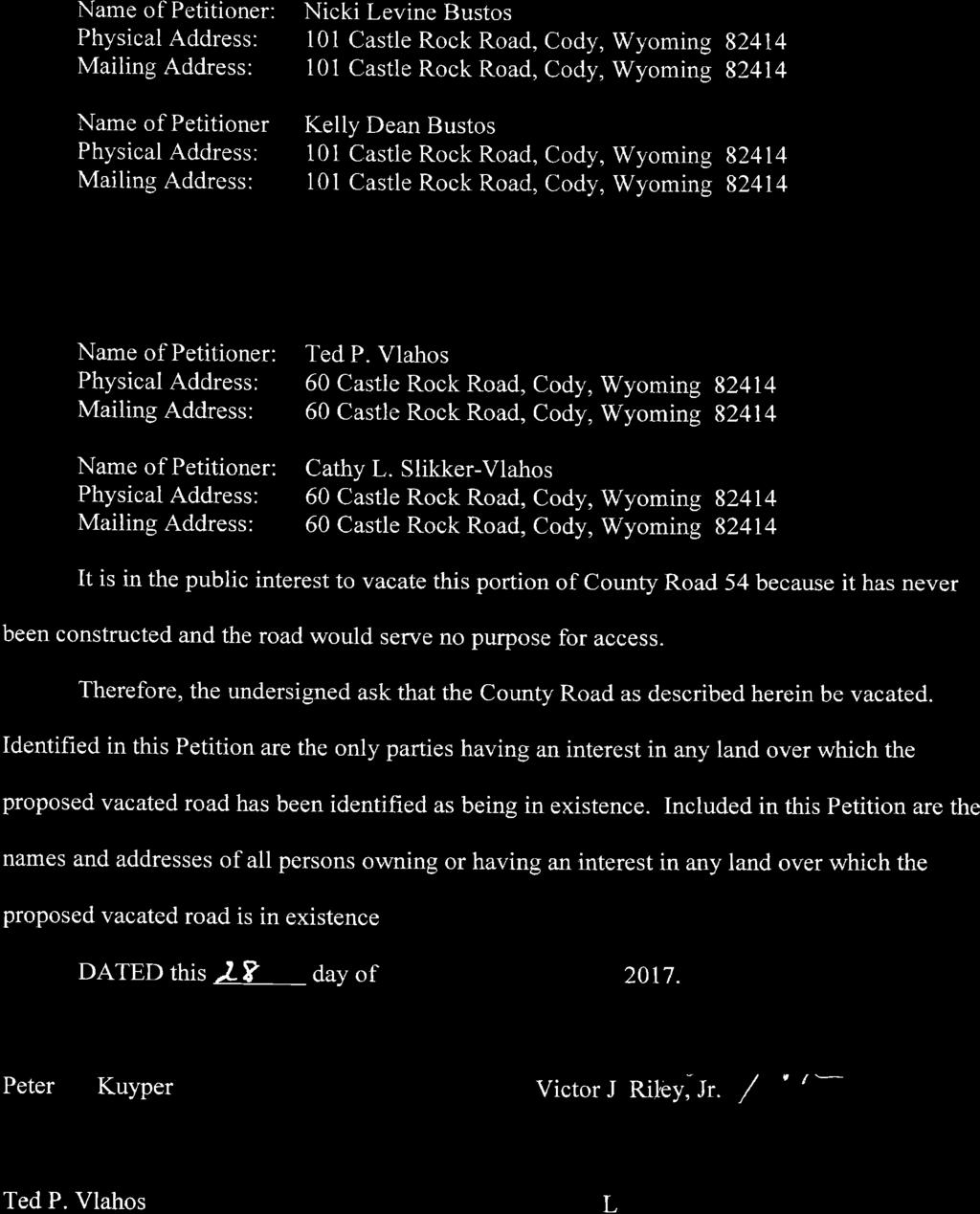
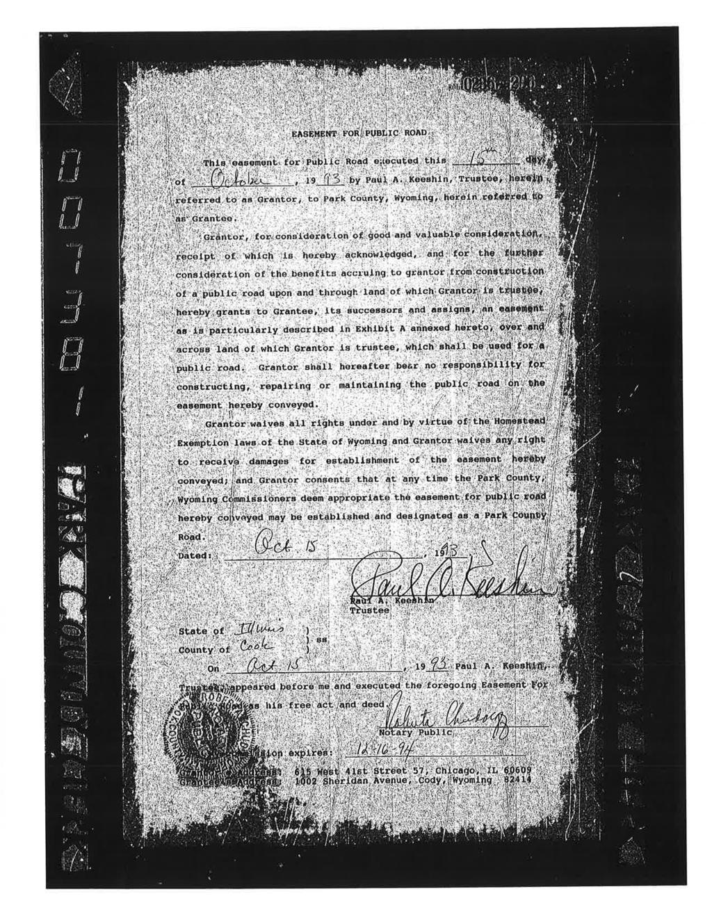
1 PUBLIC WORKS DEPARTMENT Brian Edwards, PE County Engineer PARK COUNTY, WYOMING ORGANIZED 1911 ORIGINAL PARK COUNTY COURTHOUSE CODY, WYOMING COMPLETED 1912 Engineering and Road & Bridge or County of Park May 1, 2018 Park County, Wyoming Board of County Commissioners Attn: Loren Grosskopf, Chairman Jake Fulkerson, Vice Chairman Lee Livingston, Commissioner Joe Tilden, Commissioner Tim French, Commissioner 1002 Sheridan Avenue Cody, WY RE: VIEWER S REPORT Proposed Vacation of Road 54 (a Public Road) Between the Westerly Boundary of Tract 68 and Castle Rock Road Township 51 North, Range 104 West, 6 th P.M.- Resurvey (Park County) Gentlemen: The following information and supporting documents constitute a Viewer s Report in accordance with Wyoming State Statute which pertains to creation, vacation or alteration of county roads. Specifically, this report is intended to address the following petition for vacation of a +/- 1.4 mile section of public road located within Park County, Wyoming. 1. Petition to Vacate a Portion of Public Road 54 - Commencing on the westerly boundary of Tract 68, thence northeasterly through Tract 66 and Tract 63 to a point which intersects with Castle Rock Road within Tract 63, Township 51 North, Range 104 West, 6 th P.M. (Re-survey), Park County, Wyoming. The Petition has been submitted by Peter W. Kuyper (Operating Manager of Hawks Hill Ranch, LLC), Victor J. Riley, Jr. (Trustee of the Victor J. Riley, Jr. Trust dated March 20, 2006, Ted P. Vlahos, and Cathy L. Slikker-Vlahos (husband and wife). This petition was filed by the petitioners in the office of the Park County Clerk on September 28, 2017 in accordance with Wyoming State Statute (b). The petition includes the signatures of at least five (5) electors of the County residing within twenty-five miles of the roads proposed to be vacated. The petition is signed by Peter W. Kuyper, Victor J. Riley, Jr., Ted P. Vlahos, Cathy L. Slikker-Vlahos, Christine Kuyper, 1131 Eleventh Street (307) Cody, Wyoming FAX: (307)


 addresses the process for establishment, vacation, or alteration for petitions initiated by the board of county commissioners.")
2 2 Viewer s Report Proposed Vacation of a Portion of Road 54 (Public Road) Between Tract 68 and Castle Rock Road Nikki Levine Bustos, and Kelly Dean Bustos. A Copy of the referenced petition is included in Attachment A for reference. The approximate location of the road section proposed for vacation is depicted on Figure 1. FIGURE 1- Approximate Road Location Road 54 Between Tract 68 and Castle Rock Road Derived from Survey of Road 54 Conducted by Paul Blough Dated 2/28/91 A. OVERVIEW OF STATUTORY REQUIREMENTS AND APPLICABILITY Chapter 3 of Title 24 of Wyoming State Statutes outlines specific requirements for the establishment, vacation or alteration of county highways. Copies of applicable sections of the Wyoming State Statutes (Chapter 3 of Title 24) are included in Attachment B for reference. Section (a) addresses the process for establishment, vacation, or alteration for petitions initiated by the board of county commissioners. Section (b) sets forth the process for establishment, vacation, or alteration of a county highway when initiated by a member or members of the public. Since the process to vacate the referenced portion of Road 54 was initiated by electors with interest in these roads, the procedures outlined in Section (b) apply. BRIAN EDWARDS, P.E. COUNTY ENGINEER MAY 1, 2018
3 3 Viewer s Report Proposed Vacation of a Portion of Road 54 (Public Road) Between Tract 68 and Castle Rock Road The Board of County Commissioners for Park County, Wyoming (BOCC) met on April 3, 2018 and reviewed the referenced petition for public road vacation pertaining to the referenced section of Road 54 (located between the westerly boundary of Tract 68 and Castle Rock Road). Upon review of the referenced petition submitted and filed with the County Clerk, Resolution was approved initiating the procedures for vacation of the referenced section of Road 54. Resolution establishes myself (County Engineer Brian Edwards, a Wyoming licensed professional engineer), as Viewer in accordance with State Statutes and A copy of Resolution is included for reference as part of this report in Attachment C. The Oath of Viewer as signed by myself (Brian Edwards) is included in Attachment D. In accordance with Section , the viewer assigned by the BOCC must be suitable and disinterested. In signing the Oath of Viewer, it is thereby acknowledged that as a licensed professional engineer holding the position of County Engineer, I have a general and working knowledge of the Park County road & bridge system. In addition, I do not have any interest, financial or otherwise, in the specific public roads being considered for vacation. In carrying out the statutory requirements and duties as Viewer, I have reviewed all known available information and historical records pertaining to this matter. In forming the judgment and professional opinions outlined herein, consideration was duly given to both public and private convenience as well as the expense of the roads proposed for vacation (Re: ). Upon hearing and reviewing the Viewer s Report, the BOCC may choose to act to proceed with the vacation of the referenced section of road outlined in the petition. If the Commissioners move to proceed with the vacation process, public notices will be issued in accordance with The notices will include filings on the County web site and in the County newspaper(s) of record. The notices will also be sent via certified mail to all persons owning lands or claiming interests in lands over or across which said road shall be vacated. The notice will include information providing an opportunity for objections and claims for damages to be filed with the County clerk. In reviewing this report, the Commissioners and all interested parties are encouraged to also review the following separate but related documents of record: 1. Viewer s Report to Consider Vacation of County Road 6JM (a public road) presented to the Board of Park County Commissioners on August 18, 2015 as prepared by Mr. Jeremy Quist (former Assistant Park County Engineer); Viewer s Report was authorized by the Board of Park County Commissioners on August 4, Viewer s Report to Consider Vacation of County Road 6JM, Road 54b, and a Portion of Road 54 (across TE Ranch Property south and west of State Lands) presented to the Board of County Commissioners on February 20, 2018 by BRIAN EDWARDS, P.E. COUNTY ENGINEER MAY 1, 2018
4 4 Viewer s Report Proposed Vacation of a Portion of Road 54 (Public Road) Between Tract 68 and Castle Rock Road Brian Edwards (Park County Engineer); Preparation of Viewer s Report was authorized by Resolution # dated November 21, Upon hearing and reviewing the Viewer s Report, various alternatives may be pursued if the BOCC chooses to not proceed with the vacation of the road section addressed herein. Possible actions by the BOCC resulting from this Viewer s Report include: 1) The BOCC may choose to reinitiate the process for continuing the original plan to develop a County road loop to connect the South Fork Road (County Road 6WX) with Castle Rock Road and County Road 6NS while utilizing existing County Road 6JM. Under this option Road 54 may still be vacated in favor of an alternate route. As described in later sections of this report, several easements across private property have been granted along the alternate route although additional easements would still need to be acquired. It should be noted that it is not practical or feasible to construct all of Road 54 along the established historical alignment due to topographical and physical constraints. 2) The BOCC may choose to vacate only the road addressed in this Viewer s Report (Road 54 between the western boundary of Tract 68 then easterly to Castle Rock Road). 3) The BOCC may choose to consider the road and associated recommendations provided in this Viewer s Report with those addressed in previous related reports prepared by Quist (August 18, 2015) and Edwards (February 20, 2018). Specifically, the Commissioners may choose to collectively pursue vacation of all of Road 6JM, Road 54b, and portions of Road 54. Under this alternative, the BOCC would pursue vacation of all sections of Road 54 across property owned by TE Ranch, the State of Wyoming, Hawks Hill Ranch, Golden Key Ranch, LLC, and the Vlahos. 4) The BOCC may choose to take no formal action on the matter and move to discontinue the vacation process if deemed to be in the best interest of the public while also considering the specific needs and requests of the petitioners as established as a matter of record in the petition. 5) The BOCC may choose some variation of Alternatives 1, 2, 3 & 4. In preparing the following report, it is the Viewer s intent to provide and outline the relative advantages, disadvantages, and estimated costs for each of the above alternatives. The goal is to provide an unbiased assessment of the circumstances pertaining to the historical development of each section of road while outlining the benefits and costs for current and future use so that the BOCC can make an informed decision regarding the petitions as submitted. BRIAN EDWARDS, P.E. COUNTY ENGINEER MAY 1, 2018
5 5 Viewer s Report Proposed Vacation of a Portion of Road 54 (Public Road) Between Tract 68 and Castle Rock Road B. HISTORICAL DEVELOPMENT OF ROAD 54 Road 54 is an established County Road Right-of-Way that is currently undeveloped and therefore not in use today. Figure 1 shows a depiction of the approximate location of Road 54 as extrapolated from the County Road Plat Map. The historical alignment of Road 54 extending from the westerly boundary of Tract 68 to Castle Rock Road involves approximately 1.4 miles. However, a cursory review of topography along the historical alignment suggests that a useable public road would be difficult and most likely not feasible to construct along certain portions of the alignment. A better and more accurate depiction of County Road 54 was prepared as a Record of Survey in 1991 by Holm, Blough and Company (HBC). Although this Viewer s Report is focused on the easterly section of Road 54 extending from the westerly boundary of Tract 68 to Castle Rock Road, the established historical alignment of Road 54 also traverses westerly across adjacent State Land and property owned by TE Ranch to Tract 73 which is located approximately 1 mile southwest of an old mining claim (Tract 50). It should be noted that a related road referred to as Road 54C was vacated by the BOCC back in The location of the vacated Road 54C as it relates to Road 54 is shown in Figure 2 for reference. It is difficult to discuss Road 54 without also addressing related roads 6NS, Castle Rock Road, 6JM and 54b (See Edwards Report dated 02/28/18). Road 6JM provides an existing public access across the South Fork of the Shoshone River and traverses across property owned by the TE Ranch. Although Road 6JM is an established public road it is in much needed repair. In addition, the associated bridge crossing the river is in desperate need of replacement if it is to remain a public access. Load restrictions based on recommendations by WYDOT have been posted restricting access to the bridge. There is a considerable amount of documentation in the form of correspondence, surveys, easements, and draft agreements pertaining to a proposed realignment of the public rightof-way in the vicinity of County Road 54. In 1988, Park County initiated a realignment of County Road 54 to secure access for all interested landowners and to relocate the rightof-way to a more desirable and feasible location. This initiative would have extended CR 6NS to eventually cross the South fork of the Shoshone River and intersect the South Fork Road (County Road 6WX). Based on historical documents of record, the 1988 initiative sought to utilize portions of Castle Rock Road and Road 6JM (existing roads) with the ultimate goal of eventually abandoning (ie, vacating) the historical Road 54 alignment south and west of Castle Rock Road. The loop road project would have absorbed the road known as Castle Rock Road, Road 6JM and would have traversed the proposed right-of-way courses laid out in the Record of Survey titled Proposed Relocation of a Portion of County Road 6JM and a Planned Future Extension of County Road 6NS, Which Will Ultimately Incorporate all of Road 6JM. This record of survey was prepared during negotiations with landowners and filed BRIAN EDWARDS, P.E. COUNTY ENGINEER MAY 1, 2018


6 6 Viewer s Report Proposed Vacation of a Portion of Road 54 (Public Road) Between Tract 68 and Castle Rock Road by Park County in The Record of Survey contains several plan sheets and is therefore included only by reference in this report in the interest of brevity. Figure 2 Location of Road 54 in Relation to Vacated Road 54C RE: County Road Plat Map (T51N, R104W of the 6 th P.M.) In researching the documents of record, it is understood that the intent at the time was for all involved parties to formulate an agreement whereby the County would acquire easements along the route described in the 1994 Record of Survey. It is clear that the County s intent was to secure all necessary permanent and temporary construction easements to build the extension of CR 6NS to the Southfork Road. Once the extension of CR 6NS was complete the County could then proceed with the vacation of Roads 54 and 54b. Ultimately, the plan at the time was for the County to formally establish the new County Road right-of-way that would absorb Castle Rock Road and Road 6JM. The entire road would then become CR 6NS. It is understood that negotiations with certain BRIAN EDWARDS, P.E. COUNTY ENGINEER MAY 1, 2018
7 7 Viewer s Report Proposed Vacation of a Portion of Road 54 (Public Road) Between Tract 68 and Castle Rock Road landowners did not materialize and eventually on December 6, 1994 the BOCC officially moved to close the file and abandon the project. A copy of Page 419 of Commissioner s Record Book 17 is included as Attachment E for reference. The historical Road 54 alignment of record also extends north of Castle Rock Road as depicted on Figure 2. However, Road 54 north of Castle Rock Road is not addressed or considered for vacation in this Viewer s Report, the Quist Viewer s Report dated August 18, 2015 or the Edwards Viewer s Report dated February 20, C. STATUS OF RELATED VACATION ATTEMPTS AND PETITIONS On August 4, 2015, the BOCC initiated the process set forth in State Statute (a) to vacate Road 6JM as referenced in Resolution Former Assistant County Engineer, Jeremy Quist was assigned as Viewer to review and report on the Commissioners intent to vacate Road 6JM. Mr. Quist subsequently prepared and submitted a Viewer s Report to the Commissioners dated August 18, In an attempt at brevity, the Viewer s Report prepared by Mr. Quist is not included as an attachment to this current Viewer s Report but will be referenced herein as the Quist Report. Quist s recommendations to the BOCC based on his own independent research was that it was in the public s best interest to proceed with vacation of Road 6JM. Quist s primary reasoning as documented in the Quist Report is the cost of continuing maintenance of Road 6JM, the cost of replacement to Bridge FII, and the minimum benefit of the road as a public road. The Commissioners moved to accept Quist s recommendation and submitted public notices in accordance with After receiving and reviewing complaints and claims for damages from Hawks Hill Ranch, LLC (HHR) and others, the Commissioners elected to cease the vacation process for Road 6JM in The February 20, 2018 Viewer s Report prepared by Edwards was authorized by Resolution # dated November 21, 2017 and addresses the vacation of Road 6JM, Road 54b and the portion of Road 54 across property owned by TE Lands. The February 20, 2018 report is currently under review by the BOCC and therefore no official action has been taken in regards to previous recommendations made by Edwards as Viewer. D. LEGAL ACCESS ISSUES RESULTING FROM PROPOSED VACATION OF A PORTION OF ROAD 54 As stated previously, although Road 54 is a legally established public road, it does not exist on the ground. The property between the State Land tract (see Figures 1 and 2) and Castle Rock Road is owned by three (3) separate private land owners. These owners include Hawks Hill Ranch, LLC, Golden Key Ranch, LLC, and the Vlahos (Ted P. Vlahos and Cathy L. Slikker-Vlahos). If Road 54 is vacated it appears that each of these landowners would retain access via an extension of Castle Rock Road based on easements filed with the County as a matter of record. Copies of these easements are provided in Attachment F for reference. BRIAN EDWARDS, P.E. COUNTY ENGINEER MAY 1, 2018
8 8 Viewer s Report Proposed Vacation of a Portion of Road 54 (Public Road) Between Tract 68 and Castle Rock Road Elimination (by vacation) of the referenced section of Road 54 would eliminate any public access to the State Land in Tract 53 from the east. Public access to the State land tract (roughly 160 acres) from the South via Road 6JM would remain unless Road 6JM is also vacated. It should be noted that the State Land tract is currently leased by the TE Ranch for grazing purposes. E. CURRENT COSTS VS. BENEFITS As stated previously, Road 54 currently does not exist on the ground. It would be difficult and likely not feasible to construct much of the referenced road section along the historical alignment. Therefore, the referenced section of Road 54 addressed in this report serves minimal public benefit. At one point back in the late 1980s and late 1990s, the Commissioners and others thought that it would be in the public interest to construct and connect the South Fork Road (County Road 6WX) to County Road 6NS by incorporating portions of Castle Rock Road and Road 6JM. Several easements were obtained across private land for this purpose. However, there are portions along the proposed loop route for which easements were never granted and/or filed. If the County were to resume the original goal of establishing a loop route, the alignment would not involve the existing Road 54 which is mostly on a different alignment. Therefore, vacation of the referenced section of Road 54 would have minimal consequences and bearing on the establishment of a loop road if/when the BOCC deem that it is in the best interest of the public. The referenced section of Road 54 currently does not cost the citizens of Park County anything in regards to improvements and maintenance since it does not physically exist on the ground. The related Castle Rock Road is a private road that is therefore not maintained by the County. In accordance with Wyoming State Statutes, the Viewer shall consider the best interest of the public and the private landowners that have interest in forming opinions and recommendations for vacation. The referenced section of Road 54 that crosses Hawks Hill Ranch, LLC, Golden Key Ranch, LLC, and the Vlahos property does not represent a physical impediment on the ground. However, the existence of the established legal public road alignment likely impacts the value and future use of the subject properties involved. For example, the presence of a legal public road right-of-way could potentially impact how the subject properties are used and developed in the future. As stated previously, if the County were to choose to pursue a connecting loop road, it would likely be initiated along a different alignment than Road 54. However for reference purposes and general information, construction of the loop road including replacement of Bridge FII on County Road 6JM is estimated to cost approximately $1.8 million not including ongoing maintenance costs (RE: Edwards Viewers Report, February 2018). BRIAN EDWARDS, P.E. COUNTY ENGINEER MAY 1, 2018
9 9 Viewer s Report Proposed Vacation of a Portion of Road 54 (Public Road) Between Tract 68 and Castle Rock Road Establishment of a loop road extension from 6NS over portions of Castle Rock Road, Road 54, and 6JM would provide convenient and secondary access to several landowners that live along Castle Rock Road. It is unclear whether or not the public as a whole would benefit from a loop road if pursued by the BOCC. The most notable benefit for the general public would be the establishment of an alternate route to portions of the Southfork Road in the event of a fire or emergency that causes blockage of County Road 6WX for a significant period of time. When considering the limited number of residences that would benefit from the road and the rare occasions when it would benefit significant numbers of motorists using the Southfork Road (CR 6WX), it is this Viewer s opinion that the loop road is not a practical alternative now or in the foreseeable future. Since the loop road has minimal value or importance to the greater public good, similar to the opinions related to Road 6JM, it is this Viewer s opinion that the cost to the County exceeds any measurable or substantial benefits. F. SUMMARY AND CONCLUSIONS As stated previously, the BOCC has at least four (4) alternatives to compare as it relates to the proposed action to vacate the referenced section of Road 54 located between the western boundary of Tract 68 and Castle Rock Road. These options include: 1) The BOCC may choose to reinitiate the process for continuing the original plan to develop a County road loop to connect the South Fork Road (County Road 6WX) with Castle Rock Road and County Road 6NS while utilizing existing County Road 6JM. Under this option Road 54 may still be vacated in favor of an alternate route. As described in later sections of this report, several easements across private property have been granted along the alternate route although additional easements would still need to be acquired. It should be noted that it is not practical or feasible to construct all of Road 54 along the established historical alignment due to topographical and physical constraints. 2) The BOCC may choose to vacate only the road addressed in this Viewer s Report (Road 54 between the western boundary of Tract 68 then easterly to Castle Rock Road). 3) The BOCC may choose to consider the road and associated recommendations provided in this Viewer s Report with those addressed in previous related reports prepared by Quist (August 18, 2015) and Edwards (February 20, 2018). Specifically, the Commissioners may choose to collectively pursue vacation of all of Road 6JM, Road 54b, and portions of Road 54. Under this alternative, the BOCC would pursue vacation of all sections of Road 54 across property owned by TE Ranch, the State of Wyoming, and Hawks Hill Ranch. BRIAN EDWARDS, P.E. COUNTY ENGINEER MAY 1, 2018
10 10 Viewer s Report Proposed Vacation of a Portion of Road 54 (Public Road) Between Tract 68 and Castle Rock Road 4) The BOCC may choose to take no formal action on the matter and move to discontinue the vacation process if deemed to be in the best interest of the public while also considering the specific needs and requests of the petitioners as established as a matter of record in the petition. 5) The BOCC may choose some variation of Alternatives 1, 2, 3 & 4. Upon reviewing all known available information, agreements, maps, plans, documents, correspondence, surveys, and reports, it is this Viewer s professional opinion that the following recommendations be considered by the BOCC. Recommendation #1: The BOCC should consider the vacation of the referenced section of Road 54 collectively with the portion of Road 54 that traverses State Lane and TE Ranch Lands. In addition, the BOCC should also consider the vacation of Road 6JM and Road 54b simultaneously as the current use and any potential future use are related (See Edwards Report February 2018). Recommendation #2: The BOCC should carefully consider whether or not it is in the public s interest to establish a loop road over and across Road 6JM, portions of Road 54, and portions of Castle Rock Road as an extension to 6NS to CR 6WX (South Fork Road). If the answer to the above planning question is no, then none of the road sections (Road 54, Road 54b, and 6JM) provide much if any public benefit. At an estimated cost of $1.8 million (not including ongoing maintenance costs), it is this Viewer s opinion that the loop road is not practical or feasible at this time or in the foreseeable future. Recommendation #3: If the County does intend to eventually create a loop road in the distant future, the County should not vacate Road 6JM as petitioned and described in the Edwards Viewers Report from February Road 54 should be vacated in the Viewer s opinion regardless of whether or not a loop road is established since the alignments would be substantially different. Note: This opinion varies from the related February 2018 report. In the February 2018 report, the Viewer took the position that Road 54 does not cost the public anything in regards to maintenance and improvements since it does not physically exist on the ground. However, a few things have come to light since the February 2018 report. First, Road 54c located approximately 1 mile southwest of the old mining claim was vacated in Therefore, the public route does not extend as far to the west as originally thought. Secondly, after further review and consideration, much of the Road 54 alignment simply is not buildable due to topographic and physical constraints. The existence of Road 54 is a possible legal impediment to future development of the private properties involved. This must be BRIAN EDWARDS, P.E. COUNTY ENGINEER MAY 1, 2018
11
12 Viewer s Report Proposed Vacation of a Portion of Road 54 (Public Road) Between Tract 68 and Castle Rock Road ATTACHMENT A Petition for Road Vacation (Road 54 East of State Land to Castle Rock Road) BRIAN EDWARDS, P.E. COUNTY ENGINEER MAY 1, 2018

13
14
15


16

17

18
19

20
21
22


23

24
25
26

27
28
29


30
31 Viewer s Report Proposed Vacation of a Portion of Road 54 (Public Road) Between Tract 68 and Castle Rock Road ATTACHMENT B Applicable Sections of State Statutes BRIAN EDWARDS, P.E. COUNTY ENGINEER MAY 1, 2018
32 Page 1 CHAPTER 3 ESTABLISHMENT, VACATION OR ALTERATION OF COUNTY HIGHWAYS ARTICLE 1 IN GENERAL Resolution by county commissioners; petition of county electors; alteration authority specified. (a) The board of county commissioners of any county, may, on its own motion by resolution duly adopted, where it deems the public interest so requires, initiate the procedure for the establishment, vacation or alteration of a county highway, as the case may be, by setting forth in such resolution the point of commencement, the course and the point of termination of said road to be established, altered or vacated, as the case may be, and thereafter following out the provisions of article 2, chapter 52, Wyoming Revised Statutes, 1931, not inconsistent therewith. If the motion specifies vacation of a county road, alley or highway located within one and one half (1 ½) miles of the boundary of a city or town, the board shall notify the governing body of the city or town. (b)(i) Any person desiring the establishment, vacation or alteration of a county highway shall file in the office of the county clerk of the proper county, a petition signed by five (5) or more electors of the county residing within twenty-five (25) miles of the road proposed to be established, altered, or vacated, in substance as follows: To the Board of County Commissioners of... County. The undersigned ask that a county highway, commencing at... and running thence... and terminating at... be established (altered or vacated as the case may be). (ii) With said petition shall be filed a list containing the names and also the known post office address of each person owning or having an interest in any land over which the proposed establishment, vacation or alteration of a county highway is to be made. (c) In altering any county highway under this article or any other road dedicated by recorded plat as a public road, a board of county commissioners may change the designation of any road to a private road. If a board alters any road, it shall reserve the access rights of the area landowners and permit governmental agencies to retain access to that road for
33 Page 2 performing essential public services. It may also designate a nongovernmental entity to be responsible for the maintenance of any road altered pursuant to this section Requiring deposit by petitioners. The board of the county commissioners may require, in their discretion, that the petitioners for the establishment, alteration or vacation of a public road, shall deposit with the county clerk, a sufficient sum of money to defray the expenses of laying out, vacating or altering such road, and such expense, when so incurred, shall be paid out of such deposit. If the road is finally established, altered or vacated, the money so deposited shall be returned to the person who deposited the same Viewer; appointment, qualifications and duties generally. Upon filing of the petition the board of the county commissioners at a regular or special meeting, or the chairman of the board, if in his judgment an emergency exists, shall appoint a suitable and disinterested person, who may be a member of the board of county commissioners, to examine into the expediency of the proposed road, alteration or vacation thereof, and to report immediately Viewer; oath; scope of investigation. The person so appointed shall be termed a viewer, and he shall be sworn by some person or officer authorized by law to administer oaths, before entering upon his duties, to faithfully and impartially discharge his duties, and he shall file his oath in the office of the county clerk. He shall not be confined to the precise matter of the petition, but may inquire or determine whether that, or any road, in the vicinity of the proposed or altered road, answering the same purpose is required Viewer; factors to be considered. In forming his judgment the viewer shall take into consideration both the public and private convenience, and also the expense of the proposed road.
34 Page Viewer; report. The said viewer shall report in writing to the board of the county commissioners, whether or not in his judgment, said proposed road is practicable, and ought or ought not be established, altered or vacated, as the case may be, stating the probable expense of the same, including damages to the property owners along the line thereof, the benefits thereto, and such other matters therein as shall enable the said board to act understandingly in the premises Viewer; compensation. The board of the county commissioners shall allow the said viewer such reasonable compensation for his services as they shall determine and fix upon Roads established by consent of landowners. Public roads shall be established without the appointment of a viewer, or without any other proceeding, than the order of the board of county commissioners; provided, that the written consent of all the owners of the land to be used for that purpose, be first filed in the office of the county clerk, and when it is shown to the satisfaction of the said board that the said road is of sufficient importance to be opened and traveled, they shall make an order establishing the same. The board of the county commissioners, when in their judgment such action shall be in the interests of economy or the public good, may purchase or receive donations or rights-of-way for a public road, or any alteration thereof, or any part thereof, from any and all persons along the route thereof, and declare the same opened, whenever the consent of the owners of the land through which said proposed road or alteration shall run, has been obtained, either by the donations of land or when an amicable adjustment of the amount to be paid therefor has been made between such landowners and said board; and all roads or parts of roads or alteration of roads heretofore opened or made, by consent or adjustment of damages, without recourse to other proceedings, are hereby declared to be public roads, the same as if such roads had been legally opened, or said alterations legally made Survey of proposed location for new road; recordation required. If, upon considering and acting upon the report of the viewer, or otherwise, the board of the county commissioners shall decide
35 Page 4 to lay out such road, they shall cause the county surveyor to make an accurate survey thereof, if such survey is deemed necessary, and to plat and record the same in the book provided by the county for such purpose; and a copy of said plat and notes of survey shall, without unnecessary delay, be filed in the office of the county clerk Notice of location of road to be published or posted; notice by mail to property owners. (a) Notice shall be published of the proposed location or alteration of any road by posting on the county's official website in the manner provided in W.S (f) and by publication for two (2) successive weeks in the designated official newspaper of the county, which notice may be in the following form: To all to whom it may concern: The Board of County Commissioners have decided to locate (or alter, as the case may be) a road commencing at... in... County, Wyoming, running thence (here describe in general terms the points and courses thereof), and terminating at.... All objections thereto or claims for damages by reason thereof must be filed in writing with the county clerk of said county, before noon on the... day of... A.D.... or such road will be established (or altered) without reference to such objections or claims for damages. Dated... A.D. County Clerk (b) The county commissioners shall cause a copy of the above notice to be mailed by registered mail to all persons owning lands or claiming any interest in any lands over or across which said road is proposed to be located or altered. The publication and posting of such notice shall be a legal and sufficient notice to all persons owning lands or claiming any interest in lands over which the proposed road is to be located or altered Objections and claims for damages; when filed. If the board of the county commissioners shall determine to establish, lay out or alter any road, they shall appoint a day, not less than thirty (30) days after such determination, on or
36 Page 5 before which day all objections to the establishment, alteration or vacation of the proposed road, and claims for damages by reason thereof, shall be filed with the county clerk Objections and claims for damages; when barred. No objections or claims for damages shall be filed or made after the noon of the day fixed for filing the same, and if no objections or claims for damages are filed, on or before noon of the day fixed for filing the same, they shall be disregarded, and not considered, and shall be deemed to have been waived and barred Objections and claims for damages; continuance of hearing upon filing. If objections to the establishment, altering or vacating of the road, or if any claims for damages shall be filed, the further hearing of the application may be continued by the board until the matter can be properly disposed of Appraisers; number; appointment; qualifications; duties generally; report. When claims for damages are filed, at the next regular meeting or special meeting of the board of the county commissioners, or as soon thereafter as may be practicable and convenient, the said board shall appoint three (3) suitable and disinterested electors of the county as appraisers, to view the ground, on a day fixed by said board, and they shall report their doings in the matter and file their report in writing with the county clerk within thirty (30) days after the date of their appointment, fixing the amount of the damages sustained by the claimants Appraisers; notification of appointment required; contents. The county clerk shall cause each of the said appraisers to be notified in writing, of his appointment, stating in said notice, first, the names of all appraisers, second, the names of all claimants for damages, on account of the location or alteration of the said road, with the amount of damages asked by each claimant, third, stating when their report must be filed, and fourth, the law relating to their duty as found in W.S The county clerk shall prepare suitable blanks, for
37 Page 6 such notice, for the oath of the appraisers and for the report, a proper number of which shall be forwarded by him to them Appraisers; specific duties enumerated; compensation. The said appraisers shall, within ten (10) days after receiving notice of their appointment, meet at some convenient place, on the line of said proposed or altered road, and take and administer to each other, an oath or affirmation to faithfully and impartially discharge their duties. They shall then view the ground, so far as they shall deem it necessary, and fix the amount of damages sustained by each claimant, after allowing for all benefits that may accrue to each claimant, by reason of the location or alteration of the said proposed road. They, or a majority of them, shall as soon as practicable, after performing their said duties, make a report in writing to the county clerk of their doings, stating that they were so sworn or affirmed as aforesaid, before performing their duties and fixing the amount of damages, if any, sustained by each claimant, after allowing and deducting for benefits, and where they have disallowed claims for damages, they shall so state in their report, and they shall immediately transmit their report, when made, to the county clerk. They shall, whenever they can conveniently do so, notify the claimants or their agents, of the place of their meeting and may hear such evidence as they may deem necessary in determining the amount of damages fixed by them. They are hereby authorized to administer oaths to each other and to such witnesses as they may hear. If any one (1) of them shall fail or refuse to perform his duty, the other two (2) appraisers shall serve and shall appoint a suitable and disinterested elector in his place, who shall be within easy access, and he shall be sworn or affirmed in like manner as the other two (2) appraisers, and the facts of such appointment and qualification shall be stated in said report to the county clerk. The said appraisers shall each receive for his compensation such reasonable sum as the board of county commissioners shall allow Neglect of duty by appraiser or viewer. If any viewer or appraiser shall refuse or neglect to perform any of the duties required by law or shall fail to act after his appointment, without a satisfactory excuse for such refusal or neglect, he shall be fined in any sum not exceeding fifty dollars ($50.00), upon his conviction thereof in any court of competent jurisdiction, and such fine when collected shall be paid into the county treasury for the benefit of the road fund.
38 Page Hearing before county commissioners; determination and payment of damages; entry on land; abandonment prohibited; records; surveys. (a) At the next meeting of the county commissioners after the report of the appraisers has been filed, or as soon thereafter as may be practicable, the said board may hear testimony and consider petitions for and remonstrances against the establishment or alteration, as the case may be of any road, or may establish or alter any road or may refuse so to do, as in the judgment of the said board, the public good may require, but in case there shall be no claim for damages filed, they shall act as speedily as possible in the matter. Said board may increase or diminish the damages allowed by the appraisers, and may make such establishment or alteration of any road, dependent or conditioned upon the payment, in whole or in part, of the damages awarded or expenses incurred in relation thereto by the petitioners for such road or such alteration of any road. (b) The amount of damages awarded, if any, shall immediately be paid to the person or persons entitled thereto or deposited with the county clerk for delivery to such person or persons, which payment shall be without prejudice to the right of such person or persons to appeal to the district court as provided by law. (c) When the road has been established and the award has been paid by the board of county commissioners or by the department of transportation, to the person or persons entitled, or deposited with the county clerk, the highway authorities and their contractors and employees may take possession and exercise full control of the land within the right-of-way of the road so established. (d) After the county or the department of transportation has taken possession of the right-of-way, there shall be no abandonment of the establishing of the highway, and in the event of an appeal by an owner of real estate affected to the district court from the award finally made by the board of county commissioners, the board shall pay the amount finally determined to be due. (e) A certificate, authorized by the board of county commissioners and signed by its chairman, setting forth the legal description of the property taken shall be recorded in the office of the county clerk, and indexed in like manner and with
39 Page 8 like effect as if it were a conveyance of the easement or right-of-way from said owners to the county. (f) If, upon considering and acting upon the report of the viewers or otherwise, the board of county commissioners shall decide to lay out or alter any road, they shall cause the county surveyor to make an accurate survey thereof, if such survey is necessary, and to plat the same in books to be provided by the county for such purpose, and the county clerk shall record in the same books opposite or near to such plat so that the same may be easily ascertained to be concerning the platted road, the proceeding of the said board in relation to the location, establishment or alteration of said road, in order to keep in a separate book a record of all the county roads of that county Appeals from decisions of county commissioners; notice; bond required. Any applicant for damages claimed, or caused by the establishment or alteration of any road, may appeal from the final decision of the board of the county commissioners to the district court of the county, in which the land lies, for the taking of which for a public road, damages are asked; but notice of such appeal must be made to the county clerk, within thirty (30) days after such decision has been made by the said board, or such claim shall be deemed to have been abandoned. No appeal shall be allowed, unless a good and sufficient bond be given by the party appealing, in a sum not less than fifty dollars ($50.00) to cover costs, said bond to be approved by the clerk of the district court Appeals from decisions of county commissioners; duties of county clerk. The county clerk shall, within ten (10) days after the notice of an appeal as provided for in W.S is filed in his office, make out and file in the office of the clerk of the district court, in his county, a transcript of the papers on file in his office, and the proceedings of the board in relation to such damages Appeals from decisions of county commissioners; recovery of damages; court costs. The amount of damages to which the claimant shall be entitled on such appeal shall be ascertained in the same manner as in a civil action, and the amount so ascertained, if any, shall be
40 Page 9 entered of record, but no judgment shall be entered therefor. The amount thus ascertained shall be certified by the clerk of the court to the county clerk who shall thereafter proceed as if such amount had been allowed by the board of the county commissioners to the claimant as damages. If the appellant shall fail to recover an amount exceeding fifty dollars ($50.00) above the amount allowed to him by the board of the county commissioners, he shall pay all costs of the appeal Condemned land tax free during use by state. No taxes covering the real estate taken by the county or the department of transportation for rights-of-way shall be assessed, or charged against the land owner or owners during the time that rights-of-way are being used for the purposes for which they were established Effect of location of new road on route of previous road. The establishment of a new road on the route of a road already established according to law, shall not vacate any road previously established, unless such vacation shall be ordered by the board of the county commissioners Removal of fences on right-of-way. Whenever a public road is ordered to be established or altered, according to the provisions of this act, which shall pass through, or on enclosed lands, the road overseer, or other proper officer, shall give the owner, agent or occupant of such lands, notice in writing to remove the fences thereon, and if such owner, agent or occupant shall not move his fence, within thirty (30) days thereafter, the same may be removed by the proper officer, and the road opened and worked; and such owner shall forfeit and pay twenty dollars ($20.00) for each day he shall permit his fence to remain after said thirty (30) days, and shall pay all necessary cost of removal, to be collected by the proper officer, in any court of competent jurisdiction, for the use and benefit of the general county road fund Streets in unincorporated towns or villages declared public roads; working. All public streets of towns or villages, not incorporated, are a part of the public roads, and all road overseers, or persons having charge of the same, in their respective districts or
41 Page 10 counties, shall work the same as provided by law or ordered by the board of the county commissioners of the proper county Abandonment of portion of highway upon reconstruction or relocation of existing highway; relinquishment to county or city in lieu of abandonment. (a) The transportation commission may abandon or relinquish any portion of state highways upon the reconstruction or relocation of any portion of an existing state highway. (b) Prior to abandonment of any portion of a state highway, the transportation commission shall offer the highway to the governing body of any county or city in which the highway is located. Upon being notified of the transportation commission's intent to abandon any portion of a state highway, the governing body of the county or city shall comply with the procedures provided for in paragraph (c)(ii) of this section in order to initiate transfer of the state highway. (c) The abandonment or relinquishment of any portion of state highways shall be conclusively evidenced by the resolution entered in the minute record of the commission. A certified copy of the resolution shall be recorded by the secretary of the transportation commission in the office of the county clerk of any county in which abandoned or relinquished highway right-of-way is located. Abandonment or relinquishment shall not affect the rights of corporations or their successors in interest acquired under the provisions of W.S to continue the operation and maintenance of transmission and distribution lines constructed upon the right-of-way and shall not affect the rights of any corporation or successors in interest to continue to maintain any facility lawfully in the highway right-of-way at the time of any abandonment or relinquishment. Corporations shall have the right to go upon these lands for the purposes associated with maintenance or use of their facility. Specific rules regarding relinquishment and abandonment are: (i) Upon the entry of the resolution of abandonment in the minute record of the commission, all title and interest, except as herein provided, to the highway right-of-way shall pass to and vest in the present adjacent landowner according to the portion contributed by adjacent landowner or his predecessor in interest;
42 Page 11 (ii) Instead of abandonment, the transportation commission may, upon written request, relinquish to any county or city any portion of a state highway within the county or city proposed to be removed from the state highway system. The request shall be in the form of a resolution adopted by the governing body of the county or city, indicating that the portion of the state highway sought by the governing body will be used for a local public purpose enumerated in the resolution and expressing the agreement of the county or city to assume all responsibility with regard thereto. Relinquishment by the transportation commission shall be by entry of the resolution of relinquishment in the minute record of the commission and by quitclaim deed effective upon recordation in the office of the county clerk and recorder of any county in which the real property is located Cooperative agreements with federal agencies to construct, maintain and use roads within county. The board of county commissioners of any county of this state may, in its discretion, enter into cooperative agreements with the forest service of the U.S. department of agriculture or other federal agency to provide for the joint construction, maintenance and use of roads located within the boundaries of the county, where such roads are used by the forest service or other federal agency in the protection, administration and utilization of the national forests and national recreation areas or other federal lands and are also used by communities or persons within or adjacent to such national forests or other federal lands in the use and development of the resources thereof or where such roads otherwise serve the needs of the public. ARTICLE 2 IDENTIFICATION OF COUNTY ROADS Purpose of procedure. The legislature finds that due to inaccurate and inconsistent records, there exist roads which are seldom used, not maintained and are not identified as or believed by the public to be county roads but are, in fact, county roads. Recognizing the numerous difficulties resulting from the existence of such county roads, the legislature finds it in the best interest of the public to create a procedure to identify county roads, thereby altering and vacating these abandoned or unnecessary county roads without survey.
43 Page Definitions. (a) As used in this act: (i) "Board" means the board of county commissioners of any county; (ii) "This act" means W.S through Board may identify county roads through specified procedure; resolution; terms; limited to not more than 1 per area. (a) Notwithstanding W.S and through , when it finds the public interest so requires, the board may initiate the identification procedure under this act for county roads in the county by adopting a resolution to which maps shall be incorporated by reference which shall indicate a general description of all county roads in the area described in the map which shall be unaffected by identification under the resolution. No county road shall be listed as unaffected by a resolution under this act unless it was established under other law. No map incorporated into the resolution shall describe an area of less than six hundred forty (640) acres. (b) The board shall not adopt more than one (1) resolution identifying county roads under this act in any area of the county. (c) No road shall be vacated or altered under this act if it is currently identified and maintained as a county road. The identification procedure under this act shall not be used to establish a county road which was not previously established under other law Notice of identification to be published. (a) Prior to adoption of a resolution identifying county roads in any area in the county, notice of the proposed identification shall be posted on the county's official website in the manner provided in W.S (f) and published for two (2) successive weeks in the designated official newspaper of the county in substantially the following form: NOTICE OF IDENTIFICATION OF COUNTY ROADS UNDER
44 Page 13 W.S THROUGH TO WHOM IT MAY CONCERN: The Board of County Commissioners intends to identify county roads in the following areas of... (name of county) county under the identification procedure contained in W.S through : (general description of areas described in the map, i.e. USGS Quad map, section, township, range, etc.) The only county roads in the township which shall exist after this identification procedure are described as follows: (Road name, road number or petition number) All other county roads within the area identified in the map which are not described above shall be accordingly vacated upon adoption of the resolution for identification. All objections to or claims for damage by reason of this identification procedure shall be filed in writing with the county clerk of this county before 12:00 noon on the... day of... (not less than thirty (30) days after publication of the second notice) or the county roads will be vacated as indicated without reference to the objections or claims. (b) The notice shall include a map of each area affected indicating the approximate location of county roads which shall exist after the proposed identification action Objections and claims for damages; when filed; when barred; procedure for considering. (a) If the board initiates identification of county roads under this act, the board shall establish a date not less than thirty (30) days after the fourth notice is published, by which all objections to and claims for damages by reason of the identification shall be filed with the county clerk. (b) Objections to or claims for damages by reason of identification under this act filed after 12:00 noon on the date established in subsection (a) of this section shall not be considered by the board and are deemed waived. (c) If claims for damage are filed under this section, the claims shall be considered in the same manner as provided under W.S through
45 Page Effect of identification. If the board identifies roads under this act, the roads designated as county roads in the identification action shall be the only county roads within the area identified and all other county roads within the area identified are accordingly altered or vacated. The board shall direct the county clerk to and the county clerk shall record the identification as an entry in the abstract of lands books as if it were a conveyance of rights from the county to the lands affected. Roads identified as county roads under this act, shall not be county roads unless the county has a valid title or recorded easement to the right-of-way.
46 Viewer s Report Proposed Vacation of a Portion of Road 54 (Public Road) Between Tract 68 and Castle Rock Road ATTACHMENT C Resolution # BRIAN EDWARDS, P.E. COUNTY ENGINEER MAY 1, 2018
47
48
49 Viewer s Report Proposed Vacation of a Portion of Road 54 (Public Road) Between Tract 68 and Castle Rock Road ATTACHMENT D Oath of Viewer BRIAN EDWARDS, P.E. COUNTY ENGINEER MAY 1, 2018
50
51 Viewer s Report Proposed Vacation of a Portion of Road 54 (Public Road) Between Tract 68 and Castle Rock Road ATTACHMENT E Page 419 of Commissioners Record Book 17- Abandonment of Loop Road Initiative BRIAN EDWARDS, P.E. COUNTY ENGINEER MAY 1, 2018
52 419 Commissioner Winninger seconded the motion All in favor, motion carried. **** ** ***** ** ***** ** ***** ** *** Frank Page, County Engineer, reported on the status of County Road 54 and 54B within T.51N.,R.104 W. from Tract 64 to Tract 73 in which several property owners had proposed an agreement. Mr. Page stated that landowners living in the area did not want to have the road vacated without providing private access easements to their properties. Attorney McCarty stated this was not negotiable. Therefore, the file will be closed. * ***** * ***** * ***** * ****** * **** Chairman Moody stated for the record that on the advice of our legal counsel, the Board reserves the right to accept another of the bids open today in the event the person or persons awarded the bids today is unable to met the financial obligation of the purchase. Chairman Moody opened the 4 sealed bids for 94-1 Property Bid: S/2 of Lot 16, Westridge Estates Subdivision from the following: James Huffman, Cody $ 1, Robert M. Fontaine, Powell $ 1, Karen Dietrich, Powell $ 2, Chuck Draper, Rock Springs $ 1, Commissioner Hedderman moved to accept the high bid from Karen Dietrich of Powell for $2, Commissioner Lundvall seconded the motion. All in favor, motion carried.

53 Viewer s Report Proposed Vacation of a Portion of Road 54 (Public Road) Between Tract 68 and Castle Rock Road \ ATTACHMENT F Relevant Easements BRIAN EDWARDS, P.E. COUNTY ENGINEER MAY 1, 2018

54

55

56
57
58
59


60
61
62

63

64

65

66
67
68

69

70
71

72
73

74
75


76

77

78

79

80
81
County of Park A. OVERVIEW OF STATUTORY REQUIREMENTS AND APPLICABILITY
 PUBLIC WORKS DEPARTMENT Brian Edwards, PE County Engineer PARK COUNTY, WYOMING ORGANIZED 1911 ORIGINAL PARK COUNTY COURTHOUSE CODY, WYOMING COMPLETED 1912 Engineering and Road & Bridge 527 8520 or 754
IC Chapter 12. County Surveyor
 IC 36-2-12 Chapter 12. County Surveyor IC 36-2-12-1 Application of chapter Sec. 1. This chapter applies to all counties. IC 36-2-12-2 Residence; term of office Sec. 2. (a) The county surveyor must reside
A Bill Regular Session, 2017 HOUSE BILL 1454
 Stricken language would be deleted from and underlined language would be added to present law. 0 State of Arkansas st General Assembly A Bill Regular Session, HOUSE BILL By: Representative L. Fite For
(c) County board of commissioners means 1 of the following, as applicable: (ii) In all other counties, 1 of the following:
 County board of commissioners means 1 of the following, as applicable: (ii) In all other counties, 1 of the following:") TOWNSHIP PLANNING Act 168 of 1959, as amended, (including 2001 amendments, 2006 amendments) AN ACT to provide for township planning; for the creation, organization, powers and duties of township planning
TOWNSHIP PLANNING Act 168 of 1959, as amended, (including 2001 amendments, 2006 amendments) AN ACT to provide for township planning; for the creation, organization, powers and duties of township planning
Assembly Bill No. 140 Committee on Commerce and Labor
 Assembly Bill No. 140 Committee on Commerce and Labor CHAPTER... AN ACT relating to real property; revising provisions relating to a notice of sale of real property under execution; establishing the crime
DELTA COUNTY ROAD COMMISSION ROAD ABANDONMENT POLICY. The following policy shall become effective immediately:
 Policy # 14 DELTA COUNTY ROAD COMMISSION ROAD ABANDONMENT POLICY The following policy shall become effective immediately: A. The requesting party or parties are required to cover all expenses, Costs. B.
City of Edwardsville, Kansas Special Benefit District Policy
 City of Edwardsville, Kansas Special Benefit District Policy Date Adopted: September 12, 2011 Section 1. Objective The objective is to establish a policy to finance public streets, sanitary sewers, water
ARTICLE 2: General Provisions
 ARTICLE 2: General Provisions 2-10 Intent The basic intent of the Town of Orange s Zoning Ordinance is to implement the goals and objectives of the adopted Town of Orange Comprehensive Plan, hereafter
DEED OF EASEMENT STATE OF NEW JERSEY AGRICULTURE RETENTION AND DEVELOPMENT PROGRAM. BETWEEN, whose address is and is referred to as the Grantor;
 Page 1 of 8 E3-E DEED OF EASEMENT STATE OF NEW JERSEY AGRICULTURE RETENTION AND DEVELOPMENT PROGRAM This Deed is made, 20. BETWEEN, whose address is and is referred to as the Grantor; AND, whose address
FINAL AUTHORIZING RESOLUTION. (Cricket Valley Energy Center, LLC 2017 Facility)
") FINAL AUTHORIZING RESOLUTION (Cricket Valley Energy Center, LLC 2017 Facility) At a special meeting of the Dutchess County Industrial Development Agency (the Agency ), held at 9:00 a.m. at 3 Neptune Road,
FINAL AUTHORIZING RESOLUTION (Cricket Valley Energy Center, LLC 2017 Facility) At a special meeting of the Dutchess County Industrial Development Agency (the Agency ), held at 9:00 a.m. at 3 Neptune Road,
CAMPBELL COUNTY AND CAMPBELL COUNTY SCHOOL DISTRICT NO. 1 GROUND LEASE
 CAMPBELL COUNTY AND CAMPBELL COUNTY SCHOOL DISTRICT NO. 1 GROUND LEASE THIS LEASE made and executed this day by and between Campbell County, 500 South Gillette Avenue, Gillette, WY 82716 (hereinafter referred
DEVELOPMENT AGREEMENT RIVER EDGE COLORADO PLANNED UNIT DEVELOPMENT
 DEVELOPMENT AGREEMENT RIVER EDGE COLORADO PLANNED UNIT DEVELOPMENT THIS AGREEMENT, is made and entered into between the BOARD OF COUNTY COMMISSIONERS OF THE COUNTY OF GARFIELD, a body politic and corporate
JERDONE ISLAND ASSOCIATION, INC. LAKE ANNA BUMPASS, VIRGINIA 23024
 AMENDED AND RESTATED BY-LAWS JULY 2010 INDEX PAGE ARTICLE TITLE PAGE INDEX 1 DEFINITIONS 2-3 I MEMBERSHIP RESPONSIBILITIES AND PRIVILEGES 3-6 II STOCKHOLDERS MEETING 6-7 III BOARD OF DIRECTORS 7-8 IV OFFICERS
CHAPTER House Bill No. 733
 CHAPTER 2004-410 House Bill No. 733 An act relating to the Loxahatchee Groves Water Control District, Palm Beach County; amending chapter 99-425, Laws of Florida; amending the district s election procedures;
DRAINAGE BY COUNTIES F.S CHAPTER 157 DRAINAGE BY COUNTIES
 Ch. 157 DRAINAGE BY COUNTIES F.S. 1995 CHAPTER 157 DRAINAGE BY COUNTIES 157.01 157.02 157.03 157.04 157.05 157.06 157.07 157.08 157.09 157.10 157.11 157.12 157.13 157.14 157.15 157.16 157.17 157.18 157.19
R162. Commerce, Real Estate. R162-2e. Appraisal Management Company Administrative Rules. R162-2e-101. Title. R162-2e-102. Definitions.
 R162. Commerce, Real Estate. R162-2e. Appraisal Management Company Administrative Rules. R162-2e-101. Title. This chapter is known as the "Appraisal Management Company Administrative Rules." R162-2e-102.
PIKE TOWNSHIP, OHIO July 6, 2010 ZONING REGULATIONS
 CHAPTER 9 - ADMINISTRATION AND ENFORCEMENT Section A - General Provisions The formulation, administration, and enforcement of these Zoning Regulations is hereby vested in the following offices of Clark
H 7425 S T A T E O F R H O D E I S L A N D
 LC001 0 -- H S T A T E O F R H O D E I S L A N D IN GENERAL ASSEMBLY JANUARY SESSION, A.D. 0 A N A C T RELATING TO THE SMITHFIELD LAND TRUST Introduced By: Representatives Winfield, and Costantino Date
IC Chapter 7. Real Property Transactions
 IC 8-23-7 Chapter 7. Real Property Transactions IC 8-23-7-0.1 Application of certain amendments to chapter Sec. 0.1. The amendments made to section 19 of this chapter by P.L.133-2007 apply only to public
PROPERTY EXCHANGE & CONVEYANCE AGREEMENT RECITALS
 PROPERTY EXCHANGE & CONVEYANCE AGREEMENT This Property Exchange and Conveyance Agreement ( Agreement ) is entered into as of the date of execution by and between Laramie Church of Christ, Inc., a Wyoming
Assignment of Leases and Rents
 Assignment of Leases and Rents This ASSIGNMENT OF LEASES AND RENTS (this Assignment ) is given as of the day of, 20 by ( Assignor ) to ( Assignee ). RECITALS A. Assignor is the owner of the real property
RULES AND REGULATIONS FOR ADMINISTRATION OF AREA DRAINAGE PLANS
 RIVERSIDE COUNTY RULES AND REGULATIONS FOR ADMINISTRATION OF AREA DRAINAGE PLANS ADOPTED JUNE 10, 1980 BY RESOLUTION NO. 80-244 AMENDMENTS RESOLUTION NO. May 26, 1981 81-148 Nov. 9, 1982 82-320 July 3,
PURCHASE AND SALE AGREEMENT
 PURCHASE AND SALE AGREEMENT This Purchase and Sale Agreement (this Agreement ) made and entered into as of the day of, 2017 (the Effective Date ), by and between the Greenville County Library System (the
Sheriff Sale info from the Ohio Revised Code
 Sheriff Sale info from the Ohio Revised Code 2335.021 Appointment of licensed auctioneer - compensation, reimbursement. Any court of record may appoint an auctioneer licensed under Chapter 4707. of the
CONSENT ACTION BY THE BOARD OF DIRECTORS OF VENETO IN MIRAMAR CONDOMINIUM ASSOCIATION, INC.
 CONSENT ACTION BY THE BOARD OF DIRECTORS OF VENETO IN MIRAMAR CONDOMINIUM ASSOCIATION, INC. The undersigned, being all of the members of the Board of Directors of Veneto in Miramar Condominium Association,
LINCOLN COUNTY COUNTY ROAD STANDARDS AND ROAD POLICY
 LINCOLN COUNTY COUNTY ROAD STANDARDS AND ROAD POLICY 1. Historical Overview Relating to County Roads 2. Current Overview 3. County Road Districts 4. Designation of County Roads by Classification a. Primary
Referred to Committee on Taxation. SUMMARY Revises provisions governing the collection of delinquent property taxes. (BDR )
") ASSEMBLY BILL NO. COMMITTEE ON TAXATION (ON BEHALF OF CLARK COUNTY) PREFILED NOVEMBER 0, 0 Referred to Committee on Taxation A.B. SUMMARY Revises provisions governing the collection of delinquent property
ASSEMBLY BILL NO. COMMITTEE ON TAXATION (ON BEHALF OF CLARK COUNTY) PREFILED NOVEMBER 0, 0 Referred to Committee on Taxation A.B. SUMMARY Revises provisions governing the collection of delinquent property
HISTORICAL CREATION OF INDIANA ROADS (How To Determine Existing Right of Way) January 19, 2017 Jason McCort, P.S.
 January 19, 2017 Jason McCort, P.S.") HISTORICAL CREATION OF INDIANA ROADS (How To Determine Existing Right of Way) January 19, 2017 Jason McCort, P.S. DEFINITION OF RIGHT OF WAY The right of passage held by the public in general to travel
HISTORICAL CREATION OF INDIANA ROADS (How To Determine Existing Right of Way) January 19, 2017 Jason McCort, P.S. DEFINITION OF RIGHT OF WAY The right of passage held by the public in general to travel
HOUSE AMENDMENT Bill No. CS/HB 411
 Senate CHAMBER ACTION 1.... House 2.. 3.. 4 5 ORIGINAL STAMP BELOW 6 7 8 9 10 11 The Committee on Agriculture & Consumer Affairs offered the 12 following: 13 14 Amendment (with title amendment) 15 Remove
All PK BRA Lessees, - 1 -
 All PK BRA Lessees, The Master Survey for the leased land at Possum Kingdom is almost complete. After final completion of the Master Survey, BRA will provide notice to each PK BRA Lessee that has improvements
IC Chapter 4. City War Memorials
 IC 10-18-4 Chapter 4. City War Memorials IC 10-18-4-1 "Board of public works" Sec. 1. As used in this chapter, "board of public works" refers to the following: (1) The board of public works and safety
ACQUISITION. Real Property Acquisition For Kansas Highways, Roads, Streets and Bridges
 ACQUISITION Real Property Acquisition For Kansas Highways, Roads, Streets and Bridges KANSAS DEPARTMENT OF TRANSPORTATION BUREAU OF RIGHT OF WAY DWIGHT D. EISENHOWER STATE OFFICE BUILDING 700 S.W. HARRISON
CHAPTER NINE SPECIAL ASSESSMENTS
 CHAPTER NINE SPECIAL ASSESSMENTS 9.0 PURPOSE The purpose of the Code is to establish the manner in which Municipal Service Taxing Units ( MSTUs ), Municipal Service Benefit Units ( MSBUs ) and Dependent
AGREEMENT TO ACQUIRE LANDS BETWEEN THE DEPARTMENT OF THE ARMY ST. PAUL DISTRICT, CORPS OF ENGINEERS AND. THE CITY OF City, State
 AGREEMENT TO ACQUIRE LANDS BETWEEN THE DEPARTMENT OF THE ARMY ST. PAUL DISTRICT, CORPS OF ENGINEERS AND THE CITY OF City, State FOR CONDEMNATION ON BEHALF OF THE SPONSOR BY THE CORPS OF ENGINEERS FOR THE
CONTRACT FOR SALE AND PURCHASE
 CONTRACT FOR SALE AND PURCHASE THIS Contract for Sale and Purchase ( Contract ) is made this day of, 20, by and between the Southwest Florida Water Management District, a public corporation of the State
ARLINGTON COUNTY, VIRGINIA
 ARLINGTON COUNTY, VIRGINIA County Board Agenda Item Meeting of October 2, 2004 DATE: September 20, 2004 SUBJECT: Adoption of a Resolution Authorizing the Acquisition by Eminent Domain of a Fee Simple Interest
UTILITY EASEMENT AGREEMENT
 THIS INSTRUMENT PREPARED BY AND RETURN TO: Roy K. Payne, Esq. Chief Assistant City Attorney 400 S. Orange Avenue Orlando, FL 32801 Roy.Payne@CityofOrlando.Net UTILITY EASEMENT AGREEMENT THIS UTILITY EASEMENT
COUNTY LAND REUTILIZATION CORPORATION. Summary of Ohio Statutory Foreclosure Proceedings
 Form XI-4 COUNTY LAND REUTILIZATION CORPORATION Summary of Ohio Statutory Foreclosure Proceedings TABLE OF CONTENTS 323.25 FORECLOSURE Commencing a 323.25 Co. Treasurer Foreclosure Action Right of Redemption
MIDWAY CITY Municipal Code
 MIDWAY CITY Municipal Code TITLE 9 ANNEXATION CHAPTER 9.01 PURPOSE CHAPTER 9.02 GENERAL REQUIREMENTS CHAPTER 9.03 PROPERTY OWNER INITIATION OF ANNEXATION CHAPTER 9.04 PROCEDURES FOR CONSIDERATION OF PETITION
TOWN OF WOODSIDE. Report to Town Council Agenda Item 6 From: Susan George, Town Manager July 26, 2011
 TOWN OF WOODSIDE Report to Town Council Agenda Item 6 From: Susan George, Town Manager July 26, 2011 SUBJECT: RESOLUTION APPROVING A HOLD HARMLESS AND INDEMNIFICATION AGREEMENT FOR THE PROPERTY LOCATED
CITY AND COUNTY OF BROOMFIELD SUBDIVISION IMPROVEMENT AGREEMENT FOR (PROPERTY NAME - ALL CAPS)
") CITY AND COUNTY OF BROOMFIELD SUBDIVISION IMPROVEMENT AGREEMENT FOR (PROPERTY NAME - ALL CAPS) THIS AGREEMENT, made and entered into this day of, 20, by and between The CITY AND COUNTY OF BROOMFIELD, a
CITY AND COUNTY OF BROOMFIELD SUBDIVISION IMPROVEMENT AGREEMENT FOR (PROPERTY NAME - ALL CAPS) THIS AGREEMENT, made and entered into this day of, 20, by and between The CITY AND COUNTY OF BROOMFIELD, a
SURPLUS PROPERTY BID PACKAGE
 SURPLUS PROPERTY BID PACKAGE Project: DPU-0072(1), DeKalb County P. I. Number: 712870 Parcel: PM File #2901 (Bid Opening Date: February 26, 2015 @ 2pm) 1 of 7 INSTRUCTIONS TO ALL BIDDERS FOR ALL PARCELS
DUNN TOWNSHIP OTTER TAIL COUNTY, MINNESOTA RESOLUTION NO RESOLUTION DETERMINING ELIGIBILITY AND CONDITIONALLY GRANTING A CARTWAY
 DUNN TOWNSHIP OTTER TAIL COUNTY, MINNESOTA RESOLUTION NO. 2018-04 RESOLUTION DETERMINING ELIGIBILITY AND CONDITIONALLY GRANTING A CARTWAY WHEREAS, the Dunn Township ( Town ) board of supervisors ( Town
CHAPTER l5 INDUSTRIAL & COMMERCIAL PROJECT REVENUE BONDS. 74-ll7 Industrial and Commercial Revenue Bonds. l
 CHAPTER l5 INDUSTRIAL & COMMERCIAL PROJECT REVENUE BONDS ORDINANCE 74-ll7 Industrial and Commercial Revenue Bonds. l0.29.74 83-l6 Amending definition of "Development Project" contained in Sec. l5-l02.
CERTIFICATE OF RECOMMENDATION
 DEPARTMENT OF PLANNING AND ZONING 308 Byers Ave P.O. Box 239 Hot Sulphur Springs Colorado 80451 970-725-3347 Ext 129 or Fax 970-725-3303 CERTIFICATE OF RECOMMENDATION TO: FROM: Grand County Board of Commissioners
QUIT CLAIM DEED (Pursuant to F. S )
") Page 1 of 10 Return signed document to: M. Andrée Hammond, Asst. R.E. Officer Real Property Section 115 S. Andrews Avenue, Room 501 Fort Lauderdale, FL 33301 This instrument prepared by: Broward County
Page 1 of 10 Return signed document to: M. Andrée Hammond, Asst. R.E. Officer Real Property Section 115 S. Andrews Avenue, Room 501 Fort Lauderdale, FL 33301 This instrument prepared by: Broward County
It is necessary for the Board to adopt the attached resolution accepting the dedication of the easement.
 SOUTHAMPTON COUNTY BOARD OF SUPERVISORS Regular Session i May 28, 2013 11. ACCEPTANCE OF A SANITARY SEWER EASEMENT FROM THE COMMONWEALTH OF VIRGINIA, DEPARTMENT OF TRANSPORTATION Attached for your review
PROPERTY ACQUISITION AND TRANSFER AGREEMENT
 STATE OF ALABAMA ) ) JEFFERSON COUNTY ) PROPERTY ACQUISITION AND TRANSFER AGREEMENT THIS PROPERTY ACQUISITION AND TRANSFER AGREEMENT (the Agreement ) is made this day of, 2017, by and between the BIRMINGHAM
AGENDA UPDATE ECONOMIC DEVELOPMENT & FINANCE STANDING COMMITTEE MEETING MONDAY, AUGUST 10, 2015 III. COMMITTEE AGENDA
 AGENDA UPDATE ECONOMIC DEVELOPMENT & FINANCE STANDING COMMITTEE MEETING MONDAY, AUGUST 10, 2015 III. COMMITTEE AGENDA REVISED ITEM NO. 4 150217.ORDINANCE: VACATION VILLAGE AREAS 1 AND 2A Synopsis: A revised
SECTION 3.1 Zoning Permit Required for Construction, Land Use and Development.
 CHAPTER 3 ADMINISTRATION, FEES AND ENFORCEMENT SECTION 3.1 Zoning Permit Required for Construction, Land Use and Development. A. Zoning Permit Required. A zoning permit is required for any of the following
CHAPTER 2 LAND TRANSFER BOARD
 CHAPTER 2 LAND TRANSFER BOARD 2101. General Provisions. 2102. Definitions. 2103. Meetings. 2104. Procedure for Leases and Sales: Applications - Forms. 2105. Same: Consideration of Applications - Notice
201 General Provisions
 201 General Provisions 201.01 Title 201.09 Amendments 201.02 Purpose and Intent 201.10 Public Purpose 201.03 Authority 201.11 Variances and Appeals 201.04 Jurisdiction 201.12 Nonconformances 201.05 Enactment
BROOKLYN BRIDGE PARK CORPORATION POLICY ON THE ACQUISITION AND DISPOSITION OF REAL PROPERTY. Board of Directors Meeting.
 BROOKLYN BRIDGE PARK CORPORATION POLICY ON THE ACQUISITION AND DISPOSITION OF REAL PROPERTY Board of Directors Meeting February 29, 2012 I. Introduction In accordance with the requirements of Title 5 A
HIDDEN VALLEY AIRPARK ASSOCIATION, INC. DECLARATION OF COVENANTS AND RESTRICTIONS WITNESSETH:
 HIDDEN VALLEY AIRPARK ASSOCIATION, INC. DECLARATION OF COVENANTS AND RESTRICTIONS As amended and approved by the Hidden Valley Airpark Association, Inc. on May 4, 2007 and on March 28, 2009. This Declaration,
WYOMING WATER DISTRICTS. Harriet M. Hageman Hageman and Brighton, P.C.
 WYOMING WATER DISTRICTS Harriet M. Hageman Hageman and Brighton, P.C. TYPES OF DISTRICTS Water Conservancy District (W.S. 41-3-701 through 41-3-779) Flood Control District (W.S. 41-3-801 through 41-3-803)
TOWN OF WATERVILLE VALLEY NEW HAMPSHIRE SITE PLAN REVIEW REGULATIONS
 TOWN OF WATERVILLE VALLEY NEW HAMPSHIRE Effective date March 17, 1981 Revised March 16, 1982 Revised March 13, 1986 Revised March 10, 1987 Revised March 14, 2013 Revised March 8, 2016 TOWN OF WATERVILLE
The meeting was called to order by the (Vice) Chairman of the Agency and, upon roll being called, the following members of the Agency were:
 Chairman of the Agency and, upon roll being called, the following members of the Agency were:") PRELIMINARY INDUCEMENT RESOLUTION ALBANY PLACE DEVELOPMENT LLC PROJECT A regular meeting of Town of Guilderland Industrial Development Agency (the Agency ) was convened in public session at the offices
PRELIMINARY INDUCEMENT RESOLUTION ALBANY PLACE DEVELOPMENT LLC PROJECT A regular meeting of Town of Guilderland Industrial Development Agency (the Agency ) was convened in public session at the offices
DECLARATIONS OF COVENANTS, RESTRICTIONS, CONDITIONS AND RESERVATIONS
 THIS DECLARATION, made this 30 th day of December, 1969, by Jasper Valley Development Corporation, hereinafter called the Developer. WITNESSETH: Whereas, Developer is the owner of the real property described
ISSUING AGENCY: Commissioner of Public Lands - New Mexico State Land Office. [ NMAC - Rp,
 TITLE 19 CHAPTER 2 PART 10 NATURAL RESOURCES AND WILDLIFE STATE TRUST LANDS EASEMENTS AND RIGHTS OF WAY 19.2.10.1 ISSUING AGENCY: Commissioner of Public Lands - New Mexico State Land Office. [19.2.10.1
COLLATERAL ASSIGNMENT OF LEASES AND RENTS
 COLLATERAL ASSIGNMENT OF LEASES AND RENTS This Assignment made this day of,, by and between, with an office at ( Assignor ) and, with an office at ( Assignee ) W I T N E S S E T H : Assignor is the fee
LAWS OF MALAYSIA. Act A1290 STRATA TITLES (AMENDMENT) ACT 2007
 ACT 2007") LAWS OF MALAYSIA Act A1290 STRATA TITLES (AMENDMENT) ACT 2007 Date of Royal Assent... 12 February 2007 Date of publication in the Gazette......... 15 February 2007 LAWS OF MALAYSIA Act A1290 STRATA TITLES
LAWS OF MALAYSIA Act A1290 STRATA TITLES (AMENDMENT) ACT 2007 Date of Royal Assent... 12 February 2007 Date of publication in the Gazette......... 15 February 2007 LAWS OF MALAYSIA Act A1290 STRATA TITLES
Terms and Conditions of the Chemung County Tax Foreclosed Real Estate Auction
 Terms and Conditions of the Chemung County Tax Foreclosed Real Estate Auction INTERNET TERMS (in addition to standard terms below) 1. Registration. All bidders are required to register and provide suitable
COMPETITIVE BIDDING NOTICE INVITATION TO BID. The County of Waller proposes to purchase the following items on competitive bid: HYDRATED LIME
 COMPETITIVE BIDDING NOTICE INVITATION TO BID The County of Waller proposes to purchase the following items on competitive bid: HYDRATED LIME Bids will be received by the Waller County Auditor, Alan Younts,
SOUTH DAKOTA BOARD OF REGENTS. Budget and Finance ******************************************************************************
 SOUTH DAKOTA BOARD OF REGENTS Budget and Finance AGENDA ITEM: 7 U DATE: October 4-6 ****************************************************************************** SUBJECT: SDSU 6 th Street Land Sale for
THIS CONVEYANCE IS SUBJECT TO
 Page 1 of 10 Return signed document to: Property Agent Real Property Section 115 S. Andrews Avenue, Room 326 Fort Lauderdale, FL 33301 Formatted: Top: 1.19" Field Code Changed This instrument prepared
DECEASED TENANT PROPERTY. Eric M. Steven, P.S. ericstevenlaw.com
 DECEASED TENANT PROPERTY Eric M. Steven, P.S. ericstevenlaw.com esteven@comcast.net Disposition of Personal Property of Deceased Tenants Introduction Dealing with the death of another is never easy. Dealing
ORDINANCE NO.: Adopted: August 2, 2005 Amended: March 27, 2007 Amended: September 23, Fillmore County Rural Addressing Ordinance
 ORDINANCE NO.: 2005-01 Adopted: August 2, 2005 Amended: March 27, 2007 Amended: September 23, 2008 Fillmore County Rural Addressing Ordinance Section 1 Purpose, Scope and Statutory Authorization 1-1 Purpose.
H 7816 S T A T E O F R H O D E I S L A N D
 LC001 01 -- H 1 S T A T E O F R H O D E I S L A N D IN GENERAL ASSEMBLY JANUARY SESSION, A.D. 01 A N A C T RELATING TO TAXATION -- TAX SALES Introduced By: Representative Robert E. Craven Date Introduced:
CHAPTER 154 RIGHTS OF WAY
 CHAPTER 154 RIGHTS OF WAY 154.01 Purpose and Rule of Interpretation 154.09 City Construction and Paving 154.02 Franchise, License or Lease Required 154.10 Design Notice to City 154.03 Fees Required 154.11
CONTRACT FOR SALE AND PURCHASE
 CONTRACT FOR SALE AND PURCHASE THIS Contract for Sale and Purchase ( Contract ) is made this day of, 20, by and between the Southwest Florida Water Management District, a public corporation of the State
CHAPTER House Bill No. 1453
 CHAPTER 2004-451 House Bill No. 1453 An act relating to the North Sumter County Hospital District; providing a popular name; providing district purpose; providing district boundaries; providing for a board
DRAFT PARK COUNTY US HIGHWAY 89 SOUTH EAST RIVER ROAD OLD YELLOWSTONE TRAIL ZONING DISTRICT REGULATIONS
 Formatting: Changes recommended by the Board and accepted by the County Commission are formatted in RED: Changes made by the Park County Commission are formatted in YELLOW highlight: and changes made by
Town of Prairie du Sac Sauk County, WI. Land Division Ordinance 07-3
 Town of Prairie du Sac Sauk County, WI Land Division Ordinance 07-3 1.01 DISCLAIMER (1) Multiple Jurisdictions. All persons reviewing the provisions of this Ordinance should be aware that the Town of Prairie
H 7816 AS AMENDED S T A T E O F R H O D E I S L A N D
 ======== LC001 ======== 01 -- H 1 AS AMENDED S T A T E O F R H O D E I S L A N D IN GENERAL ASSEMBLY JANUARY SESSION, A.D. 01 A N A C T RELATING TO TAXATION -- TAX SALES Introduced By: Representative Robert
ARIZONA DEPARTMENT OF TRANSPORTATION RIGHT OF WAY GROUP/PROPERTY MANAGEMENT SECTION EXCESS LAND PURCHASE AGREEMENT AND RECEIPT FOR DEPOSIT
 ARIZONA DEPARTMENT OF TRANSPORTATION RIGHT OF WAY GROUP/PROPERTY MANAGEMENT SECTION EXCESS LAND PURCHASE AGREEMENT AND RECEIPT FOR DEPOSIT Project No.: 010 MA 151 H7441 Date: Month Day, Year Sale No. L-C-047
ARTICLES OF INCORPORATION Of LAKE IN THE WOODS OWNERS ASSOCIATION, INC.
 ARTICLES OF INCORPORATION Of LAKE IN THE WOODS OWNERS ASSOCIATION, INC. In compliance with the requirements of Chapter 617, Florida Statutes, the undersigned, all of whom are residents of the State of
EXTRACTS FROM MINUTES OF MEETING OF THE BOARD OF TRUSTEES OF THE VILLAGE OF MAMARONECK, COUNTY OF WESTCHESTER, STATE OF NEW YORK
 EXTRACTS FROM MINUTES OF MEETING OF THE BOARD OF TRUSTEES OF THE VILLAGE OF MAMARONECK, COUNTY OF WESTCHESTER, STATE OF NEW YORK (Refunding Bond Resolution, 2019) A regular meeting of the Board of Trustees
CHAPTER 17 STREETS AND SIDEWALKS ARTICLE I TOWNSHIP ROAD OCCUPANCY PERMITS
 CHAPTER 17 STREETS AND SIDEWALKS ARTICLE I TOWNSHIP ROAD OCCUPANCY PERMITS History: Adopted by the Board of Supervisors of Center Township as Ordinance No. 26, July 5, 1978 and amended by Ordinance No.
ORDINANCE NO AN ORDINANCE ESTABLISHING A UNIFORM SYSTEM FOR STREET ADDRESSING IN EMERY COUNTY
 ORDINANCE NO. 21505 AN ORDINANCE ESTABLISHING A UNIFORM SYSTEM FOR STREET ADDRESSING IN EMERY COUNTY The County Commission of the County of Emery, State of Utah, being the Legislative Body of said county,
PROPOSED SECOND AMENDED AND RESTATED ARTICLES OF INCORPORATION OF WILDCAT RUN COMMUNITY ASSOCIATION, INC.
 PROPOSED SECOND AMENDED AND RESTATED ARTICLES OF INCORPORATION OF WILDCAT RUN COMMUNITY ASSOCIATION, INC. SUBSTANTIAL REWORDING OF ARTICLES OF INCORPORATION SEE CURRENT ARTICLES OF INCORPORATION FOR CURRENT
ORDINANCE NO: BE IT ORDAINED BY THE CITY COUNCIL OF THE CITY OF GREENVILLE, TEXAS:
 ORDINANCE NO: AN ORDINANCE GRANTING TO ATMOS ENERGY CORPORATION, A TEXAS AND VIRGINIA CORPORATION, ITS SUCCESSORS AND ASSIGNS, A FRANCHISE TO CONSTRUCT, MAINTAIN, AND OPERATE PIPELINES AND EQUIPMENT IN
ARTICLE XXIII ADMINISTRATION
 ARTICLE XXIII ADMINISTRATION 20 2301. Duties of the Zoning/Code Enforcement Officer The Zoning/Code Enforcement Officer shall be appointed by the Board of Supervisors and may hold no elective office in
BLUEPRINT REAL ESTATE POLICY
 DATE September 19,2007 TITLE BLUEPRINT REAL ESTATE POLICY ORG. AGENCY Blueprint Intergovernmental Agency APPROVED.01 STATEMENT OF POLICY The purpose of this administrative regulation is to establish a
Dated October 14, 1966 As to Acknowledged October 14, 1966 University Hills No. 2 Subdivision Reported October 18, 1966 Liber 1954, Page 28
 Orchard Lane Land Company Declaration of Restrictions Dated October 14, 1966 As to Acknowledged October 14, 1966 University Hills No. 2 Subdivision Reported October 18, 1966 Liber 1954, Page 28 This Declaration,
PETITION APPLICATION PROCEDURE
 INSTRUCTIONS & EXPLANATIONS TO ABANDON/VACATE RIGHTS OF WAY, EASEMENTS AND PLATS UNDER THE JURISDICTION OF THE BOARD OF COUNTY COMMISSIONERS OF PALM BEACH COUNTY The following are explanations of the required
RECITALS STATEMENT OF AGREEMENT. Draft: November 30, 2018
 MEMORANDUM OF AGREEMENT TO FACILITATE THE EXPANSION, RENOVATION, AND EFFICIENT AND SAFE OPERATION OF THE ALBEMARLE CIRCUIT COURT, THE ALBEMARLE GENERAL DISTRICT COURT, AND THE CHARLOTTESVILLE GENERAL DISTRICT
KRS 324A A.150 Definitions for KRS 324A.150 to 324A.164. Effective: June 25, 2013
 KRS 324A.150 324A.150 Definitions for KRS 324A.150 to 324A.164 Effective: June 25, 2013 As used in KRS 324A.150 to 324A.164, unless the context otherwise requires: (1) Appraisal management company means
Acquiring Real Property for Federal and Federal-Aid Programs and Projects
 Acquiring Real Property for Federal and Federal-Aid Programs and Projects Uniform Relocation Assistance and Real Property Acquisition Policies Act of 1970 as Amended. Modified specifically for Alaska.
Oregon Statutes Relevant to Quiet Water Home Owners Association
 Oregon Statutes Relevant to Quiet Water Home Owners Association 1 1 1 1 0 1 0 1 0 1 PLANNED COMMUNITIES (General Provisions).0 Definitions for ORS.0 to.. As used in ORS.0 to.: (1) Assessment means any
DEED OF EASEMENTS PREPARED BY, AND WHEN RECORDED RETURN TO:
 Addendum-12-14-13-C1-4736 Lee Highway Easements - Page 1 PREPARED BY, AND WHEN RECORDED RETURN TO: Real Estate Bureau Chief Department of Environmental Services Arlington County Government 2100 Clarendon
CHAPTER 303 TAX ACQUIRED PROPERTY PROCEDURES ORDINANCE TOWN OF GRAY Adopted March 1, 2011 Effective March 31, 2011
 CHAPTER 303 TAX ACQUIRED PROPERTY PROCEDURES ORDINANCE TOWN OF GRAY Adopted March 1, 2011 Effective March 31, 2011 SECTION 1 TITLE This Ordinance shall be known and cited as the Town of Gray Tax Acquired
Kimball, Tirey & St. John LLP
 Kimball, Tirey & St. John LLP Security Deposit Law for California Residential Landlords July, 2015 California law regarding residential security deposits is found at California Civil Code 1950.5, attached
October 25, Eric R. King
 Unitization and Communitization October 25, 2012 Eric R. King 52 O.S. 287.1 Unitized Management and Operation of Oil and Gas Properties The Legislature finds and determines that it is desirable and necessary,
ENGINEERING DEPARTMENT
 PUBLIC IMPROVEMENT DISTRICT CUSTOMER ASSISTANCE PACKET ENGINEERING DEPARTMENT 970-668-4200 Fax 970-668-4225 Post Office Box 5660 0037 SCR 1005 Frisco, Colorado 8044 APPICATION FEE: $250 WHO SHOULD USE
INSTRUCTIONS FOR LANDLORDS - SERVING LEGAL NOTICE ON TENANTS
 INSTRUCTIONS FOR LANDLORDS - SERVING LEGAL NOTICE ON TENANTS THREE DAY NOTICES A Three-Day Notice is used when the tenant is in default under the terms of the Lease. The most common default of the tenant
Silverdale Water District 2017 Construction Agreement Developer to Build Extension
 Silverdale Water District 2017 Construction Agreement Developer to Build Extension Project Name: Construction Agreement No.: The undersigned Developer and Property Owner hereinafter designated as Developer,
RESPONSIBILITY AND PROCEDURE FOR IMPROVEMENT AND MAINTENANCE OF DRAINS, DITCHES AND WATERCOURSES
 RESPONSIBILITY AND PROCEDURE FOR IMPROVEMENT AND MAINTENANCE OF DRAINS, DITCHES AND WATERCOURSES FORWARD The Offices of the County Engineer and County Commissioners of Greene County are inundated yearly
ESCROW AGREEMENT. Recitals
 ESCROW AGREEMENT THIS ESCROW AGREEMENT (the Agreement ) is made as of, 20 among Private Motorsports Group, LLC., ( Company ) an Arizona limited liability company and [ ], ( Member ) and Arizona Escrow
An Act respecting The Trustee Board of The Presbyterian Church in Canada
 PRESBYTERIAN CHURCH OF CANADA c. 75 1 An Act respecting The Trustee Board of The Presbyterian Church in Canada being a Private Act Chapter 75 of the Statutes of Saskatchewan, 1943 (effective April 12,
WATER AND WASTEWATER AGREEMENT (Individual)
") WATER AND WASTEWATER AGREEMENT (Individual) THIS AGREEMENT ("WATER AND WASTEWATER AGREEMENT") made and entered into this day of, 20_, by and between hereinafter referred to as "DEVELOPER" and the CITY
WATER AND WASTEWATER AGREEMENT (Individual) THIS AGREEMENT ("WATER AND WASTEWATER AGREEMENT") made and entered into this day of, 20_, by and between hereinafter referred to as "DEVELOPER" and the CITY