Land Use Planning Division 1600 SE h Ave, Ste 116 Portland OR 97233
|
|
|
- Hilda Henderson
- 5 years ago
- Views:
Transcription
i...!lr1 l c 1-1 1\"\",1.:l 1,1-.,-.11\"11-.1 J.!.,-,r -:i!:'._1._.,1 4.. ;.::..1... 1 c~ 'i' =.~1br l, u1j1_.. _.u i. * ::it1.::...j ( 0005 JACKE PEF.")
 Height ft Existing Floor Area (500 sf min) Existing Height ft (greater than proposed) 0 Accessory structure: Size,Aix 1 c( (60 to 200 sf) Height ''")
1 A Multnomah a a Cou nty PROPERTY Land Use Planning Division 1600 SE h Ave, Ste 116 Portland OR PROPOSED DEVELOPMENT (check all that apply) Ph: RESDENTAL Fax: APPLCATON. multco. us/land use ' i1~,,:' -,a-..,; )i...!lr1 l c 1-1 1"",1.:l 1,1-.,-.11"11-.1 J.!.,-,r -:i!:'._1._.,1 4.. ;.:: c~ 'i' =.~1br l, u1j1_.. _.u i. * ::it1.::...j ( 0005 JACKE PEF.'.M T:3-T'lPE 2 $ l 75 s 00 NSA HOTCE FEE $15'3 00 EXPEDTED CHECK $334" oo /. i:>3 0 Addition or covered deck: Size (200 sf max) Height ft Existing Floor Area (500 sf min) Existing Height ft (greater than proposed) 0 Accessory structure: Size,Aix 1 c( (60 to 200 sf) Height '' ft (10 ft max) 0 Uncovered, attached deck: Size_ (500 sf max) Height inches (30" max) For Staff Use 505 3tJ1 CASE NUMBER 'T:!-Z.Olf,,...1o'ft State D# R J 21vcez. 0 Demolition: Structure Type Age (less than 50 yrs) ~l, solid, or semi-solid fence-:--h-e-ig_h_t - 6--ft-(6-' max) Length~ (100' max) 0 Wire strand fence: Height_ ft (greater than 4 ') Length (greater than 500 ') 0 Woven wire fence: Agricultural enclosure only Area fenced (80 ac max) 0 Pave existing dirt/gravel road: All work to occur within existing road prism 0 Decommission non-paved road: ncludes ripping road surface, barriers, revegetation 0 Retaining wall: Height ft (2 'max exposed surface) Length (100 ' max) Alt Acct.# 'KCJ'iSJ ic:>l/o DATE SUBMTTED M liy 2 ~. Ze>~ ZONNG GG-Z-JO MCC CTATON (For Qualifying Use) 0 Outdoor lights: 0 Other: 1.1/fhU.t. OHONENT ""'#dot..) W~a» /A-)FZ.L a ~tltt.j,a!rl ANl:J,/)()' > -:: "'' 6«Jl} lt/,ioh" #. ~ ~,.~r.,."" o~ ;-/ll~ APPLCANT Name U..tE" GMl</H~ Mailing Address ~ 6y ~r City ~ State ~ Zipcode 974L f OWNER Related Case No pp 't> -/(.>J't Open UR/ZV - Phone ~J,.,6Jtl -M./V Fax Z.S'l.. Z rc By: J<S et. /11H#lult1ve "' 'fc'-r~ '.~-...-~~~~~~ Name Kem SH/sH tod Phone Street Address "'{ l/'l y F ~" ~,fz.t:j City (!~;- State ~ Zipcode l~ejl9 authorize the applicant to make this application... ~ E - u~.4-untr:d'.j~7uv ~KlJ Property Owner Signature NOTE: By signing this form, the property owner or property owner's agent is granting permission for Planning Staff to conduct site inspections on the property. ~ f no owner signature above, a letter of authorization from the owner is required. NSA Expedited Application Res (Rev. 02/14) Page 1
.")


 and the fencing is for agricultural use and encloses an area that is less than 80 acres in size.")

 be dark earth-tones found at the specific site or the surrounding landscape.")
2 nstructions for applicants: The checklist below asks you to confirm facts or conditions related to your property and your proposal. The numbered paragraphs in bold represent code requirements or criteria for development in the National Scenic Area (NSA). Those criteria are addressed when you check a box below each numbered paragraph. By checking a box, you are confirming that the corresponding statement applies to your project. Staff concurrence is indicated by initials in the boxes along the right column of this form. Please ensure that you check a box under every numbered paragraph or staff will not be able to process this application under the Expedited Review Process. The NSA Handout #4: Expedited Development Review Process that accompanies this form explains each of the criteria. Scenic Resources 1. n the General Management Area, the scenic resource protection criteria shall not apply to woven-wire fences for agricultural use that would enclose 80 acres or less. D This application includes new woven-wire fencing on property that is within the General Management Area (i.e. it is in a zone district that begins with "GG") and the fencing is for agricultural use and encloses an area that is less than 80 acres in size. The scenic resource criteria do not apply to the new woven wire fence. [Proceed to the Recreational Resource criteria (page 4) if this application is only for fencing. Otherwise, respond to the remaining scenic criteria for other uses or development that are eligible for expedited review.] ~ application is not for new woven wire fencing. The scenic resources criteria are applicable. \2J The colors of structures topographically visible from key viewing areas shall ) be dark earth-tones found at the specific site or the surrounding landscape. The specific color~ or list of acceptable colors shall be included as a condition of approval. This guideline shall not apply to 'additions, which m ay match the color of existing buildings. D The application is for an addition to or modification of an existing structure, or placement of a new structure that is not topographically visible from a Key Viewing Area (KVA). The KVA(s) the structure is visible from are. The attached site plan illustrates how the structure is topographically screened from these KVA(s). This criterion has been met. Note to applicant: Show on the site plan the location of the terrain feature or landform that screens the structure with arrows identifying the vantage point from which the site is viewed from the KV A(s). ctthe application is for an addition. As shown in the attached color chip and site photograph, the addition will match the color of the existing buildings. This criterion has been met. ~s ~_S SeeNSA 1 Handout #4: 1 Expedited Development 1 Review 1 Process,for 1 _ us! of~ As r : Attach plan Attach color, chip & photo of existing ~ _ ~!!'ilding NSA Expedited Application Res (Rev. 02/14) Page2


3 D The application is fo/ ~ 1 addition to or modification of an l~_ dng structure, or placement of a new structure that is topographically visible from one or more key viewing areas. As shown in the attached color chip and site photograph, the proposed addition will be dark earth tones that are found at the site or surrounding landscape. This criterion has been met. 3. Structures topographically visible from key viewing areas shall use low or non-reflective building materials, including roofing, gutters, vents, and c~~~ ~4 lication does not involve a structure that is topographically visible from a key viewing area. This criterion has been met. cothe application includes structure(s) that are topographically visible from one or more key viewing areas. As shown in the attached samples, the proposed structure(s) will use low or non-reflective building materials. This criterion has been met. 4. Outdoor lights shall be directed downward and sited, hooded, and shielded such that they are not highly visible from key viewing areas. Shielding and hooding materials shall be composed of non-reflective, opaque materials. Attach color chip(s) & plwto(s) of structure & surrounding landscape r-..., , Attach building material samples lirfhe application does not include outdoor lights. This criterion is not applicable. 0 The application includes outdoor lights. As shown in the attached specification sheet, the proposed lights will be hooded_ and shielded and are composed of non-reflective, opaque materials. A site plan and/ or elevation drawings shows the location of the lighting. Based on these drawings the lighting will not be highly visible from key viewing areas. This criterion has been met. Attach spec sheet here 5. Structures within 1/z-mile of a key viewing area and topographically visible from the key viewing area shall be sited, screened and/or designed to achieve the applicable scenic standard (e.g., visual subordinance, not visually evi~,w ~TJ:Wapplication does not involve a structure that is within 1 /2-mile of and topographically visible from a key viewing area. This criterion is not applicable. ~pplication includes structure(s) that are within 1 h-mile of and i ---Att~~h topographically visible from (a) key viewing area(s). As shown on the elevations or attached site plan, and exterior architectural elevations or rendered photo, [photo of the proposed structure(s) will be sited, screened, and/ or designed so that it structure achieves the standard of: ~al subordinance, or D not visually evident Explain how standard is achieved ~ '"#-r 41/Uaw 1 A.UW ilk~ (A.19<_ ~L< H Oi\.J 7N" NE SeeNSA SiCc At' 6RA.oF ljl2. 8Ec..oc,.t1. 'PE' ~ tf) 1YVxL11 Handout#5: LC H-So 04.J?E.SCl.HH.n;, ~ Btf'M...J AtlJJA-U!alr EUl/Alrz~A}!. Designing /OJ' V,,. Cl llm! Ft.').JU:' ~ ~ Pfl4~'-'"Ntf This criterion has been met. _h/_ -7-"1!_! r!! ~!!~ - A/1';11 '111Sf11t/t,,gro ~"'. NSA Expedited Application Res (Rev. 02/14) Page3


: 0 s limited to the modification, expansion,")
4 Recreation Resources 6. The development shall not detract from the use and enjoyment of established recreation sites on adjacent parcels. ~ attached site plan labels the uses on adjacent parcels. There is no established recreation site on an adjacent parcel. This criterion is not applicable. 0 The attached site plan labels show that the property is adjacent to at least one established recreation site, but does not detract from the use and enjoyment of the site. The proposed development will not generate noise, dust, or odors at levels significant enough to impact the use. Also, the site plan shows that the proposed development would not interfere with access to the adjacent recreation site(s). T71is criterion has been met. f(:'s Label 1 adjacent uses on attached, siteplan Cultural Resources 7. The expedited development review process shall only be used to review proposed development that does not require a reconnaissance survey or historic survey. Note to applicant: f an ndian tribe sends a letter in response to the application indicating that the proposal affects a treaty right or cultural resource, then the application can not be reviewed using the expedited development review process. Reconnaissance Survey Proposed development does not require a reconnaissance survey if it meets any of the following (check at least one that applies): 0 s limited to the modification, expansion, replacement, or reconstruction of existing buildings and structures. 0 Will not disturb the ground (e.g. storage shed without a foundation) ~ curs on a site that was previously disturbed by human activities where the depth and extent of the grading does not exceed prior ground disturbance. 0 nvolves minor ground disturbance, as defined by depth and extent (e.g. fence construction, footings for a deck, etc.) Show area and type of disturbance on plan L-~~-- Width x Length x Depth Note to applicant: The project will not qualify for expedited review if the Gorge Commission disagrees that the activity results in minor disturbance. 0 Occurs on a site that has been adequately surveyed in the past, or has beerr identified by the Gorge Commission, USPS Archaeologist, or private archaeologist as having a low.probability of containing cultural resources. A ttach survey. This criterion has been met. NSA Expedited Application Res (Rev. 02/14) Page4
, nor does it compromise features of the surrounding area that help define the historic")


5 Historic Survey ( ( A historic survey is not required for the following activities (check at least one): ~here are no structures 50 years old or older on the property. D There is/ are structures 50 years old or older; however, the application does not alter the structure(s), nor does it compromise features of the surrounding area that help define the historic character of the structure(s). This criterion has been met. Natural Resources 8. The development is outside buffer zones for wetlands, streams, rivers, ponds, and lakes. This guideline shall not apply to development located inside road, utility or railroad rights-of-way or easements that have been previously disturbed and regularly maintained. ld'the proposal is for development located inside road, utility or railroad rightsof-way or easements that have been previously disturbed and regularly maintained. This criterion is not applicable. ~As shown on the attached site plan, proposed development is outside buffer zones for wetlands, streams, rivers, ponds, and lakes. The criterion has been met. 9. The development will not adversely impact sensitive wildlife or plant species or is at least 1,000 feet from known sensitive wildlife areas or sites (excluding sensitive aquatic species, deer winter range, and turkey habitat) and known sensitive plants. This guideline shall not apply to development that does not disturb the ground or is located inside road, utility or railroad rights-of-way or easements that have been previously disturbed and regularly maintained. Show rightsof-way or easement boundary on site plan ~) 121" As shown on the attached site plan and confirmed by planning staff, the proposed development is over 1,000 feet from known sensitive wildlife areas or sites (excluding sensitive aquatic species, deer winter range, and turkey habitat) and known sensitive plants. This criterion has been met. D The proposed development does not disturb the ground or is inside road, utility or railroad rights-of-way or easements or other areas that have been previously disturbed and regularly maintained. This criterion is not applicable. D Although proposed development is within 1,000 feet of a known sensitive wildlife area or site, the Oregon Department of Fish and Wildlife (for GMA lands) or U.S. Forest Service (SMA lands) has determined that the area or site is not active, that development will not compromise the integrity of the wildlife area or site, or that development will not occur during a time of year that the wildlife species are sensitive to disturbance. D Although proposed development is within 1,000 feet of known sensitive plants, a representative of the Oregon Natural Heritage Program or an expert in botany or plant ecology has determined that development will not occur within 200 feet of a sensitive plant species. See land use staff for agenc~ contacts t_ : Attach agency confirmation NSA Expedited Application Res (Rev. 02/14) Page 5


6 NOTCE OF PRELMNARY DECSON n accepting this application for expedited review, the Planning Director is granting preliminary approval of the development. The Gorge Commission, U.S. Forest Service, ndian tribal governments, and property owners within 750 feet of the subject tract will be given 14 days to provide comments. f no comments are received, the decision shall become final at the close of business on the 14th day. f substantive written comments are submitted, the Planning Director will either modify the decision to address the comments and re-issue it for a 14-day appeal period or re-direct the application to full review if comments establish that the proposed development is not eligible for expedited review. Comments must be directed to the applicable approval criteria. Those in bold above are listed in MCC of the County code. Failure to provide comments during the comment period will preclude a right to appeal. Conditions/Limitations of Approval 1. f, during construction, cultural or historic resources are discovered, the applicant/ owner shall immediately cease development activities and inform the Multnomah County Land Use Planning Division, Columbia River Gorge Commission, and the U.S. Forest Service of any discovery pursuant to MCC (L) & (M), or MCC (H) as applicable. Once halted, construction activities shall not resume until these standards have been satisfied. 2. Approval of this land use permit is based upon the statements made in this application and attached materials. No work shall occur under this permit other than that which is specified in these documents. 3. Development of structures must be commenced within 2 years of the date of this decision, and completed within 2 years of the date of commencement. The property owner may request an extension of either of these timeframes, as provided in MCC Such a request must be made prior to expiration of the permit. This decision is final at the close of the comment period unless comments are received. f no comments are received, the effective date of the decision is ~ U(l-e.,, d ;J 1 f){) <tefv dpti1. FOR STAFF USE At close of the comment period (check one that applies): D No substantive written comments were received. The decision is final. D Substantive written comments were received. The Planning Director will issue a letter addressing the comments and may modify this preliminary decision. Date: D Written comments were submitted showing that the proposed development is not eligible for expedited review. The project will be reviewed using the full development review process. Any comments received are included in the County records for this application. D Fill out NSA DR Database Form for Gorge Commission and include copy with file. NSA Expedited Application Res (Rev. 02/14) Page 6


7 5/29/2018 Property nformation ( Property lnforrnati on 'io~:1t;=-- "" -- ir.:.;.;;;, :::: J ::i:;.:u::1 Property nformation Tax Summary Assessment History mprovement nformation New Search Search Results Printable Summary Log off Owner Name SHSHDO,KETH Owner Address E LARCH MOUNTAN RD CORBET, OR Alternate Account Number R Map Tax Lot 1N5E31B Portland Maps Click to QRen MaQ Property D Number R Situs Address E LARCH MOUNTAN RD CORBET, OR Neighborhood ROlO Levy Code Area - Taxing Districts 074 nformation on Ordering Copies Click to 0Ren Order Form Pvn~~~~:: i:y Exemption Tax Roll Description SECTON 31 ln SE, TL ACRES Parcel Expiration Date Map Number 311NSE 1NSE31B Account Status A - Active Property Use Year Built Acreage B - RESDENTAL MPROVED Related Accounts Linked Accounts / Split/Merge Account Split/Merge Account Message Special Account nformation Deed Grantor (Seller) Grantee (Buyer) nstrument Date Consideration Amount WD STANTON,WLLAM SHSHDO,KETH J WD HENZ,LAURA A STANTON,WLLAM J WD DEBERT,KM J HENZ,LAURA A BSD DEBERT,CHARLES DEBERT,KM J L /04/17 $403, /01/07 $271, /21/00 $85, /21/00 $0 1/2
8 5/29/2018 Property nformation WD LEWS,KELLEY M D L ~RT,CHARLES /01/9. $62,000 D Type L1 RES - RESDENTAL LAND Acres 1.03 Sq Ft NFORMATON SUBJECT TO DSCLAMER - SEE HOf:'.lE PAGJ;, 2/2
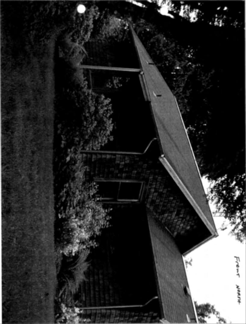
9 May 29th 2018 APPLCATON FOR A EXPEDTED REVEW FOR PROPERTY LOCATED N THE NSA LOCATON: E. LARCH MT RD CORBETT, OR SEC 31 ln SE TL AC ZONED GGR-10 THS APPLCATON S TO APPROVE AN ACCESSORY STRUCTURE CONSTRUCTED WTHOUT REVEW BY THE PREVOUS OWNER. THE STRUCTURE MEASURES 7XX14X10. THE APPLCATON ALSO REQUESTS THE NSTALLATON OF A BASEMENT WNDOW AND WNDOW WELL AT THE NORTH EAST CORNER OF THE EXSTNG HOME AND THE NSTALLATON OF A 6FT CEDAR FENCE ON THE EAST PROPERTY LNE NOT TO EXCEED 100 FT. THE APPLCATON OF A STE PLAN SHOWNG LOCATON OF STRUCTURES AND ELEVATONS FOR THE PROPERTY S NCLUDED. THERE WLL BE NO GRADNG OF THE STE WTH THE EXCEPTON TO THE MNMAL AREA TO NSTALL THE WNDOW AND WNDOW WELL. PLEASE LET ME KNOW F THERE ANY QUESTONS OR F ANf ADDTONAL NFORMATON S NEEDED KND REGARDS DALE BURKHOLDER/ PRNCPAL BROKER LAND USE ASSSTANCE
 ~ ~=8/i,0\";~0,;;A:i;,~:f,.")
 ~241R rt: ~BATH..&\"\"eu X 3,_ou.._v.. \" 7HJ!J.. i: ~ - ~.. f3eproom UP 1~'-1\X13;-1 1 ~ 11 is ~,.")

10 D... /3/1-P.EJHcVT /ll:-vg -ft',.us't.tcq w1,j~l->.t'1-jl1t-'o 5n space between conaete wall and stua iwll \ 77J qx.t._,,..', f7,cot<. 1-<'f..+L. /3c-l?t~CO(;(A. stan4ard ~ht?w~renc1osure r~,;;.,.;;~:;~:;;-,;;:~:;;;;;, ~~'f.;~.i~0;;$~) ~ ~=8/i,0";~0,;;A:i;,~:f,.:~:~;:-~ ess to sump belcw stor~e ess to water main $hut0ff. -../ /.:. ~.. :..;; " WH. ~; - - -,,..._. -' ~.: ~~ / ;.... ~ 11 ~ - -- r 1 ~. ~) ~241R rt: ~BATH..&""eu X 3,_ou.._v.. " 7HJ!J.. i: ~ - ~.. f3eproom UP 1~'-1\X13;-1 1 ~ 11 is ~,.-- :,, EP ~.a. -f.~:, -:-E: -.. ~,. '[ Af.~ ~t: ~ ' ~; r _j ;-~ 1 ~. '.~?:~~~:~~,~:;~~~::~:.~~i~ -~=;~~ -:~~~:~~~::~~f3f~~~:?2t=1f!!!z~~~~~:e J. --~ i!t&or ~.. ll ;: T " W.. _J!- ~ t w 8 1- w W VJ,,. a:: ~ a..... ~ ~ ~ a: w Z ~ Ci D....,. ;, fil ~ 0.. l1 i a S:CAlE: li;hfet,
11 600 No t:lrat?..l Avenue, >;'t!a.:l" DR CE. 791.J. 742 r~.f nrnetro.ge;,.j''"'.":.' ~~: :: ;;:;,1 ::?.:.:. 'it'1h'. :r ;_;~!-::_-;;;:.:;'. ~;;.;_!:" ;~~t;;,~ ~!1 ; :11 ;> ~:J:l '::J.~ ~i':'.,;.-',~..: ~.-, <- a ; ~-,.f 't:r:,,.,, ~ '''" '~ -?.~;;~ t : :; t,.. r,~ '


12
13
Forest Service Role CHAPTER 2
 CHAPTER 2 Forest Service Role Implementation of the Management Plan charters a federal presence with an expanded focus beyond traditional Forest Service roles. In addition to administration of the National
APPLICATION FOR SUBDIVISION APPROVAL OF A SKETCH PLAN with checklist
 Prior to filing any application for SUBDIVISION approval, the applicant shall request in writing that the zoning administrator schedule a pre-submission conference. APPLICATION TO THE PLANNING BOARD TOWN
All of the following must be submitted before the Planning Department can process the application:
 CITY OF WEST COVINA PLANNING DEPARTMENT Instructions for filing for a Conditional Use Permit All of the following must be submitted before the Planning Department can process the application: 1. Application
SITE ANALYSIS LEVEL II (SALII) INTAKE CHECKLIST
 INTAKE CHECKLIST") Skamania County Community Development Department Building/Fire Marshal Environmental Health Planning Skamania County Courthouse Annex Post Office Box 1009 Stevenson, Washington 98648 Phone: 509-427-3900
Skamania County Community Development Department Building/Fire Marshal Environmental Health Planning Skamania County Courthouse Annex Post Office Box 1009 Stevenson, Washington 98648 Phone: 509-427-3900
NOTICE OF DECISION. FILE #: PLASTS DECISION DATE: November 2, 2017 APPEAL DEADLINE: November 14, 2017
 Wasco County Planning Department Service, Sustainability & Solutions 2705 East Second St. The Dalles, OR 97058 (541) 506-2560 wcplanning@co.wasco.or.us www.co.wasco.or.us/planning NOTICE OF DECISION FILE
Commercial Land SCENIC AREA ACT PROVISIONS KEY ISSUES CHAPTER 5
 CHAPTER 5 Commercial Land There have been centers of trade and commerce in the Gorge for almost as long as humans have inhabited it. Gorge Indians were renowned traders. With the exception of a few small
CONDITIONAL USE PERMIT Application Packet
 CONDITIONAL USE PERMIT Application Packet Community Development Department 1020 East Pioneer Road, Draper, UT 84020 (801) 576-6539 Fax (801) 576-6526 Dear Applicant, This application packet has been developed
REQUEST FOR ALTERATION REVIEW VERANDA GARDENS HOMEOWNERS ASSOCIATION, INC.
 Please Complete The Following Name: Directions: 1. Fill in requested information 2. Attach required checks Address: 3. Attach required certificates 4. Sign required forms and return to: Lot number GRS
DISCUSSION DRAFT OF URBAN AREA BOUNDARY REVISION POLICY For October 15, 2018 Workshop
 OF URBAN AREA BOUNDARY REVISION POLICY For October 15, 2018 Workshop This discussion draft policy framework is solely the work of the Commission staff. The staff has not shared this with any other person.
DRAFT FOR PUBLIC HEARING (rev. March, 2016)
") Chapter 200. ZONING Article VI. Conservation/Cluster Subdivisions 200-45. Intent and Purpose These provisions are intended to: A. Guide the future growth and development of the community consistent with
Chapter 200. ZONING Article VI. Conservation/Cluster Subdivisions 200-45. Intent and Purpose These provisions are intended to: A. Guide the future growth and development of the community consistent with
APPLICATION PROCESSING
 MAJOR SUBDIVISION 1810 E. HAZELTON AVENUE, STOCKTON CA 95205 BUSINESS PHONE: (209) 468-3121 BUSINESS HOURS: 8:00 A.M. TO 5:00 P.M..(Monday through Friday) APPLICATION PROCESSING STEPS STEP 1 STEP 2 CHECK
APPLICATION FOR PERMIT: (Pursuant to Ord & Reso ) 4d Habitat Loss Permit Vegetation Removal Tree Removal. Address:
 4d Habitat Loss Permit Vegetation Removal Tree Removal. Address:") CITY OF ESCONDIDO Planning Division 201 North Broadway Escondido, CA 92025-2798 (760) 839-4671 Fax: (760) 839-4313 APPLICATION FOR PERMIT: (Pursuant to Ord. 91-54 & Reso. 94-436) Case No: FOR INTERNAL
CITY OF ESCONDIDO Planning Division 201 North Broadway Escondido, CA 92025-2798 (760) 839-4671 Fax: (760) 839-4313 APPLICATION FOR PERMIT: (Pursuant to Ord. 91-54 & Reso. 94-436) Case No: FOR INTERNAL
Incorporated Village of Port Jefferson 88 North Country Road, Port Jefferson, NY Telephone: (631) Fax: (631)
 Fax: (631)") 88 North Country Road, Port Jefferson, NY 11777 Telephone: (631) 473-4744 Fax: (631) 473-2049 TREE CLEARING & GRADING APPLICATION To avoid delay in the processing of your application, be sure all the information
88 North Country Road, Port Jefferson, NY 11777 Telephone: (631) 473-4744 Fax: (631) 473-2049 TREE CLEARING & GRADING APPLICATION To avoid delay in the processing of your application, be sure all the information
Land Use Application
 Permit Center 210 Lottie Street, Bellingham, WA 98225 Phone: (360) 778-8300 Fax: (360) 778-8301 TTY: (360) 778-8382 Email: permits@cob.org Web: www.cob.org/permits Land Use Application Check all permits
Guidelines for Construction of Recreational Buildings and Improvements Greater than 1000 Square Feet Outside Acceptable Development Areas
 Guidelines for Construction of Recreational Buildings and Improvements Greater than 1000 Square Feet Outside Acceptable Development Areas The following guidelines are established by the Easement Committee
Special Land Use. SLU Application & Review Standards
 review and approval is needed for certain uses of property that have the potential to impact adjacent properties and the neighborhood. The application and review procedure is intended to ensure that the
Accessory Dwelling Unit Permit
 PLANNING SERVICES DEPARTMENT 411 Main Street (530) 87-6800 P.O. Box 3420 Chico, CA 527 Application No. APPLICATION FOR Accessory Dwelling Unit Permit Applicant Information Applicant Street Address Daytime
New Cingular Wireless Telecommunication Tower at County Road 48, Milner Conditional Use Permit
 New Cingular Wireless Telecommunication Tower at 39415 County Road 48, Milner ACTIVITY #: Conditional Use Permit PP2012-023 HEARING DATES: Planning Commission (PC): August 16, 2012 at 6:00pm PETITIONER:
SECTION 5: ACCESSORY USES
 SECTION 5: ACCESSORY USES A. In Any District Subject to the restrictions of the Zoning Resolution, a use, equipment or item customarily incidental to an existing permitted use on a lot shall also be permitted
DAMMERON VALLEY LANDOWNERS ASSOCIATION ARCHITECTURAL GUIDELINES [May, 2010] PREFACE
![DAMMERON VALLEY LANDOWNERS ASSOCIATION ARCHITECTURAL GUIDELINES [May, 2010] PREFACE](/thumbs/95/123903050.jpg "DAMMERON VALLEY LANDOWNERS ASSOCIATION ARCHITECTURAL GUIDELINES [May, 2010] PREFACE") DAMMERON VALLEY LANDOWNERS ASSOCIATION ARCHITECTURAL GUIDELINES [May, 2010] PREFACE To preserve the plan of development for the various subdivisions of Dammeron Valley, the developer established conditions
DAMMERON VALLEY LANDOWNERS ASSOCIATION ARCHITECTURAL GUIDELINES [May, 2010] PREFACE To preserve the plan of development for the various subdivisions of Dammeron Valley, the developer established conditions
Land Use Application
 Permit Center 210 Lottie Street, Bellingham, WA 98225 Phone: (360) 778-8300 Fax: (360) 778-8301 TTY: (360) 778-8382 Email: permits@cob.org Web: www.cob.org/permits Land Use Application Check all permits
JOINT PLANNING BOARD APPLICATION FORM
 JOINT PLANNING BOARD APPLICATION FORM TOWNSHIP OF RIVER VALE 406 RIVERVALE ROAD RIVER VALE, NJ 07675 The application, with supporting documentation, must be filed with the Administrative Officer to the
APPLICATION PACKET FOR. In the Coastal Zone Area
 APPLICATION PACKET FOR Coastal Zone Permit In the Coastal Zone Area Planning Department 1650 Mission Street Suite 400 San Francisco, CA 94103-9425 T: 415.558.6378 F: 415.558.6409 Pursuant to Planning Code
Josephine County, Oregon
 Josephine County, Oregon PLANNING OFFICE 700 NW Dimmick Street, Suite C, Grants Pass OR 97526 (541) 474-5421 / Fax (541) 474-5422 E-mail: planning@co.josephine.or.us HOME OCCUPATION APPLICATION PRE-APPLICATION
LAND USE PERMIT APPLICATION
 LAND USE PERMIT APPLICATION Date Application No. TYPE OF PERMIT Subdivision Short Plat Conditional Use Binding Site Plan Final Plat Final Short Plat Variance Final Binding Site Plan Plat Amendment Short
TOWN OF LERAY PLANNING BOARD Minor Subdivision Application Packet
 This Packet is designed to assist applicants in providing the forms needed for submission of a 1 to 4 lot subdivision to the Planning Board for approval. The following should be filled out to ensure the
LAND VALLEY FOR SALE. - in - RESIDENTIAL SUBDIVISION OPPORTUNITY SE McKinley Road, Gresham OR GRESHAM S PLEASANT SUBDIVISION OPPORTUNITY
 FOR SALE JENNE BUTTE PARK EXISTING HOMES S BORDER AY (SITE ACCE) LAND SUBDIVISION OPPORTUNITY - in - 15.26 AC GRESHAM S PLEASANT VALLEY 2839 S 2nd Avenue Portland OR, 97201 503.222.1655 www.reig.com 15.26
Bowie Marketplace Residential Detailed Site Plan Statement of Justification January 13, 2017 Revised February 2, 1017
 Bowie Marketplace Residential Detailed Site Plan Statement of Justification January 13, 2017 Revised February 2, 1017 Submitted on behalf of: BE Bowie LLC 5410 Edson Lane, Suite 220 Rockville, MD 20852
FEE The staff will let you know the current cost of filing an application. Make checks payable to the San Joaquin County Treasurer.
 VARIANCE 1810 E. HAZELTON AVENUE, STOCKTON CA 95205 BUSINESS PHONE: (209) 468-3121 Business Hours: 8:00 a.m. to 5:00 p.m. (Monday through Friday) STEP 1 STEP 2 APPLICATION PROCESSING STEPS CHECK WITH STAFF
Moore Township Planning Commission 2491 Community Drive, Bath, Pennsylvania Telephone: FAX: Rev:12/23/2013
 2491 Community Drive, Bath, Pennsylvania Telephone: 610-759-9449 FAX: 610-759-9448 Rev:12/23/2013 APPLICATION FORM FOR A SITE PLAN PER MOORE TOWNSHIP ZONING ORDINANCE SECTION 200-58.1 NORTHAMPTON COUNTY,
R/W PREQUALIFICATION ODOT, 3/14/2018 PROPERTY MAP SHEET
 R/W PREQUALIFICATION ODOT, 3/14/2018 3A Title Block 3B Sheet Heading 3C Station Limit Flags 3D Revision Block 3E Ownership Name and Number 3F Centerline Stationing 3G Proposed R/W and Pavement 3H Structures
R E S O L U T I O N. 2. Development Data Summary:
 R E S O L U T I O N WHEREAS, the Prince George s County Planning Board has reviewed Special Permit Application No. SP-170001, Mama s Care Assisted Living Facility, requesting to expand an existing congregate
MARION COUNTY GROWTH SERVICES
 MARION COUNTY GROWTH SERVICES Date: 6/5/27 P&Z: 5/31/27 BCC: 6/20/27 Item Number 270606Z Type of Application: Rezoning Request: FROM: A-1 (General Agriculture) TO: PUD (Planned Unit Development) for SFR
TOWNSHIP OF BORDENTOWN LAND DEVELOPMENT APPLICATION CHECKLIST. General Requirements for all Applications
 TOWNSHIP OF BORDENTOWN LAND DEVELOPMENT APPLICATION CHECKLIST This CHECKLIST has been adopted in accordance with Section 25:807 of the Land Development Ordinance of the Township of Bordentown and will
TYPE II LAND USE APPLICATION Telecommunications Tower: Collocation
 LAND MANAGEMENT DIVISION Date Received: TYPE II LAND USE APPLICATION Telecommunications Tower: Collocation PUBLIC WORKS DEPARTMENT 3050 N. DELTA HWY, EUGENE OR 97408 Planning: 682-3577 For Office Use Only
Minor Remodel Checklist
 Effective date: 11/17/14; ARC APPROVED REV 11/10/17 BOD APPROVED REV 11/18/17 Minor Remodel Checklist SUBMITTAL FOR LOT VILLAGE OWNER A. Step One A: ARC Conceptual Design Review Please submit the following
Guide to Combined Preliminary and Final Plats
 Guide to Combined Preliminary and Final Plats Introduction The Douglas County is committed to providing open, transparent application processes to the public. This Guide is provided to assist anyone interested
SKETCH PLAN REVIEW SPECIAL EXCEPTION, SPECIAL REVIEW,
 www.larimer.org Planning Department 200 W. Oak Street 3 rd Floor Fort Collins, CO 80521 970-498-7683 SKETCH PLAN REVIEW SKETCH PLAN REVIEW for Conservation Developments, Planned Land Divisions, Subdivisions,
Land Use Application
 Land Use Application Check all permits you are applying for in the boxes provided. Submit this application form, the applicable materials listed in the corresponding permit application packet(s) and application
2012 COMMUNITY INFORMATION
 2012 COMMUNITY INFORMATION THE HARPER S PRESERVE COMMUNITY ASSOCIATION INC. ( HOA ) HAS PREPARED THIS COURTESY NOTICE OFSUMMARY INFORMATION TO ENCOURAGE THOSE INTERESTED IN HARPER S PRESERVE TO START TO
TOWN OF EASTCHESTER BUILDING AND PLANNING DEPARTMENT PLANNING BOARD APPLICATION PACKAGE SUBDIVISIONS
 TOWN OF EASTCHESTER BUILDING AND PLANNING DEPARTMENT 40 Mill Road (914) 771-3317 building@eastchester.org Eastchester, NY 10709 (914) 771-3322 Fax www.eastchester.org TABLE OF CONTENTS PLANNING BOARD APPLICATION
JOINT PUBLIC NOTICE CORPS OF ENGINEERS STATE OF ARKANSAS Application Number: Date: December 9, 2016 Comments Due: January 3, 2017
 US Army Corps of Engineers Little Rock District JOINT PUBLIC NOTICE CORPS OF ENGINEERS STATE OF ARKANSAS Application Number: 2016-00183-1 Date: December 9, 2016 Comments Due: January 3, 2017 TO WHOM IT
Applying for a Conditional Use Permit
 What is it? What conditions might be applied? Alameda County is divided into zoning districts, which govern the land uses permitted on properties in each district. Some uses are prohibited, some are allowed
Residential Deck Permit Submittal Checklist
 Residential Deck Permit Submittal Checklist Applications for construction of Residential Decks are reviewed by the Building and nspection Services Division and Planning Division for compliance with applicable
Sample Baseline Documentation Report (BDR) Annotated Template for Environmentally Important Land
 Annotated Template for Environmentally Important Land") Sample Baseline Documentation Report (BDR) Annotated Template for Environmentally Important Land The baseline documentation report (BDR) provides a snap shot of the biophysical condition of a property
Sample Baseline Documentation Report (BDR) Annotated Template for Environmentally Important Land The baseline documentation report (BDR) provides a snap shot of the biophysical condition of a property
CITY OF SONORA PLANNING COMMISSION SITE PLAN REVIEW APPLICATION
 CITY OF SONORA PLANNING COMMISSION SITE PLAN REVIEW APPLICATION APPLICANT: MAILING ADDRESS: PHONE: CELL#: EMAIL: OWNER S NAME: MAILING ADDRESS: PHONE: CELL#: EMAIL: ADDRESS OF PROPERTY INVOLVED: ASSESSOR
TOWN OF BRISTOL. Ontario County, New York APPLICATION FOR LOT LINE ADJUSTMENT
 TOWN OF BRISTOL Ontario County, New York APPLICATION FOR LOT LINE ADJUSTMENT Lot Line Adjustment: The adjusting of common property line(s) or boundaries between adjacent lots, tracts, or parcels for the
PLANNING CLEARANCE. Planning Clearance is required prior to the submittal of most building and development permit applications.
 PLANNING CLEARANCE Description Planning Clearance is the County s review of the site plan for a proposed development, and is the starting point for most of the County s permitting processes, including
SECTION 118.0: B 1 (Business: Local) District
 District") SECTION 118.0: B 1 (Business: Local) District A. Purpose The B-1 District is established to provide areas of local business that can directly serve the general public with retail sales and services. B.
SECTION 118.0: B 1 (Business: Local) District A. Purpose The B-1 District is established to provide areas of local business that can directly serve the general public with retail sales and services. B.
Wildlife Habitat Conservation and Management Program
 EXHIBIT 1 PC-2015-4106 ODFW Guide Wildlife Habitat Conservation and Management Program Manual for Counties and Cities Oregon Department of Fish and Wildlife March 2006 Table of Contents 1. Introduction
ARTICLE IV: DEVELOPMENT STANDARDS
 ARTICLE IV: DEVELOPMENT STANDARDS IV-53 409 PRIVATE STREETS A private street means any way that provides ingress to, or egress from, property by means of vehicles or other means, or that provides travel
TOWNSHIP OF DOYLESTOWN APPLICATION FOR REVIEW OF SUBDIVISION OR LAND DEVELOPMENT PROPOSAL. Please PRINT; all information MUST be filled out completely
 TOWNSHIP OF DOYLESTOWN APPLICATION FOR REVIEW OF SUBDIVISION OR LAND DEVELOPMENT PROPOSAL Please PRINT; all information MUST be filled out completely Date: Name of Subdivision or Land Development: Location:
ZONING PERMIT APPLICATION
 ZONING PERMIT APPLICATION OFFICE USE ONLY Date Received: FILE NO. 120 DAY EXPIRATION Purpose: Some types of land use activities listed in the Lake County Zoning Ordinance are allowed to occur with a minimal
The Maryland-National Capital Park and Planning Commission Prince George s County Planning Department Development Review Division
 The Maryland-National Capital Park and Planning Commission Prince George s County Planning Department Development Review Division 301-952-3530 Note: Staff reports can be accessed at www.mncppc.org/pgco/planning/plan.htm.
11 November 13, 2013 Public Hearing
 11 November 13, 2013 Public Hearing APPLICANT:. D/B/A RYAN HOMES PROPERTY OWNER: MUNDEN LAND, LLC STAFF PLANNER: Carolyn A.K. Smith REQUEST: Modification of Conditional Change of Zoning approved by the
COMMUNITY DEVELOPMENT DEPARTMENT 333 Broadalbin Street SW, P.O. Box 490 Albany, OR 97321
 COMMUNITY DEVELOPMENT DEPARTMENT 333 Broadalbin Street SW, P.O. Box 490 Albany, OR 97321 STAFF REPORT Application for Site Plan Review (SP-02-18) Residential Accessory Building Ph: 541-917-7550 Fax: 541-917-7598
REPORT REQUIREMENTS FOR DISCRETIONARY PERMIT APPLICATION SUBMITTAL North County (Non-Coastal) Area Plan
 Area Plan") When is this Erosion Control Plan All Discretionary Permits Title 16 (Environment) Sections 16.08.340 (p. 25) & 16.12.060 (p. 37) Submittal is mandatory at the building permit stage. Typically requested
When is this Erosion Control Plan All Discretionary Permits Title 16 (Environment) Sections 16.08.340 (p. 25) & 16.12.060 (p. 37) Submittal is mandatory at the building permit stage. Typically requested
Article 7: Residential Land Use and Development Requirements
 Article 7: Residential Land Use and Section 701: Statement of Intent (A) (B) (C) The intent of Article 7 is to develop certain land use and development requirements for the residential uses within Cumru
Appendix1,Page1. Urban Design Guidelines. Back to Back and Stacked Townhouses. DRAFT September 2017
 Appendix1,Page1 Urban Design Guidelines DRAFT September 2017 Back to Back and Stacked Townhouses Appendix1,Page2 Table of Contents 1 Introduction 1 1.1 Purpose 1 1.2 Urban Design Objectives 1 1.3 Building
A. Appropriate agency responsible for transportation review for the subject property.
 7.8.10 Procedure Any person desiring to create a minor subdivision shall submit to the Commission for approval an application on forms provided by the Division, and a record plat in conformance with the
TOWN OF ROXBURY PLANNING BOARD
 UPDATED: APRIL 2011 TOWN OF ROXBURY PLANNING BOARD Applicant s Guide for Subdivision Review The Town Planning Board administers the subdivision review process. This guide has been prepared in order to
PLANNING & DEVELOPMENT SERVICES 1800 Continental Place Mount Vernon, WA Inspections Office Fax 360.
 PLANNING & DEVELOPMENT SERVICES 1800 Continental Place Mount Vernon, WA 98273 Inspections 360.416.1330 Office 360.416-1320 Fax 360.416-1340 Date Received: Administrative Setback Reduction Checklist Pursuant
PERMIT APPLICATION FORM
 CVCA File #: P.O. Box 416, 70 Hughes Lane, Marmora, ON K0K 2M0 Tel: 613-472-3137 Fax: 613-472-5516 www.crowevalley.com PERMIT APPLICATION FORM FOR A DEVELOPMENT, INTERFERENCE WITH WETLANDS AND ALTERATIONS
Skamania County Community Development Department
 Skamania County Community Development Department Skamania County Courthouse Annex Post Office Box 790 Stevenson, Washington 98648 509 427-3900 FAX: 866 266-1534 Section I. Overview SEPTIC PROCESS 1. Application:
APPLICATION PROCESSING STEPS STEP 1 CHECK WITH STAFF
 APPLICATION PROCESSING STEPS STEP 1 CHECK WITH STAFF - Development Services Staff will explain the requirements and procedures to you. However, before filing an application with the Community Development
CITY OF MONTEBELLO Community Development Department Planning Division 1600 W. Beverly Boulevard Montebello CA
 CONDITIONAL USE PERMIT APPLICATION FOR ALCOHOL SALES CITY OF MONTEBELLO Community Development Department Planning Division 1600 W. Beverly Boulevard Montebello CA 90640 www.cityofmontebello.com This checklist
For office use only:
 VILLAGE OF COTTAGE GROVE SITE PLAN REVIEW APPLICATION APPLICANT: APPLICANT ADDRESS: TELEPHONE: FAX: EMAIL ADDRESS: ***************************************************** LOCATION OF SITE: PROPOSED USE OF
LAND USE APPLICATION - ADMINISTRATIVE Property Line Adjustment Review (Ministerial No Notice)
") LAND MANAGEMENT DIVISION Date Received: LAND USE APPLICATION - ADMINISTRATIVE Property Line Adjustment Review (Ministerial No Notice) PUBLIC WORKS DEPARTMENT 3050 N. DELTA HWY, EUGENE OR 97408 Planning:
LAND MANAGEMENT DIVISION Date Received: LAND USE APPLICATION - ADMINISTRATIVE Property Line Adjustment Review (Ministerial No Notice) PUBLIC WORKS DEPARTMENT 3050 N. DELTA HWY, EUGENE OR 97408 Planning:
L L O T DESIGN GUIDELINES. Appendices
 S M AL L L O T DESIGN GUIDELINES Appendices APPENDIX A VENICE SPECIFIC PLAN VERIFICATION The community of Venice has a refined set of small lot guidelines that are based on the Venice Coastal Specific
Issaquah Highlands Architectural Improvement Application
 Issaquah Highlands Architectural Improvement Application Owner Name: Date Submitted: Address: Division #: Lot #: Phone Number: Alternate Phone: Email: Estimated Start Date: Estimated Completion Date: Project
Land Uses, Maps, Illustrations and Locations
 2016 KINGS MILL COMMUNITY INFORMATION THE MONTGOMERY KINGS MILL HOMEOWNER S ASSOCIATION INC. ( HOA ) HAS PREPARED HIS COURTESY NOTICE OF SUMMARY INFORMATION TO ENCOURAGE THOSE INTERESTED IN KINGS MILL
APPLICATION PROCEDURE
 ANTRIM PLANNING BOARD P. O. Box 517 Antrim, New Hampshire 03440 Phone: 603-588-6785 FAX: 603-588-2969 APPLICATION FORM AND CHECKLIST FOR MINOR OR MAJOR SITE PLAN REVIEW File Date Received By APPLICATION
ORDINANCE NO. _4.06 AN ORDINANCE TO ESTABLISH BUILDING SITE REGULATIONS SECTION A PURPOSE AND INTENT
 ORDINANCE NO. _4.06 AN ORDINANCE TO ESTABLISH BUILDING SITE REGULATIONS SECTION A PURPOSE AND INTENT This Ordinance provides minimum regulations, provisions and requirements for safe, aesthetically pleasing
Conservation Easement Stewardship
 Conservation Easements are effective tools to preserve significant natural, historical or cultural resources. Conservation Easement Stewardship Level of Service Standards March 2013 The mission of the
TOWN OF MELBOURNE BEACH 2016 DEVELOPMENT APPLICATION
 TOWN OF MELBOURNE BEACH 2016 DEVELOPMENT APPLICATION I. SUBMITTAL REQUIREMENTS: 1. Fees per current schedule. 2. Deed to property. 3. Pre-Application meeting is mandatory. Contact the Building Official
Land Use Application
 Permit Center 210 Lottie Street, Bellingham, WA 98225 Phone: (360) 778-8300 Fax: (360) 778-8301 TTY: (360) 778-8382 Email: permits@cob.org Web: www.cob.org/permits Land Use Application Check all permits
INSTRUCTIONS AND INFORMATION FOR LAND LEASE APPLICATION
 TED STEVENS ANCHORAGE INTERNATIONAL AIRPORT Department of Transportation & Public Facilities Airport Leasing & Property Management PO Box 196960, Anchorage AK 99519-6960 Phone: 907-266-2420 Fax: 907-266-2458
DAVIDSON PLANNING ORDINANCE AMENDMENTS AFTER SEPTEMBER 2009 SECTION 9
 AMENDMENT ADOPTED 6/12/2012 Section 9.1.3.3.1 Wall Murals Entire Section Added: 9.1.3.3.1 Wall Murals DAVIDSON PLANNING ORDINANCE AMENDMENTS AFTER SEPTEMBER 2009 SECTION 9 Exterior wall murals are only
Land Use Application
 Land Use Application Check all permits you are applying for in the boxes provided. Submit this application form, the applicable materials listed in the corresponding permit application packet(s) and application
Application for a HOME OCCUPATION - Conditional Use Permit
 TOWN OF WARNER PLANNING BOARD P.O. Box 265 Warner, New Hampshire 03278-0059 Telephone: (603) 456-2298, ext. 7 Fax: (603) 456-2297 Application for a HOME OCCUPATION - Conditional Use Permit Please note
4 DEVELOPMENT STANDARDS FOR
 4 DEVELOPMENT STANDARDS FOR RESIDENTIAL MIXED-USE PROJECTS This chapter presents standards for residential mixed-use projects in the Ashland-Cherryland Business District and the Castro Valley Central Business
Application Instructions for: Type II Home Occupation
 WASHINGTON COUNTY Dept. of Land Use & Transportation Planning and Development Services Current Planning 155 N. 1 st Avenue, #350-13 Hillsboro, OR 97124 Ph. (503) 846-8761 Fax (503) 846-2908 http://www.co.washington.or.us
APPLICATION PROCESS FOR PROJECT REVIEW
 APPLICATION PROCESS FOR PROJECT REVIEW 290 NORTH 100 WEST, LOGAN UT 84321 PHONE (435) 716-9021 FAX (435) 716-9001 www.loganutah.org THE PROJECT REVIEW PROCESS The application must be complete and submitted
Easement Program Guidelines for Locating Towers and Communication Devices
 Easement Program Guidelines for Locating Towers and Communication Devices The following guidelines are established by the Easement Committee to create standards for reviewing requests by landowners to
CITY OF BIG BEAR LAKE
 CITY OF BIG BEAR LAKE (909) 866-5831 P.O. Box 10000 39707 BIG BEAR BOULEVARD BIG BEAR LAKE, CA 92315 DEVELOPMENT REVIEW APPLICATION FOR STAFF USE ONLY FILING DATE: RECEIVED BY: FILE #: FEES PAID: RECEIPT
CHAPTER 3 PRELIMINARY PLAT
 10-3-1 10-3-3 SECTION: CHAPTER 3 PRELIMINARY PLAT 10-3-1: Consultation 10-3-2: Filing 10-3-3: Requirements 10-3-4: Approval 10-3-5: Time Limitation 10-3-6: Grading Limitation 10-3-1: CONSULTATION: Each
Conditional Use Permit / Standard Subdivision Application
 Conditional Use Permit / Standard Subdivision Application Name of Proposed Subdivision: Total Area (Acres) Is Proposed Subdivision to be built in phases? Number of Lots If yes, how many phases? Applicant/Owner
MARIJUANA FACILITY CONDITIONAL USE PERMIT APPLICATION File No.
 Fairbanks North Star Borough Department of Community Planning 907 Terminal Street/P.O. Box 71267 Fairbanks, Alaska 99707-1267 (907) 459-1260 Fax: (907) 205-5169 planning@fnsb.us For Office Use Only Received
TOWN OF ROCKINGHAM ZONING APPLICATION FORMS INFORMATION SHEET
 TOWN OF ROCKINGHAM ZONING APPLICATION FORMS INFORMATION SHEET Rockingham Zoning-Planning Office P.O. Box 370 Bellows Falls VT 05101 Tel. 802-463-1229 www.rockbf.org GENERAL INFORMATION 1. This application
Single Family Residential
 Housing Development Tools Single Family Residential Single Family Residence 1 Current Accessory Apartment Ordinance Single Family Residence 600 Square Foot Accessory Apartment (Net Floor Area) Twice Minimum
{{t:t;r:n;o:"signer 2";l:"Date";}}
 Application/File # Date Application Rec'd: Oct 13 2017 Fee Collected $ (for office use only) CONDITIONAL USE APPLICATION MOTLEY MN Site Address (E-911#): 164 MORRISON STREET WEST 410095000 Lake/River Name:
CONDITIONAL USE APPLICATION
 CONDITIONAL USE APPLICATION Planning Division 5155 Silverton Rd. NE; Salem OR 97305 Ph. (503) 588-5038 http://www.co.marion.or.us/pw/planning PROCEDURE: A. Once a complete application is received, the
ZONING PERMIT APPLICATION and INSTRUCTIONS
 ZONING PERMIT APPLICATION and INSTRUCTIONS INSTRUCTIONS 1. Completely fill out, sign, and date the attached form. Include a check for $35.00 payable to the Borough of Oradell or exact cash amount. Please
APPLICATION SUBMITTAL REQUIREMENTS FOR Tentative Parcel or Subdivision Maps
 CITY OF EL CERRITO Community Development Department Planning and Building Division 10890 San Pablo Avenue, El Cerrito, CA 94530 (510) 215-4330 FA (510) 233-5401 planning@ci.el-cerrito.ca.us APPLICATION
Residential Minor Subdivision Review Checklist
 Residential Minor Subdivision Review Checklist Plan Submittal Requirements: 2 full sets of stamped plans Electric submittal - all plans contained in a single PDF 3 full sets if commercial kitchen or dining
Article Floating Zone Requirements
 Division 5.1. In General Article 59-5. Floating Zone Requirements Section 5.1.1. Zone Categories There are 4 categories of Floating zones: A. Residential Floating zones (Division 5.2); B. Commercial/Residential
I. General. 1 Property managed by Cube includes the land below waters of the reservoirs and the generating facilities.
 Yadkin Project Shoreline Management Plan (FERC No. 2197) Appendix E: Specifications for Private Recreation Facilities at High Rock and Narrows Reservoirs I. General A. These Specifications of Cube Yadkin
PLANNING COMMISSION STAFF REPORT
 106 William Avenue PC Meeting: 8/26/14 Agenda Item: 3 PLANNING COMMISSION STAFF REPORT DATE: August 26, 2014 RE: DR/FAR 14-26, Geoffrey Butler, Applicant; House Properties 77 LLP, Property Owner; 106 William
LAND USE APPLICATION Land Use Compatibility Statement Recreational Marijuana Uses
 LAND MANAGEMENT DIVISION Date Received: LAND USE APPLICATION Land Use Compatibility Statement Recreational Marijuana Uses PUBLIC WORKS DEPARTMENT 3050 N. DELTA HWY, EUGENE OR 97408 Planning: 541-682-3577
COUNTY OF ALBEMARLE APPLICATION FOR FAMILY DIVISION. Family Division = $742 (Provide 5 copies of plat)
") Page 1 APPLICATION FOR FAMILY DIVISION Family Division = $742 (Provide 5 copies of plat) Tier 2 Groundwater Review = $355 (Required for all plats showing lots less than 21 acres) Tier 3 Groundwater Review
Page 1 APPLICATION FOR FAMILY DIVISION Family Division = $742 (Provide 5 copies of plat) Tier 2 Groundwater Review = $355 (Required for all plats showing lots less than 21 acres) Tier 3 Groundwater Review