TOWN OF WINTER PARK PLANNING COMMISSION Tuesday, January 8, :00 AM A G E N D A
|
|
|
- Pierce Simmons
- 5 years ago
- Views:
Transcription
1 TOWN OF WNTER PARK PLANNNG COMMSSON Tuesday, January 8, :00 AM A G E N D A. Meeting Call to Order.. V. Roll Call of Commission Members Town Hall Meeting (time for anyone from the public to speak about items not on the agenda) Approval of December 11, 2018 minutes V. Conflicts of nterest V. NEW BUSNESS: A. Election of Chairman and Vice Chairman (yearly) B. Adoption of Winter Park Town Plan (magine Winter Park) C. Waldron Minor Subdivision D. Design Review - 39 Alpine Way, Hermes V. Staff Update

2 . The Meeting was called to order at 8:00am. TOWN OF WNTER PARK PLANNNG COMMSSON Tuesday, December 11, :00 AM Minutes.. V. Roll Call indicated present: Brad Holzwarth, Mike Davlin, Jonathan Larson, Doug Robbins, Roger Kish, and George Stevens. Town Hall Meeting No comments received. Commissioner Robbins moved and Commissioner Davlin seconded a motion to approve minutes from November 13, 2018 and November 27, Motion Carried 6-0. V. Conflicts of nterest- No comments were received. V. NEW BUSNESS: A. Roam Preliminary Plat Planner Owen presented the Staff Report as follows: Project Update- Since the last Planning Commission meeting on October 23, 2018 much has been done on the Preliminary Plat for the Roam Development. Staff organized several meetings to facilitate conversations around the identified concerns brought up at that October 23 meeting, and commissioned a roundabout study: Meeting with Town Engineers Meeting with Colorado Department of Transportation (CDOT) and Engineers Meeting with Agencies and Utilities Roundabout Study Complete Meeting with Town Staff for Roundabout Discussion Through all of these meetings, substantial progress has been made on addressing the comments made by the agencies, the Town and CDOT. However, due to the significant amount of work needed before a second submission to Planning Commission is made, and the need to incorporate roundabout designs, the applicant has requested that the full Preliminary Plat submission be continued until the January 22 regular meeting of Planning Commission. This is to allow enough time for all comments to be addressed and fully updated plans to be submitted and reviewed. Therefore, at this meeting, staff would like to present an overview of the progress made and discuss the results of the roundabout study. The full Roam Preliminary Plat submission will be made on January 22, 2019 if Planning Commission approves. Roundabout Study Update- n response to the last meeting with Planning Commission
3 and comments regarding the south entrance to the Roam development turning into a roundabout and perhaps changing location, staff commissioned a roundabout study to give more technical feedback on the ideal option that will be both physically, technically, and financially feasible to implement. The roundabout study is complete and is attached for your review. The main takeaway from a traffic generation standpoint is that three options for roundabout design have been presented, and all three are capable of handling expected traffic volumes at peak period (Saturday evening) without impacting level of service. After reviewing the Roundabout Study, staff is in favor of Design C which places the roundabout at the south entrance to the Roam development (currently proposed as a full movement intersection with a traffic signal). This option is the most favorable for several reasons. First, is the limited amount of vehicular crossings across the Fraser River Trail which will stay in its current alignment in addition to the new leg that will be added through Roam. Second, is the ability to maintain the existing retaining wall which would be a considerable extra cost to move or alter in any way. Third, is the alignment itself being centered on the road and being fully circular instead of oblong. This allows people to anticipate where lanes are, even if they are covered in snow, and would most likely create less confusion as it is designed as the average person would expect a roundabout to look like. Fourth, this last option is the most effective at creating an entryway feature, since it is located at the main entrance to what will become a significant section of Downtown with the Roam Development. Having the roundabout at Village Drive would make it so a visitor would drive past several new commercial areas in Roam before arriving at the entryway to town. Fifth, is that option C does not disturb the current location of the bus stop at Village Drive and would easily allow for a pedestrian refuge at the median to accommodate any visitors crossing Highway 40 to use the bus stop. Sixth, is that this alignment of the roundabout does not impact the annexation or development agreement the town currently has with Roam as it does not change alignment of their entrance or affect their previously granted development areas. Seventh, is that the additional land required on the west side to accommodate the roundabout in option C is owned by Roam and they are supportive of that land being used for that purpose. On the diagram, this is the area labeled grading impacts. Planning Commission is invited to discuss the results of the roundabout study and meeting notes from the Utility and Agency meeting, and to consider continuance of the full Preliminary Plat submission until January 22, Planning Commission held discussion- Commissioner Kish asked if this proposed roundabout location would be considered a major entrance to the development since he felt that density should be associated with the roundabout.
4 Discussion was had regarding moving the retaining wall, how expensive it is and why CDOT would not want to have anyone move it. Commissioners wanted to know if anyone had discussed these possibilities with Beavers Condos? Yes, Planning Director Shockey stated that the Town Manager has talked to HOA and that they are aware this conversation is happening. Commissioner Stevens stated a preference for Option B. Discussion was had around the fact that Option B required acquiring and putting the roundabout on what is now county land, verses working with Roam to place a roundabout where they have land and are willing to give the land. Commissioner Davlin pointed out that some of the location ideas are nice, but finance plays an important part as well and the option that is likely to be the most financially feasible is Option C. Commissioner Holzwarth was concerned about what would make the easiest access to town from roam and helping with traffic. Discussion was had around the idea that adding a second option through town by opening up Roam to dlewild could help with traffic. After looking at the full buildout of Roam, Commissioner Kish felt that there will be adequate density near the roundabout so it could actually be a real entrance to town. Discussion was had about where funding for the roundabout will be coming from. The funds will be split up between the Developer, the Town, and hopefully a CDOT grant. Commissioner Kish brought up the idea of having a separated pedestrian crossing for the Fraser River Trail that would go under the Roam entrance. This would allow for a safer crossing of the space. n a straw poll of where commissioners felt on the three options Commissioner Stevens would like more information from the Beavers HOA, and would like to see cost options if possible for option B. The other five commissioners were comfortable with option C. Commissioner Davlin moved and Commissioner Stevens seconded a motion to continue the Preliminary Plat until Jan 22, Motion carried 6-0. B. Adoption of Winter Park Town Plan (magine Winter Park) Community Development Director Shockey gave the Staff Report outlining the Colorado Revised Statues regarding adoption of a master plan and where the process is now: Staff has completed the final draft of the magine Winter Park Town Plan including an Executive Summary. The Planning Commission will need to review the plan at a public hearing on January 8, 2019 and adopt it as the official master plan for the Town of
5 Winter Park. Before the final public hearing, staff would like the Planning Commission to review the plan and provide feedback, so the plan is in final form for adoption in January. The Town Council will review the plan on December 18 and provide feedback as well. The Town Council does not approve the master plan, they only accept it. As required by state statue, the Commission is required to adopt the master plan. Community Development Director Shockey gave a presentation on the Master Plan including all updates to the plan. Staff Recommendation - The Commission should direct staff to publish notice in the Middle Park Times newspaper of the public hearing set for January 8, 2019 in compliance with C.R.S Commissioner Stevens commented that the title picture for the Executive Summary had too much similarity with the iconic Steamboat barn pictures. All other Commissioners were pleased with the edits and the final adoption drafts. Commissioner Robbins moved and Commissioner Davlin seconded a motion directing staff to schedule public hearing on Jan 8, Motion carried 6-0. V. Staff Update This is the last Planning Commission meeting of the year. James presented the downtown plan ideas that were presented to Town Council in a workshop on December 4. A Planning Refresher Workshop is being hosted by DOLA on Wednesday, January 16 from 5-7pm in Granby. All are welcome to attend. Gondola update - on schedule and should open before Christmas. Upon a previously adopted motion, the meeting was adjourned at 9:43am.
6 TO FROM THRU DATE RE Planning Commission James Shockey, Community Development Director Keith Riesberg, Town Manager January 8, 2019 magine Winter Park Adoption C.R.S t is the duty of the commission to make and adopt a master plan for the physical development of the municipality, including any areas outside its boundaries, subject to the approval of the governmental body having jurisdiction thereof, which in the commission's judgment bear relation to the planning of such municipality. The master plan of a municipality shall be an advisory document to guide land development decisions; however, the plan or any part thereof may be made binding by inclusion in the municipality's adopted subdivision, zoning, platting, planned unit development, or other similar land development regulations after satisfying notice, due process, and hearing requirements for legislative or quasi-judicial processes as appropriate. When a commission decides to adopt a master plan, the commission shall conduct public hearings, after notice of such public hearings has been published in a newspaper of general circulation in the municipality in a manner sufficient to notify the public of the time, place, and nature of the public hearing, prior to final adoption of a master plan in order to encourage public participation in and awareness of the development of such plan and shall accept and consider oral and written public comments throughout the process of developing the plan. Final Adoption The Town Council reviewed the plan at a public hearing on December 18, The Council approved Resolution 1669, Series 2018, a resolution approving the Town Plan and recommending the Planning Commission formally adopt the Town Plan as the official master plan for the Town of Winter Park. A public notice was published in the Sky-Hi News on December 20, 2018 providing notice of this hearing. No comments have been received. The Executive Summary can be reviewed here magine Winter Park Executive Summary The Full Plan can be reviewed here magine Winter Park Chapters 1-7 Recommended Motion Staff recommends the Planning adopt Resolution , a resolution approving the magine Winter Park Town Plan as the official master plan for the Town of Winter Park in compliance with C.R.S The resolution will be provided to the Commission as a table-setting ahead of the meeting.
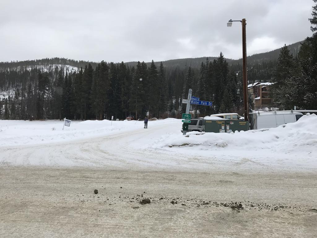
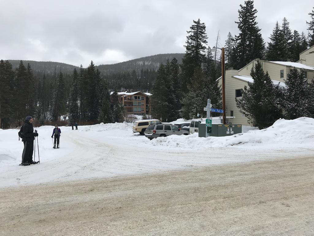
7 TO FROM THRU DATE RE Planning Commission Mara Owen, Planner James Shockey, Community Development Director January 8, 2019 Minor Subdivision Adolf s on the Fraser General nformation: The applicant, Janice L. Waldron, is proposing to divide the 5.79 acre parcel known as 1008 Winter Park Drive into two parcels. The property is currently vacant besides the Adolf s Building which is used as a ski shop at this time. The applicant is proposing to divide the parcel into two along the centerline of Timberline Drive. The parcels will then be marketed for sale, leaving the eventual development of the parcels to future owners. No development work is anticipated at this time. Outlot A has been created to accommodate Winter Park Drive, and the applicant is proposing to convey Outlot A to the Town of Winter Park. Since this plat is only subdividing one lot into two lots, the application can be processed as a Minor Subdivision. 5% Land Dedication: The Town Code ( ) requires either the dedication, reservation or conveyance of areas suitable for public purposes such as parks, flood channels, scenic areas and greenbelts of up to five percent (5%) of the total area of the subdivision, or a payment in lieu of such dedication. The applicant has proposed reserving acres or 21.97% of the total area for Open Space as defined in the Winter Park Town Code. n addition, the applicant is proposing the dedication of.324 acres, or 5.41% of the total area for Right of Way (Outlot A) to be conveyed to the Town of Winter Park for Winter Park Drive. School mpact Fee None are due at this time, but any future development will be subject to them at time of final condominium andor townhome plat at the rate of acres per multifamily dwelling unit unless that calculation is updated prior to development occurring on the site. Review Agency Comments: Town Engineer The Town engineer has reviewed the minor subdivision and recommends that the Town modifies the existing access easement along Trademark Drive to resolve stormwater issues in the area which would
8 affect any future development on the site, as well as all existing development. Please see attached letter for more detail. Mountain Parks Electric After reviewing the proposed minor subdivision, Mountain Parks Electric has several major concerns with the location of existing utilities in that area, specifically an existing switchgear that may be located in the road easement shown on the plat. Please see the attached letter and diagram for more details. Winter Park Water and Sanitation The water district requests that the 10 utility easement that connects to the existing 20 utility easement be brought up to their current standards which state that Any easements or rights -of-way shall have a minimum width of 20 feet for one utility and 30 feet for two utilities. Please see attached document for documentation of their current standards. Adjacent Property Owner Comments: Staff sent notice to adjacent property owners on December 31, No comments have been received as of but comments are expected either in person or as a table setting from Trademark Condominiums at the meeting. Plat: Staff has prepared a red-marked print for the proposed Final Plat. 1. Prior to recordation, the applicant shall revise the Final Plat in conformance with the redmarked print dated December 28, Prior to recordation applicant shall make the following plat changes: a. Add bearing between Lots 1 and Lot 2 for the distance b. Suggest adding the distance for the S E bearing c. Add legend for set monuments on Sheet 2, or call out SEE NOTE 10 on just one of the solid circles d. Add as-survey legal description on the cover sheet (since this is a new plat) e. The legal description on the Owner s Cert must match the legal on the title exactly. f. Per Kendra Carberry, Notes 1 and 3 must be removed and Note 9 requires clarification. g. Per Kendra Carberry, please provide a note addressing what Outlot A is supposed to be doing. h. ndicate where all existing roads lie on the plat, not only the easements, and indicate any changes being proposed to either. Recommendation: Staff recommends the Commission provide a favorable recommendation of approval to the Town Council for the Final Plat of Adolf s on the Fraser with the following conditions to be met andor provided prior to recording: 1. The applicant shall revise the submitted plans and documents in conformance with the official redmarked print dated December 28, The applicant shall make the following plat changes: a. Add bearing between Lots 1 and Lot 2 for the distance
9 b. Suggest adding the distance for the S E bearing c. Add legend for set monuments on Sheet 2, or call out SEE NOTE 10 on just one of the solid circles d. Add as-survey legal description on the cover sheet (since this is a new plat) e. The legal description on the Owner s Cert must match the legal on the title exactly. f. Per Kendra Carberry, Notes 1 and 3 must be removed and Note 9 requires clarification. g. Per Kendra Carberry, please provide a note addressing what Outlot A is supposed to be doing. h. ndicate where all existing roads lie on the plat, not only the easements, and indicate any changes being proposed to either. 3. The applicant shall work with Town Staff and the Town engineer modify the existing access easement within Trademark Drive to allow for the construction and maintenance of underground utilities and stormwater drainage. 4. The applicant shall work with Mountain Parks Electric to resolve concerns regarding utilities within the subdivision and the alignment of Trademark Drive. 5. The applicant shall revise the plat to bring the 10 wide utility easement into conformance with the Winter Park Water and Sanitation District s Standard of a 20 easement. 6. A Certificate of Taxes, shown to be paid in full from the County Treasurer, shall be provided for the subject property prior to the recording of any Final Plat. 7. A Statement of Authority shall be provided for each party that signs the Final Plat. 8. f there is a lien holder, a ratification and confirmation of the plat shall be provided. 9. A digital file of the approved plat must be submitted. The digital file shall be in a format acceptable to the Town's System. Requirements for digital submittal can be obtained from the Town's Planning Department. 10. An executed Final Plat Mylar and other supporting documents, as well as recording fees, be provided.
10
11
12
13

14
15 January 3, 2019 Mara Owen Town Planner Town of Winter Park 50 Vasquez Road Winter Park, Colorado Via RE: Adolf s on the River Final Plat Review JVA Job# c Dear Mara: JVA nc. received Final Plat submittal documents, dated December 5, 2018, regarding the above referenced project. We have reviewed the documents and have the following comments to provide. 1. t is recommended for the Town to modify the existing access easement within Trademark Drive to allow for the construction and maintenance of underground utilities. We feel it is in the best interest of the Town to have the capability to extend the existing public underground storm sewer within Winter Park Drive to the Fraser River along this alignment. 2. The opportunity to obtain additional necessary accessutilitydrainage easements should be assessed at the time of site development. Please feel free to contact us with any questions, comments, or concerns you may have. Sincerely, JVA, NCORPORATED By: Cooper Karsh, P.E., CFM Senior Project Engineer
16 From: To: Subject: Date: Attachments: Jean Johnston Mara Owen RE: Old Town Thursday, January 03, :41:15 AM image006.png image007.png FBlogo20x20_f385a67c-d933-45ab-89b5-afca2eff55b1.png twitter20x20_4b90b8ef-da46-4b7b-814e-87a8b9a2dc73.png Adolf"s on the Fraser.pdf Hi Mara, MPE is concerned about an existing switchgear that may be located in the road easement shown on the proposed plat. There is some confusion with the location of the current road versus where the road was originally platted to be. tried to contact the surveyor but have not heard back from him. t would be helpful to know where the switchgear is in relation to everything shown on the proposed plat. This may require more surveying. t will not be easy to move this piece of equipment. There are a lot of conductors that would need to be re-routed to move it. This would cause lengthy outages to many meters during the process of moving it. Some questions we have include: s the existing road in the platted easement? f not, are there plans to move the road into the platted easement? s the owner willing to record a new road easement that matches the location of the existing road? Please let me know how these discussions proceed. am available to answer any questions can. Thanks, Jean Click here to take our quick online survey for chance to win a $50 bill credit!
17 40 This map is to be used for reference purposes only. Mountain Parks Electric, nc. makes no warranty as to its completeness or accuracy for either electric facilities or land base features Large Electric switchgear Existing Underground primary power lines shown as red and yellow dashed lines Existing Underground and overhead secondary power lines shown as solid and dashed blue lines Source: Esri, DigitalGlobe, GeoEye, Earthstar Geographics, CNESAirbus DS, USDA, USGS, AeroGRD, GN, and the GS User Community 49955
18
19
20
21 TOWP Redlined Plat Must match legal description on the title exactly. Town Council (capitalized) Town Council (capitalized) Please clarify this note
22
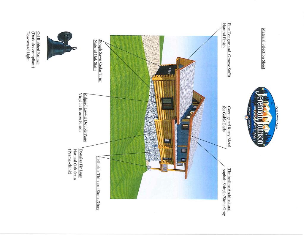
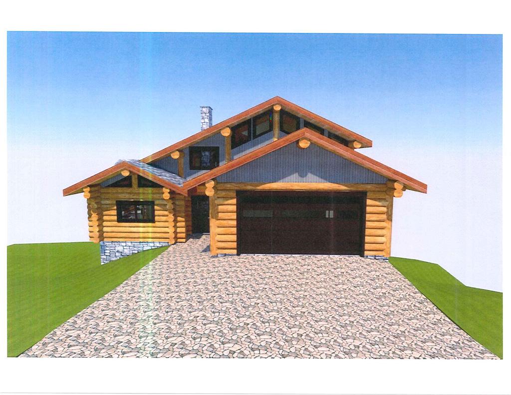
23 TO FROM THRU DATE RE Planning Commission Joan Evans, Planning and Building Technician James Shockey, Community Development Director January 8, 2019 Design Review 39 Alpine Way, Lot 8, Hideaway Village South 1 Applicant: John & Tamara Hermes Zoning: R-1 Architectural: This is a single-family home that has a building footprint square footage of 3,783 with a garage. Homeowner s Association Review: Hideaway Village South does not have an HOA. Proposed Material & Color: Please see attached materials board and elevations for the material list. Exterior Lighting: The applicant states the fixtures will comply with Town guidelines and are dark sky compliant. Prior to building permit issuance, cut sheets will need to be provided for exterior fixtures that state they comply with Town guidelines and are dark sky compliant. Building Height: Building height complies with Town standards. The midpoint building height is 35 which is permitted based on the building height definition. Parking: Adequate parking has been provided in compliance with Town standards. The design includes a garage plus exterior parking. LandscapingRevegetation: A landscape plan was submitted. No site clearing shall be permitted until staff has verified the Pre-Disturbance Checklist has been implemented on the site. Any disturbed areas on the site shall be revegetated with an appropriate seed mix per the Single Family Duplex Deposit Agreement. Site Plan and Building Elevations: Staff is satisfied with the overall design. Setbacks: The structure is located within required setbacks; which include the 30 water quality setback.
24 Coverage: Building coverage is 31% building to open space. nspection: A site inspection of the property has not been performed by staff. No site clearing shall be permitted until staff has verified the Pre-Disturbance Checklist has been implemented on the site. Driveway: The driveway has been designed with a 5% grade at the entrance, then goes to 9.6 % and becomes 2% approaching the garage door which is in compliance with Town Standards. Once the driveway is completed it will need to be verified that it is seven (7) feet from the property line. A stabilized construction entrance shall be installed prior to ground disturbance. Erosion Control Drainage: The erosion and drainage plan complies with Town standards. Approved drainage and erosion control shall be in place prior to and throughout site preparation and construction and through successful revegetation. Staff Recommendation: Staff recommends the Planning Commission approve the singlefamily design for Lot 8, Hideaway Village South Subdivision with the following conditions: No site clearing shall be permitted until staff has verified the Pre-Disturbance Checklist has been implemented on the site. Any disturbed areas on the site shall be revegetated with an appropriate seed mix per the Single Family Duplex Deposit Agreement. A stabilized construction entrance shall be installed prior to ground disturbance. Approved drainage and erosion control shall be in place prior to and throughout site preparation and construction and through successful revegetation. Prior to building permit issuance, cut sheets will need to be provided for exterior fixtures that state they comply with Town guidelines and are dark sky compliant. Required Permits: Building Permit Single Family Duplex Deposit Agreement Driveway Permit
25
26
27
28
29
30
31
32
33 '-5" 2 EL. RDGE: 25'-3 34" 7 EL. SECOND FLOOR: 10'-2 34" (TOP OF SUBFLOOR) NOTE: COMPLETE SET OF PLANS TO BE ENGNEERED & STAMPED BY STATE LCENSED ENGNEER ALL DMENSONS TO BE VERFED ON STE BY GENERAL CONTRACTOR ALL DMENSONS ARE CONSTRUCTON TME DMENSONS T S THE SOLE RESPONSBLTY OF THE GENERAL CONTRACTOR TO CHECK & VERFY ALL DMENSONS & SPECFCATONS ON THS SET OF PLANS BEFORE STARTNG CONSTRUCTON ALL LOG DAMETER SZE TO BE MEASURED AT MD SPAN BULDER S RESPONSBLE FOR COMPLYNG WTH ALL LOCAL BULDNG CODES AND PRACTCES GROUND LEVEL EL. GARAGE FLOOR: 1'-9" (TOP OF SLAB) EL. FRST FLOOR: 0" (BOTTOM OF LOG WALL) 10 FRONT ELEVATON EL. BASEMENT: -11'-1 38" (TOP OF CONC. SLAB) CONSTRUCTON MATERALS ASPHALT SHNGLES CEDAR SDNG FNSH LOG WALL CONSTRUCTON B D E F G 4 1 VENTED RDGE CAP EL. RDGE: ' EL. RDGE: 25'-3 34" DESCRPTON: CHMNEY LOG BEAM WNDOW UNT AS PER SCHEDULE 2 EAST MD PONT: ' WEST MD PONT: ' DATE: REVSON: NOV.2618 ENG. REV. 2 REV. 3 7 LOG PURLN STONE VENEER W CONC. CAP LOG POST ROCK VENEER 16'-7 716" EL. SECOND FLOOR: 10'-2 34" (TOP OF SUBFLOOR) 25.31' 14" = 1'-0" SCALE: OCT. 16, 2018 DATE: G.C. DRAWN BY: C.C. CHECKED BY: EL. GARAGE FLOOR: 1'-9" (TOP OF SLAB) PROPOSED WALL (BY OTHERS) TOW= BOW= '-0" RGHT ELEVATON GARAGE: ' FRST FLOOR: 0" ' BASEMENT: ' EXSTNG GRADE: ' 35.00' EL. FRST FLOOR: 0" (BOTTOM OF LOG WALL) 11.11' EL. BASEMENT: -11'-1 38" (TOP OF CONC. SLAB) JEREMAH JOHNSON LOG HOMES LOG BULDER : Hermes ELEVATONS CLENT : TTLE: PROPOSED WALL (BY OTHERS) TOW= BOW= PROPOSED WALL (BY OTHERS) TOW= BOW= A-2 19

34 EL. RDGE: 25'-3 34" 9'-5 916" 4'-8 34" 4'-8 34" midpoint EL. SECOND FLOOR: 10'-2 34" (TOP OF SUBFLOOR) ' " ' " 8' " 16'-9 916" CONSTRUCTON MATERALS ASPHALT SHNGLES CEDAR SDNG FNSH LOG WALL CONSTRUCTON CHMNEY LOG BEAM NOTE: COMPLETE SET OF PLANS TO BE ENGNEERED & STAMPED BY STATE LCENSED ENGNEER ALL DMENSONS TO BE VERFED ON STE BY GENERAL CONTRACTOR ALL DMENSONS ARE CONSTRUCTON TME DMENSONS T S THE SOLE RESPONSBLTY OF THE GENERAL CONTRACTOR TO CHECK & VERFY ALL DMENSONS & SPECFCATONS ON THS SET OF PLANS BEFORE STARTNG CONSTRUCTON ALL LOG DAMETER SZE TO BE MEASURED AT MD SPAN BULDER S RESPONSBLE FOR COMPLYNG WTH ALL LOCAL BULDNG CODES AND PRACTCES 6 WNDOW UNT AS PER SCHEDULE EL. FRST FLOOR: 0" (BOTTOM OF LOG WALL) 7 LOG PURLN 8 STONE VENEER W CONC. CAP 9 LOG POST 10 ROCK VENEER EL. BASEMENT: -11'-1 38" (TOP OF CONC. SLAB) REV. 2 DESCRPTON: SCALE: DATE: DRAWN BY: C.C. CHECKED BY: LOG BULDER : CLENT : TTLE: 19 A-3 REVSON: ENG. DATE: 8 10 BACK ELEVATON CONC. FTG'S TO BE BELOW LOCAL FROST LNE REV. 3 NOV.2618 GROUND LEVEL H G F E 4 D 1 C B A VENTED RDGE CAP EL. RDGE: 25'-3 34" 9 2 EL. SECOND FLOOR: 10'-2 34" (TOP OF SUBFLOOR) 14" = 1'-0" OCT. 16, 2018 G.C EL. GARAGE FLOOR: 1'-9" (TOP OF SLAB) EL. FRST FLOOR: 0" (BOTTOM OF LOG WALL) EL. BASEMENT: -11'-1 38" (TOP OF CONC. SLAB) JEREMAH JOHNSON LOG HOMES Hermes ELEVATONS LEFT ELEVATON
' e PUBESCENT WHEATGRASS LUNA 1.")
 TALL ORANGE CONSTRUCTON FENCNG, OR OTHER ACCEPTABLE MEANS.")

 (1) 6' EVERGREEN TREE EVERY 15' SLT FENCESTRAW WADDLE 4.")

35 GRADNG, EROSON AND SEDMENT CONTROL PLAN AND PRVATE ACCESS DRVEWAY PLAN LEGEND 7560' EXSTNG CONTOURS -:>, S :_- 0 DESGN CONTOURS TEMPORARY S.EED MX LAND USE STE BOUNDARY FF RH k. J hi NOTES: FNSHED GRADE SPOT ELEVATON. 2. FNSHED FLOOR 3. RDGE HEGHT 4. @D -: ;0 ssa :,>> >",;. :_:1. )' e PUBESCENT WHEATGRASS LUNA 1. NO DSTURBANCE, GRADNG, OR REMOVAL OF SGNFCANT NATURAL FEATURES AND VEGETATON WLL OCCUR BEYOND THE "LMT OF DSTURBANCE" LNE, AS SHOWN ON THS PLAN. 2. THE "LMTS OF DSTURBANCE" LNE SHALL BE DELNEATED PROR TO CONSTRUCTON WTH FLAGS, ROPNG, FOUR FOOT (4') TALL ORANGE CONSTRUCTON FENCNG, OR OTHER ACCEPTABLE MEANS. PROPOSED DECK BASS OF BEARNGS: ASSUMED S51 "02'49"E, ALONG THE NORTH BOUNDARY OF LOT 7, MONUMENTED AS SHOWN, DERVED WTH GPSRTK ELEVATON DATUM: NAVDB8 (GROUND) PLEASE REFERENCE SURVEY BY ROCKY MOUNTAN SURVEYS, NC. CONSTRUCTON EQUPMENT & MATERAL STORAGE RETANNG WALL NOTES: VEHCLE TRACKNG CONTROL 1. RETANNG WALL MADE OF NATURAL STONES BOULDERS. EROSON CONTROL BLANKET "LMTS OF DSTURBANCE" 2. RETANNG WALL RALNG TO BE PROVDED, DESGNED BY OTHERS. SEED AND MULCH 3. RETANNG WALL WLL HAVE THE REQURED LANDSCAPNG VEGETATON: a.) (1) 5 GALLON SHRUB EVERY 4' b.) (1) 6' EVERGREEN TREE EVERY 15' SLT FENCESTRAW WADDLE 4. WETLANDS NOT TO BE DSTURBED STABLZED STAGNG AREA PORTABLE RESTROOM CONCRETE WASH AREA 6' EVERGREEN TREES 5 GALLON SHRUBS PROPOSED RESDENCE & GARAGE 1911 SQ FT DECK 588 SQ FT PORCH 51 SQ FT OVERHANGS 1233 SQ FT TOTAL BULDNG AREA FROM ABOVE TEMS 3783 SQ FT PROPOSED DRVEWAY & SDEWALK 1162 SQ FT 31% LOT SZE 15,756 SQ FT SLOPES GREATER THAN 25% YES DSTURBANCE N SLOPES >25% YES \<>< GENERAL CONSTRUCTON NOTES Feet ''.... ', ' x V r,,,<v \ \ c, _ { l.. \ J' ' id'. 6\ \ ,_ aa.3 PROVDE POSTVE DRANAGE AWAY, FROM FOUNDATON 3. THE CONTRACTOR SHALL BE RESPONSBLE FOR THE LOCATON OF ALL EXSTNG UTLTES AND SHOULD NOT RELY SOLELY ON THESE CONSTRUCTON PLANS FOR UTLTY LOCATONS. DAMAGE TO ANY EXSTNG UTLTES S THE RESPONSBLTY OF THE CONTRACTOR. 4. THE CONTRACTOR SHALL CONFNE HS OPERATONS TO THE CONSTRUCTON LMTS OF THE PROJECT AND N NO WAY SHALL ENCROACHMENT OCCUR ONTO ADJACENT PROPERTES UNLESS LEGAL EASEMENTS ARE OBTANED. ALL FLL AND CUT SLOPES SHALL BE SETBACK FROM THE PROPERTY LNE N ACCORDANCE WTH ALL APPLCABLE BULDNG CODES. THE CONTRACTOR WLL BE HELD RESPONSBLE FOR ANY AGREEMENTS NECESSARY OR DAMAGE CAUSED BY CONSTRUCTON ACTVTES TO PUBLC OR PRVATE PROPERTY, NCLUDNG UTLTES ENGNEERNG ANDOR ENGNEER WAVES ANY AND ALL RESPONSBLTY AND S NOT LABLE FOR PROBLEMS WHCH ARSE FROM FALURE TO FOLLOW THESE PLANS, SPECFCATONS AND THE DESGN NTENT THEY CONVEY FOR PROBLEMS WHCH ARSE FROM OTHERS' FALURE TO OBTAN ANDOR FOLLOW 285 ENGNEERNG ANDOR ENGNEER'S GUDANCE WTH RESPECT TO ANY ERRORS, OMSSONS, NCONSSTENCES, AMBGUTES OR CONFLCTS. 6. THE CONSTRUCTON SURVEYOR SHALL VERFY PROPOSED GRADES AND NVERT ELEVATONS, FLOW LNES, ALGNMENTS, SETBACKS AND TOPOGRAPHY PROR TO CONSTRUCTON. 7. THE LANDOWNER AND CONTRACTOR SHALL BE RESPONSBLE FOR AND VERFY, PROR TO CONSTRUCTON, PERMT SSUANCE, STE CONDTONS, SETBACKS, PROPERTY LNES, BULDNG LOCATON, DMENSONS, MATERALS, QUANTTES, ELEVATONS AND GRADE FNSHES. ALL WORK SHALL COMPLY WTH APPLCABLE GOVERNNG CODES AND MANUFACTURER SPECFCATONS. PROJECT CONTACTS: PROPERTY OWNER: JOHN HERMES 1001 W YNDHAM LAKES DRVE ODESSA, FLORDA (813) PROPERTY LNE (TYPCAL) \ rz5; 'v. PROPOSED o THE LANDOWNER ANDOR CONTRACTOR S RESPONSBLE FOR OBTANNG A PERMT FOR STORMWATER DSCHARGES ASSOCATED WTH CONSTRUCTON ACTVTY FROM THE COLORADO DEPARTMENT OF PUBLC HEALTH AND ENVRONMENT, AT LEAST 10 DAYS PROR TO THE START OF CONSTRUCTON ACTVTES FOR LAND DSTURBANCE AREAS OF ONE ACRE OR GREATER. THE PERMT MUST BE KEPT CURRENT THROUGHOUT THE CONSTRUCTON DURATON. THE STORMWATER VOLUME CAPACTY OF DETENTON PONDS MUST BE RESTORED AND STORM SEWER LNES WLL BE CLEANED UPON COMPLETON OF THE PROJECT. THE LANDOWNERCONTRACTOR ARE RESPONSBLE FOR THE REMOVAL OF ALL SEDMENT AND DEBRS FROM DRANAGE STRUCTURES AND OTHER PUBLC FACLTES. 10. THE LANDOWNERCONTRACTOR S RESPONSBLE FOR CONTROLLNG WASTE SUCH AS, DSCARDED BULDNG MATERALS, CONCRETE TRUCK WASHOUT, CHEMCALS, LTTER, AND SANTARY WASTE, AS APPLCABLE. N ADDTON, SPLL PREVENTON AND CONTANMENT BMP'S FOR CONSTRUCTON MATERALS, WASTE, AND FUEL MUST BE PROVDED AS APPLCABLE \\ 1:s-, \' ', 'f9 'll' 't,> o,;.,- '-".,,, ; 1 1 'x'o 'li!oj -- --(A; "0o,,v 1,, FF GARAGE ELEV ' DR VEWAY f \ '3 PROPOSED WALL T.0.W= B.O.W.= CLENT: JOHN HERMES, ' Revisions \ ' \ '\ 11.-S93& ) 's;,_<6 ') 1 COUNTY COMMENTS No. Revisionssue Date \. ',. PROPOSED WATER LNE r.., PROPOSED SEWER LNE,, CONSTRUCTON EQUPMENT AND MATERAL STORAGE 20' PJ,'VED...,... PROPERTY ADDRESS: 39 ALPNE WAY WNTER PARK, COLORADO LANDSCAPNG: (1) 5 GALLON SHRUB EVERY 4' (1) 6' EVERGREEN TREE EVERY 15' TYPCAL A9 & -- _, -.,,... PARKNG PROVDED WTHN THE GARAGE \... J, PARCEL D: LMTS OF DSTURBANCE , O' SDE SETBACK <1> PROJECT NUMBER: d FF MAN ELEV ' FF LOWER ELEV ', ' '.::::,., PROPOSED WALL T.0.W= B.0.W.= ' FROM AS N HWL SETBACK _,.. _. PROPOSED EDGE OF FOOTNG PROPOSED WALL T.0.W = 8916 B.O.W. = ,... PROPOSED 140 LF NATURAL STO NE BOULDER RETANNG WALL AND RALNG PROVDED AND DESGNED BY OTHER ' PROPOSED EDGE, OF FOUNDATON NATURAL STON E BOULDER RETANNG WALL AND RALNG PROVDED AND DESGNED BY OTHER _., '\ 0 PROPOSED EDGE OF ROOF EAVE (TYPCAL) PROPOSED DECK MAN LEVEL -,,,,..: '. t ---, -- TOWN OF WNTER PARK COMMUNTY DEVELOPMENT: 50 VASQUEZ ROAD P.O. BOX 3327 WNT!sli PARK, COLORADO PHONE: (970) FAX: (970) PROPOSED WALL T.0.W = 8916 B.O.W. = \ '<... '2as SURVEYOR: ROCKY MOUNTAN SURVEYS, NC. LCENSED LAND SURVEYORS P.O. BOX 552 WNTER PARK, COLORADO ARCHTECT: JEREMAH JOHNSON LOG HOMES 1501 CO RD 308 DUMONT, CO (303) \ LOT 8 aplot. \ 1 ::,, oo, <)-oo, o'\:<'.,. - LMTS OF DSTURBANCE r<;,_,<::),..- 2.;> "111 ALL EXSTNG TOPOGRAPHC SURVEY DATA SHOWN ON THESE PLANS HAS BEEN OBTANED AND CERTFED BY OTHERS. 285 ENGNEERNG ANDOR ENGNEER HAS UNDERTAKEN NO FELD VERFCATON OF THS TOPOGRAPHY NFORMATON, AND MAKES NO REPRESENTATON PERTANNG THERETO, AND ASSUMES NO RESPONSBLTY OR LABLTY THEREFOR OF THS TOPOGRAPHY. 12. ALL FLL ONSTE SHALL BE COMPACTED TO 95% DENSTY OF STANDARD PROCTOR. 1 LANDSCAPNG:,....Jo (1) 5 GALLON SHRUB EVERY 4' (1) 6' EVERGREEN TREE EVERY 15' WETLANDS NOT TO BE DSTURBED.,_,..,PROPOSED DECK PER (TYPCAL)., PROPOSED EDGE OF ROOF EA VE (TYPCAL) MAXMUM CUT AND FLL SLOPES SHALL NOT EXCEED 2 FOOT HORZONTAL: 1 FOOT VERTCAL (2:1). 1\ ,;:¾-;f'.,-.,-,,.. "" 1,...,, ENGNEERNG ANDOR ENGNEER S TO BE NOTFED PROR TO ANY PLAN CHANGES OR ON-STE DESGN MODFCATONS. 9. \ 285 ENGNEERNG P.O. BOX 1048 CONFER, CO PROJECT STE: LOT 8 HDEAWAY VLLAGE, SOUTH #1 39 ALPNE WAY WNTER PARK, COLORADO Qr 9f' PROPERTY LNE (TYPCAL) i\.,, <v.::,..p...,_'\ '20,( )..... PROPERTY LNE. (TYPCAL) "... N,,<v ALL PROPERTY CORNERS TO BE STAKED WTH WOODEN STAKES AND FLAGGNG PROR TO CONSTRUCTON ' PLATTED PEDESTRAN EASEMENT 290 SQ FT % COVERAGE TO OPEN SPACE 8 The Dpp1ied seed shall not le covered by a oil,iclrness grester than 0.5'' in depth. Seeding shall 1ake place OT all disturbed areas and stockpiles expected to remain dormant for a period greater than 30 days. To provide temporary erosion control prior to seed application. utilize surface roughening (on the contour or perpendicular to prevailing wincls) and apply mulch. Seed shall be planted with drill seodini; cqu.,prnent, whenever po»ible. Areas that require broadc!l$1 seeding shall mulched 11r1d llltkified, PROPOSED FOUNDATON DRAN STATSTCAL NVENTORY SNOW STORAGE ( 25%) MANCHAR PROTECTON NOTES: PROPOSED WALL.... SMOOTH BROOME PROPOSED SWALE PROPOSED PATO APPLCA TJON RA TE (LBSAC 8 VARETY SPECES RRGATED RECLA[MATJON BULDNG SETBACK %OF MX DRY LAND NON- WATERLNE 89 5 F.G. PREPARED FOR: JOHN HERMES 1001 WYNDHAM LAKES DRVE ODESSA, FLORDA ALL DSTURBED AREAS DURNG CONSTRUCTON THAT REQURE REVEGETATON SHALL RECEVE A MNMUM OF FOUR NCHES (4") OF TOP SOL REPLACEMENT OR AN APPROVED DESGN FROM A LANDSCAPE ARCHTECT. THE FOLLOWNG SEEED MX S RECOMMENDED BY THE GRAND COUNTY NATURAL RESOURCE CONSERVATON SERVCE AND SHALL BE MPLEMENTED ON ALL STES DSTURBNG SOL: FOUNDATON DRAN DAYLGHT PROPERTY LNE TO BE CLEARLY MARKED PROR TO EXCAVATON TO PREVENT ACCDENTAL GRADNG ACROSS LOT O' SDE SETBAC), ---,,,. L J... -.Jo':, - _V J_fr ;,, (TYPCAL) \. l n \ pv \, C1 R=45',,,,,,, C A=71 Y 'i.2'!:; '64.04',:;5552 4S:'W EXSTNG POWER LNE PROPERTY,, PROPOSED POWER LNE _,,, 1 1 EXSTNG CURB STOP "',,,,j' Project EXSTNG CURB STOP, \,', Oote Scale SHOWN Sheet... C-1 '
APPLICATION PROCEDURE
 ANTRIM PLANNING BOARD P. O. Box 517 Antrim, New Hampshire 03440 Phone: 603-588-6785 FAX: 603-588-2969 APPLICATION FORM AND CHECKLIST FOR MINOR OR MAJOR SITE PLAN REVIEW File Date Received By APPLICATION
City of Ferndale CITY COUNCIL STAFF REPORT
 SUBJECT: Final Plat Approval DATE: January 19, 2016 FROM: Haylie Miller, Assistant Planner PRESENTATION BY: Haylie Miller City of Ferndale CITY COUNCIL STAFF REPORT MEETING DATE: January 19, 2016 AGENDA
City of Brooklyn Park Planning Commission Staff Report
 City of Brooklyn Park Planning Commission Staff Report Agenda Item: 6D Meeting Date: August 9, 2017 Originating Agenda Section: Public Hearing Department: Community Development Resolution: X Ordinance:
Site Plan Application
 Site Plan Application City of St. Pete Beach Community Development Department 155 Corey Avenue St. Pete Beach, Florida 33706 (727) 367-2735 www.stpetebeach.org Case Number: PROPERTY OWNER: Name: Address:
Condominium Unit Requirements.
 ARTICLE 19 CONDOMINIUM REGULATIONS Section 19.01 Purpose. The purpose of this Article is to regulate projects that divide real property under a contractual arrangement known as a condominium. New and conversion
ARTICLE V PRELIMINARY PLAN SUBMISSION
 ARTICLE V PRELIMINARY PLAN SUBMISSION 501. Plan Requirements a. On or before the 25 th day of the month prior to a regularly scheduled meeting of the Planning Commission, the applicant shall submit two
Re: Case # ZP Preplanning Application for 8 townhomes at 1526 Ingalls Street in Lakewood, CO.
 Planning Department Civic Center North 480 South Allison Parkway Lakewood, Colorado 80226-3127 303.987.7505 303.987.7057 TTY/TDD Lakewood.org/Planning February 27, 2017 Nathan Taylor 601 S Jason Street
PRELIMINARY PLAT CHECK LIST
 PRELIMINARY PLAT CHECK LIST Name of Proposed Subdivision: The following items must be included with the initial submittal of a Preliminary Plat: Application, filled out completely Project Narrative Pre-application
MINOR SUBDIVISION FINAL PLAT APPLICATION Town of Apex, North Carolina
 MINOR SUBDIVISION FINAL PLAT APPLICATION Town of Apex, North Carolina This document is a public record under the North Carolina Public Records Act and may be published on the Town s website or disclosed
TENTATIVE MAP APPLICATION GUIDE (BCC 20-1)( 20-2 to )( to 20-91)( to )
( 20-2 to )( to 20-91)( to )") Butte County Department of Development Services PERMIT CENTER 7 County Center Drive, Oroville, CA 95965 Planning Division Phone 530.552.3701 Fax 530.538.7785 Email dsplanning@buttecounty.net FORM NO PLG-05
Butte County Department of Development Services PERMIT CENTER 7 County Center Drive, Oroville, CA 95965 Planning Division Phone 530.552.3701 Fax 530.538.7785 Email dsplanning@buttecounty.net FORM NO PLG-05
City of East Orange. Department of Policy, Planning and Development LAND USE APPLICATION & SITE PLAN REVIEW CHECKLIST
 Department of Policy, Planning and Development LAND USE APPLICATION & SITE PLAN REVIEW CHECKLIST COMPLETE: Applicant Information: Type of Proposal: OFFICE USE ONLY: New Residential Case #: Date: New Accessory
Guide to Preliminary Plans
 Guide to Preliminary Plans Introduction The Douglas County is committed to providing open, transparent application processes to the public. This Guide is provided to assist anyone interested in the procedures
APPLICATION for MINOR SUBDIVISION REVIEW for CONCEPT and FINAL PLAT within COALVILLE CITY. Project Name: Project Address or Area: Name of Owner:
 APPLICATION for MINOR SUBDIVISION REVIEW for CONCEPT and FINAL PLAT within COALVILLE CITY For Office Use Only: Application #: Application Date: PC Approval Date: CC Approval Date: Community Development
Residential Development
 Resdental Development Polcy Type: Local Plannng Polcy Polcy Owner: Drector Urban Plannng Polcy No. LPP3.1 Last Revew Date: 15 November 2016 Background Many physcal attrbutes combne to defne local resdental
MASTER SUBDIVISION FINAL PLAT APPLICATION Town of Apex, North Carolina
 MASTER SUBDIVISION FINAL PLAT APPLICATION Town of Apex, North Carolina This document is a public record under the North Carolina Public Records Act and may be published to the Town s website or disclosed
PREDEVELOPMENT PLAN REVIEW OF A 90-UNIT RESIDENTIAL CARE FACILITY AT 995 SOUTH FAIR OAKS AVENUE (ARLINGTON REGENCY PARK SENIOR LIVING)
") Agenda Report TO: FROM: SUBJECT: Honorable Mayor and Cty Councl Plannng & Communty Development Department PREDEVELOPMENT PLAN REVEW OF A 90-UNT RESDENTAL CARE FACLTY AT 995 SOUTH FAR OAKS AVENUE (ARLNGTON
Agenda Report TO: FROM: SUBJECT: Honorable Mayor and Cty Councl Plannng & Communty Development Department PREDEVELOPMENT PLAN REVEW OF A 90-UNT RESDENTAL CARE FACLTY AT 995 SOUTH FAR OAKS AVENUE (ARLNGTON
MAJOR SUBDIVISION APPLICATION
 Revised 2.26.18 The Department is here to assist you with your development application pursuant to the Community Development Code (CDC). This publication outlines the Major Subdivision Development Application
Guide to Combined Preliminary and Final Plats
 Guide to Combined Preliminary and Final Plats Introduction The Douglas County is committed to providing open, transparent application processes to the public. This Guide is provided to assist anyone interested
FINAL PLAT CHECKLIST
 FINAL PLAT CHECKLIST Project Name: Tax ID #: Project Number: Date: _ Reviewed By: Telephone: Please address all items marked with an "X" Please return redline comments with corrected plan, original mylar,
FINAL SPUD APPLICATION
 The Planning & Development Services Department is here to assist you with your development application pursuant to the Community Development Code (CDC). This publication outlines the Final SPUD Development
VARIANCE PROCESS APPLICATION
 The Department is here to assist you with your development application pursuant to the Community Development Code (CDC). This publication outlines the Variance Process Development Application process of
PARCEL MAP CHECK ENG
 Engineering Division 201 North Broadway, Escondido, CA 92025 (760) 839-4651, FAX (760) 839-4597 PARCEL MAP CHECK ENG To: Date: Project: Site Address Check No. Attn: Via: The attached plans have been reviewed
PLYMOUTH PLANNING BOARD APPLICATION FOR A MINOR SUBDIVISION OR MAJOR SUBDIVISION
 CASE # PLYMOUTH PLANNING BOARD APPLICATION FOR A MINOR SUBDIVISION OR MAJOR SUBDIVISION The undersigned Applicant hereby submits to the Plymouth Planning Board a completed application for a proposed minor
MINUTES of the Vernal City PLANNING COMMISSION Vernal City Council Chambers 447 East Main Street August 13, 2009
 MINUTES of the Vernal City PLANNING COMMISSION Vernal City Council Chambers 447 East Main Street Members Present: Freida Parker, Shirley Wilkins, Gordon Seitz, Eric Olsen, Sonja Norton, Troy Allred Alternates
Application for Sketch Plan Review
 Town of Standish 175 Northeast Road Standish, ME - 04084 Phone: (207)642-3461 Fax: (207) 642-5181 Application for Sketch Plan Review Applicant & Owner Information 1) Name of Applicant: Address: Phone:
JEFFERSON COUNTY, ALABAMA
 JEFFERSON COUNTY, ALABAMA Major Development Checklist, Notes and Information A Major Development is any proposed new structure or addition to an existing structure which will cause a change in the topography
TOWN OF NORTHWOOD, NEW HAMPSHIRE
 TOWN OF NORTHWOOD, NEW HAMPSHIRE OFFICE OF THE PLANNING BOARD 818 First New Hampshire Turnpike, Northwood NH 03261 (603)942-5586 Extension 205 Facsimile: (603)942-9107 Major Subdivision Application Form
Level III Preliminary and Final Site Plans Development Review Application Portland, Maine Planning and Urban Development Department Planning Division
 Level III Preliminary and Final Site Plans Development Review Application Portland, Maine Planning and Urban Development Department Planning Division Portland s Planning and Urban Development Department
FINAL SITE PLAN PLAT APPLICATION Town of Apex, North Carolina
 FINAL SITE PLAN PLAT APPLICATION Town of Apex, North Carolina This document is a public record under the North Carolina Public Records Act and may be published on the Town s website or disclosed to third
Watertown City Council
 City of Watertown Watertown City Council 2/14/2017 Agenda Item: Riverpointe Subdivision 2 nd Replat Request for Action: Sketch Plan Department: Planning Request for Action Request: Paxmar, LLC (Applicant)
City of Prior Lake APPLICATION FOR PRELIMINARY PLAT
 City of Prior Lake APPLICATION FOR PRELIMINARY PLAT Requested Action Brief description of proposed project (Please describe the proposed amendment, project, or variance request. Attach additional sheets
* KNOW ALL PERSONS BY TIIESE PRESENTS: COUNTY OF GALVESTON *
 FOREST COVE SECTON HOMEOWNERS ASSOC.'S GUDELNES FOR SUBMTTNG CONSTRUCTON PLANS POLCY THE STATE OF TEXAS * * KNOW ALL PERSONS BY TESE PRESENTS: COUNTY OF GALVESTON * WHEREAS, Forest Cove Secton Homeowners
SUBMITTAL REQUIREMENTS: The number indicates the number of copies for submittal (if applicable).
.") Office Use Only Preliminary Long Plat Long Subdivision Applicant Checklist PLANNING, COMMUNITY, & ECONOMIC DEVELOPMENT DEPARTMENT PRELIMINARY LONG PLAT LONG SUBDIVISION CHECKLIST Mailing Address: P.O.
Office Use Only Preliminary Long Plat Long Subdivision Applicant Checklist PLANNING, COMMUNITY, & ECONOMIC DEVELOPMENT DEPARTMENT PRELIMINARY LONG PLAT LONG SUBDIVISION CHECKLIST Mailing Address: P.O.
SUBMITTAL REQUIREMENTS: The number indicates the number of copies for submittal (if applicable).
.") Office Use Only Preliminary Long Plat Long Subdivision Applicant Checklist PLANNING, COMMUNITY, & ECONOMIC DEVELOPMENT DEPARTMENT FINAL LONG PLAT LONG SUBDIVISION CHECKLIST Mailing Address: P.O. Box 547,
Office Use Only Preliminary Long Plat Long Subdivision Applicant Checklist PLANNING, COMMUNITY, & ECONOMIC DEVELOPMENT DEPARTMENT FINAL LONG PLAT LONG SUBDIVISION CHECKLIST Mailing Address: P.O. Box 547,
URBANDALE PLANNING AND ZONING COMMISSION MINUTES. July 9, 2018
 URBANDALE PLANNING AND ZONING COMMISSION MINUTES The Urbandale Planning and Zoning Commission met in regular session on Monday,, at the Urbandale City Hall, 3600 86th Street. Chairperson Jeff Hatfield
COMMERCIAL SITE DEVELOPMENT GUIDE FOR UNINCORPORATED ST. CHARLES COUNTY
 COMMERCIAL SITE DEVELOPMENT GUIDE FOR UNINCORPORATED ST. CHARLES COUNTY GENERAL INFORMATION: This brochure is to be used as a guide and is not intended to amend or supersede the corresponding County ordinances
City of Prior Lake APPLICATION FOR COMBINED PRELIMINARY AND FINAL PLAT
 Case File No. Property Identification No. City of Prior Lake APPLICATION FOR COMBINED PRELIMINARY AND FINAL PLAT Requested Action Brief description of proposed project (Please describe the proposed amendment,
SUBDIVISION APPLICATION CHECKLIST SKETCH PLAN PRELIMINARY PLAT FINAL PLAT
 RECEIVED STAMP SUBDIVISION APPLICATION CHECKLIST SKETCH PLAN PRELIMINARY PLAT FINAL PLAT A checklist of background information and submission requirements for processing of a sketch plan, preliminary plat
CONDOMINIUM REGULATIONS
 ARTICLE 37 CONDOMINIUM REGULATIONS SECTION 37.01. Purpose The purpose of this Article is to regulate projects that divide real property under a contractual arrangement known as a condominium. New and conversion
DRIVEWAY REQUIREMENTS
 APPLICATION FOR: RESIDENTIAL DRIVEWAY / ACCESS Zoning Review Mail: - 101 White Ave. S.E. - Live Oak, FL 32064 Office: City Hall Annex - 416 Howard Street E - Live Oak, FL 32064 Phone: 386.362.2276 ofc.
DETAILED GRADING PLAN CHECKLIST (TEARDOWN/REDEVELOPMENT)
") GENERAL DETAILED GRADING PLAN CHECKLIST (TEARDOWN/REDEVELOPMENT) ADDRESS: PERMIT #: DATE: 1. Plan is signed and sealed by an Illinois registered professional engineer including date signed and license
GENERAL DETAILED GRADING PLAN CHECKLIST (TEARDOWN/REDEVELOPMENT) ADDRESS: PERMIT #: DATE: 1. Plan is signed and sealed by an Illinois registered professional engineer including date signed and license
Plat Checklist PLAT TYPES AND DESCRIPTIONS
 Master Plan / Revision to Master Plan (For Platting Purposes Only) Preliminary/Final Plat Preliminary Plat Final Plat Minor Plat Replat Amended Plat Plat Checklist So that we may efficiently review your
Tentative Map Application Review Procedures
 FOR REFERENCE ONLY This page is not part of the application. Tentative Map Application Review Procedures The tentative map process in Churchill County is designed to provide a mechanism in order to divide
TOWN OF LEWISTON PLANNING BOARD APPLICATION
 TOWN OF LEWISTON PLANNING BOARD APPLICATION DESCRIPTION OF PROPOSED REQUEST: Name of Property Owner: Phone #: Name of Applicant:Phone #: Address or Location of Proposal:_SBL# Size of Parcel or Structure:Existing
FREQUENTLY USED PLANNING & ZONING TERMS
 City Of Mustang FREQUENTLY USED PLANNING & ZONING TERMS Abut: Having property lines, street lines, or zoning district lines in common. Accessory Structure: A structure of secondary importance or function
Preliminary Subdivision Application (Minor) (Three (3) lots or less)
 (Three (3) lots or less)") Gunnison City Offices www.gunnisoncity.org 38 West Center Gunnison, Utah 84634 (435) 528 7969 Date of Application: Preliminary Subdivision Application (Minor) (Three (3) lots or less) APPLICANT INFORMATION
Gunnison City Offices www.gunnisoncity.org 38 West Center Gunnison, Utah 84634 (435) 528 7969 Date of Application: Preliminary Subdivision Application (Minor) (Three (3) lots or less) APPLICANT INFORMATION
TENTATIVE MAP INFORMATION SHEET
 TENTATIVE MAP INFORMATION SHEET GENERAL INFORMATION This information sheet explains how your Tentative Map application will be processed, what fees you must pay, and what plans you must submit. If you
MINOR PLAT AMENDMENT APPLICATION CHECK APPLICABLE PERMIT ATTACHMENT:
 240 East Gammon Road Vineyard, Utah 84058 (801) 226-1929 MINOR PLAT AMMENDMENT APPLICATION Please Note: Attachment of request specific documents is required prior to processing your application. APPLICATION
CHAPTER 3 PRELIMINARY PLAT
 10-3-1 10-3-3 SECTION: CHAPTER 3 PRELIMINARY PLAT 10-3-1: Consultation 10-3-2: Filing 10-3-3: Requirements 10-3-4: Approval 10-3-5: Time Limitation 10-3-6: Grading Limitation 10-3-1: CONSULTATION: Each
CITY OF OAK HARBOR Development Services Department
 CITY OF OAK HARBOR Development Services Department Shortt Subdiiviisiions Shorrtt Pllatt Reviiew Prrocess IIII What is a Short Plat, and when is it necessary? A short plat is a map that represents a short
Guide to Minor Developments
 Guide to Minor Developments Introduction The Douglas County (DCD) is committed to providing open, transparent application processes to the public. This Guide is provided to assist anyone interested in
Preliminary Subdivision Application (Major) (Four (4) lots or more)
 (Four (4) lots or more)") Gunnison City Offices www.gunnisoncity.org 38 West Center Gunnison, Utah 84634 (435) 528 7969 Date of Application: Preliminary Subdivision Application (Major) (Four (4) lots or more) APPLICANT INFORMATION
Gunnison City Offices www.gunnisoncity.org 38 West Center Gunnison, Utah 84634 (435) 528 7969 Date of Application: Preliminary Subdivision Application (Major) (Four (4) lots or more) APPLICANT INFORMATION
To provide for the review of the final engineering plans, the subdivision improvement agreement, public dedications, and other legal agreements.
 ARTICLE 5 FINAL PLAT 501 Intent DOUGLAS COUNTY SUBDIVISION RESOLUTION To provide for the review of the final engineering plans, the subdivision improvement agreement, public dedications, and other legal
DIVISION 2 - CONSTRUCTION PLAN AND MISCELLANEOUS REQUIREMENTS
 DIVISION 2 - CONSTRUCTION PLAN AND MISCELLANEOUS REQUIREMENTS 2.1 Required Plan Sheets 2.2 Drawing Requirements 2.3 Graphic Standards 2.4 Easements 2.5 Utility Locations 2.6 Private Facility Locations
ELMORE COUNTY LAND USE & BUILDING DEPARTMENT 520 E 2 nd South Mountain Home, ID (208) Preliminary Plat Application
 Preliminary Plat Application") ELMORE COUNTY LAND USE & BUILDING DEPARTMENT 520 E 2 nd South Mountain Home, ID 83647 (208) 587-2142 www.elmorecounty.org Preliminary Plat Application We are unable to accept facsimile copies. (Subdivisions
ELMORE COUNTY LAND USE & BUILDING DEPARTMENT 520 E 2 nd South Mountain Home, ID 83647 (208) 587-2142 www.elmorecounty.org Preliminary Plat Application We are unable to accept facsimile copies. (Subdivisions
ELK RAPIDS TOWNSHIP ANTRIM COUNTY, MICHIGAN ORDINANCE NO
 ELK RAPIDS TOWNSHIP ANTRIM COUNTY, MICHIGAN ORDINANCE NO. 3-2011 AN ORDINANCE TO REPLACE THE SUBDIVISION CONTROL ORDINANCE WITH A NEW SUBDIVISION DEVELOPMENT ORDINANCE, IN ACCORD WITH THE LAND DIVISION
SECTION SITE SURVEYS
 PART 1 - GENERAL 1.1 DESCRIPTION SECTION 02 21 00 SPEC WRITER NOTES: 1. Use this section only for NCA projects. 2. Delete between //---// if not applicable to project. Also delete any other item or paragraph
STAFF REPORT FOR MAJOR SUBDIVISION
 STAFF REPORT FOR MAJOR SUBDIVISION FINAL PLAT CASE NO. FA-13-001 HEARING DATE: November 6, 2013 CASE NAME: Solterra Subdivision Filing No. 14 PROCEDURE: Planning Commission ADDRESS OF MAJOR SUBDIVISION
GENERAL PLAN, DEVELOPMENT CODE AND ZONING MAP AMENDMENT APPLICATION INFORMATION SHEET
 GENERAL PLAN, DEVELOPMENT CODE AND ZONING MAP AMENDMENT APPLICATION INFORMATION SHEET GENERAL INFORMATION This information sheet explains how an application requesting an amendment to the Truckee General
City of Prior Lake APPLICATION FOR REGISTERED LAND SURVEY
 Case File No. Property Identification No. City of Prior Lake APPLICATION FOR REGISTERED LAND SURVEY Requested Action Brief description of proposed project (Please describe the proposed amendment, project,
Waterford Owners Association Construction Guidelines
 Waterford Owners Association Construction Guidelines 1. A $5,000.00 construction deposit on any new home will be required before clearing or construction can commence. These funds will be refunded, without
City of Midland Application for Site Plan Review
 City of Midland Application for Site Plan Review Submission Date: Property Owner: Mailing Address: Phone number: ( ) Cell phone: ( ) Email address: Fax: ( ) Owner s Signature: Applicant Name (if not owner):
ARTICLE 13 CONDOMINIUM REGULATIONS
 ARTICLE 13 CONDOMINIUM REGULATIONS Section 13.01 Purpose. The purpose of this Article is to regulate projects that divide real property under a contractual arrangement known as a condominium. New and conversion
PERMIT AND SUBMITTAL REQUIREMENTS (PR)
") SECTION 2 PERMIT AND SUBMITTAL REQUIREMENTS (PR) 2-1 GENERAL - No work of any type shall be performed within the City right-of-way and easements without approved plans and an encroachment permit. No grading
SECTION 2 PERMIT AND SUBMITTAL REQUIREMENTS (PR) 2-1 GENERAL - No work of any type shall be performed within the City right-of-way and easements without approved plans and an encroachment permit. No grading
A GUIDE TO PROCEDURES FOR: SUBDIVISIONS & CONDOMINIUM CONVERSION
 A GUIDE TO PROCEDURES FOR: SUBDIVISIONS & CONDOMINIUM CONVERSION A GUIDE TO PROCEDURES FOR: SUBDIVISIONS (TENTATIVE MAPS) PURPOSE Definition: A subdivision is defined as the division of any improved or
DETAILED GRADING PLAN CHECKLIST (TEARDOWN/REDEVELOPMENT) Updated: 12/12/2017
 Updated: 12/12/2017") DETAILED GRADING PLAN CHECKLIST (TEARDOWN/REDEVELOPMENT) Updated: 12/12/2017 ADDRESS: PERMIT #: DATE: Sat. Not GENERAL 1. A disposition of comments should be included in all subsequent submittals. 2. Plan
DETAILED GRADING PLAN CHECKLIST (TEARDOWN/REDEVELOPMENT) Updated: 12/12/2017 ADDRESS: PERMIT #: DATE: Sat. Not GENERAL 1. A disposition of comments should be included in all subsequent submittals. 2. Plan
19.12 CLUSTER RESIDENTIAL DISTRICT
 Chapter 19.12 CLUSTER RESIDENTIAL DISTRICT (Adopted 12/22/2003; Ordinance #0061970). Amended 7/3/17, Ordinance #079100. Section 19.12.010 - Declaration of Intent. The Cluster Residential District provides
a. provide for the continuation of collector streets and thoroughfare streets between adjacent subdivisions;
 Section 7.07. Intent The requirements of this Section are intended to provide for the orderly growth of the Town of Holly Springs and its extra-territorial jurisdiction by establishing guidelines for:
LABEL PLEASE NOTE: ALL APPLICATIONS AND SITE PLANS MUST BE COMPLETED IN BLACK OR BLUE INK ONLY Intake by:
 STAFF USE ONLY Thurston County Resource Stewardship 2000 Lakeridge Dr. S.W. Olympia, WA 98502 (360)786-5490 / (360)754-2939 (Fax) TDD Line (360) 754-2933 Email: permit@co.thurston.wa.us Supplemental Application
MINOR & MAJOR SUBDIVISION APPLICATION
 TOW OF HOOKSETT APPLICATIO # DATE MIOR & MAJOR SUBDIVISIO APPLICATIO Application for: Completeness Map and Lot o. Public Hearing o. of Lots LOCATIO: (Specify Street Address) OWER: APPLICAT: ADDRESS: ADDRESS:
MINOR SUBDIVISION PLAT CHECKLIST
 MINOR SUBDIVISION PLAT CHECKLIST Project Name: Tax ID #: Project Number: Date: _ Reviewed By: Telephone: NOTES: All lots on septic systems must comply with the Fulton County Health Department requirements
REGULAR PLANNING COMMISSION MEETING FOR OCTOBER 26, 2016, 6:00 PM
 Archuleta County Development Services Department ARCHULETA COUNTY PLANNING COMMISSION AGENDA County Commissioners Meeting Room, 398 Lewis Street Public is welcome and encouraged to attend. REGULAR PLANNING
Use permitted by: Right Special Exemption
 CENTER TOWNSHIP 150 Henricks Road Butler, PA 16001-8472 Phone (724) 282-7805 Fax (724) 282-6550 Application Number: FEE COLLECTED: Application for: Preliminary Final Land Development Location: Map and
TOWN OF EASTCHESTER BUILDING AND PLANNING DEPARTMENT PLANNING BOARD APPLICATION PACKAGE SUBDIVISIONS
 TOWN OF EASTCHESTER BUILDING AND PLANNING DEPARTMENT 40 Mill Road (914) 771-3317 building@eastchester.org Eastchester, NY 10709 (914) 771-3322 Fax www.eastchester.org TABLE OF CONTENTS PLANNING BOARD APPLICATION
Planned Residence District (PR) To review a plan to construct 11 single family homes on approximately 4.01 acres.
 To review a plan to construct 11 single family homes on approximately 4.01 acres.") STAFF REPORT PLANNING & ZONING COMMISSION Village Green Municipal Building, Council Chambers 47 Hall Street Wednesday, March 13, 2019 7:00 P.M. 1. FINAL DEVELOPMENT PLAN REVIEW Applicant: Romanelli and
STAFF REPORT PLANNING & ZONING COMMISSION Village Green Municipal Building, Council Chambers 47 Hall Street Wednesday, March 13, 2019 7:00 P.M. 1. FINAL DEVELOPMENT PLAN REVIEW Applicant: Romanelli and
COLUMBIA COUNTY LAND DEVELOPMENT SERVICES COURTHOUSE 230 STRAND ST. HELENS, OREGON (503) APPLICANT: Name:
 APPLICANT: Name:") COLUMBIA COUNTY LAND DEVELOPMENT SERVICES COURTHOUSE 230 STRAND ST. HELENS, OREGON 97051 (503) 397-1501 PARTITION General Information File No. APPLICANT: Name: Mailing address: City State Zip Code Phone
COLUMBIA COUNTY LAND DEVELOPMENT SERVICES COURTHOUSE 230 STRAND ST. HELENS, OREGON 97051 (503) 397-1501 PARTITION General Information File No. APPLICANT: Name: Mailing address: City State Zip Code Phone
SPECIAL USE PERMIT APPLICATION CHECKLIST BUCKINGHAM COUNTY OFFICE OF ZONING AND PLANNING MINUMUM SUBMISSION REQUIREMENTS
 SPECIAL USE PERMIT APPLICATION CHECKLIST BUCKINGHAM COUNTY OFFICE OF ZONING AND PLANNING MINUMUM SUBMISSION REQUIREMENTS The following table lists the information necessary to review a special use application.
DEVELOPMENT PROCEDURES MANUAL
 DEVELOPMENT PROCEDURES MANUAL City of Siloam Springs Community Services Department Planning Division 400 N. Broadway St./P.O. Box 80 Siloam Springs, AR 72761 Phone: (479) 524 5136 www.siloamsprings.com
FINAL PLAT GUIDE TO SUBDIVIDING PROPERTY. Background
 FINAL PLAT GUIDE TO SUBDIVIDING PROPERTY Background A final plat is the second step in the process of subdividing land into separate parcels for future sale or lease. Once a preliminary plat has been approved
Planning Board Regular Meeting September 20, 2010
 Planning Board Regular Meeting September 20, 2010 Attending Board Members: Chairman, G. Peter Jensen Keith Oborne, John R. Arnold, Thomas Field, Erik Bergman, Alternate: Dave Paska Recording Secretary:
FINAL MAP PLAN CHECK
 Engineering Division 201 North Broadway, Escondido, CA 92025 (760) 839-4651, FAX (760) 839-4597 FINAL MAP PLAN CHECK To: Date: Project: Address: Check No: Attn: VIA: The attached FINAL MAP has been reviewed
PROTOCOL FOR ZONING PERMIT SUBMITTAL
 CALN TOWNSHIP Department of Code Enforcement Andrew F. Reczek, Director of Code Enforcement & Zoning Officer Raymond Stackhouse, Code Official &Fire Marshal Joseph Arvay, Property Main./Housing Inspector
CITY OF GROVER BEACH COMMUNITY DEVELOPMENT DEPARTMENT Tentative Map Checklist
 CITY OF GROVER BEACH COMMUNITY DEVELOPMENT DEPARTMENT Tentative Map Checklist The following list includes all of the items you must submit for a complete application. Some specific types of information
COMMERCIAL SITE PLAN & CONDITIONAL USE PERMIT REVIEW PROCESS & CHECKLIST
 Community Development 110 South Main Street Springville, UT 84663 COMMERCIAL SITE PLAN & CONDITIONAL USE PERMIT REVIEW PROCESS & CHECKLIST 801.491.7861 www.springville.org Prior to the issuance of a building
TOWN OF LERAY PLANNING BOARD Minor Subdivision Application Packet
 This Packet is designed to assist applicants in providing the forms needed for submission of a 1 to 4 lot subdivision to the Planning Board for approval. The following should be filled out to ensure the
Town of Lisbon, Maine SUBDIVISION REVIEW APPLICATION
 Date Received: Fee Paid (amount): Applicant: Town of Lisbon, Maine SUBDIVISION REVIEW APPLICATION Subdivision Name/Title: This application must be received at the Town Office by close of business on the
A.3. ARTICLE 7 PLAN REQUIREMENTS FOR MINOR SUBDIVISION AND/OR LAND DEVELOPMENT
 700. 701.A.3. ARTICLE 7 PLAN REQUIREMENTS FOR MINOR SUBDIVISION AND/OR LAND DEVELOPMENT SECTION 700 PURPOSE The purpose of this Article is to set forth a streamlined set of Plan Requirements for minor
Initial Subdivision Applications Shall Include the Following:
 Initial Subdivision Applications Shall Include the Following: 1) Subdivision Application Form: completely filled out (12 copies) 2) Plat: The Plat must adhere to the requirements set forth in the Town
REZONING APPLICATION CHECKLIST BUCKINGHAM COUNTY OFFICE OF ZONING AND PLANNING MINUMUM SUBMISSION REQUIREMENTS
 REZONING APPLICATION CHECKLIST BUCKINGHAM COUNTY OFFICE OF ZONING AND PLANNING MINUMUM SUBMISSION REQUIREMENTS The following table lists the information necessary to review a rezoning application. All
SECTION 4: PRELIMINARY PLAT
 SECTION 4: PRELIMINARY PLAT After the completion of the sketch plan process, if submitted, the owner or developer shall file with the City an application for preliminary plat. The preliminary plat stage
Residential Major Subdivision Review Checklist
 Residential Major Subdivision Review Checklist Plan Submittal Requirements: 2 full sets of stamped plans Electric submittal - all plans contained in a single PDF 3 full sets if commercial kitchen or dining
ARTICLE 8C SITE CONDOMINIUM DEVELOPMENT ORDINANCE
 ARTICLE 8C SITE CONDOMINIUM DEVELOPMENT ORDINANCE SECTION 8C.01 PURPOSE It is the purpose of this Ordinance to insure that plans for development within Oceola Township proposed under the provisions of
CHECKLIST FOR DEVELOPMENT REVIEW
 CHECKLIST FOR DEVELOPMENT REVIEW Petitions and related documents and plans for land development or other proposals regulated by Title 16 of the Municipal Code (Development Ordinance) and Title 17 of the
City of Lake Elmo Planning Commission Meeting Minutes of January 14, 2013
 City of Lake Elmo Planning Commission Meeting Minutes of January 14, 2013 Chairman Williams called to order the workshop of the Lake Elmo Planning Commission at 7:00pm COMMISSIONERS PRESENT: Fliflet, Obermueller,
ARTICLE 900 PLAT AND PLAN REQUIREMENTS
 ARTICLE 900 PLAT AND PLAN REQUIREMENTS SEC. 900.1 ITEMS TO BE SHOWN ON PLAT OR PLAN General (1) Property lines of all property owners adjacent to the exterior boundaries of the project shall be located
Oakland County Michigan Register of Deeds Plat Engineering, GIS, & Remonumentation Dept. Ph: (248) Fax (248)
 Fax (248)") Oakland County Michigan Register of Deeds Plat Engineering, GIS, & Remonumentation Dept. Ph: (248)-858-1447 Fax (248)-858-7466 Requirements Needed for Final Plat Approval No. General Requirements. 1 Routing
Oakland County Michigan Register of Deeds Plat Engineering, GIS, & Remonumentation Dept. Ph: (248)-858-1447 Fax (248)-858-7466 Requirements Needed for Final Plat Approval No. General Requirements. 1 Routing
PRELMINARY PLAT CHECKLIST
 PRELMINARY PLAT CHECKLIST A. All preliminary plat submitted for approval shall be prepared by a Registered Professional Land Surveyor. B. Preliminary plats must be drawn to a scale of XXX with such accuracy
BOSSIER CITY PARISH METROPOLITAN PLANNING COMMISSION 620 Benton Rd. Bossier City, LA Phone: Fax: PRELIMINARY PLAT
 (OFFICE USE ONLY) Application Fee: Paid: Date: CASE # Project Information BOSSIER CITY PARISH METROPOLITAN PLANNING COMMISSION 620 Benton Rd. Bossier City, LA 71111 Phone: 318-741-8824 Fax: 318-741-8827
BRIDGETON SUBDIVISION APPLICATION CHECKLIST
 APPLICATION NAME AND # CHECKLIST COMPLETED BY: DATE: Signature and printed name BRIDGETON SUBDIVISION APPLICATION CHECKLIST TO SUBDIVISION APPLICANTS: The attached checklist is to assist you in the submission
1.. PURPOSE & DISCLAIMER.
 Resoluton # 13-01 HLL FARM HOMEOWNERS ASSOCATON An Arzona nonproft corporaton RESOLUTON OF THE BOARD OF DRECTORS REGARDNG PERMETER EASEMENTS At a meetng of the Board of Drectors of Hll Farm Homeowners