Re-engineering engineering the cadastre to support e-governmente
|
|
|
- Camilla Murphy
- 5 years ago
- Views:
Transcription
1 Centre for SDIs and Land Administration Department of Geomatics Re-engineering engineering the cadastre to support e-governmente Ian Williamson UN sponsored Third Land Administration Forum, Tehran, 2009

2 My University and the City of Melbourne Spatial systems to support CRICOS: sustainable 00116K development
3 Centre for SDIs and Land Administration Department of Geomatics and my home
4
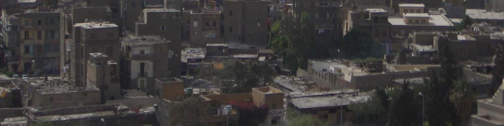
5 But that is not the real world!
6


7


8
9
10


11

12
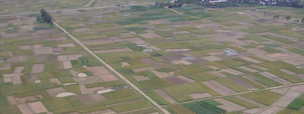
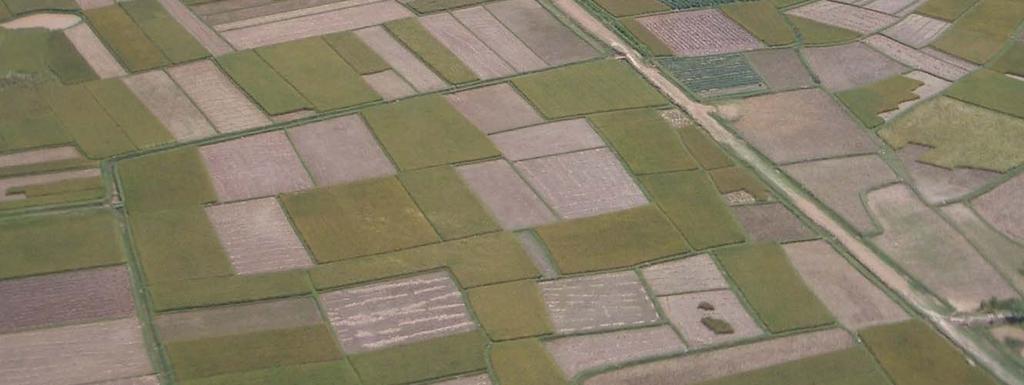
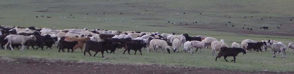
13 The real challenges 120,000 people added to Asian cities each day requiring 20,000 dwellings, 250 kms of roads and six megalitres of potable water daily 12 square kilometres of productive agricultural land lost to ubanisation in Asia daily. Over next decade about USD300 billion in infrastructure required per year in Asia (total aid globally USD75 billion) Global warming (floods, heat waves and cyclones) and rise in sea levels (currently over 0.25 billion people in Asia in areas <10m above MSL) Impact of increased air conditioning (global warming, population, wealth) In Africa 6000 people move into Lagos, Nigeria every day And the list goes on and on. ADB 2006
14 Centre for SDIs and Land Administration Department of Geomatics OBJECTIVE OF PRESENTATION Explain how land administration and the core cadastre supports spatial enablement of government and wider society to pursue sustainable development within an e-government environment
15 Sustainable development Economicdimension Environmental dimension Socialdimension Governance dimension
16 While the incorporation of sustainable development objectives into land administration systems (LAS) is accepted, this is very difficult and generally not happening. The focus of LAS is still primarily on security of tenure and simple land trading at a local or provincial level.
17 Centre for SDIs and Land Administration Department of Geomatics Take away message from presentation The use and potential of cadastral data as an enabling technology or infrastructure within e-government will outweigh its value to government from supporting security of tenure and simple land trading
18 Key issues Land is changing - modern land markets use complex commodities ie unbundle rights such as water and create instruments like mortgage backed certificates Design cadastres and land administration systems to serve markets and sustainable development, not the other way around Recognise the importance of land information as part of e-government

19 Land Management Vision Geo-referenced information from LAS, land registry, cadastre, parcels etc.
20 The needs of national governments for land information an issue not well understood
21 The needs of national governments Banks and insurance companies are national organisations (and are nationally regulated) Most complex commodities are national (water, carbon, biota, timber, mortgage backed certificates etc) National governments require real time aggregated information on land transactions, mortgages, planning applications, business licenses etc Yet land administration is often managed or coordinated at a state or provincial responsibility Land records will become national assets with national coordination
22 But this is just one reason why national governments want large scale parcel/property information. They also require this information for tax, fraud, security, emergency, environmental, health and many other activities.
23 A key problem Land administration silos at a provincial level
24 Land Administration information silos Land titles and land registries Properties Street address Land valuation Land tax Planning and land use Land development Digital cadastral map and these are often separated from state or national mapping or geographic information agencies The silo approach makes land administration very difficult if not impossible at a provincial level (local government, city and provincial) without even considering national needs
25 A holistic approach A holistic approach is to integrate cadastre, land administration and SDI The cadastre is the core of large scale SDIs


.")

26 The cadastral concept The traditional view of the cadastre and LA (buying, selling, leasing and mortgaging interests in land). The new approach makes the cadastre central to information management locally and nationally.
27 Modern cadastres Cadastre as an infrastructure for land management Key is cadastral processes Complete includes all private, communal, common, provincial and federal property Includes a unique identifier as well as a street address (the Crown jewel ) Publicly available via Internet Most cadastres are graphical but moving to survey accurate over time
28 Land administration and ICT New land administration with the cadastre as the central component takes advantage of ICT advances since Manual Systems Hardcopy Maps and Indexes Computerization DCDB and Indexes Online Land Administration Web enablement eland Administration Interoperability iland Spatially Enabled Government and Private Sector
29 A key challenge is the integration of Built (cadastral) and Natural (topographic) Environmental Datasets Sustainable Development Built Dataset Natural Dataset
30 iland vision as part of e-government
31 The potential of spatially enabled government
32 KEY ISSUES WITH SEG What is Spatially enabled government (SEG)? The role of property in SEG Key strategies to achieve SEG
33 Organisation of information Alpha names, categories Numeric tax files, medicare, Dewey library system, cadastral and parcel/property identifiers Geocodes where the Crown Jewel is a high integrity geocoded national address file (GNAF) based on the cadastre
34 Spatially enabled government Most current spatial information (and cadastral) activities are concerned with organising spatial information and building the infrastructure SEG uses the spatial information infrastructure or platform to organise other information

35 Rosie Fleming - Ngapa Jukurrpa We all think spatially Spatial concepts map directly on to the brain s cortex as topologically correct mappings. Hunter-gatherer societies use topologically correct mappings to communicate spatial information. Australian Aboriginal Water Dreaming. The rain (ngapa) story The straight lines represent the ngawarra (flood waters) running through the landscape. The small bar shapes signify mangkurdu (clouds). The small circles are mulju (water soakages).


36 . Modern societies use the same techniques. TOPOLOGICALLY CORRECT DIAGRAMS ARE EASILY UNDERSTOOD BY HUMANS

37 The earliest map? 6200 BC Ankara, Turkey excavation of Çatalhöyük site in Anatolia Urbanisation and the start of civil society required spatial information which was less relative and more geographic ; less symbolic and more quantitative.

38 Who owns what, where is it and how much tax should they pay? Topologically correct depictions were inadequate for the purposes of government. Consistent scale and consistent orientation appeared about 8,500 years ago to meet the needs of government
. There is emphasis on public structures such as temples, canals, store houses and a park.")
39 Mesopotamian City Plan, Nippur 1500 B.C., showing part of the defensive city wall and planned repairs. This shows internal property boundaries precisely, and to scale (in units of twelve cubits six meters). There is emphasis on public structures such as temples, canals, store houses and a park. (Clay tablet 18 x 21 cm) Property ownership, taxation, defence and facilities management are the main purposes of these artefacts the universal businesses of all governments.
40 These slides from history give an insight into what we mean by spatially enabled government and its importance
41 Today we use computers, not rocks. But the message is the same.
42 e-land administration Many countries now have eland Administration initiatives as part of e- government In the Asia and the Pacific region there are many excellent examples such as Singapore, Korea, Australia and New Zealand with many other countries introducing initiatives
43 While these initiatives are very significant and have been developed over decades, they are now not the main game. The main game is to use concept of location or place derived from the cadastre to re-organise government activities
44 But who understands place? Less than 1% of people are specialists Less than 5% understand the technology 95% do not understand the technology
45 Google Maps gives a small insight to spatially enabling government for example Australia
46 The key to SEG is the property base - or for the initiated - the cadastre The property base connects people to land The cadastre gives us a high integrity geocoded national address file (GNAF)
47 Examples of SEG National reserve banks tracking all land transactions and mortgages linked to land use, owner status (ie first home buyer), type of creditor/debtor, building types, occupation by elderly and land values Automatic property verification based on geocoded national address file (ie local government, taxation, health services, border security, agriculture security etc)
48 If the USA had systems like this available to its Federal Reserve Bank, could the subprime mortgage crisis have been moderated or even averted?
49 United States of America National Academy of Sciences National Land Parcel Data A Vision for the Future silos into one national land parcel data base complete national land parcel data is necessary, timely, technically feasible, and affordable. Federal Land Parcel Coordinator, National Land Parcel Coordinator
50 Key strategies for SEG Geocode information and use place or location as key organiser Use holistic cadastral data models to integrate data silos and allow spatial enablement of society and government Use complete and up-to-date (real time) cadastral maps of legal parcels, properties and legal land objects Aggregate and integrate land information in real time nationally
51 CONCLUSION Modern cadastres are the key to spatial enablement of government and sustainable development through e-government Land information will become more important to support spatial enablement than simple land trading Land information will become a national asset coordinated nationally
52 Thank you
Lessons for federated countries that have state land registries the Australian experience
 Lessons for federated countries that have state land registries the Australian experience Ian Williamson Centre for SDI and Land Administration Department Infrastructure Engineering University of Melbourne
THINKING OUTSIDE THE TRIANGLE TAKING ADVANTAGE OF MODERN LAND MARKETS. Ian Williamson
 THINKING OUTSIDE THE TRIANGLE TAKING ADVANTAGE OF MODERN LAND MARKETS Ian Williamson Professor of Surveying and Land Information Head, Department of Geomatics Director, Centre for Spatial Data Infrastructures
Opportunities for Surveyors in Modern Land Markets
 Opportunities for Surveyors in Modern Land Markets Ian WILLIAMSON, Australia Key words: Land administration, land market, cadastre SUMMARY A large component of the activities of the land surveyor, land
Centre for SDIs and Land Administration Department of Geomatics Spatial systems to support sustainable development
 Centre for SDIs and Land Administration Department of Geomatics Spatially Enabled Government and Society United Nations-FIG Bathurst Declaration on Sustainable Development Melbourne, 1999 Good information
Land Administration And Spatial Data Infrastructures
 Land Administration And Spatial Data Infrastructures Ian WILLIAMSON, Donald GRANT and Abbas RAJABIFARD Centre for SDIs and Land Administration Department of Geomatics University of Melbourne, Australia
Global Challenges for Land Administration and Sustainable Development
 Summary Global Challenges for Land Administration and Sustainable Development Ian Williamson Professor of Surveying and Land Information Head, Department of Geomatics Director, Centre for Spatial Data
THE FUTURE ROLE OF THE CADASTRE
 SUMMARY THE FUTURE ROLE OF THE CADASTRE Ian Williamson Professor of Surveying and Land Information Head, Department of Geomatics Director, Centre for Spatial Data Infrastructures and Land Administration
CADASTRE 2014: New Challenges and Direction
 CADASTRE 2014: New Challenges and Direction Anna KRELLE and Abbas RAJABIFARD, Australia Key words: Cadastre, Cadastre 2014, Land Administration SUMMARY Land and land related activities form part of the
STATUS REPORT
 Working Group 3 Land Administration STATUS REPORT 2006-2009 2009 Prof Ian Williamson (Chair) Mr Ahmad Fauzi Nordin (Vice Chair) Assoc. Prof Abbas Rajabifard (Vice Chair) 18th UNRCC-AP Conference Bangkok
Centre for SDIs and Land Administration Department of Geomatics Spatial systems to support sustainable development
 Centre for SDIs and Land Administration Department of Geomatics MODERN CADASTER and LAND ADMINISTRATION تهران-مرداد 1386 2014 ..... 2 ماه Centre for SDIs and Land Administration Department of Geomatics
COORDINATED CADASTRES - A KEY TO BUILDING FUTURE GIS
 Proceedings of the Regional Conference on Managing Geographic Information Systems for Success, Melbourne, 3-4 July, pp.60-69 (1996). COORDINATED CADASTRES - A KEY TO BUILDING FUTURE GIS Ian P.Williamson
A New Vision on Cadastral Data Model
 Mohsen KALANTARI, Abbas RAJABIFARD, Jude WALLACE and Ian P. WILLIAMSON, Australia Key words: Land administration, cadastre, land parcel, legal property object, interoperability SUMMARY Land administration
Ian WILLIAMSON, Jude WALLACE, and Abbas RAJABIFARD
 Ian WILLIAMSON, Jude WALLACE, and Abbas RAJABIFARD Centre for SDIs and Land Administration Department of Geomatics, The University of Melbourne, Victoria 3010, AUSTRALIA http://www.geom.unimelb.edu.au/research/sdi_research
Smart Infrastructure Benefits and Key Players from a Global Perspective
 Smart Infrastructure Benefits and Key Players from a Global Perspective Spatial@gov 2010 October 5-7 Canberra Jude Wallace and Abbas Rajabifard Centre for Spatial Data Infrastructures and Land Administration
A Geocoded Cadastral Fabric as a Precondition for a Sustainable Land Management System
 A Geocoded Fabric as a Precondition for a Sustainable Land Management System Gottfried KONECNY, Germany; J.P. LAUZON, Canada; Abdul Salam MOHAMMED, India Key words: SDI,, Parcel Boundaries, GPS-GNSS, Land
Incorporating Sustainable Development Objectives into ICT Enabled Land Administration Systems - Case Study Switzerland
 EXPERT GROUP MEETING ON INCORPORATING SUSTAINABLE DEVELOPMENT OBJECTIVES INTO ICT ENABLED LAND ADMINISTRATION SYSTEMS 9-11 November 2005, Centre for Spatial Data Infrastructures and Land Administration
Expert Group Meeting 9-11 November 2005 Geomatics The University of Melbourne Centre for Spatial Data Infrastructures and Land Administration
 Incorporating Sustainable Development Objectives into ICT Enabled Land Administration Systems Australia s International Science Linkages Program Expert Group Meeting 9-11 November 2005 Geomatics The University
Overview of PCGIAP-WG3 and Spatially Enabled Government
 Working Group 3 3 rd Land Administration Forum Overview of and Spatially Enabled Government Abbas Rajabifard Vice Chair, Established in 2000 based on a Resolution from the 15th UNRCC-AP in Malaysia. With
NEW ROLES OF LAND ADMINISTRATION SYSTEMS
 NEW ROLES OF LAND ADMINISTRATION SYSTEMS Centre for SDIs and Land Administration Department of Geomatics The University of Melbourne Email: ianpw@unimelb.edu.au SUMMARY This paper sketches the key issues
Cadastral Futures building a new vision for the nature and role of cadastres. XXIV FIG International Congress Sydney, April 11-15
 Cadastral Futures building a new vision for the nature and role of cadastres XXIV FIG International Congress Sydney, April 11-15 Rohan Bennett, Abbas Rajabifard, Mohsen Kalantari, Jude Wallace, Ian Williamson
Digitalisation of the Real Property Rights Towards Spatially enabled E-Government
 Digitalisation of the Real Property Rights Towards Spatially enabled E-Government Lise Schroeder, Bent Hulegaard Jensen, Esben Munk Soerensen & Line Hvingel Istanbul, Turkey 25 june 201 Overview Introduction
PROJECT INFORMATION DOCUMENT (PID) CONCEPT STAGE Report No.: AB3229 Project Name. Land Registry and Cadastre Modernization Project Region
 CONCEPT STAGE Report No.: AB3229 Project Name. Land Registry and Cadastre Modernization Project Region") PROJECT INFORMATION DOCUMENT (PID) CONCEPT STAGE Report No.: AB3229 Project Name Land Registry and Cadastre Modernization Project Region EUROPE AND CENTRAL ASIA Sector Central government administration
PROJECT INFORMATION DOCUMENT (PID) CONCEPT STAGE Report No.: AB3229 Project Name Land Registry and Cadastre Modernization Project Region EUROPE AND CENTRAL ASIA Sector Central government administration
Challenges for the multi purpose cadastre
 Jens RIECKEN, Markus SEIFERT, Germany Key words: Multi purpose cadastre, 3d-cadastre, land use, SDI, solar cadastre SUMMARY Over the past 30 years, with the progress of information technologies the development
Spatial Data Infrastructure in Sweden
 Spatial Data Infrastructure in Sweden Hans-Erik WIBERG, Sweden Key words: ABSTRACT Sweden was one of the first countries to address Data Infrastructure matters and have during several decades developed
Presented at the FIG Congress 2018, May 6-11, 2018 in Istanbul, Turkey
 Presented at the FIG Congress 2018, May 6-11, 2018 in Istanbul, Turkey 5 Bibliometric Analysis of Articles Presented Under Commission 7: A Case of the 25th Fig Congress in Malaysia in 2014 Zeynel Abidin
Chapter 9: 3D Visualisation as a Tool to Facilitate Managing Land and Properties
 Chapter 9: 3D Visualisation as a Tool to Facilitate Managing Land and Properties Davood Shojaei Overview The rapid population growth and decrease of natural resources have concerned decision makers about
Universal Geo-database Connector Interface Component (UG-CIC) For Virtual Web-base GIS Server Essential For Real Estate Industry Uses
 For Virtual Web-base GIS Server Essential For Real Estate Industry Uses") Universal Geo-database Connector Interface Component (UG-CIC) For Virtual Web-base GIS Server Essential For Real Estate Industry Uses Jad Jarroush & Dr. Kobi Zaid Zaid Orniv Group L.T.D Israel kobi_z@zaidorniv.co.il
Universal Geo-database Connector Interface Component (UG-CIC) For Virtual Web-base GIS Server Essential For Real Estate Industry Uses Jad Jarroush & Dr. Kobi Zaid Zaid Orniv Group L.T.D Israel kobi_z@zaidorniv.co.il
LIS a motivation for SDI initiative
 Eric Mwaikambo Ardhi University Dar es Salaam Tanzania Overview Status of LIS in Tanzania Relationship between SDI and LIS Spatial Standards LIS a motivation for SDI initiative Conclusion & Recommendations
Cadastre and Land Registration in Europe
 Annex A: Questionnaire 2007 for Information Resource Cadastre and Land Registration in Europe Introduction This questionnaire is based on the EuroGeographics vision document 'Cadastre and Land Registration
PROJECT INFORMATION DOCUMENT (PID) APPRAISAL STAGE Report No.: PIDA Project Name. Region Country Sector(s) Theme(s)
 APPRAISAL STAGE Report No.: PIDA Project Name. Region Country Sector(s) Theme(s)") Public Disclosure Authorized Public Disclosure Authorized Public Disclosure Authorized Public Disclosure Authorized Project Name Region Country Sector(s) Theme(s) Lending Instrument Project ID Borrower(s)
Public Disclosure Authorized Public Disclosure Authorized Public Disclosure Authorized Public Disclosure Authorized Project Name Region Country Sector(s) Theme(s) Lending Instrument Project ID Borrower(s)
Click to edit Master title style
 Click to edit Master title style Modern Cadastre and Land Administration Session 5a. The toolbox approach Jude Wallace 2007 Click to edit Overview Master title style Objectives To understand the circumstances
Design and Determine 3D Cadastral Systems: A Case Study of Turkey Hicret GURSOY SURMENELI* and Mehmet ALKAN* (Turkey)
") Design and Determine 3D Cadastral Systems: A Case Study of Turkey Hicret GURSOY SURMENELI* and Mehmet ALKAN* (Turkey) *Yildiz Technical University, Civil Engineering Faculty, Department of Geomatics CONTENTS
Design and Determine 3D Cadastral Systems: A Case Study of Turkey Hicret GURSOY SURMENELI* and Mehmet ALKAN* (Turkey) *Yildiz Technical University, Civil Engineering Faculty, Department of Geomatics CONTENTS
GIS & GPS Applications in Valuation/Appraisal Assessments
 GIS & GPS Applications in Valuation/Appraisal Assessments Simon ADCOCK, Australia Key words: GIS, GPS, mass assessments, 3-dimensional, modelling. SUMMARY The development of GIS and GPS systems has substantially
National Spatial Data Infrastructure development in Republic of Macedonia
 National Spatial Data Infrastructure development in Republic of Macedonia Sonja Dimova, state advisor for geomatics AGENCY FOR REAL ESTATE CADASTRE September 6-th, 2017, Strasbourg AREC competence for
PREPARING SURVEY TENDER GIS DATABASE OUTCOMES
 PREPARING SURVEY TENDER SPECIFICATIONS FOR PROJECT GIS DATABASE OUTCOMES Presentation by Ian Harper GEODATA AUSTRALIA ESRI User Conference 2009 24 st July 2009 BACKGROUND GIS databases now provide a more
New Technology for Cadastral Systems. Brent Jones, PE, PLS
 New Technology for Cadastral Systems Brent Jones, PE, PLS Benefits of Good Land Administration Key to addressing global challenges.. Secure Tenure Equitable Land and Property Taxation Support for Government
A beautiful setting. The Evolving Role of Cadastral Systems in Support of Good Land Governance. Setting the scene
 The Evolving Role of Cadastral Systems in Support of Good Land Governance Prof. Stig Enemark President Aalborg University, Denmark THE DIGITAL CADASTRAL MAP FIG COMMISSION 7 OPEN SYMPOSIUM KARLOVY VARY,
Land Information System as new instrument for Land Administration: Case Examples. Mike Cheremshynskyi Consultant, Land Administration Expert
 Land Information System as new instrument for Land Administration: Case Examples Mike Cheremshynskyi Consultant, Land Administration Expert Background Growth of population and fast urbanization in many
Directorate of Survey and Mapping NAMIBIA. Cadastral Information System. Vehupisa Kasuko Tjatindi Surveyor Directorate of Survey and Mapping NAMIBIA
 Vehupisa Kasuko Tjatindi Directorate of Survey and Mapping NAMIBIA Tel: +64 61 965000 Directorate of Survey and Mapping NAMIBIA Cadastral Information System Introduction Over the past few decades cadastral
The importance of changes in land surveyors education
 András OSSKÓ Key words: land administration, roles of land surveyors, extended education, lifelong learning SUMMARY It s a world wide experience, especially in developed countries that the interest in
Greetings from Denmark. Property Rights, Restrictions and Responsibilities - A Global Land Management Perspective. Wonderful Copenhagen
 Property Rights, Restrictions and Responsibilities - A Global Land Management Perspective Greetings from Denmark 43,000 sq km Prof. Stig Enemark President Aalborg University, Denmark Aalborg Copenhagen
Keith Clifford Bell The World Bank -East Asia and the Pacific Region WASHINGTON D.C., USA
 Keith Clifford Bell The World Bank -East Asia and the Pacific Region WASHINGTON D.C., USA 4th Land Administration Forum for the Asia and Pacific Region Beyond Spatial Enablement October 5-7, 2011 Melbourne,
A Vision for a Fully Digital Cadastral Survey System
 A Vision for a Fully Digital Cadastral Survey System Anselm HAANEN, Trent GULLIVER, New Zealand Key words: cadastral survey system, digital cadastre, survey plans SUMMARY Surveyors have traditionally prepared
Field surveying inspection using tablets
 Field surveying inspection using tablets Rami Farraj, Ahmad Sghyyer Survey of Israel, Lincoln 1, Tel-Aviv, Israel rami@mapi.gov.il ahmad@mapi.gov.il Key words: Field Surveying, Cadastre, Mapping Procedures
Land Administration and Spatial Enablement Victoria s Experience. Chris McRae, Executive Director Land Victoria
 Land Administration and Spatial Enablement Victoria s Experience Chris McRae, Executive Director Land Victoria 4 th UN Land Administration Forum, October 2011 Outline About Land Victoria Land Victoria
AAA Land Information: Accurate, Assured and Authoritative
 Ian WILLIAMSON, Abbas RAJABIFARD, Mohsen KALANTARI and Jude WALLACE, Australia Key words: Land information, VGI, Cadastre, Authoritative data, Accuracy, Assurance SUMMARY Online spatial data 1 are being
Understanding Cadastral Maps
 The Australian Surveyor, Vol. 41, No. 1, 38-52, 1996 by Understanding Cadastral Maps Ian Williamson Professor of Surveying and Land Information, Department of Geomatics, The University of Melbourne, Australia
TOWARDS E-LAND ADMINISTRATION - ELECTRONIC PLANS OF SUBDIVISIONS IN VICTORIA
 TOWARDS E-LAND ADMINISTRATION - ELECTRONIC PLANS OF SUBDIVISIONS IN VICTORIA Mohsen Kalantari 1, Chris Lester 2, David R Boyle 3, Neil Coupar 4 1 eplan Coordinator 2 SPEAR Manager 3 Deputy Surveyor General
Iranian Cadastre System. Nasrollah Jahangard Iran s Deeds and Properties Registration Organization I.R. of Iran 14 th PCGIAP, KL, Malaysia 2008
 Iranian Cadastre System Nasrollah Jahangard Iran s Deeds and Properties Registration Organization I.R. of Iran 14 th PCGIAP, KL, Malaysia 2008 General Information Europe Middle East Asia Africa Middle
The Danish Digital Cadastral Map A Tool for Land Management
 The Danish Digital Cadastral Map A Tool for Land Management Søren CHRISTENSEN, Denmark Key words: Digital cadastre, restrictions pertaining to public law, land management. ABSTRACT The establishments of
Urban Management Land Information System (UMLIS) project in Ghana. Presentation at FIG TS 1 F Property Taxation. Sydney, Australia 12 April 2010
 project in Ghana. Presentation at FIG TS 1 F Property Taxation. Sydney, Australia 12 April 2010") Urban Management Land Information System (UMLIS) project in Ghana Presentation at FIG TS 1 F Property Taxation Sydney, Australia 12 April 2010 Linda Johansson / Kofi Yeboah Urban Management Land Information
Urban Management Land Information System (UMLIS) project in Ghana Presentation at FIG TS 1 F Property Taxation Sydney, Australia 12 April 2010 Linda Johansson / Kofi Yeboah Urban Management Land Information
Esri Middle East and Africa User Conference. December Abu Dhabi, UAE. Land Administration. Mark Baker
 Esri Middle East and Africa User Conference December 10 12 Abu Dhabi, UAE Land Administration Mark Baker Our Agenda 0900 0930 Welcome Mark Baker, Esri 0930 1030 New Directions The New Addressing System
Scenic Nepal. Land Administration Systems. Outline of Presentation. Interests in land. Rights: Registration and security of tenure positions
 Scenic Nepal Land Administration Systems Managing Rights, Restrictions, and Responsibilities in Land Prof. Stig Enemark President Aalborg University, Denmark SURVEY DEPARTMENT KATHMANDU, NEPAL. 16 FEBRUARY
Spatial Data Infrastructure for knowledge sharing
 , THE NETHERLANDS Key words: SDI, knowledge sharing, people profit planet, Kadaster, system of key registers, good governance, e-government, spatially enabled society, GIDEON SUMMARY Today s global challenges
Land Administration and Spatial Data Infrastructures
 Land Administration and Spatial Data Infrastructures Ian WILLIAMSON, Donald GRANT and Abbas RAJABIFARD Australia Key words: Land administration, SDI SUMMARY Internationally the spatial data infrastructure
Building Modern Land Administration Systems in Developed Economies
 Building Modern Land Administration Systems in Developed Economies S Enemark I Williamson J Wallace S Enemark Department of Development and Planning Aalborg University Denmark enemark@land.auc.dk I Williamson
International funding projects in Republic Geodetic Authority
 International funding projects in Republic Geodetic Authority Serbia: Republic Geodetic Authority Workshop Exploring Funding Instruments for NMCA 7-8 November 2012 Republic Geodetic Authority Republic
Jack McKenna, Director of Business Development, Africa and the Caribbean
 Presented at the FIG Working Week 2016, May 2-6, 2016 in Christchurch, New Zealand Jack McKenna, Director of Business Development, Africa and the Caribbean FIG WORKING WEEK 2016 Fit for Purpose Parcel
The New Technology of a Survey Data Model and Cadastral Fabric as the Foundation for a Future Land Administration System.
 The New Technology of a Survey Data Model and Cadastral Fabric as the Foundation for a Future Land Ian HARPER, Australia Key words: cadastral modelling, survey data model, Survey Accuracy, Cadastre 2014
The Cadastral Template 2.0, From Design to Implementation
 Abbas RAJABIFARD (Australia), Daniel Steudler (Switzerland), Ali AIEN, and Mohsen KALANTARI, Australia Key words: Cadastral Template 2.0, Cadastral Template Project, Land Administration, PCGIAP SUMMARY
Moving from a Successful to a Modern Cadastre in LAO PDR
 Moving from a Successful to a Modern Cadastre in LAO PDR Daniel CARTER (Australia) and Bounhom HEUANGSAVATH (Lao PDR) Key Words: cadastre; digital cadastre; land administration systems; South East Asia
Land surveying is probably the (second) oldest profession in the world
 oldest profession in the world") Land Surveying and Land Management in an International Perspective Prof Stig Enemark Honorary President Aalborg University, Denmark CADASTRE IN A DIGITAL WORLD NORDIC AND GLOBAL PRESPECTIVES INTERNATIONAL
Land Surveying and Land Management in an International Perspective Prof Stig Enemark Honorary President Aalborg University, Denmark CADASTRE IN A DIGITAL WORLD NORDIC AND GLOBAL PRESPECTIVES INTERNATIONAL
Land Consolidation Thesaurus finding common ground. 9 th International LANDNET workshop 3-5 October 2017 Budapest, Hungary
 Land Consolidation Thesaurus finding common ground 9 th International LANDNET workshop 3-5 October 2017 Budapest, Hungary Maxim Gorgan, Land Tenure and Rural Development Specialist, FAO Regional Office
Marine Spatial Data Infrastructure (MSDI) & The Marine Cadastre Application. April 10, 2018
 & The Marine Cadastre Application. April 10, 2018") Marine Spatial Data Infrastructure (MSDI) & The Marine Cadastre Application April 10, 2018 A Collaborative Pilot Project Vision of CHS: A framework of geographic data, metadata, users and tools Intent
Marine Spatial Data Infrastructure (MSDI) & The Marine Cadastre Application April 10, 2018 A Collaborative Pilot Project Vision of CHS: A framework of geographic data, metadata, users and tools Intent
The Role of the Swedish Land Information System
 The Role of the Swedish Land Information System In the Business Society Tommy Österberg Swedesurvey 1 SWEDEN 9 million inhabitants 450 000 sq. km 21 Counties 291 Municipalities 4.6 million properties in
GLOBAL GEOSPATIAL MANAGEMENT INFORMATION
 GLOBAL GEOSPATIAL MANAGEMENT INFORMATION SEOUL, KOREA 24 th to 26 th October 2011 COUNTRY REPORT - REPUBLIC OF BOTSWANA 1. INTRODUCTION 1.1. SOCIAL, ECONOMIC AND POLITICAL BACKGROUND Botswana attained
Understanding the Land Management Paradigm
 FIG COM 7 SYMPOSIUM ON INNOVATIVE TECHNOLOGIES FOR LANDADMINISTRATION 19 25 June 2005, Madison, Wisconsin, USA. Understanding the Land Management Paradigm Prof. Stig Enemark Vice-President of FIG Department
DEVELOPMENT OF A GIS-BASED LAND REGISTRY SYSTEM
 DEVELOPMENT OF A GIS-BASED LAND REGISTRY SYSTEM *Vanum Govindu 1, Kidu Gebremedhin 2 and Desta Luel Tsegay 3 1 Department of GEOS for Natural Resource Management, Institute of Geo-Information and Earth
Quarterly Review The Australian Residential Property Market and Economy
 Quarterly Review The Australian Residential Property Released January 2018 Contents Introduction 3 Housing Market 4 Mortgage Lending 11 Housing Supply 17 Demographic Overview 20 Household Finances 22 National
THE XXV FIG INTERNATIONAL CONGRESS IN MALAYSIA Kuala Lumpur, Malaysia, June 2014 at Kuala Lumpur Convention Centre
 CALL FOR PAPERS TO THE XXV FIG INTERNATIONAL CONGRESS IN MALAYSIA Kuala Lumpur, Malaysia, 16 21 June 2014 at Kuala Lumpur Convention Centre Dear Friend and Colleague, It is our privilege and honour to
Cloud GIS Real Estate Management, Appraisal and Development Service USING ESRIs ARCGIS SERVER
 Cloud GIS Real Estate Management, Appraisal and Development Service USING ESRIs ARCGIS SERVER INFODIM: Was founded on 1992 and is internationally certified as a GIS company from D&B Dun & Bradstreet Global
The creation of a Survey Accurate Cadastral Map for surveyed areas in Trinidad & Tobago
 The creation of a Survey Accurate Cadastral Map for surveyed areas in Trinidad & Tobago Anesh Gopee, Keith Miller and Charisse Griffith Charles University of the West Indies Trinidad aneshtt@yahoo.com
The World Bank Modernization of Real Property Registration and Cadastre (P151746)
") Public Disclosure Authorized EUROPE AND CENTRAL ASIA Uzbekistan Social, Urban, Rural and Resilience Global Practice Global Practice IBRD/IDA Investment Project Financing FY 2016 Seq No: 5 ARCHIVED on 23-Apr-2018
Public Disclosure Authorized EUROPE AND CENTRAL ASIA Uzbekistan Social, Urban, Rural and Resilience Global Practice Global Practice IBRD/IDA Investment Project Financing FY 2016 Seq No: 5 ARCHIVED on 23-Apr-2018
Cadastre: definitions
 Introduction New vision towards a multipurpose cadastral system to support land management in Morocco Moha EL-AYACHI, El Hassane SEMLALI, Mohamed ETTARID, Driss TAHIRI, Institut Agronomique et Vétérinaire
Land Management and Development
 CLGE INTERNATIONAL CONFERENC 2005 EUROPEAN PROFESSIONAL QUALIFICATIONS IN GEODETIC SURVEYING BRUSSELS, 1-2 DECEMBER 2005 Land Management and Development Professor Stig Enemark Department of Development
Supporting Capacity Development for Sustainable Land Administration Infrastructures
 THE EIGHTH UNITED NATIONS REGIONAL CARTOGRAPHIC CONFERENCE FOR THE AMARICAS (UNRCCA) 27 June 1 July 2005, United Nations Headquarters, New York Supporting Capacity Development for Sustainable Land Administration
THE APPLICATION OF GIS AND LIS Solutions and Experiences in East Africa. Lenny Kivuti
 Using GIS and LIS for Planning Sustainable Development Bepic Group CHOGM, Malta 2005 THE APPLICATION OF GIS AND LIS Solutions and Experiences in East Africa Lenny Kivuti 21 November, 2005 Presented by
Land Administration Infrastructures for Sustainable Development
 The Global Challenges Land Administration Infrastructures for Sustainable Development Prof. Stig Enemark Department of Development and Planning Aalborg, University, Denmark INTERNATIONAL CONFERENCE ON
Alternatives for Economic Boundary Determination in the Establishment of a Cadastral System. Paper to the FIG Working Week 2012 Rome, May 9, 2012
 Alternatives for Economic Boundary Determination in the Establishment of a Cadastral System Paper to the FIG Working Week 2012 Rome, May 9, 2012 by Gottfried Konecny Emeritus Professor Leibniz University
Land Administration Infrastructure: The Other Side of the Coin 1
 IV. Land Administration Infrastructure: The Other Side of the Coin 1 Ian Williamson, Director, Centre for SDI and Land Administration, The University of Melbourne, Australia Introduction There is a great
Spatial Data Warehouse Ltd. Cadastral Mapping INITIATIVE 1: CADASTRAL MAPPING. Version Spatial Data Warehouse Ltd. & AltaLIS Ltd.
 Spatial Data Warehouse Ltd. Initiative 1: Cadastral Mapping INITIATIVE 1: CADASTRAL MAPPING 29 P3 The SDW/AltaLIS Model Background The Government of Alberta started a mapping program, the Municipal Integrated
Land Markets and Land Rights in support of the Millennium Development Goals
 Land Markets and Land Rights in support of the Millennium Development Goals A Global Perspective Prof. Stig Enemark President Aalborg University, Denmark 3rd LAND ADMINISTRATION FORUM FOR THE ASIA AND
Spatially Enabled Society Role of the Cadastre
 armasuisse Bundesamt für Landestopografie swisstopo Swiss Federal Directorate for Cadastral Surveying Spatially Enabled Society Role of the Cadastre XXIV FIG International Congress 2010 FIG-Task Force
Chapter 3: A Framework for a National Land Information Infrastructure
 Chapter 3: A Framework for a National Land Information Infrastructure Brian Marwick Overview As a federated county, Australia s land administration systems are state and territory based. These systems,
The Real Estate and Land Market of Russia: Factors of the Sustainable Development
 The Real Estate and Land Market of Russia: Factors of the Sustainable Development Vasily Nilipovskiy (State University of Land Use Planning, Moscow, Russia) ? &! and! &? There is no definite answer in
Quality Improvement of the Real Estate Cadastre in Serbia
 , Serbia Key words: quality improvement, real estate information, quality assurance, Serbia SUMMARY The concept of cadastral modernization in the Republic of Serbia was defined in 1992, and it is being
LESSONS FOR FEDERAL COUNTRIES THAT HAVE STATE LAND REGISTRIES - THE AUSTRALIAN EXPERIENCE
 LESSONS FOR FEDERAL COUNTRIES THAT HAVE STATE LAND REGISTRIES - THE AUSTRALIAN EXPERIENCE 1 Ian Williamson, 1 Rohan Bennett, 1 Abbas Rajabifard, 1 Jude Wallace 1 Department of Infrastructure Engineering,
Land and Property Information in 3D
 Abbas RAJABIFARD, Mohsen KALANTARI and Ian WILLIAMSON, AUSTRALIA Key words: 3D Cadastre; Legislation; Land Administration, Land Development; Property SUMMARY People increasingly live in high density urban,
Seventh Session of the United Nations Committee of Experts on Global Geospatial Information Management
 Report of the Forum P a g e 1 Seventh Session of the United Nations Committee of Experts on Global Geospatial Information Management Report of the Forum Secure Land Rights and Smart Cities - Making It
The Digital Cadastral Database and the Role of the Private Licensed Surveyors in Denmark
 IRISH INSTITUTE OF SURVEYORS, DUBLIN INSTITUTE OF TECHNOLOGY, 23 NOVEMBER 2005 PUBLISHED IN IIS NEWS, WINTHER 2006. The Digital Cadastral Database and the Role of the Private Licensed Surveyors in Denmark
Information Quality - A Critical Success Factor How to make it all right!
 Information Quality - A Critical Success Factor How to make it all right! Anders Svensson, Sweden Key words: Cadastre, information quality, property information, property boundaries SUMMARY Sweden has
Reliability of the Italian cadastral system data quality and improvement prospects
 Reliability of the Italian cadastral system data quality and improvement prospects Eng. Franco MAGGIO (Central Director for Cadastral, Cartographic and Land Registration Services) Eng. Arturo ANGELINI
Developing a Modern Cadastre in Lao PDR
 Developing a Modern Cadastre in Lao PDR Bounhom Heuangsavath Deputy Director General, Department of Lands, Lao PDR 1 May 27 Project Contributors Lao PDR 16 provinces, 1municipality 6.2 million population
An Approach for Re-Engineering Organizational Structure of Real Estate Valuation System in Turkey
 An Approach for Re-Engineering Organizational Structure of Real Estate Valuation System in Turkey Nuri ERDEM and Mehmet CETE, Turkey Keywords: Real estate, Valuation, Organizational Structure, Re-Engineering,
Addressing Land Sector Opportunities with Geospatial Information in Nepal
 The 20th UNRCC-AP and the 4th UN-GGIM-AP 5-10 October 2015 Jeju Island, Republic of Korea Addressing Land Sector Opportunities with Geospatial Information in Nepal Krishna Raj BC Executive Director Land
A National Vision for Australian Land Registries
 Rohan BENNETT, Abbas RAJABIFARD, Ian WILLIAMSON, Jude WALLACE, Brian MARWICK, Australia Key words: Land Administration, Key Registers, Australia, Land Registration SUMMARY We in Australia run the risk,
Egyptian Nationwide Title Cadastre System
 Kholoud SAAD, Egypt Key words: Cadastre, Registration, Urban, Rural, National Cadastre, Automation, reengineering. SUMMARY With growing need for integrated information, Enterprise Solutions has become
Creation Land Administration in Formal and Informal Environment. FIG Commission 7 Working Group 1
 Creation Land Administration in Formal and Informal Environment András OSSKÓ, Hungary Key words: land administration, informal land tenure, customary tenure, sustainable Development. SUMMARY FIG Commission
Land Tenure and Geospatial Data and Technology
 Land Tenure and Geospatial Data and Technology Ioana Bouvier E3/Land and Urban, USAID Senior Geospatial Analyst January 23, 2018 January 23, 2018 1 OUTLINE 1. Overview of geospatial data and technology
Key Registers in Finland and some views of Cadastre 2035
 Presented at the FIG Working Week 2016, May 2-6, 2016 in Christchurch, New Zealand Key Registers in Finland and some views of Cadastre 2035 FIG Working Week, Christchurch New Zealand May, the 3rd, 2016