Cadastral Survey in the 21 st Century. Gavin Adlington. Land Program Team Leader Europe and Central Asia Region (ECA)
|
|
|
- Joleen Quinn
- 5 years ago
- Views:
Transcription
1 E-learning Series Cadastral Survey in the 21 st Century June 3, 2010 Gavin Adlington. Land Program Team Leader Europe and Central Asia Region (ECA) The World Bank
2 Content : Purpose of cadastral survey Error theory 19th and 20 th Centuries 21 st Century technology Conclusion 2 RPM-50
3 Purpose of Cadastral Survey 1. Real Estate Property Taxation 2. Protection of Property Rights 3. Land Use Control and Monitoring 4. Multi-purpose p For each we need to know what is needed dd for the task.
4 Property Taxation To derive income for government Cover every property no gaps Value Area? Maybe depends on valuation methodology Accuracy of measurement need cost/ benefit for difference in cost of collecting the tax against income derived.
5 Protection of Property Rights To enable the real estate market to operate with efficiency Cover every property that has private property rights. No overlaps or duplications Define boundaries in such a way that they can be replaced in time of dispute.

6 Land Use Control and Monitoring To ensure that land is used in a sustainable manner. Ensure land is not laid waste. Ensure land is used for the overall benefit of society. Need to cover all land, but data content and accuracy of information depend on government policy.
7 Multi-Purpose Cadastre To maximise efficient use of spatial information Provide the where, who, what basic information to multiple users. Provide better service to the public. Reduce duplication of costs and time for information gathering. Accuracy dictated by the level needed by individual id cadastres.
8 We do not require high accuracy of measurement for any of these cadastres. But We have very good reason for measuring to high standards
9 Content : Purpose of cadastral survey Error theory 19th and 20 th Centuries 21 st Century technology Conclusion 9 RPM-50
10 Gross Errors Error Theory Random Errors Systematic Errors. It is the systematic errors that require us to be careful in measurement.
11
12
13
14
15
16 and we measure as accurately as we can. To reduce the likelihood of this happening we work from the whole to the part utilizing first/ second/ third/ fourth order networks, and local networks within towns.
17 Content : Purpose of cadastral survey Error theory 19th and 20 th Centuries 21 st Century technology Conclusion 17 RPM-50


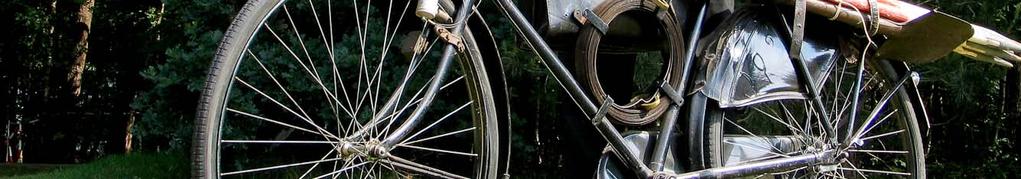

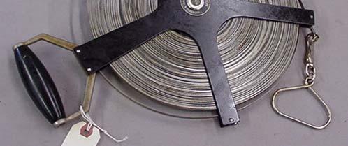
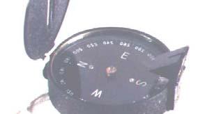
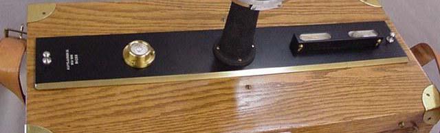
18 Thanks to John Tomasowa of Dutch Kadaster for these photographs. 19 th and 20 th Centuries


19
20 : How was the old survey done? Was it checked? What accuracy should we expect to see? A boundary is not really fixed unless a second survey agrees with the first! 20 RPM-50
21 Content : Purpose of cadastral survey Error theory 19th and 20 th Centuries 21 st Century technology Conclusion 21 RPM-50


22 21 st Century GNSS LIDAR Orthophoto 3-D imagery Geoeye image
23 : Errors do not accumulate No need for geodetic network! Accuracies improving Availability increasing It will only get easier, quicker, more available and more accurate. Need to rethink our procedures and standards. 23 RPM-50
24 : It is now easier to re-measure than to investigate i where errors have occurred in the past and try to fix them. Accuracy is no longer a problem with modern instruments. But you still have to meet the owners and walk the boundaries! 24 RPM-50
25 In case of dispute over boundaries: Rules of Evidence unlikely to change Where do owners and past owners say the boundary is? What physical features on the ground show where the boundary is? What does the description in the deed say? What do the survey plans show? Coordinates? 25 RPM-50
26 And Remember Cadastre Cadastres will show the complete legal picture including public rights and restrictions 2. The separation between maps and registers will be abolished. 3. Cadastre mapping will be dead modeling has arrived. 4. Paper and pencil (or ink!) will have disappeared. 5. Cadastre will be highly privatized, with private and public sector working together. 6. Cadastre will work on the basis of cost recovery 26 RPM-50
27 Content : Purpose of cadastral survey Error theory 19th and 20 th Centuries 21 st Century technology Conclusion 27 RPM-50
28 Conclusion When surveying in the 21 st century we have to know how previous surveys were completed. : Technology is changing rapidly keep up to date and make good use of it. Go back and think what is actually needed for this work 28 RPM-50
29 That s it Folks Many Thanks
Alternatives for Economic Boundary Determination in the Establishment of a Cadastral System. Paper to the FIG Working Week 2012 Rome, May 9, 2012
 Alternatives for Economic Boundary Determination in the Establishment of a Cadastral System Paper to the FIG Working Week 2012 Rome, May 9, 2012 by Gottfried Konecny Emeritus Professor Leibniz University
A Geocoded Cadastral Fabric as a Precondition for a Sustainable Land Management System
 A Geocoded Fabric as a Precondition for a Sustainable Land Management System Gottfried KONECNY, Germany; J.P. LAUZON, Canada; Abdul Salam MOHAMMED, India Key words: SDI,, Parcel Boundaries, GPS-GNSS, Land
PROJECT INFORMATION DOCUMENT (PID) CONCEPT STAGE Report No.: AB3229 Project Name. Land Registry and Cadastre Modernization Project Region
 CONCEPT STAGE Report No.: AB3229 Project Name. Land Registry and Cadastre Modernization Project Region") PROJECT INFORMATION DOCUMENT (PID) CONCEPT STAGE Report No.: AB3229 Project Name Land Registry and Cadastre Modernization Project Region EUROPE AND CENTRAL ASIA Sector Central government administration
PROJECT INFORMATION DOCUMENT (PID) CONCEPT STAGE Report No.: AB3229 Project Name Land Registry and Cadastre Modernization Project Region EUROPE AND CENTRAL ASIA Sector Central government administration
Regional Cadastral Study Reforms in the Region
 UNECE WORKING PARTY ON LAND ADMINISTRATION Workshop on the Influence of Land Administration on People and Business Cavtat, Croatia 2-3 October 2008 Regional Cadastral Study Reforms in the Region Miodrag
Building Fit for Purpose Land Administration Systems - World Bank Experience
 Building Fit for Purpose Land Administration Systems - World Bank Experience Gavin Adlington Lead Land Administration Specialist The World Bank Fit For Purpose The only way to establish a successful land
Reporting Thailand Cadastral System in Cadastre 2014 Trends BY VUTTINAN UTESNAN. Rajamangala University of Technology Krungthep
 Reporting Thailand Cadastral System in Cadastre 2014 Trends BY VUTTINAN UTESNAN Rajamangala University of Technology Krungthep Faculty of Engineering, Bangkok, THAILAND Topics INTRODUCTION THAILAND CADASTRAL
GOVERNMENT. Case Study Ville de Trois Rivières streamlines property assessment
 GOVERNMENT Case Study Ville de Trois Rivières streamlines property assessment GIS-generated parcel basemap provides powerful visualization & analysis capabilities With a population of just over 130,000,
Land Details. Bridging the Gap between Assessor Acres and GIS Acres
 Land Details Bridging the Gap between Assessor Acres and GIS Acres What are Assessor Acres? It is a legally agreed upon approximation of size Applies to larger parcels Has deep historical roots. Thomas
Technology-driven solutions for the innovation of land administration and management
 Technology-driven solutions for the innovation of land administration and management Technology and economic growth - Studies*find link between technology innovation and national economic prosperity especially,
Jack McKenna, Director of Business Development, Africa and the Caribbean
 Presented at the FIG Working Week 2016, May 2-6, 2016 in Christchurch, New Zealand Jack McKenna, Director of Business Development, Africa and the Caribbean FIG WORKING WEEK 2016 Fit for Purpose Parcel
The New Technology of a Survey Data Model and Cadastral Fabric as the Foundation for a Future Land Administration System.
 The New Technology of a Survey Data Model and Cadastral Fabric as the Foundation for a Future Land Ian HARPER, Australia Key words: cadastral modelling, survey data model, Survey Accuracy, Cadastre 2014
MASS REGISTRATION OF LAND PARCELS USING FIT-FOR-PURPOSE LAND ADMINISTRATION: PROCEDURES AND METHODS
 MASS REGISTRATION OF LAND PARCELS USING FIT-FOR-PURPOSE LAND ADMINISTRATION: PROCEDURES AND METHODS TAREK ZEIN Hansa Luftbild AG, Germany zein@hansaluftbild.de Paper prepared for presentation at the 2017
Land and Geographic Information, an Important Part of the Infrastructure in Sweden
 Land and Geographical Information Land and Geographic Information, an Important Part of the Infrastructure in Sweden Land and Geographic Information, an Important Part of the Infrastructure In Sweden Bo
Land Administration and Management Towards the Fifth Dimension
 Bundesamt für Landestopografie swisstopo Eidgenössische Vermessungsdirektion Land Administration and Management Towards the Fifth Dimension Geoconference on Cadastre 4.0, 25/26 Oct. 2016 Dr. Daniel Steudler
BOUNDARIES & SQUATTER S RIGHTS
 BOUNDARIES & SQUATTER S RIGHTS Odd Results? The general boundary rule can have results that seem odd - for example the Land Registry s Practice Guides make it clear that they may regard you as owning land
Directorate of Survey and Mapping NAMIBIA. Cadastral Information System. Vehupisa Kasuko Tjatindi Surveyor Directorate of Survey and Mapping NAMIBIA
 Vehupisa Kasuko Tjatindi Directorate of Survey and Mapping NAMIBIA Tel: +64 61 965000 Directorate of Survey and Mapping NAMIBIA Cadastral Information System Introduction Over the past few decades cadastral
Support to Implementation of Multipurpose Cadastral Information system in Vietnam
 Support to Implementation of Multipurpose Cadastral Information system in Vietnam Lennart JOHANSSON and Per SÖRBOM, Sweden Key words: Land Registration, Land Information, Land Administration, SWOT analyse,
KHANALIBAYLI UNECE WPLA
 UNECE Working Party on Land Administration The role of the UNECE Working Party on Land Administration (WPLA) in the promotion and improvement of land administration and land management in the UNECE region
CADASTRE 2014: New Challenges and Direction
 CADASTRE 2014: New Challenges and Direction Anna KRELLE and Abbas RAJABIFARD, Australia Key words: Cadastre, Cadastre 2014, Land Administration SUMMARY Land and land related activities form part of the
Quality Improvement to Cadastral Information in Sweden
 Gunnar BLIXT, Sweden Key words: digital cadastre, quality, cadastral index map, real property register. SUMMARY Lantmäteriet is a governmental agency which gives support for creating an efficient and sustainable
Cadastral Futures building a new vision for the nature and role of cadastres. XXIV FIG International Congress Sydney, April 11-15
 Cadastral Futures building a new vision for the nature and role of cadastres XXIV FIG International Congress Sydney, April 11-15 Rohan Bennett, Abbas Rajabifard, Mohsen Kalantari, Jude Wallace, Ian Williamson
Cadastre A Vision on Future Cadastral Systems
 Cadastre 2014 - A Vision on Future Cadastral Systems Jürg Kaufmann - 1 - CONTENTS ABOUT FIG ENVIRONMENT FOR THE DEVELOPMENT OF CADASTRE 2014 DEVELOPMENT OF CADASTRE 2014 PRINCIPLES OF CADASTRE 2014 EFFECTS
Systematic Land Information Management (SLIM)
") Systematic Land Information Management (SLIM) By Mr. Jukka Nieminen Jaakko Pöyry Infra Soil and Water Ltd. Expert Group Meeting on Secure Land Tenure: New Legal Frameworks and Tools Nairobi 12 November
Systematic Land Information Management (SLIM) By Mr. Jukka Nieminen Jaakko Pöyry Infra Soil and Water Ltd. Expert Group Meeting on Secure Land Tenure: New Legal Frameworks and Tools Nairobi 12 November
CLACKMANNANSHIRE TENANTS AND RESIDENTS ASSOCIATION WRITTEN SUBMISSION
 CLACKMANNANSHIRE TENANTS AND RESIDENTS ASSOCIATION Introduction WRITTEN SUBMISSION In order to respond to the Scottish Government s Housing (Scotland) Bill Clackmannanshire Tenants and Residents Federation
Questions and Answers For Recorders About Land Records And GIS Integration
 2501 Aerial Center Parkway, Suite 103, Morrisville, NC 27560 877.997.7742 Questions and Answers For Recorders About Land Records And GIS Integration Adopted by the PRIA Board on March 15, 2011 http://www.pria.us
Low Cost Titling in Africa
 Low Cost Titling in Africa Land Tenure Regularisation in Rwanda Presentation to the World Bank Annual Land Conference, Washington DC April 26-27, 2010 National Land Centre, Ministry of Environment and
THE XXV FIG INTERNATIONAL CONGRESS IN MALAYSIA Kuala Lumpur, Malaysia, June 2014 at Kuala Lumpur Convention Centre
 CALL FOR PAPERS TO THE XXV FIG INTERNATIONAL CONGRESS IN MALAYSIA Kuala Lumpur, Malaysia, 16 21 June 2014 at Kuala Lumpur Convention Centre Dear Friend and Colleague, It is our privilege and honour to
Cadastre in Addis Ababa. Status and future development
 Status and future development Dr.-Ing. Paul Hartfiel Mülheim, 1. Oct. 2010-1 - Addis Ababa Capital of Ethiopia Area population 540 km² > 3,200,000 (rapidly growing) 2,300,000 in 1994 > 22% of all urban
REGISTRATION OF PROPERTIES IN STRATA
 REGISTRATION OF PROPERTIES IN STRATA REPORT ON THE WORKING SESSIONS INTRODUCTION A cadastre is usually, and in most countries, a parcel-based, and up-to-date land information system containing records
Role of Republic Geodetic Authority in the Serbian geo-sector
 Role of Republic Geodetic Authority in the Serbian geo-sector Republic Geodetic Authority, Serbia www.rgz.gov.rs EuroGeographics General Assembly 2014 Moldova, Chisinau, 28 th 30 th September 2014 The
Land Administration and Spatial Enablement Victoria s Experience. Chris McRae, Executive Director Land Victoria
 Land Administration and Spatial Enablement Victoria s Experience Chris McRae, Executive Director Land Victoria 4 th UN Land Administration Forum, October 2011 Outline About Land Victoria Land Victoria
UTAH COUNCIL OF LAND SURVEYORS STANDARDS OF PRACTICE FOR BOUNDARY SURVEYS
 UTAH COUNCIL OF LAND SURVEYORS STANDARDS OF PRACTICE FOR BOUNDARY SURVEYS By the Utah Council of Land Surveyors Committee on Boundary Survey Standards Adopted by the Utah Council of Land Surveyors Executive
Spatially Enabled Society Role of the Cadastre
 armasuisse Bundesamt für Landestopografie swisstopo Swiss Federal Directorate for Cadastral Surveying Spatially Enabled Society Role of the Cadastre XXIV FIG International Congress 2010 FIG-Task Force
Responsible and Innovative Land Administration
 Responsible and Innovative Land Administration An Example from Ethiopia 3 RD DECEMBER 2018 Outline A few words about NIRAS Fit-for-purpose: A low-tech disruptive approach? The REILA Project in Ethiopia
REFORM OF LAND CADASTRE IN LITHUANIA
 REFORM OF LAND CADASTRE IN LITHUANIA Romualdas KASPERAVICIUS, Lithuania Key words: ABSTRACT Main aim for every Government is to create legal, financial and organisational circumstances for real property.
Measured surveys at the heart of every good survey is a strong specification (8064)
") FIG WW Christchurch 2016 TS03D 04/05/16 11.00 Measured surveys at the heart of every good survey is a strong specification (8064) Presented at the FIG Working Week 2016, May 2-6, 2016 in Christchurch,
FIG WW Christchurch 2016 TS03D 04/05/16 11.00 Measured surveys at the heart of every good survey is a strong specification (8064) Presented at the FIG Working Week 2016, May 2-6, 2016 in Christchurch,
EXPLORING OPTIONS FOR STANDARDISATION OF PROCESSES AND TRANSACTIONS IN LAND ADMINISTRATION
 EXPLORING OPTIONS FOR STANDARDISATION OF PROCESSES AND TRANSACTIONS IN LAND ADMINISTRATION CHRISTIAAN LEMMEN (1),(2), EVA-MARIA UNGER (2), PETER VAN OOSTEROM (3), MOHSEN KALANTARI (4) AND KEES DE ZEEUW
Lessons for federated countries that have state land registries the Australian experience
 Lessons for federated countries that have state land registries the Australian experience Ian Williamson Centre for SDI and Land Administration Department Infrastructure Engineering University of Melbourne
WHAT IS AN APPROPRIATE CADASTRAL SYSTEM IN AFRICA?
 WHAT IS AN APPROPRIATE CADASTRAL SYSTEM IN AFRICA? Tommy ÖSTERBERG, Sweden Key words: ABSTRACT The following discussion is based on my experiences from working with cadastral issues in some African countries
The Impact of Using. Market-Value to Replacement-Cost. Ratios on Housing Insurance in Toledo Neighborhoods
 The Impact of Using Market-Value to Replacement-Cost Ratios on Housing Insurance in Toledo Neighborhoods February 12, 1999 Urban Affairs Center The University of Toledo Toledo, OH 43606-3390 Prepared by
A Vision for a Fully Digital Cadastral Survey System
 A Vision for a Fully Digital Cadastral Survey System Anselm HAANEN, Trent GULLIVER, New Zealand Key words: cadastral survey system, digital cadastre, survey plans SUMMARY Surveyors have traditionally prepared
Presented by: Stewart Information International, Inc. Jack McKenna
 Presented by: Stewart Information International, Inc. Jack McKenna Held at the: 2007 ESRI Survey & Engineering GIS Summit San Diego Convention Center San Diego, California June 16-19, 2007 Integrating
Proposal to Restructure
 ~ Public Disclosure Authorized Public Disclosure Authorized Public Disclosure Authorized Public Disclosure Authorized Date: November 10,2008 Country: Ukraine Project Name: Rural Land Titling and Cadastre
World Bank Responses to the Problem of Informal Development: Current Projects and Future Action
 World Bank Responses to the Problem of Informal Development: Current Projects and Future Action Prepared for the Workshop: Informal Settlements Real Estate Markets Needs Related to Good Land Administration
Designing for transparency and participation in the Hellenic Cadastral Project
 Designing for transparency and participation in the Hellenic Cadastral Project Dr. Dimitris Rokos Director of Planning and Investments, Hellenic National Cadastre and Mapping Agency S.A. Table of Contents
Topographic Signs Important Context of 3D Cadastre
 STATE GEODETIC ADMINISTRATION Gruška 20,10 000 Zagreb, Croatia Delft University of Technology Faculty of Architecture and the Built Environment Department OTB GIS Technology Section Topographic Signs Important
Depreciation A QUICK REFERENCE GUIDE FOR ELECTED OFFICIALS AND STAFF
 Depreciation A QUICK REFERENCE GUIDE FOR ELECTED OFFICIALS AND STAFF This booklet is a quick reference guide to help you to: understand the purpose and function of accounting for and reporting on the depreciation
Revolutionizing Land Survey in the 5G era
 Presented at the FIG Working Week 2017, May 29 - June 2, 2017 in Helsinki, Finland Revolutionizing Land Survey in the 5G era Kim Muni, Republic of Korea C o n t e n t s 1 2 3 4 5 The current system of
BULGARIAN CADASTRE A GUARANTEE FOR THE OWNERSHIP RIGHTS IN IMMOVABLE PROPERTIES
 4 TH INTERNATIONAL CONFERENCE RECENT PROBLEMS IN GEODESY AND RELATED FIELDS WITH INTERNATIONAL IMPORTANCE February 28 - March 2, 2007, Inter Expo Centre, Sofia, Bulgaria BULGARIAN CADASTRE A GUARANTEE
KEY REGISTERS AS BASE OF THE DUTCH SDI
 CO-151 KEY REGISTERS AS BASE OF THE DUTCH SDI BAKKER N.J. Kadaster, APELDOORN, NETHERLANDS This paper reports on the realisation of the Key Registers in the Netherlands as the foundation of the Dutch National
Development of e-land Administration in Sweden
 Development of e-land Administration in Sweden Roger EKMAN, Sweden Key words: e-land Administration, e-cadastre, delivery times, process development SUMMARY A characteristic of the Swedish cadastral procedure
Shaping the Cadastral Infrastructure for a Digital Future
 DEPARTMENT OF LANDS PLANNING and the ENVIRONMENT Shaping the Cadastral Infrastructure for a Digital Future Craig Sandy Director Surveys Surveyor General Survey Branch NT Australia Digital Cadastral Databases
Local Housing Allowance Information for private landlords
 Local Housing Allowance Information for private landlords Who does Local Housing Allowance apply to? Local Housing Allowance applies to most tenants who rent their home from a private landlord and make
Meeting the Changing National Geospatial Information Needs. Palitha Udayakantha Surveyor General - Sri Lanka
 Meeting the Changing National Geospatial Information Needs Palitha Udayakantha Surveyor General - Sri Lanka Sri Lanka Location Latitude 5 55 10-9 50 6 North Longitude 79 31 19-81 52 36 East Area 65610
Cadastre and the crowd: a brief encounter or a long-lasting marriage?
 Cadastre and the crowd: a brief encounter or a long-lasting marriage? Martin Salzmann Cadastre, Land Registry and Mapping Agency The Netherlands PCC Conference Towards Digital Europe and Spatially Enabled
WPLA WORKSHOP Cadastral and real estate registration systems: Economic information for real estate markets in the UNECE region. Rome, 5-6 May 2011
 WPLA WORKSHOP Cadastral and real estate registration systems: Economic information for real estate markets in the UNECE region Rome, 5-6 May 2011 Marco Selleri Regional Director for Sicily 1 The Hadrian
Results of Central European Land Knowledge Center (CELK) Activities
 Activities") Results of Central European Land Knowledge Center (CELK) Activities András OSSKÓ, Hungary Key words :CELK Center, Property Rights and Land Market Development, Networking, direct knowledge transfer SUMMARY
Results of Central European Land Knowledge Center (CELK) Activities András OSSKÓ, Hungary Key words :CELK Center, Property Rights and Land Market Development, Networking, direct knowledge transfer SUMMARY
Land Administration and Management Towards the Fifth Dimension
 Presented at the FIG Working Week 2016, May 2-6, 2016 in Christchurch, New Zealand Bundesamt für Landestopografie swisstopo Eidgenössische Vermessungsdirektion Land Administration and Management Towards
Map Modernization Modernization Program
 FEMA Map Modernization Program Presented to Maryland Association of Floodplain and Stormwater Managers October 27, 2005 Map Modernization Program Autorun.exe 2 Map Modernization Program Outline Map Mod
Unified Land Administration for a Better Spatial Infrastructure
 Unified Land Administration for a Better Spatial Infrastructure Gyula IVÁN Institute of Geodesy, Cartography & Remote Sensing FÖMI (HUNGARY) Open Symposium 30th Korean Cadastral Seminar & FIG Commission
Section I General Information
 General Information Table of Contents A. Introduction... I-2 1. Purpose... I-2 2. Scope... I-2 3. Maintenance... I-3 4. Units... I-3 B. Public Relations... I-3 1. General Public... I-3 2. Property Owners...
National Technical University of Athens School of Rural and Surveying Engineering
 National Technical University of Athens School of Rural and Surveying Engineering INFORMAL SETTLEMENTS REAL ESTATE MARKET NEED FOR GOOD LAND ADMINISTRATION AND PLANNING FIG COM3, UNECE CHLM & WPLA JOINT
Measuring GLA Mixing ANSI Standards with Local Custom
 Measuring GLA Mixing ANSI Standards with Local Custom Let s face it, if you put 2 or more of any profession in the same room and ask for an opinion, the number and variations of that opinion will probably
Information Quality - A Critical Success Factor How to make it all right!
 Information Quality - A Critical Success Factor How to make it all right! Anders Svensson, Sweden Key words: Cadastre, information quality, property information, property boundaries SUMMARY Sweden has
Report and update from Working Group A on Core Data
 JOINT UN-GGIM: EUROPE ESS MEETING ON THE INTEGRATION OF STATISTICAL AND GEOSPATIAL INFORMATION LUXEMBOURG 31 MARCH 2017 Report and update from Working Group A on Core Data François Chirié, Dominique Laurent,
Boundary Disputes. Geomatics Client Guides. A clear impartial guide to... Check. They re Chartered.
 Check. They re Chartered. Geomatics Client Guides A clear impartial guide to... Boundary Disputes Property Registration Boundary Dispute Resolution Boundary Identification and Demarcation A clear, impartial
86 years in the making Caspar G Haas 1922 Sales Prices as a Basis for Estimating Farmland Value
 2 Our Journey Begins 86 years in the making Caspar G Haas 1922 Sales Prices as a Basis for Estimating Farmland Value Starting at the beginning. Mass Appraisal and Single Property Appraisal Appraisal
Transparent Valuation as a Planning Support for Just Land Management System (LMS)
") Hrvoje TOMIĆ, Siniša MASTELIĆ IVIĆ, Miodrag ROIĆ, Croatia Transparent Valuation as a Planning Support for Just Land Management System (LMS) Contents Introduction Land management Real estate valuation The
Hrvoje TOMIĆ, Siniša MASTELIĆ IVIĆ, Miodrag ROIĆ, Croatia Transparent Valuation as a Planning Support for Just Land Management System (LMS) Contents Introduction Land management Real estate valuation The
Report. complaint no 03/B/13806 against Oxford City Council. on an investigation into. 31 May 2006
 Report on an investigation into complaint no 03/B/13806 against Oxford City Council 31 May 2006 The Oaks No 2, Westwood Way, Westwood Business Park, Coventry CV4 8JB Investigation into complaint no 03/B/13806
Field surveying inspection using tablets
 Field surveying inspection using tablets Rami Farraj, Ahmad Sghyyer Survey of Israel, Lincoln 1, Tel-Aviv, Israel rami@mapi.gov.il ahmad@mapi.gov.il Key words: Field Surveying, Cadastre, Mapping Procedures
Germany on the way to a 4D-Cadastre
 Germany on the way to a 4D-Cadastre Dr. Jens Riecken (DVW Vicepresident), Ulrich Gruber, Dr. Markus Seifert (DVW WG Geoinformation) TS 9.1 4D Cadastre, Land Domain Models & Concepts 1 Content About my
THINKING OUTSIDE THE TRIANGLE TAKING ADVANTAGE OF MODERN LAND MARKETS. Ian Williamson
 THINKING OUTSIDE THE TRIANGLE TAKING ADVANTAGE OF MODERN LAND MARKETS Ian Williamson Professor of Surveying and Land Information Head, Department of Geomatics Director, Centre for Spatial Data Infrastructures
INDIAN INSTITUTE OF TECHNOLOGY ROORKEE. Presentation on REAL TIME CADASTRAL SURVEYING SOLUTION WITH A SPECIAL IMPHESIS TO MODERN GPS TECHNOLOGY.
 INDIAN INSTITUTE OF TECHNOLOGY ROORKEE Presentation on REAL TIME CADASTRAL SURVEYING SOLUTION WITH A SPECIAL IMPHESIS TO MODERN GPS TECHNOLOGY By: Prof. Kamal Jain, Dept. of Civil Engg. IIT-Roorkee AIM
The computerised land reallotment process in Turkey and the Netherlands in multi-purpose land consolidation projects
 The computerised land reallotment process in Turkey and the Netherlands in multi-purpose land consolidation projects FIG Conference, 15 April 2010, Sydney Louisa J. M. Jansen (Netherlands), Mustafa Karatas,
Information contained
 Cadastral Integrity Unit Audit Survey Procedures August 2012 Table of Contents Introduction... 2 2. Objectives... 3 3. Roles, responsibilities and delegations... 4 3.1 Ethical conduct... 4 3.2 Workplace
Mining Rehabilitation Fund (MRF)
") Government of Western Australia Department of Mines and Petroleum Department of Mines and Petroleum Mining Rehabilitation Fund (MRF) Frequently Asked Questions www.dmp.wa.gov.au 1 Contents Mining Rehabilitation
Government of Western Australia Department of Mines and Petroleum Department of Mines and Petroleum Mining Rehabilitation Fund (MRF) Frequently Asked Questions www.dmp.wa.gov.au 1 Contents Mining Rehabilitation
Building Integrated Land Information Systems and Development of NSDI
 Stig JÖNSSON, Sweden Key words: Land administration, land information systems, property formation, spatial data infrastructure, Inspire, institutional cooperation SUMMARY Lantmäteriet the Swedish agency
What Every New Zealander Should Know About Relationship Property
 What Every New Zealander Should Know About Relationship Property ARE YOU IN A RELATIONSHIP COVERED BY THE LAW OF RELATIONSHIP PROPERTY? The Property (Relationships) Act 1976 affects the lives of almost
Value Chain Mapping. 3D Cadastre and Valuation The Added Value of 3D Geo-information Richard Witmer, Kadaster NL, 30 March 2017
 Value Chain Mapping 3D Cadastre and Valuation The Added Value of 3D Geo-information Richard Witmer, Kadaster NL, 30 March 2017 Agenda Purpose: why look at 3D cadastre and valuation? Approach: what we did.
NSDI assessment for the Netherlands
 for the Netherlands Ruby Beltman, Geonovum May 24 2007 Presentation the Dutch public geo-information playing field Geonovum and the Dutch NSDI need for results The Dutch public geo-information playing
Egyptian Nationwide Title Cadastre System
 Kholoud SAAD, Egypt Key words: Cadastre, Registration, Urban, Rural, National Cadastre, Automation, reengineering. SUMMARY With growing need for integrated information, Enterprise Solutions has become
ABSTRACT Land Administration System in Lithuania
 ABSTRACT Land Administration System in Lithuania 1. General introduction to the Lithuanian Land Administration System and State Enterprise Centre of Registers ( shortly SECR) Lithuania has established
A Short Guide to Security Deposits for Residential Tenancies
 A Short Guide to Security Deposits for Residential Tenancies What is the Residential Tenancies Board? The Residential Tenancies Board (RTB) is a public body set up to support and develop a well-functioning
Challenges for the multi purpose cadastre
 Jens RIECKEN, Markus SEIFERT, Germany Key words: Multi purpose cadastre, 3d-cadastre, land use, SDI, solar cadastre SUMMARY Over the past 30 years, with the progress of information technologies the development
The rules will affect both commercial and residential properties, but this paper considers only the implications for commercial properties.
 Discussion paper on proposed amendments to the Model Commercial Lease to take account of the Minimum Energy Efficiency Standard regulations and the Heat Network regulations 7 October 2015 Overview The
Due Diligence Process - Sweden
 Due Diligence Process - Sweden Petra Wiklander, 2011-01-17 Due Diligence in property transactions When buying properties all possibilities and risks must be known and assessed in order for us to be able
NEW DEVELOPMENTS IN THE REAL PROPERTY REGISTER AND CADASTRE IN LITHUANIA
 NEW DEVELOPMENTS IN THE REAL PROPERTY REGISTER AND CADASTRE IN LITHUANIA Jaunius Grigas E-mail: jaunius.grigas@registrucentras.lt Verona, 2008 FUNCTIONS OF STATE ENTERPRISE CENTRE OF REGISTERS Registration
Country Report SWITZERLAND
 armasuisse Federal Office of Topography, swisstopo Country Report SWITZERLAND Dr. Daniel Steudler Swiss Annual Meeting 2013, FIG-Commission 7 22 October 2013, Yaoundé, Cameroon Basic Dimensions SWITZERLAND
The Digital Cadastral Database and the Role of the Private Licensed Surveyors in Denmark
 IRISH INSTITUTE OF SURVEYORS, DUBLIN INSTITUTE OF TECHNOLOGY, 23 NOVEMBER 2005 PUBLISHED IN IIS NEWS, WINTHER 2006. The Digital Cadastral Database and the Role of the Private Licensed Surveyors in Denmark
Background. Contents. Analyses of current LA. Data workflow within LA. Strategy for an integrated LAS. Conclusion
 2007. 5. 21 Contents Background Analyses of current LA Data workflow within LA Strategy for an integrated LAS Conclusion Background LA data is a main sector for successful e-government Customer demands
Property Transactions in the Digital Age. The Property Cadastre in the Context of Spatial. Dr. Jens Riecken, NRW Ministry of the Interior
 Property Transactions in the Digital Age The Property Cadastre in the Context of Spatial Data Infrastructure (SDI) Dr. Jens Riecken, NRW Ministry of the Interior Property Transactions in the Digital Age
PROJECT INFORMATION DOCUMENT (PID) APPRAISAL STAGE Report No.: PIDA Project Name. Region Country Sector(s) Theme(s)
 APPRAISAL STAGE Report No.: PIDA Project Name. Region Country Sector(s) Theme(s)") Public Disclosure Authorized Public Disclosure Authorized Public Disclosure Authorized Public Disclosure Authorized Project Name Region Country Sector(s) Theme(s) Lending Instrument Project ID Borrower(s)
Public Disclosure Authorized Public Disclosure Authorized Public Disclosure Authorized Public Disclosure Authorized Project Name Region Country Sector(s) Theme(s) Lending Instrument Project ID Borrower(s)
Job profile Private Rented Housing Officer Salary: Grade H
 Job profile Private Rented Housing Officer Salary: Grade H Fixed Term to 30 September 2020 (there is potential for this to be extended) Group: Communities and Environment Service: Development, Transport
New Developments in the Hellenic Cadastre
 New Developments in the Hellenic Cadastre Prof. M. Kavouras Vice-president Ktimatologio S.A. (Hellenic Cadastre) The Hellenic Cadastre Background The Hellenic National Cadastre Organizational and institutional
COUNTRY REPORT ON CADASTRE AND LAND REGISTRAION IN IRAN. By: Hamid Berenjkar, IRAN
 COUNTRY REPORT ON CADASTRE AND LAND REGISTRAION IN IRAN By: Hamid Berenjkar, IRAN Key words: Comprehensive Cadastre, Cadastre System, Cadastral Survey, Land Book, Iran ABSTRACT Land registration and cadastral
Spatial Data Infrastructure in Sweden
 Spatial Data Infrastructure in Sweden Hans-Erik WIBERG, Sweden Key words: ABSTRACT Sweden was one of the first countries to address Data Infrastructure matters and have during several decades developed
A NOMINAL ASSET VALUE-BASED APPROACH FOR LAND READJUSTMENT AND ITS IMPLEMENTATION USING GEOGRAPHICAL INFORMATION SYSTEMS
 A NOMINAL ASSET VALUE-BASED APPROACH FOR LAND READJUSTMENT AND ITS IMPLEMENTATION USING GEOGRAPHICAL INFORMATION SYSTEMS by Tahsin YOMRALIOGLU B.Sc., M.Sc. A thesis submitted for the Degree of Doctor of
Re-engineering engineering the cadastre to support e-governmente
 Centre for SDIs and Land Administration Department of Geomatics Re-engineering engineering the cadastre to support e-governmente Ian Williamson UN sponsored Third Land Administration Forum, Tehran, 2009
Collateral Risk Network. The Language of Data. April Elizabeth Green
 Collateral Risk Network April 2012 www.rel-e-vant.com The Language of Data Elizabeth Green 1 2 CRN April 2012 Appraisal Prose? I came to explore the wreck. The words are purposes. The words are maps. I
Ignition for Fit For Purpose Land Administration in Nepal
 Presented at the FIG Working Week 2017, May 29 - June 2, 2017 in Helsinki, Finland Ignition for Fit For Purpose Land Administration in Nepal Paula Dijkstra (Netherlands), David Mitchell, Rohan Bennett