A variance to exceed the maximum sign height by 3-feet - being a variance from the Sign Ordinance, Appendix A, Section 22.c.(1)
|
|
|
- Cori Thompson
- 5 years ago
- Views:
Transcription
1 City of Friendswood Memo To: From: Zoning Board of Adjustment Members Brian Rouane, Building fficial Becky Summers, Development Coordinator Date: August 21, 2018 Subject: 1765 S. Friendswood Drive The applicant is requesting the following: A variance to exceed the maximum sign height by 3-feet - being a variance from the Sign rdinance, Appendix A, Section 22.c.(1) The applicant is constructing two commercial strip centers on a single lot and is allowed one monument sign. The applicant is requesting to increase the sign height to accommodate tenants for both buildings. Architect provided drawing Appendix A Sign rdinance, Section 22 Permanent Signs in Non-Residential Districts, c. Monument Signs (1) Individual monument sign. ne monument sign is allowed for each business establishment, with an allowable sign area of 50 square feet. The highest part of any such sign or structure shall not be greater than seven feet above the highest finished grade at the front property line. Monument signs must be permitted separately.

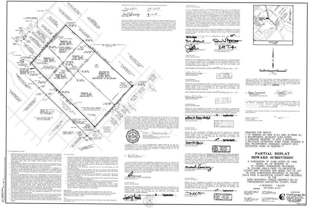
2 Staff Memo for ZBA August 21, 2018 Re: 1765 S. Friendswood Drive page 2 (2) Multi-tenant monument sign. Where two or more tenants make up a business establishment they shall collectively be entitled to one monument sign that would be authorized for said business establishment. The total sign area shall not exceed 50 square feet plus ten square feet for each tenant in the complex up to a maximum of 100 square feet. The highest part of any such sign or structure shall not be greater than seven feet above the highest finished grade at the front property line. It shall be the responsibility of the property owner to allocate such sign area to each tenant. A master sign plan drawn to a standard architectural or engineering scale shall be submitted to community development for this type project showing the exact size and location of each sign for this project. The subject property is zoned Community Shopping Center (CSC) and ffice Park District (PD) and is abutted by zoning districts of the same. The change in zoning districts bisects the proposed development. Friendswood GIS Zoning Map The subject property located at 1765 S. Friendswood Drive was platted as Reserve E of the Howard Subdivision Replat in Definitions from Zoning rdinance: Business Establishments. A project or undertaking that involves the use of one lot with buildings or structures, permanent or temporary, for the primary purpose of conducting on said lot a commercial enterprise, or other nonresidential use, in compliance with all ordinances and regulations of the city. Multiple services and/or goods offered by a business establishment shall be considered one business establishment for the purposes of this appendix. Monument Sign. A sign not more than seven feet in height from natural ground level to the highest portion of the sign, designed and constructed to substantially appear as a solid mass, such as a block, rectangle, or square, and supported by an integral structural framework. Attachments: Maps: Location, Aerial, and Zoning Map
3 Staff Memo for ZBA August 21, 2018 Re: 1765 S. Friendswood Drive page 3 ZBA Application Denied plan Howard Subdivision Replat Copy of the property owner notice that was mailed to owners within 200 feet of the subject property
4 CSC 104 E PARKWD AVE PD CSC , CHURCH SFR CSC 1715 MFR-L SFR 1706 E WINDING WAY , CHURCH FREST (PVT) 309 CVE (PVT) S FRIENDSWD DR PD CSC CSC SFR CSC , CHURCH LN (PVT) LN (PVT) SFR S FRIENDSWD DR 100 EAGLES CV LEISURE LN TALN DR HUNT DR SFRStreets PUD Creeks City Limits Counties Legend Special Uses 1908 Disclaimer: This product is for informational purposes and may not have been prepared for or be suitable for legal, engineering, or surveying purposes. It does not represent an on-the-ground survey and represents only the approximate relative location of property boundaries. Gov. C The user is encouraged to independently verify all information contained in this product. The City of Friendswood makes no representation or warranty as to the accuracy of this product or to its fitness for a particular purpose. The user: (1) accepts the product AS IS, WITH ALL FAULTS; (2) assumes all responsibility for the use thereof; and (3) releases the City of Friendswood from any damage, loss, or liability arising from such use. City of Friendswood 910 South Friendswood Drive Friendswood, Texas (281) Friendswood GIS Mapping I 1 " = 237 '
5 211 AV E AY W PA R NG DI E IN W Subject Tract: includes 1765 S Friendswood Dr 1729 D 1771 LN SW 1803 RE D D IS U IE N R 1802 T) (P V LN HU N TE 101 (P V 10 LN RS FR TE ND IE S CV D DR N 1809 DR SW 213 LE TA L S HU N HU F N TE R (P ES RS VT T ) EA G T) 1705 H C UN V E TE R (P S VT ) DR RS 1709 T HU N LE FR 303 E KW D S Legend Streets Creeks 2001 City Limits Counties Disclaimer: This product is for informational purposes and may not have been prepared for or be suitable for legal, engineering, or surveying purposes. It does not represent an on-the-ground survey and represents only the approximate relative location of property boundaries. Gov. C The user is encouraged to independently verify all information contained in this product. The City of Friendswood makes no representation or warranty as to the accuracy of this product or to its fitness for a particular purpose. The user: (1) accepts the product AS IS, WITH ALL FAULTS; (2) assumes all responsibility for the use thereof; and (3) releases the City of Friendswood from any damage, loss, or liability arising from such use. City of Friendswood 910 South Friendswood Drive Friendswood, Texas (281) Friendswood GIS Mapping 1 " = 237 ' I
 S FRIENDSWD DR EAGLES CV TALN DR HUNT DR AK DR CVE (PVT) TRL (PVT) BEND (PVT) FREST (PVT) LN (PVT) LAKESIDE LN WDSTREAM CIR LAKEVIEW CIR EAGLE LAKES")
6 FREST PINES CT SILVERSTNE DR PINE RIDGE CT (PVT) S FRIENDSWD DR E WINDING WAY E PARKWD AVE PINE CREEK DR (PVT) PARKWD VILLAGE DR (PVT) N CLEAR CREEK DR S CLEAR CREEK DR LEISURE LN E WINDING WAY CANDLELIGHT CT FIELDCREEK DR W PARKWD AVE LN (PVT) S FRIENDSWD DR EAGLES CV TALN DR HUNT DR AK DR CVE (PVT) TRL (PVT) BEND (PVT) FREST (PVT) LN (PVT) LAKESIDE LN WDSTREAM CIR LAKEVIEW CIR EAGLE LAKES DR FALCN LAKE CIR S FRIENDSWD DR Legend Streets Lot Lines Creeks City Limits Counties AK DR Disclaimer: This product is for informational purposes and may not have been prepared for or be suitable for legal, engineering, or surveying purposes. It does not represent an on-the-ground survey and represents only the approximate relative location of property boundaries. Gov. C The user is encouraged to independently verify all information contained in this product. The City of Friendswood makes no representation or warranty as to the accuracy of this product or to its fitness for a particular purpose. The user: (1) accepts the product AS IS, WITH ALL FAULTS; (2) assumes all responsibility for the use thereof; and (3) releases the City of Friendswood from any damage, loss, or liability arising from such use. City of Friendswood 910 South Friendswood Drive Friendswood, Texas (281) Friendswood GIS Mapping I 1 " = 475 '
7
8
9

10 City of Friendswood Community Development Department 910 S. Friendswood Drive Friendswood, Texas August 16, 2018 T WHM IT MAY CNCERN: In accordance with State and Local Zoning Law, all owners of land within two hundred feet of any property being considered for an appeal, variance, or a special exception must be afforded an opportunity to address the subject at a public meeting held for this purpose. You are hereby notified that the Friendswood Zoning Board of Adjustment will hold a Public Hearing to consider a request for a variance that may be of interest to you. PRPERTY WNER: LCATIN F PRPERTY: Leisure Lane LLC 1765 S. Friendswood Drive Block 1, Reserve E, Howard Subdivision Partial Replat, Friendswood, Texas, Galveston County REQUEST: To exceed 3-feet above the maximum allowable sign height of 7- feet - being a variance from Section 22.c.(1) of Appendix A, the Sign rdinance. The Public Hearing will be held at Friendswood City Hall, Council Chambers, 910 S. Friendswood Drive Friendswood, Texas PUBLIC HEARING DATE: August 28, 2018 PUBLIC HEARING TIME: 7:00 PM Documentation will be available online 72 hours prior to the meeting. Government Information > Meeting Agendas & Minutes Documents are currently available for viewing at City Hall in the Community Development Department - 2 nd Floor, 910 S. Friendswood Dr., Friendswood, Texas Staff contact: Becky Summers, Development Coordinator or bsummers@friendswood.com BUILDING PERMITS & INSPECTINS ~ CDE ENFRCEMENT ~ PLANNING & ZNING Main Number: (281)
Rezoning Report October 2018
 Zone Change Request 3099 W. Parkwood Ave. Request to change from Light Industrial (LI) to Light Industrial / Specific Use Permit (LI/SUP) to allow NAICS Use #7139 Other Amusement and Recreation Industries
City of Ferndale CITY COUNCIL STAFF REPORT
 SUBJECT: Final Plat Approval DATE: January 19, 2016 FROM: Haylie Miller, Assistant Planner PRESENTATION BY: Haylie Miller City of Ferndale CITY COUNCIL STAFF REPORT MEETING DATE: January 19, 2016 AGENDA
July 18, 2017 Planning & Zoning Meeting 6:30 p.m.
 July 18, 2017 Planning & Zoning Meeting 6:30 p.m. Date: July 18, 2017 PLANNING AND ZONING MEETING ATTENDANCE LIST Commissioners Position Present Absent R.G. Reeder Bill Bonham Greg Smith Leslie Boudwin
C i t y o f C o r a l G a b l e s P l a n n i n g a n d Z o n i n g S t a f f R e p o r t
 C i t y o f C o r a l G a b l e s P l a n n i n g a n d Z o n i n g S t a f f R e p o r t Applicant: Application: Property: Mario Garcia-Serra Variance 944 Lugo Avenue BA-17-09-1073 Legal Description:
ZONING BOARD OF ADJUSTMENTS (ZBOA) MEETING AGENDA
 MEETING AGENDA") ZONING BOARD OF ADJUSTMENTS (ZBOA) MEETING AGENDA Notice is hereby given of a Regular Meeting of the La Porte Zoning Board of Adjustments to be held on Thursday, April 27, 2017 at 6:00 p.m. at City Hall
ZONING BOARD OF ADJUSTMENTS (ZBOA) MEETING AGENDA Notice is hereby given of a Regular Meeting of the La Porte Zoning Board of Adjustments to be held on Thursday, April 27, 2017 at 6:00 p.m. at City Hall
Ridgefield Crossing. New Commercial Development. Site FOR SALE, GROUND LEASE, OR BUILT-TO-SUIT S. 65TH AVE AND PIONEER STREET RIDGEFIELD,WA 98642
 FOR SALE, GROUND LEASE, OR UILT-TO-SUIT N 65th Ave N 10th St Pioneer St Site S 5th St S 6th Way New Commercial Development Location: Pioneer Street at I-5 Ridgefield Junction Exit 14 Size: Approx 13.2
City of Fayetteville, Arkansas Page 1 of 1
 City of Fayetteville, Arkansas 113 West Mountain Street Fayetteville, AR 72701 (479) 575-8323 Legislation Text File #: 2018-0399, Version: 1 VAC 18-6148 (1901 S. HARDING PL./THOMPSON): AN ORDINANCE TO
ARLINGTON COUNTY, VIRGINIA. County Board Agenda Item Meeting of May 14, 2016
 ARLINGTON COUNTY, VIRGINIA County Board Agenda Item Meeting of May 14, 2016 DATE: May 6, 2016 SUBJECT: Deed of Lease between NOBE I, LLC and SHCII, LLC, both Virginia limited liability companies, as landlord,
NORTH TARRANT PARKWAY NEW 12,617 SF EMERGENCY ROOM + 11,054 SF MOB SHELL SPACE FOR SALE OR LEASE MEDICAL RETAIL BUILDING
 NEW 12,617 SF EMERGENCY ROOM + 11,054 SF MOB SHELL SPACE FOR SALE OR LEASE MEDICAL RETAIL BUILDING PROPERTY INFORMATION: Free Standing, Single-story 23,671 SF Class A Medical Facility Spaces Available:
TO: Glynn County Islands Planning Commission. Karl W. Bursa, AICP, Planner II. PP3105 Stillwater Phase III. DATE: November 10, 2015
 COMMUNITY DEVELOPMENT DEPARTMENT Planning and Zoning Division 1725 Reynolds Street, Suite 200, Brunswick, GA 31520 Phone: 912-554-7428/Fax: 1-888-252-3726 TO: Glynn County Islands Planning Commission FROM:
City Council Agenda Item #13_ Meeting of October 10, 2016
 City Council Agenda Item #13_ Meeting of October 10, 2016 Brief Description Recommendation Resolution approving vacation of existing drainage and utility easements located at 4301 Highview Place and an
University Park Plaza
 Office Space For Lease Property Highlights Great visibility & exposure to high traffic counts on University Drive Move-in ready for doctor s office or professional office user Rare opportunity for a Class
OWNERS ACKNOWLEDGMENT
 OWNERS ACKNOWLEDGMENT STATE OF TEXAS COUNTY OF GALVESTON/HARRIS I (or we), (name of owner or owners) acting by and through (name and title of officer) being officers of (name of company or corporation),
LARAMIE COUNTY PLANNING & DEVELOPMENT DEPARTMENT
 LARAMIE COUNTY ANNING & DEVELOPMENT DEPARTMENT Planning Building MEMORANDUM TO: FROM: Laramie County Board of Commissioners Seth Frentheway, Associate Planner DATE: June 19 th, 2018 TITLE: Review and action
RESOLUTION NO. ZR
 RESOLUTION NO. ZR-2013-034 RESOLUTION APPROVING ZONING APPLICATION ZV-2013-02127 CONTROL NO. 1985-00007 TYPE II VARIANCE (STAND ALONE) APPLICATION OF BW-PC, LLC BY Urban Design Kilday Studios, BW-INV-
CITY OF WAUPACA CITY PLAN COMMISSION MEETING WEDNESDAY, FEBRUARY 8, :15 P.M. COUNCIL CHAMBERS, CITY HALL AGENDA: 1.
 CITY OF WAUPACA CITY PLAN COMMISSION MEETING WEDNESDAY, FEBRUARY 8, 207 5:5 P.M. COUNCIL CHAMBERS, CITY HALL CITY OF WAUPACA MISSION STATEMENT: The city of Waupaca s mission is to lead creatively, plan
TO: Glynn County Mainland Planning Commission. Eric Lee Johnson, Planning Division Manager. PP2944 McKenzie Gardens. DATE: November 20, 2014
 MEMO COMMUNITY DEVELOPMENT DEPARTMENT Planning and Zoning Division 1725 Reynolds Street, Suite 200, Brunswick, GA 31520 Phone: 912-554-7428/Fax: 1-888-252-3726 TO: Glynn County Mainland Planning Commission
TO: Glynn County Islands Planning Commission. Eric Landon, Planner II. PP2754 Stones Throw Cottages. DATE: February 6, 2014
 COMMUNITY DEVELOPMENT DEPARTMENT Planning and Zoning Division 1725 Reynolds Street, Suite 200, Brunswick, GA 31520 Phone: 912-554-7428/Fax: 1-888-252-3726 TO: Glynn County Islands Planning Commission FROM:
City Council Agenda Memo
 City Council Agenda Memo TO: FROM: Robert Hanna, City Manager Jon James, AICP Director of Planning and Development Services City Council Meeting Date: 6/11/2015 SUBJECT: Final reading and public hearing
STAFF REPORT FOR THE CITY OF GOOSE CREEK ZONING BOARD OF APPEALS
 ` STAFF REPORT FOR THE CITY OF GOOSE CREEK ZONING BOARD OF APPEALS For reference, the City of Goose Creek Code of Ordinances are available online at https://www.cityofgoosecreek.com/government/code ordinances
AGENDA PLANNING AND ZONING BOARD CITY OF DEERFIELD BEACH, FLORIDA May 2, 2013
 AGENDA PLANNING AND ZONING BOARD CITY OF DEERFIELD BEACH, FLORIDA May 2, 2013 The following is the agenda of a regular meeting of the Planning and Zoning Board of the City of Deerfield Beach, a municipal
F O R L EA S E : W ES T C H E ST E R, PA +/- 4,000 SF W AREHOUSE & O FFICE (R EAR )
") F O R L EA S E : W ES T C H E ST E R, PA +/- 4,000 SF W AREHOUSE & O FFICE (R EAR ) +/- 4,000 SF Warehouse 1 2 2 0 A ME R I C A N B LV D., W E S T C H E S T E R, PA 1 9 3 8 0 P i l l a r R e a l E s ta
F O R L EA S E : W ES T C H E ST E R, PA +/- 4,000 SF W AREHOUSE & O FFICE (R EAR ) +/- 4,000 SF Warehouse 1 2 2 0 A ME R I C A N B LV D., W E S T C H E S T E R, PA 1 9 3 8 0 P i l l a r R e a l E s ta
City of Coral Gables Planning and Zoning Staff Report
 City of Coral Gables Planning and Zoning Staff Report Property: Applicant: Application: Public Hearing: Date & Time: Location: 625 Almeria Avenue Global Rental E&P, LLC Subdivision Review for a Tentative
PLANNING COMMISSION ANNEXATION, COMPREHENSIVE PLAN MAP AMENDMENT, AND ZONING MAP AMENDMENT CASE SUMMARY
 Subject Property: Applicant: PLANNING COMMISSION ANNEXATION, COMPREHENSIVE PLAN MAP AMENDMENT, AND ZONING MAP AMENDMENT CASE SUMMARY 385 SPEARS CREEK CHURCH ROAD ANNEX, ASSIGN LAND USE CLASSIFICATION UEMF
Conceptual Review Agenda
 Conceptual Review Agenda Schedule for 06/18/12 to 06/18/12 281 Conference Room A Monday, June 18, 2012 Time Project Name Applicant Info Project Description Planner 10:15 McClelland's Creek Filing 3 - Replat
Preliminary Plat/Final Plat Application
 Melissa Municipal Center 3411 Barker Avenue Melissa, Texas 75454 Phone: (972) 838-2036 Applicant: Date: Address: Phone: Contact: Fax: E-mail: Propose Addition Name: Acres: Existing Zoning: Propose Zoning:
Innsbruck Val Moritz AFP of Lot 46, Lot 47, & Amended Lot 48 Block 17 Amended Final Plat Adjustment of Interior Lot Lines
 Innsbruck Val Moritz AFP of Lot 46, Lot 47, & Amended Lot 48 Block 17 Amended Final Plat Adjustment of Interior Lot Lines APPLICATION: AMENDED FINAL PLAT HEARING DATES: Planning Commission: 8 November
City Council Agenda Memo. David A. Vela, Interim City Manager Jon James, AICP Director of Planning and Development Services
 City Council Agenda Memo TO: FROM: David A. Vela, Interim City Manager Jon James, AICP Director of Planning and Development Services City Council Meeting Date: 3/26/2015 SUBJECT: First reading on an ordinance
City Council Agenda Memo
 City Council Agenda Memo TO: FROM: Larry D. Gilley, City Manager Jon James, AICP Director of Planning and Development Services City Council Meeting Date: 10/7/2013 SUBJECT: Final reading and public hearing
 OnPoint Search Result http://gis1.hallcounty.org/public/webpages/map/mapviewer.aspx Map Tools Search Base Map Zoning Utilities Fire Services Law Enf Elections Pictometry Parcel / Owner Search Address Search
CITY OF DECATUR, TEXAS
 CITY OF DECATUR, TEXAS AGENDA CITY COUNCIL MEETING Monday, January 14, 2018 REGULAR MEETING 6:00 p.m. CALL TO ORDER MOMENT OF SILENCE PLEDGE OF ALLEGIANCE Planning and Zoning Report: 1. CONSIDER TAKING
REQUEST FOR PLANNING COMMISSION ACTION
 REQUEST FOR PLANNING COMMISSION ACTION DATE: 9/3/2008 ITEM NO: 5c Department Approval: Agenda Section: PUBLIC HEARINGS Item Description: Request by Cent Ventures II (in cooperation with Joel McCarty property
City of Ferndale CITY COUNCIL STAFF REPORT
 SUBJECT: Final Plat Approval DATE: February 6, 2017 FROM: Haylie Miller, Associate Planner PRESENTATION BY: Haylie Miller City of Ferndale CITY COUNCIL STAFF REPORT MEETING DATE: FEBRUARY 6, 2016 AGENDA
MAJOR RESIDENTIAL AND NONRESIDENTIAL SUBDIVISIONS
 MAJOR RESIDENTIAL AND NONRESIDENTIAL SUBDIVISIONS Final Plats The applicant shall schedule a Pre-Application meeting with Planning Staff at least seven (7) working days prior to submittal of the application.
COMMERCIAL PROPERTY SALMON CREEK WA 900 NE 155TH CIR, VANCOUVER, WA OFFICE BUILDING FOR SALE. D M
 COMMERCIAL PROPERTY SALMON CREEK WA BECKY POTTER, CCIM D. 360.816.9218 M. 360.241.8829 bpotter@bhhsnw.com TABLE OF CONTENTS 1. PROPERTY INFORMATION 3 Executive Summary Property Details 2. LOCATION INFORMATION
Conceptual Review Agenda
 Conceptual Review Agenda Schedule for 03/19/18 to 03/19/18 281 Conference Room A Monday, March 19, 2018 Time Project Name Applicant Info Project Description Planner 9:30 Purpose Brewing CDR180013 Zach
MAP CHECKLIST (Rev 02/13)
") Note: [ ] 1 is Gov. Code, [ ] 2 is BP Code, [ ] 3 is S.M.Co. Ord. MAP CHECKLIST (Rev 02/13) COUNTY OF SAN MATEO TRACT NO. INITIAL SUBMISSION Final Map Conditional Approval Letter and Approved Tentative
Note: [ ] 1 is Gov. Code, [ ] 2 is BP Code, [ ] 3 is S.M.Co. Ord. MAP CHECKLIST (Rev 02/13) COUNTY OF SAN MATEO TRACT NO. INITIAL SUBMISSION Final Map Conditional Approval Letter and Approved Tentative
- AUCTION. By Order of Executor To Settle Estate Saturday April 21 st at 11am Held at the Home Maywood Lane Chattanooga, TN 37416
 - AUCTION By Order of Executor To Settle Estate Saturday April 21 st at 11am Held at the Home 4618 Maywood Lane Chattanooga, TN 37416 Table of Contents Property Description... 1 Open House Schedule...
AGENDA ZONING BOARD OF ADJUSTMENT August 10, :00 pm BURLESON CITY HALL 141 W. RENFRO BURLESON, TX 76028
 AGENDA ZONING BOARD OF ADJUSTMENT August 10, 2017 6:00 pm BURLESON CITY HALL 141 W. RENFRO BURLESON, TX 76028 Call to Order - 6:00 pm 1. Approve the minutes from the July 20, 2016 meeting. 2. Public hearing
For Sale or Ground Lease Prime Restaurant or Retail. Cresson, Texas
 9321 E. Hwy 377 Cresson, TX 76035 For Sale or Ground Lease Prime Restaurant or Retail. Cresson, Texas 20 15 10 9321 E Hwy 377 Great location for restaurant or retail Great visibility on Hwy 377 Traffic
RESIDENTIAL BUILDING PERMIT REQUIREMENTS
 CITY OF BLANCHARD 122 N. MAIN BLANCHARD, OKLAHOMA 73010 (405) 485-9392 RESIDENTIAL BUILDING PERMIT REQUIREMENTS Building permits are required fr all prperty imprvements including additins t existing structures.
Please visit our website to view maps and photographs of this tract and all of our active listings
 K INGWOOD FORESTRY SERVICES, INC. LAND FOR SALE LISTING #4486 JERSEY TRACT 223 GIS acres, more or less, Bradley & Calhoun Counties, AR Over One-Half-Mile Frontage on Highway 160 2013 Well-Stocked Pine
Conceptual Review Agenda
 Conceptual Review Agenda Schedule for 06/14/18 to 06/14/18 281 Conference Room A Thursday, June 14, 2018 Time Project Name Applicant Info Project Description Planner 9:30 Sunshine House CDR180038 Bo Brown
PARCEL MAP CHECKLIST
 PARCEL MAP NO. Note: [ ] 1 is Gov. Code, [ ] 2 is BP Code, [ ] 3 is S.M.Co. Ord. PARCEL MAP CHECKLIST COUNTY OF SAN MATEO (Rev. 04/10) INITIAL SUBMISSION - PARCEL MAP Conditional Approval Letter and Approved
CITY OF PAPILLION PLANNING COMMISSION STAFF REPORT MAY 31, 2017 AGENDA SHADOW LAKE 2 FINAL PLAT FP
 I. GENERAL INFORMATION CITY OF PAPILLION PLANNING COMMISSION STAFF REPORT MAY 31, 2017 AGENDA SHADOW LAKE 2 FINAL PLAT FP-17-0006 A. APPLICANT: Shadow Lake 2, LLC 15950 West Dodge Road, Suite 300 Omaha,
NJ PROPERTY FAX. Western NJFlood Technologies Group LLC
 NJ PROPERTY FAX Courtesy of: Andrew Despina Yesaitis Baczynskyj Western NJFlood Technologies Group LLC 908-725-1143 973-812-6680 andy@wtgroupllc.com pmcclellan@mcbea.com Property 12 Yale Way Oakland Borough,
INDUSTRIAL PROPERTY SALE - OFFERING MEMORANDUM. 106 EXECUTIVE DRIVE Sterling, VA 20166
 INDUSTRIAL PROPERTY SALE - OFFERING MEMORANDUM 106 EXECUTIVE DRIVE Sterling, VA 20166 TABLE OF CONTENTS 01 EXECUTIVE SUMMARY :: The Offering :: Recent Improvements :: Location Highlights :: Site Highlights
PARISH OF ASCENSION OFFICE OF PLANNING AND DEVELOPMENT PLANNING DEPARTMENT. Planning Commission
 1. Call to Order 2. Roll Call of Members 3. Pledge of Allegiance 4. Introduction of Staff 5. Chairman's Comments 6. General Business 7. Minutes (A) 8. Consent Agenda PARISH OF ASCENSION OFFICE OF PLANNING
 Commissioner O Neal introduced the following Amendment concerning the Surry County Subdivision Ordinance, and moved the adoption of the Amendment. The motion was seconded by Commissioner Johnson, the following
DEER CREEK ESTATES DEVELOPMENT SITE
 DEER CREEK ESTATES DEVELOPMENT SITE For more information contact: 1-815-741-2226 mgoodwin@bigfarms.com Goodwin & Associates Real Estate, LLC is an AGENT of the SELLERS. County: Will Township: Wilmington
City of Rockwall SF-7 PD-59. Feet Z Renfro St. REPLAT - LOCATION MAP = ALUMINUM PLANT H AR T MA
 20 40 80 120 Feet 160 Z2016-007- 303 Renfro St. REPLAT - LOCATION MAP = HA MM AC K ALUMINUM PLANT SF-7 H AR T MA N RENFRO 0 PD-59 City of Rockwall Planning & Zoning Department 385 S. Goliad Street Rockwall,
Conceptual Review Agenda
 Conceptual Review Agenda Schedule for 11/13/17 to 11/13/17 281 Conference Room A Monday, November 13, 2017 Time Project Name Applicant Info Project Description Planner 9:30 Voice of Truth Tabernacle CDR170069
City Council Agenda Memo
 City Council Agenda Memo TO: FROM: Larry D. Gilley, City Manager Jon James, AICP Director of Planning and Development Services City Council Meeting Date: 9/12/2013 SUBJECT: Final reading and public hearing
REPORT TO THE SHASTA COUNTY PLANNING COMMISSION
 REPORT TO THE SHASTA COUNTY PLANNING COMMISSION PROJECT IDENTIFICATION: REGULAR AGENDA GENERAL PLAN AMENDMENT GPA18-0003 AND ZONE AMENDMENT ZA18-0004 AREA 3 - SOUTHWEST PALO CEDRO: GILBERT DRIVE CONTINUED
Louisiana Place. For Lease GREAT UPTOWN RATE! UPTOWN OFFICE BUILDING. Lease Rate:
 GREAT UPTOWN RATE! SEQ I-40 & Louisiana Blvd NE For Lease Lease Rate First Floor Suite 110: Lease Rate: Suite 130: Lease Rate: Second Floor Suite 220: Lease Rate: Third Floor ±3,933 SF $1725/SF ±3,011
Presents: 400 ELM. EXCLUSIVELY OFFERED AT JUST $119,999! REDEVELOPMENT OPPORTUNITY Owner willing to consider all reasonable offers
 Presents: 400 ELM 400 ELM HOLLY, MICHIGAN 1 UNIT INDUSTRIAL -54,932 SQ FT VALUE ADD OR REDEVELOPMENT OPPORTUNITY Located in High Demand Industrial Market of Metro Detroit Between US-23 & I-75 Easy Access
OFFICE FOR LEASE MILL ST. presented by: IAN COCHRAN, CCIM Vice President
 OFFICE FOR LEASE presented by: IAN COCHRAN, CCIM Vice President 775.225.0826 icochran@logiccre.com GREG RUZZINE, CCIM Vice President 775.450.5779 gruzzine@logiccre.com AMANDA LAVI Associate 281.300.2722
3 PLUS ACRE PLAINFIELD COMMERCIAL SITE
 3 PLUS ACRE PLAINFIELD COMMERCIAL SITE For more information contact: 1-815-741-2226 mgoodwin@bigfarms.com County: Kendall Township: Na-Au-Say Gross Land Area: 3.64 Total Acres Property Type: Vacant farmland
DEVIL S CANYON TRACT
 P.O. Box 65 No. 4 Executive Circle Arkadelphia, AR 71923 (870)246-5757 FAX 1-870-246-3341 E-mail: arkadelphia@kingwoodforestry.com Other Kingwood Locations: P.O. Box 1290 145 Greenfield Drive Monticello,
AUCTION! 140 +/- Acres Meigs County, TN
 AUCTION! 140 +/- Acres Retired Owner Selling for Health Reasons Property Sells Divided or as a Whole Saturday, October 15th at 11:00 A.M. Sale Site: on Location at the Property 168 Benson Ln - Decatur,
LARAMIE COUNTY PLANNING & DEVELOPMENT DEPARTMENT
 LARAMIE COUNTY PLANNING & DEVELOPMENT DEPARTMENT Planning Building MEMORANDUM TO: FROM: Laramie County Board of Commissioners Brad Emmons, Planning Director DATE: May 15, 2018 TITLE: Review and action
Conceptual Review Agenda
 Conceptual Review Agenda Schedule for 12/13/18 281 Conference Room A Thursday, December 13, 2018 Time Project Name Applicant Info Project Description 9:30 1909 Harmony Dr CDR180091 Christopher Martin 970-388-6690
BOARD OF ZONING APPEALS CASE SUMMARY FOR VARIANCE REQUEST. 707 Catawba Street
 BOARD OF ZONING APPEALS CASE SUMMARY FOR VARIANCE REQUEST 707 Catawba Street November 8, 2016 at 10:00 A.M. City Council Chambers, 1737 Main Street, 3 rd Floor Columbia, South Carolina Case Number: 16-065-V
13599 NE 224th St, Okeechobee, FL ,226 +/- Acres. Okeechobee Ranch and Farm REALTY MASTERS
 13599 NE 224th St, Okeechobee, FL 34972 2,226 +/- Acres Okeechobee Ranch and Farm OKEECHOBEE RANCH AND FARM The Okeechobee Ranch & Farm is a 2,226- acre tree-farm/ranch in Okeechobee County, Florida. This
APB Mission Statement:
 APB Missin Statement: T frever preserve the beautiful farmland and prductive sils f Lancaster Cunty and its rich agricultural heritage; and t create a healthy envirnment fr the lng-term sustainability
City of Kingston Report to Planning Committee Report Number PC
 City of Kingston Report to Planning Committee Report Number PC-16-045 To: Chair and Members of Planning Committee From: Lanie Hurdle, Commissioner, Community Services Resource Staff: Paige Agnew, Director,
City of Coral Gables Planning and Zoning Staff Report
 Applicant: Application: City of Coral Gables Planning and Zoning Staff Report Biltmore Parc Homes, LLC Subdivision Review for a Tentative Plat Property: Biltmore Parc Homes (760 Valencia Ave.; 2605, 2611,
Planning. the propertyy. Texas Local. Government. Code. size of 2,0000 RSF-2-PUD. Road within the Wharf at a. Citizen. 0 Letter of. 1.
 Planning & Zoning Commissionn Replat Phase I of the Wharf at Clear Lake, Dock 18, Slips 1 and 2 Planning & Development Department February 15, 20166 Request Replat approximately 0.0209 acres of a previouslyy
LONGHORN LANE 4-PLEX
 4-Unit Multi-Family Investment 12285 SW Longhorn Lane, Beaverton, Oregon 97008 MULTI-FAMILY INVESTMENT PROPERTY ANALYSIS 136 NE 28 th Avenue Portland, Oregon 97232 503-327-8237 Office 503-954-3087 Fax
AGENDA FOR MEETING OF THE DEVELOPMENT REVIEW COMMITTEE. 4 Pages February 23, 2012
 AGENDA FOR MEETING OF THE DEVELOPMENT REVIEW COMMITTEE 4 Pages February 23, 2012 DEVELOPMENT CENTER - CONFERENCE ROOM - THE GRAND 206 W. Church Street, Grand Prairie, Texas - 9:30 a.m. I. NEW PLAT APPLICATIONS
SKETCH OF BOUNDARY SURVEY ALTA / ACSM LAND TITLE SURVEY
 SKETCH OF BOUNDARY SURVEY ALTA / ACSM LAND TITLE SURVEY SURVEYOR'S NOTES: All distances as shown hereon are based on the US Survey foot. Subject property lies inside the UBD (Urban Development Boundary),
DLH LOGISTICS, LLC INDUSTRIAL DEVELOPMENT OPPORTUNITY DLH PARCELS # 71-1, 71-2 & 71-3 NW/CORNER LANCASTER-HUTCHINS ROAD & PLEASANT RUN ROAD
 DLH LOGISTICS, LLC INDUSTRIAL DEVELOPMENT OPPORTUNITY DLH PARCELS # 71-1, 71-2 & 71-3 NW/CORNER LANCASTER-HUTCHINS ROAD & PLEASANT RUN ROAD +/- 62.43 ACRES LANCASTER, TEXAS Daniel J. McAuliffe, CCIM 1700
9010 Justin Road Rufe Snow Commercial 407 S Pate Orr Rd Keller, Tarrant County, Texas 76248
 KW Commercial - DFW 850 E State Hwy 114, Suite 100 Southlake, Texas 76092 e 9010 Justin Road Rufe Snow Commercial Rd 46,560 sqft (1.07 ac) For Sale Land Commercial Development Exclusively Presented By
Regular Session. Public Wishing to Address the Board. Consent Agenda
 Notice of Meeting for the Planning and Zoning Commission of the City of Georgetown May 20, 2014 at 6:00 PM at City Council Chambers, 101 East 7th Street, Georgetown, TX The City of Georgetown is committed
NOTICE OF A REGULAR MEETING OF THE ENID-GARFIELD COUNTY METROPOLITAN AREA PLANNING COMMISSION
 NOTICE OF A REGULAR MEETING OF THE ENID-GARFIELD COUNTY METROPOLITAN AREA PLANNING COMMISSION Notice is hereby given that the Enid-Garfield County Metropolitan Area Planning Commission will meet in regular
NOTICE OF PUBLIC HEARING
 PUBLIC NOTICE is hereby given to all interested persons that a hearing will be held with the City of Naperville Planning and Zoning Commission, 400 S. Eagle Street, Naperville, Illinois, 60540, to consider
ROYAL VIEW DEVELOPMENT
 GRETNA BUILDING FOR LEASE ROYAL VIEW DEVELOPMENT PROPOSED RENDERING AVAILABLE FOR LEASE + + LEASE RATE AND AVAILABILITY MINIMUM SPACE: MAXIMUM SPACE: LEASE RATE: 1,162 SF 14,675 SF + + Retail building
9.31 ACRES OF COMMERCIAL LAND - PERRIS, CA
 SALE PRICE: $2,839,000 CN Zoning (Commercial Neighborhood) Zoning 15,000 Average Daily Traffic Count on Nuevo Road Signalized Corner Location Copper Creek Park Intersection and Road Recently Widend and
Retail Space(s) $699.00/mo. For Lease S US Highway 1, Fort Pierce FL
 $699.00/mo. For Lease S US Highway 1, Fort Pierce FL") For Lease $699.00/mo. Disclaimer Statement This information has been prepared only for information purposes to assist a potential buyer in determining whether it wishes to proceed with an indepth investigation
For Lease $699.00/mo. Disclaimer Statement This information has been prepared only for information purposes to assist a potential buyer in determining whether it wishes to proceed with an indepth investigation
APPENDIX C: PLAT SPECIFICATIONS AND CERTIFICATES
 APPENDIX C: PLAT SPECIFICATIONS AND CERTIFICATES A. Drawing. All plats for recording must be submitted on photographically reproducible and dimensionally stable polyester sheets such as Mylar, Cronar or
PLANNING COMMISSION AGENDA PACKET
 City of Litchfield PLANNING COMMISSION AGENDA PACKET Monday, December 11 th, 2017 City of Litchfield Planning Commission AGENDA Monday, December 11, 2017 5:30 P.M. Held in the Council Chambers of City
City Council Agenda Memo
 City Council Agenda Memo TO: FROM: Robert Hanna, City Manager Jon James, AICP Director of Planning and Development Services City Council Meeting Date: 5/28/2015 SUBJECT: First reading on an ordinance for
The County of Bedford, VA Legend
 The County of Bedford, VA Legend E911 Address Highway Blue Ridge Parkway US Primary Virginia Primary Roads Driveway Parcels - County Parcels - Town Public School Boundary Title: Parcels - County Date:
REGULAR PLANNING COMMISSION MEETING FOR OCTOBER 26, 2016, 6:00 PM
 Archuleta County Development Services Department ARCHULETA COUNTY PLANNING COMMISSION AGENDA County Commissioners Meeting Room, 398 Lewis Street Public is welcome and encouraged to attend. REGULAR PLANNING
Dunkin Donuts $1,750,000. For Sale S US Highway 1, Fort Pierce FL
 For Sale $1,750,000 Disclaimer Statement This information has been prepared only for information purposes to assist a potential buyer in determining whether it wishes to proceed with an indepth investigation
I I 1 I I C LE VI I I I I I 1 I I
 C LE V ARTCLE V M NOR R ES 0 E NT A L S U BD V S ON 60. Definition "Minor Residential Subdivision" shall mean a Subdivision of five (5) lots or less for residential purposes not involving any new streets
City of Colleyville Community Development Department. Subdivision Application Packet
 Community Development Department Subdivision Application Packet 1 Development Application Fees 100 Main Street Colleyville TX 76034 817.503.1050 Zoning Zoning Change $ 500 + $5 per acre Planned Unit Development
CITY OF SPOKANE VALLEY Request for Council Review
 CITY F SPKANE VALLEY Request for Council Review Meeting Date: May 8, 2012 Department Director Approval Check all that apply: consent old business new business public hearing information admin. report pending
NJ PROPERTY FAX. Angela lachenmayr Coldwell Banker - Flemington
 NJ PROPERTY FAX Courtesy of: Angela lachenmayr Coldwell Banker - Flemington 908-310-3946 winglover@hotmail.com Property 87 Dreahook Rd Readington Township, NJ 08833-5014 Hunterdon County Block 44 Lot 23
NOTICE OF TIMBERLAND SALE BY SEALED BID IN CLEVELAND COUNTY, AR. Cleveland County CM acres, more or less
 NOTICE OF TIMBERLAND SALE BY SEALED BID IN CLEVELAND COUNTY, AR Cleveland County CM 80 80 acres, more or less BIDS DUE: Thursday, October 11, 2018 Davis DuBose Knight Forestry & Real Estate LLC has been
MINNETONKA PLANNING COMMISSION October 26, Rear yard setback variance for a deck expansion at 5732 Kipling Avenue
 MINNETONKA PLANNING COMMISSION October 26, 2017 Brief Description Rear yard setback variance for a deck expansion at 5732 Kipling Avenue Recommendation Adopt the resolution approving the variance Background
CITY OF DECATUR, TEXAS
 CITY OF DECATUR, TEXAS AGENDA CITY COUNCIL MEETING Monday, October 8, 2018 REGULAR MEETING 6:00 p.m. CALL TO ORDER MOMENT OF SILENCE PLEDGE OF ALLEGIANCE 1. MAYOR WOODRUFF TO PRESENT A PROCLAMATION TO
WEST CHESTER PLAZA CONTACT US RETAIL SPACE FOR LEASE 9145 CINCINNATI COLUMBUS ROAD, WEST CHESTER, OH 45069
 PROPERTY HIGHLIGHTS + + 11,000 sq ft. available + + $8.00 - $10.00 per sq. ft. NNN + + Easy access and parking + + Located at the corner of Cincinnati Columbus Road (SR 42) and Cox Road + + Less than 10
Appendix S I. H. 20 OVERLAY DISTRICT. LAST UPDATE: December 10, 2013 CASE NUMBER: TA ORDINANCE Number
 Appendix S I. H. 20 OVERLAY DISTRICT LAST UPDATE: December 10, 2013 CASE NUMBER: TA131201 ORDINANCE Number 9655 2013 Unified Development Code Grand Prairie, Texas Planning Department S.1 INTRODUCTION The
ZONING BOARD OF APPEALS APPLICATION
 ZONING BOARD OF APPEALS APPLICATION Town of Westbrook ZBA Appeal No. Land Use Department Mulvey Municipal Center, 866 Boston Post Road, Connecticut 06498 (860)-399-3047 Fax (860)-399-2084 ZBA App. Fee
20.52 Acres th St NE Arlington WA 98223
 20.52 Acres 6927 7415 204 th St NE Arlington WA 98223 Various Retail CONTACT INFORATION: Melissa Johnson Director melissaj@kwcommercial.com (425) 765-3568 NEWLY OPENED Condos ARLINGTON DEVELOPMENT SITE
VAR17-03 St. Charles County Board of Zoning Adjustment
 VAR17-03 St. Charles County Board of Zoning Adjustment 79 FARM VIEW LN - VARIANCE REQUEST Application: Owner: Applicant: Variance Requested: Zoning: Area: Location: Council District: 1 Account No.: 676770A000
TRADITION STUDIOS FOR SALE
 TRADITION STUDIOS FOR SALE (FORMER DIGITAL DOMAIN SITE) 10250 SW Village Parkway, Port St. Lucie, FL www.cityofpsl.com/tradition-studio/index.html Contact Information: Robyn Holder, Office of Management
CONTRA COSTA LOCAL AGENCY FORMATION COMMISSION EXECUTIVE OFFICER'S REPORT August 12, 2015 (Agenda)
") CONTRA COSTA LOCAL AGENCY FORMATION COMMISSION EXECUTIVE OFFICER'S REPORT PROPONENTS ACREAGE & LOCATION Laurel Place/Pleasant View Annexation to the City of Concord Curt Blomstrand, Lenox Homes landowner/petitioner
CONTRA COSTA LOCAL AGENCY FORMATION COMMISSION EXECUTIVE OFFICER'S REPORT PROPONENTS ACREAGE & LOCATION Laurel Place/Pleasant View Annexation to the City of Concord Curt Blomstrand, Lenox Homes landowner/petitioner
Kingwood Forestry Services, Inc. has been authorized to manage the sale of the Womble Silver Road
 K I N G WO O D F O R E S T RY S E RV I CE S, I NC. LISTING #4530 LAND FOR SALE Womble Silver Road Tract Mountain Views near Lake Ouachita Adjoins Ouachita National Forest within 15 miles of Hot Springs