99 FIFTH AVENUE TACT. Zoning By-law Amendment Application. and Design Brief ARCHITECTURE
|
|
|
- Maud Eaton
- 6 years ago
- Views:
Transcription


1 99 FIFTH AVENUE TACT ARCHITECTURE November 28, 2017 Planning Rationale and Design Brief Zoning By-law Amendment Application
2 99 FIFTH AVENUE ZONING BY-LAW AMENDMENT PLANNING RATIONALE AND DESIGN BRIEF Prepared for Minto Properties Inc. Prepared by Fotenn Consultants Inc. 223 McLeod Street Ottawa, ON K2P 0Z8 November 2017 FOTENN The information contained in this document produced by Fotenn is solely for the use of the Client identified above for the purpose for which it has been prepared and Fotenn undertakes no duty to or accepts any responsibility to any third party who may rely upon this document. All rights reserved. No section or element of this document may be removed from this document, reproduced, electronically stored or transmitted in any form without the written permission of Fotenn Consultants Inc.
3 CONTENTS 1.0 Introduction Purpose of the Applications Site Context Existing Conditions Surrounding Area Site Photos Site Inventory and Analysis Transit Network Cycling Routes and Multi-Use Pathways Road Network Proposed Development Policy and Regulatory Framework Provincial Policy Statement City of Ottawa Official Plan City of Ottawa Official Plan Amendment No Urban Design Guidelines for Development Along Traditional Mainstreets City of Ottawa Comprehensive Zoning By-law ( ) Proposed Zoning By-law Amendment Proposed Amendments Discussion Design Proposal Site Plan Massing Elevations Transition and Angular Plane Perspective Views Shadow Analysis Conclusions 53
4 1.0 INTRODUCTION 1 Fotenn Consultants has been retained by Minto Properties Inc. to assess the appropriateness of the proposed redevelopment of their property at 99 Fifth Avenue, along Bank Street, between Fourth and Fifth Avenue in the Glebe. The subject property is currently occupied by a two (2) storey retail and commercial development with street-oriented retail, restaurant, and personal service uses on the ground floor and restaurant, office, and medical centre uses above. The existing building is made up of two distinct buildings, connected by a glass atrium. The older of the two buildings abuts the east side of Bank Street and has a depth of approximately 14 metres. A newer two (2) storey building is located further east, abutting Fifth Avenue. On the north side of the subject property is a small surface parking area, and access to the underground parking garage. A one-way lane crosses the back of the subject property, between Fourth and Fifth Avenue. 1.1 Purpose of the Applications The purpose of the Zoning By-law Amendment is to permit the redevelopment and intensification of the subject property with a mixed-use development. The proposal includes 124 dwelling units in a new eight (8) storey building located behind the retained two (2) storey commercial building along Bank Street. The proposed development intensifies the property while providing a sensitive transition to the adjacent residential neighbourhood, preserving the character and scale of the existing context. A Minor Zoning By-law Amendment application is being submitted to facilitate the redevelopment of the subject lands. The subject property is currently zoned Traditional Mainstreet, Exception 93, Maximum Height 15 metres (TM[93] H(15)). The proposed Zoning By-law Amendment seeks to revise special exception 93 to address built form, height, and setbacks. The following specific amendments are anticipated to the zone provisions: To recognize the existing condition on site, by permitting a maximum front yard setback of metres for approximately 7 metres of the frontage whereas the By-law requires a maximum front yard setback of 2 metres; To recognize the existing condition on site, by permitting a minimum corner side yard setback of 0 metres abutting Fourth Avenue for the retained commercial building whereas the By-law requires a setback of 3 metres; To amend the stepback provisions to permit a stepback of 2.0 metres after the fifth storey or 15.8 metres, whereas the By-law requires a stepback after the fourth storey or 15 metres (whichever is lesser); To permit a building height of 26 metres, whereas the By-law permits a building height of 15 metres; To permit an angular plane of 46.6 degrees measured from a height of 15.8 metres and a setback of 7.5 metres, whereas the By-law requires a 45 degree angular plane measured from a height of 15 metres or the top of the fourth storey, whichever is less, and a setback of 7.5 metres; To recognize the existing condition on site by permitting a 0 metre landscaped buffer in the rear yard abutting a residential zone, whereas the By-law requires a 3 metre landscpaed buffer (or 1 metre buffer with a 1.4 metre opaque fence); To require five (5) residential visitor parking spaces for the proposed development, whereas the By-law requires 11 spaces; and, To require six (6) parking spaces for any nonresidential uses on the property, whereas the By-law currently requires 79 spaces. A Site Plan Control application will be forthcoming to determine matters such as landscaped treatment, pedestrian access, and drainage control.
5 2 Figure 1: Proposed Development (looking north from Fifth Avenue)
 with approximately 64 metres of frontage along Bank Street, 54.")
6 2.0 SITE CONTEXT Existing Conditions The subject property is located on the east side of Bank Street, occupying the entire block between Fourth and Fifth Avenue. The subject property has a total area of approximately 0.37 hectares (0.92 acres) with approximately 64 metres of frontage along Bank Street, 54.5 metres of frontage on Fourth Avenue, and 64 metres of frontage on Fifth Avenue. The property is currently occupied by a two (2) storey mixed-use building containing retail, restaurant, personal service, and office uses. As noted in Section 1.0, the oldest part of the existing building abuts Bank Street. The two (2) storey structure is in fact three separate buildings clad in similar red brick and built in phases over time, appearing as a single continuous structure today. The building features a range of smaller retail and commercial spaces on the ground floor with direct access to the street. On the second floor are offices, a restaurant, and personal service uses. BANK STREET THIRD AVENUE FOURTH AVENUE FIFTH AVENUE In 1976, the subject property was vacant aside from the commercial buildings abutting Bank Street, with a large surface parking area in the rear. In or around 1980, the subject property was redeveloped to its current form, adding the two (2) storey commercial building at the rear of the subject property with an underground parking garage below. The two buildings were connected via a covered atrium, accessible from both Fourth and Fifth Avenue. The atrium opens into a larger indoor courtyard in the centre of the property with commercial uses on both floors accessible from within. THORNTON AVENUE HOLMWOOD AVENUE Figure 2: Site Context
7 4 As noted, the 1980 renovation included the addition of an underground parking garage which provides the subject property with approximately 68 parking spaces. The parking garage is currently accessed with a ramp at the north end of the subject property, directly abutting Fourth Avenue. Approximately 15 additional surface parking spaces are provided in a surface parking lot at the north end of the subject property (abutting Fourth Avenue) and as parallel spaces along the rear lane which abuts the east property line. 2.2 Surrounding Area The area surrounding the subject property is characterized by a range of land uses and building forms. Bank Street is a Traditional Mainstreet running through the Glebe neighbourhood of the City and features a series of older, low-profile retail buildings, as well as some redevelopment projects to the south, including Lansdowne Park which is a shopping and entertainment district anchored by a large public park and major urban facility (TD Place). Properties fronting onto Bank Street are generally shallow in depth and/or have limited land areas. Intensification along Bank Street, north of the Rideau Canal has most notably occurred at Lansdowne Park and on properties that have wide frontages along Bank Street, despite their shallow depth. Outside of the subject property, no lands, with the exception of the Lansdowne Park, has a comparable depth. The closest is 900 Bank Street which has a slightly smaller area and shallower depth. This property was the subject of recent development approvals and is located southwest of the subject property. The surrounding uses can be described as follows: North: On the north side of Fourth Avenue, abutting Bank Street, is a continuation of the two (2) storey built form. Along Fourth Avenue, facing the subject property are three (3) storey townhouse units that have been converted into offices and restaurants. Northeast of the subject property are two (2) and three (3) storey detached and semidetached homes, interspersed with multi-unit, lowrise apartment buildings and mixed-use buildings. East: East of the subject property, is a low-rise residential community with two (2) and three (3) storey detached and semi-detached dwellings, interspersed with multi-unit converted houses and new build multi-unit dwellings. Further east is the Rideau Canal and the Queen Elizabeth Driveway. Sylvia Holden Park provides a major neighbourhood park for the community abutting the Rideau Canal and Fifth Avenue. O Connor Avenue, is approximately 297 metres east of the subject property and is a major route into the downtown core. The roadway has been recently upgraded with north-south cycle tracks that provide a connection from Lansdowne Park north to the downtown core. South: To the immediate south of the subject property is a recently reconstructed single-storey retail plaza abutting Bank Street. Previously destroyed by fire, the new building includes a range of smaller restaurant and retail tenants. The one (1) and two (2) storey retail form continues down both sides of Bank Street until Holmwood Avenue where a high-rise retirement home and mixed-use building occupy the southwest and southeast corners respectively. The property at 900 Bank Street (currently occupied by the Beer Store), located just north of Holmwood Avenue, has recently been approved for an eight (8) storey mixed-use redevelopment. West: West of the subject property are one, two and three-storey buildings abutting Bank Street all with retail uses at-grade and residential units above. Further west is a low-rise neighbourhood featuring a mix of detached, semi-detached, and converted dwellings, together with institutional uses (schools, community centre, and churches).


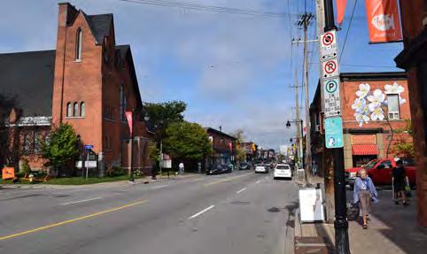
8 3.0 SITE PHOTOS


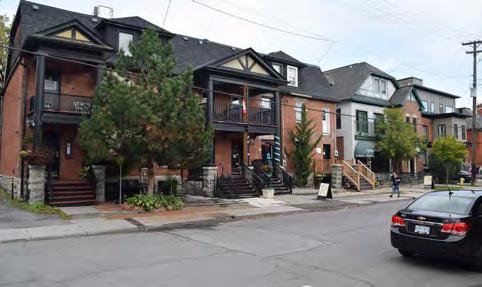
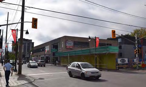

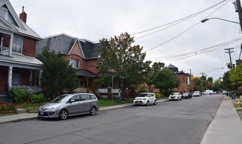
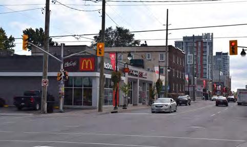
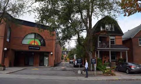
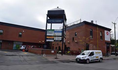
9
10 4.0 SITE INVENTORY AND ANALYSIS Transit Network The subject property is located adjacent to Bank Street - a designated Transit Priority Corridor in the City of Ottawa s Official Plan. Route 7 runs along Bank Street between St. Laurent Shopping Centre and Carleton University. The route has 15 minute headways throughout the day Route 6 also runs along Bank Street between Greenboro Station and Rockcliffe Park. Route 6 also has 15 minute headways throughout the day. Fourth Ave Fifth Ave Bank St O Connor St 7 6 Figure 3: Transit Network
11 8 4.2 Cycling Routes and Multi-Use Pathways The site is located in proximity to existing cycling infrastructure including the new O Connor bike lanes that access from Fifth Avenue and Lansdowne Park into the downtown core. Multiuse pathway connections along the Rideau Canal also provides access to the downtown core, and to Dow s Lake and further path systems to the southwest. Major park space in proximity to the site includes Sylvia Holden Park and Lionel Britton Park at the east end of Fifth Avenue, and Lansdowne Park further south. These outdoor spaces provide a range of amenities including wading pools, play structures, baseball diamonds, basketball courts, skating rinks, a skateboard park and more. Fourth Ave Fifth Ave Bank St O Connor St Construction has also recently begun on the Fifth Avenue pedestrian bridge across the canal, linking Fifth Avenue in the west with Clegg Street in the east. The crossing is scheduled for completion in August Multi-Use Pathway Cycle Lanes Park Future Rideau Canal Crossing Figure 4: Parks, Pathways, and Cycling Routes
12 9 4.3 Road Network Bank Street is designated as an Arterial Road in the City of Ottawa Official Plan while Fifth Avenue is designated as a collector. Arterial roads are intended to carry large volumes of traffic over the longest distance. Collector roads connect communities and distribute traffic between the arterial and local roads. Fourth Ave Fifth Ave Bank St O Connor St Existing Arterial Existing Collector Existing Federally Owned Road Figure 5: Road Network
13 5.0 PROPOSED DEVELOPMENT 10 The subject property represents one of the most significant opportunities for intensification along the Bank Street corridor in the Glebe. The proposed development provides for an intensification of the lands that carefully considers the impacts on both the mainstreet, and the surrounding uses. The subject property plan can be divided into two relatively distinct, though related components. The first, is the retained two (2) storey retained building along the western edge of the property, abutting Bank Street. The second, which occupies the balance of the subject property, consists of an eight (8) storey residential building containing 124 units. Together, the two create a coordinated redevelopment that supports and maintains the existing mainstreet character of Bank Street while achieving the City s objectives for intensification along Mainstreets throughout the City. The retained two (2) storey retail building abuts Bank Street across nearly the entire frontage and includes approximately 16,000 square feet (1,483 square metres) of non-residential space (7,984 square feet (742 square metres) per floor). The ground floor is presently occupied by a range of small, individually articulated groundfloor retail, restaurant and personal service uses characteristic of a Mainstreet, and second-storey restaurant, medical centre, and office space. This building will not be significantly altered through the redevelopment of the lands. The new mid-rise building at the rear of the subject property is proposed as an eight (8) storey Figure 6: Proposed Development (looking northeast from Bank Street)
14 11 building having a U shape and featuring a highly articulated building form. The building provides a 7.5 metre setback from the rear (east) property line and the abutting low-rise residential uses as well as a 3 metre setback along both Fourth and Fifth Avenue to the north and south. The west facade of the new building follows the angle of Bank Street and provides a staggered elevation with varying balcony depths and treatment. Along Fourth Avenue, the north facade of the new building has a 15 metre (five (5) storey) podium abutting the street, before stepping back for floors 6, 7 and 8. The ground floor is articulated with ground-oriented, two (2) storey units accessed directly from the sidewalk and featuring front yard terraces to animate the street. Similarly, the Fifth Avenue frontage has a 15 metre (five (5) storey) podium before stepping back for floors 6, 7 and 8. The existing retail outdoor plaza is retained at the corner of Bank Street and Fifth Avenue and the lobby providing the primary access to the new building is located just east of the intersection. The two (2) storey glass lobby will highlight the entrance to the building while also providing access to the second storey of the retained building. Moving further east along the Fifth Avenue frontage, ground-oriented, two (2) storey units the same as those on the Fourth Avenue side will animate the streetscape. At the far east end B A N K S T R E E T 1 EXISTING PATIO SPACE TO REMAIN 1 EXISTING COMMERCIAL BLDG 7,984 sq ft ±4.51 Lobby 2,566 sq ft OPEN TO ABOVE ±4.52 CACF F O U R T H A V E N U E OUTDOOR AMENITY 1,265 sq ft 2 ST 679 sq ft ST 842 sq ft 2 ST 679 sq ft 2 ST 628 sq ft 2 ST 679 sq ft 2 ST 706 sq ft 2 ST 680 sq ft 2 ST 706 sq ft SINGLE CHUTE WASTE COMPACTOR + TRISORTER GARB. / BIN STORAGE 910 sq ft BIKE STORAGE 992 sq ft sq ft GYM MOVIE ROOM 688 sq ft 304 sq ft AMENITY 2,696 sq ft KITCHEN/ STORAGE/ LOUNGE/DINING ETC. 1,180 sq ft 348 sq ft WC FOR RES /RETAIL WC FOR RES /RETAIL GCA 16,751 sq ft 3A 3B 4 6 F I F T H A V E N U E 2 3 3B BULKY STORAGE JAN. MAIL ROOM/ PARCEL STOR. MOVING 244 sq ft STUDIO 301 sq ft STUDIO 301 sq ft STUDIO 301 sq ft STUDIO 301 sq ft STUDIO 301 sq ft STUDIO 301 sq ft OFFICE 243 sq ft % 7.5% % DN TO P INTAKE 5.20 EXHAUST 8 RV RV RV RV RV 2.18 ONE WAY 7.50 PICK UP / DROP OFF CV CV CV CV CV CV A B C D E F G H I J K L M EXISTING TREE TO REMAIN ESTIMATED SITE AREA: 39,792 sq ft Figure 7: Ground Floor Plan 6.40
15 12 of the building is the access to the redesigned underground parking garage. The rear (east) facade of the building incorporates a significant number of setbacks and stepbacks to get as close as possible to achieving the angular plane as defined by the Traditional Mainstreet zoning. The first 15 metres of building height are generally setback a minimum of 7.5 metres from the rear property line. The ground floor is setback further, to at least 9.68 metres to accommodate at-grade visitor parking and access. Above the fifth storey, the building incorporates a number of stepbacks: At the 6th storey, the building steps back 3.61 metres from the floor below; At the 7th storey, the building steps back an additional 3.0 metres from the floor below; and finally, At the 8th storey, the building steps back an additional 3.0 metres. The east facade of the building also incorporates a greater setback at the centre of the building, creating the afore-mentioned U-shape. The indentation of the building has been aligned to the rear yards of the adjacent low-rise residential uses. All floors of the building incorporate this greater setback providing metres of separation between the rear property line at the ground floor and increasing to metres for all floors above. Pedestrian access to the retained building will be remain from Bank street. An existing outdoor commercial plaza at the northeast corner of the retained building, currently serving Von s Bistro, will be retained as will the patio at the south end of the retained building, currently utilized by Pure Gelato. The main pedestrian access to the new building, and to the second storey of the retained building will be provided via a new lobby located at the southwest corner of the retained building. The two (2) storey lobby will provide an attractive primary entrance for visitors and residents. The proposed development maintains the existing rear lane within the 7.5 metre setback from the adjacent properties, reversing the direction as it exists today and allowing cars to proceed north to south only (i.e. from Fourth Avenue through to Fifth Avenue). Five (5) angled parking spaces have been provided along the west side of this lane for visitors to the residential units, with an additional six (6) parallel spaces along the east side reserved for users of the commercial and retail space. A designated drop-off/lay-by is also provided along this east side. A new, two (2) storey underground parking garage is proposed to serve the new residential building. The parking garage is accessed from Fifth Avenue, and provides 111 additional parking spaces. Together, a total of 122 parking spaces are provided as part of the redevelopment. Several units include balconies and terraces as private outdoor amenity areas. The building as a whole is also served by both indoor and outdoor amenity areas at-grade and on the rooftop. A total of 648 square metres of indoor and outdoor communal amenity area is provided. This includes a common room, kitchen, movie room, and gym as well as outdoor amenity at-grade and on the roof. Bike storage is provided on the ground floor, and on both levels of underground parking. A total of 83 spaces have been provided. An additional 108 storage lockers are provided in the parking garage and integrated onto floors 2 through 6 of the building.
16 6.0 POLICY AND REGULATORY FRAMEWORK Provincial Policy Statement The Provincial Policy Statement (PPS) was issued under Section 3 of the Planning Act in April It provides direction on matters of provincial interest related to land use planning and development. The Planning Act requires that decisions affecting planning matters shall be consistent with policy statements issued under the Act. The PPS recognizes that the long-term prosperity and social well-being of Ontarians depends on maintaining strong communities, a clean and healthy environment and a strong economy. To this end, the PPS generally promotes the creation of healthy, liveable and safe communities, through efficient land use patterns based on densities and a mix of land uses that efficiently use land, resources, infrastructure, and public service facilities, minimize air quality impacts, promote energy efficiency, support active transportation, are transit and freight supportive, and include a range of uses and opportunities for redevelopment and intensification. Planning authorities are to identify appropriate locations for intensification and redevelopment taking into account the existing building stock and the availability of suitable existing or planned infrastructure and public service facilities (Policy ). New development is to have a compact form, and a mix of uses and densities that allow for the efficient use of land, infrastructure and public service facilities. Section 1.4 contains policies specific to housing and states that planning authorities shall provide for an appropriate range of housing types and densities to meet projected requirements of current and future residents. This to be accomplished by: Directing the development of new housing towards locations where appropriate levels of infrastructure and public service facilities are, or will be, available to support current and projected needs; Promoting densities for new housing that efficiently use land, resources, infrastructure and public service facilities and support the use of active transportation and transit in areas where it exists or is to be developed; Establishing development standards for residential intensification, redevelopment, and new residential development which minimize the cost of housing and facilitate compact form, while maintaining appropriate levels of public health and safety. Healthy, active communities should be promoted by planning public streets, spaces and facilities to be safe, meet the needs of pedestrians, foster social interaction and facilitate active transportation and community connectivity. The PPS also states that efficient use should be made of existing and planned transportation systems, including rapid transit and cycling infrastructure. Policy states that land use patterns, densities and a mix of uses should be promoted that minimize the length and number of vehicle trips and supports the development of viable choices and plans for public transit and other alternative transportation modes. The proposed development intensifies a property along an existing urban corridor, where public services, infrastructure, and community amenities are already in place to support the new development. The proposed density and compact built form are appropriate for a targeted intensification area such as a Traditional Mainstreet. The new development will support existing and planned investments into the transit and cycling infrastructure in the surrounding area. 6.2 City of Ottawa Official Plan The City of Ottawa Official Plan is composed of eight sections, each addressing a different aspect of the planned function of the City as a whole. Section 2 of the Official Plan provides Strategic Directions for growth and development within the City. Ottawa s population is projected to grow by up to 30 percent by At the same time, it is anticipated that the number of people per household will decline, resulting in the need for approximately 145,000 new homes in Ottawa by One third of housing growth is anticipated to occur within the Greenbelt with much of the demand for new housing being in the form of smaller units such as apartments or condominiums. The City plans to meet this growth challenge by managing it in ways that support liveable communities and healthy environments. More specifically, the Official Plan pursues strategic
17 14 directions in four key areas, two of which are relevant to the proposal: 1. Managing Growth The City will manage growth by directing it to the urban area where services already exist or where they can be provided efficiently; Growth in the urban area will be directed to areas where it can be accommodated in compact and mixed-use development, and served with quality transit, walking and cycling facilities. 2. Creating Liveable Communities Growth will be managed in ways that create complete communities with a good balance of facilities and services to meet people s everyday needs, including schools, community facilities, parks, a variety of housing and places to work and shop; Familiar landscapes and heritage buildings will be maintained despite ongoing change; Attention to design will help create attractive communities where buildings, open space, and transportation work well together; These strategic directions are developed further in the policies of Section 2.2 (Managing Growth) and 2.5 (Building Liveable Communities), as discussed below Managing Growth The City anticipates that approximately 90 percent of the growth in population, jobs and housing will be accommodated within the urban area. Concentrating growth within the urban area makes efficient use of existing services and infrastructure and allows for a pattern and density of development that supports transit, cycling, and walking as viable and attractive alternatives to private automobiles. Section deals specifically with the management of growth within the urban area and recognizes that intensification is generally the most cost-effective pattern of development for the provision of municipal services, transit, and other infrastructure. The pattern of intensification described by the Official Plan is one of a series of nodes and corridors. The Central Area is the focus and contains the highest density development pattern in the City. Radiating out from the downtown is a linear network of Mainstreets which carry cross-town commuters and also act as the primary service corridors, meeting places, and residence for the neighbourhoods they cross. Additional intensification areas are focused around the rapid transit network, within Mixed-Use Centres and Town Centres. Consequently, the Plan directs growth to locations with significant development potential, specifically those designated as Central Area, Mixed-Use Centres, Employment Areas, Enterprise Areas, Developing Communities, and Mainstreets. These are areas that are focused on the rapid transit network, major roads, busy commercial streets, and large tracts of vacant land. By directing growth to the specific land use designations, the stability of neighbourhoods within the General Urban Area designation is enhanced. With the expectation for intensification comes a recognition of the importance for public spaces and buildings to be well-designed to achieve compatibility between the existing and planned built form. Residential intensification is broadly defined in Section 2.2.2, Policy 1 as the intensification of a property, building or area that results in a net increase in residential units or accommodation and can include: Redevelopment (creation of new units, uses or lots on previously developed land in existing communities); The development of vacant or under-utilized lots within previously developed areas; Infill development; and, The conversion or expansion of existing commercial buildings for residential uses. The proposed redevelopment of the subject lands with a mixed-use building and an increased number of dwelling units is residential intensification, as defined in the Official Plan. Policy 4 of Section identifies target areas for intensification including the Central Area, Mixed- Use Centres, Mainstreets, and Town Centres. Policy 9 notes that the City will eventually establish minimum residential density targets for Traditional Mainstreets. To date, these targets have not been defined.

18 15 The additional height and density proposed for the subject property is in conformity with the intent of the Official Plan policies on managing growth within the City. The Official Plan identifies Traditional Mainstreets, like Bank Street, as a target area for intensification Land Use Designation The subject property is designated Traditional Mainstreet on Schedule B of the City of Ottawa s Official Plan. Traditional Mainstreets are corridors that generally developed prior to 1945 and are typically set within a tightly knit urban fabric with buildings that are often small-scale with narrow frontages, and that are set close to and addressing the street. Traditional Mainstreets are planned as compact, mixed-use, pedestrian-oriented streets that provide for access by foot, cycle, transit and automobile. Mainstreets function as mixed-use corridors with the ability to provide a range of goods and services for neighbouring communities and beyond. It is the intent of the Official Plan that intensification General Urban Area Employment Area Major Open Space Urban Natural Features Mixed Use Centre Arterial Mainstreet Traditional Mainstreet Subject Property Figure 8: City of Ottawa Official Plan - Schedule B
19 16 continue to focus on nodes and corridors (Mixed Use Centres and Mainstreets) to support the public transit system, to create an essential community focus, to allow for minimum travel, and to minimize disruption in existing stable neighbourhoods. A broad range of uses is permitted on Traditional Mainstreets including retail, service and commercial uses, offices, residential and institutional uses. Uses may be mixed in individual buildings or occur side by side in separate buildings. Policy 8 of section states that redevelopment and infill are encouraged on Traditional and Arterial Mainstreet in order to optimize the use of land through intensification, in a building format that encloses and defines the street edge and provides direct pedestrian access to the sidewalk. The Official Plan supports building heights up to six (6) storeys on Traditional Mainstreets. Greater building heights may be considered in accordance with policies 8 through 14 of Section 4.11, discussed in section of this report. The proposed redevelopment of the subject property achieves the City s objectives for Traditional Mainstreet by intensifying the subject lands with a mixed-use development in a compatible manner. The mix of commercial uses with the retained building abutting Bank Street and the new residential building at the rear of the subject property contribute to the mix of uses and vibrant pedestrian environment along Bank Street. The additional height on the new building has been carefully designed to appropriately transition to the low-rise community to the east, consistent with Section Building Liveable Communities Section 2.5 of the Official Plan states that Ottawa s communities should be built on the basics of good housing, employment, ample greenspace, and a sense of history and culture, but also focusing on community design and by engaging in collaborative community building especially in and around Mixed-Use Centres and Mainstreets where there is the greatest potential for growth. Section provides guidance as to how to achieve compatibility between form and function when introducing new development into existing areas. Compatible development means development that, although not necessarily the same as or similar to existing buildings in the vicinity, nonetheless enhances an established community and coexists with existing development without causing undue adverse impact on surrounding properties. It fits well within its physical context and works well among those functions that surround it. Section provides design objectives and associated principles to guide development to achieve a good fit within the existing context. New development is evaluated at five scales: Citywide, neighbourhood, street, subject property, and building. The following objectives are considered the most applicable to the proposed development: To enhance the sense of community by creating and maintaining places with their own distinct identity. The proposed development will contribute to the vibrancy of Bank Street by intensifying the existing property with a mixed-use development. The existing community focused around the Bank Street corridor will be strengthened with the addition of new residential units. The retention of the existing building along Bank Street maintains the existing identity of the street and the additional residents will further support the retail and service commercial uses along the street. To define quality public and private spaces through development. The proposed development maintains a continuous street frontage along Fourth Avenue, Fifth Avenue and Bank Street and animates the frontages with active retail (Bank Street) and residential entrances (Fourth and Fifth Avenues). The groundoriented units on the side-streets will contribute positively to the streetscape and, in the case of Fourth Avenue, will replace the existing surface parking area and parking garage ramp with active entrances.
20 17 The existing commercial patios at the corner of Fifth Avenue and Bank Street (for the Pure Gelato) and behind the retained building along Fourth Avenue (for Von s Bistro) will be retained as part of the redevelopment. A private outdoor amenity area is provided internal to the subject property, between the retained building and the new construction. This space will be well used by residents as it is adjacent to the internal amenity spaces. Further outdoor amenity areas for residents are provided on the rooftop. The private and public spaces are defined and enclosed by the building and will be activated by the surrounding uses to create a vibrant pedestrian realm. To create places that are safe, accessible and are easy to get to. The proposed development prioritizes the three street frontages, addressing them with retail uses along Bank Street and ground-floor residential units on both Fourth and Fifth Avenue. The intensification of the subject property supports the Transit Priority Corridor designation along Bank Street, adding residents in a built form that will encourage transit use and other active modes of transportation. To ensure that new development respects the character of existing areas. As noted above, Traditional Mainstreets like Bank Street are target areas for intensification radiating out from the City s central area. The subject property is the largest development parcel in the vicinity, with a depth greater than any other property along Bank Street between the Rideau Canal and the Queensway (outside of Lansdowne Park). This greater depth allows for an appropriate transition from the low-rise neighbourhood to the east and the mainstreet. The building has a U-shape, where the north and south wings are generally located adjacent to the neighbouring residential buildings and the indentation generally aligns with the rear yards of these dwellings. The two wings achieve an angular plane of 46.6 degrees from a height of 15.8 metres at a setback of 7.5 metres across 59% of the lot width. The Traditional Mainstreet zone typically requires an angular plane of 45 degrees from a height of 15 metres at a setback of 7.5 metres. For the balance of the lot width (41%) including the 20 metre wide indentation, the proposed building achieves the 45 degree angular plane as set out in the TM zone. The result is a building the transitions smoothly into the neighbouring community. In addition to the stepbacks and setbacks, the proposed development addresses the side streets with ground-oriented units and a five (5) storey podium to create a pedestrian scale. The ground-oriented units provide a rhythm and scale of unit similar to that of a typical street and act as a transition zone from the retail mainstreet into the residential community. On Bank Street, the retained two (2) storey building will maintain the same character as exists on Bank Street today. The proposed development has been carefully designed to respect the character of the existing area. To consider adaptability and diversity by creating places that can adapt and evolve easily over time and that are characterized by variety and choice. The proposed redevelopment of the subject property will intensify the subject property, achieving a more compact urban form and creating a mixeduse development on the mainstreet. The redevelopment represents the intensification of the property over time, which has transitioned from a retail building with rear parking area, to a mixed-use retail and office development, and now to a higher density, more compact mixed-use development with residential uses.
21 18 F O U R T H A V E N U E To maximize energy-efficiency and promote sustainable design to reduce the resource consumption, energy use, and carbon footprint of the built environment. N K S T R E E T EXISTING PATIO SPACE TO REMAIN Existing Commercial Building Lobby Roof Res. Entrance Green Roof Exit Stairs 992 sq ft 688 sq ft 304 sq ft Outdoor Amenity 1,180 sq ft 348 sq ft Mech 8th Floor Terrace 3rd to 8th Floor Balconies 2nd Floor Terrace 243 sq ft 8th Floor Terrace 7th Floor Terrace 7th Floor Terrace 6th Floor Terrace th Floor Terrace 2.60 ONE 15.2 m WAY 7.5 m m 10.0 m The depth of the north and south wings have a depth of 21.4 metres from the lot line, leaving stepping back for 10 metres of adjacent outdoor amenity area. Projection from Proposed Building Wall The greater stepback in the centre of the building corresponds to the outdoor amenity areas of the adjacent dwellings Projection from Proposed Building Wall Angular Plane Areas 46.6 degree from a height of 15.8 metres at a setback of 7.5 metres 45 degree from a height of 15 metres at a setback of 7.5 metres Figure 9: Illustration of Built Form Transition The proposed redevelopment will support the transit priority corridor along Bank Street and to other active modes of transportation. Adjacency to Bank Street retail, restaurant, and service uses will encourage walking and cycling to satisfy daily needs. Proximity to cycling infrastructure on O Connor and along the Rideau Canal also promote opportunities to cycle north and south of the subject property Design Priority Areas The Official Plan designates Traditional Mainstreets as Design Priority Areas within the City. The objectives of the Official Plan are to direct growth to these areas, to protect and enhance the character and sustainability of theses places as mixed-use communities, and to provide a focus for coordinating urban design efforts and enhancements. A formal consultation with the City of Ottawa Urban Design Review Panel will be held following submission of a Site Plan Control application Cultural Heritage Resources The retained building fronting onto Bank Street, which is in fact three (3) separate building clad N Planning Rationale F I Fand T Design H A Brief V E N U E
22 19 in similar brick, are not currently designated as individual heritage resources, nor are they part of a heritage conservation district, or listed on the City of Ottawa s heritage register. However, the block is one of the older blocks in the area and is expected to be of heritage interest. Policy 11 of Section states that where development is proposed adjacent to, or across the street from a building on the Heritage Resource List, the applicant shall demonstrate the proposal s compatibility with that heritage resource and it s streetscape. The Heritage Considerations Report, prepared by MTBA provides a detailed review of the potential impact of the proposed development on the retained building(s) along Bank Street. The recommendations of that report have been considered as part of the current Zoning By-law Amendment application Compatibility To arrive at a compatibility of scale and use requires a careful design response that appropriately addresses impact generated by infill or intensification. Policy 2 of Section 4.11 establishes criteria to evaluate the compatibility of development applications. The proposed development meets these criteria as follows: Traffic Vehicular Access Parking Requirements The subject property is located south of the downtown, along the Bank Street Traditional Mainstreet, and benefits from excellent proximity to the Central Area, direct transit access to the downtown, and pedestrian and cycling infrastructure that provide commuter and recreational access to other areas of the City. Given this, it is anticipated that the proposed development will generate fewer vehicle trips. The subject property fronts onto Bank Street - a designated arterial roadway intended to carry high volumes of traffic distances. The vehicular access to the parking garage will be from Fifth Avenue, which has a full movement intersection with Bank Street. A traffic study prepared in support of the current application to evaluate the capacity of the existing road network and recommended approval of the project from a transportation perspective. Vehicular access for the development is proposed via Fourth and Fifth Avenue. From Fourth Avenue, a one-way driveway will connect to Fifth Avenue, providing access to five (5) residential visitor parking spaces and six (6) commercial visitor parking spaces. The rear laneway will also be where service vehicles (garbage, etc.) service the building. The parking garage access is from Fifth Avenue. The garage access has been located here given its proximity to the signalized, full movement intersection at Bank Street. From the access on Fifth Avenue, two (2) levels of underground parking provide a total of 111 parking spaces, all for the residential units in the building. The at-grade parking spaces, accessible from the rear laneway provide residential visitor parking, and parking for the commercial uses. In total, the building provide 122 parking spaces. An amendment to the Zoning By-law for the residential visitor parking requirement is requested to reduce the required number of spaces from 11 to 5. A total of 83 bicycle parking spaces are provided in the building. Spaces are provided at the ground floor, and throughout the parking garage. No amendments are requested with respect to the number of bicycle parking spaces.
23 20 Outdoor Amenity Areas Loading and Service Areas, Outdoor Storage Lighting Noise and Air Quality Sunlight Microclimate Supporting Neighbourhood Services The affected outdoor amenity areas will be those of the adjacent residential uses immediately east of the subject property. Careful attention has been paid to this relationship which has led to the proposed U-shaped building. The two wings of the building are generally aligned with the adjacent dwellings (Figure 9), while the indentation, which provides a minimum of metres of separation from the shared property line, abuts the adjacent outdoor amenity areas. The wings of the building achieve an angular plane of 46.6 degrees from a height of 15.8 metres and a setback of 7.5 metres, while the indented portion of the building achieves an angular plane of 45 degrees from a height of 15 metres and a setback of 7.5 metres. Together, these measures will mitigate potential overlook impacts on the adjacent outdoor amenity areas. The commercial uses abutting Bank Street will be loaded from the street and do not require dedicated loading facilities. The residential building services (garbage, etc.) will be from the rear lane with all storage located internal to the building. Trucks will travel from Fourth Avenue to Fifth Avenue. Lighting will be designed and installed to provide a safe and secure environment while meeting the City s requirements and ensuring no significant impacts on adjacent properties. This lighting plan will be secured through Site Plan Approval. Gradient Wind Engineering Inc. prepared a Roadway Traffic Noise Assessment for the proposed development application which found that noise levels are not out of typical ranges, and that upgraded building components would sufficiently mitigate noise impacts for the residential use. No significant impacts related to noise or air quality are expected as a result of the proposed development. The impacts of shadowing on adjacent properties has been evaluated in a shadow study completed by TACT Architecture. The study shows that the shadows cast by the building are generally cast across Fourth Avenue with limited impacts on the rear yards of the immediately adjacent dwellings. During the summer, when amenity areas are more likely to be used, shadows will not affect these yards. In the other seasons, shadows will be cast onto the adjacent yards in the late afternoon. The shadow impacts are considered appropriate for the urban context. The setbacks and stepbacks integrated into the building will ensure no shadow impacts in the summer months, when outdoor amenity is used most. A Wind Assessment was prepared by Gradient Wind Engineering Inc. in support of the proposed development application. The assessment was intended to evaluate the wind impacts both on the street. The assessment found that there were no unacceptable adverse impacts on pedestrians along either of the three (3) streets. The building is not anticipated to create any significant microclimate impacts on surrounding properties. The subject property is located in proximity to several existing amenities including schools, parks, shopping areas (Bank Street, Lansdowne Park, etc.), cycling infrastructure and multi-use pathways. Pathways, cycle lanes, and transit service along Bank Street provide excellent connectivity to the downtown core.
24 Building Profile Policy 7 of Section 4.11 defines building profiles including low-rise buildings as up to four (4) storeys, mid-rise as between five (5) and nine (9) storeys, and high-rise as anything ten (10) storeys or above. The proposed mixed-use development is an eight (8) storey building and is therefore a midrise building as defined by the policies of the Official Plan. Policy 10 states that greater building heights along Traditional Mainstreets can be considered in specific instances, listed in policy 9. These instances include proximity to rapid transit stations, areas characterized by high-rise buildings, or within areas where a built form transition described in policy 12 is appropriate. Policy 12 suggests the following measures for achieving transition: Incremental change in building height (e.g. angular planes or stepping building profile up or down); Massing (e.g. inserting ground-oriented housing adjacent to the street as part of a high profile development or incorporating podiums along a Mainstreet); Character (e.g. scale and rhythm, exterior treatment, use of colour and complementary building finishes); Architectural design (e.g. the use of angular planes, cornice lines); and Building setbacks. The proposed development for the subject property implements several of these measures in an effort to achieve appropriate transition to the surrounding uses, particularly to the abutting residential along Fourth and Fifth Avenue. A 7.5 metre setback is incorporated along the rear property line, providing a significant separation between the neighbouring dwellings and the proposed buildings. As noted, the U-shape of the buildings means that the north and south wings are generally aligned to the residential dwellings. In the centre of the subject property, the stepback is doubled to provide 15 metres of separation between the building and those uses. Each of the wings incorporates a series of stepbacks and increasing setbacks to achieve the angular plane above the 5th storey (15.8 metres) and ensure adequate transition. The result is an appropriate transition from the mid-rise building into the neighbourhood. The massing of the building incorporates the retained two (2) storey building along Bank Street, maintaining the existing pedestrian scale on the street and providing a podium for the new building. As the development returns along Fourth and Fifth Avenue, ground-oriented units are accessed directly from the sidewalk. A five (5) storey podium on both these streets also provides a pedestrian scale for the street. Finally, the design of the building responds to the masonry that is typical in the area and utilizes limestone on the exterior, complementing the red brick of the retained building. The scale and the mass of the building is broken down by horizontal and vertical reveals throughout the exterior of the building.
25 City of Ottawa Official Plan Amendment No. 150 In 2013, the City of Ottawa reviewed its Official Plan resulting in numerous policy changes. Ottawa Council adopted Official Plan Amendment (OPA) 150 in December 2013, receiving Ministry of Municipal Affairs and Housing approval April 24, As OPA 150 is currently under appeal, the current policies of the City of Ottawa Official Plan 2003, consolidated May 2013 remain in full force and effect and have been used to review and evaluate the proposed development. Although OPA 150 is not in full force and effect, the new policies relevant to the proposed development have been considered as the intended direction of City Council and are described below. Section of the Official Plan which was entitled Managing Growth, is amended in OPA 150 to Managing Intensification with the Urban Area. This section has been revised to better reflect the general focus on intensification throughout the urban area where there are opportunities to accommodate more jobs and housing and to increase transit use. Intensification is to be directed to target areas which have the potential to develop at moderate to high densities in a compact form. Mainstreets remain as target areas of intensification given their location on the Rapid Transit and Transit Priority Network as identified on Schedule D. Schedule D identifies Bank Street as a Transit Priority Corridor (Isolated Measures) abutting the subject property. The City has established minimum residential intensification targets to reside outside the Plan (in the Residential Land Strategy or subsequent study) for areas designated on Schedule B of the Plan as Mixed Use Centre, Town Centre, Traditional Mainstreet and Arterial Mainstreet. These targets are intended to inform the community design plan process, infrastructure planning, growth projections, and other planning processes and policies. Density targets are not proposed for Traditional Mainstreets at this time. It is anticipated that Staff, in subsequent reviews of the OP and implementing Zoning By-laws will establish clear direction for Mainstreets. Policy 2.2.2(10) states that taller buildings should be located in areas that support the rapid transit network, in areas with a mix of uses, and in areas that can accommodate large-scale intensification. Building heights and densities for different areas may be established through a secondary plan. The distribution of appropriate building heights will be determined by the location in a target area and the design and compatibility of the development with the surrounding existing context and planning function, as detailed in section The Traditional Mainstreet policies of Section have been revised. Specifically, a revised policy 12 states that on Traditional Mainstreets the plan supports mid-rise buildings up to six (6) storeys, unless a Secondary Plan states otherwise. Building heights greater than six (6) storeys will only be permitted through a Secondary Plan.
26 23 The subject property is located along a Traditional Mainstreet, within a target area for intensification per OPA 150. The proposed eight (8) storey building height is greater than the six (6) storey building height permitted in Section While a Secondary Plan for Bank Street has not been completed, in our opinion the subject property would be an ideal candidate for consideration of greater height, given its size and depth. In a recently completed update of the Uptown Rideau Community Design Plan for the Rideau Street Traditional Mainstreet, the largest properties were recognized as having greater potential for intensification than other properties. They were assigned a greater maximum floor space index and greater heights accordingly. While OPA 150 is not in full force and effect, and no secondary plan is proposed for Bank Street, the proposed development demonstrates the opportunity for meaningful intensification that is compatible with the character of the existing community and provides appropriate transition between the mainstreet and the residential neighbourhood to the east, while also achieving the objectives for Traditional Mainstreets of achieving a pedestrian scale along the street and intensifying the corridors in proximity to a Transit Priority Corridor. Revisions to Section 4.11, renamed Urban Design and Compatible Development, contain more robust policies related to building and site design. Policies 5 through 8 have regard for the design of buildings. Policy 5 requires proponents to also demonstrate how the design of the development fits with the existing desirable character and planned function. Policy 6 contains new design requirements for principal entrances being oriented towards the street, windows, and other architectural elements. Policy 7 recognizes the gateway function that sites at the intersection of arterial and collector roads can play and notes that these areas can support high levels of pedestrian and vehicular traffic, the greatest density of housing, etc. Finally, policy 8 requires that loading facilities, service areas, mechanical equipment, vents, and metering devices should be visually screened from the public street, pedestrian and cycle pathways or adjacent ground-oriented residences. The subject property is located at the corner of an Arterial Road (Bank Street) and a collector road (Fifth Avenue). Given this, the main residential entrance has been oriented towards this intersection. The subject property is also appropriate for the greatest intensity of housing, further supporting the suggestion that the subject property s size and depth make it wellsuited for greater building heights. Policies 9 through 12 speak to the massing and scale of new development. Policy 9 states that proposals will be assessed based on Councilapproved design guidelines, as well as: Building height, massing and scale permitted by the planned function of adjacent properties as well as the character established by the prevailing pattern of abutting development and development that is across the street; Prevailing patterns of rear and side yard setbacks, building separation and landscaped open spaces and outdoor amenity areas, as established by existing zoning where that pattern is different from the existing pattern of development; The need to provide a transition between areas of different development intensity and scale. Policies 11 and 12 outline compatibility with regards to transition. Policy 11 states that proposals for buildings that are taller than the existing or planned context are required to demonstrate that and effective transition can be achieved such as a stepping down or variation in building form. Policy 12 specifies that building height and massing transitions will be accomplished through a variety of means, including incremental changes in building height, massing, or building stepbacks and step-backs.
27 24 As detailed in the discussion on the current City of Ottawa Official Plan, the proposed development integrates several setbacks and stepbacks to achieve an appropriate transition and to provide variation in the built form. The result is an appropriate transition between the higher intensity Bank Street corridor and the lower intensity residential neighbourhood. Policies 15 and 16 address outdoor amenity areas. Policy 15 deals specifically with the impacts on any outdoor amenity areas of adjacent properties, while policy 16 encourages well-designed, usable amenity areas appropriate to the size, location and type of development. The proposed development includes indoor and outdoor communal amenity areas at-grade, as well as communal outdoor amenity on the rooftop. Private balconies and terraces also provide private amenity areas for units within the building. Finally, policies 18 through 20 deal specifically with Design Priority Areas, referring specifically to the importance of high-quality design standards for the facades of these buildings that abut the public realm. Figure 10: Proposed Building Stepbacks along East Property Line (looking northwest from Fifth Avenue)
28 Urban Design Guidelines for Development Along Traditional Mainstreets The City of Ottawa s Guidelines for Development along Traditional Mainstreets provide urban design guidance at the planning application stage to assess, promote, and achieve appropriate development for proposed developments on Traditional Mainstreets. The proposed development supports several of the Traditional Mainstreet guidelines. In particular it: Aligns and maintains the existing streetwall along Bank Street (Guideline 1); Retains existing trees and adds new ones along both Fourth and Fifth Avenue (Guideline 2); Maintains a 2.0 metre wide sidewalk along Bank Street (Guideline 3); Creates public and semi-public outdoor amenity space at the corner of Bank Street and Fifth Avenue (Guideline 6); Provides a quality building design that is rich in architectural detail and respects the rhythm and pattern of the existing or planned buildings on the street through the alignment of the windows and front doors (Guideline 8); Pays careful attention to the residential properties to the rear with a compatible built form that is sensitive with regards to maximizing light and minimizing overlook (Guideline 9); Utilizes an appropriate ratio of building height to road corridor width of 1:1.4 along Bank Street and Fourth Avenue, and 1:1.3 along Fifth Avenue, proposing a height of metres as compared to the rightof-way width of 18 metres for Bank Street and Fourth Avenue, and 20 metres for Fifth Avenue (Guideline 10). Uses clear windows and doors to make the pedestrian level façade of walls facing the street highly transparent and locates active pedestrian-oriented uses at-grade (Guideline 11); Proposes setbacks to the upper floors of the building to help achieve a human scale and add more light to the sidewalks (Guideline 12); Locates residential units above the level of vehicular traffic along the Mainstreet (Guideline 13); Locates a mixed-use development by concentrating height and mass at nodes and gateways (Guideline #14); in this case the node is represented by the intersection of Bank Street and Fifth Avenue; Ensures adequate sunlight for sidewalks by building within a 45 angular plane measured from the opposite sidewalk curb along Bank Street (Guideline 15); Locates front doors to face the mainstreet and be directly accessible from the public sidewalk (Guideline 19); Uses materials such as concrete or unit pavers for pedestrian sidewalks that are easily maintained for safety (Guideline 20); Locates surface parking in the rear yard with vehicular access off side streets and laneways (Guideline 23); Proposes shared service and utility areas for the development (Guideline 37); and, Will design lighting so that there is no glare or light spilling onto surrounding uses (Guideline 40). The proposed development is consistent with the design direction provided in the Urban Design Guidelines for Development Along Traditional Mainstreets.
29 26 PROPERTY LINE 45 degree angular plane measured from opposite sidewalk curb along Bank Street (Guideline 15) PROPERTY LINE 3A 3B PROPERTY LINE 7.50 PROPERTY LINE Roof F F F F F F F Ground Floor ±0.00 P P Roof F F F F F F F Ground Floor ±0.00 P P DEGREE ANGULAR PLANE, FROM CURB B A N K S T B A N K S T COMMERCIAL BUILDING LOBBY COMMERCIAL BUILDING MECH OUTDOOR AMENITY RESIDENTIAL 2 RESIDENTIAL GARBAGE 1 PARKING PARKING P1 PARKING PARKING P P1 P2 PARKING RAMP 46.6 DEGREE ANGULAR PLANE, AT 15.8 M 45 DEGREE ANGULAR PLANE, AT 15M Figure 11: 45 Degree Angular Plane measured from the Opposite Sidewalk Curb (Guideline 15) DEGREE ANGULAR PLANE, AT 15M P R I V A T E D R I V E P R I V A T E D R I V E 1 Section A-3 A4.3 1:300 1 Sectio A4.1 1:300
![27 6.5 City of Ottawa Comprehensive Zoning By-law (2008-250) The subject property is zoned Traditional Mainstreet, Exception 93, Maximum Height 15 metres (TM[93] H(15)).](/docs-images/78/77908231/images/30-0.jpg "The purpose of the Traditional Mainstreet zone is to accommodate a broad range of uses, including retail and residential in a compact mixed-use pedestrian-friendly environment.")
30 City of Ottawa Comprehensive Zoning By-law ( ) The subject property is zoned Traditional Mainstreet, Exception 93, Maximum Height 15 metres (TM[93] H(15)). The purpose of the Traditional Mainstreet zone is to accommodate a broad range of uses, including retail and residential in a compact mixed-use pedestrian-friendly environment. Permitted uses in the TM zone include retail, service commercial, office, residential and institutional uses. Exception 93 contains site specific provisions, including: Maximum 550 sm gross floor area permitted for medical facility; Maximum cumulative total of 915 sm gross floor area permitted for restaurant uses; Maximum cumulative total of 1,100 sm gross floor area permitted for a retail food store, retail store use Maximum 3,660 sm of gross floor area permitted for all non-residential uses 79 parking spaces are required for the nonresidential uses; and, Despite Section 197(1)(c) internal ground floor uses without direct access to Bank Street are permitted. The purpose of the minor rezoning application is to amend specific performance provisions in order to permit the development as planned. The lands are also subject to Interim Control By-law which affects lands in the Glebe south of Third Avenue, west and north of the Rideau Canal, and east of Bronson Avenue. This interim control by-law deals specifically with lands zoned R1, R2, R3 and R4 within this area and limits the number of bedrooms within a building. Interim Control By-law does not affect the subject property. The table below outlines the required standard provisions of the TM[93] H(15) zone and those for the proposed development. Figure 12: City of Ottawa Zoning By-law
31 28 Table 1: Zoning Provisions Required Proposed Minimum Lot Area No minimum 3,698 square metres Minimum Lot Width No minimum 63.5 metres Maximum Front Yard (Bank Street) Setback Minimum Corner Side Yard (Fourth and Fifth Avenue) Setback 2 metres 0 metres At the southwest corner of the subject property, the setback increases to metres * 3 metres, except for any part of a building above 15 metres for which an additional 2 metre setback must be provided 0 metres, where the retained building abuts Fourth Avenue * 3 metres in all other cases 2 metre stepback at 15.8 metres Minimum Rear Yard Setback 7.5 metres 7.5 metres Minimum Building Height 6.7 metres for a distance of 20 metres from the front lot line > 6.7 metres Maximum Building Height 15 metres Where the building height is greater than four (4) storeys or 15 metres, at and above the fourth storey or 15 metres (whichever is lesser) the building must be setback a minimum of 2 metres more than the provided setback from the front and corner side lot lines metres Above the fifth storey/15.8 metres, the building steps back and additional 2 metres from Fourth and Fifth Avenue Angular Plane Minimum Width of Landscaped Area Abutting a Residential Zone Minimum Aisle and Driveway Width * denotes existing condition No part of a building on a lot with a rear lot line abutting an R1, R2, R3 or R4 Zone may project above a 45 degree angular plane measured at a height of 4 storeys or 15 metres (whichever is lesser) from a point 7.5 metres from the rear lot line, projecting upwards towards the front lot line 3 metres, may be reduced to one metre where a 1.4 metre high opaque fence is provided 3 metres for driveway accessing the parking lot 3.5 metres for aisle accessing perpendicular spaces 4.3 metres for aisle accessing 45 degree angular spaces 6 metres for driveway accessing and aisle within the parking garage Provides a 46.6 degree angular plane measured at a height of 15.8 metres from a point 7.5 metres from the rear lot line, project upwards towards the front lot line 0 metres * 4.5 metres for driveway and aisle accessing the rear parking area, including parallel and angled parking spaces 6 metres for driveway accessing and aisle within the parking garage
32 29 Restriction on Uses Abutting Mainstreet Ground Floor Activation Required Where in a commercial or mixed use building and located on the ground floor abutting a street having direct pedestrian access to that street, residential, office and research and development centre uses must not be located within a depth of six metres of the front wall of the main building abutting the street A minimum of 50% of the ground floor façade facing the main street, measured from the average grade to a height of 4.5 metres, must comprise transparent windows and active entrances; and where an active entrance is angled on the corner of the building, such that it faces the intersection of the main street and an intersecting side street, it is deemed to face the main street Proposed No residential office, or research and development centre uses are proposed within the first 6 metres of the front wall of the main building abutting the street. Residential uses are located in the new building behind the retained commercial building, and office uses are on the second storey of the retained commercial building. Greater than 50% of the ground floor facade contains glazing with several active entrances directly onto Bank Street. *Note: Exception 93 states that internal ground floor uses without direct access to Bank Street are permitted Storage Storage must be completely enclosed within a building No outdoor storage is proposed. Maximum Gross Floor Area For Restaurant Uses: 915 square metres For Retail Uses: 1,100 square metres Non-Residential Uses: 3,660 square metres No change proposed along Bank Street. Total gross floor area for non-residential uses is 1,482 square metres. * denotes existing condition
33 30 Minimum Parking Requirements Residential: First 12 units: None required Other: 0.5 spaces/dwelling unit Residential Visitor: First 12 units: None required Other: 0.1 spaces/dwelling unit Maximum 30 spaces Retail: 1.25 spaces/100 sm of GFA Restaurant: 5 spaces/100 sm of GFA Office: 1 spaces/100 sm of GFA *Note: Where a non-residential use located partly or entirely on the ground floor has a gross floor area of 200 sm or less, no off-street parking is required to be provided Exception 93 requires 79 parking spaces for all non-residential uses Bicycle Parking Requirements 0.5 spaces/dwelling unit 1 space/250 sm of GFA for restaurant, retail and office Required Residential: 56 spaces Residential Visitor: 11 spaces Retail (second floor): 7 spaces Total: 76 spaces Residential: 62 spaces Retail/Restaurant/Office: 6 spaces Total: 69 spaces Proposed Residential: 111 spaces Residential Visitor: 5 spaces Retail (second floor): 6 spaces Total: 122 spaces Residential: 77 spaces Retail/Restaurant/Office: 6 spaces Total: 83 spaces * denotes existing condition
34 7.0 PROPOSED ZONING BY-LAW AMENDMENT Proposed Amendments The current application is for a minor Zoning Bylaw Amendment to facilitate the development of the lands as proposed. The proposed amendments are as follows: To recognize the existing condition on site, by permitting a maximum front yard setback of metres for approximately 7 metres of the frontage whereas the By-law requires a maximum front yard setback of 2 metres; To recognize the existing condition on site, by permitting a minimum corner side yard setback of 0 metres abutting Fourth Avenue for the retained commercial building whereas the By-law requires a setback of 3 metres; To amend the stepback provisions to permit a stepback of 2 metres after the fifth storey or 15.8 metres, whereas the By-law requires a stepback after the fourth storey or 15 metres (whichever is lesser); To permit a building height of 26 metres, whereas the By-law permits a building height of 15 metres; To permit an angular plane of 46.6 degrees measured from a height of 15.8 metres and a setback of 7.5 metres, whereas the By-law requires a 45 degree angular plane measured from a height of 15 metres or the top of the fourth storey, whichever is less, and a setback of 7.5 metres; To recognize the existing condition on site by permitting a 0 metre landscaped buffer in the rear yard abutting a residential zone, whereas the By-law requires a 3 metre landscaped buffer (or 1 metre buffer with a 1.4 metre opaque fence); To require five (5) residential visitor parking spaces for the proposed development, whereas the By-law requires 11 spaces; and, To require six (6) parking spaces for any nonresidential uses on the property, whereas the By-law currently requires 79 spaces. 7.2 Discussion Maximum Front Yard Setback The proposed development maintains the existing condition along Bank Street. The retained building occupies the majority of the lot frontage along Bank Street with only the south end of the subject property, adjacent to Fifth Avenue, being setback the greater distance of metres. The minimal existing void in the continuous street wall along Bank Street is occupied by an outdoor commercial patio which serves to animate the street and contributes positively to the vibrancy of the Traditional Mainstreet. In our opinion, the requested amendment is appropriate in this context Minimum Corner Side Yard Setback The retention of the existing two (2) storey nonresidential building abutting Bank Street means that the existing condition at the corner of Bank Street and Fourth Avenue will remain unchanged.
35 32 Currently, the north end of this building is located at a 0 metre setback from the corner side lot line. The retention of the existing building along Bank Street is an important element of the design and helps to maintain the existing scale and character of the street. While the retained building has a 0 metre setback from the corner lot line, the wide sidewalk at this corner provides ample space for infrastructure, and street furniture without obstructing pedestrian flows. Further, the reduced setback contributes to the continuity of the street wall along Bank Street, consistent with the objectives of the Traditional Mainstreet zone Building Step Back Above the Fourth Storey For buildings higher than four storeys, the Traditional Mainstreet zone requires a 2 metre stepback above the fourth storey or 15 metres, whichever is lesser, from the setback of the building below. The intent of this policy is to create maintain a pedestrian scale along the street and provide for sunlight to reach the sidewalk on the street. The proposed development provides a 2 metre stepback at 15.8 metres, above the fifth storey. In our opinion, the proposed stepback above the fifth storey and at metres still achieves the intent of the zoning to create a pedestrian scale on the street. The podium, or first five-storeys of the building, have a height of 15.8 metres which is only minimally greater than the permitted 15 metres. The 0.8 metre difference will be generally imperceptible from street level. Along Fourth Avenue, which has an 18 metre right-of-way, the building above the step back has no balconies which serves to reduce the impact on the street and the mass of the upper storeys. The proposed amendment still achieves the intent of the zoning and is appropriate Building Height As noted in the table above and discussed at length throughout this report, the proposed development has a height of eight (8) storeys, or metres which exceeds the currently permitted building height for the subject property (15 metres) and exceeds what is to be generally supported building height along Traditional Mainstreets of six (6) storeys. With regards to the Official Plan direction for building height, the policies recognize that while the generally permitted height is six (6) storeys for Traditional Mainstreets, greater building heights may be appropriate in specific instances to help in the intensification of these corridors. One such instance is the ability to appropriately transition the built form between the taller building and the adjacent neighbourhood. As described in earlier sections of this report, the proposed development provides a sensitive
36 33 and appropriate response to the surrounding neighbourhood from the eight (8) storey height. Transition is achieved as follows: The building incorporates a number of setbacks and stepbacks from the rear property line that contribute to the achievement of a 46.6 degree angular plane from 15.8 metres across 59% of the lot width, whereas the Zoning Bylaw requires a 45 degree angular plane measured from a height of 15 metres or four storeys, whichever is lesser. The remaining 41% of the lot width achieves the 45 degree angular plane from 15 metres. The additional height from which Roof the angular plane is measured will have no perceivable impacts on the surrounding 8F land uses and will provide an appropriate transition into the community from the 7F higher density mainstreet. The 6F U-shape of the building responds to the surrounding context. Specifically, the 5F indentation at the centre of the subject property generally aligns with the 4F permitted rear facade 45 of DEGREE the residences ANGULAR along Fourth and Fifth PLANE, Avenue. The 3F FROM CURB result is a 7.5 setback adjacent to the neighbouring 2F dwellings, and an over metre setback from the adjacent rear yards. This approach mitigates concerns ±0.00 with privacy and overlook of the adjacent outdoor P1 amenity areas Similarly, the retention of the two (2) storey building P2 along Bank Street provides the scale and character envisioned for the Ground Floor B A N K S T PROPERTY LINE COMMERCIAL BUILDING LOBBY 3A 3B MECH RESIDENTIAL PARKING PARKING P1 P2 PARKING RAMP DEGREE ANGULAR PLANE, AT 15.8 M 45 DEGREE ANGULAR PLANE, AT 15M P R I V A T E D R I V E Figure 13: Proposed Angular Plane for 59% of Lot Width PROPERTY LINE 1 Section A-1 A4.1 1:300
37 34 mainstreet with the taller building set back. It is also worth noting that the Traditional Mainstreet policies would support a six (6) storey office building, with retail uses at-grade, which would typically have a height in the range of 24 metres. The proposed eight (8) storey built form achieves the intent of the policies in the Traditional Mainstreet zone that would typically dictate a six (6) storey building. As a result, the additional building height is appropriate Landscaped Buffer Abutting Residential Zone The proposed development provides a 7.5 metre setback from the rear yard, but retains the existing rear lane and 0 metre landscaped buffer along the rear property line. The proposed development maintains the existing rear lane along the east edge of the property. The intent of the landscaped buffer is to provide screening between a parking area in the rear yard and the adjacent residential uses. The By-law permits a reduction of the buffer to 1 metre where a 1.4 metre opaque fence is provided along the lot line. As part of the proposed development, an opaque fence will be provided along the property line to screen the parking area, both visually and from headlights. Further, the parking abutting the rear yard is parallel parking, limiting the impact of headlights on the adjacent property Minimum Parking Requirements The existing site-specific exception to the zoning states that 79 total parking spaces are required for the non-residential uses on the property. The proposed amendment will remove this total requirement. In total 122 parking spaces are provided on the subject property spaces below grade to serve the residential uses and 11 spaces at-grade for residential and commercial visitors. While the total number of spaces required by the By-law are provided on the subject property, the distribution of spaces is the subject of the proposed amendment. The subject property is located within Area Y on Schedule 1A of the Zoning By-law, an area applied to Inner Urban Mainstreets throughout the City. The parking provisions for Area Y state the following: Where a residential use is located in a building of five or more storeys, no vehicle parking is required to be provided for the first 12 residential units; Where a non-residential uses is located partly or entirely on the ground floor or in the basement: -- In the cases of a restaurant with a gross floor area of 350 square metres or less, no off-street vehicle parking is required to be provided; and,
38 35 -- In the case of any other non-residential use with a gross floor area of 500 square metres or less, no off-street motor vehicle parking is required to be provided. The retained building along Bank Street contains ground floor retail uses, each with access to the street and an area under 350 square metres in the case of restaurant uses, and 500 square metres in other cases. The second floor uses include a restaurant with a vestibule and access from Bank Street, and a range of other uses accessed internally. Parking is required for the other second uses. The proposed amendment seeks to reduce the number of spaces required from 7 spaces to 6. Despite the above, the existing zoning for the subject property, which includes exception 93, states that 79 parking spaces are required for non-residential uses. A total of five (5) residential visitor parking spaces are provided at-grade for the 124 units. The Zoning By-law would require 11 spaces to serve the proposed 124 units. The reduction is, in our opinion, reasonable given the availability of on-street parking in the immediate area and the recently constructed Glebe parking garage, located approximately 150 metres from the subject property at 170 Second Avenue. This parking garage provides 141 parking spaces for vehicles. Parking off-site and walking to visit a residential building is appropriate in the context of a Traditional Mainstreet. The distribution of parking spaces reflects Minto s recent experience in other Traditional Mainstreet intensification projects and is what s expected to satisfy market demands. It should be noted that, were the building four storeys or less, then no parking would be required for any second floor office use. The proposed development is a single building, given the common lobby along Fifth Avenue, but in reality functions as two separate buildings. The request to reduce the office parking from 7 spaces to 6 is reasonable and appropriate given the Traditional Mainstreet policies and the parking provisions for Area Y.
39 8.0 DESIGN PROPOSAL Site Plan The proposed site plan for the redevelopment of the lands retains the existing two (2) storey building adjacent to Bank Street. This building is actually made up of three older buildings, all clad in similar red brick. The building features ground floor retail and restaurant uses, and second floor offices and a restaurant. The intensification of the subject property is proposed for the balance of the site, setback from the retained building. The two building components of the project are connected by a common lobby entrance located at the southwest corner of the site. The lobby will provide the primary access to the residential building while also providing access to the second storey uses within the retained building. A rear lane is maintained along the eastern edge of the property with limited surface parking for residential and commercial visitors. The lane is reversed in direction from its current configuration, allowing vehicles now to travel north to south, from Fourth Avenue to Fifth Avenue. The pedestrian access is located on Fifth Avenue to take advantage of the existing setbacks and the node created by the intersection of Bank Street and Fifth Avenue. This node will be strengthened through the future Rideau Canal crossing currently under construction which will connect Fifth Avenue and Clegg Street with a pedestrian and cycling connection. Bus Stop B A N K S T R E E T EXISTING PATIO SPACE TO REMAIN Existing Commercial Building Lobby Roof Res. Entrance 3.00 F O U R T H A V E N U E sq ft 688 sq ft 304 sq ft 1,180 sq ft 348 sq ft Mech Green Roof Exit Stairs Outdoor Amenity 8th Floor Terrace 3rd to 8th Floor Balconies 2nd Floor Terrace 243 sq ft 8th Floor Terrace 7th Floor Terrace 7th Floor Terrace 6th Floor Terrace th Floor Terrace 2.60 ONE WAY 7.50 PROJ EAST UNOB SPAC F I F T H A V E N U E Figure 15: Site Plan Bus Stop
40 Massing The proposed development retains the existing two (2) storey commercial building along Bank Street and focuses on creating a transition to the neighbourhood to the east. The as-of-right six (6) storey massing has been reconfigured to arrive at the proposed built form and massing. 1: Policy As-of-right Six (6) Storey Building 1 1 2: Consider the retained two (2) storey commercial 1 building along Bank Street : Shifting the As-of-Right Massing from the Retained Block to the back of the Subject Property 3 4: Redistributed Eight (8) Storey Mass : Articulated Eight (8) Storey Mass Including 4 U-Shape to Address Rear Yard Setback 5 5
41 Elevations The proposed elevations and materiality respond to the masonry materials that are prevalent in the surrounding community. Rather than copying the present cladding of the retained commercial building, the new building uses limestone to compliment the facade. The stepped back rear (east) facade acknowledges and addresses the buildings context and the abutting residential neighbourhood. The scale and mass of the building is broken down with horizontal and vertical reveals on the exterior. A transition from masonry on the building base to glass on the upper storeys create a smooth transition between the two. PROPERTY LINE 3A 3B PROPERTY LINE The Bank Street facade is designed to be vibrant, like the street itself. The west facade of the new building achieves this through the staggered elevation and varying balcony depths and treatments Roof F F MECHANICAL PENTHOUSE METAL PANEL FROSTED GLASS PRIVACY PARTITION CLEAR GLASS GUARD GLASS BALCONY PANEL The building is proposed to utilize a natural feeling material palette of limestone, wood, and warm grey metal paneling to create a warm modern aesthetic. Lower balconies at the fourth and fifth storeys have solid portions to promote privacy and a clean, refined look F F F F F B A N K S T LIMESTONE PANEL LIMESTONE CLEAR GLASS GUARD LIMESTONE PANEL P R I V A T E D R I V E ±0.00 Ground Floor METAL PANEL WITH WOOD GRAIN TEXTURE Figure 16: Side (South) Elevation 1:200
42 39 PROPERTY LINE A B C D E F G H I J K L M PROPERTY LINE Roof EXIT STAIR MECHANICAL PENTHOUSE METAL PANEL F F F F F F F O U R T H A V E. CLEAR GLASS GUARD CLEAR GLASS GUARD LIMESTONE CLEAR GLASS GUARD LIMESTONE PANEL F I F T H A V E F ±0.00 Ground Floor Figure 17: Front (West) Elevation 1:200
43 40 PROPERTY LINE B 3A 4 PROPERTY LINE MECHANICAL PENTHOUSE Roof METAL PANEL FROSTED GLASS PRIVACY PARTITION F CLEAR GLASS GUARD F GLASS BALCONY PANEL F F F F F LIMESTONE PANEL LIMESTONE CLEAR GLASS GUARD LIMESTONE PANEL P R I V A T E D R I V E B A N K S T ±0.00 Ground Floor METAL PANEL WITH WOOD GRAIN TEXTURE Figure 18: Side (North) Elevation 1:200
44 41 PROPERTY LINE M L K J I H G F E D C B A PROPERTY LINE MECHANICAL PENTHOUSE METAL PANEL Roof CLEAR GLASS GUARD F F F F F F F I F T H A V E. GLASS BALCONY PANEL LIMESTONE PANEL METAL PANEL WITH WOOD GRAIN TEXTURE F F O U R T H A V E. ±0.00 Ground Floor Figure 19: Rear (East) Elevation 1:200
45 Transition and Angular Plane The building has a U-shape, where the north and south wings are generally located adjacent to the neighbouring residential buildings and the indentation generally aligns with the rear yards of these dwellings (Figure 20). F O U R T H A V E N U E The two wings achieve an angular plane of 46.6 degrees from a height of 15.8 metres at a setback of 7.5 metres across 59% of the lot width. The Traditional Mainstreet zone typically requires an angular plane of 45 degrees from a height of 15 metres or four (4) storeys, whichever is lesser, at a setback of 7.5 metres (Figure 21). For the balance of the lot width (41%) including the 20 metre wide indentation, the proposed building achieves a 45 degree angular plane from a height of 15 metres (Figure 22). The result is a building the transitions smoothly into the neighbouring community. B A N K S T R E E T Existing Commercial Building Green Roof Exit Stairs 992 sq ft 688 sq ft 304 sq ft Outdoor Amenity 1,180 sq ft 348 sq ft 8th Floor Terrace 3rd to 8th Floor Balconies 2nd Floor Terrace 7th Floor Terrace 6th Floor Terrace ONE WAY m m 10.0 m The depth of the north and south wings have a depth of 21.4 metres from the lot line, leaving stepping back for 10 metres of adjacent outdoor amenity area. Projection from Proposed Building Wall The greater stepback in the centre of the building corresponds to the outdoor amenity areas of the adjacent dwellings Projection from Proposed Building Wall Lobby Roof Mech 243 sq ft 8th Floor Terrace 7th Floor Terrace 6th Floor Terrace 7.5 m Bus Stop EXISTING PATIO SPACE TO REMAIN Res. Entrance Angular Plane Areas 46.6 degree from a height of 15.8 metres at a setback of 7.5 metres 45 degree from a height of 15 metres at a setback of 7.5 metres Figure 20: The U-Shaped Building Responds to the Surrounding Context F I F T H A V E N U E
46 43 PROPERTY LINE TACT PROPERTY LINE Revision: No. Date Revision INITIAL ZBA 3A 3B PROPERTY LINE PROPERTY LINE Roof F F F F F F F Ground Floor ±0.00 P P DEGREE ANGULAR PLANE, FROM CURB B A N K S T B A N K S T COMMERCIAL BUILDING COMMERCIAL BUILDING LOBBY LOBBY MECH 3A 3B MECH RESIDENTIAL RESIDENTIAL PARKING PARKING PARKING P1 P1 P2 PARKING RAMP 46.6 DEGREE ANGULAR PLANE, AT 15.7 M PARKING RAMP DEGREE ANGULAR PLANE, AT 15M L A N E W A Y 46.6 DEGREE ANGULAR PLANE, AT 15.8 M 45 DEGREE ANGULAR PLANE, AT 15M P R I V A T E D R I V E TACT Architecture Inc. 660R College St [Rear Lane] Toronto, ON M6G 1B8 (416) info@tactdesign.ca Note: This drawing and all copyright therein are the sole and exclusive property of TACT Architecture Inc. Reproduction or use of this drawing in whole or in part by any means or in any way whatsoever without the prior written consent of TACT Architecture is strictly prohibited. Do not scale this drawing. Print date: Thursday, November 23, Þle: 819 Bank v13_option N Team Back up.pln job title Ottawa client Minto Communities sheet title Section A-1 drawn by AS/AK issue date Thursday, November 23, 2017 scale checked by PJ 1 Section A-1 A4.1 1:300 Figure 21: Section Demonstrating Angular Plane for North and South Wings of the Proposed Building job number 1716 A4.1 1 Section A-1 A4.1 1:300
47 44 PROPERTY LINE TACT Revision: No. PROPERTY LINE Date Revision INITIAL ZBA PROPERTY LINE PROPERTY LINE OUTDOOR AMENITY 7.50 Roof F F F F F F F Ground Floor ±0.00 P P B A N K S T B A N K S T COMMERCIAL BUILDING COMMERCIAL BUILDING OUTDOOR OUTDOOR AMENITY AMENITY P1 P2 8 OUTDOOR AMENITY RESIDENTIAL 3 AMENITY 2 PARKING 1 PARKING P1 P2 RESIDENTIAL AMENITY PARKING PARKING DEGREE ANGULAR PLANE, AT 15M P R I V A T E D R I V E 1 Section A-2 A4.2 1: DEGREE ANGULAR PLANE, AT 15M Figure 22: Section Demonstrating Angular Plane for the Centre Indentation of the Proposed Building P R I V A T E D R I V E TACT Architecture Inc. 660R College St [Rear Lane] Toronto, ON M6G 1B8 (416) info@tactdesign.ca Note: This drawing and all copyright therein are the sole and exclusive property of TACT Architecture Inc. Reproduction or use of this drawing in whole or in part by any means or in any way whatsoever without the prior written consent of TACT Architecture is strictly prohibited. Do not scale this drawing. Print date: Thursday, November 23, Þle: 819 Bank v13_option N [server.local] job title Ottawa client Minto Communities sheet title Section A-2 drawn by AS/AK issue date scale job number 1716 checked by PJ Thursday, November 24, 2017 A4.2 1 Section A-2 A4.2 1:300
48 45 PROPERTY LINE TACT Revision: No. Date PROPERTY LINE Revision INITIAL ZBA A B C D E F G H I J K L M Roof F F F F F F F Ground Floor ±0.00 P P F O U R T H A V E. F O U R T H A V E. PROPERTY LINE A B C D E F G H I J K L M RESIDENTIAL 1 GARB. P1 P GARB. P1 PARKING PARKING P2 PARKING PARKING PROPERTY LINE F I F T H A V E. TACT Architecture Inc. 660R College St [Rear Lane] Toronto, ON M6G 1B8 (416) info@tactdesign.ca job title Ottawa sheet title Section A-5 F I F T H A V E. Note: This drawing and all copyright therein are the sole and exclusive property of TACT Architecture Inc. Reproduction or use of this drawing in whole or in part by any means or in any way whatsoever without the prior written consent of TACT Architecture is strictly prohibited. Do not scale this drawing. Print date: Thursday, November 23, Þle: 819 Bank v13_option N [server.local] client Minto Communities drawn by AS/AK issue date scale checked by PJ Thursday, November 24, Section A-5 A4.5 1:300 job number 1716 Figure 23: North-South Section A4.5 1 Section A-5 A4.5 1:300

49 Perspective Views The proposed development has been designed to provide a sensitive transition to the surrounding community and to respect the character of the existing community while recognizing the potential for intensification on the lands. Figure 24: Looking Northwest (from Fifth Avenue)
50 47 Figure 25: Fifth Avenue (South) Facade
51 48 Figure 26: Looking Northeast (from the intersection of Fifth Avenue and Bank Street)

52 49 Figure 27: Looking Southeast (from the intersection of Fourth Avenue and Bank Street)
")
53 50 Figure 28: Fourth Avenue (North) Frontage
ADELAIDE APARTMENTS TOWER EXTENSION
 ADELAIDE APARTMENTS TOWER EXTENSION SEPTEMBER 2016 CONTENTS INTRODUCTION 1 PURPOSE OF THE APPLICATIONS 1 SITE CONTEXT 2 EXISTING CONDITIONS 2 SURROUNDING AREA 3 SITE PHOTOS 4 PUBLIC TRANSIT 6 ROAD NETWORK
Montreal Road District Secondary Plan [Amendment #127, October 9, 2013]
![Montreal Road District Secondary Plan [Amendment #127, October 9, 2013]](/thumbs/72/66783104.jpg "Montreal Road District Secondary Plan [Amendment #127, October 9, 2013]") [Amendment #127, October 9, 2013] 1.0 General The following policies are applicable to the Montreal Road District as set out in Schedule 1. 1.1 District Objectives The objective of this Plan is to guide
[Amendment #127, October 9, 2013] 1.0 General The following policies are applicable to the Montreal Road District as set out in Schedule 1. 1.1 District Objectives The objective of this Plan is to guide
PLANNING RATIONALE 680 BRONSON AVENUE OTTAWA, ONTARIO PROPOSED ZONING BY-LAW AMENDMENT
 PLANNING RATIONALE 680 BRONSON AVENUE OTTAWA, ONTARIO PROPOSED ZONING BY-LAW AMENDMENT FRANK PARAVAN APRIL 2014 Planning Rationale Introduction FOTENN Consultants Inc. has been engaged by Frank and Michael
770 BROOKFIELD ROAD Site Plan Control Atlantis Investments November 2017
 770 BROOKFIELD ROAD Site Plan Control Atlantis Investments November 2017 Prepared for: Atlantis Investments Inc. Prepared by: Fotenn Planning + Design 223 McLeod Street Ottawa, ON K2P 0Z8 fotenn.com October
50+54 BELL STREET NORTH
 50+54 BELL STREET NORTH SITE PLAN CONTROL APPLICATION OCTOBER 2014 PREPARED BY: FOTENN Consultants Inc. 223 Mcleod Street Ottawa, ON K2P OZ8 (613) 730-5709 PREPARED FOR: Ottawa Chinese Alliance Church
900 ALBERT STREET PLANNING RATIONALE ADDENDUM NO. 2
 900 ALBERT STREET PLANNING RATIONALE ADDENDUM NO. 2 March 26, 2018 Planning Rationale Addendum No. 2 Official Plan and Zoning By-law Amendment Prepared for: TIP Albert GP Inc. 485 Bank Street, Suite 200
774 BRONSON AVENUE MINOR ZONING BY-LAW AMENDMENT + SITE PLAN CONTROL PLANNING RATIONALE + DESIGN BRIEF
 774 BRONSON AVENUE MINOR ZONING BY-LAW AMENDMENT + SITE PLAN CONTROL PLANNING RATIONALE + DESIGN BRIEF JANUARY 2016 Prepared for: Textbook Suites 51 Caldari Road, Suite A1M Concord, ON L4K 4G3 T: 416 477
PLANNING PRIMER. Elective: Understanding Residential Intensification and Infill. Planning and Growth Management Department.
 PLANNING PRIMER Elective: Understanding Residential Intensification and Infill Planning and Growth Management Department Amended 2015 Agenda Information re: Infill and Intensification Initiatives Residential
Urban Design Brief Dundas Street. London Affordable Housing Foundation. November Zelinka Priamo Ltd.
 Urban Design Brief 1039-1047 Dundas Street London Affordable Housing Foundation November 2017 Zelinka Priamo Ltd. TABLE OF CONTENTS Page No. INTRODUCTION... 3 SECTION 1 LAND USE PLANNING CONTEXT... 3 1.1
371 Richmond Road. Zoning By-law Amendment Site Plan Control
 371 Richmond Road Zoning By-law Amendment Site Plan Control August 2014 Prepared by: FOTENN Consultants 223 McLeod Street Ottawa, ON K2P 0Z8 613-730-5709 fotenn.com Prepared for: Domicile Developments
112 Montreal Road. 314 Gardner Street. + Site Plan Control. Zoning By-law Amendment. September 2014
 112 Montreal Road + 314 Gardner Street Zoning By-law Amendment + Site Plan Control September 2014 Prepared by: FOTENN Consultants Inc. 223 McLeod Street Ottawa, ON K2P 0Z8 613-730-5709 Prepared for: 1147310
DRAFT FOR DISCUSSION PURPOSES ONLY. Port Credit Local Area Plan Built Form Guidelines and Standards DRAFT For Discussion Purposes
 Port Credit Local Area Plan Built Form Guidelines and Standards DRAFT For Discussion Purposes 1 Local Area Plan - Project Alignment Overview Directions Report, October 2008 (General Summary Of Selected
320 MCRAE AVENUE (320 MCRAE AVENUE SCOTT STREET TWEEDSMUIR AVENUE) Planning Rationale Zoning By-law Amendment Application
 Planning Rationale Zoning By-law Amendment Application") 320 MCRAE AVENUE (320 MCRAE AVENUE + 1976 SCOTT STREET + 315 TWEEDSMUIR AVENUE) Planning Rationale Zoning By-law Amendment Application February 2016 Prepared by: FOTENN Consultants Inc. 223 McLeod Street
320 MCRAE AVENUE (320 MCRAE AVENUE + 1976 SCOTT STREET + 315 TWEEDSMUIR AVENUE) Planning Rationale Zoning By-law Amendment Application February 2016 Prepared by: FOTENN Consultants Inc. 223 McLeod Street
LITTLE MOUNTAIN ADJACENT AREA REZONING POLICY
 LITTLE MOUNTAIN ADJACENT AREA REZONING POLICY JANUARY 2013 CONTENTS 1.0 INTENT & PRINCIPLES...1 2.0 APPLICATION...2 3.0 HOUSING TYPES, HEIGHT & DENSITY POLICIES...3 3.1 LOW TO MID-RISE APARTMENT POLICIES...4
25 Leonard Avenue - Official Plan Amendment and Zoning Amendment Applications - Preliminary Report
 STAFF REPORT ACTION REQUIRED 25 Leonard Avenue - Official Plan Amendment and Zoning Amendment Applications - Preliminary Report Date: March 8, 2017 To: From: Wards: Reference Number: Toronto and East York
PLANNING RATIONALE REPORT CODEAU BUILDING LTD RIDEAU STREET OTTAWA DECEMBER 2013
 PLANNING RATIONALE REPORT CODEAU BUILDING LTD 541-545 RIDEAU STREET OTTAWA DECEMBER 2013 1 This report has been prepared on behalf of Codeau Building Ltd. in support of a Zoning By-law Amendment Application
P. H. Robinson Consulting Urban Planning, Consulting and Project Management
 PLANNING RATIONALE REPORT FOR SITE PLAN AND DRAFT PLAN OF CONDOMINIUM APPLICATIONS 73-75 HARVEY STREET CITY OF OTTAWA PREPARED BY: P H ROBINSON CONSULTING AUGUST 2012 1 This report has been prepared on
Appendix1,Page1. Urban Design Guidelines. Back to Back and Stacked Townhouses. DRAFT September 2017
 Appendix1,Page1 Urban Design Guidelines DRAFT September 2017 Back to Back and Stacked Townhouses Appendix1,Page2 Table of Contents 1 Introduction 1 1.1 Purpose 1 1.2 Urban Design Objectives 1 1.3 Building
Urban Design Brief (Richmond) Corp. 1631, 1635, 1639, 1643 and 1649 Richmond Street City of London
 Corp. 1631, 1635, 1639, 1643 and 1649 Richmond Street City of London") Urban Design Brief 1635 (Richmond) Corp. 1631, 1635, 1639, 1643 and 1649 Richmond Street City of London Site Plan Control Application Holding Provision Application April 1, 2015 Prepared for: Rise Real
Urban Design Brief 1635 (Richmond) Corp. 1631, 1635, 1639, 1643 and 1649 Richmond Street City of London Site Plan Control Application Holding Provision Application April 1, 2015 Prepared for: Rise Real
Zoning By-law Amendment & Site Plan Control Application
 1560 SCOTT Zoning By-law Amendment & Site Plan Control Application February 2014 1560 SCOTT Prepared by: FOTENN Consultants Inc. 223 McLeod Street Ottawa, ON K2P 0Z8 613-730-5709 fotenn.com Prepared for:
71 RUSSELL AVENUE. PLANNING RATIONALE FOR SITE PLAN CONTROL APPLICATION (Design Brief)
") ` 71 RUSSELL AVENUE Ottawa September 14, 2018 PLANNING RATIONALE FOR SITE PLAN CONTROL APPLICATION (Design Brief) Introduction The intent of this Planning Rationale and Design Brief is to provide planning
` 71 RUSSELL AVENUE Ottawa September 14, 2018 PLANNING RATIONALE FOR SITE PLAN CONTROL APPLICATION (Design Brief) Introduction The intent of this Planning Rationale and Design Brief is to provide planning
113 AND 115 ECHO DRIVE OFFICIAL PLAN AND ZONING BY-LAW AMENDMENT
 113 AND 115 ECHO DRIVE OFFICIAL PLAN AND ZONING BY-LAW AMENDMENT SEPTEMBER 2015 Prepared by: FOTENN Consultants Inc. 223 McLeod Street Ottawa, Ontario K2P 0Z8 613.730.5709 fotenn.com Prepared for: Uniform
Planning Rationale in Support of an Application for Plan of Subdivision and Zoning By-Law Amendment
 Planning Rationale in Support of an Application for Plan of Subdivision and Zoning By-Law Amendment The Kilmorie Development 21 Withrow Avenue City of Ottawa Prepared by: Holzman Consultants Inc. Land
3.1. OBJECTIVES FOR RESIDENTIAL LAND USE DESIGNATIONS GENERAL OBJECTIVES FOR ALL RESIDENTIAL DESIGNATIONS
 3. RESIDENTIAL LAND USE DESIGNATIONS INTRODUCTION The Residential land use designations provide for housing and other land uses that are integral to, and supportive of, a residential environment. Housing
222 BEECHWOOD AVENUE, OTTAWA PLANNING RATIONALE ZONING BY-LAW AMMENDMENT
 222 BEECHWOOD AVENUE, OTTAWA PLANNING RATIONALE ZONING BY-LAW AMMENDMENT DECEMBER 2011 INTRODUCTION FoTenn Consultants Inc. have been engaged by Domicile Developments Inc., Owners, to assess the appropriateness
Jasper 115 Street DC2 Urban Design Brief
 Jasper 115 Street DC2 Urban Design Brief Greenlong Construction Ltd. Stantec Consulting Ltd. 2017 Overview The proposed rezoning application supports the development of two mixed-use high-rise buildings
Planning Rationale in Support of an Application for Site Plan Control
 Planning Rationale in Support of an Application for Site Plan Control 18 McArthur Avenue City of Ottawa Prepared by: Holzman Consultants Inc. Land Development Consultants May 19, 2016 TABLE OF CONTENTS
PREPARED FOR: ADI DEVELOPMENT GROUP INC.
 Acronym Urban Design and Planning/Mark Sterling Consulting Inc. 111 Clendenan Avenue, Toronto, Ontario M6P 2W7 URBAN DESIGN BRIEF PROPOSED DEVELOPMENT 4880 VALERA ROAD, CITY OF BURLINGTON PREPARED FOR:
1417, , 1427 & 1429 Yonge Street - Official Plan Amendment and Zoning Amendment Applications - Preliminary Report
 STAFF REPORT ACTION REQUIRED 1417, 1421-1425, 1427 & 1429 Yonge Street - Official Plan Amendment and Zoning Amendment Applications - Preliminary Report Date: March 24, 2015 To: From: Wards: Reference Number:
Ashcroft Homes Trim Road Development Planning Rationale
 18 Antares Drive Ottawa, ON K2E 1A9 Ashcroft Homes Trim Road Development Planning Rationale Proposed Site Plan & Zoning Amendment Applications File No: D02-02-17-0129 & D07-12-17-0175 August 2018 Planning
1012 & 1024 MCGARRY TERRACE
 0 & 0 MCGARRY TERRACE December, 07 Planning Rationale and Design Brief Official Plan Amendment, Zoning By-law Amendment, and Site Plan Control 0 & 0 McGARRY TERRACE OFFICIAL PLAN AMENDMENT, ZONING BY-LAW
6040 Bathurst Street and 5 Fisherville Road Zoning Bylaw Amendment Application Preliminary Report
 STAFF REPORT ACTION REQUIRED 6040 Bathurst Street and 5 Fisherville Road Zoning Bylaw Amendment Application Preliminary Report Date: January 24, 2017 To: From: Wards: Reference Number: North York Community
Yonge Street and 3 Gerrard Street East - Zoning Amendment Application - Preliminary Report
 STAFF REPORT ACTION REQUIRED 363-391 Yonge Street and 3 Gerrard Street East - Zoning Amendment Application - Preliminary Report Date: May 22, 2015 To: From: Wards: Reference Number: Toronto and East York
3.1 Existing Built Form
 3.1 Existing Built Form There is a wide variety of built form in the study area, generally comprising 2 and 3 storey buildings. This stretch of Queen Street East is somewhat atypical of Toronto's main
6208 Jeanne D Arc Boulevard North. Planning Rationale. Site Plan Control
 Site Plan Control Prepared By: NOVATECH Suite 200, 240 Michael Cowpland Drive Ottawa, Ontario K2M 1P6 November / 24 / 2015 Novatech File: 115100 Ref: R-2015-179 November 24, 2015 City of Ottawa 110 Laurier
66 Isabella Street Rezoning Application - Preliminary Report
 STAFF REPORT ACTION REQUIRED 66 Isabella Street Rezoning Application - Preliminary Report Date: November 15, 2010 To: From: Wards: Reference Number: Toronto and East York Community Council Director, Community
PLANNING RATIONALE 560 RIDEAU
 PLANNING RATIONALE 560 RIDEAU 1.0 INTRODUCTION FOTENN Consultants Inc. has been retained by Richcraft Homes to prepare a Planning Rationale in support of an Official Plan Amendment and Zoning By-law Amendment
FEASIBILITY REPORT. 1486, 1490 and 1494 Clementine. Prepared by: Lloyd Phillips & Associates Ltd. For: Ottawa Salus
 DRAFT FEASIBILITY REPORT 1486, 1490 and 1494 Clementine Prepared by: Lloyd Phillips & Associates Ltd. For: Ottawa Salus LPA File No. 1008 Lloyd Phillips & Associates June 9, 2010 Feasibility Report Page
Planning Justification Report
 Planning Justification Report 101 Kozlov Street, Barrie, Ont. Destaron Property Management Ltd. November 2015 Revised February 2017 TABLE OF CONTENTS Page 1.0 INTRODUCTION... 1 2.0 DESCRIPTION OF SUBJECT
Urban Design Brief. Italian Seniors Project 1090, 1092, 1096 Hamilton Road City of London
 Urban Design Brief Italian Seniors Project City of London October 1, 2017 TABLE OF CONTENTS Page No. INTRODUCTION... 2 1.0 LAND USE PLANNING CONCEPT... 2 1.1 Subject Lands... 2 1.2 Official Plan and Zoning
LAND USE AND BUILT FORM
 5 LAND USE AND BUILT FORM The existing zoning on Bank Street already allows for considerable general intensification, since the permitted Floor Space Index (FSI) would already allow several times more
Plan Dutch Village Road
 Plan Dutch Village Road Objective: The lands around Dutch Village Road are a minor commercial area that services the larger Fairview community. Maintaining the vibrancy of the area by planning for redevelopment
200 St. Clair Ave W - Official Plan Amendment and Zoning Amendment Applications - Preliminary Report
 STAFF REPORT ACTION REQUIRED 200 St. Clair Ave W - Official Plan Amendment and Zoning Amendment Applications - Preliminary Report Date: December 15, 2014 To: From: Wards: Reference Number: Toronto and
3 and 5 Southvale Dr - Official Plan Amendment and Zoning Amendment Applications - Preliminary Report
 STAFF REPORT ACTION REQUIRED 3 and 5 Southvale Dr - Official Plan Amendment and Zoning Amendment Applications - Preliminary Report Date: August 20, 2015 To: From: Wards: Reference Number: North York Community
12, 14, 16 and 18 Marquette Avenue and 7 Carhartt Street Zoning By-law Amendment Application - Preliminary Report
 STAFF REPORT ACTION REQUIRED 12, 14, 16 and 18 Marquette Avenue and 7 Carhartt Street Zoning By-law Amendment Application - Preliminary Report Date: July 17, 2014 To: From: Wards: Reference Number: North
Director, Community Planning, Toronto and East York District
 STAFF REPORT September 1, 2005 To: From: Subject: Toronto and East York Community Council Director, Community Planning, Toronto and East York District Further Report Applications to amend Official Plan
Church Street and 117 Dundas Street East - Zoning Amendment Application - Preliminary Report
 STAFF REPORT ACTION REQUIRED 215-229 Church Street and 117 Dundas Street East - Zoning Amendment Application - Preliminary Report Date: February 26, 2015 To: From: Wards: Reference Number: Toronto and
Urban Design Brief 6233, 6237, 6241 and 6245 Main Street, Stouffville Pace Savings and Credit Union June 15, 2012
 Pace Savings and Credit Union June 15, 2012 1.0 Introduction 3 2.0 The Proposal 4 3.0 Site and Development Context 5 4.0 Planning Background 7 5.0 Design Rationale 8 5.1 Limited Opportunities 5.2 Overall
Sherwood Forest (Trinity) Housing Corporation. Urban Design Brief
 Housing Corporation. Urban Design Brief") Sherwood Forest (Trinity) Housing Corporation Sherwood Place Affordable Housing Apartments Trinity Presbyterian Church Orchard Park Nursery School 590 Gainsborough Road, London Urban Design Brief REVISED
Sherwood Forest (Trinity) Housing Corporation Sherwood Place Affordable Housing Apartments Trinity Presbyterian Church Orchard Park Nursery School 590 Gainsborough Road, London Urban Design Brief REVISED
470, 490 and 530 Wilson Avenue - Zoning Amendment and Rental Housing Demolition and Conversion Applications - Preliminary Report
 STAFF REPORT ACTION REQUIRED 470, 490 and 530 Wilson Avenue - Zoning Amendment and Rental Housing Demolition and Conversion Applications - Preliminary Report Date: January 31, 2017 To: From: Wards: Reference
3005 Bloor Street West and 14 Humbervale Boulevard - Official Plan and Zoning Amendment Applications - Preliminary Report
 STAFF REPORT ACTION REQUIRED 3005 Bloor Street West and 14 Humbervale Boulevard - Official Plan and Zoning Amendment Applications - Preliminary Report Date: March 10, 2018 To: From: Wards: Reference Number:
Planning Rationale. 224 Cooper Street
 Submitted by: Robertson Martin Architects Tel 613.567.1361 Fax 613.567.9462 216 Pretoria Ave, Ottawa, Ontario, K1S 1X2 Planning Rationale 224 Cooper Street Planning Rationale Application to City of Ottawa
Planning Justification Report
 Planning Justification Report Kellogg s Lands City of London E&E McLaughlin Ltd. June 14, 2017 Zelinka Priamo Ltd. Page i TABLE OF CONTENTS Page No. 1.0 2.0 2.1 2.2 3.0 4.0 5.0 5.1 5.2 5.3 5.4 5.5 5.6
Richmond Street West Zoning Amendment Application - Preliminary Report
 STAFF REPORT ACTION REQUIRED 543-553 Richmond Street West Zoning Amendment Application - Preliminary Report Date: April 24, 2015 To: From: Wards: Reference Number: Toronto and East York Community Council
Richmond Street West - Zoning Amendment Application - Preliminary Report
 STAFF REPORT ACTION REQUIRED 457-457 Richmond Street West - Zoning Amendment Application - Preliminary Report Date: March 10, 2017 To: From: Wards: Reference Number: Toronto and East York Community Council
PLANNING RATIONALE REPORT
 PLANNING RATIONALE REPORT Zoning By-law Amendment Application 2920 Danbury Way Prepared for: Bravar Custom Builders Inc. and Village View Estates Ltd. by: 6393 Roslyn Street Ottawa (Orleans), Ontario K1C
40-58 Widmer Street - Zoning Amendment Application - Preliminary Report
 STAFF REPORT ACTION REQUIRED 40-58 Widmer Street - Zoning Amendment Application - Preliminary Report Date: April 19, 2013 To: From: Wards: Reference Number: Toronto and East York Community Council Director,
307 Sherbourne Street - Zoning Amendment Application - Preliminary Report
 STAFF REPORT ACTION REQUIRED 307 Sherbourne Street - Zoning Amendment Application - Preliminary Report Date: August 14, 2015 To: From: Wards: Reference Number: Toronto and East York Community Council Director,
STAFF REPORT PLN September 11, 2017
 Page: 1 TO: SUBJECT: GENERAL COMMITTEE APPLICATIONS FOR OFFICIAL PLAN AMENDMENT AND ZONING BY-LAW AMENDMENT 37 JOHNSON STREET WARD: WARD 1 PREPARED BY AND KEY CONTACT: SUBMITTED BY: GENERAL MANAGER APPROVAL:
Sheppard Ave East and 6, 8 and 10 Greenbriar Road - Official Plan Amendment and Zoning Amendment Applications - Preliminary Report
 STAFF REPORT ACTION REQUIRED 625-627 Sheppard Ave East and 6, 8 and 10 Greenbriar Road - Official Plan Amendment and Zoning Amendment Applications - Preliminary Report Date: April 15, 2016 To: From: Wards:
150 Eglinton Avenue East - Zoning Amendment Application - Preliminary Report
 STAFF REPORT ACTION REQUIRED 150 Eglinton Avenue East - Zoning Amendment Application - Preliminary Report Date: May 15, 2015 To: From: Wards: Reference Number: Toronto and East York Community Council Director,
333 College Street and 303 Augusta Avenue Official Plan Amendment and Zoning Amendment Applications Final Report
 STAFF REPORT ACTION REQUIRED 333 College Street and 303 Augusta Avenue Official Plan Amendment and Zoning Amendment Applications Final Report Date: August 15, 2017 To: From: Wards: Reference Number: Toronto
LOT AREA AND FRONTAGE
 LOT AREA AND FRONTAGE Lot Area & Frontage for the R2.1 Zone Lot Area & Frontage for the R2.4 Zone Minimum Lot Minimum Lot Zone Area Width R2.1 700 sq m 18 m R2.4 600 sq m 16 m Lot Area means the total
666 Spadina Ave - Official Plan Amendment and Zoning Amendment Applications - Preliminary Report
 STAFF REPORT ACTION REQUIRED 666 Spadina Ave - Official Plan Amendment and Zoning Amendment Applications - Preliminary Report Date: October 25, 2016 To: From: Wards: Reference Number: Toronto and East
MINTO COMMUNITIES INC. AVALON WEST STAGE 4 PLANNING RATIONALE. July Prepared for:
 MINTO COMMUNITIES INC. AVALON WEST STAGE 4 PLANNING RATIONALE July 2015 Prepared for: MINTO COMMUNITIES INC. 200 180 Kent Street Ottawa, Ontario K1P 0B6 Prepared by: J.L. RICHARDS & ASSOCIATES LIMITED
Update on the Avenues and Mid-Rise Buildings Action Plan
 STAFF REPORT INFORMATION ONLY Update on the Avenues and Mid-Rise Buildings Action Plan Date: May 15, 2009 To: From: Wards: Reference Number: Planning and Growth Management Committee Chief Planner and Executive
1202 & 1204 Avenue Road Zoning By-law Amendment Application - Preliminary Report
 STAFF REPORT ACTION REQUIRED 1202 & 1204 Avenue Road Zoning By-law Amendment Application - Preliminary Report Date: March 17, 2017 To: From: Wards: Reference Number: North York Community Council Director,
50 and 52 Finch Avenue East - Official Plan and Zoning By-law Amendment Applications - Preliminary Report
 STAFF REPORT ACTION REQUIRED 50 and 52 Finch Avenue East - Official Plan and Zoning By-law Amendment Applications - Preliminary Report Date: August 16, 2016 To: From: Wards: Reference Number: North York
Urban Design Brief. Proposed Medical / Dental Office 1444 Adelaide Street North. Vireo Health Facility Ltd.
 Urban Design Brief Proposed Medical / Dental Office Vireo Health Facility Ltd. November 27, 2013 TABLE OF CONTENTS Page No. INTRODUCTION... 1 SECTION 1 LAND USE PLANNING CONTEXT... 1 1.1 The Subject Lands...
Hazelton Avenue Official Plan Amendment and Zoning Amendment Applications - Preliminary Report
 STAFF REPORT ACTION REQUIRED 126-128 Hazelton Avenue Official Plan Amendment and Zoning Amendment Applications - Preliminary Report Date: December 11, 2015 To: From: Wards: Reference Number: Toronto and
836 St Clair Ave W - Zoning Amendment Application - Preliminary Report
 STAFF REPORT ACTION REQUIRED 836 St Clair Ave W - Zoning Amendment Application - Preliminary Report Date: October 24, 2013 To: From: Wards: Reference Number: Toronto and East York Community Council Director,
10 St Mary Street - Zoning Amendment Application - Preliminary Report
 STAFF REPORT ACTION REQUIRED 10 St Mary Street - Zoning Amendment Application - Preliminary Report Date: May 14, 2015 To: From: Wards: Reference Number: Toronto and East York Community Council Director,
8.5.1 R1, Single Detached Residential District
 8.5.1 R1, Single Detached Residential District The purpose of this district is to provide for residential development in the form of single detached dwellings. Dwelling, Single Detached Home Business,
Yonge Street, 5-9 St. Joseph Street and 11-19, 25 St. Nicholas Street Rezoning Application - Preliminary Report
 STAFF REPORT ACTION REQUIRED 606-618 Yonge Street, 5-9 St. Joseph Street and 11-19, 25 St. Nicholas Street Rezoning Application - Preliminary Report Date: December 11, 2008 To: From: Wards: Reference Number:
230 Oak Street- Official Plan Amendment and Zoning Bylaw Amendment Applications - Preliminary Report
 STAFF REPORT ACTION REQUIRED 230 Oak Street- Official Plan Amendment and Zoning Bylaw Amendment Applications - Preliminary Report Date: February 6, 2014 To: From: Wards: Reference Number: Toronto and East
Peter Street and 357 Richmond Street West - Zoning Amendment Application - Preliminary Report
 STAFF REPORT ACTION REQUIRED 122-128 Peter Street and 357 Richmond Street West - Zoning Amendment Application - Preliminary Report Date: March 11, 2016 To: From: Wards: Reference Number: Toronto and East
REDEVELOPMENT OF 403 TWEEDSMUIR AVENUE
 REDEVELOPMENT OF 403 TWEEDSMUIR AVENUE December 20, 2017 Planning Rationale Zoning By-law Amendment Prepared for: Claude Leclair 844 Aurele Road Casselman, ON K0A 1M0 casselview.com Prepared by: Fotenn
3390, 3392, 3394, 3396 and 3398 Bayview Avenue - Official Plan Amendment, Zoning By-law Amendment Application - Preliminary Report
 STAFF REPORT ACTION REQUIRED 3390, 3392, 3394, 3396 and 3398 Bayview Avenue - Official Plan Amendment, Zoning By-law Amendment Application - Preliminary Report Date: March 14, 2016 To: From: Wards: Reference
PIN , Part 1, Plan SR-713 in Lot 2, Concession 5, Township of McKim (1096 Dublin Street, Sudbury)
") STAFF REPORT Applicant: Dalron Construction Limited Location: PIN 02124-0103, Part 1, Plan SR-713 in Lot 2, Concession 5, Township of McKim (1096 Dublin Street, Sudbury) Official Plan and Zoning By-law:
STAFF REPORT Applicant: Dalron Construction Limited Location: PIN 02124-0103, Part 1, Plan SR-713 in Lot 2, Concession 5, Township of McKim (1096 Dublin Street, Sudbury) Official Plan and Zoning By-law:
P. H. Robinson Consulting Urban Planning, Consulting and Project Management
 PLANNING RATIONALE REPORT 351 CROYDON - SITE PLAN APPLICATION CITY OF OTTAWA PREPARED BY: P H ROBINSON CONSULTING JULY 2017 This report has been prepared on behalf of Urban Structure Properties Ltd in
PLANNING REPORT: BANK STREET SITE PLAN CONTROL APPLICATION
 URBAN CAPITAL 488-500 BANK ST JULY 2014 1 July 31, 2014 Erin O Connell City of Ottawa 110 Laurier Avenue West Ottawa, ON K1P 1J1 PLANNING REPORT: 488 500 BANK STREET SITE PLAN CONTROL APPLICATION FOTENN
100 Ranleigh Ave - Zoning Amendment Application - Request for Direction Report
 STAFF REPORT ACTION REQUIRED 100 Ranleigh Ave - Zoning Amendment Application - Request for Direction Report Date: May 27, 2016 To: From: Wards: Reference Number: North York Community Council Director,
MINOR VARIANCE REQUESTED:
 November 6 th, 2016 Committee of Adjustment 101 Centrepointe Dr. Ottawa, ON K2G 5K7 Re: 83 Hinton Avenue Ave. Applications for Minor Variances APPLICATION OVERVIEW The applicant proposes to construct a
Director, Community Planning, North York District NNY 10 OZ and NNY 10 RH
 STAFF REPORT ACTION REQUIRED 847 873 Sheppard Avenue West - Official Plan Amendment and Zoning By-law Amendment and Rental Housing Demolition and Conversion Applications - Preliminary Report Date: April
67 & 71. Marquette Avenue. Zoning By-law Amendment and Site Plan Control Application
 67 & 71 Marquette Avenue Zoning By-law Amendment and Site Plan Control Application April 2014 Prepared by: FOTENN Consultants Inc. 223 McLeod Street Ottawa, ON K2P 0Z8 613-730-5709 www.fotenn.com Prepared
4650 Eglinton Avenue West - Zoning By-law Amendment Application - Preliminary Report
 STAFF REPORT ACTION REQUIRED 4650 Eglinton Avenue West - Zoning By-law Amendment Application - Preliminary Report Date: August 14, 2015 To: From: Wards: Reference Number: Etobicoke York Community Council
25 St. Dennis Drive - Zoning By-law Amendment Application - Preliminary Report
 STAFF REPORT ACTION REQUIRED 25 St. Dennis Drive - Zoning By-law Amendment Application - Preliminary Report Date: February 4, 2016 To: From: Wards: Reference Number: North York Community Council Director,
Figure 1: Area Context. Municipal
 Introduction This Planning Rationale has been prepared in support of a Zoning By-law Amendment and Official Plan Amendment for lands located at 101 Norman Street in the City of Ottawa. The purpose of the
Official Plan & Zoning By-law Amendment Application Preliminary Report
 STAFF REPORT ACTION REQUIRED 847 873 Sheppard Avenue West Official Plan & Zoning By-law Amendment Application Preliminary Report Date: January 13, 2010 To: From: Wards: Reference Number: North York Community
Kassner Goodspeed Architects Ltd.
 Kassner Goodspeed Architects Ltd. 29 & State Street Developments Ltd. The Promenade at Robie South Case 20761: Application for Development Agreement Design Rationale The land assembly is a 1.3 Acre parcel
111 Wenderly Drive Official Plan and Zoning By-law Amendment Applications - Preliminary Report
 STAFF REPORT ACTION REQUIRED 111 Wenderly Drive Official Plan and Zoning By-law Amendment Applications - Preliminary Report Date: August 17, 2015 To: From: Wards: Reference Number: North York Community
75 The Esplanade - Zoning Amendment Application - Preliminary Report
 STAFF REPORT ACTION REQUIRED 75 The Esplanade - Zoning Amendment Application - Preliminary Report Date: August 14, 2015 To: From: Wards: Reference Number: Toronto and East York District Community Council
Director, Community Planning, North York District
 STAFF REPORT ACTION REQUIRED 3, 5, 11, 17, 21 Allenbury Gardens & 3, 5 Kingslake Road Official Plan and Zoning By-law Amendment and Rental Housing Demolition Applications Final Report Date: February 6,
Keele Street - Official Plan and Zoning By-law Amendment Application - Preliminary Report
 STAFF REPORT ACTION REQUIRED 406-410 Keele Street - Official Plan and Zoning By-law Amendment Application - Preliminary Report Date: September 20, 2017 To: From: Wards: Reference Number: Etobicoke York
Toronto and East York Community Council. Director, Community Planning, Toronto and East York District
 STAFF REPORT ACTION REQUIRED 1481, 1491, 1501 Yonge Street, 25 & 27 Heath Street East and 30 Alvin Avenue Official Plan and Zoning Amendment Application 06 199698 STE 22 OZ Preliminary Report Date: March
Toronto and East York Community Council. Director, Community Planning, Toronto and East York District
 1000 Bay Street Rezoning Application Final Report Date: August 10, 2010 STAFF REPORT ACTION REQUIRED To: From: Wards: Reference Number: Toronto and East York Community Council Director, Community Planning,
3636 Bathurst Street Zoning By-law Amendment Application - Preliminary Report
 STAFF REPORT ACTION REQUIRED 3636 Bathurst Street Zoning By-law Amendment Application - Preliminary Report Date: February 29, 2012 To: From: Wards: Reference Number: North York Community Council Director,
2306 St. Clair Avenue West Zoning By-law Amendment Application - Preliminary Report
 STAFF REPORT ACTION REQUIRED 2306 St. Clair Avenue West Zoning By-law Amendment Application - Preliminary Report Date: August 10, 2017 To: From: Wards: Reference Number: Etobicoke York Community Council
Bathurst Street Zoning Amendment Application and Rental Housing Demolition Application under Municipal Code Chapter 667 Final Report
 STAFF REPORT ACTION REQUIRED 1996-2000 Bathurst Street Zoning Amendment Application and Rental Housing Demolition Application under Municipal Code Chapter 667 Final Report Date: January 26, 2017 To: Toronto
45 & 77 Dunfield Avenue - Zoning Amendment Application - Preliminary Report
 STAFF REPORT ACTION REQUIRED 45 & 77 Dunfield Avenue - Zoning Amendment Application - Preliminary Report Date: January 22, 2014 To: From: Wards: Reference Number: Toronto and East York Community Council