Site Plan/Architectural Review
|
|
|
- Roxanne Arnold
- 6 years ago
- Views:
Transcription

1 MEMO To: Planning Commission From: Paul Rayl, Senior Planner Date: August 20, 2015 Subject: Lafayette City Center Preliminary Plan/PUD, Growth Management Permit Allocation, Vacation of Right-of-Way, Site Plan/Architectural Review Applicant/Owner: Rubicon Development Applicant Lafayette South LLC - Owners Location: South and West of City Center Circle between S. Public Road and South Boulder Road and the north side of South Boulder Road between City Center Circle and Merlin Drive Land Use Designation: Commercial Current Zoning: C1/PUD (Regional Business/Planned Unit Development) & T1/PUD (Transitional Business/Planned Unit Development) Total Area: 10.6 acres Vicinity Map BACKGROUND The subject property is part of the Lafayette City Center PUD approved by the City in The original PUD included an office building on both Lots 1 and 3 surrounding City Hall and
2 anticipated development of an assisted living facility on Tract B located between City Center Circle and Merlin Drive on the north side of South Boulder Road. In 2010 the City approved a Special Use Review and Site Plan for a parking lot on Lots 1 and 3 for Flatirons Community Church. The church sold the property and the parking lots were never developed. Until now, the City has not reviewed any development plans for Tract B. A preliminary plan has been submitted for a mixed use building complex on Lots 1 and 3 to include commercial and residential uses, and multi-family residential development on Tract B. Prior Agreements: The Lafayette City Center Subdivision and PUD were approved in The property included the aforementioned lots and tract as well as City Hall (Lot 2), the commercial property north and east of the RTD Park-n-Ride and the Strathmore Park Apartments. The development agreement for Lafayette City Center required the subdivision developer to provide 25% of the funding for a future traffic signal at Merlin Drive and South Boulder Road. This obligation has been met. A sketch plan for this Lafayette City Center mixed use commercial/residential on the west side and multi-family residential on Tract B was approved by the Planning Commission in February of Public Notification and Comment: Per the requirements of Section (c) of the Municipal Code, a neighborhood meeting was held on Tuesday, July 21, A copy of the sign-in sheet is included in the applicant s submittal and attached to this report. There were 7 people in attendance. None of the meeting attendees chose to leave written comments. However, staff did receive an from one of the neighborhood meeting attendees after the meeting. The is attached. Basically the was encouraging the developer to consider energy usage and sustainability. Per the public notification requirements, letters to property owners within 750 feet of the subject property have been mailed, a public notice has been advertised in the Colorado Hometown News, and public hearing signs have been posted on the property. Staff has received one (1) in support of the project and one opposed to the project. Both are attached to this report. The from an adjacent property opposing the project cited traffic, density and heights of the buildings being out of character with downtown. Procedure: Using the criteria set forth in the Code of Ordinances and the Comprehensive Plan the Planning Commission is charged with approving, approving with conditions, or denying the application. In approving a preliminary plan the Commission may impose any reasonable conditions to ensure that the proposal satisfies the established criteria. If the applicant fails to submit a final plan conforming to the approved preliminary plan to staff within 90-days the preliminary plan shall be deemed withdrawn. Upon determining that the final plan complies with all conditions of the preliminary plan approval, staff will forward the final plan to City Council for review and approval. Lafayette City Center Subdivision Page 2 Preliminary Plan, Vacation, Site Plan/Architectural Review

3 Regarding the growth management permit allocation, right-of-way (ROW) vacation request and the site plan/architectural review, the Planning Commission is charged with making a recommendation to the City Council. The Commission may recommend approval of the applications as submitted, approval with modifications, or may recommend denial of the applications based upon applicable code criteria. PRELIMINARY PLAN/PUD General: A preliminary plan has been submitted which includes a total of 208 multi-family residential units. Of the 208 total units, the mixed use building complex is to include approximately 136 multi-family units and approximately 18,885 square feet of commercial space on 5.4 acres zoned C1/PUD within 4 buildings. Multi-family is allowed in the C1 zone if approved as part of a PUD for a mixed use building complex. Building A is a 43,522 square foot, 4-story building with retail and commercial space on the ground floor and 27 residential units on the three (3) floors above. Building B is a 36,583 square foot, 4-story building and will include commercial and retail flex space on the first floor with 27 residential units above. Building C, located to the east of City Hall is a 53,468 square foot. 4-story building with 38 residential units. Building D, also east of City Hall adjacent to South Boulder Road is a 51,683 square foot, 4-story building with 44 residential units. Resolution No addressing mandatory and aspirational standards for mixed use building complexes indicates that when the underlying zoning is non-residential, no greater than 75% of the floor area within the complex shall be residential. The standards also allow the Planning Commission to recommend up to 95% of the floor area to be used for residential upon finding that the PUD is unique and/or necessary for economic development, the market is unlikely to support 25% or more of the floor area being nonresidential and that one or more of the following criteria has been met: Lafayette City Center Subdivision Page 3 Preliminary Plan, Vacation, Site Plan/Architectural Review
4 A. That 50% of the nonresidential floor area of the proposed mixed use building complex shall be legally restricted by the owner to uses that will generate sales tax revenues for the city; B. That the proposed mixed use building complex is a redevelopment project that will result in the abandonment of a legal nonconforming use; C. That 50% of the residential floor area within the proposed mixed use building complex shall be legally restricted by the owner to be affordable; D. The proposed mixed use building complex is a redevelopment of a property which has caused significant problems for adjacent neighborhood(s), such as, but not limited to, graffiti, vagrancy, noise, or other similar deleterious impacts to the quiet enjoyment of neighboring properties; or E. That the proposed mixed use building complex provides some parking spaces available for the Urban Renewal Authority. The proposed mixed use building development includes 90% residential uses and 10% commercial. This 10% equals 18,885 square feet of commercial area. The applicant has indicated that 50% of this area, 9,442 square feet, will be legally restricted to uses that will generate sales tax revenues for the City. Staff supports this increase to 90% for residential uses within the mixed use building complex finding that the proposed PUD is unique and necessary for economic development and that the market is unlikely to support 25% or more of the floor area being non-residential. Staff also believes the development will be successful in meeting the minimum requirements for sales tax generating businesses. To the east of City Center Circle is proposed 72 multi-family residential units on 3.94 acres zoned T1/PUD (Tract B). Multi-family residential is a permitted use in the T1 zone. This area includes four (4) apartment buildings with a total of 60 units and 12-townhomes located on the north side of the site adjacent to the existing detention and outdoor recreation area for the subdivision. The development to Tract B is anticipated as a later phase of the project but is being platted into a single lot. The preliminary plan also includes changes to Lot 2 (City Hall) to accommodate the proposed development. Some of these changes include acquisition of land in order to allow development to the east of City Hall to shift to the west away from the area of undermining shown on the plans. These changes include part of the City Hall parking lot on the east and north sides as well as the solar panels in the northeast corner of Lot 2. Portions of both parking areas would become shared parking and access for not only City Hall but the entire development. The City Hall parking lot would also be reconfigured to accommodate traffic flow throughout the entire mixed use development site. The existing solar panels are Lafayette City Center Subdivision Page 4 Preliminary Plan, Vacation, Site Plan/Architectural Review
5 intended to be relocated on the City Hall lot to provide covered parking on the south side of the building. If all the existing panels cannot be relocated at City Hall they will be moved to other City owned locations. PUD (Planned Unit Development): A PUD is required for all mixed use and residential development that does not qualify as a minor subdivision. The intent of the PUD requirement is to promote the most beneficial and creative development of the land. A PUD permits greater flexibility in design by having the effect of overlaying the existing zoning district and thereby adding to and modifying the existing zoning regulations. A PUD may modify any measurable standard of Lafayette s Development and Zoning Code, except those specified in Section The applicant has proposed a number of PUD modifications for the project. A couple of the modifications include an increase in building height from 27 feet to 35 feet for the T1 zoned property, and 39% lot coverage for the T1 zoned property. The current PUD already allows a building height of 40 feet within the entire Lafayette City Center PUD. Additionally, the Code allows a maximum lot coverage of 50% in the T1 zone. A Code modification is not necessary if the lot coverage is below the maximum allowed. Based on these findings, staff believes PUD modifications for building height of 35 feet in the T1 zoned portion of the development, and lot coverage of 39% for the T1 zoned property is not necessary as it is already allowed. Staff recommends the final plan be amended to remove the aforementioned requests. The actual Code modifications are listed below and are grouped as to whether the modification applies to the mixed-use or residential portion of the site. Mixed-Use Area: A reduction in the minimum parking requirement for mixed use Lot 2 of 14% from 323 to 286 spaces; A reduction in the minimum parking requirement for Lot 1 (City Hall) of 2% from 60 spaces to 59 spaces; A reduction in the front yard (street) setback to City Center Circle from 20 feet to 18.5 feet; A reduction in the parking lot setback along City Center Circle from 10 feet to 5 feet; An increase in the allowable density in the C1 zone from 4 dwelling units per acre to 25 dwelling units per acre; An increase in the allowable building height of 4 feet from 46 feet to 50 feet; and Allow more than one prinicipal building on a lot. Lafayette City Center Subdivision Page 5 Preliminary Plan, Vacation, Site Plan/Architectural Review
6 Residential Area: A reduction in the front yard setback along South Boulder Road from 45 feet to 16 feet; A reduction in the rear yard setback from 25 feet to 10 feet; An increase to the allowable density in the T1 zone from 10 dwelling units per acre to 18 dwelling units per acre; and Allow more than one prinicipal building on a lot. Staff believes the modifications as requested will allow for flexibility in the development of the property. A detailed analysis of each request is provided. The preliminary plan includes a parking reduction of 14% for mixed-use Lot 2 and a 2% reduction for Lot 1 (City Hall). The total parking proposed for the mixed-use area is 345 spaces and the minimum Code requirement would be 383, which is a total reduction of 38 spaces. Staff supports this parking reduction with the belief that parking demands will vary throughout the site with the mix of commercial, office and residential uses. The office uses will most likely generate a very low parking demand on most nights when the residential may be at its highest demand. Depending on the mix of retail or restaurant uses, parking demand may also be greater at varying times of the day. Also with the close proximity to transit via the RTD park-n-ride, alternative transportation modes to and from the property will be more convenient. Section allows the Planning Commission to grant a parking reduction of up to 20% in a PUD. The applicant has proposed a height modification for the mixed-use buildings that would increase the building height from 46 to 50 The current Lafayette City Center PUD allows a building height of 46 feet for the property within the mixed-use portion of the development. Some of the justifications for this increase include that mixed-use buildings require a greater floor to floor dimension in order to accommodate mechanical systems and elevators. Also considering a increase in height to accommodate an elevator helps to justify the costs and helps support visitable units that can be dispersed throughout the building and not just the ground floor. Within the South Boulder Road and S. Public Road corridor there are other example s where an increase building height has been approved. These examples include the Flatiron s Community Church which was approved with a 50 foot height modification and the Lafayette Tech Center which includes a 55 foot height allowance. An existing, 3-story office building on South Boulder Road next to the Lafayette Tech Center is approximately 45 feet in height. The proposed mixed-use buildings will include primarily flat roofs with parapets. Some features of the buildings do include a sloped roof element which will be discussed in more detail during the site plan/architectural review discussion in the staff report. The current Lafayette City Center PUD specifically allows height to be measured from existing grade to the mid-point between roof eave and ridge line. The current code measures height from final Lafayette City Center Subdivision Page 6 Preliminary Plan, Vacation, Site Plan/Architectural Review
7 overlot grade to the top of a flat roof. It would appear that the top of the flat roof portion of the buildings, not including parapets, is at or below 46 feet in height. Staff is not able to ascertain if this is from existing grade or overlot grade. While the height modification for the mixed use buildings may not be needed based on information provided, staff believes allowing a 4 foot increase in height to 50 feet will address any grading issues that may arise with development of the property. The Code also states that architectural appurtnenaces such as parapets and elevator towers may extend 10 feet above the maximum height of the building. With the current PUD allowing a height of 46 feet, this would mean up to 56 feet. It would appear the parapets do not exceed 50 feet in height and would be allowed. Staff believes that a reasonable building height modification would not be out of character with the area and would be appropriate in order to assist in the development of the site and to encourage a vertical mixed-use building complex. In addition, this application proposes a high density development that will boost support for downtown businesses, those along the South Boulder Road corridor as well as the new businesses that will locate within the mixed use development. Another Code modification included within the application is for the building setback from City Center Circle. The Lafayette City Center PUD and the C1 zone require a 20 foot setback. The request includes a reduction of 1 foot for a 19 foot setback. This would only apply to Building A. Staff does not believe this is out of character with other setbacks including the current PUD which allows a minimum 10 foot setback along Public Road. Although the building will be setback greater than 10 feet to accommodate outdoor seating and patio s this one foot reduction should not have a negative affect on the overall scale and appearance of the development and most likely would not be noticeable when looking at the building. The plans also include a request to reduce the front setbacks for the proposed multi-family apartment buildings, buildings F, G, & H located adjacent to South Boulder Road in Tract B. For buildings F, G, & H the Code and the current PUD require a 45 foot setback to South Boulder Road, which is classified as an arterial. The plans indicate a 16 foot setback at this location. Overall the buildings would be 28 feet from the back of curb along South Boulder Road however building setbacks are measured from the property line. Included within that 28 foot wide area will be a 10 foot wide, detached multi-modal path, a 5 foot wide tree lawn and a 13 foot wide landscape buffer area. The landscape plan submitted includes increased plantings between the street and the 10-foot wide multi-modal path. In addition to the required street trees, many shrubs are proposed. While these additional shrubs will help mitigate impacts of a decreased setback along South Boulder Road and provide a buffer from the multi-modal path and the street, staff is concerned that the shrubs within the tree lawn will be negatively affected by snow plowing. A condition will be included within the site plan/architectural review analysis to address this concern. Overall, staff encourages the increased plantings and recommend the applicant work with staff to address buffering techniques with the use of plantings and walls. Lafayette City Center Subdivision Page 7 Preliminary Plan, Vacation, Site Plan/Architectural Review
8 South Boulder Road is an arterial roadway and as such the Code does require a 45 foot setback. This setback was applied to the Coal Creek Village North development on the south side of South Boulder Road which also included a 50 foot wide high pressure gas line easement for Xcel. Because of the easement it was not possible to bring buildings any closer to the street. The setback is not intended to keep buildings from the street, but is instead intended to provide a buffer between less intensive uses and high traffic volume streets. The lower density residential units of Coal Creek Village North are buffered from South Boulder Road with berms and landscaping. However, staff also believes that South Boulder Road is a clear transition between the lower density residential uses and higher density residential and higher intensity commercial uses as you get closer to Public Road and downtown Lafayette. Staff believes buildings with a reduced setback to South Boulder Road will also help to mitigate the sometimes unsightly impacts of parking lots adjacent to the roadway which could create an undesirable streetscape. The reduced setbacks of the buildings will help to provide some human scale elements to the South Boulder Road streetscape besides just vehicles and parking. In addition to the reduced front setback, the PUD includes a request to modify the rear setback from 25 feet to 10 feet for the multi-family townhomes located on the eastern portion of the property. This setback reduction would be along the northern boundary of Tract B adjacent to the private park and detention area. With the existing buffer between the Strathmore Park apartments and this development, staff believes the reduced rear setback will not have a negative impact on the townhomes or existing apartment residents. Staff supports the reduced rear yard setback for the T1 zoned portion of the project. Finally, the plans include a reduced parking lot setback along City Center Circle near the South Boulder Road intersection. The Code requires parking lots be setback 15 feet from local streets. This setback may be reduced to 10 feet with the use of a 3 to 4 foot tall screen wall and landscaping. However, it will require approval of a PUD modification to reduce the setback further. While the site does include a small parking reduction request, staff believes the project should not lose any additional parking in order to meet the Code setback. Staff believes the parking lot setback reduction should only apply to the first 150 feet of frontage along City Center Circle north of South Boulder Road. Staff also believes that in order to support this modification a screen wall and increased landscaping will be necessary along this frontage. Staff recommends approval of this modification subject to staff review and approval of a decorative screen wall constructed of materials harmonious and compatible with the buildings. The application includes a request to modify the density for both the C1 and T1 zoned parcels. The Code allows a density of 4 dwelling units/acre in the C1 zone. However, this low density requirement does not allow for mixed use developments which are encouraged in Downtown Lafayette. The preliminary plan includes 136 units within the mixed use portion Lafayette City Center Subdivision Page 8 Preliminary Plan, Vacation, Site Plan/Architectural Review
9 of the development. The mixed use portion is approximately 5.4 acres, for a density of 25 dwelling units/acre. On Tract B, zoned T1, the Code allows a maximum density of 10 dwelling units/acre. The preliminary plan includes a request for up to 18 dwelling units/acre. As a comparison, the adjacent Strathmore Park apartments are at dwelling units/acre and the Ardenne (former Peakview) Apartments are dwelling units/acre. The request for both the C1 and T1 zoned portions of the development are not out of character with densities found in the adjacent developments. Additionally the City has approved density modifications for other recent developments. Some of these projects include the Affinity Apartments at Baseline and Crossing Drive with a density of 24 dwelling units/acre, Prana and Prasanna located in SoLa with a density of 18 dwelling units/acre, and the recently approved Simpson Old Town mixed use development with a density of 28 dwelling units/acre. Staff believes that increasing the allowable density would be appropriate, especially for a development project located along a transit corridor and within Downtown Lafayette as identified in the Comprehensive Plan. The higher densities will also encourage mixed use development which is a high priority as part of the Downtown Vision Plan. The Code allows only one (1) principal building per lot. The preliminary plat submitted with the application includes one lot for the mixed use portion and a replat of Tract B, the residential portion into a single lot. The City has approved this request multiple times in both commercial and multi-family residential developments because many times it is not practical for each building to be on its own lot. Staff supports this request and believes in this instance it is reasonable to have multiple principal buildings on the same lot to encourage the mixed use and residential development. PUD Criteria: The following PUD criteria apply to all PUD s and has been analyzed as follows: 1. The City finds the project is unique and/or necessary for economic development of the City. This project is unique in that it will be the first mixed-use commercial residential project in downtown Lafayette of this size. The property where the development is proposed has been a vacant piece of ground at one of the major commercial intersections within the City. Even with this location the site has been vacant since development of the original Lafayette City Center subdivision in The high-denisty residential component will be necessary to support the commercial uses within this development as well as existing commercial uses in downtown Lafayette and the South Boulder Road corridor. The Downtown Vision Plan adopted in 2011, identified multi-family and mixed use as important components of the continued revitalization of Downtown Lafayette. 2. The development is in the best interest of the City. The development is in the best interest of the City as it will provide a high quality mixed use product on vacant land within downtown Lafayette. This mix of commercial and residential uses should help with continued revitalization of the South Boulder Road commercial area and as Lafayette City Center Subdivision Page 9 Preliminary Plan, Vacation, Site Plan/Architectural Review
10 previously mentioned will be an important component of continued revitalization of Downtown Lafayette. 3. The modifications to the Code by the PUD are in the best interest of the City and the neighborhood in which the development is occurring. Overall staff believes the PUD modifications requested provide a cohesive design throughout the development. The modifications being requested, including an increased building height, setbacks and density will not be out of character with some of the adjacent developments as well as others located within downtown Lafayette. Subject to this analysis staff recommends approval of the following PUD modifications for the Lafayette City Center PUD and that the modifications be included as shown on the final plan: a. A reduction in the minimum parking requirement for Lot 2 of 14% from 323 to 286 spaces. b. A reduction in the minimum parking requirement for Lot 1 (City Hall) of 2% from 60 spaces to 59 spaces. c. A reduction in the front yard (street) setback from City Center Circle from 20 feet to 18.5 feet. d. A reduction in the parking lot setback from City Center Circle from 10 feet to 5 feet for the first 150 feet of parking lot frontage to the north of South Boulder Road subject to staff review and approval of a decorative screen wall constructed with materials harmonius and compatible with the principal buildings. e. An increase in the allowable density in the C1 zone from 4 dwelling units per acre to 25 dwelling units per acre. f. An increase in the allowable building height of 4 feet from 46 feet to 50 feet for those properties within the development zoned C1. g. A reduction in the front yard setback along South Boulder Road from 45 feet to 16 feet for buildings F, G & H within the T1 zoned property. h. A reduction in the rear yard setback from 25 feet to 10 feet for structures in the T1 zoned portion of the development. i. An increase to the allowable density in the T1 zone from 10 dwelling units per acre to 18 dwelling units per acre. j. Allow more than one prinicipal building on a lot. Streets and Traffic: The property will be served by the existing street system including Public Road, City Center Circle and South Boulder Road. No new streets are proposed with the development. Per the traffic study submitted, striping along City Center Circle and Public Road will be adjusted to accommodate traffic lanes and left-turn lanes as a result of this development. As a result of the anticipated changes to City Center Circle, RTD has begun to look at options for redesigning the park-n-ride to accommodate more bus storage as well as the anticipated increase in activity with the proposed future BRT routes. Lafayette City Center Subdivision Page 10 Preliminary Plan, Vacation, Site Plan/Architectural Review
11 A traffic impact study was submitted with the preliminary plan. Information provided included trip generations and distributions. It is anticipated that the development will generate approximately 1,851 new daily trips with the greatest number of trips being generated during the PM Peak Hour. Traffic from Flatirons Community Church does not typically occur during the Peak AM and PM hours. The traffic study indicates that currently the intersection of South Boulder Road and Merlin/Saratoga Drive is the most congested during the AM peak hours. With the development of Coal Creek Village north it was anticipated that this intersection would be signalized at some point in the future. Based on the traffic study it is not anticipated that this development will trigger warrants for installation of a traffic signal. However, background traffic along South Boulder Road that is not a direct result of either this development or Coal Creek Village will most likely require the installation of a traffic signal by Vehicular Access: Vehicular access is from S. Public Road and City Center Circle. For the mixed use portion of the development, there is an existing access into the City Hall site located on S. Public Road. This access is proposed to be relocated to the north and will include a southbound left-turn lane. The other existing access is into the City Hall lot from South Boulder Road. With the redevelopment of this portion of the City Hall lot, this access will remain as the only vehicular access from South Boulder Road to a drive aisle and parking area separating City Hall from the mixed use portion of the development. There are four vehicular access points proposed from City Center Circle. The first will be a rightin/right-out approximately 100 feet east of the intersection of S. Public Road. Due to it s proximity to the intersection the plans call for a traffic island to be constructed at the intersection to prevent vehicles from making unauthorized left hand turns onto City Center Circle. This traffic median will also allow clear definition of the travel lanes and turn lanes. The second entrance is across from the intersection of Strathmore Lane. With this entrance aligning with the intersection it will allow full movement with both left and right turns possible onto City Center Circle. The third access will be on the east end of City Center Circle and will include full movement and will line up with the proposed access into Tract B on the east side of the development. For the multi-family residential portion of the development there is an access from City Center Circle which lines up with the access into the mixed use portion. This access is intended to be a vehicular and emergency access easement through the site connecting to Merlin Drive on the east side of Tract B. In order to ensure this easement will be sufficient, staff recommends the applicant work with staff to identify any issues with an access easement through the site that is not intended to be maintained by the City. There will be no new access from South Boulder Road. A fourth access from City Center Circle will be a rightin/right-out into the multi-family portion of the development approximately 70 feet north of the intersection of South Boulder Road. Lafayette City Center Subdivision Page 11 Preliminary Plan, Vacation, Site Plan/Architectural Review
12 Pedestrian and Bicycle Access: Pedestrian and bicycle access will be possible from all streets abutting the development. There are existing sidewalks adjacent to most of the proposed development except for a small section on the west side of City Center Circle. The plans indicate this area will be improved with a 5-foot wide detached sidewalk similar to what is found on the opposite side of City Center Circle. The plans also indicate pedestrian access into the site from the sidewalks along S. Public Road, South Boulder Road, City Center Circle and Merlin Drive. As part of the improvements to South Boulder Road from Public Road to 120 th Street, the City will be constructing a 10-foot wide multi-modal path along the southern and western boundary of Tract B connecting to the RTD park-n-ride. The preliminary plan includes accommodations for the 10-foot wide multi-modal path adjacent to the development. Parking: There are a total of 483 parking spaces proposed for the entire development. As mentioned previously there were some parking reductions for Lots 1 and 2 within the mixed use portion of the development. For Lots 1 and 2 of the mixed use portion of the development a total of 383 would be required where 345 are provided according to plans. It is anticipated that lots 1 and 2 will include cross parking and access easements as part of the final plat. The multi-family proposed for the eastern portion of the development does not include any parking reductions. The Code requires 123 spaces and the plans call for a total of 138 spaces for the multi-family. Public Transportation: The Lafayette Park-n-Ride is located immediately adjacent to the subject property on the north side of City Center Circle. There are 4 routes that serve Lafayette and provide service at the park-n-ride including, the regional L route providing service to Denver; the local DASH and JUMP which provide service within Lafayette as well as Louisville and Boulder; and route 225 which provide service within Lafayette as well as to Boulder and the new BRT improvements on US 36 in Broomfield which is expected to begin operation in January Engineering/Utilities: Xcel reports that electric and gas facilities are nearby and the property can be served. There is also a high pressure gas line that runs through the property along Tract B and City Center Circle. There are no buildings proposed in this area just parking and site improvements such as landscaping. Xcel has indicated the applicant should contact them prior to any work within the easement area to acquire the necessary permits. The city engineer has reviewed the preliminary plan and has submitted his comments in the attached memo dated August 20, Staff recommends that the applicant address the issues identified by the city engineer, in the attached memo, prior to the submittal of the final plan for Council consideration. Lafayette City Center Subdivision Page 12 Preliminary Plan, Vacation, Site Plan/Architectural Review
13 Water and Wastewater: Water services are available through existing water lines crossing the property. Connection to the City wastewater system is also feasible with service lines available immediately adjacent to the property. Drainage: All storm water drainage is proposed to flow into the existing detention facility located to the north of Tract B on the east side of City Center Circle and a smaller detention pond located at the northeast corner of City Center Circle and South Boulder Road. The existing detention pond was sized to provide detention for this area. The drainage study submitted with this application indicates some improvements will need to be made to the exisiting pond to accommodate volumes associated with this development. This has been reviewed by the City Engineer and the scope of improvements as presented with the application has generally been supported by staff. Water Rights: Water rights for the residential development will be due as part of the recording of the final plan and development agreement. Based on current requirements, water rights for the residential portion of this project would equal approximately 52 acrefeet, or 74.3 shares of Colorado Big Thompson (CBT), for the 208 residential units, plus additional water rights for the commercial uses and site landscaping. The additional water rights will be calculated at the time the commercial development is proposed. Floodplain & Subsidence: The subject property is not located within a 100-year floodplain. According to the 1986 Dames & Moore subsidence study portions of the property are encumbered by an area of undermining which includes high subsidence potential. As part of the original Lafayette City Center Subdivision and PUD a mine subsidence investigation was completed. This study is dated November 4, 1997 and indicated that approximately 50% of the original subdivision was undermined by the workings of the Strathmore Mine. This area of undermining was identified on the Lafayette City Center subdivision and PUD. The study also concluded that collapse of the Strathmore Mine had already occurred and that only slight damage would occur to structures in a worst case scenario. The current plan does not include any buildings within the area of undermining and only includes surface improvements such as parking and landscaping. Public Land Dedication: The public land dedication for the Lafayette City Center Subdivision was calculated as acres. This requirement was satisfied with the dedication of a 20 foot wide trail easement totaling.758 acres within Outlot A on the south side of the Strathmore Park Apartments; ½ credit for private park totaling 88 acres and payment of cash-in-lieu fee of $23, for.530 acres. Open Space/Recreation: The subdivision includes an existing private park that this development will also have access to. The applicant has indicated that approximately 1.89 acres of open area (28%) will be available on the west parcel and acres (39%) on the east parcel. Lafayette City Center Subdivision Page 13 Preliminary Plan, Vacation, Site Plan/Architectural Review
14 Community Amenities: In addition the existing private subdivision park, amenities include a clubhouse, outdoor pool and community garden located on the eastern portion of the development which will be available to all residents. Extensive pedestrian connections are also provided within the development allowing residents access to the amenities. Landscaping: The applicant has submitted a landscape plan for the site. The plan includes the required street trees along with a landscaped entry areas and parking lot landscaping. Staff will include a more detailed analysis of the landscape plan during discussion of the site plan/architectural review submittal. Visitability: This project is subject to the Visitability regulations adopted by the City Council in September The Visitability ordinance states that a minimum of 25% of the dwelling units within the development shall comply with the Visitability criteria, which includes a zero step entry, wider hallways and a ground level bathroom that can accommodate a wheelchair. Of the 208 proposed dwelling units, 52 units will need to comply with the aforementioned criteria. The Visitability plan submitted with this application indicates that all 136 units within the mixed use buildings will be visitible due to the proposed elevators making units on the upper levels accessible. Of the 4 multi-family buildings on the eastern portion of the development, all ground floor units (12) will be visitable. This makes a total of 148 visitable units geographically dispersed throughout the site. Public Safety: Staff referred the preliminary plan to both the Police Department and Fire Marshall. The Fire Marshall has indicated the site should be able to accommodate access and turning movements needed for emergency equipment to access the site. Building improvements will need to include standpipes and roof-top standpipes for the 4-story buildings. He also indicated he will be looking to ensure the elevators have emergency backup power with review of the building permit. No comments were received from the Lafayette Police Department. Schools: The Boulder Valley School District (BVSD) has indicated that the proposed development would be served by Sanchez Elementary, Angevine Middle School and Centaurus High School. The following student numbers are expected to be generated from the development: Elementary School 19 Middle School 7 High School 9 TOTAL 35 The School District has indicated that this development can be served at the elementary, middle school and high school levels within existing capacity. Lafayette City Center Subdivision Page 14 Preliminary Plan, Vacation, Site Plan/Architectural Review
15 Developer s Ability to Complete the Project: This is the first project for this developer in the City of Lafayette. The developer has successfully completed projects in other Colorado communities including Boulder. Growth Management Permit Allocation: The development will be subject to a growth management priority status and building permit allocations. The application includes a building permit allocation request of 208 residential units. At this time the City appears to have the ability to provide building permits for the proposed development. All developments receiving preliminary plan approval after November 2013 are classified as Non-exempt for purposes of allocating residential permits. The annual allotment of dwelling unit permits is a component of the PUD criteria and is required to be included in the consideration of a preliminary plan. Growth management requires the City to provide a development with an annual allocation with sufficient numbers to build out the development. Currently there are 368 permits allocated of the 1200 permits available from January 2014 through December Based on the applicants analysis staff recommends a building permit allocation for the Lafayette City Center Subdivision as follows: Year Annual Allocation Goal Fulfillment: This project complies with a number of policies listed in the City s Comprehensive Plan: Policy B.2.2: Encourage compact and clustered development to facilitate more efficient provision of utility, drainage, and transportation infrastructure; community services; and, community facilities. Policy C.: Ensure that proposed development and redevelopment projects conform to the Land Use Map s designations. Policy C.1.4 Provide neighborhood-oriented commercial development in locations that are convenient to residential neighborhoods. Policy C.1.5: Enhance Lafayette's pedestrian, small-town character by targeting future medium and high-density residential development to infill development locations that are readily accessible to and otherwise integrated with potential employment centers, commercial shopping areas and transit service routes. Policy C.2.2: Mixed-use development shall provide pedestrian connections to adjacent development and whenever feasible to existing and proposed trail systems as identified in the PROST Master Plan. Lafayette City Center Subdivision Page 15 Preliminary Plan, Vacation, Site Plan/Architectural Review
16 Policy C.3.1 Encourage new residential developments to provide a variety of housing densities, styles, and price ranges. Policy C.3.5: Consider changing family and household needs when reviewing proposed residential development applications. Policy C.4.1: Encourage future commercial businesses to cluster buildings and to provide publicly accessible amenities. Policy C.4.2: Require adequate infrastructure improvements including paved access, utilities, and controlled access from major collectors and Policy C.4.3 arterials. Encourage neighborhood-oriented retail and service activities in locations that are convenient to residential neighborhoods and major collectors and arterials. Policy D.: Ensure that both the scale and appearance of proposed development and redevelopment responds appropriately to adjacent development and provides a compatible transition to existing neighborhoods. Policy D.2.1 Improve the streetscape along important thoroughfares to strengthen Lafayette s overall community image and to stimulate future development and redevelopment by providing a more attractive and cohesive street edge. Policy D.4.2: Require new development in Downtown Lafayette to include architectural elements, site planning, and hardscape elements that encourage pedestrian activity. Policy D.4.3: Promote mixed-use development in Downtown Lafayette. Policy D.4.6: Ensure that Downtown Lafayette is pedestrian friendly. Policy D.4.8: Promote a pedestrian-friendly and inviting downtown environment that encourages residents and visitors to frequent and remain in Downtown Lafayette for extended periods of time. Policy D.4.11: Continue efforts to create a more creative, diverse and eclectic streetscape on Public Road that slows traffic and strengthens and extends Downtown Lafayette s pedestrian oriented environment. Policy E. Encourage residential development that supports the spectrum of housing needs in the community, including seniors, first time home buyers and entry-level to mid-level employees through the provision of a variety of housing types, prices, styles, and sizes. Policy E.1.5: Support housing that meets the health and childcare, transit, social, and recreational needs of households with special considerations, including seniors, single-parent families and persons with disabilities. Policy E.1.6 Increase housing choice by exploring strategies that encourage mixeduse and mixed-income development. Policy E.1.9: Support increased housing densities in appropriate areas and encourage greater overall diversity in unit mix, size, and bedroom configurations. Lafayette City Center Subdivision Page 16 Preliminary Plan, Vacation, Site Plan/Architectural Review
17 Policy E.2.1: Increase the number of multi-family rental housing units in Lafayette to increase housing affordability. Policy F.2.1: Encourage commercial development which is safe, healthy, attractive, and which meets the City s planning and design criteria. Policy F.2.2: Encourage businesses to locate in compatibly zoned activity centers or in other appropriate areas to maximize use of existing public services and infrastructures. Policy F.2.7: Encourage the development of commercial retail and service businesses, both large and small, to serve the local community, thus limiting the necessity by residents to leave the community to purchase goods and services. Policy F.3.2: Support businesses and other uses that grow and attract similar businesses and uses to Downtown Lafayette. Policy F.3.3: Provide opportunities for development on vacant parcels in the Downtown Lafayette area to serve both the region s retail market and local residents. Policy F.4.3: Ensure that new development provides safe, pedestrian-friendly, barrier free, streetscape design. Policy G.1.6: Encourage all proposed subdivisions to have multiple vehicular access points. In the rare case when multiple access points are not practical, a secondary emergency vehicle access point should be provided. Policy G.3.3: Ensure that proposed development and redevelopment provides an adequate system of sidewalks and trail facilities that meet City standards to promote walking and bicycling throughout the City. Connect new sidewalks and trails to existing sidewalks and trails. Policy G.3.6: Support higher density, more compact development along transit corridors. Policy G.3.8: Ensure that proposed development plans include the interconnection of all multi-modal neighborhood transportation systems. Policy I.: Policy I.3.4: Encourage infill development over green-field development. Encourage residential developments to provide common areas and irrigation for community gardens City s Financial Ability to Serve: The city is currently able to provide services in this area. Environment: Staff is not aware of any wildlife on the property except for what appear to be 3 or 4 prairie dog mounds on the eastern portion of the development. When the property was owned by Boulder County, a prairie dog mitigation plan was undertaken to remove prairie dogs from the property. Due to current site conditions, staff is unable to ascertain if any prairie dogs have returned to the western portion but it doesn t appear that there are any active colonies within the western portion of the development at this time. Prior to commencement of construction activities on the property, staff recommends the applicant Lafayette City Center Subdivision Page 17 Preliminary Plan, Vacation, Site Plan/Architectural Review
18 mitigate any prairie dogs following the City of Lafayette prairie dog mitigation plans for public lands a copy of which will be provided to the applicant. Subject to approval of final plans, the applicant will be required to submit a fugitive particulate emission abatement and control plan to the Boulder County Health Department s Environmental Health Program for review and approval prior to commencing construction activities. This plan will detail how they are to prohibit and control off-property dust during the grading process. Cultural: While no cultural resources have been identified on the subject property it was a part of the original homesite for Mary Miller, Lafayette s founder, as well as part of the aforementioned Strathmore Mine. Prior to submittal of a final plan for City Council consideration, staff recommends the applicant meet with the Historic Preservation Board to develop an interpretive historical component for this development to be located within the mixed use portion of the development. Owner s Association: The property is part of the existing Lafayette City Center Owner s association and is already responsible for a proportional share of the maintenance of common areas within the subdivision. The entire project will be owned by the applicant. No new common areas are proposed that would be subject to maintenance by the larger Owner s Association. The owners of the mixed use and multi-family lots would be responsible for maintenance of existing subdivision common areas. The lot owner s would also be responsible for maintenance of any recreational amenities constructed as part of this development. Preliminary Plat The application includes a preliminary subdivision plat to replat the existing Lots 1 and 3, Lafayette City Center into a single lot; adjust lot lines for Lot 2, Lafayette City Center (City Hall) to incorporate some of the lot area into the new single, mixed-use lot being created and replat Tract B, Lafayette City Center into a single lot. In addition to the new lot configurations, the plat includes dedications of new emergency access and access easements for the subdivision. Prior to submittal of the final plan for City Council consideration staff recommends the applicant work with staff to address the concerns of the City to ensure the new easements are sufficient to convey clearly the intent of each easement. The City Attorney has expressed concerns with the line of undermining included on the plat. Although the report generated for the original subdivision in 1997 indicated that mine collapse had already occurred and that any future collapse would only result in slight structural damage, the applicant has chosen to keep any buildings out of the area identified within the area of undermining. Staff recommends a note be added to the plat that states the project engineer believes it is reasonable to build outside the line of undermining Lafayette City Center Subdivision Page 18 Preliminary Plan, Vacation, Site Plan/Architectural Review
19 identified on the plat, and not advisable to build structures within the area of undermining where subsidence exists. Staff has identified some minor clerical errors on the required signature blocks and other minor grammatical errors on the plat. Staff recommends the errors be corrected prior to submittal of the final plan for City Council consideration. RIGHT-OF-WAY VACATION Per Section (c) of the Development and Zoning Code, the Planning Commission must find that a vacation is in compliance with two findings, if applicable: 1. That no land adjoining any roadway to be vacated is left without an established public road connecting said land with another established road; and 2. That the land to be vacated is no longer necessary for the public use and convenience. The application includes a request to vacate the Cambro Lane right-of-way (ROW) within the Lafayette City Center Subdivision. Cambro Lane was never constructed. The Cambro Lane ROW was platted with the original subdivision in 1998 to provide a connection between Merlin Drive and City Center Circle in anticipation of a future traffic signal at either the South Boulder Road/City Center Circle intersection or South Boulder Road/Merlin Drive intersection. With the development of the Coal Creek Village Subdivision on the south side of South Boulder Road, it was anticipated that traffic being generated from the Coal Creek Village subdivision would make a future traffic signal at the South Boulder Road/Merlin Drive intersection the most practical. With the aforementioned development, an access drive is being planned between City Center Circle and Merlin Drive to replace the Cambro Lane ROW. Prior to submittal of the final plan, staff recommends the applicant work with the City to ensure the access drive from City Center Circle to Merlin Drive will be sufficient for providing vehicular and emergency access. When a right-of-way is vacated, the property is divided equally among property owners on either side of the right-of-way. In the case of Cambro Lane that would include the applicant on the south side and the Lafayette City Center Owner s Association on the north side. In order for the entire vacated right-of-way to be included in the final PUD before Council, the Owner s Association will need to deed their interest over to the applicant. Staff recommends vacation of the Cambro Lane right-of-way be subject to applicant receiving the deed for the north half of the vacated right-of-way from the Owner s Association. This shall occur prior to submittal of the final plan for City Council consideration. Staff finds the ROW vacation request is in compliance with Section (c) in that the land adjoining the roadway being vacated will not be left without a connection to an established public road. The existing Tract B has direct access to both City Center Circle and Lafayette City Center Subdivision Page 19 Preliminary Plan, Vacation, Site Plan/Architectural Review

20 Merlin Drive. Additionally, the ROW being vacated is no longer needed for public use and in fact was never constructed. Staff recommends approval of the request subject to approval and recording of Lafayette City Center Subdivision Replat B and the Lafayette City Center PUD. SITE PLAN/ARCHITECTURAL REVIEW Proposal: The application submitted includes a total of 208 residential units within a mixed use and multi-family development. The mixed use building complex is proposed to include 136 multi-family units and 18,885 square feet of commercial space within 4 buildings on 5.4 acres. Building A is a 43,522 square foot, 4-story building with retail and commercial space on the ground floor and 27 residential units on the three (3) floors above. Building B is a 36,583 square foot, 4-story building and will include commercial and retail flex space on the first floor with 27 residential units above. Building C, located to the east of City Hall is a 53,468 square foot. 4-story building with 38 residential units. Building D, also east of City Hall adjacent to South Boulder Road is a 51,683 square foot, 4-story building with 44 residential units. In addition to the mixed use component, the application also includes 72 multi-family units with 60 apartments in 4 buildings and 12 townhome style attached multi-family residential units. The 4 apartment buildings are identified as buildings E, F, G and H and are located on proposed Lot 3, Lafayette City Center, Replat B. Buildings E and H are both 3-story structures, 22,445 square feet in size and include 20 apartment units. Buildings F and G are both 10,845 square foot, 3-story buildings with 10 apartments in each building. The 12 townhome units are proposed to be in 3 groups of 4 units. The townhome units will be 2 story s with approximately 1,400 square feet. Other proposed site improvements include 482 parking spaces for the entire development and 3.19 acres of landscaping over the entire site. Lafayette City Center Subdivision Page 20 Preliminary Plan, Vacation, Site Plan/Architectural Review
21 Dimensional Standards: The following table illustrates the existing bulk and area requirements and those proposed for the development: C1 Lot 2 T1 Lot 3 Building Coverage: N/A 18% 50% 39% Area for Landscaping: 15% 28% 15% 39% Building Setback: Front Yard (South Boulder Rd) (S. Public Road) N/A N/A (City Center Circle) (Merlin Drive) N/A N/A 20 2 Side Yard 0 N/A 15 N/A Rear Yard 0 N/A Building Height: Parking Lot Setback: (South Boulder Rd) (City Center Circle) As demonstrated in the table, the dimensional standards comply with the minimum zoning requirements of the C1 and T1 zoning district and the current PUD except for those specifically included in the Code modification requests that is part of the Preliminary Plan/PUD. Additionally, parking lot setbacks may be reduced to 10 feet with the use of a 3 to 4 foot high screen wall and landscaping. Parking: A total of 483 parking spaces are provided on the entire subject property. Of this, 345 spaces are provided on the mixed use western portion of the development and 138 parking spaces are provided on the multi-family eastern portion of the development. As mentioned previously the PUD did include a small parking reduction for Lots 1 and 2 of the mixed use portion. However, no parking reduction is proposed for multi-family eastern portion of the development. The proposed parking will be primarily surface parking with some tuck under parking provided on the mixed use portion of the development and tuck under and garage parking provided on multi-family portion. The PUD also included a parking setback reduction along City Center Circle to the north of South Boulder Road. The Code requires a parking lot setback of 20 feet to arterial roadways and 15 feet to all other streets. The plans indicate that in addition to the aforementioned parking lot setback, a portion of the parking on the mixed use portion of the development adjacent to City Center Circle immediately east of S. Public Road is also setback less than 15 feet. This is allowed with the installation of a 3 to 4 foot high screen wall and landscaping. The site plan and landscape plan do not appear to show any screen wall at the locations where the parking lot is less than 15 feet from the property line. The PUD modifications included a parking lot setback of 5 feet for the first 150 feet of City Center Circle north of South Boulder Road. Staff recommends the applicant work with staff to design a 3 to 4 foot tall screen wall Lafayette City Center Subdivision Page 21 Preliminary Plan, Vacation, Site Plan/Architectural Review

22 constructed of materials complimentary and compatible with the principal buildings to be installed along with increase landscaping in those areas where the parking lot setback is less than 15 feet. Bicycle parking is provided on site next to the mixed use buildings and near the townhomes and clubhouse/pool within the multi-family portion of the development. However there do not appear to be any bike racks provided within close proximity to the 4 apartment buildings located in the eastern portion of the development. Bicycle racks should be located near building entrances to provide safe, secure and convenient areas to store bicycles. Staff recommends bike racks be added to plans near buildings E, F, G and H specifying the total amount of bicycle parking available and that the location of bike racks be indicated on the site plan subject to staff review and approval. Architecture: The primary building materials for the proposed buildings are a combination of brick/masonry, stucco, wood siding and metal accents. The base of the buildings will be primarily masonry with the stucco and wood siding acting as accents. The masonry will be a buff colored block with tan, green and red accents. The brick will include both dark gray and red brick with a lighter tan/gray brick accent. The stucco used in the main body of the building will include green and warm gray colors. The stucco accents will be blue, white, tan and a cool gray. The wood siding is intended to be dark brown and metal accents and canopies will be orange and silver. Typical storefront windows and accents will be used for the commercial components of the mixed use area. The roof includes a raised stucco parapet and sloped metal roofing silver in color. In addition to the flat, raised parapets the plans include elevator towers for the mixed use buildings which extend 4 feet above the top of the roofline. The plans indicate that rooftop mechanical equipment will be screened from the public way by parapet walls. The architecture for the apartment buildings and townhomes on the eastern parcel utilizes similar exterior building materials including stucco and wood siding. No masonry is proposed for the apartment buildings. The stucco is the warm gray color and the wood siding will be a dark brown. The roofline includes flat roof and sloping metal roof elements to screen rooftop mechanical units. The metal roof will be silver in color. Lafayette City Center Subdivision Page 22 Preliminary Plan, Vacation, Site Plan/Architectural Review

23 Overall staff is very pleased with the architecture of the proposed development. Staff believes the scale is appropriate to the site and function of the project; the architecture promotes a harmonious transition in scale and character of the proposed buildings to surrounding land uses; the quality and overall design is compatible with the location and proposed use as demonstrated by the building elevations; the building materials are suitable to the type of building and design for which they are to be used; and building articulation and rooflines are varied by the use of architectural elements. The exterior materials are compatible with those found in the immediate area and comply with the C1 design guidelines for choosing durable materials that are complimentary to other building materials found in the immediate area. Staff was unable to locate any wall-mounted meters or electrical boxes on the plans. Staff recommends the location of all wall-mounted meters and electrical boxes be included on the plans and painted to match the surrounding wall color. Staff also recommends additional landscape screening be provided for the wall mounted meters and electrical boxes if they will be visible from adjacent roadways. Trash Enclosure/Generator: There are multiple trash enclosures proposed for both the mixed use and multi-family portions of the development. The plans indicate the enclosures will be constructed of masonry and colored CMU similar to the exterior materials of the principal buildings. There is a trash enclosure located between Buildings A & B and 2 enclosures between Buildings C & D. There does not appear to be a trash enclosure for the City Hall lot. Staff recommends the applicant work with staff to identify an appropriate location for a trash enclosure on the City Hall lot. Currently, City Hall has a ground-mounted generator located near the east entrance of the building. The revised site plan does not appear to provide an area for the City Hall generator. Staff recommends the applicant work with staff to identify an appropriate location for the City Hall generator on Lot 1. Landscaping: The landscape plan submitted with the application includes a number of trees, shrubs, and ornamental grasses for not only on-site landscaping but parking lot and streetscape landscaping as well. The quantitative landscape requirements for the minimum number of trees and shrubs are shown in the following table: Lafayette City Center Subdivision Page 23 Preliminary Plan, Vacation, Site Plan/Architectural Review
24 Site Code Percent Landscaped Area 32% 15% Square Footage 138,956 69,348 Site Landscaping (15% of area) Trees Shrubs Parking Lot Landscaping Trees Shrubs Street Trees Total Trees Total Shrubs Overall the table indicates the site will exceed the required number of trees and shrubs. However some of the information provided on the landscape data table does not appear to be correct. The numbers included for the parking lot trees and shrubs do not meet the minimum requirement. However, after reviewing the landscape plan and counting the plants, staff found that the site landscaping and street trees exceed the minimum requirements. It would appear that either an incorrect calculation was utilized or some of the parking lot trees and shrubs got counted in the site total thus coming up short on the parking lot requirements. Staff does not believe that in fact the parking lot landscape requirements are short after a review of the plans and counting plants. Staff believes the overall landscape plan exceeds the minimum requirements, but recommends the landscape table be amended to reflect the correct number of trees and shrubs provided for parking lot landscaping, site landscaping and street trees. The water budget calculations indicate a maximum water usage of approximately 1 gallons/square foot/season which is well within the maximum 15 gallons allowed by Code. An irrigation schedule was provided as a separate sheet. The schedule appears to indicate compliance with the water budget calculations. However, the Code requires an irrigation plan be submitted with the landscape plan. Prior to submittal of a building permit application, staff recommends an irrigation plan be submitted that complies with the irrigation schedule and water budget and which includes details for the location of wind/rain/freeze sensors. The Code allows both deciduous and ornamental trees to count as street trees. The plan includes a mix of deciduous and ornamental street trees. However, along South Boulder Road next to the apartment buildings where the applicant is seeking a reduced building setback the street trees shown on the plans are all ornamental. Staff feels that a mix of ornamental and deciduous street trees would be appropriate at this location in order to provide some additional buffering between the buildings with a reduced setback and the Lafayette City Center Subdivision Page 24 Preliminary Plan, Vacation, Site Plan/Architectural Review
25 street. Staff recommends the landscape plan be amended to include large deciduous shade trees for the street trees adjacent to buildings E, F, & G along South Boulder Road. As mentioned during discussion of the PUD modification for the reduced building setbacks along South Boulder Road, staff identified shrubs within the tree lawn adjacent to the roadway. Staff is concerned that shrubs within the tree lawn will not survive winter snow plows. Staff recommends the landscape plan be amended to remove the shrubs from the tree lawn and move them onsite behind the 10 foot wide multi-modal path. Lighting: The lighting plan indicates a total of 92 pole-mounted lights scattered throughout the development. The plan indicates that all include LED fixtures and with full cutoff so the light source is not visible. The poles include more traditional pedestrian scale lights along the walkways and sidewalks and taller fully shielded parking lot lights. The plan includes a number of pole mounted pedestrian lights along the projects Public Road frontage. There are already pedestrian scale street lights along the entire Public Road frontage. The current lights match the lighting style found up and down Public Road from Baseline Road to the Coal Creek Trailhead. Staff believes the existing lights are sufficient and that additional lights are not necessary nor would they match the theme that has been established along Public Road. Staff recommends the lighting plan be amended to remove the proposed lights from the Public Road frontage. The lighting plan does not include any reference to wall-mounted lighting on the buildings. Any wall-mounted lighting including patio lighting should include a fully shielded light source to ensure there won t be off-site glare from wall-mounted lighting. Staff recommends the lighting plan be amended to include the specifications for fully shielded, architectural, wallmounted and patio lighting subject to staff review and approval. The photometric plan submitted indicates zero or near zero foot candle readings at the exterior property lines adjacent to Public Road, South Boulder Road and City Center Circle. With this, the full cut-off fixtures, and staff s recommended conditions, staff is comfortable there will be minimal light spillage or glare coming from the proposed development. Signs: The plans do not include any specific development signage. All signs will require a separate permit and will be subject to the Sign Code regulations of Section Completion Schedule: Construction is scheduled to begin within 6 to 8 months of final approvals. Completion will depend on a variety of factors including weather. SUMMARY Most of the subject property has remained vacant since the subdivision was originally approved in City Hall was already built prior to the subdivision and has been the only development for the C1 and T1 zoned parcels of the Lafayette City Center PUD. The original Lafayette City Center Subdivision Page 25 Preliminary Plan, Vacation, Site Plan/Architectural Review
26 PUD identified office buildings for the lots surrounding City Hall and an assisted living facility for Tract B between City Center Circle and Merlin Drive. A few years ago the City approved a parking lot for Flatirons Community Church on Lots 1 and 3. Since then the Church acquired other property more suitable for their use and did not develop the property. The applicants have identified the subject site as suitable for mixed use development. This is in part due to the Downtown Vision Plan adopted in 2011 which identified multi-family and mixed use as important components of the continued revitalization of Downtown Lafayette. The preliminary plan includes a mixed use development on approximately 5.4 acres zoned C1 and located on the northeast corner of S. Public Road and South Boulder Road. The mixed use development is proposed to include approximately 136 multi-family residential units (90%) and 18,885 square feet of commercial (10%). The plan also includes a 72 unit multi-family development on approximately 3.94 acres located at the northeast corner of City Center Circle and South Boulder Road for a total of 208 residential units. This property is zoned T1. Several PUD modifications have been identified by the applicant and staff in order to facilitate a quality development on the vacant parcels. Downtown development is a goal of the Comprehensive Plan and this plan will meet that encouraging mixed use development in the City Core. Due to some of the existing site issues including the extent of undermining from long abandoned mines, development of this site has been difficult and will require a degree of flexibility with respect to Code requirements. The development of this site is clearly in the best interest of the City. It will provide a compact, high density development, with a mixed-use component, in an infill location that is readily accessible to Downtown Lafayette, the commercial corridor along South Boulder Road and transit service routes. The development will provide housing opportunities near downtown Lafayette that supports the spectrum of housing needs and includes mixed-use and mixed-income development. The Comprehensive Plan encourages higher densities in appropriate areas and along transit corridors. This site is an appropriate area for higher density development and is located along a major transit corridor. Staff finds the preliminary plan is appropriate and feasible for the site, and the plan complies with the goals and policies of the Comprehensive Plan. Subject to the concerns expressed within this report the proposed PUD modifications meet the intent of a PUD by providing for the most beneficial development of the land. Staff believes the architecture is harmoniuous and compatible with the surrounding area and is especially with compliance with the C1 Design Guidelines to create pedestrian scale improvements at the ground-level and the use of durable materials. Subject to the conditions as recommended by staff, the site, architecture, and landscape plans will comply with Code requirements. The scale is appropriate to the site and function of the project; monotony of design will be avoided by providing variation of detail and form; the landscape treatment of exterior spaces enhances the quality of the project; and exterior lighting will not shine directly on adjacent properties. Lafayette City Center Subdivision Page 26 Preliminary Plan, Vacation, Site Plan/Architectural Review
27 RECOMMENDATIONS Preliminary Plan/PUD Staff recommends approval of the Lafayette City Center Preliminary Plan subject to the recommended conditions finding the plan complies with the criteria of Section , the goals and policies of the Comprehensive Plan and the submittal requirements of Section Furthermore, staff believes the plan is unique; in the best interest of the City; and the Code modifications are in the best interest of the City and the neighborhood. Vacation of Right-of-Way Staff recommends approval of the vacation of the Cambro Lane right-of-way, subject to the recommended conditions, finding that the request complies with Code section (c) because no property will be left without a connection to a public street and that the right-ofway to be vacated is no longer necessary for public use and convenience. Site Plan/Architectural Review Staff finds that, subject to the recommended conditions, the proposed site plan/architectural review complies with the review criteria of Section and the submittal requirements of Section and recommends approval. RECOMMENDED CONDITIONS OF APPROVAL Preliminary Plan/PUD 1. The Lafayette City Center mixed use project is approved for 90% residential and 10% commercial uses with the commercial area no less than 18,885 square feet with 50% (9,442 sq. ft.) limited to retail sales tax generating uses. 2. The PUD shall be amended to reflect only those Code modifications which apply to this development. 3. The following Code modifications are approved for the Lafayette City Center PUD and shall be listed on the plans: a. A reduction in the minimum parking requirement for Lot 2 of 14% from 323 to 286 spaces. b. A reduction in the minimum parking requirement for Lot 1 (City Hall) of 2% from 60 spaces to 59 spaces. c. A reduction in the front yard (street) setback from City Center Circle from 20 feet to 18.5 feet. d. A reduction in the parking lot setback from City Center Circle from 10 feet to 5 feet for the first 150 feet of parking lot frontage to the north of South Boulder Road subject to staff review and approval of a decorative screen wall constructed with materials harmonius and compatible with the principal buildings. e. An increase in the allowable density in the C1 zone from 4 dwelling units per acre to 25 dwelling units per acre. f. An increase in the allowable building height of 4 feet from 46 feet to 50 feet for those properties within the development zoned C1. Lafayette City Center Subdivision Page 27 Preliminary Plan, Vacation, Site Plan/Architectural Review
28 g. A reduction in the front setback along South Boulder Road from 45 feet to 16 feet for buildings F, G & H within the T1 zoned property. h. A reduction in the rear yard setback from 25 feet to 10 feet for structures in the T1 zoned portion of the development. i. An increase to the allowable density in the T1 zone from 10 dwelling units per acre to 18 dwelling units per acre. j. Allow more than one prinicipal building on a lot. 4. The applicant shall address concerns with the public access easement through the site that is not intended to be maintained by the City by changing it to a private easement to be dedicated to the lots within the Lafayette City Center PUD. 5. The applicant shall address the issues identified by the city engineer, in the attached memo, dated August 20, 2015 prior to the submittal of the final plan for Council consideration. 6. The building permit allocation for the Lafayette City Center Subdivision shall be as follows: Year Annual Allocation The applicant shall mitigate any prairie dogs on-site following the City of Lafayette prairie dog mitigation plans for public lands a copy of which will be provided to the applicant. 8. The applicant shall meet with the Historic Preservation Board to develop an interpretive historical component for this development to be located within the mixed use portion of the development. 9. Prior to submittal of the final plan for City Council consideration the applicant shall work with staff to ensure the new easements are sufficient to convey clearly the intent of each easement. 10. A note shall be added to the plat that states the project engineer believes it is reasonable to build outside the line of undermining identified on the plat, and not advisable to build structures within the area of undermining where subsidence exists. 11. The clerical errors on the required signature blocks and other minor grammatical errors on the plat shall be corrected prior to submittal of the final plan for City Council consideration. 12. The applicant shall receive the deed for the north half of the vacated Cambro Lane right-of-way from the Owner s Association prior to submittal of the final plan for City Council consideration. Lafayette City Center Subdivision Page 28 Preliminary Plan, Vacation, Site Plan/Architectural Review
29 Vacation of Right-of-Way 1. The applicant shall work with the City to ensure the private access drive from City Center Circle to Merlin Drive dedicated to the lots within the Lafayette City Center PUD will be sufficient for providing vehicular and emergency access. 2. Approval of the vacation of Cambro Lane is subject to approval of the Lafayette City Center PUD Preliminary Plan and Site Plan/Architectural Review. Site Plan/Architectural Review 1. The applicant shall work with staff to design a 3 to 4 foot tall screen wall constructed of materials complimentary and compatible with the principal buildings to be installed, along with increased landscaping, in those areas where the parking lot setback is less than 15 feet. 2. Bike racks shall be added to plans near buildings E, F, G and H specifying the total amount of bicycle parking available and that the location of bike racks be indicated on the site plan subject to staff review and approval. 3. The location of all wall-mounted meters and electrical boxes shall be included on the plans and painted to match the surrounding wall color. 4. Additional screening including a combination of landscaping and screen walls where appropriate shall be provided for the wall mounted meters and electrical boxes if they will be visible from adjacent roadways. 5. The applicant shall work with staff to identify an appropriate location for a trash enclosure and generator on the City Hall lot. 6. The lighting plan shall be amended to remove the proposed lights from the Public Road frontage as street lights already exist at this location. 7. The plans shall include the specifications for fully shielded, architectural, wallmounted and patio lighting subject to staff review and approval. 8. The landscape plan shall be amended as follows subject to staff review and approval: a. Revise the landscape table to reflect the correct number of trees and shrubs provided for parking lot landscaping, site landscaping and street trees. b. Submit an irrigation plan that complies with the irrigation schedule and water budget and which includes details for the location of wind/rain/freeze sensors. c. Include large deciduous shade trees for the street trees adjacent to buildings E, F, & G along South Boulder Road. d. Remove the shrubs from the tree lawn and move them onsite behind the 10 foot wide multi-modal path. MOTIONS: Preliminary Plan/PUD Proposed Motion for Approval: The Planning Commission approves this request for Preliminary Plan/PUD approval, subject to staff s recommended conditions, finding that the proposal complies with the requirements for preliminary plan submittal; complies with the Lafayette City Center Subdivision Page 29 Preliminary Plan, Vacation, Site Plan/Architectural Review
30 PUD criteria; and that the proposal is unique, the development is in the best interest of the City, and the modifications to the Code are in the best interests of the City and the neighborhood in which the development is occurring, and complies with the Comprehensive Plan s goals and policies, and land use map. Proposed Motion for Denial: The Planning Commission denies this request for Preliminary Plan/PUD approval finding that the proposal does not comply with preliminary plan requirements; does not meet the PUD criteria; and that the propsosal is not unique, and the Code modifications are not in the best interest of the City; and does not comply with the Comprehensive Plan s goals and policies or land use map. Vacation of Right-of-Way Proposed Motion for Approval: The Planning Commission recommends the City Council approve the requested vacation of the Cambro Lane right-of-way, subject to the recommended conditions of approval, finding that the request complies with Section (c) of the Code in that no land adjoining any roadway to be vacated is left without an established public road connecting said land with another public road and that the right-of-way to be vacated is no longer necessary for public use and convenience. Proposed Motion for Denial: The Planning Commission recommends the City Council deny this request for the vacation of the Cambro Lane right-of-way finding that the request does not comply with the criteria of Section (c) of the Development and Zoning Code. Site Plan/Architectural Review Proposed Motion for Approval: The Planning Commission recommends approval of this Site Plan/Architectural Review, subject to the recommended conditions, finding that the plan complies with the criteria of Section , the submittal requirements of Section have been met, and the design is compatible with the location and proposed use. Proposed Motion for Denial: The Planning Commission recommends denial of this Site Plan/Architectural Review finding that the plan does not comply with the criteria of Section , the submittal requirements of Section have not been met, and the design is incompatible with the location and proposed use. Attachments: City Engineer s memo, dated August 20, 2015; Neighborhood meeting sign-in sheet & ed comment from attendee; Two (2) comments from adjacent property owners; Plans (Preliminary Plan/PUD, ROW Vacation exhibit, Site Plan/Architectural Review) Lafayette City Center Subdivision Page 30 Preliminary Plan, Vacation, Site Plan/Architectural Review
31 To: From: Paul Rayl, Planner III Kenneth J. Kelgard., City Engineer Eric Agnes., Civil Engineer Intern Date: August 20, 2015 Subject: Lafayette City Center Engineering Review We have completed a review of the documents provided (dated July 24 th ) and have the following comments: 1. Storm Water Verify Pond elevations will not flood Strathmore buildings Provide calculations on how storm sewer pipe sizing was determined Provide verification that slope will be able to achieve the standard 2 ft/ sec velocity for self cleaning Roof drains details are not given, roof drains are not to use sidewalk chases A weir is to be installed to detention Pond D, please provide details in drawings. A State and City stormwater permit will be required for the development. Developer to work with staff to make sure all appropriate soil and erosion control plans are completed for the permit. 2. Water Utilities Is building F feeding off the meter Pit for building G? Please call out water meter and tap sizes for all buildings. City Halls water tap is not located on drawings We typically see fire service lines to be 6, please provide indication on how 4 service lines were calculated Backflow meters are required for each building There is no indication of irrigation service, are they connecting to the building tap? All connections must be saddle connections and where connections to existing water mains they shall be cut in tees and valves. Check fire hydrant placements meet standards. 3. Easements The North West easement running through building A is to be vacated The Southern easement below building D is to be expanded enough to include the storm water line. There is also a high powered gas line that is within this easement, for construction purposes this will need to be identified in drawings. 4. Traffic Do Not Enter signs should be considered for the round-about and city hall parking lot. Engineering strongly suggest using fiber mesh in concrete round-about.

32 5. Soils The two handicap spots in the southern parking lot of city hall are to be moved to the western parking lot. Typical round about signage will be needed. There are missing stop signs at the exit to S. Boulder from city hall and the exit to S Public above city hall. Recommend looking into parallel parking on the east side of city hall to allow for generator/screening/sidewalk.. GROUND suggests using Underdrains to keep effective draining, if installed please identify how they are tied in. 6. Construction Because site is larger that 1.0 acre, construction is required to have a state storm water permit in addition to a city permit. 7. General A trash enclosure will need to be designed for city hall. There is a generator on the east side of the city hall building that will affect current sidewalk path and parking. Grease traps will be needed for any restaurant retail facilities being constructed.
33
34 From: To: Cc: Subject: Date: Paul Rayl Jenn Ooton Fwd: Comments from Tuesday meeting in Lafayette Monday, July 27, :28:13 AM Paul, Please forward to Planning Commission members when appropriate for their discussion on City Center. While I am sending this to you as a member of the community (not as a LURA member/chair) I am copying to Jenn as she offered to sent this to you through the city system. I understand there are regs that may not apply and even not in the city's regulations---but I would like to discuss them with you in order to educate myself. Thank you, Sally Martin 3-3/ Original Message----- From: scmartin06 <scmartin06@aol.com> To: mb <mb@rubiconteam.com> Sent: Fri, Jul 24, :02 am Subject: Comments from Tuesday meeting in Lafayette Michael, Let me start by saying welcome to Lafayette. I was pleased to attend last Tuesday's presentation of Rubicon's City Center development plan. I'm happy with your development and believe that it will significantly add to our community. While there were many interesting designs and thought processes covered in your presentation, I do have a few issues that still concern me. Perhaps you could answer in more depth the questions I asked about "life-cycle" energy usage/sustainability, the use of "green" building materials and the lack of a certain amount of 15-20% of dedicated affordable units. I know you will be meeting higher standards in your Mapleton project in Boulder and even if not yet required in Lafayette, would be an indication of your good will and commitment to our city. I expect that these 209 units plus commercial footage will be profitable ----otherwise why would you do this. I also want you to be successful. But it is also good business to have a product that is marketable over the long run. Renters will appreciate the lower energy costs to them as well as play areas for children where they did not have to cross a very busy road to play. Lafayette citizens are as environmentally and energy conscious as Boulder's are and will appreciate Rubicon Development all the more for following the three platforms of our Downtown Vision plan--- "creative, diverse and eclectic". I appreciate that you are following the letter-of-the-law here in Lafayette but want to ask you to stretch past that for a potential award winning mixed use project that will bring a sense of pride to you and the City. Again, thank you for the work already done. City Center is an enormously important project for our city. I'm happy to continue our conversation. Sally Martin 303/
35 From: To: Subject: Date: Dennis Cooper Paul Rayl Rubicon Development plan Monday, August 17, :45:30 PM hey Paul, We here at Cooper's Automotive have been to the mtgs at the public library about this project. Cooper's Auto, Dennis and Kathy Cooper are in favor of this project. It would certainly help the area look finished. We need to continue to upgrade public road from baseline all the way down to hiway 287. Nice to see upgrade south of SBR taking shape. There are more than a couple places that need upgraded between SBR and baseline, this is a good start. Would be good to see south boulder road continue east past 111th as well, for better access to Lafayette from east. Need more access to Lafayette from east, nice to be located on state hiway for north/south access. West has south boulder road, baseline and Arapahoe all for access to Lafayette. Not sure what ever happened to new access from 111th and baseline into downtown?? Thank you for listening, Dennis Cooper Cooper's Automotive
36 From: To: Subject: Date: Edmond Billingsley Paul Rayl Public Comments of Rubicon Development Tuesday, August 18, :59:14 PM August 18, 2015 To: Mr. Paul Rayl, AICP, Senior Planner From: Edmond Billingsley Subject: Response to Request for Zoning Modifications Rubicon Development You requested and welcomed comments before the public hearing scheduled for the August 26, 2015 Planning Commission Meeting. We currently own and occupy a home (Ryland s Coal Creek Village North) across the street from the proposed development. As I understand it, the plan is for 4 (four story) commercial buildings (A,B,C,and D) containing 18,00 sq feet of commercial space, 4 (three story) apartment buildings (E,F,G and H) and 12 (two story) Town Houses within the proposed development. The developers are requesting approval of modifications to the current Lafayette Building Code, including 1) building height increases, 2) decreased in building setbacks on South Boulder Road and S. Public Road, 3) increase in residential density and 4) a possible reduction in parking spaces. Although it is not stated, I am assuming that the current Lafayette Building Code does not permit the construction of four story buildings on this site (the City Hall is 2 stories), requires greater setbacks from the roads, requires a lesser density on this site and requires greater parking spaces for such high density developments. There must have been good reasons for the current Lafayette Building Code restrictions in terms of the vision for Lafayette in general and Old Town Lafayette in specific as it related to such building restrictions. If there is a new, revised or proposed General Plan for Lafayette in which the Old Town Lafayette section allows such large structures then the public comments meeting relative to the Rubicon development is just to meet legal requirements. We are just going through the legal motions. It s a done deal. To date, there are (to my knowledge) no structures taller than two stories in the Old Town section of Lafayette. Four, 4 story buildings will dwarf the Old Town. If Lafayette wants to become Broomfield north, this is the way to do it. If it wants to retain the look and feel of
37 Old Town Louisville then three and four story structures in close proximity to an Old Town will make that highly unlikely. Depending upon the type of occupancy of the commercial buildings, parking can become a nightmare in such high density complex. Before we moved to Lafayette (while building new our home in Lafayette) we occupied an apartment in a huge apartment complex in what is known as the AMLI Flatiron complex in Broomfield Colorado. It was composed of four, four story apartment complexes with two (four story) parking structures needed to accommodate parking needs. It was an unsightly, ugly nightmare. We are not anti-growth. It all depends upon where it happens, how high it goes and the density of the complex. PS I am assuming that a stop light at the corner of Merlin Drive and S. Boulder and Saratoga Drive will occur as part of the development. The density of the development will make turning onto S. Boulder Drive a safety hazard of great importance. Respectfully, Edmond and Carol Billingsley 321 Flagstaff Drive Lafayette, CO edmond43@msn.com


 067-5436 ARCHITECTURE AND MASTER PLANNING")

 uj F I uj >- 1730 BLAKE STREET,")


 494-9138 CIVIL ENGINEERING")
38 - S SHEET INDEX A A-B 11 A 0 22 A-Il 2:1 COVE N SI 1FF I NARRA1 lye- ZONING LAND USE. 8 TRANSPORTATION SITE DATA A-i 01 A 1 02 A 1 03 A 121 OVERALL SITE PLAN WEST PARCEL SITE PLAN EAST PARCEL SITE PLAN VISITABILITY PLAN L 10 L-ii OVERALL LANDSCAPE PLAN LANDSCAPE PLAN EAST LANDSCAPE PLAN - WEST PLANT SCHEDULE NOTES DETAILS QEVELOPLR RUBICON DEVELOPMENTS BOULDER. COLORADO THE MLTHERN GROUP. LTD. ARCh,CTUR -A,, N -4A-JC,. IrJ;[FIORS CONSULTANb PROJECT DIRECTORY DEVELOPER RULEICON DEVELOPMENT 1035 PEARL STREET, SUITE 205 BOULDER, COLORADO MICHAEL BOSMA MBRUBICONTEAM.COM ROBERT HAAg RH@RUBICONTEAM.COM PH (303) ARCHITECTURE AND MASTER PLANNING THE MULHERN GROUP LTD I SPR-1-15 PRELIMINARY PLAN PACKET CONTENTS LAFAYETTE CITY CENTER SOUTH BOULDER ROAD & SOUTH PUBLIC ROAD LAFAYETTE, COLORADO uj F z uj C) >- F C) w F F w >- 0< LL 0 0 -J 0 C-) uj F I uj > BLAKE STREET, SUITE 435 DENVER, COLORADO LIZ PETERSEN LPETERSEN@THEMULHERNGROUP.COM 0)_I U -J PH (303) LANDSCAPE DESIGN STUDIO TERRA 758 CLUB CIRCLE LOUISVILLE, COLORADO CAROL ADAMS CAROL@STUDIOTERRA,NET IDATE RFVICON SUBIRTIAL I RAE M NAIE Su ATTAL 1 PH (303) CIVIL ENGINEERING NORTHERN ENGINEERING 301 NORTH HOWES STREET, SUITE 100 FORT COLLINS, COLORADO I SHELTNAIII SAL. T NU.IAI A COVER SHEET RYAN BANNING RYAN@NORTHERNENGINEERING COM PH (970) EA-O.O1
 lii, south.iiiu v1itiifl D live II n.i.,i. f(:ii( IVII iii PI J,iIIi liii 1 phi;:. 1 IiiiI!hIwI I 1 lily XI:!")
 I Ii,, ofilpfir It f)fly. (.11 lull ri iii iii Ifi forth Of irofrolilin( 1 fioni If ii. hi Sf,iffoiiore fiiii fo fir, IlorffU.1.f TI dou{f(i,i1i I1f I iii f S, LI.")


39 open uifrrsuik. Ii Ii INTRODUCTION II çtup ( t v ( cut U t it U utt 1ii t f 1 ii I ifiyett lii. htl ((OtIflit. Lu City ii I tittl(t LI ttotc it (hi It) II I( IflP Ii,oi I.i.I IUU. L I ii p, I hy II I ii.! Ro,,tI I S (nil hj (h,r Ro;I[J It) lii, south.iiiu v1itiifl D live II n.i.,i. f(:ii( IVII iii PI J,iIIi liii 1 phi;:. 1 IiiiI!hIwI I 1 lily XI:! )I)rlI flhli:,i Iiiiily lu iiiiiii ii ji,i till ;g,iii,i t. UI liulli liii L.I iytii (JE)UIII(l. i \ui.ui1 I I,Ui,ipiil ti I eii C:ITIproIUpI( PI,IU,UUI CrC lie (I.IIc dy IU 111(1 IU I };U(IUU UIUsI1 of I f! ) I Ii,, ofilpfir It f)fly. (.11 lull ri iii iii Ifi forth Of irofrolilin( 1 fioni If ii. hi Sf,iffoiiore fiiii fo fir, IlorffU.1.f TI dou{f(i,i1i I1f I iii f S, LI.O Ut ph f :I(II{OrO.IF.l I. i iiio f. 101 I ii.y fu flunk ii f ofii. I; iiid btfpoot {FOOIUJI f(j Iii oily ft irii.iiiijiiiuiiiiiiifii.:i f Iiy oiii If if liii sifi s ii iciiiiicfiii. Ifi Ilifoil lid iliffilili 1I.icfe iiti;iiiiiiil lil o. I UI oiiiy lii C ly if Iii yi Ii. F.1ii:ii.f:.iI ftiiilfiii rd n iii ci%iill liii Iii Uric ii ircf ilt I. rioi Lifiyitfo. Ii I i i d(oulufiitloot Iio:je to 0001(11 ijt0_ Iii oid..o ci to ofi,il I. 111, i ii y ill JrdL riooil iii kol in ilooritooll L;il.iyetlo irid. fri Itirri(fr;ioITiorocil;000S ;ioil v.toiiicy to too iii 1 Wlii ltioi by drawiiiifiiiori 0 illiiiiii hilt. itiiiipioiii iii of lie Flatiron, Ctiuroii oyi,eo itooiitiiif to oroati i I, io, s,iiirktt tioxiblo id iii.;.ini iii ii.iiito lii it be iii lix iiiiyiii it itivilofiiiixiit itiiiiunit to o ilk Ix oxix xl too xiioy 10 tiiioiiii mu ;liiiil ix itowotoivo Lillyitli. llii itivio1iiiii iit 0010 to be i ki y tooi 0 the to tg tcroi xcoiioiiiio li000 ol tic City 1 DESIGN INTENT Uiiog the City ot Litiyelle Coriioieroial Dooelofioioot Deigo St iiidords. a lixt of desiyo leitoris for Lifiyrttxi City Cxoter is oiitlioid tiolow. I i STRrETS, Btkth AND PFTDESTRtAN CtRCULATtQN. Nirrow itrioi l,iiios with diittooii y k iii iitjicoiit to yrooiotx tow ri.yori. tic di olog Coite 1 hilt 0 oircti is botti,i tiillic.citiiiiri t ilivici ixd iteixoot of iisoit iritirlot. Distribute iirkiiig bitwiii i pirittet yirkiiig to ritiii oh tri took oiidtr iirkinq for oooie of fir tesioltoots oiid rn ollit cit orfioi ikii i foi toiiti I tiiiil 11 ijiiti,it. oftiot.iod iitiil. P. ho1 it. of.ioiooit di.tribotict to brook ti ti boo t tots iii taoitsoapxd to yioo do oisit reyito s hr o ho ooerxtt yiik oy tot ao.s. Poo itt riyiiii od coiiieot!o y oproo do stiooy witkioity o;roito:ioo with o for pidx.trioo. ocre.iti oooniotioos to Sooth hoottir hors aod Sooth Pobtio Rood wh oh olow throogh txow roist og hoist oooidioit dx id-cod of stihtiih b hi tirkiot witflio bobtio out yris.itry. sri to iocoiiiiqo iioi ot ittorirtsi roodxs ii ttoiition tioi is ir,d tioro tfio ole ofstlrhtifr rroi roieot otoog Sooth Piibtio Ro.rd ood C y Ciolir tirotr sooty cot costiouir mc ti-osodal both oornoctions ocoooeot to regioorl trot toot oomos sooth from ic, scoot opio ry000 ood conoect to Otii.ti-ioort,l path along booth Ron s Road. Provide in.tioe u hot -ciii omitiw dl surface arhoj areos by creiting sotatlet coops tot biit5iflh both o resideits nod for retail Users osupplerreot this by nddeo tookoede parkioq for some of the ms di oct so sod ci pirkiog is tortlir r ml aled or-fed lie block it wet edite with retail to coot ove toe coiomiicoil tibtic sooth from dowolowo Latiyelte and eocoorage yedesttiao actio ty. ocmotr a rhythmic tree lowo sidewalk oopeti0000 for 00 arbao eftect with stroog yodestriao coeoeotioos from block to btook proof to barcot. Proo de welhdistr holed parkiog ateas that some both residential aod rota ltcomiootcorl users 1i SITE PLANNING GUIDELINES.Promoh stroog 00 of owoerhiy withro ooiomooily by oredog diverse xcsidentiat hoooiog loses nooded to anchor dowotowo Lofiyettrr and to bolster existing tel i with seroion- orieotoit busroesso and iolorest oi restiuraoto Stri-otcipo ate desigoed with poblic and prioale zone ateas ot lice lowe ted vi lewtlks lot public wilkiog areas at patios aod ootdooi seating tot PtiOat 00. Reidetttoil abets kane the beoetit of a community garden, olabhoose and outdoor pooi with ma king pine city to restauronts and service reta I with n a shoot distaoce Ustrrs afso base the honeht of beiog io close pronioi p to tog onal boo tr sosportat 00 an well oh being located on both a regiooal ma I and multi-modal pith.501g. igs ac deserod to be di owed smnller w 1kb iga coo rrsdions to link one to too ithor. Po Ic-hone visual ototost is provided in dorirn ol ot-g:ade retail storetoots 0th stepsod facades rod massing. Tsso buld..ngv hoee too rnuodtboot to co.ite a gateway feel to the yroyct aod mike the c rootatian throudh Itie site more cetemon at. Small pock tool laodscape and gteon aro proaided to oioe usem a oinco to rest or walk the famity yet Tuck-uo tot pork ng is yrooided on the rat of buldngs to giox residents the c000enience of covered parking aod to visoally shreld some ot the park ng from geeesil oiew Althoo.h there is a nlight grade okaeoo ocesill the more concentrated chango or eleoation between Suitding S and the costing Muwcipal Eoiding is mitigated by lots maps teys and ramps orhick help beak op Itt, c trot rt oo and add o oat obtest. The sooth odno of RailS sg A is dec 1ncd tsa towi r etemeet help.ng to gniund the project o-uolly and alas a way-i nd eg sywbot..create ociil sustainobibtf in prnoiinr enriched oul toot shored sp.ico at the community yaza footers er arts miirbtn concens. dooces, otosies or tot re axed gathceng rev dod gardens andton dnoks ant adacsnc Oslo Los rosti sand bicjc e tacos lfoli the block at west edge with retail to cuntioue the commercial tabric sooth row doontown Lafayette and encourage pedestr an aclioity..511 cnetmercial service areas ote olonded to he behind the buildings. As the perconfage ot commercial space is limited this fottiiod is not anticip nted to be groat Swatter retail buildings m ght receine sonre delioedes ham the hoot dons Trash and recyctirsg areas mill be lxv nlvd throurthoat the parking areas fo ptnorde a place of refuse away froni too buitdings. All trash and iecycling enolosores miti be eoctosed us eg durable maledals sack as masoery aod accxssed with nretal gates ARCHITECTURAL DESIGN a Cowplewevb through texture aod labr cot oeigue domstome Lafayette nergkbotbood using a oariety xl oterestieg shapes colors and teatures a Proo de a carport tot the counting of city solar punets, which shields both panels and C ty ockiclen from olem. Use maberiafs and notates which sotgest retererti es to historic La yetre but na way that reseshes the r general use on I building Mio Tat roots wrbh sloped roofs tot visual intetost, ati des gned to shied roohsy aoits ftom viam Make a statemertt stood on its own anchor the corner aed the downtown area Mako the ptoject hove sbrong oowwsniy oherings - spaces, plazas. long 5 ghr sestoiews into the oro cot, let the yroject bocome a beacon a boat powt for La ayr tte Parape walls and fatse rants will be ased to create oatcat scn000s for toottop-mounted coo omeob So Idind matctials camplenseot tie existing adjaceocios and downtown Laayete tadt.c. Toe me ned-use baud igs are a conrluation vt br:cklmasoory stacco siding and metal accents asirg masoery as a hold watosal. with stucco and svood sic og acting as accoots to balance out tme base of tee boildungs are intended lobe masonry which semes as a dumasle water of for maintenance the selection of matetials are taking a nod from roe historic palette of downtown Latapette and the Cotorado regon Lower leoel uoils anon direct access to grade for ceoenence and pedestcan act oity Mn al accents such as canopies tistels and accent anels work afoeg with nther derails like canoas aarnns ana strong signaoo design Is -naintain Ihe desied level of gaality a Comnietc al stotefmoot des goed to meference h storic storetroots. I I i I i t I. 1 i I I t m I m, i I u I.. I I I t u i t LANDSCAPE ARCHITECTURAL DESIGN acm ilu ii miii,,uiiru tuuittmm it seuitft loll-il 0 uuinm lu mtmiturlitmn uumu 1umu t lit Soobh Esiul mu flu vt tim lii lvi I uiuil ri iiuuvu I mu it iuirm Ii n It ma.. mutt m x ml ull.uu it t In,, mssui tm lunirl a If cmi it Cu isuli mu.tmmumr. ru tluu k mum luu iitungs kt tm;uummgn iou b mmm ii u; mt i.uii lit Pttittt biikimmtt lumm 5 lb ttmmu. t. Ii, us Iuumuuuuu-muuuuiu lu_st Ierunitrrmnods. a LImuul,o i, uiimi.1 tusil bi_itio mis- iubmrs_u m ti.1 ituli uim mu livnt thin ton baud.ngs brogumuit bix0t 1im iurl il. uuutuu ibis trm Iitvbm-tsolk mm tn 1 mit tutmub intl. n_tv Cnt.tttmt a uiirui 1 miummu by mtimrbt fr tlruiuuium 1imnu.1 li_loll bft.nt tlliuts iii tints to eopm.mumuurt,ou bnmtlimot w.ftmuum nmm ntunnttmttxutt oootylu Lenummm mc mis mmun of If in- 0 tumu n-il mrn Ii piiitib buuumt -mi_n 0 mm- p in plaot tnatemu_mi rmmtl iiibutt. giuurut lugmtm trb ou-ual mutt-ru -I I_into tu it. for tuutubomo tb_ill itiuiii i-il rtuuuumu mmiut uuutn iiilimsi ii 1 mmli 01 tng nimbcssnlk j acm ti a tfhthmnuu. mc t Iinm itn, 1k in. ii immr in sib aiim-ilmi I.1 ii in-nmmi tlmnoagfi stitch ii mi I. I_tm a.- wilt inc ii5i mmtrimal sceenmng deem_c. n rmmn liii mmum mu mmgniibm SIGNAGE Sumtumuubu fot tel mitcis is umittmsmbind to Iurn.eml is ummtrgmtl tim tlum bitulutuuuibmtt go where moargonne surfim-ngmi is mmriuuurilu en lop ot nmelab c.toopuis wublu r tmtiilimt umrm mutrmuum-mru ck rtiimc st rvuuug is illoitnumt.nfuomi a D rn-ctuooal r ugmtigm amtmb Immoloct uult mrt liut,mtnusn is intxndxd to mx muitmllm- rod inttngrabeg into sultn fm qnt nnml nmekufr-cbural vftamtcbt-r, bo toinutonce tin ooinm_ull mmcluuteu_touul urmi-im b of the miii-cb LIGHTING a Rlmyblmmtu ctt-mbuut milk u patbtntn ol bitibcbmi.mmt luutlut amrml sttx ol toes limii tg Ike mator dnuons nmtmd liitiimmmlirm nut to bimmu subu All trubnul n igisugi- uusbmmtutmd to be tub by m hi unltr nlrrvn mnvm-ck tuobiumt-r. aalt s ti utlrt isg isull omsltntitoe IotrdmstxuntO ivtlkwniy tuuil stmtor lii mummy limo nisudeobs hotoc cufo uutul coamtmf ati ui-i ott or tlml rig pnicknmmtim is intnndnd to cormutulm nmmmusb lii mi loruu. ml mm_ntume otbhe r-nir.tiiuct itt-it ytt lit n nmodrme rvlcmpmcbubuon for -I morut buwiiess gottluby. LLD unborn-n w II be ni oimocudir.mb on, do itim mbummg on buditet conslr muitbs DEVFLGPMENT SCHEDULE. tries I iou-dip. s lx be cov -lmuclod in iso ibm -i-s Tiut first ytsnse is to coo. -b of bbsi hciulslutmg lcuorbr-mt ott tie moslem parcel and itl mebaled unfr.nsbmucture tmtuuimd mr tutuirmiciliti Ruulmluuug ilme. mnuiuuii I bin wmuald be lie me mlmn-mult g mrstifrnmtbuib units to Ito o-ist of Culy Conber Cicln- on I stab ig Thm 000siructuors tnirtmne would hr Ix lad 000sbtocbioo wulhue If-S mmsoobhs ahee ylannuog tpyroo-t, once luo.ni scinstractuon draot.vt-v ann apptoaed from bhe Litipebttn Guild ut Gepttuoent DEVELOPER INTENT SDCIAL SUSTAINASILITY to nd r inn to using Cansmtrcu.il Geaelopmtot Gesugo Guugeluoe as a tnol. the I rcr oct foiiow. sustainibilufy pr.nctucns in a s nsuble ard comoriht-e iso may becnusnn cummnnob boudung codes dicbntt- swig Jr m to and consomiabuco of resnunoes social no biunakuluty Lo-omcs ni drio n boot that v-no crente n pmojecf, whim h us - 0cm - fol tom both tt ni deuits and o sitoms al he Prtnited nod cnwwon -ptcos ate nltmti-it, whoto re,udeot and the goncsnl pubt 0 can co-is tglt ned eotop the comotanuly plazas and stmtetscnpts a_f ku pl.mzi uod outuboor cpict-s aloe t the esbry dnoes are meant for cow-eon use of both ho mositleots of both blocks aed lot lot, pootic ffurpclt p thing, both public tog pm sate. wilt be bmrooidmd in tbaodnoct- as crlzerts coobuvoo In desetoy stmoog commuter habibs. b.nbtuocto to residential ho lduogt will hi- scm mu to be Ituonudly. nil rccuchti ssttosoung tot gmoaod-foor resutbrnnu es lo dinecblp access the plazas and open areas of the s.1 he resident-- mill h.wum ose ol e common gardeo, sen-ut af Ike west ontoin of Ike eosbern p11cc Tom deoelopmeob of ii residool commuorty girden where pmnoplo conoe lognthn-r to gtom ha ts md on-gilmbles for their dinner b,mblt or grow homers. a In both cowmoe spacos and the resident spacos bhe usets will have ire of e evbruc car chaigots in both book-under park ng areas sorb ice lobs. Ae iitiuodnuore of bicycle racks ume locibid Pot oistbots and secore. inter rur bike pamkiog areas for me udnnbc Pno 1ect bc ibiao naluratly promotm- susbu nubility. The silo us umteutly Incited nd aced bo t meg oval bud pith and ede. Thus york and r dnr pmooudts high hegaencp 1mm pombnbuoo muthio Rouldm-r Coaebp md 0 oct service to Dr osor Applicant sbtnds bo umplemenb and promote braosyottttuoo by pbs ding u-co-p u s iocentuse- Ia tt-navbs alt no the imbcsb of btmo d vu. opum to clunlu- a ecu,. 1mg m on d-aa- deorloynscvb. which nics ms km gatm-oip bo Oowel can Lam.tp-tm It us nppicrcts otluof tttab 1k s can be bib nchuurscd by noopnm.nlung the City Matuosal Ruuldung into 1km, silo 005 Jv and chaaobs ot his pmoject Gut psway gim.tl is to one to a mecudn-ob al nccnomuc md municipal actio.ty cr-clot that bnueg a eu-lint of aorancp to Lii uptte. We plan on acpitoing thus by rdd.no rdd tuooat ness rosidm-efs and bringing unucae and ctt.tt 01 5 mw ho mess to Latayege. mu ut pto-mdog opnn and oibraet ootdoom gathonog areas. We untrod Ix work coopcmab soly milk the Cubp of Lafayehe tcademstnp aod star to creabe a visionary and successlal oenbare GPEN AREAS, PRIVATE DWNERSHIP Gao bo be comain-euby of creating -n seaunloss pnoecb ard the dmrsro of Pulp nteorabicg the fitunucuf al Ruldueg nod the acacent dooeloper owned laed lhn proposed plan reguutr-c lob-line adta.tnmmrets 1 cc also regauw the dt-coiopi-r lo improve land that is oomn nlfy owned sy the City of Laayu-tbe Altos monp rnsisuons and a 000pt st so Slug by bruls the devolnpwenb learn and City, cur team believes a creative and dynimuc fosugn has been ach tood I PRDPDSED FINAL COVENANTS AND HOMEOWNER ASSGCIATIDN DOCUMENTS The sabtecl silo in carrontly a member of tho combing Lif yr-ito City Cnnntm r Deciarat on The pt-rcenlago of common interest ownership is defined in this declamation and mill not change as a resull of this deom lnpmeol pmopvsal. Ptopi rly owsets mill still participate in the Cup Ce mter Rocuness Association and be bound by Ike catted bylaws. The proposed new dovnlapmeob wi nol tie dehned as condominiums om subject bo aey Colorado Common Gmnersgup letemest Aol (CCIOAj nrnuumemeots and thocaot-m homeowners srcvocuatuon mull cot be estahlushod. The usew II be for apadwenbs and commercial ann all of which mu ho dooolopor owned and fot tent. All uchod and included are the counting declaration, bylaws, articles of incorpomatioo. and cediticato of good stand ng for the acsoc alive LAFAYETTE COMPREHENSIVE PLAN CGMPATISILITY Applicant fools this protect salisf en the foil swing key ohju-ctuoes outlined w Ihun the LabayeRo Comprehension Plan. We feel thts pmojecf is a drool roflecluon of whal Ike comprebens ae plan is attentobing bo accomplish The pmotormt d land use scenario of Ihe eowyrohoosroe plan unlisted as be og able a integrate retail ottis.e and tes.deeluat in m oed-use deseloymoob Within the land use sect on of tin comepmohensuoe plan. mann ci Ihe knp nbjecbioes ate otot w tin Ihic pmoposat atho futst onoc 00 met is Ia pnno.dur medmuw bo ki doosuly houcunt within Laiaye:te to balance m rustmng single-family Poas-ng Thus ptctmrct moald ho cons doted a lsgh-dons-y preoct. attme second objeotroe us to dutoot noduaw to hugh-density mesideefual deoeloo.nunnt to ayprapsato vi 1 parcels that ptooude easy access to otostual onmyloy nent centers aed transit snows. Ph 5 pmotect is ideally looted adiacont In the mator tmaosrt center in Lafayette Po -o le aggi anai oopodaeut os for metal deoelopotent thai cervices ness ream gooo opu000l 5h LAFAYErrE DDWNTDWN VISION PLAN COMPATISILErY Aocluoanb feels tk 5 pro oct drectlp addresses many oojeccoes nutl.ned w ton Ine LatayeOe Domnossn Vus-on Pan Ito tali. ssuoy 1eJ oes ate addressed is-itmun thus proposal aloe pmotect creates a vs Ole anchor to Ihe dcmnrnmn area. lb ctrnates a galemay and area of unferest at the South Rouldcr and Sooth Pabtuc Roads intersection The mathot suwwamy within the oisuon plan espressos the need to create areas of unlerest to attract metaulems away from the othem malon irarsut areas aihe ousuon pan also states fhe need tot greater cr1 cal mass in the downtown area. The crealuco ot additional retail space promoting em tawny oriented revtaurants aod cow con adtftoss to booed. atrue additional density located w thin the area mull pmonuote business and cteate a fee ng of vitiranoy mithin the dometomo anna ob TABLE GF CODE MODIFICATIONS or Oenhaxli t/oa usc irmea (cute cede totodilisition Ci sueun5rtado in 0-0 eneni one ss to sear hand t m1suntrmi2 Den mip rdaey anien Unmle (edo Mnmliticumueun Ci mrruomaw SO Or a t ts Ootat anuls not 1 p mccl a to ac coot os.t EU/ac 0-i tut.nnsnom SU/Oc- IS f2 nenul unintu n 01 parcel 5. ma cc= go onus ai.s na/an neque n 00 Eoildi Ooi, ht fstod fixonuen code code tsteditun.iiuami C 0 05w -unit mumn so nicuen bout icirk parapet R-qooti Ito nonerr 0 r-n op mn sos us Oooaues000sortk parapet Mircoo-nscelcecnmau-n fsodi c.imao Ceae cndn Mo biltittut it s-s pot ms moo ri comet Gnb iawkon a5 Ptimnsiaal So dncn onasmncte Let curmit cede Medulisatunin 0-1/5-i Lets na e a e 0. 11cm for mass tnan one pnnmrpfe bunidotg ar-n tar Oegccct 6 Ps cr omae xl eeta t per denied cede C-s ynoside inr,i_ 5 sf101 la. code molodnfleation Sons 0 noon sr tea iii ir inn gnxntatun scclctioos ounc RUR1ICGN DFVPI GPMENTS ifqjj55 COLORADO 000suoeoo.t.ON55i5tuin5O VLHERN (ROL? w H z uj C) >- H C) w H H uj >- LO< co_i eosuusioin a r 5 icolii P-u -J H H 0 U) LU 0> o::z 0< -J-J 00 0> Hg LU >--- WUJ <I -JO- LW OrPi mssais pstvu - DEVELOPMENT SCHEDULE Pmnjnct, ideally n to be consteucfnd no two phases The 5mb phase is to coos st of rho boildivgs localed on the western parcel and all related infrastructure among the Manucupal Building. The second phanc mvald be the momais ng resugontual units to the east of City Center Circle on Tract B. atbe ennstrsctuon timelnne mould be Ix start construction mithin k-s months abet planning approoat, once Real construct on drawings are approved fmow the Lafayette Build ng Gepadweet I seeetnime [ t0 scene sir NARRAI VS A-O.02


40 SINOLE- - - ZIRANSPORTATION ZONING MAP SCALL LAND USE MAP L,CALL 1 = 500 MAP SCALS: 1 = I Esr*utLIáIT - 2 Q ifb [ I V I if.1[ li WI Ill-VS LIEPEH RURICON DFVFI OPMI NTR BOULDER, COLORADO ARCHITECT THE \{ULIIERN GROUP, LTD, / ACBTETTUVT PLANS L2-IEUER ORS CONSULTANT - - NOETII SOC 1000 ZONING LEGEND RE1 RO - RURAL ESTATE RESIDENTIAL LOW DENSI I F RESIDENTIAL R-MFrIIIIM EIFNSITY RFRIr1FNTIAI R-2 - OTR - P3 R4 - RSR - Ti - Dl - Ci & TWO-FAMILY RESIDENTIAL OLD TOWN RESIDENTIAL MULTIFAMILY RESIDENTIAL HIOH DENSITY RESIDENTIAL SFNIOR K SFFCIAI RFSII IFNTIAI TRANSITIONAL BUSINESS COMMUNITY SERVICC BUSINESS REOIONAL BUSINESS Ci-Mi -RELIONAL BUSINESS INUUSIRIAL Mi - F - DR - INDUSTRIAl FUBLIC DLVLLOPINC RESOURCE [PLANNED UNIT DEVELOPMENT OVERLAY[ NOR EII low LAND USE LEGEND [ OPEN SPACE LOW UENSITY RESIUENTIAL MFDII IM DFNSITY RFSIDFNTIAI 1-11DB DENSITY RESIDENTIAL LOW DENSITY COMMERCIAL COMMERICAL OPPORTUNITY PARCEL CYIMMFRCIAI -INDIIRTRIAI INSTITUTIONAL PUBLIC FACILITY CITY PARK CDI F CDLIRSF EXISTINO FAFAYETTE OPEN SPACE HOA PARK FLOODPLAIN URBAN RENL WAL DISTRICT NOISTII TRANSPORTATION LEGEND REOIONAL L BUS ROUTE LOCAL JUMR BUS ROUTE I CECAI CARP RUS ROUTF 9_ LOCAL 22S BUS ROUTE PARKNRIDC RECIONAL TRAIL w H z uj a >- H C) LU H H uj >- 0 i J 0 C-) UJ H H LU >- 4 U 4 -J I AFAYFTTF CITY I IMITS URBAN OROWTH BOUNDARY OTHER MUNICIPALITIES UNICORPORATED BOULDER COUNTY - BOULUER COUNTY LINL TATE o1-s-20l [SAl SI NAM/ REVISION AL/IIMIFTAL I ZONING LAND USE, & TRANSPORTATION TIICCi SIIICCO A-O.22


 >- H C) w H H w >- Lo< Lw (/) i -J F I D C/) w 0> OW 0< J--J 00 Ci> I uj")
41 B Studio I I WEST PARCFI EAST PARCEL ARFA Building A Total Building Area Total 43,522 SF AREA Building F Total Building Area Total 22,445 SF A - Bridge Total Building Area Total 1,600 SF Building F Total Building Area Total 10,845 SF Builditig B Total Building Area Total 36,503 SF Building G Total Buildin Area 8 Total 10,045 SF Building C Total Building Area Tnt-il 53,460 SF Budding H Total Building Area Total 22,445 SF uii,i.i Ci Lii C -0 Bridge Total Building Area Building 0 Total Building Area Bldg A-0 Area: Total 1000 SF Total 51,603 SF 160,856 SF UNIT COUNT Building A First Floor Second Floor Third Floor Fourth Floor Total Sludia Bndrnn n 0 5 S l-idrnsnr 0 Ii Total Ui-iits Building B First Flour Second Flour Third Flour Fourth Flour Total :,T,:-hn t iidr,rnm SJii drsoirr TotatUnits Building C First Floor Second Floor Third Floor Fourth Floor Total 1: I (Indinniri Bedrnorn Total Units 6 11 II Building 0 First Fluor Second Floor Third Floor Fourth Flour Total Sliidin t S I Bedrniarrt Sdi,lrirur r Total Units Suhtntal Total S%d:a 14 1 Bodronm 75 2 Bedroom 47 Total Units 136 MOTOR VEHICLE PARKING WEST PARCEL Use Required Ratio Area! Number Percentage Reguired Spaces 0% Parking Reductini Rela:I Tleu 1 per 200 SF 18, Renideirlial per Unit Residential - Bedroom 1.5 per Unit 75 55% ReSdenlial -2 Bedroom 20 per Unit 47 35% Total % Provided Parking Number Standard Parking Spaces 284 HG Spaces 8 Compact Spaces 52 Total Parking Spaces 344 Townhouses (12 Units( Total Building Area UNIT COUNT Building E l,iiiclin Residential - Sludis Residential - Bedroom Residential - Bedroom Townhouses -2 i esrscm Total Area (Number Total 76,000 SF First Floor Second Floor Third Floor Total B B le-dinurri j 1hmon 2 B 2 4 Total Units Building F First Flour Second Floor Third Floor Total I Ii,-disn n dlirdino rr Total Units Building 0 First Floor Second Floor Third Floor Total 1 (li-dinner rrlrnnni t Total Units Building H First Floor Second Floor Third Floor Total Stsdm B Brdrnmn Brdinnrn Total Units Townhouses First Floor Total 3 Bedroniri Total Units Subtotal Total SI_ins 4 I Bedrnsm 38 2Bedrnnnr 18 3EcBroorr itsrsnhsu e( 12 Total Units 72 MOTOR VEHICLE PARKING EAST PARCEL Use Reooired Ratio 1.SpnrUnd 1 5 per Unit 2 0 per Unit 2 B per Unit - Provided Parking Number Slardard Parking Spaces 117 HG Spacet 6 Ctrrocl13rrcrs 19 Total Parking Spaces 138 DEVELOPMENT TOTAL RecuiredSoaces TOTAL FIGURES Parking Required Req. ml 10% Reduction Provided ScsI Parcel East Parcel NA 138 Total RUBICON DEVELDPMrNTB BOULDER, CULORADO snr:ni i- cocsnlnnsn w H z uj C) >- H C) w H H w >- Lo< Lw (/) i -J F I D C/) w 0> OW 0< J--J 00 Ci> I uj >- LLW -Jo- S*.r IftAi - COMMERCIAL SPACE Square Feet Percentage Tan Generating SF Residential Commercial SF 188,856SF 18,056 10% 9428 I SiiLi : saris SITB DATA, VARIANCFS, & UNIT TYPES ncctn 5.rr, o A-O.23
42 U -) 0 C-) C) C-) LU LU F z GVOèI DI1fld HIflOS j 1VIDCi3VIO3 ±NDYrQ - H C/) C/) rr zo -J -J D w z I-. CL) 0 C) -J C-) <C / r sj (s). > LU9 LU LU -J -J > 0 z LU // I z /* / -J -J C/) I i Wi / / / / /// 1 ẕ j AIèiG NIld]V J 9.-VddS L2uJ C i]!n]d AlID LIAVdV1 OGYHO100 J!AYdV1 >0 UJO 00 Ci)
 0")


-.")

.")
11 U.")


43 ,// - C/) F D 0 C) ) \\ -IL L, I -3 0 I zw C-) 0 C-) uj ci -J D0 ci 0 0 -J ID - I ; 1, WEST PARCEL SITE PLAN A-1.02 NEW EASTMENT FOR CITY TO CONNECT ALONG CITY CENTER CIRCLE 10 WIDE MULTI-MODAL PATH WEST PARCEL SITE GLAN - T L si ii 2 STORY MUNICIPAL IlK 1 I BUILDING Jtr1 I \LINE OF SOLAR iiii;iji3l) I SAIITNAME / \ PANEL CAR PORT 25-5 SETBACK 1(1 LOT5 1 1 EXISTING T / 6 U 0 Hi sicjd1i) 1vt 3STORY F - II < U.L. L. I T 0 1 /4 I K b_j) SOUTH BOULDER ROAD 7z----H-- zhz \tz SUBMItTAL PRELIMINARY SABMITTAL 1 i-;7--- K, A 11 1(1K (I)-.- -J :: :- i : LL (33 SPI >- 0< F zlu F LU >- F- LU F- LU LOT6 ci 0 w H H U >- I)..OI Lii 0 -J 0 C) \) II - - 1,1)11 U. I ARC H - Aid- -I SHRINK Nil Al ii THE vfljthern GROUP. LTD K BOULDER, COLORADO RUBICON DEVELOPMt NIS PARK / [SEE CIVIL ENGINEER DRAWINGS] DETENTION POND 4 4 \ NE or UNDERMINING OLIIiC PARKING GRAd 0 LEGEND P DbS1R,N IGfl /) _


 / I I")


![n]d AltO](/docs-images/73/68447839/images/44-9.jpg "L!AVdV1")

")
 (3 U")
 lood I")


44 C) r) /GccU A- - C ) uj LU w J z I w z Qz zq: 0< (9 z (I) / I I ij ///\ - I.- / / /J-/ / c \ 0 zz / I / / 7 / / _J z uj ML 9[4-ddS d!n]d AltO L!AVdV1 [E I OD o I -_-_ _zzi -: a- DC) ziz< z L I-) (3 U UUJ LI, / C) lood I 11! ),If - //\\ H \ / il / - -.c. LU (/)9 Ur / I AIdG NI1HV I -J C!) uj <I z P C 20 w >0 wo OGVdO100 1!AY1V1
45 0 C,) I I D Ii -J D C) 0 ID J Total [ 1 BuUdngD VA 44 ICAYS_ Bu1dngC L BuddingB LOAnS BoLIdingA %. at unitu at vititie UnhiN Percefl13g LINE OF SOLAR PANEL CAR PORT SOUTH BOULDER ROAD [136 VISITABLE UNITS] THE WEST PARCEL ARE VISITABLE ALL UNITS ON I r1 Building CL Total Townhomet Building H BAlding F Bulding F (ISflABIL ITY PLAN 0 IT., % % % % * of Units B of Vislable UnIt Percentage 4 20% LU -j 0 > LU VISF1ALILE UNIT /7 LEGEND A-1 SHEET NUMAi A I VSITABILITY PLAN 5N5 AF,[tUIN/.H SLIFSSI,flF. DATI REVISION C,) I LU F- F C) >- C-) LU z Lii LU F- LU LU C) 0 -J j CONSULTANT AVTH;T: C7Ui:.IL,.r7rlIN(,.INT THE MULHERN GROUP. LTD. ARCHITECT RUBICON OEVELOPMENTS BOULDER, COLORADO IDEVELOPER
46 INIMUM - El - MINILIIJM / / JTh /1 C - Jj 1,fEI j II 4 U D ilii)ta / 4/ T% / /- UI-I I-I-UI-SR RUBICDN BOULDER, DEVELOPMENTS COLORADO BUILDING A BUILDING B C Is,1H.,.\ / ct L3/ ipk \ 6-1I - 1 sos ARC)) TI-C - IJIE MULl IERN GROUP, LTD..1- INR RIRA+ S, III ILL/Il I Is (3 7* EXISTING 3 SJA UT TACT -.1 N, \ w Hzw - = NOTES: I rn a_aaeaeaeaa k. Lj Al L LANDs) APE AREAS ALOE TD HAVE SDIE PREPARATIUN TILl ED INTO RDUGH ORADES TD A DEPTH DEE INCHES MINIMUM RATE DP 4 CUBIC YARDS DRDANIC MATTER PER 1005 SDUARE PEET. 2. ALL UT LITY EASEMENTS SHALL REMAIN UNOBSTRUCTED AND EULLY ACCESSIBLE ALONG THEIR ENTIRE LENL.H EOR MAINENANI A EOUIPMENT ENTYE 3 I lie UEEELDP-Il, HIS SUCCESSORS AND ASSIGNS. SHALL BE RESPDNISBLE POR INSTALLATION MAINTENANCE AND IVTTLA TENT OP ALL MATERIALs SHDWE DR INDIDAT D ON THE APPROVED SITE PLAN UP LAND-CAPE PLAN ON PILE IN THE PLANNING DEPARTMENT ALL LANDSCAPING SHALL BE INSTALLED AS DELINSATED UN TILL PLAN. PR DR TO THL ISSUANCE DE CERTIEICATU DE UCCJPANI.Y O I ANUSCAOED AREAS ANT li-ant MAP-RIB MUST BE ISAEOEI: BE AN AUTDMATC UNIJE HURGUND IRRIDA ON 5551 EM IRRIGATIDN SYSTEM DESIGN, INSTAL - ALIGN DEERATIUN, ANT MA NIENANCE SILAL CON UIIM ID THE REQUIREMENTS TDUND IN THE CITY OF SUBURB ISSIUATIUN UPS NANCE. S ALL PLANTING BED SRI-AS ARE TO BE MJLL HED WITH 3 DSPTH SHREDDED CEDAR MULCH IGURILLS HAIR/ WEED BARRIER PABRIC IS NLOUIRLD IN SHRUB BEDS CNLY DU NOT PLACE EASBIC IN PERENNIAL BEDS N ALE TREES ARE TORE STAKED AND GUYED PER DETAILS EONS PBRIDD DE ONE YEAR. 15 DO DISTURB EEISTINU PAVING, LIGHTING LANDSCAPE ON INNIGATIUN GIST EXISTS SDJAEENT TDTHB SITE UNLESS OTHERWISE NUP-D UN THE PLANS 7ALL PLANT MATERIAL SHALL MEET SPECIPICATIUNS DE THE AMERICAN ATSUCISTIDN GE NURSERYMEN SAN EON NUMBER DNE GRADE ALL BEES S -ls SI-BALLED AND BURLAPOED ON ECU VALENT ALL l LANT MP-LRIALT SIIALL HAVE ALL WINE AINE OR OTREN CO1USIIIIJ-NT I P-BRIBES, ESCEPS EON BURLAP PEI/DVED ENDII P-CEO AND NDDT BALL DE THE BEANS PNION TD EL ANTINI, S. DNADES SHALL BE SET TD ALLOW TUE PPDPLN DRAINADE SWAT EROM STRUCTURES. GRADES SHALE UA NTSIN SMDGTR PRDTILES AND SE ENEE OF SUNESCE DENNIS, BUMPS AND DEPNSSSIGNS 9. OWNERS SHALL ENSURE TEAT TEE LANDSCAPE PLAN IS CDORDINSSED WITH THE PLANS DUNE BY DTHEN CONSULTANTS SO THAT THE PROPOSED GRADING, STONM DNAINAGE. DR OTHER CDNSTNUCTIDNS ODES NDT EUNEL CT N-TB po5 I LIDS II-5TAELATI..-N AND MAINTENANCE DE LANDSEAPS E. EIAPN S ON THIS PLAN 15 SHNUS ALDS ADJA.:NT P- T-JRP APESI- I-HALE SE EDCED WITH BEEP-ON GA SEPNDVED SOJIVALENT P-EEL EDCEP - N. - TIIPUR EED AHEAD I -RENNIALI- SET I,I:DUNDCDVBN SHALL BE ETJLCHED WEE LAYER D SENBDDED Si-RH MGI CH 12 PRIOR TG INP-ALLATIDN UP PLANT EATER A S AREAS THAT NAVE BEEN CGMPSCTED DR DISTURBED BY CONSTRUCTION ACTIVITY SHALL BE THGPDUDHLS LGDSENSD DPDANIC SOIL AMENDMENTS SHALL BE INCORPORATED AT THE NATE DENT LEAST POUR /4/ CUB C YARDS PER TOSS SDUARE EEET OP LANDSCAPE AREA 13 CONTRACTOR SEIALL VERITY ALL MATER AL DUANTISIES PRIOR TO INSTAL LATIDN ACTUAL NUMBER GE PLANT SYMBGLS SHALL HAVE PRIDNITY OVER THE OUANTITY DESIDNAT ED 14 REFER TU SHE CIVIL ENGINEER DPSWINUS EDO GRATING AND U ILI V EL Ls I4D Dr I.AND 5CAPiND INEDRI!P- L SC 3.JA 1 BUILDING COMPLIANCE AND QUALITY STATEMENT THE LAFAYACTE CITY CENTER LANDSCAPL PLAN MEETS AND EXCEEDS THE CITY S LANDSCAPE REGULATIONS. I EN I i-dr TREE LIN: D STREETS AND PEDESTRI::N Hi-. TNNE(TIUIn. GVID PERENNIAL BEDS AND MASSES DAN! ME NTAL U- IN ADCIIIDN SHRLLR TREES, A S) AL-i-AS F THAT THE PROJECT WILL BE ATTRACTIVE IN ALL EGIIR SEA DNS AND WILL ENHANCE THE PROPERTY AND ITS SURROUNDINC S IT PROVIDES MULTIPLE OPEN LANDS) APED ASLAS FOR USE BY RE SIDENTS AND VISITORS INCLUDING A CUElILJN TY DARDEN ALL PARK 5: IS SCREENED TRDM PUBLIC VIEW WITH EXTENSIVE L/,D+.ESTINC AND IN) LLDT+ A-CE IN HE PARKIND A EXCEED SE U AAUN+ i-rd IN IT C ELATTLI INTO TNT LANDSCAPE AND NEEDED I DW WATR DEMAND CL EXTENSIVELYUSPDAND PLANTS ARE ALSO SLLTCTED FDR THEIR HARDINESS AND YEAR HOUND INTEREST. Al-FAST 0 id A -JS, :.T)AIWSTL+ EAsT TIE5 Dr ETREEN+D\THEEE ANTSA-E - -CUD LI - LI - - ru TANI)PE C-RS NuFE MIXED USE PARKIND LOT STANDARDS 1 RI-F li-spaces NIEIUM HI-UI3EACE 1) BEGUIlED AROVIDED -1 PARRIND REDUCTIONI - IS TREEs 150 SHRUBS TSTTS, 220+ SN-RUBs ISEEDR MULTI PAMIEY LANDSCAPE SSANDARDS IAINII,IUM 1 SITE AREA SI FAIL SE LANDSCAI ED -1! NLMUM I EIIEE I III SE UT LANDSCAPED AREA T sri- UR T -R SE UP LAND SRI-A NUTE THE TOTAL NUMEER STE TREES SHDWN UN THE PLAN IS 3SS- INTL SEEING OARrINL,LDTTREES ANTSTHEET TREES OPEN SPACE WEST SIDE SITE AREA AC WEST SIDE OPEN SPACE = 1 BRAT TOTAL WEST SIDE 28% EA5 GI:D.S PEDUIRED LANDSCAPE AREA LANDS) APE AREA PSOUIRED ALES -40 PRDVIDEU TREES - 15)1 NEDSINED SHRUBS PGEIDET PNDVIDBD SHRUBS = 1,000 = 667 SIDE SITE APLA.34 AC EAS SELL UI-TN L = 2 AC TOTAL EAST SIDE 39% + N SITETET S (APP- :3,44 SE 511 SE I-/aM DC 2 ACT LEGEND EXFXD D 4 Mi PROPOSES LARGE SESIS004S TREE - I-, R95 5RNNNELET4S. TREE PROPOSES EVERGREEN TREE PRBPSSEDORNGL4ENRQ G4.RSSES PROPOSED PENENNISLS SR SAORPFTCOSERS ESCPC is RL,000RLT DELWNS NOD.5.,:,:I5OVEI NL SCALE V SS -B 55 2S S NNNNSSS,. LILLATLI. - is TWE C) >- H C) uj H H w >- th< 35 J OVERALL REV SIGN -J ci: H H III 0 U) UJ 0> ow 0< -J-J on H H uj >- U-w <0:: 0>- JO- LANDSCAPE PLAN SSEET NOBSEN A 1L1.0
47 L OFT S EET ELF/bRIE!MflhiV SIJRF.i!I FRI F JATE SE. SIS (f)j jq >- LU I-I- 0>-i I < J_J Hz. 0> () LU F o > c D I LJJ w FzIII LU RA S i IIIT ri FIRS U, S-i. -S F O Ll l,lj HISS WATER OPERAS/P SOD ASSTURFI - N DCALE 3O -O N LANDSCAPE PLAN - WEST SIDE SOUTH BOULDER ROAD SHEET SlIME SEEI?OEUSMxp._RSDLIpNnh.FOi[AI.ATUNS PROPITSEIT SEED MIS TORI- IT/PA loll FESCUEF PROPOSED low WATER operand/or GROUP. LTD., MULl IERN PROPOSED PERENNIALS OR ORDIJNITCOVERS ii1e,i P -CS oqns.e JrOr.1105/ps ODD PRPPIP,i U PIlES/P / RUBICON DEVELOPMENTS BOULDER. COLORADO HiiIF ifiii FE/PR P1 SPREE 0 [wsllopes i ROI C,SrO L/aC OFUIPIIOIIS RI-I, LEGEND 1

 a 0")


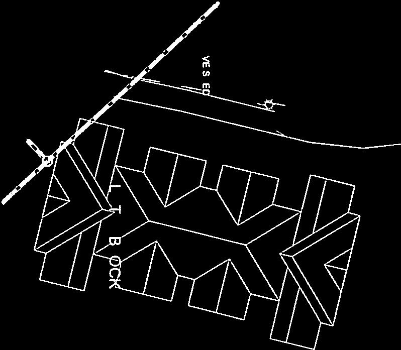


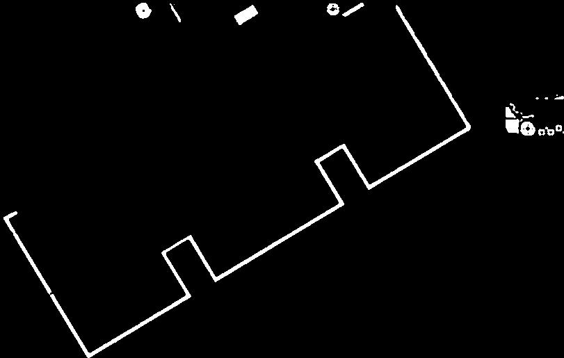


48 SOUTH BOULDER ROAD ER zcx:) a 0 LEGEND OFT SCALE jo H 3H WATER DENROD 0)30 esopoard prrrnai*tortr)un (OO)FR PU LO ORNAMLFI.A, (EVA F OPO 1)0-SUE F, MOPE F POE) 0,) jour ro V 3 FiR STEEr L OHEET NUMBER EAST SIDE LANDSCAPE PLAN - SHEETS DATE REV1S ON 35-J u-w LJJ 00 0> 0< -J-J (3>uJ< H ow C/) H w H -J >- >- >- C) z LU LU LU FF- LU C) F- it :V10 T SIL DITCI CCNSL,LAV r GROUP. LTD. MULIIERN THE ARrurTFrr POULDER, COLORADO RUBICON DEVELOPMENTS DEVELOPER


 I ML ISO l,,si 111 61,114,l,,1,0L0l,l,.")

, 23 45 14 2 slj5ta,lll,: 24.")


49 ,,; I. - -, :,, T A :; 0 PLANT NCREDULL LAF011 STE :,:, ::; 0,2,r,, Q I) 2 (.1 (./ 11 /315, (0 (I I l (0 (3. fl (0)., 2 (3 II1A 20%IllIlAI20,002 4L15 llalr00iiaa U (I JO I; Ii (I AM li II,,A I, l.a II, 300 LS OF 0.111, OI U 1 Ill, LI, II ,61 LI ,06 I UMRAC,ISTLIII II CI. I ll CI1ILII S IOLUI I ll LI 1,11111 AllIs SOL,S(TOITO 21,43 IlL III ALLIS S1LLLA 02 P110 GAl 141 LI III 651, II LUll GAL I III A LILLIMI I,IOOUPIKIIUI,l LIIIII III III II 1FOI 0106 GUI ,6: fall III000PALI 11011,1123,1 ( COMMoN NAMI li6,al LOlA OL L, 1DM 6,0 OWAFI,LLII 1 91 TIEr II II, I TWAI L I 1 11,1 A 111(1 I0 I O,, I ,1 ( 13,11 A_Il 01 SAL LOlA 0O III AU ILOOSI II COLOII LASTS SUN I Is s L l L,IISl I O II L A SUN Al LOIS I4III 1411 I 1824 BID Cl B L,CLL, I IL SUMMEA All D S II R Ci All//I il LI, IlL SLMI4III 2 S 34 I. AS SUN Ill CLII,l EARLY 10 MIII SAMMIO SAN LATE 00111( SAN-MU B 22 BID L 11 SUN 1 I : EARLS SPRINOTO Mb S 1 I Ii C SAN 04 EARLYIOLATESUMMCA 0 II L IC 415 CII 135 MIA SUMMER ,5 L A SUN LII 4111,1 LATE SUMMER 0000 QflhIN TA L iitrflpiat10aeiatas11l4l I I I I GRNAMENTAL GlASSES AlA OIIANT Ill BOTANICAL NAME CAl 01 11,61 1, , 1113 III I ll (013,1,111,,) I ML ISO l,,si ,114,l,,1,0L0l,l,.,5i,I.1I411 M 4 TB IL,,, l,l LS,, U l P,SS I 1U10fl5 MV ,, \, II.,.3 C Al, I U 04,.,lJ II CI :RllL33 3,0000 E,1J, OMMON 5(0, ALII,HT 000 A BA AAX ETPOSUOL 24 M A N M A 6: M A C), slj5ta,lll,: SUN I 1-LOWE SEASON SIJNR,ILI, 6 I (, )LIII L [III EARLY RRON7E LATE SUMMER 011,/I 11,16,0 01,6 Ii SUMMER 5111, LATESUMI, IAOFCPI loll p TREE AND SPR3S PROTECTION 1 - / I I,I WO5 INfl8Rfl0R184IIIA1flrn4flNfl i H20 H-i1 :4,f&=-== LEGEND D LOW- 18,591 SF MODERATE -83,829 SF HIGH-15,EO8SF CIA I lion 32 2,2, LX 65 PA 294 P0 1,1 PS 92 PB - 0 PC 46 1SF lb SAG 145 TA , 152 0GW 19 JO 205 SI 183 KIT AS 1(1 AT 28 CCI 28 CII 39 MI Mb Ii A MU, 34 P00 15 GB CM 30 GIl IS 2.4K ii OF 30 SIZE R1.L N GAL TOW, S COAL A G,AL N GAL 5 GAL 001, N G,AL SOUl. 061, 1 SAL SIZE 25 CAL 2.5 CAL 25 CAL 3 C,AL 2.5 CAL 25 (01 25 CAL 25 CAl 4 CUE 3 LW 3 (AL 3 CAL 3 CAL 3120-AL CONTAINI II 3,00011, AOTANII AL SSMI 61(65( ALSLL I ,1,1 SA LIb II, [ I ll P1614 I I l,,lll, l LIi ILL 1 III LLI XLL/,LILII,IiL l,iilt 1101 I Ll 1,3 0,1 JUL I (1513 I0 0L1 1 LLL IILIPLLI. ILI,T 1,31 IlL I IL,L1LlI,IIWIIINS 01(661 TI 6 O l.1 IL, 1,0,) PRLB...I.,. Al P50, A LIEN-A 00CM,,FlI.IOLGULSFiILE LINE 5, (0 000 LOW II W IlL.66 ILl CIlIA WILD,I IIlI A.I6I All L.A AN-lOONY A II I I SDIIINI,6 F616LA MIST Fill DECIDUOUS AND OTNAME010L TALES BOTANICAL NAMI N,IELANCIJILO A, CLI 3 0 U I. LLI LI ACER TATAII 1161 TALl LAL, CBAT000U 31,064 I,ALL NEILM I I A GIFDITSIA EO 6, DS LI AL l I.I MALUS INTWN MAGIC N/ALAS RET RAAO0N MALAS SAOIILA 5N0 W P FA A,A ( *00,56( *10005 ( SF OUEACUO (610 S AI,MII, Ill 151 A TAMMON GAME 6( I.1,1 COMPACT PURPLE (411 COMI ACI WA IL IIAILI CC 11:01 CII I III II GO, 4( ,41 I EMEN-.LDM ,114 (CU MOCEOMANSI IIW,,l,l 610:6 5 CL I LLE NINEBARA, Nl2,EAOAK. SUMMER WINE 011(500 CREEPING WEST EIlN 00.0, (41,EAF leone ( 40, 111,1 PNAORMJT O AlT,, l(6 F RINK I I P ,I LALU WATERER I 14,0 II CIII E,SC Ll COMMON NAME SEPLICIV000Y OI ILL, IAUPI,F,PATTFRSII I I, I IIALO IHOllN ILLOONLEST COO., 110 1,01,41 L0LST. SIIASFI.ENSTFR CRABAPPLE, INDIAN MAGIC CRABAPPLE, 0111 SUAUON CRABAPPLE, ,0 RF4P C1MWTILLPPA OAK, GWSMP WTATE 0 CRIMSON WORE OAK. RUN OAKLLI ILl JAPA4.,SL 15, ELM FEUSTIPO ALI501 P ACU EOPOSAIOL FLOWER COLAS SEASOS I 0 0 SUN 139 Mill SAYING 40 A S M 1:101 PURPLEI MIOTOLATESAMMER /6 20 ORUN L (CL I S l.a II 00 SUN IC I S WWIE LATE 500MEA 2 S 34 II U SUN RLAE N-IC TO LATE SUMMER 3,4 M 3,4 SUN LAOE SPRINO TO EARLY I. TO ES 11,11, L SUN TOES TLLLUU LATE SPRING U OH WHITE ,1 SUN WRITE 0 SUMMER loll CA Ii AU 5,5 ( 15 0,01100 LATC SPRII4G M TX GAIN WNfl NUM00R 44 IT-IS L,.l0 0,5810 SPRING A F 0 CIII, RAIl 1(51 1,10 AP IC., M A SUN I PLC.111,15 SPRING A M 000 SUN CE,,LOW EARLY SPRING M 9 s TELLUU,SA MS SPA NI) IS,, Es 11-SN U 00 SUN PINK EARLS SUMMER M 031 SUN PINK CARLA TO LATE SUMMER /0 15 ROSE RED EARLY SUN-N-CA M 65 SUN PALE LAVENDER LATE SPRING SPREAD HEI EXPOSARE ELOWLT COLOR 0 AR3 SEATON CIII M U SUN WHOA IS 2D M 101 AOAPTARLE OREENISI, LIHTF CPA NO M SUN WRITE SPRING lU 40-SO M SUN N/A N/A A ST M 0 SUN [ [(P P15.0 SPRING SUN SEEP AFT SPRING DI 35 M 0 3 WRITS SPAWG M SUN WIATE SPRING WI 40-AX M 00 ES TO UHOCE N/A N/A OW SUN N/A N/A M 000 OliN N/A N/A M 00 SUN N/A N/A SUN TO PS WhITE SUMMER A S M U SUN N/A N/A EAEAGAELNS BOTANICAL SGML 401: TIll, AL400ti/6 LI II JLINIPARDS C MED A II 1/66 Ci: I(0,LL,LlA , SPREAD PE150T A AOX EXPOSURE FLOWER COLOR SEASON 58 I 2 L 102 SUN S A N/A L L SUN N/A N/A A S L 141 SUN TEl PS N/A N/A N/A N/A,. ARTIOR, P55 I 1-RIGS AS 25 GRASSlIKE P r K 49 1I.A N/fl WO P.,,,,, :,. g, BI.K4.d U; fli
50 BEING A REPLAT OF LOTS 1, 2 AND 3, BLOCK 2, TRACT B, AND CAMBRO LANE, LAFAYETTE CITY CENTER SUBDIVISION, LOCATED IN THE SOUTHWEST QUARTER OF SECTION 2, TOWNSHIP 1 SOUTH, RANGE 69 WEST OF THE 6TH P.M., CITY OF LAFAYETTE, COUNTY OF BOULDER, STATE OF COLORADO CERTIFICATE OF DEDICATION AND OWNERSHIP : Know all persons by these presents, that, being the owner(s) of all that real property situated in Boulder County, Colorado, and lying within the exterior boundary of "LAFAYETTE CITY CENTER SUBDIVISION REPLAT B," a subdivision of a portion of LAFAYETTE CITY CENTER SUBDIVISION, City of Lafayette, County of Boulder, State of Colorado, described as follows: Lots 1, 2 and 3, Block 2, Tract B, and Cambro Lane contains 462,318 square feet or acres, more or less. Have by these presents laid out, platted and subdivided the same into tracts and lots as shown hereon and designate the same as "LAFAYETTE CITY CENTER SUBDIVISION REPLAT B," in the City of Lafayette, County of Boulder, State of Colorado, and do hereby dedicate and convey to the City of Lafayette, Colorado, for public use the streets and Right-of-Way (R.O.W.), the pedestrian access easements shown hereon for pedestrian access purposes only, the access easements shown hereon for access purposes only, the emergency access easements for emergency access purposes only, the utility easements shown hereon for utility purposes only and the drainage easements shown hereon for drainage purposes only. CITY ADMINISTRATOR'S CERTIFICATE: I, Gary Klaphake, City Administrator of the City of Lafayette, Colorado, hereby certify that I have examined the final plat of LAFAYETTE CITY CENTER SUBDIVISION REPLAT B and it appears to be in compliance with all applicable ordinances of the city and that a development agreement has been executed by the developer and accepted by the City. City Administrator Attest: City Clerk SITE CITY CENTER CIRCLE MERLIN DR. NOTICE: According to Colorado law you must commence any legal action based upon any defect in this survey within three years after you discover such defect. In no event may any action based upon any defect in this survey be commenced more than ten years after the date of the certificate shown hereon. W. SOUTH BOULDER RD. OWNER: Executed this day of, 20, A.D. Owner STATE OF COLORADO ) )ss. COUNTY OF BOULDER ) SURVEYOR'S CERTIFICATE: I, Eric R. Smith, do hereby certify that I am a duly registered professional land surveyor licensed under the laws of the State of Colorado, that this plat is a true, correct and complete plat of "LAFAYETTE CITY CENTER SUBDIVISION REPLAT B" as laid out, platted, dedicated and shown hereon, that such plat was made from an accurate survey of said property by me and under my direct responsibility, supervision and checking and correctly shows the location and dimensions of the tracts staked upon the ground in compliance with Articles of Title 38, Colorado Revised Statutes governing the subdivision of land. In witness whereof, I have set my hand and seal this day of, 20, A.D. NORTH S. PUBLIC RD. MINERS DR. VICINITY MAP N ORTHE RN PHONE: The foregoing instrument was acknowledged before me this day of, 20, A.D. by, as of, as owner of the property described hereon. Witness my hand and official seal 301 North Howes Street, Suite 100 Fort Collins, Colorado My commission expires: For and on Behalf of Northern Engineering Eric R. Smith Colorado Registered Professional Land Surveyor No Notary Public CLERK AND RECORDER'S CERTIFICATE: PLANNING COMMISSION CERTIFICATE: I hereby certify that this instrument was filed in my office at o'clock.m., this day of, 20, and is recorded in Plan File #. The Preliminary Plat for LAFAYETTE CITY CENTER SUBDIVISION REPLAT B was approved by the City of Lafayette Planning Commission on, 20 A.D. Reception # Fees: Deputy Clerk and Recorder Chairperson Attest: Secretary CITY COUNCIL CERTIFICATE: This final plat of LAFAYETTE CITY CENTER SUBDIVISION REPLAT B is approved by the City Council of the City of Lafayette, Colorado this day of, 20, A.D. for filing with the Clerk and Recorder of Boulder County and for conveyance to the City of the public dedications shown hereon; subject to the provision that approval in no way obliges the City of Lafayette for the financing or constructing of improvements on land or easements dedicated to the public except as specifically agreed to by the City Council. NOTES: 1. Basis of Bearings is the South line of the Southwest Quarter of Section as bearing North 89 14' 11" West (assumed bearing) and monumented as shown. 2. All information regarding easements, rights-of-way or Title of Record, Northern Engineering relied upon Commitment Number CO-FFAH-IMP H , prepared by Heritage Title Company, dated June 4, 2014 and Commitment Number CO-FFAH-IMP H , prepared by Heritage Title Company, dated June 12, The lineal unit of measurement for this plat is U. S. Survey Feet. Mayor Witness my hand and official seal of the City of Lafayette. 4. All easements and lot lines from Lots 1, 2 and 3, Block 2 and Tract B, and Cambro Lane right-of-way, Lafayette City Center Subdivision, are vacated with the filing of this plat. 5. There were no current zoning classifications or building setback requirements/restrictions provided to the surveyor by the insurer. 6. Flood Zone Designation: According to Firm Panel Number 08013CO602J, for Boulder County, this tract does not lie within a FEMA designated 100-year floodplain Attest: City Clerk S:\Survey Jobs\ \Dwg\Plat\ Plat.dwg, 7/24/ :15:42 AM, 1:1 1


51 S W BEING A REPLAT OF LOTS 1, 2 AND 3, BLOCK 2, TRACT B, AND CAMBRO LANE, LAFAYETTE CITY CENTER SUBDIVISION, LOCATED IN THE SOUTHWEST QUARTER OF SECTION 2, TOWNSHIP 1 SOUTH, RANGE 69 WEST OF THE 6TH P.M., CITY OF LAFAYETTE, COUNTY OF BOULDER, STATE OF COLORADO CURVE C1 C2 C3 C4 C5 C6 C7 C8 C9 C10 DELTA 91 27'36" 16 32'12" 23 59'16" 50 35'42" 25 05'18" 58 32'52" 73 05'06" 19 45'12" 7 57'47" 51 42'41" CURVE TABLE RADIUS 260' ' 310' 140' 321' 80' 25.00' 250' 180' 23.50' LENGTH ' 59.31' ' ' 142' 81.75' 31.89' 86.88' 25.02' 21' BEARING S44 16'12"E S09 43'45"W N10 32'01"W S86 12'51"E S48 22'21"E S65 06'08"E N49 04'54"E S02 39'45"W S03 13'57"E S26 36'01"W CHORD ' 59.11' ' ' ' 78.24' 29.77' 86.45' 25.00' 20' LINE L1 L2 L3 L4 L5 L6 L7 LINE TABLE LENGTH 35.91' 14.46' 2' 55.49' 28.53' 27.12' 45.44' BEARING N56 55' 33"E N90 00' 00"E N00 00' 00"E S01 27' 37"W S46 05' 45"W N43 45' 44"W S61 09' 46"E LAND USE TABLE PARCEL DESCRIPTION AREA PERCENT INTENDED OWNERSHIP/MAINTAINANCE BY LOT 1 Mixed Use 55,583 S.F. 8 AC. 12% City of Lafayette LOT 2 Mixed Use 235,072 S.F AC. 55% HOA LOT 3 Mixed Use 171,663 S.F AC % HOA TOTAL 462,318 S.F AC. 100% NORTH UE SECTION LINE EASEMENT LINE EXISTING PROPERTY LINES PLATTED BOUNDARY LINE LOT LINE FOUND CORNER AS DESCRIBED SECTION CORNER SET #4 REBAR WITH 1" PLASTIC CAP, LS UTILITY EASEMENT NOTICE: According to Colorado law you must commence any legal action based upon any defect in this survey within three years after you discover such defect. In no event may any action based upon any defect in this survey be commenced more than ten years after the date of the certificate shown hereon. W&SE A&EAE W,S,A&EAE WATER & SEWER EASEMENT ACCESS & EMERGENCY ACCESS EASEMENT WATER, SEWER, ACCESS & EMERGENCY ACCESS EASEMENT COUNTRYSIDE VILLAGE SHOPPING CENTER AMD. 3 OWNER: ASIAN KING BUFFET INC ADDRESS: 199 S. BOULDER RD. OWNER: KCTSSC LLC ADDRESS: 1265 S. PUBLIC RD. FND #5 REBAR W/YPC LS "KELLEY" W SOUTH PUBLIC ROAD (PUBLIC ROW VARIES) 239' L1 15' UE 39.5' 31' W FND 1 1/2" ALUM CAP LS "SELLARS" F RD OWNER: REGIONAL TRANSPORTATION DISTRICT ADDRESS: 1080 PUBLIC ROAD CITY CENTER CIRCLE (PUBLIC ROW VARIES) Y N90 00'00"E ' WV W W W,S,A & EAE RD 24' S 15' UE D FND #5 REBAR W/YPC LS D "KELLEY" W,S,A & EAE 26' 24' A&EAE F W L3 L2 W W W&SE D UE D A&EAE W,S,A & EAE OWNER: 990 INVESTMENT GROUP LLC ADDRESS: 990 S. PUBLIC RD. FND #5 REBAR W/YPC LS "KELLEY" G W W 20' W&SE 20' W&SE SS SS SS SS S STRATHMORE LANE 20' W&SE SS SS WV C1 D W WV D CITY CENTER CIRCLE (PUBLIC ROW VARIES) W C3 L7 N68 29'18"E 83.65' E E F W E OUTLOT A & B LAFAYETTE CITY CENTER SUBDIVISION OWNER: CITY CENTER BUSINESS OWNERS ASSOC. INC ADDRESS: 0 PUBLIC RD. S F W C4 10' UE S E E PE S60 55'00"E 88.78' PEDESTRIAN EASEMENT E E E N ORTHE RN PHONE: North Howes Street, Suite 100 Fort Collins, Colorado S:\Survey Jobs\ \Dwg\Plat\ Plat.dwg, 7/24/ :16:15 AM, 1:1 UNPLATTED OWNER: CHALET PROPERTIES LLC ADDRESS: 100 W. SOUTH BOULDER RD. OWNER: O'REILLY AUTO PART ADDRESS: 1285 S. PUBLIC RD. OWNER: COLO-WYO GAS CO. ADDRESS: 0 S. BOULDER RD. W W W W W W W W W W W 50' R.O.W. N00 00'00"E ' Y ' SW CORNER 2-1S-69W FND 3" ALUM. CAP ILLEG. 30' A& EAE 15' 15' UE FND 1 1/2" ALUM CAP LS "SELLARS" Y S N90 00'00"E ' LOT sq.ft. 8 ac 15' UE A&EAE A&EAE 45' R.O.W. S00 00'00"E ' 30' A&EAE D LOT sq.ft ac 15' LOT LINE TO BE VACATED PER THIS PLAT ' ' N89 14'11"W ' GAS FND #5 REBAR NO CAP W W W W W W W W W W OWNER: MULTIPLE ENTITIES ADDRESS: 100 E. SOUTH BOULDER RD. RD S S F W 15' UE SOUTH BOULDER ROAD (PUBLIC ROW VARIES) RD W W F 30' WV WW WV G WV Y W W WV WV W W W W W W W W W W W W W SS SS SS SS SS SS SS SS SS SS SS SS SS SS SS SS SS SS SS SS SS OWNER: VFW MILE HIGH POST #1771 ADDRESS: 110 E. SOUTH BOULDER RD. OWNER: MULTIPLE ENTITIES ADDRESS: 200 E. SOUTH BOULDER RD. S FND NAIL & BRASS TAG LS FND #5 REBAR W/YPC LS "KELLEY" FND #5 REBAR W/YPC LS "KELLEY" FND NAIL & BRASS TAG LS FND #5 REBAR W/YPC LS "KELLEY" W W BASIS OF BEARINGS SOUTH LINE OF THE SW 1/4 SECTION 2, T1 S, R69W OWNER: RODITIS IOANNIS/MARIA ADDRESS: 0 E. SOUTH BOULDER RD. D L5 D C2 S01 27'37"W ' L4 S89 14'11"E ' S D S89 14'14"E 97.80' (TIE) N01 27'37"E ' L6 FND SCRIBED "X" IN CONCRETE FND SCRIBED "X" IN CONCRETE 15' UE 11' PE FND SCRIBED "X" IN CONCRETE D FND #5 REBAR W/YPC LS "KELLEY" D D D 26' W,S,A & EAE W F S S W F S 20' W,S,A & EAE W S 26' A&EAE LOT sq.ft ac N89 14'11"W ' OUTLOT 1, BLOCK 1 COAL CREEK VILLAGE NORTH FILING 1 OWNER: CITY OF LAFAYETTE F S C5 30' W,S,A & EAE W 15' UE F LOT 1, BLOCK 3 LAFAYETTE CITY CENTER SUBDIVISION S C6 6.5' PE N85 37'27"E 75.30' F S W 15' UE C7 N89 14'11"W 48.90' C8 C9 S00 44'55"W 105' GG MERLIN DRIVE (PUBLIC ROW VARIES) C10 WV S N00 05'08"E 45.05' FND #5 REBAR W/YPC LS "KELLEY" S W WV W W FND #5 REBAR W/YPC LS "KELLEY" WV FND #5 REBAR W/YPC LS "KELLEY" WV SS WV W Y PEAKVIEW APARTMENTS SUBDIVISION W 1/16 COR 2-1S-69W FND 2" ALUM CAP STEVEN J. SELLARS W 1/16 S 2 S LS S OWNER: FAIRFIELD PEAKVIEW LLC 2

52 DESCRIPTION: Right-of-way to be vacated located in Section 2, Township 1 South, Range 69 West of the 6th P.M., City of Lafayette, County of Larimer, State of Colorado, and being more particularly described as follows: Considering South line of the Southwest Quarter of Section 2 as bearing North 89 14' 11" West and with all bearings contained herein relative thereto: COMMENCING at the West 1/16 th corner of Section 2; thence along the East line of the Southwest Quarter of the Southwest Quarter, South 00 05' 08" West, feet; thence, South 89 54' 52" East, 41 feet to the POINT OF BEGINNING; thence along a curve concave to the southwest having a central angle of 88 03' 08" with a radius of feet, an arc length of feet and the chord of which bears North 50 21' 00" West, feet; thence, South 85 37' 27" West, feet; thence along a curve concave to the northeast having a central angle of 58 32' 51" with a radius of 120 feet, an arc length of feet and the chord of which bears North 65 06' 04" West, feet; thence along a curve concave to the southwest having a central angle of 25 05' 17" with a radius of 280 feet, an arc length of feet and the chord of which bears North 48 22' 22" West, feet; thence, North 60 55' 00" West, feet; thence along a curve concave to the south having a central angle of 50 35' 42" with a radius of 100 feet, an arc length of feet and the chord of which bears North 86 12' 51" West, feet; thence, South 68 29' 18" West, 106 feet; thence, South 24 36' 55" West, feet; thence along a curve concave to the west having a central angle of 19 03' 26" with a radius of 310 feet, an arc length of feet and the chord of which bears North 12 59' 56" West, feet; thence, South 61 09' 46" East, feet; thence, North 68 29' 18" East, feet; thence along a curve concave to the south having a central angle of 50 35' 42" with a radius of 140 feet, an arc length of feet and the chord of which bears South 86 12' 51" East, feet; thence, South 60 55' 00" East, feet; thence along a curve concave to the southwest having a central angle of 25 05' 18" with a radius of 320 feet, an arc length of 142 feet and the chord of which bears South 48 22' 21" East, feet; thence along a curve concave to the northeast having a central angle of 58 32' 52" with a radius of 80 feet, an arc length of feet and the chord of which bears South 65 06' 08" East, feet; thence, North 85 37' 27" East, feet; thence along a curve concave to the northwest having a central angle of 73 05' 06" with a radius of feet, an arc length of feet and the chord of which bears North 49 04' 54" East, feet; thence along a curve concave to the east having a central angle of 18 51' 36" with a radius of 250 feet, an arc length of feet and the chord of which bears South 03 06' 33" West, feet to the POINT OF BEGINNING. The above described tract of land contains 26,431 square feet or acres, more or less and is subject to all easements and rights-of-way now on record or existing. LMS August 11, 2015 S:\Survey Jobs\ \Dwg\Exhibits\ Description.docx
53 CITY CENTER CIRCLE C5 L4 L5 L6 L3 CAMBRO LANE ROW TO BE VACATED 26,431 sq. ft ac. SOUTH BOULDER ROAD C1 BASIS OF BEARINGS SOUTH LINE OF THE SW 1/4 SECTION L1 C2 L8 C8 C3 C9 POINT OF COMMENCEMENT WEST 16 1 CORNER SECTION N89 14'11"W MERLIN DRIVE N00 05'08"E ' LOT 3 LAFAYETTE CITY CENTER SUBDIVISION N89 54'52"W 41' C10 C7 L2 C4 L7 CAMBRO LANE LOT 1, BLOCK 3 LAFAYETTE CITY CENTER SUBDIVISION POINT OF BEGINNING CURVE C1 C2 C3 C4 C5 C6 C7 C8 C9 C10 DELTA 88 03'08" 58 32'51" 25 05'17" 50 35'42" 19 03'26" 50 35'42" 25 05'18" 58 32'52" 73 05'06" 18 51'36" CURVE TABLE RADIUS 25.00' 120' 280' 100' 310' 140' 320' 80' 25.00' 250' LENGTH 38.42' ' ' 88.30' ' ' 142' 81.75' 31.89' 82.95' C6 RIGHT-OF-WAY VACATION EXHIBIT A TRACT OF LAND LOCATED IN THE SOUTHWEST QUARTER OF SECTION 2, TOWNSHIP 1 SOUTH, RANGE 69 WEST OF THE 6TH P.M., CITY OF LAFAYETTE, COUNTY OF LARIMER, STATE OF COLORADO LINE L1 LINE TABLE LENGTH 63.48' BEARING S85 37' 27"W LINE L5 L2 L3 L ' 106' 38.26' N60 55' 00"W S68 29' 18"W S24 36' 55"W L6 L7 L8 301 North Howes Street, Suite 100 Fort Collins, Colorado BEARING CHORD N50 21'00"W 34.75' N65 06'04"W ' N48 22'22"W ' N86 12'51"W 85.46' N12 59'56"W ' S86 12'51"E ' S48 22'21"E ' S65 06'08"E 78.24' N49 04'54"E 29.77' S03 06'33"W 82.58' LINE TABLE LENGTH BEARING 45.44' S61 09' 46"E 83.65' N68 29' 18"E 88.78' S60 55' 00"E 75.30' N85 37' 27"E N ORTHE RN PHONE:


 667-9436 ARCHITECTURE AND MASTER PLANNING: THE MULHERN GROUP, LTD.")

54 SHEET INDEX A-1 COVER SHEET A-1 NARRATIVE A-2 INSPIRATION PHOTOS A-3 SITE PHOTOS - EXISTING A-1 EXISTING CONDITIONS A-3 SITE DATA A-1.01 OVERALL SITE PLAN A-1.02 WEST PARCEL SITE PLAN A-1.03 EAST PARCEL SITE PLAN A-1 BUILDING A FLOOR PLAN A-2 BUILDING B FLOOR PLAN A-3 BUILDING C FLOOR PLAN A-4 BUILDING D FLOOR PLAN A-5 TRASH ENCLOSURE DEVELOPER: RUBICON DEVELOPMENTS BOULDER, COLORADO ARCHITECT: A-2 BUILDING A + B ELEVATIONS A-3 BUILDING C + D ELEVATIONS A-4 EAST PARCEL ELEVATIONS A-3.01 SITE SECTION A-7.01 RENDERINGS A-7.02 RENDERINGS A-7.03 RENDERINGS A-7.11 LIGHTING / PHOTOMETRIC PLAN A-7.12 FIXTURES L-1.0 OVERALL LANDSCAPE PLAN L- LANDSCAPE PLAN - EAST L- LANDSCAPE PLAN - WEST L- PLANT SCHEDULE, NOTES, DETAILS PROJECT DIRECTORY DEVELOPER: CONSULTANT: SPR-1-15 SITE PLAN / ARCHITECTURAL REVIEW PACKAGE CONTENTS RUBICON DEVELOPMENT BOULDER, COLORADO MICHAEL BOSMA: MB@RUBICONTEAM.COM ROBERT HAAS: RH@RUBICONTEAM.COM PH: (303) ARCHITECTURE AND MASTER PLANNING: THE MULHERN GROUP, LTD BLAKE STREET, SUITE 435 DENVER, COLORADO LAFAYETTE CITY CENTER SPR PEARL STREET, SUITE 205 SOUTH BOULDER ROAD & SOUTH PUBLIC ROAD LAFAYETTE, COLORADO LIZ PETERSEN: LPETERSEN@THEMULHERNGROUP.COM LAFAYETTE, COLORADO BUILDING A + B ELEVATIONS LAFAYETTE CITY CENTER A-1 PH: (303) LANDSCAPE DESIGN: STUDIO TERRA DATE: REVISION: SUBMITTAL 1 PRELIMINARY SUBMITTAL CLUB CIRCLE LOUISVILLE, COLORADO CAROL ADAMS: CAROL@STUDIOTERRA.NET PH: (303) CIVIL ENGINEERING: SHEET NAME: COVER SHEET NORTHERN ENGINEERING 301 NORTH HOWES STREET, SUITE 100 SHEET NUMBER: FORT COLLINS, COLORADO RYAN BANNING: RYAN@NORTHERNENGINEERING.COM PH: (970) A-1

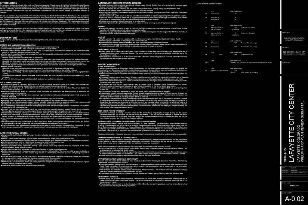
55
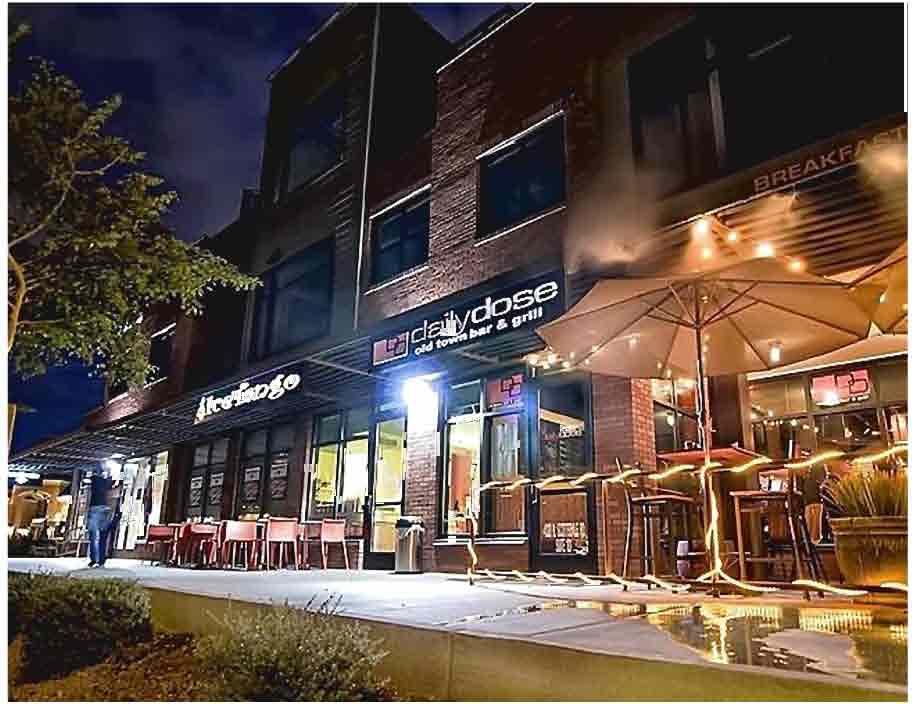
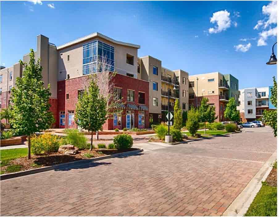
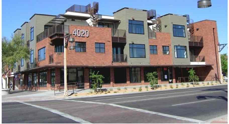


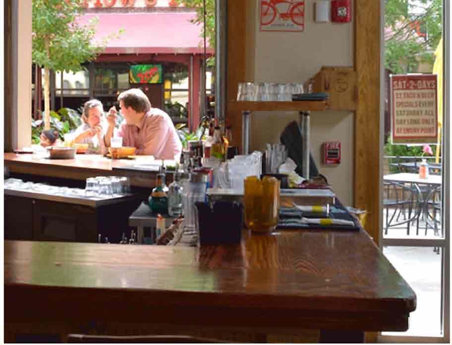
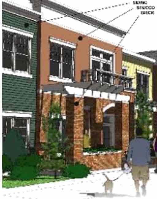
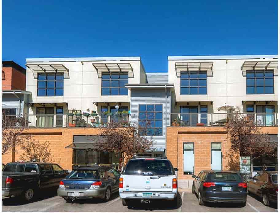
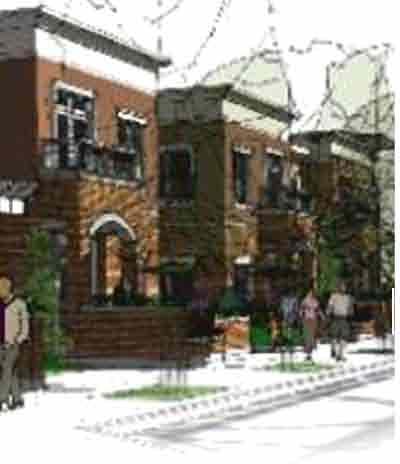
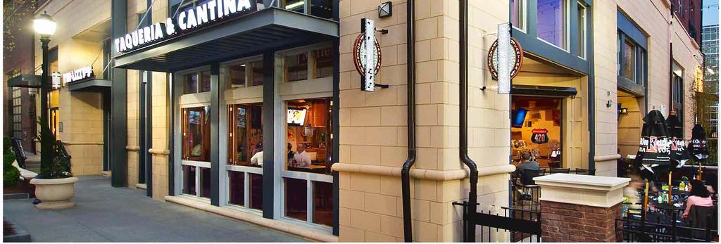
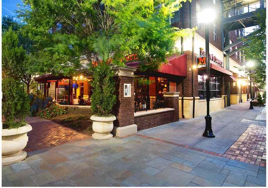
56
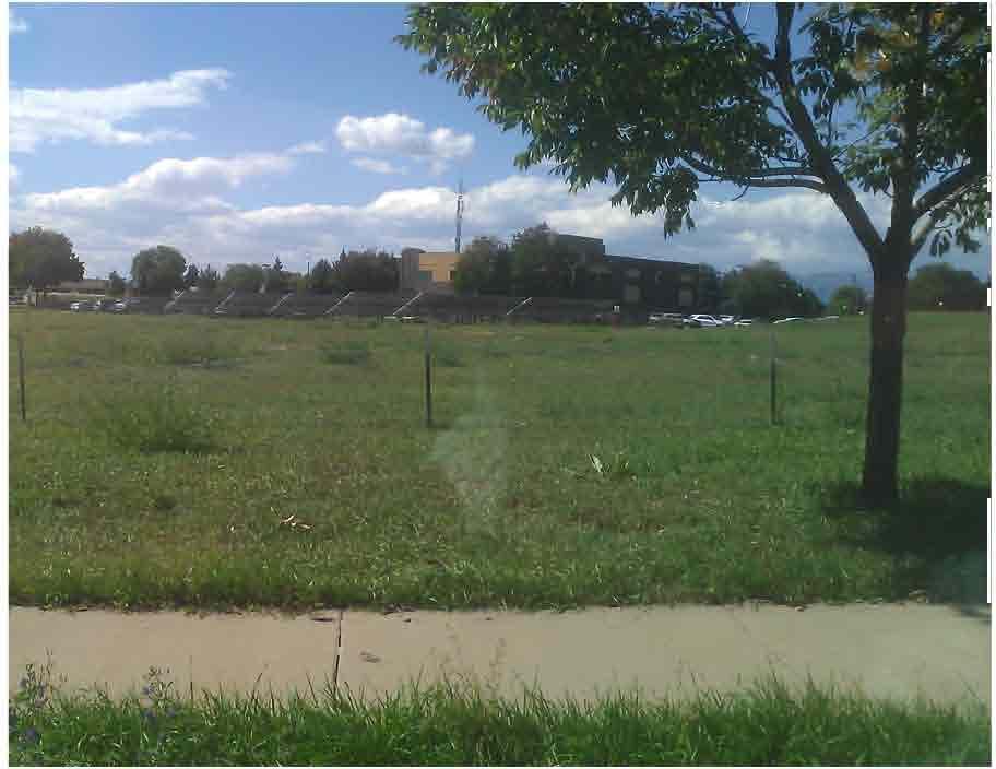
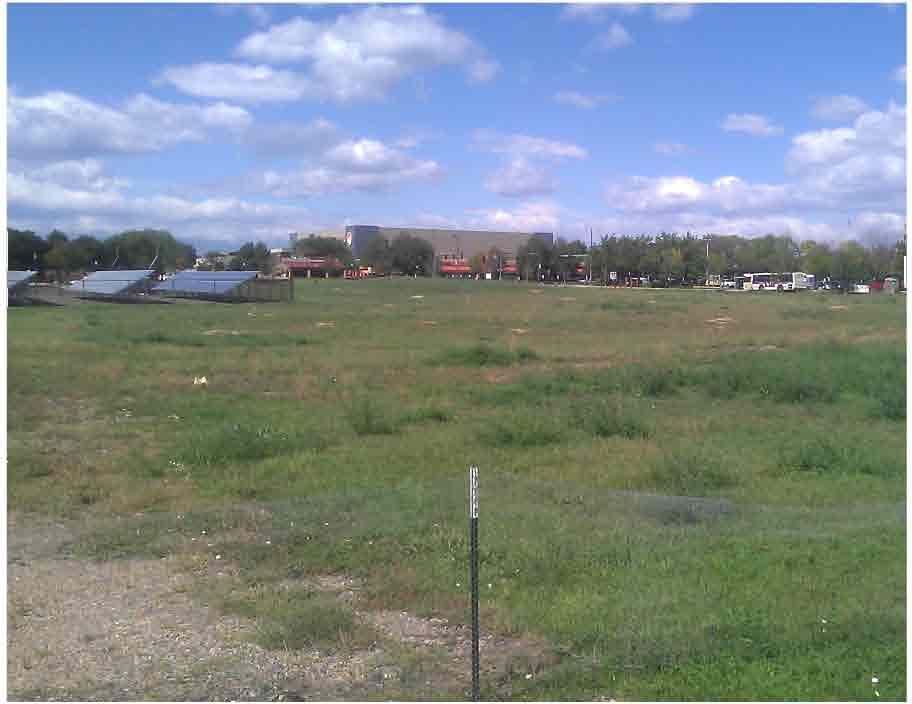
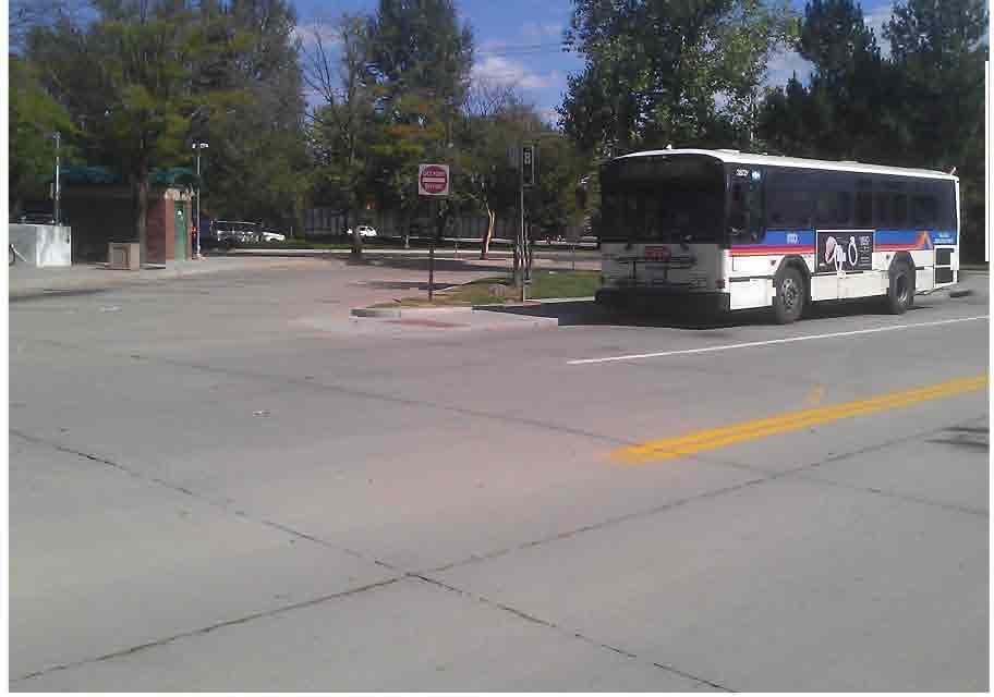
57
58 COMMERCIAL COMMERCIAL LINE OF UNDERMINING STRATHMORE LANE CITY TRAIL DETENTION POND TRAIL HIGH DENSITY RESIDENTIAL DEVELOPER: RUBICON DEVELOPMENTS BOULDER, COLORADO CENTER HOA OPEN SPACE ARCHITECT: TING'S PLACE CONSULTANT: COMMERCIAL O'REILLY AUTO PARTS MONUMENT SIGN SOUTH PUBLIC ROAD EXISTING PARKING EXISTING PARKING EXISTING 2 STORY MUNICIPAL BUILDING EXISTING PARKING EXISTING SOLAR PANEL FIELD EXISTING PARKING ALL-WEST TROPHIES LINE OF UNDERMINING RUSSELL AUTO SERVICE [TYP.] CIRCLE 75'-0" EASEMENT SOUTH BOULDER ROAD LINE OF UNDERMINING MERLIN DRIVE SPR-1-15 LAFAYETTE CITY CENTER LAFAYETTE, COLORADO NATURAL GROCERS FORTUNE COOKIE CHINESE CAFE HOMESTYLE LAUNDRYMAT COMMERCIAL MEDIUM DENSITY RESIDENTIAL DATE: REVISION: SUBMITTAL PRELIMINARY SUBMITTAL 1 SHEET NAME: EXISTING SITE CONDITIONS COMMERCIAL AUTOZONE SHEET NUMBER: RMI LASER, LLC 1 A-1
59
60 STRA PEDESTRIAN LIGHT LINE OF UNDERMINING C COMPACT PARKING SPACE TRASH ENCLOSURE 3 STORY C 8 12 C C C C C C C C C C C C LOT 1 59 SP 3 POCKET PARK 3 CITY CENTER DETENTION POND [SEE CIVIL ENGINEER DRAWINGS] DEVELOPER: RUBICON DEVELOPMENTS BOULDER, COLORADO 4 15 SP 5 12 ARCHITECT: ADJACENT COMMERCIAL SOUTH PUBLIC ROAD 13 BUILDING A 4 STORY 24 SP 11 BRIDGE EXISTING 2 STORY MUNICIPAL BUILDING LOT 2 11 SP BUILDING B 28 SP 4 STORY SP SP 4 BUILDING C 4 STORY BRIDGE LOT 3 10 BUILDING D 4 STORY SP C C C C C C C C C C C C C C C C C C C 3 STORY SP LOT 4 83 SP LOT CIRCLE LOT SP 32 SP 10 CON 5 6 SP 2 CONSULTANT: SPR-1-15 LAFAYETTE CITY CENTER LAFAYETTE, COLORADO DATE: REVISION: SUBMITTAL PRELIMINARY SUBMITTAL 1 LINE OF SOLAR PANEL CAR PORT SOUTH BOULDER ROAD SHEET NAME: WEST PARCEL SITE PLAN 1 SHEET NUMBER: A-1.02
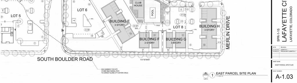
61
62 DEVELOPER: RUBICON DEVELOPMENTS BOULDER, COLORADO ARCHITECT: CONSULTANT: SPR-1-15 LAFAYETTE CITY CENTER LAFAYETTE, COLORADO DATE: REVISION: SUBMITTAL PRELIMINARY SUBMITTAL 1 SHEET NAME: FLOOR PLANS - BUILDING A WEST PARCEL - BUILDING A SCALE: 1 16" = 1'-0" SHEET NUMBER: A-1
63 DEVELOPER: RUBICON DEVELOPMENTS BOULDER, COLORADO ARCHITECT: CONSULTANT: 1 2 SPR-1-15 LAFAYETTE CITY CENTER LAFAYETTE, COLORADO DATE: REVISION: SUBMITTAL PRELIMINARY SUBMITTAL 1 SHEET NAME: FLOOR PLANS - BUILDING B WEST PARCEL - BUILDING B SCALE: 1 16" = 1'-0" SHEET NUMBER: A-2
64 DEVELOPER: RUBICON DEVELOPMENTS BOULDER, COLORADO ARCHITECT: CONSULTANT: 1 2 SPR-1-15 LAFAYETTE CITY CENTER LAFAYETTE, COLORADO DATE: REVISION: SUBMITTAL PRELIMINARY SUBMITTAL 1 SHEET NAME: FLOOR PLANS - BUILDING C WEST PARCEL - BUILDING C SCALE: 1 16" = 1'-0" SHEET NUMBER: A-3
65 DEVELOPER: RUBICON DEVELOPMENTS BOULDER, COLORADO ARCHITECT: CONSULTANT: 2 3 SPR-1-15 LAFAYETTE CITY CENTER LAFAYETTE, COLORADO DATE: REVISION: SUBMITTAL PRELIMINARY SUBMITTAL 1 SHEET NAME: 1 WEST PARCEL - BUILDING D SCALE: 1 16" = 1'-0" FLOOR PLANS - BUILDING D SHEET NUMBER: A-4
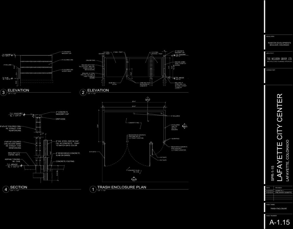
66


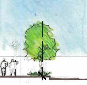
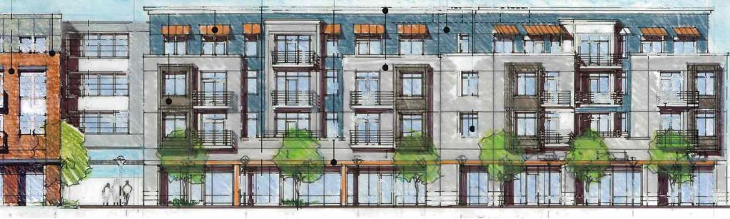
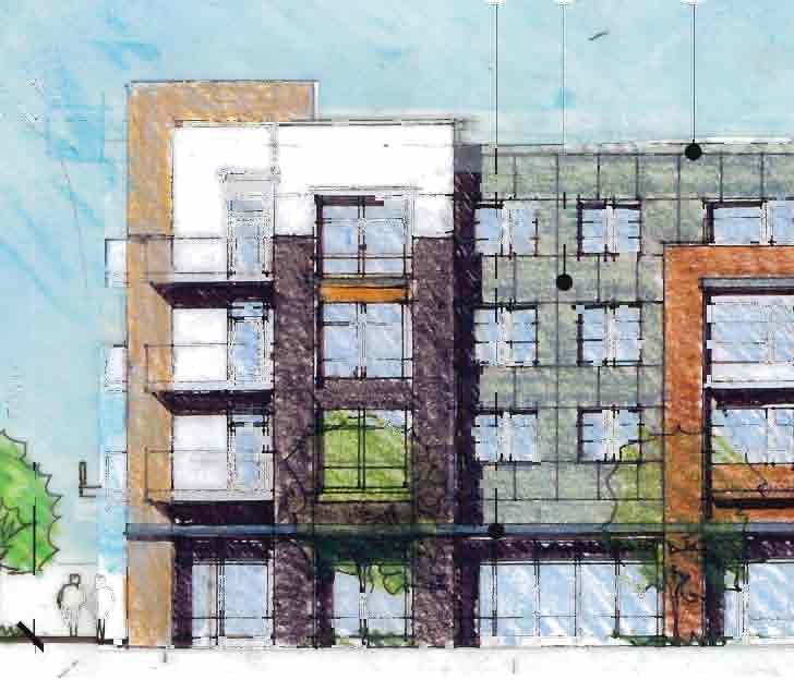

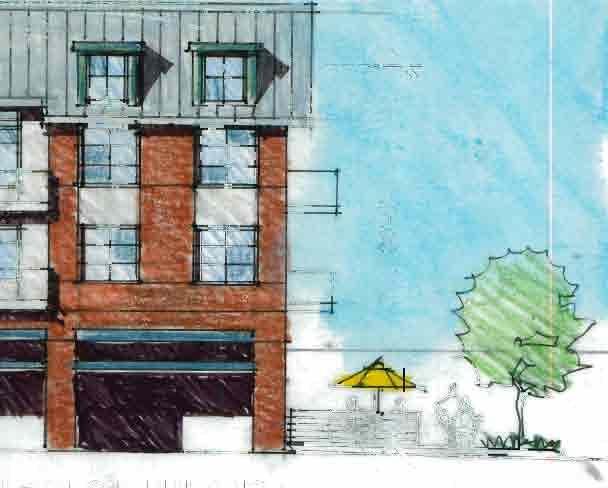
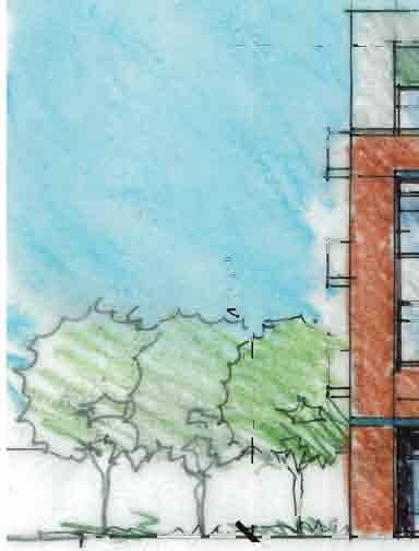


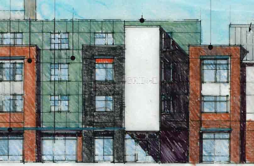
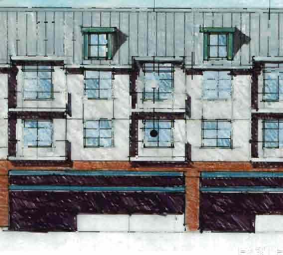
67
68


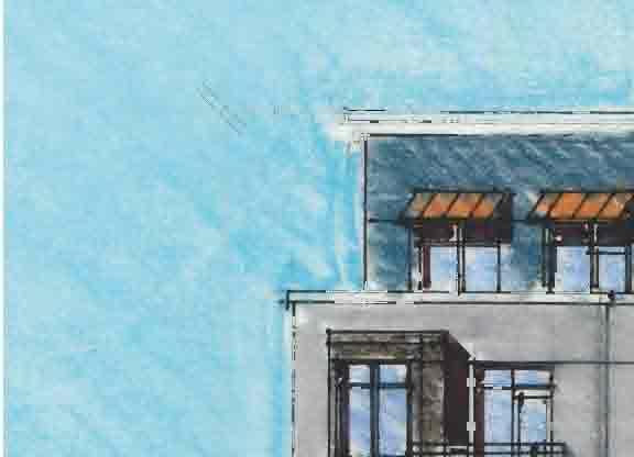


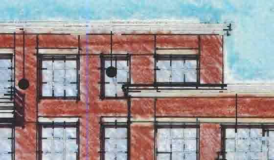


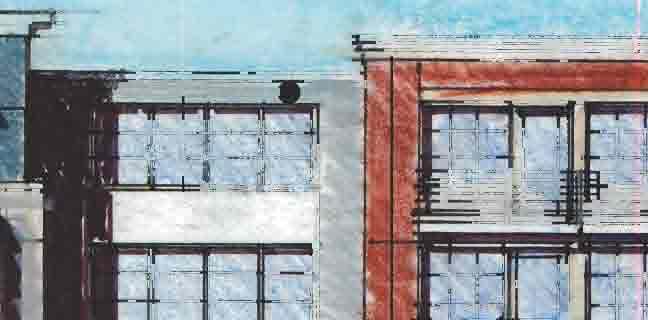


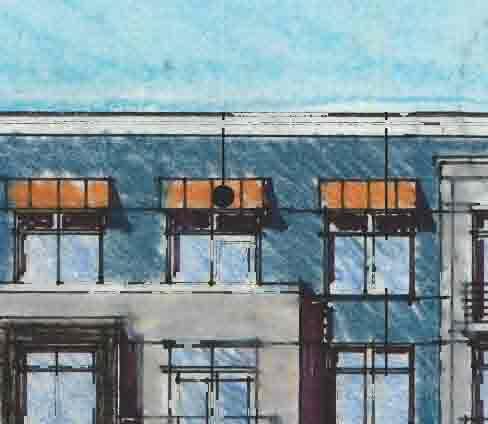
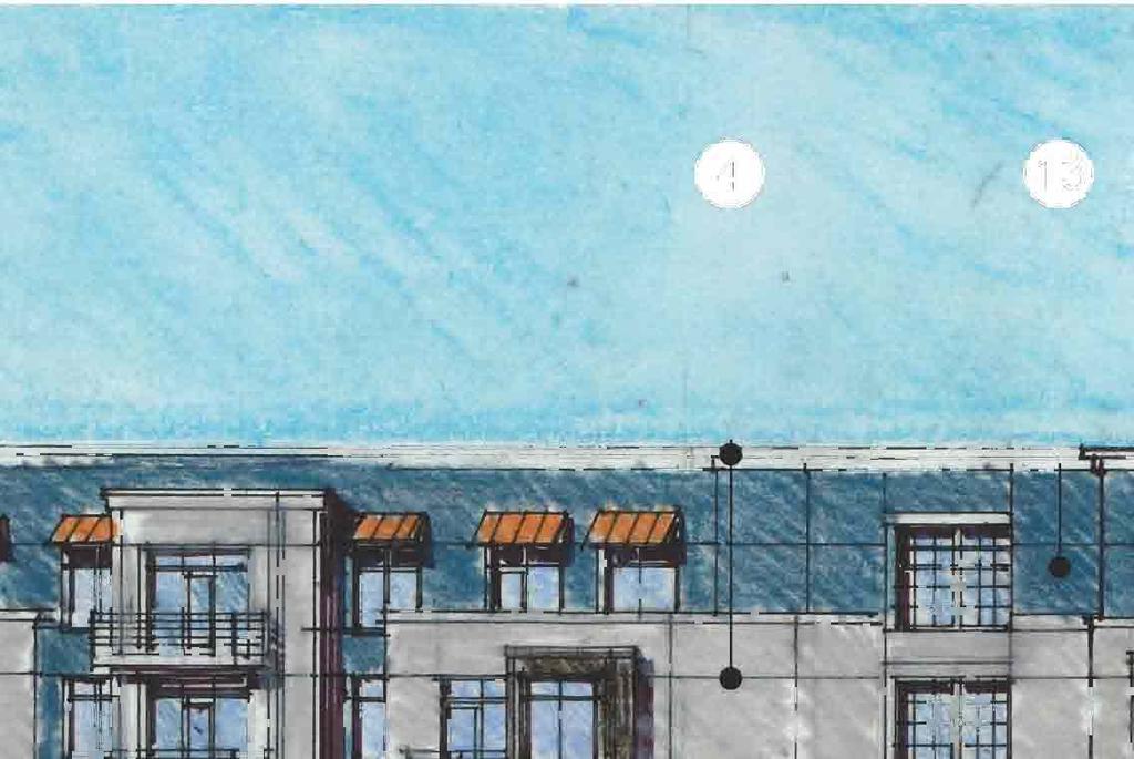


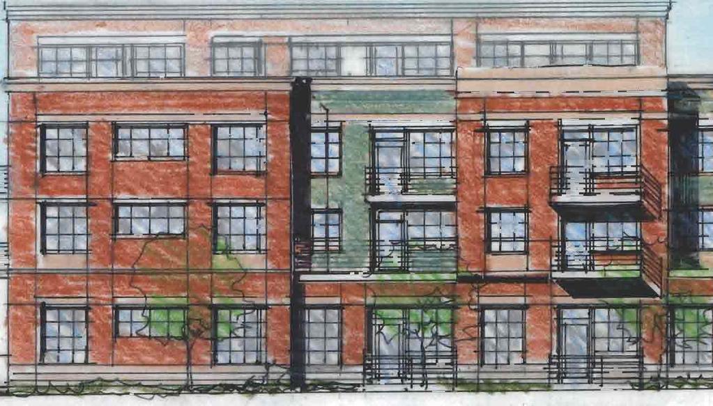
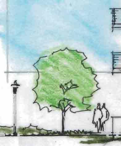
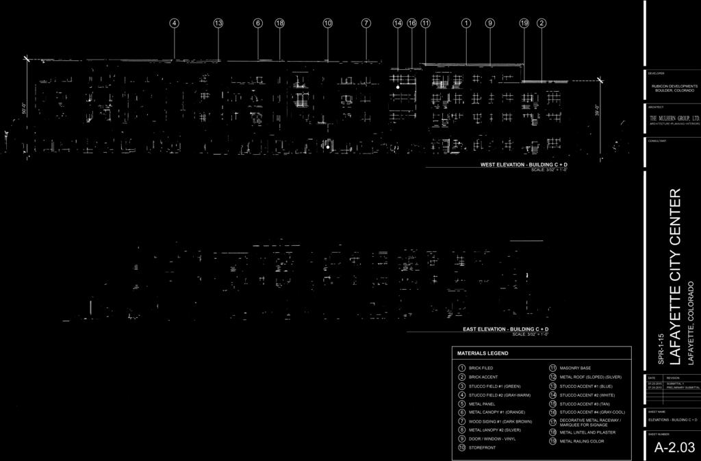
69


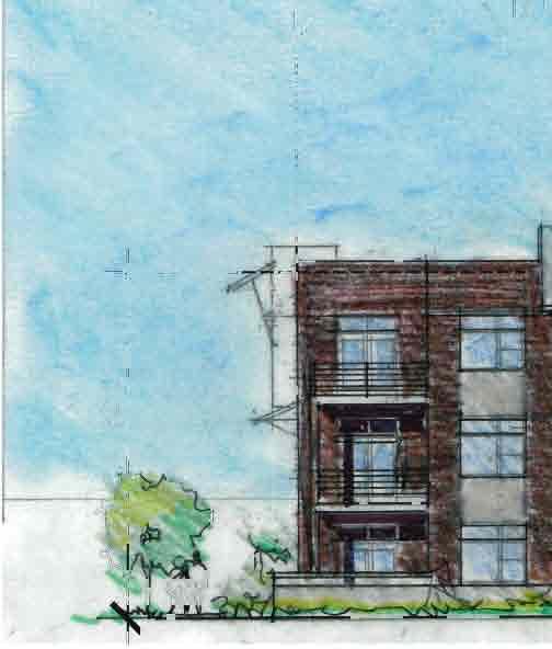
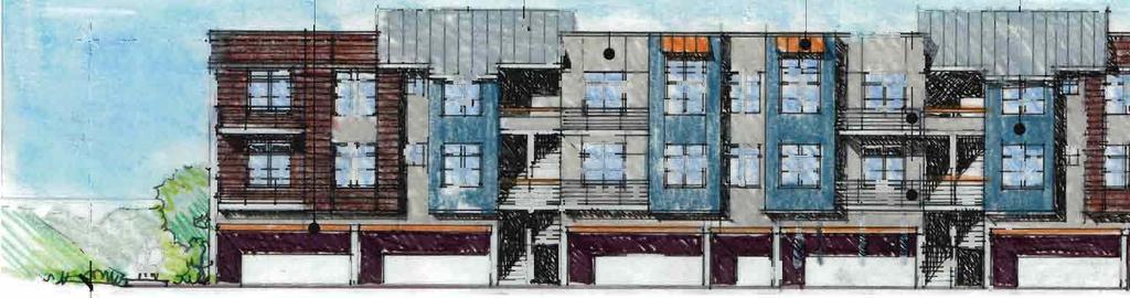
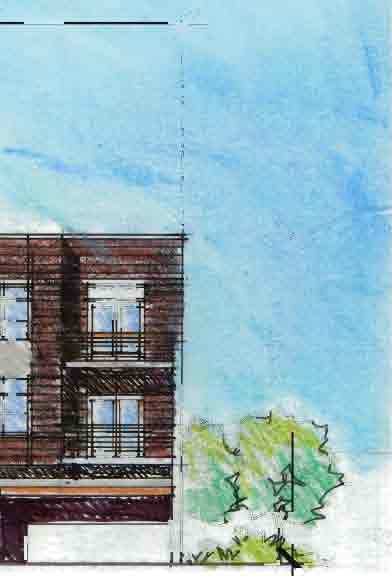

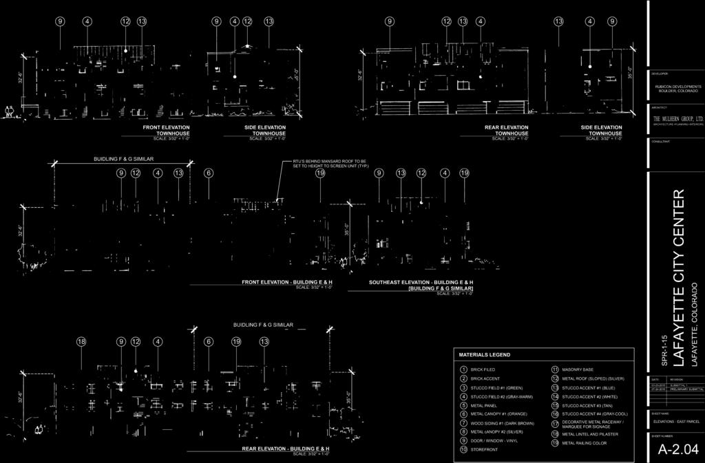
70


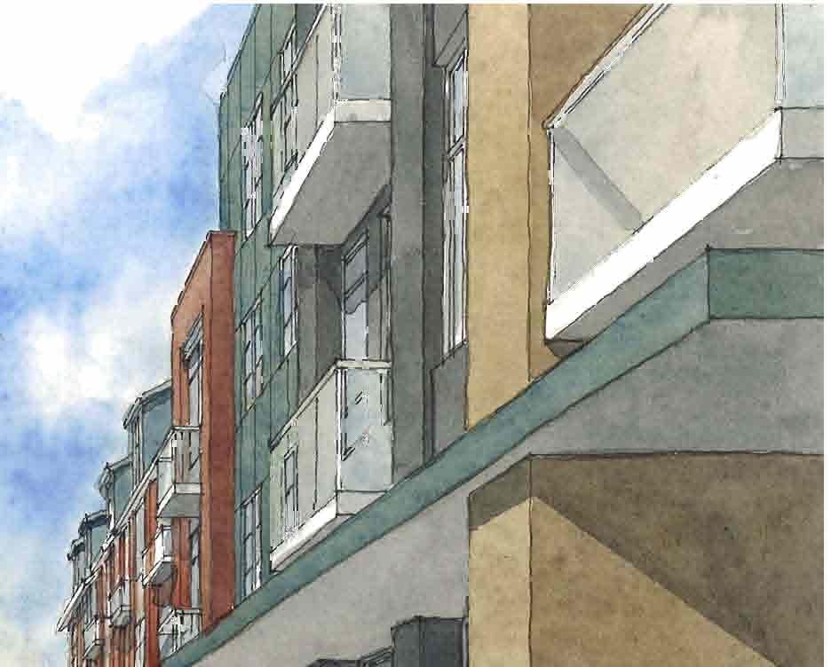
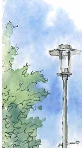


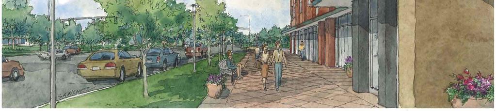


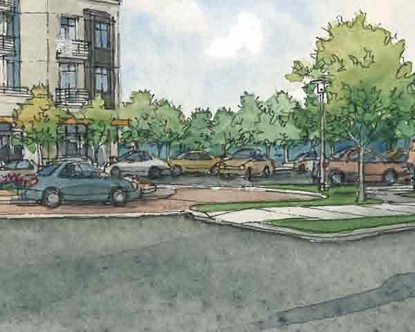

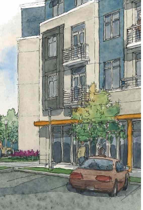
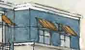
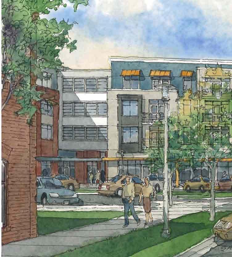
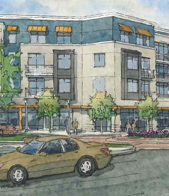
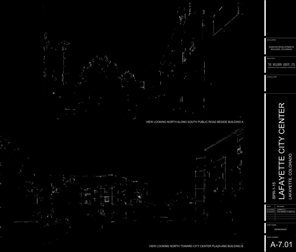
71


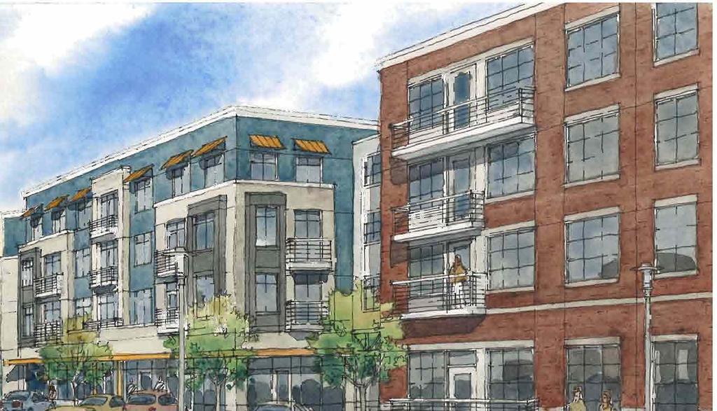
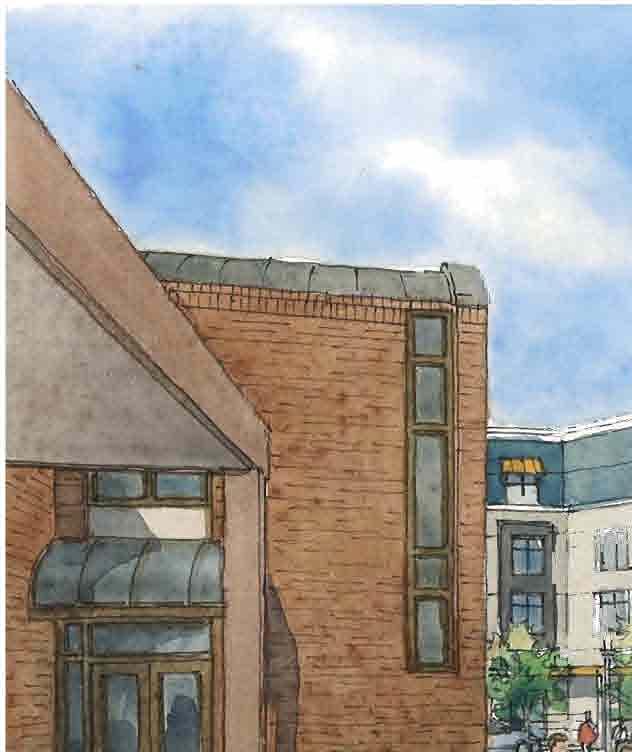
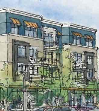

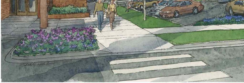

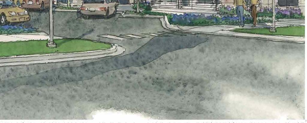


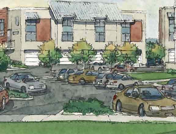
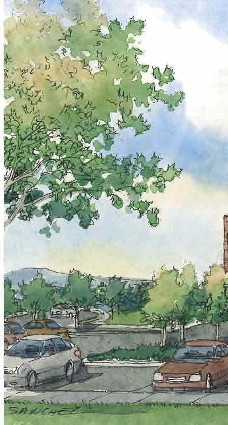
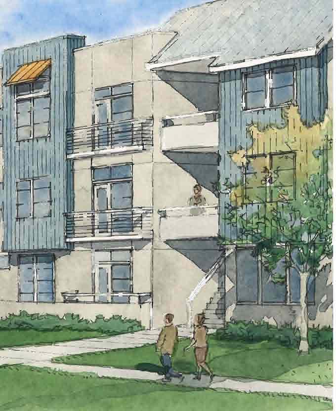
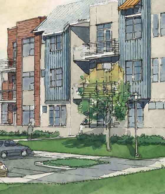
72


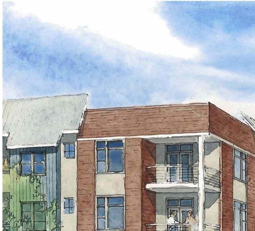


73
74 Statistics Description Symbol Avg Max Min Max/Min Avg/Min Calc Zone #1 fc 7.3 fc fc N/A N/A Luminaire Locations Location Aim No. Label X Y Z MH Orientation Tilt X Y Z 2 A A B B B B B C C C C C C D D D D D D D D C E D C E E E E D E E E E D E E E D C D DEVELOPER: RUBICON DEVELOPMENTS BOULDER, COLORADO ARCHITECT: 6 D D D D D D D D D D D D D D D D D D D D D E E E E E E E E E E E E E E E E E E E E E E E E E E E E E E E E E E E E E Schedule E D 1.0 E E E D E E E E E E E D E G E E E D B E 2.2 E E E E E E C E E E E E 2.6 E G G E E E G E E G G G B Symbol Label Quantity Manufacturer Catalog Number Description Lamp A 2 Lithonia Lighting DSX0 LED 40C K T4M MVOLT DSX0 LED WITH (2) 20 LED LIGHT ENGINE, TYPE T4M OPTIC, 1000mA B Number Lamps Filename LED 1 DSX0_LED_40C_ 1000_40K_T4M_ MVOLT.ies D G G C 7.3 C D Lumens Per Lamp Light Loss Factor D D Wattage D A D D D B D B A D D D CONSULTANT: DATE: SPR-1-15 LAFAYETTE CITY CENTER REVISION: LAFAYETTE, COLORADO 38 E E E E E E B C 5 Lithonia Lighting DSX0 LED 40C K T4M MVOLT HS 6 Lithonia Lighting DSX0 LED 40C K T4M MVOLT DSX0 LED WITH (2) 20 LED LIGHT ENGINE, TYPE T4M OPTIC, 1000mA WITH HOUSE SIDE SHIELD DSX0 LED WITH (2) 20 LED LIGHT ENGINE, TYPE T4M OPTIC, 1000mA LED 1 DSX0_LED_40C_ 1000_40K_T4M_ MVOLT_HS.ies LED 1 DSX0_LED_40C_ 1000_40K_T4M_ MVOLT.ies SUBMITTAL PRELIMINARY SUBMITTAL 1 44 E E G G G G G G G G G D E G 25 Lithonia Lighting DSX0 LED 40C K T2M MVOLT 45 SELUX CORPORATION SACL-1-LG3500-R Lithonia Lighting DSX0 LED 40C K T5M MVOLT DSX0 LED WITH (2) 20 LED LIGHT ENGINE, TYPE T2M OPTIC, 1000mA Saturn Cutoff LED DSX0 LED WITH (2) 20 LED LIGHT ENGINE, TYPE T5M OPTIC, 1000mA LED 1 DSX0_LED_40C_ 1000_40K_T2M_ MVOLT.ies (5 Clusters of 30 LED's) White 50W SSL c/w Advance Driver XITANIUM 100W 120V 1 SACL-1-LG3500- R5-35.ies LED 1 DSX0_LED_40C_ 1000_40K_T5M_ MVOLT.ies SHEET NAME: LIGHTING / PHOTOMETRIC PLAN SHEET NUMBER: A-7.11

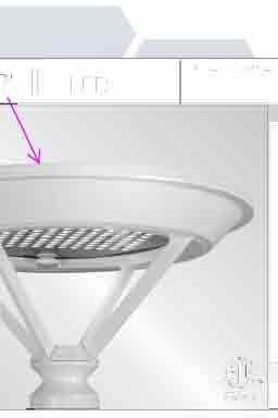

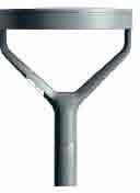

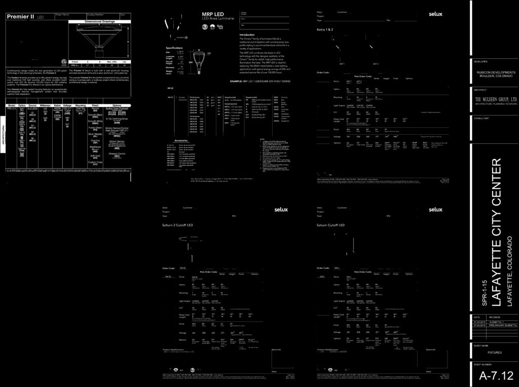
75
MEMO. Proposed Zoning: R4/PUD (High Density Residential) Vicinity Map
 Vicinity Map") MEMO To: Planning Commission From: Paul Rayl, Planning Manager Date: February 22, 2018 Subject: Sundar Apartments Sketch Plan Review Applicant/Owner: Milestone Development Group Applicant Stevenson Land
MEMO To: Planning Commission From: Paul Rayl, Planning Manager Date: February 22, 2018 Subject: Sundar Apartments Sketch Plan Review Applicant/Owner: Milestone Development Group Applicant Stevenson Land
Town of Cary, North Carolina Rezoning Staff Report 14-REZ-31 Cary Park PDD Amendment (Waterford II) Town Council Meeting January 15, 2015
 Town Council Meeting January 15, 2015") Town of Cary, North Carolina Rezoning Staff Report 14-REZ-31 Cary Park PDD Amendment (Waterford II) Town Council Meeting January 15, 2015 REQUEST To amend the Town of Cary Official Zoning Map by amending
Town of Cary, North Carolina Rezoning Staff Report 14-REZ-31 Cary Park PDD Amendment (Waterford II) Town Council Meeting January 15, 2015 REQUEST To amend the Town of Cary Official Zoning Map by amending
Town of Cary, North Carolina Rezoning Staff Report 12-REZ-27 Morris Branch Town Council Public Hearing January 24, 2013
 Town of Cary, North Carolina Rezoning Staff Report 12-REZ-27 Morris Branch Town Council Public Hearing January 24, 2013 REQUEST To amend the Town of Cary Official Zoning Map to rezone approximately 9.0
Cover Letter with Narrative Statement
 Cover Letter with Narrative Statement March 31, 2017 rev July 27, 2017 RE: Rushton Pointe Residential Planned Unit Development Application for Public Hearing for RPUD Rezone PL2015 000 0306 Mr. Eric Johnson,
Statement of Vision. Statement of Values
 Statement of Vision Lafayette s panoramic view of the Rocky Mountains inspires our view into the future. We value our heritage, our unique neighborhoods, a vibrant economy and active lifestyles. We envision
4 June 11, 2014 Public Hearing
 4 June 11, 2014 Public Hearing APPLICANT: FRANKLIN JOHNSTON MANAGEMENT DEVELOPMENT, L.L.C. PROPERTY OWNER: TRUSTEES OF FIRST LYNNHAVEN BAPTIST CHURCH STAFF PLANNER: Stephen J. White REQUEST: Change of
PLANNED UNIT DEVELOPMENT & SUBDIVISION STAFF REPORT Date: April 18, 2019
 PLANNED UNIT DEVELOPMENT & SUBDIVISION STAFF REPORT Date: April 18, 2019 DEVELOPMENT NAME SUBDIVISION NAME Springhill Village Subdivision Springhill Village Subdivision LOCATION 4350, 4354, 4356, 4358,
PLANNING COMMISSION REPORT Regular Agenda -Public Hearing Item
 PDP-13-00518 Item No. 3B- 1 PLANNING COMMISSION REPORT Regular Agenda -Public Hearing Item PC Staff Report 2/24/14 ITEM NO. 3B PRELIMINARY DEVELOPMENT PLAN FOR HERE @ KANSAS; 1101 INDIANA ST (SLD) PDP-13-00518:
PLANNING AND ZONING COMMISSION AGENDA MEMORANDUM
 City and County of Broomfield, Colorado PLANNING AND ZONING COMMISSION AGENDA MEMORANDUM To: Planning and Zoning Commission From: John Hilgers, Planning Director Anna Bertanzetti, Principal Planner Meeting
CITY OF NAPLES STAFF REPORT
 Meeting of 6/17/15 Variance Petition 15-V4 CITY OF NAPLES STAFF REPORT To: Planning Advisory Board From: Planning Department Subject: Variance Petition 15-V4 Petitioner: Ted Karwoski Agent: Edward Westwood
Section 1: US 19 Overlay District
 Section 1: US 19 Overlay District Section 1.1 Intent and Purpose The purpose of the US Highway 19 Overlay District is to manage access to land development along US Highway 19 in a manner that preserves
PLANNED UNIT DEVELOPMENTS (Ordinance No.: 3036, 12/3/07; Repealed & Replaced by Ordinance No.: 4166, 10/15/12)
") 159.62 PLANNED UNIT DEVELOPMENTS (Ordinance No.: 3036, 12/3/07; Repealed & Replaced by Ordinance No.: 4166, 10/15/12) A. PURPOSE 1. General. The Planned Unit Development (PUD) approach provides the flexibility
159.62 PLANNED UNIT DEVELOPMENTS (Ordinance No.: 3036, 12/3/07; Repealed & Replaced by Ordinance No.: 4166, 10/15/12) A. PURPOSE 1. General. The Planned Unit Development (PUD) approach provides the flexibility
Staff Report: Date: Applicant: Property Identification: Acreage of Request: Current Zoning of Requested Area: Requested Action: Attached:
 Staff Report: Completed by Jeff Palmer Director of Planning & Zoning Date: November 7, 2018, Updated November 20, 2018 Applicant: Greg Smith, Oberer Land Developer agent for Ronald Montgomery ET AL Property
Items from the Public Not on the Agenda. None.
 Page 1 Record of Proceedings City of Lafayette Planning Commission Wednesday, October 25, 2017 Vice Chair Godfrey called the meeting to order at 7:00 p.m. Those in attendance included: Vice Chair Godfrey
PLANNING COMMISSION STAFF REPORT
 PLANNING COMMISSION STAFF REPORT REZONING CASE: RZ-16-001 REPORT DATE: March 8, 2016 CASE NAME: Trailbreak Partners Rezoning PLANNING COMMISSION DATE: March 16, 2016 ADDRESSES OF REZONING PROPOSAL: 5501
CITY OF CHARLOTTESVILLE DEPARTMENT OF NEIGHBORHOOD DEVELOPMENT SERVICES STAFF REPORT APPLICATION FOR A SPECIAL USE PERMIT
 CITY OF CHARLOTTESVILLE DEPARTMENT OF NEIGHBORHOOD DEVELOPMENT SERVICES STAFF REPORT APPLICATION FOR A SPECIAL USE PERMIT PLANNING COMMISSION AND CITY COUNCIL JOINT PUBLIC HEARING DATE OF HEARING: December
Draft Model Access Management Overlay Ordinance
 Draft Model Access Management Overlay Ordinance This model was developed using the City of Hutchinson and the Trunk Highway 7 corridor. The basic provisions of this model may be adopted by any jurisdiction
Spring Creek Village Town of Gypsum, CO. Preliminary Plan and Final Plat Applications
 Spring Creek Village Town of Gypsum, CO Preliminary Plan and October 6, 2017 Table of Contents Spring Creek Village Preliminary and Gypsum, CO Section Topic Pages Submittal Cover Letter Section I Introduction
SUBJECT: Application for Planned Unit Development and Rezoning 1725 Winnetka Road
 TO: FROM: CHAIRMAN BILL VASELOPULOS AND MEMBERS OF THE PLAN & ZONING COMMISSION STEVE GUTIERREZ DIRECTOR OF COMMUNITY DEVELOPMENT MEETING DATE: September 5, 2017 SUBJECT: Application for Planned Unit Development
CHAPTER 14 PLANNED UNIT DEVELOPMENTS
 9-14-1 9-14-1 CHAPTER 14 PLANNED UNIT DEVELOPMENTS SECTION: 9-14-1: Purpose 9-14-2: Governing Provisions 9-14-3: Minimum Area 9-14-4: Uses Permitted 9-14-5: Common Open Space 9-14-6: Utility Requirements
Montreal Road District Secondary Plan [Amendment #127, October 9, 2013]
![Montreal Road District Secondary Plan [Amendment #127, October 9, 2013]](/thumbs/72/66783104.jpg "Montreal Road District Secondary Plan [Amendment #127, October 9, 2013]") [Amendment #127, October 9, 2013] 1.0 General The following policies are applicable to the Montreal Road District as set out in Schedule 1. 1.1 District Objectives The objective of this Plan is to guide
[Amendment #127, October 9, 2013] 1.0 General The following policies are applicable to the Montreal Road District as set out in Schedule 1. 1.1 District Objectives The objective of this Plan is to guide
Indian Peaks Filing No. 2 Replat B Page 2 Sketch Plan Review
 MEMO To: Planning Commission From: Paul Rayl, Planning Manager Date: February 18, 2016 Subject: Indian Peaks Filing No. 2, Replat B Sketch Plan Review Applicant/Owner: McStain Neighborhoods, Applicant
Land Use, Transportation, and Infrastructure Committee of the Denver City Council FROM: Scott Robinson, Senior City Planner DATE: March 22, 2018 RE:
 Community Planning and Development Planning Services 201 W. Colfax Ave., Dept. 205 Denver, CO 80202 p: 720.865.2915 f: 720.865.3052 www.denvergov.org/cpd TO: Land Use, Transportation, and Infrastructure
2015 Downtown Parking Study
 2015 Downtown Parking Study City of Linden Genesee County, Michigan November 2015 Prepared by: City of Linden Downtown Development Authority 132 E. Broad Street Linden, MI 48451 www.lindenmi.us Table of
Deerfield Township Community Development Department
 STAFF REVIEW Deerfield Township Community Development Department To: From: Hayfaa Wadih, AICP Lois McKnight, AICP Meeting Date: October 20, 2014 Continued from October 13, 2014 Re: Major PUD Modification
REPORT TO THE SHELBY COUNTY PLANNING COMMISSION From the Department of Development Services Planning Services. February 4, 2019
 REPORT TO THE SHELBY COUNTY PLANNING COMMISSION From the Department of Development Services Planning Services February 4, 2019 Case No. Request for Rezoning Approval From E-1 to E-2 SD This is a request
Article 3. SUBURBAN (S-) NEIGHBORHOOD CONTEXT
 NEIGHBORHOOD CONTEXT") Article 3. SUBURBAN (S-) NEIGHBORHOOD CONTEXT this page left intentionally blank Contents ARTICLE 3. SUBURBAN (S-) NEIGHBORHOOD CONTEXT DIVISION 3.1 NEIGHBORHOOD CONTEXT DESCRIPTION...3.1-1 Section 3.1.1
Article 3. SUBURBAN (S-) NEIGHBORHOOD CONTEXT this page left intentionally blank Contents ARTICLE 3. SUBURBAN (S-) NEIGHBORHOOD CONTEXT DIVISION 3.1 NEIGHBORHOOD CONTEXT DESCRIPTION...3.1-1 Section 3.1.1
Plan Dutch Village Road
 Plan Dutch Village Road Objective: The lands around Dutch Village Road are a minor commercial area that services the larger Fairview community. Maintaining the vibrancy of the area by planning for redevelopment
Planned Residence District (PR) To review a plan to construct 11 single family homes on approximately 4.01 acres.
 To review a plan to construct 11 single family homes on approximately 4.01 acres.") STAFF REPORT PLANNING & ZONING COMMISSION Village Green Municipal Building, Council Chambers 47 Hall Street Wednesday, March 13, 2019 7:00 P.M. 1. FINAL DEVELOPMENT PLAN REVIEW Applicant: Romanelli and
STAFF REPORT PLANNING & ZONING COMMISSION Village Green Municipal Building, Council Chambers 47 Hall Street Wednesday, March 13, 2019 7:00 P.M. 1. FINAL DEVELOPMENT PLAN REVIEW Applicant: Romanelli and
Attachment 4. Planning Commission Staff Report. June 26, 2017
 Planning Commission Staff Report June 26, 2017 Agenda #: Regular Agenda - 2 Title: Applicant: Request: Location: Existing Zoning: Proposed Use: Staff Planner: The Brands and The Brands West Eagle Crossing
Staff Report for Town Council
 Staff Report for Town Council Meeting Date: June 22, 2017 16-REZ-24 Trimble Avenue Residential Rezoning Purpose: Consider action on proposed rezoning request Prepared by: Katie Drye, Planning Speaker:
City of Valdosta Land Development Regulations
 Chapter 206 Section 206-1 Base Zoning Districts Standards for Uses, Structures, and Property Development (B) (C) Principal Uses and Structures. Principal uses and structures permitted in each base zoning
Conditional Use Permit case no. CU 14-06: Bristol Village Partners, LLC
 PLANNING AND ZONING COMMISSION STAFF REPORT August 7, 2014 Conditional Use Permit case no. CU 14-06: Bristol Village Partners, LLC CASE DESCRIPTION: LOCATION: LEGAL DESCRIPTION: EXISTING LAND USE: ZONING:
To: Planning and Zoning Commission Anna Bertanzetti, Planning Director Alice Hanson, Senior Planner
 To: Planning and Zoning Commission From: Anna Bertanzetti, Planning Director Alice Hanson, Senior Planner Meeting Date Agenda Category Agenda Item # June 26, 2017 Business 4.b 1. Public Hearing on a Proposed
PLANNING COMMISSION STAFF REPORT
 PLANNING COMMISSION STAFF REPORT West Capitol Hill Zoning Map Amendment Petition No. PLNPCM2011-00665 Located approximately at 548 W 300 North Street, 543 W 400 North Street, and 375 N 500 West Street
Downtown Development Focus Area: I. Existing Conditions
 Downtown Development Focus Area: I. Existing Conditions The Downtown Development Focus Area is situated along Route 1, south of the train tracks, except for the existing Unilever property. It extends west
PLAINFIELD CHARTER TOWNSHIP COMMUNITY DEVELOPMENT DEPARTMENT PLANNING, ZONING & BUILDING SERVICES MEMORANDUM
 PLAINFIELD CHARTER TOWNSHIP COMMUNITY DEVELOPMENT DEPARTMENT PLANNING, ZONING & BUILDING SERVICES 6161 BELMONT AVENUE N.E. BELMONT, MI 49306 PHONE 616-364-1190 FAX: 616-364-1170 www.plainfieldchartertwp.org
ARTICLE OPTIONAL METHOD REGULATIONS
 ARTICLE 59-6. OPTIONAL METHOD REGULATIONS DIV. 6.1. MPDU DEVELOPMENT IN RURAL RESIDENTIAL AND RESIDENTIAL ZONES SEC. 6.1.1. GENERAL REQUIREMENTS... 6 2 SEC. 6.1.2. GENERAL SITE AND BUILDING T PE MIX...
Midwest City, Oklahoma Zoning Ordinance
 2010 Midwest City, Oklahoma Zoning Ordinance 9/2/2010 Table of Contents Section 1. General Provisions... 5 1.1. Citation... 5 1.2. Authority... 5 1.3. Purpose... 5 1.4. Nature and Application... 5 1.5.
MEADOWBROOK FLATS SPECIAL USE PERMIT APPLICATION
 MEADOWBROOK FLATS SPECIAL USE PERMIT APPLICATION March 26, 2013 Submitted by: Bluestone Land, L.L.C. William N. Park, Manager 1821 Avon St. Suite 200 Charlottesville VA 22902 434-979-2900 wpark@pinnacleconstructionva.com
3.1. OBJECTIVES FOR RESIDENTIAL LAND USE DESIGNATIONS GENERAL OBJECTIVES FOR ALL RESIDENTIAL DESIGNATIONS
 3. RESIDENTIAL LAND USE DESIGNATIONS INTRODUCTION The Residential land use designations provide for housing and other land uses that are integral to, and supportive of, a residential environment. Housing
Staff Report: Date: Applicant: Property Identification: Acreage of Request: Current Zoning of Requested Area: Requested Action: Attached:
 Staff Report: Completed by Jeff Palmer Director of Planning & Zoning Date: November 7, 2018 Applicant: Greg Smith, Oberer Land Developer agent for Ronald Montgomery ET AL Property Identification: Frontage
PLANNING AND ZONING COMMISSION AGENDA MEMORANDUM
 To: From: Planning and Zoning Commission John Hilgers, Planning Director Anna Bertanzetti, Principal Planner City and County of Broomfield, Colorado PLANNING AND ZONING COMMISSION AGENDA MEMORANDUM Meeting
Letter of Intent May 2017 (Revised November 2017)
") THE BEACH AT WOODMOOR LETTER OF INTENT MAY 2017 (REVISED NOVEMBER 2017) OWNER/APPLICANT: CONSULTANT: Lake Woodmoor Holdings LLC N.E.S. Inc. 1755 Telstar Drive, Suite 211 619 North Cascade Avenue Colorado
THE BEACH AT WOODMOOR LETTER OF INTENT MAY 2017 (REVISED NOVEMBER 2017) OWNER/APPLICANT: CONSULTANT: Lake Woodmoor Holdings LLC N.E.S. Inc. 1755 Telstar Drive, Suite 211 619 North Cascade Avenue Colorado
CITY COUNCIL STUDY SESSION MEMORANDUM
 City and County of Broomfield, Colorado To: From: Prepared by: Owner Applicant Property Size Property Location: CITY COUNCIL STUDY SESSION MEMORANDUM Mayor and City Council Charles Ozaki, City and County
INDIAN RIVER COUNTY, FLORIDA. The Honorable Members of the Planning and Zoning Commission DEPARTMENT HEAD CONCURRENCE
 Public Hearing Legislative INDIAN RIVER COUNTY, FLORIDA M E M O R A N D U M TO: The Honorable Members of the Planning and Zoning Commission DEPARTMENT HEAD CONCURRENCE Robert M. Keating, AICP; Community
STAFF REPORT FOR MAJOR SUBDIVISION
 STAFF REPORT FOR MAJOR SUBDIVISION FINAL PLAT CASE NO. FA-13-001 HEARING DATE: November 6, 2013 CASE NAME: Solterra Subdivision Filing No. 14 PROCEDURE: Planning Commission ADDRESS OF MAJOR SUBDIVISION
Land Use, Transportation, and Infrastructure Committee of Denver City Council FROM: Scott Robinson, Senior City Planner DATE: December 6, 2018 RE:
 Community Planning and Development Planning Services 201 W. Colfax Ave., Dept. 205 Denver, CO 80202 p: 720.865.2915 f: 720.865.3052 www.denvergov.org/cpd TO: Land Use, Transportation, and Infrastructure
PLANNED DEVELOPMENT DISTRICT STANDARDS. Cadence Site
 PLANNED DEVELOPMENT DISTRICT STANDARDS Cadence Site A Planned Development District 1. Statement of General Facts, Conditions and Objectives Property Size: Approximately 57.51 Acres York County Tax Map
Composition of traditional residential corridors.
 Page 1 of 7 St. Petersburg, Florida, Code of Ordinances >> PART II - ST. PETERSBURG CITY CODE >> Chapter 16 - LAND DEVELOPMENT REGULATIONS >> SECTION 16.20.060. CORRIDOR RESIDENTIAL TRADITIONAL DISTRICTS
EXHIBIT 1 PROJECT DESCRIPTION AND DESCRIPTION OF REQUESTED AREA VARIANCES REDEVELOPMENT OF 201 ELLICOTT STREET
 EXHIBIT 1 PROJECT DESCRIPTION AND DESCRIPTION OF REQUESTED AREA VARIANCES REDEVELOPMENT OF 201 ELLICOTT STREET I. PROJECT DESCRIPTION: Ciminelli Real Estate Corporation (the Applicant ) is seeking area
REZONING GUIDE. Zone Map Amendment (Rezoning) - Application. Rezoning Application Page 1 of 3. Return completed form to
 - Application. Rezoning Application Page 1 of 3. Return completed form to") Zone Map Amendment (Rezoning) - Application COMMUNITY PLANNING & DEVELOPMENT REZONING GUIDE Rezoning Application Page 1 of 3 PROPERTY OWNER INFORMATION* CHECK IF POINT OF CONTACT FOR APPLICATION Property
Zone Map Amendment (Rezoning) - Application COMMUNITY PLANNING & DEVELOPMENT REZONING GUIDE Rezoning Application Page 1 of 3 PROPERTY OWNER INFORMATION* CHECK IF POINT OF CONTACT FOR APPLICATION Property
TOTTENHAM SECONDARY PLAN
 TOTTENHAM SECONDARY PLAN AMENDMENT NO. 11 TO THE OFFICIAL PLAN OF THE TOWN OF NEW TECUMSETH The following text and schedules to the Official Plan of the Town of New Tecumseth constitute Amendment No. 11
Chapter Planned Residential Development Overlay
 Chapter 19.29 Planned Residential Development Overlay Sections 010 Purpose 020 Scope 030 Definitions 030 Minimum Size 040 Allowable Uses 050 Minimum Development Standards 060 Density Bonus 070 Open Space
Town of Jamestown Planning Board Zoning Staff Report June 14, 2010
 Town of Jamestown Planning Board Zoning Staff Report June 14, 2010 The information provided in this staff report has been included for the purpose of reviewing proposed zoning changes. Since the zoning
CITY OF SIGNAL HILL SUBJECT: PUBLIC HEARING THE COURTYARD RESIDENTIAL DEVELOPMENT OF 10 CONDOMINIUMS AND A NEW SPECIFIC PLAN
 CITY OF SIGNAL HILL 2175 Cherry Avenue Signal Hill, CA 90755-3799 AGENDA ITEM TO: FROM: HONORABLE CHAIR AND MEMBERS OF THE PLANNING COMMISSION SELENA ALANIS ASSOCIATE PLANNER SUBJECT: PUBLIC HEARING THE
Staff Report & Recommendation Rezoning Case RZ Date of Report: June 6, 2014 Report by: Doug Stacks
 Staff Report & Recommendation Rezoning Case RZ-2014-02 Date of Report: June 6, 2014 Report by: Doug Stacks Hearing Dates: Planning Commission June 26, 2014 Mayor and Council July 14, 2014 GENERAL INFORMATION
Planning Department Oconee County, Georgia
 Planning Department Oconee County, Georgia STAFF REPORT REZONE CASE #: 6985 DATE: October 31, 2016 STAFF REPORT BY: Andrew C. Stern, Planner APPLICANT NAME: Williams & Associates, Land Planners PC PROPERTY
Rapid City Planning Commission Conditional Use Permit Project Report
 Rapid City Planning Commission Conditional Use Permit Project Report September 21, 2017 Applicant Request(s) Case # 17UR020 Conditional Use Permit to allow a mini-storage facility Companion Case(s) # Item
Enclosed are amended PUD documents for The Grove at Shoal Creek Proposed by
 Enclosed are amended PUD documents for The Grove at Shoal Creek Proposed by The Bull Creek Road Coalition (BCRC) was formed in 2012 and is made up of residents in the six neighborhoods surrounding the
Salem HNA and EOA Advisory Committee Meeting #6
 Salem HNA and EOA Advisory Committee Meeting #6 Residential Land Policies Employment Land Policies Policy Discussions with the Committee Outcome of today s meeting Direction from this Committee on proposed
Representative Name. Address. City, State, Zip. Telephone.
 COMMUNITY PLANNING & DEVELOPMENT ~~DENVER... THE MILE HIGH CITY REZONING GUIDE Zone Map Amendment (Rezoning)- Application Rezoning Application Page 1 of 3 Property Owner Name Philip M. Falco Address 730
9. REZONING NO Vicinity of the northwest corner of 143 rd Street and Metcalf Avenue
 9. REZONING NO. 2002-15 Vicinity of the northwest corner of 143 rd Street and Metcalf Avenue 1. APPLICANT: Andrew Schlagel is the applicant for this request. 2. REQUESTED ACTION: The applicant is requesting
Planning Justification Report
 Planning Justification Report 101 Kozlov Street, Barrie, Ont. Destaron Property Management Ltd. November 2015 Revised February 2017 TABLE OF CONTENTS Page 1.0 INTRODUCTION... 1 2.0 DESCRIPTION OF SUBJECT
PROPOSED AMENDMENTS TO THE DERBY ZONING REGULATIONS AUGUST 12, 2008
 ARTICLE II Definitions and word usage 195-7. Definitions and word usage. Modify the following: HOUSING FOR THE ELDERLY OLDER PERSONS Housing in accordance with and as defined in the United States Fair
Chapter SPECIAL USE ZONING DISTRICTS
 Chapter 20.20 Sections: 20.20.010 Urban Transition (U-T) Zoning District 20.20.020 Planned Development (P-D) Zoning Districts 20.20.010 Urban Transition (U-T) Zoning District A. Purpose. The purpose of
COMMUNITY DEVELOPMENT. Staff Report. Site Plan Review. SP June 19, 2018
 COMMUNITY DEVELOPMENT 333 Broadalbin Street SW, PO Box 490, Albany, Oregon 97321-0144 BUILDING 541-917-7553 PLANNING 541-917-7550 Staff Report Site Plan Review SP-18-18 June 19, 2018 Summary On May 1,
ARTICLE VII. NONCONFORMITIES. Section 700. Purpose.
 ARTICLE VII. NONCONFORMITIES. Section 700. Purpose. The purpose of this chapter is to regulate and limit the development and continued existence of legal uses, structures, lots, and signs established either
ZONING AMENDMENT & SUBDIVISION STAFF REPORT Date: November 3, 2016
 ZONING AMENDMENT & SUBDIVISION STAFF REPORT Date: November 3, 2016 APPLICANT NAME SUBDIVISION NAME David Shumer 5955 Airport Subdivision CITY COUNCIL DISTRICT District 6 5955 Airport Boulevard, 754 Linlen
DEVELOPMENT DEPARTMENT STAFF REPORT THE PARK AT 5 TH
 DEVELOPMENT DEPARTMENT STAFF REPORT ARB Meeting Date: July 3, 2018 Item #: _PZ2018-293_ THE PARK AT 5 TH Request: Site Address: Project Name: Parcel Number: Applicant: Proposed Development: Current Zoning:
NOTICE OF MEETING AND AGENDA FOR THE PLANNING COMMISSION OF SPRINGVILLE, UTAH... JANUARY 23, 2018
 NOTICE OF MEETING AND AGENDA FOR THE PLANNING COMMISSION OF SPRINGVILLE, UTAH............................ JANUARY 23, 2018 Notice is hereby given that the Planning Commission will hold a public meeting
M-43 CORRIDOR OVERLAY ZONE
 ARTICLE 26.00 M-43 CORRIDOR OVERLAY ZONE Section 26.01 Findings A primary function of the M-43 state highway is to move traffic through the Township and to points beyond. As the primary east-west arterial
Hamilton County Regional Planning Commission
 Hamilton County Regional Planning Commission March 1, 2012 Colerain Township Staff Report Zone Map Amendment: Case No.: ZA2012-01 Joseph Toyota Prepared By: Amy Bancroft, Land Use Planner ACTION REQUESTED:
January 7, Sarah Smith Community Development Director City of Mound 5341 Maywood Road Mound, MN Dear Ms. Smith,
 January 7, 2019 Sarah Smith Community Development Director City of Mound 5341 Maywood Road Mound, MN 55364 Dear Ms. Smith, We are pleased to present the enclosed concept plan and requisite attachments
Town of Cary, North Carolina Rezoning Staff Report 14-REZ-24 Indian Wells Road Properties Town Council Meeting November 20, 2014
 Town of Cary, North Carolina Rezoning Staff Report 14-REZ-24 Indian Wells Road Properties Town Council Meeting November 20, 2014 REQUEST To amend the Town of Cary Official Zoning Map by revising a condition
DEPARTMENT OF COMMUNITY PLANNING, HOUSING AND DEVELOPMENT Planning Division
 DEPARTMENT OF COMMUNITY PLANNING, HOUSING AND DEVELOPMENT Planning Division #1 Courthouse Plaza, 2100 Clarendon Boulevard, Suite 700 Arlington, VA 22201 TEL 703.228.3525 FAX 703.228.3543 www.arlingtonva.us
HOUSING ELEMENT GOALS, OBJECTIVES, AND POLICIES
 HOUSING ELEMENT GOALS, OBJECTIVES, AND POLICIES GOAL 1: To promote the preservation and development of high-quality, balanced, and diverse housing options for persons of all income levels throughout the
CHAPTER34 PRUD - PLANNED RESIDENTIAL UNIT DEVELOPMENT
 CHAPTER34 PRUD - PLANNED RESIDENTIAL UNIT DEVELOPMENT 17-34-1 17-34-2 17-34-3 17-34-4 17-34-5 17-34-6 17-34-7 17-34-8 17-34-9 Purpose Planned Residential Unit Development Defined Planned Residential Unit
CITY OF CHARLOTTESVILLE DEPARTMENT OF NEIGHBORHOOD DEVELOPMENT SERVICES STAFF REPORT APPLICATION FOR A SPECIAL USE PERMIT
 CITY OF CHARLOTTESVILLE DEPARTMENT OF NEIGHBORHOOD DEVELOPMENT SERVICES STAFF REPORT APPLICATION FOR A SPECIAL USE PERMIT PLANNING COMMISSION AND CITY COUNCIL JOINT PUBLIC HEARING DATE OF HEARING: July
SECTION 7000 LAND DEVELOPMENT REQUIREMENTS
 SECTION 7000 LAND DEVELOPMENT REQUIREMENTS 7000 LAND DEVELOPMENT REQUIREMENTS... 1 7001 LEGISLATIVE AUTHORITY... 1 7001.1 LAND DEVELOPMENT... 1 7001.1.1 Title 40, Idaho Code... 1 7001.1.2 Idaho Code 40-1415
Director, Community Planning, North York District
 STAFF REPORT ACTION REQUIRED 32-50, 52, 55, 56, 59, 60, 62, 65, 66, 70, 72, 76, 80, 85 & 90 Forest Manor Road, 100, 106, 110, 123, 123A, 125 and 130 Parkway Forest Drive, 1751 and 1761 Sheppard Avenue
TOWN OF LOS ALTOS HILLS January 11, 2018 Staff Report to the Planning Commission
 ITEM #3.2 TOWN OF LOS ALTOS HILLS Staff Report to the Planning Commission SUBJECT: FROM: REQUEST FOR APPROVAL OF A CONDITIONAL DEVELOPMENT AND SITE DEVELOPMENT PERMITS FOR A NEW 2,831 SQUARE FOOT, TWO
Town of Cary, North Carolina Rezoning Staff Report 14-REZ-20 Habitat for Humanity Evans Road Town Council Meeting October 16, 2014
 Town of Cary, North Carolina Rezoning Staff Report 14-REZ-20 Habitat for Humanity Evans Road Town Council Meeting October 16, 2014 REQUEST To amend the Town of Cary Official Zoning Map by rezoning 0.53
United States Post Office and Multi-Family Residential; and, Single- Family Residence with an Apartment
 Planning Commission File No.: AME2013 0009 January 9, 2014 Page 2 of 9 Existing Land Use: United States Post Office and Multi-Family Residential; and, Single- Family Residence with an Apartment Surrounding
Article 6: Planned Unit Developments
 LUDC 2013 GARFIELD COUNTY, COLORADO Article 6: Planned Unit Developments ARTICLE 6 PLANNED UNIT DEVELOPMENTS TABLE OF CONTENTS DIVISION 1. GENERAL.... 1 6-101. GENERAL PROVISIONS.... 1 A. Purpose....
b) Tangerine Corridor Overlay District 1) Tangerine Corridor District Regulations
 Tangerine Corridor Overlay District 1) Tangerine Corridor District Regulations") Attachment 1 Tangerine Road Corridor Overlay District Section 27.10.D.3.f.vi.b Initiation of Code Amendment September 2, 2014, Planning and Zoning Commission b) Tangerine Corridor Overlay District 1) Tangerine
Attachment 1 Tangerine Road Corridor Overlay District Section 27.10.D.3.f.vi.b Initiation of Code Amendment September 2, 2014, Planning and Zoning Commission b) Tangerine Corridor Overlay District 1) Tangerine
ARTICLE 23 CONDOMINIUM STANDARDS
 ARTICLE 23 CONDOMINIUM STANDARDS Section 23.01 Intent. The intent of this Article is to provide regulatory standards for condominiums and site condominiums similar to those required for projects developed
Development Plan DP13-3 (Arlington Lofts) Planning and Zoning Meeting Date: Document Being Considered: Ordinance
 Planning and Zoning Meeting Date: Document Being Considered: Ordinance") Staff Report Development Plan DP13-3 (Arlington Lofts) Planning and Zoning Meeting Date: 6-19-13 Document Being Considered: Ordinance RECOMMENDATION Following the public hearing, consider Development Plan
Staff Report Development Plan DP13-3 (Arlington Lofts) Planning and Zoning Meeting Date: 6-19-13 Document Being Considered: Ordinance RECOMMENDATION Following the public hearing, consider Development Plan
Silo Subdivision Page 2 Preliminary Plan/PUD
 MEMO To: Planning Commission From: Paul Rayl, Planning Manager Date: November 18, 2016 Subject: Silo Subdivision (formerly known as Weems Neighborhood a.k.a. HeartEye Village) Supplemental information
ARTICLE 3 DEFINITIONS
 Sections: 3-1 Rules of Construction 3-2 Definitions ARTICLE 3 DEFINITIONS SECTION 3-1 RULES OF CONSTRUCTION 3-101. a. The language set forth in these regulations shall be interpreted in accordance with
Village of Port Jefferson Urban Renewal Plan
 Urban Renewal Plan Village of Port Jefferson Urban Renewal Plan Port Jefferson, New York PREPARED FOR Village of Port Jefferson Village Board 121 West Broadway Port Jefferson, NY 11777 631.473.4724 PREPARED
ARTICLE 15 - PLANNED UNIT DEVELOPMENT
 Section 15.1 - Intent. ARTICLE 15 - PLANNED UNIT DEVELOPMENT A PUD, or Planned Unit Development, is not a District per se, but rather a set of standards that may be applied to a development type. The Planned
City and County of Broomfield, Colorado
 City and County of Broomfield, Colorado CITY COUNCIL AGENDA MEMORANDUM To: From: Mayor and City Council George Di Ciero, City and County Manager Teri Malies, Principal Planner Terrance Ware, Planning Director
UPPER MOUNT BETHEL TOWNSHIP NORTHAMPTON COUNTY, PENNSYLVANIA
 UPPER MOUNT BETHEL TOWNSHIP NORTHAMPTON COUNTY, PENNSYLVANIA JOINDER DEED / LOT CONSOLIDATION TOWNSHIP REVIEW PROCESS When accepting proposed Joinder Deeds / Lot Consolidations, review the Joinder Deed
DATE: February 28, Marilynn Lewis, Principal Planner
 DATE: February 28, 2007 TO: FROM: RE: Salt Lake City Planning Commission Marilynn Lewis, Principal Planner Planning Commission Hearing for Petition 400-06-41 Zoning Map Amendment to Rezone 6 Properties,
New Millennium Senior Living Communities, LLC
 Applicant Property Owners Baylake Limited Partnership, W. Heywood Fralin 2012 Revocable Trust, W. Heywood Fralin Irrevocable Children s Trust, & Karen Holly Waldron Trust Public Hearing August 9, 2017
STAFF REPORT PLN September 11, 2017
 Page: 1 TO: SUBJECT: GENERAL COMMITTEE APPLICATIONS FOR OFFICIAL PLAN AMENDMENT AND ZONING BY-LAW AMENDMENT 37 JOHNSON STREET WARD: WARD 1 PREPARED BY AND KEY CONTACT: SUBMITTED BY: GENERAL MANAGER APPROVAL:
Urban Design Brief Dundas Street. London Affordable Housing Foundation. November Zelinka Priamo Ltd.
 Urban Design Brief 1039-1047 Dundas Street London Affordable Housing Foundation November 2017 Zelinka Priamo Ltd. TABLE OF CONTENTS Page No. INTRODUCTION... 3 SECTION 1 LAND USE PLANNING CONTEXT... 3 1.1
Planning Rationale in Support of an Application for Plan of Subdivision and Zoning By-Law Amendment
 Planning Rationale in Support of an Application for Plan of Subdivision and Zoning By-Law Amendment The Kilmorie Development 21 Withrow Avenue City of Ottawa Prepared by: Holzman Consultants Inc. Land
MEMORANDUM. DATE: August 31, Honorable Mayor and City Councilmembers Patrick Klaers, City Administrator. Matthew Bachler, Associate Planner
 NEW BUSINESS 8B MEMORANDUM DATE: August 31, 2015 TO: FROM: Honorable Mayor and City Councilmembers Patrick Klaers, City Administrator Matthew Bachler, Associate Planner SUBJECT: Planning Case #15-016 Applicant: